A. Sánchez-Alzola

5 papers on arXiv

Academic Profile

Name: A. Sánchez‐Alzola
Total Papers: 31

Statistics

arXiv Papers 5
Total Publications 31

Papers on arXiv

Thumbnail for The Padul normal fault activity constrained by GPS data: Brittle
  extension orthogonal to folding in the central Betic Cordillera

The Padul normal fault activity constrained by GPS data: Brittle extension orthogonal to folding in the central Betic Cordillera

The Padul Fault is located in the Central Betic Cordillera, formed in the framework of the NW-SE Eurasian-African plate convergence. In the Internal Zone, large E-W to NE-SW folds of western Sierra ...

Thumbnail for Scattering images from autocorrelation functions of P-wave seismic
  velocity images: the case of Tenerife Island (Canary Islands, Spain)

Scattering images from autocorrelation functions of P-wave seismic velocity images: the case of Tenerife Island (Canary Islands, Spain)

We present a P-wave scattering image of the volcanic structures under Tenerife Island using the autocorrelation functions of P-wave vertical velocity fluctuations. We have applied cluster analysis t...

Thumbnail for Geodetic Research on Deception Island and its Environment (South
  Shetland Islands, Bransfield Sea and Antarctic Peninsula) During Spanish
  Antarctic Campaigns (1987-2007)

Geodetic Research on Deception Island and its Environment (South Shetland Islands, Bransfield Sea and Antarctic Peninsula) During Spanish Antarctic Campaigns (1987-2007)

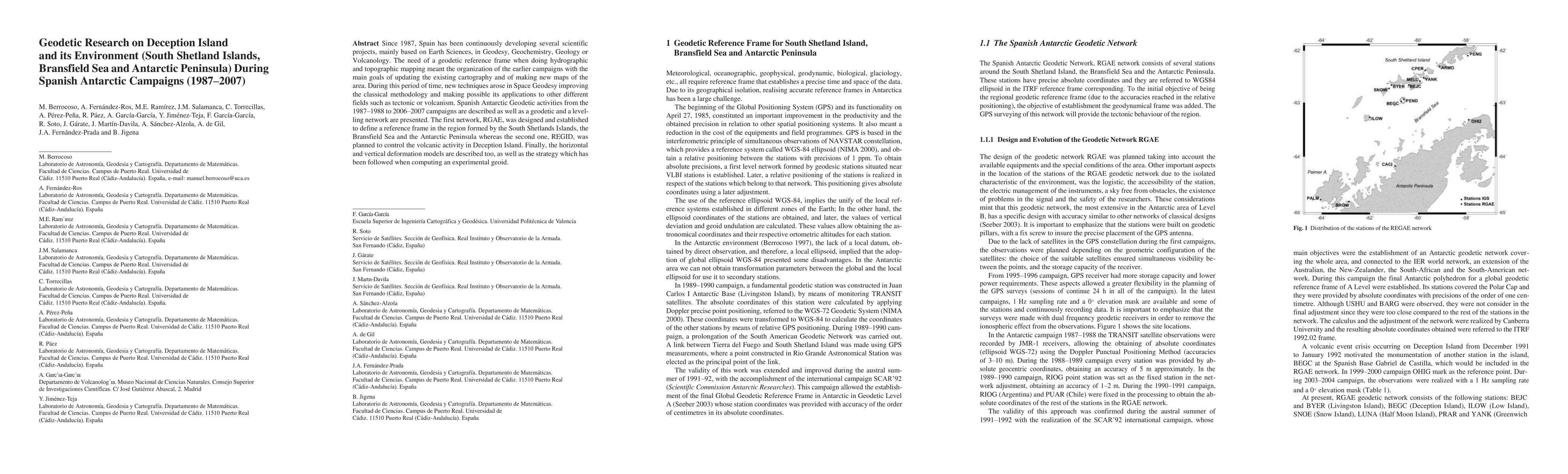
Since 1987, Spain has been continuously developing several scientific projects, mainly based on Earth Sciences, in Geodesy, Geochemistry, Geology or Volcanology. The need of a geodetic reference fra...

Thumbnail for Subsidence and current strain patterns on Tenerife Island (Canary
  Archipelago, Spain) derived from continuous GNSS time series (2008-2015)

Subsidence and current strain patterns on Tenerife Island (Canary Archipelago, Spain) derived from continuous GNSS time series (2008-2015)

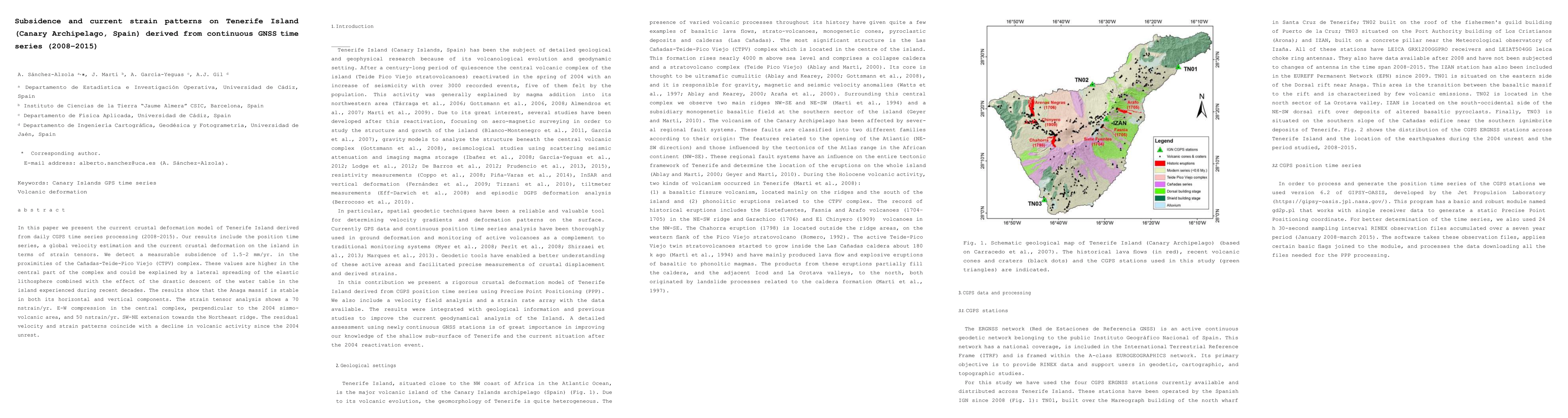
In this paper we present the current crustal deformation model of Tenerife Island derived from daily CGPS time series processing (2008 to 2015). Our results include the position time series, a globa...

Thumbnail for A 3D joint interpretation of magnetotelluric and seismic tomographic
  models: the case of the volcanic island of Tenerife

A 3D joint interpretation of magnetotelluric and seismic tomographic models: the case of the volcanic island of Tenerife

In this work we have done a 3D joint interpretation of magnetotelluric and seismic tomography models. Previously we have described different techniques to infer the inner structure of the Earth. We ...

This website uses cookies to ensure you get the best experience. Learn more