Academic Profile
Statistics
Similar Authors
Papers on arXiv
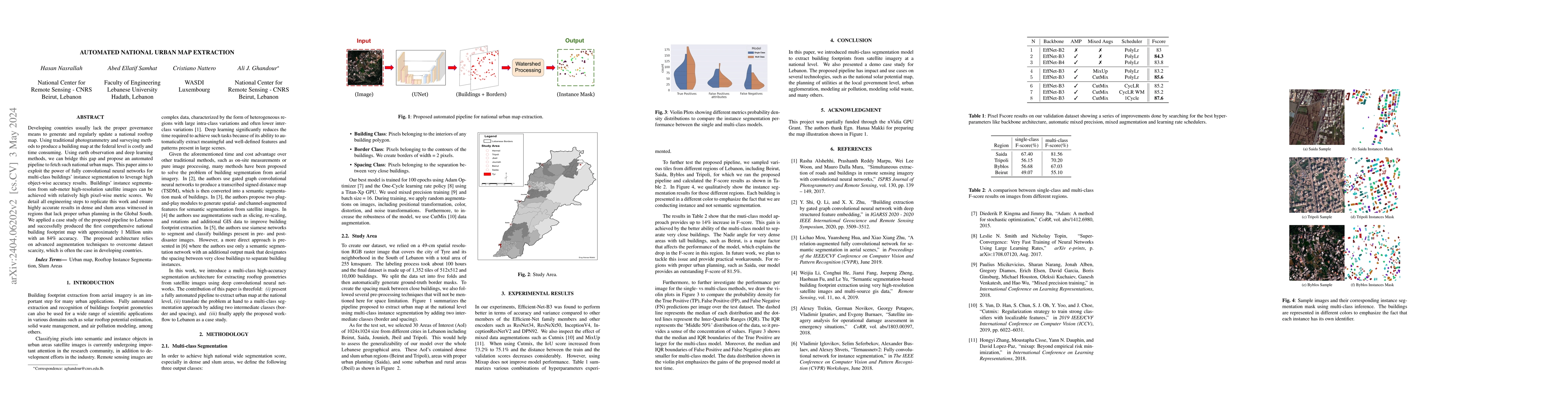
Developing countries usually lack the proper governance means to generate and regularly update a national rooftop map. Using traditional photogrammetry and surveying methods to produce a building ma...
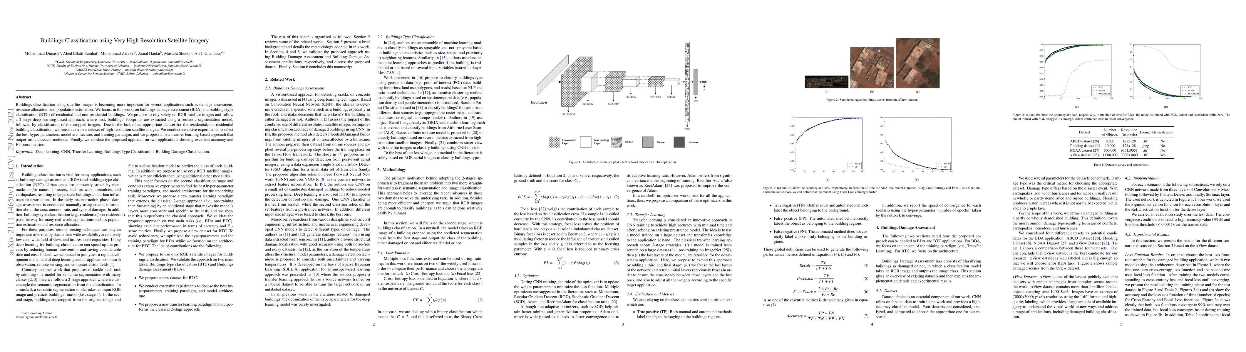
Buildings classification using satellite images is becoming more important for several applications such as damage assessment, resource allocation, and population estimation. We focus, in this work,...
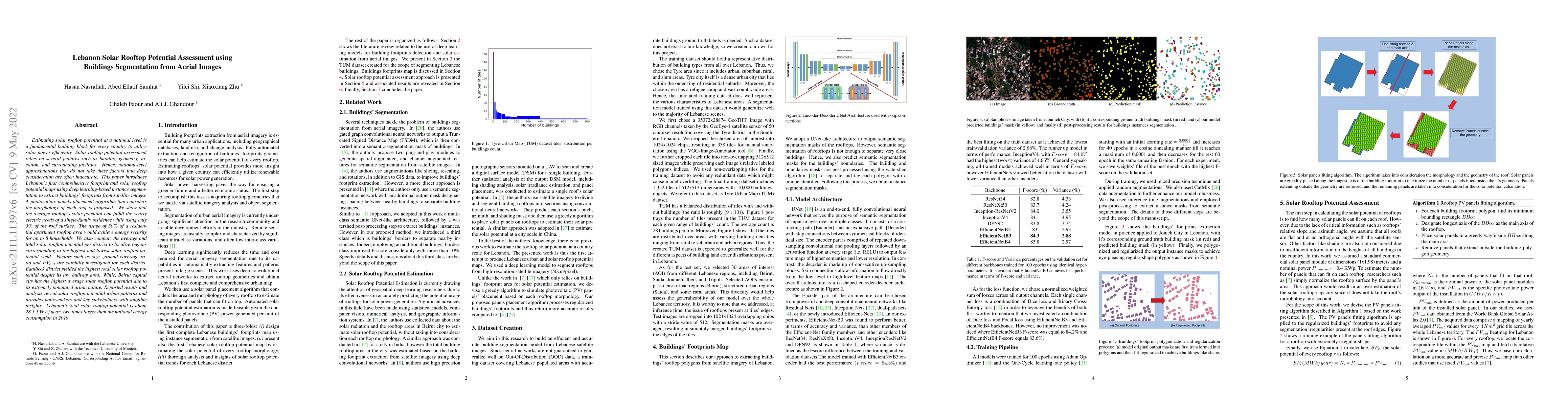
Estimating solar rooftop potential at a national level is a fundamental building block for every country to utilize solar power efficiently. Solar rooftop potential assessment relies on several feat...