Academic Profile
Statistics
Similar Authors
Papers on arXiv
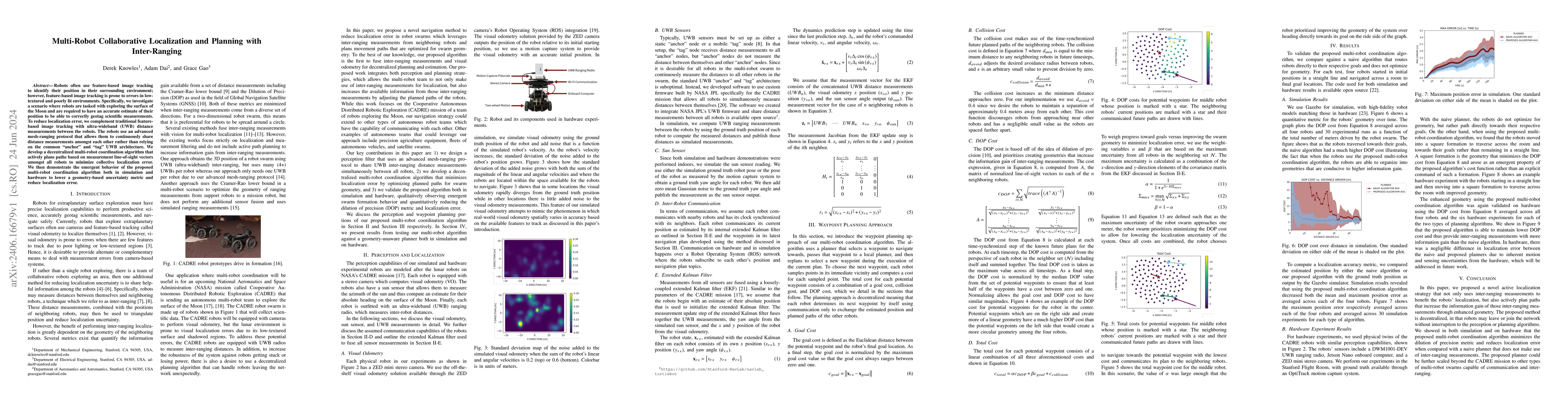
Robots often use feature-based image tracking to identify their position in their surrounding environment; however, feature-based image tracking is prone to errors in low-textured and poorly lit env...
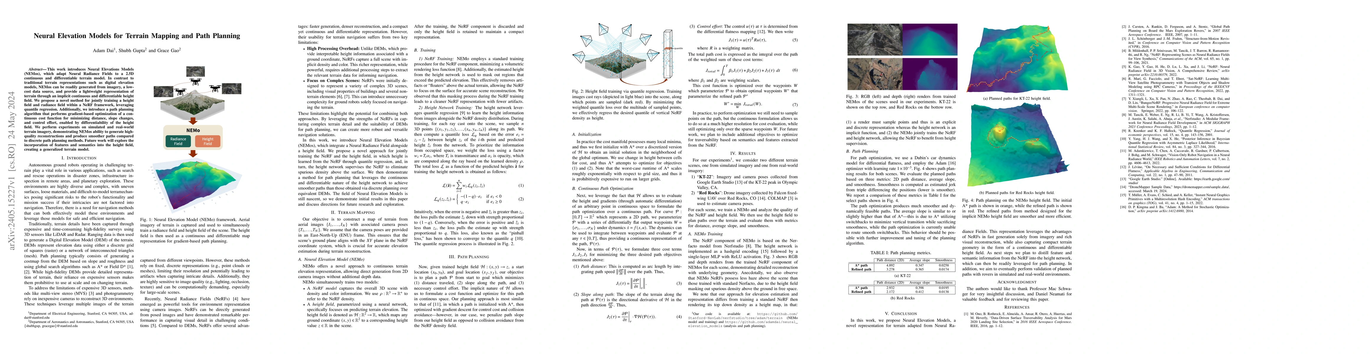
This work introduces Neural Elevations Models (NEMos), which adapt Neural Radiance Fields to a 2.5D continuous and differentiable terrain model. In contrast to traditional terrain representations su...
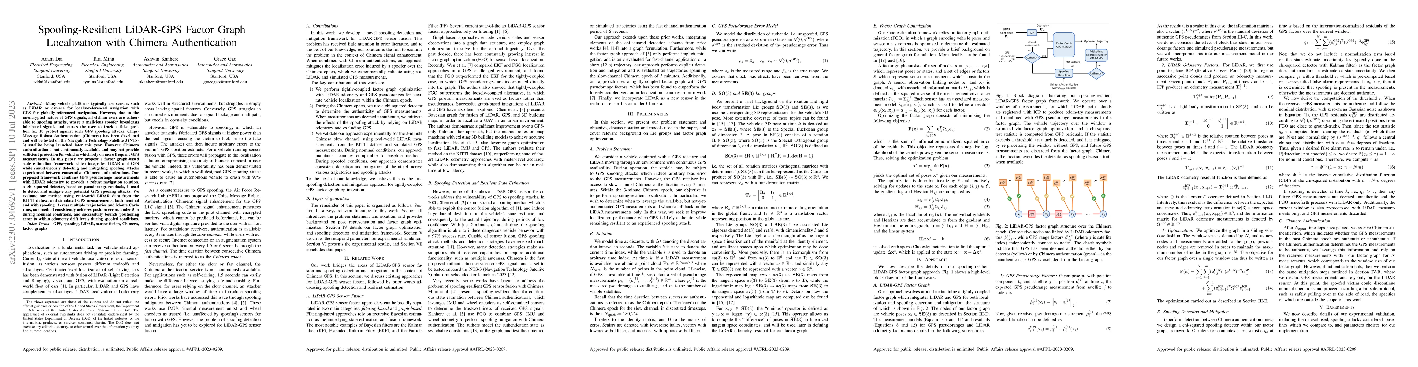
Many vehicle platforms typically use sensors such as LiDAR or camera for locally-referenced navigation with GPS for globally-referenced navigation. However, due to the unencrypted nature of GPS sign...
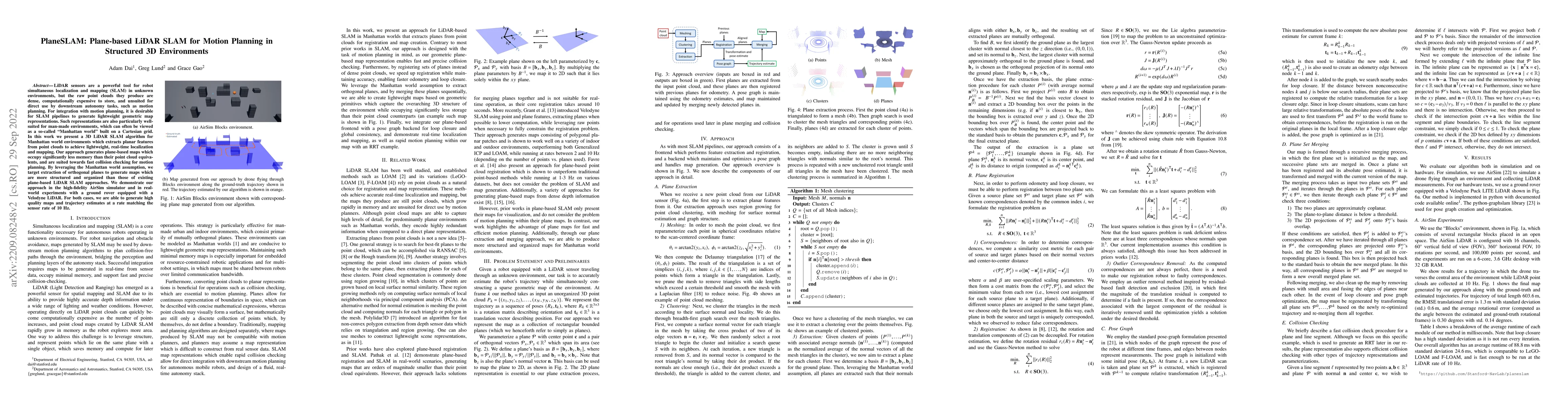
LiDAR sensors are a powerful tool for robot simultaneous localization and mapping (SLAM) in unknown environments, but the raw point clouds they produce are dense, computationally expensive to store,...
Ellipsoids are a common representation for reachability analysis, because they can be transformed efficiently under affine maps, and allow conservative approximation of Minkowski sums, which let one...
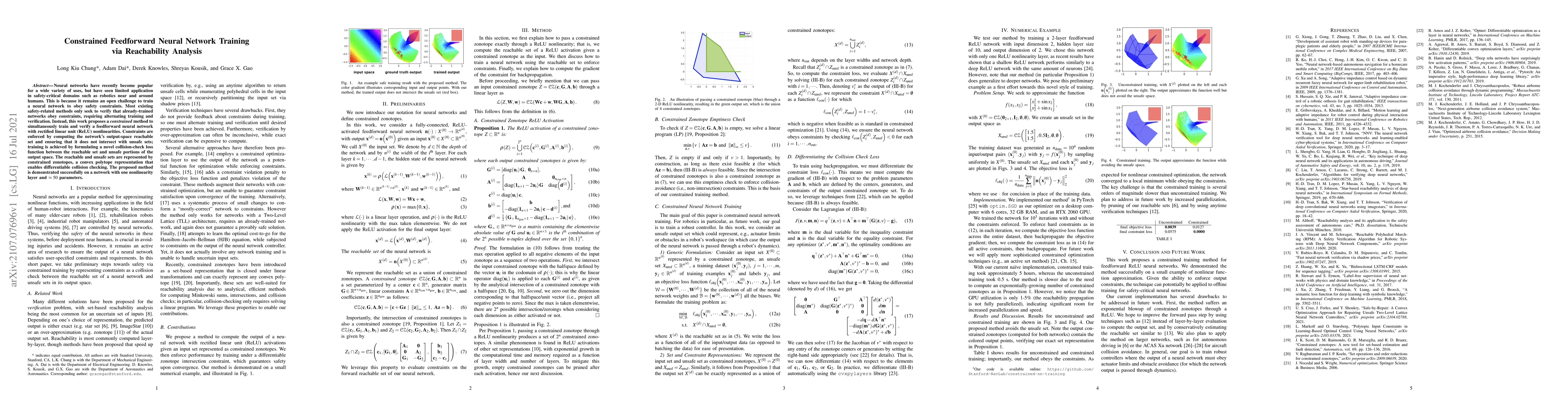
Neural networks have recently become popular for a wide variety of uses, but have seen limited application in safety-critical domains such as robotics near and around humans. This is because it rema...
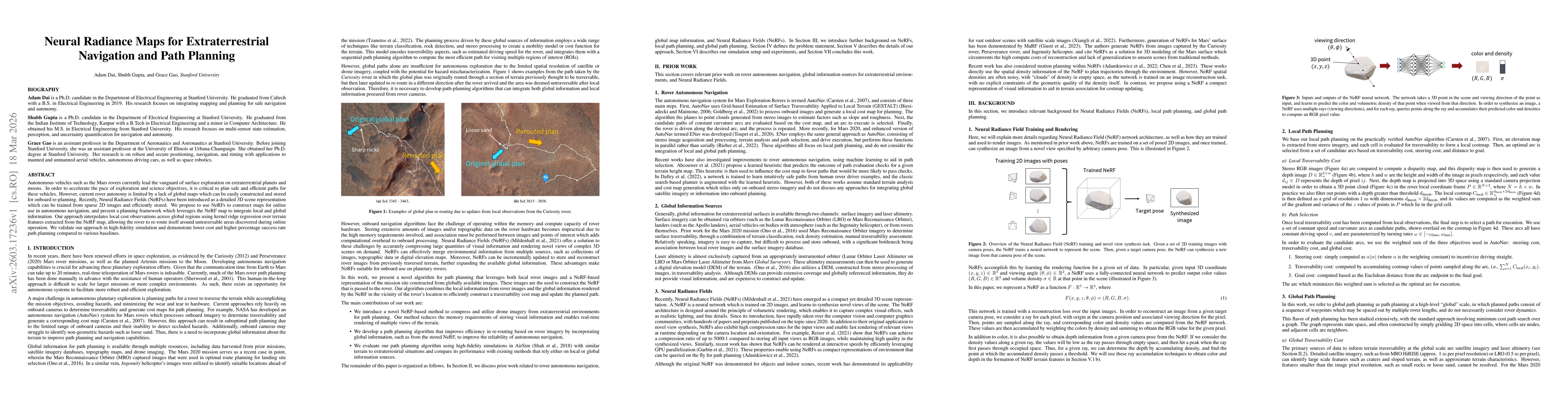
Autonomous vehicles such as the Mars rovers currently lead the vanguard of surface exploration on extraterrestrial planets and moons. In order to accelerate the pace of exploration and science objecti...
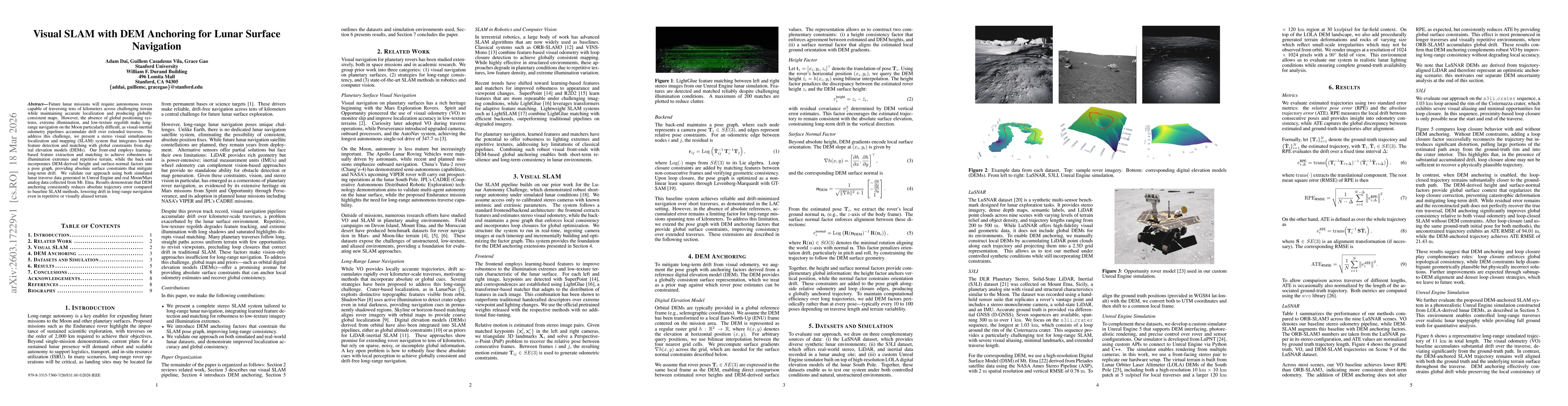
Future lunar missions will require autonomous rovers capable of traversing tens of kilometers across challenging terrain while maintaining accurate localization and producing globally consistent maps....
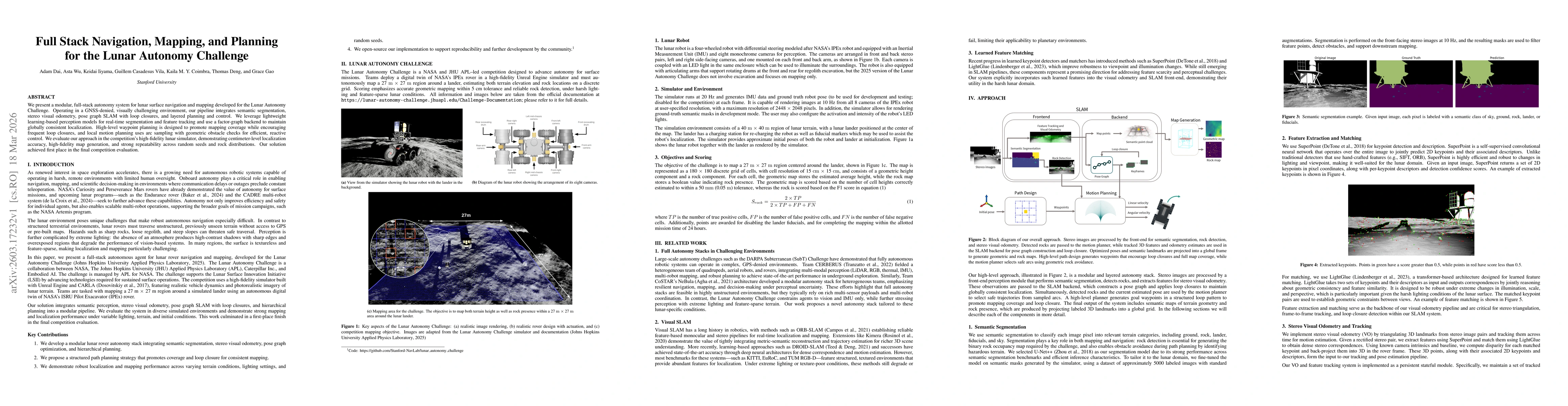
We present a modular, full-stack autonomy system for lunar surface navigation and mapping developed for the Lunar Autonomy Challenge. Operating in a GNSS-denied, visually challenging environment, our ...
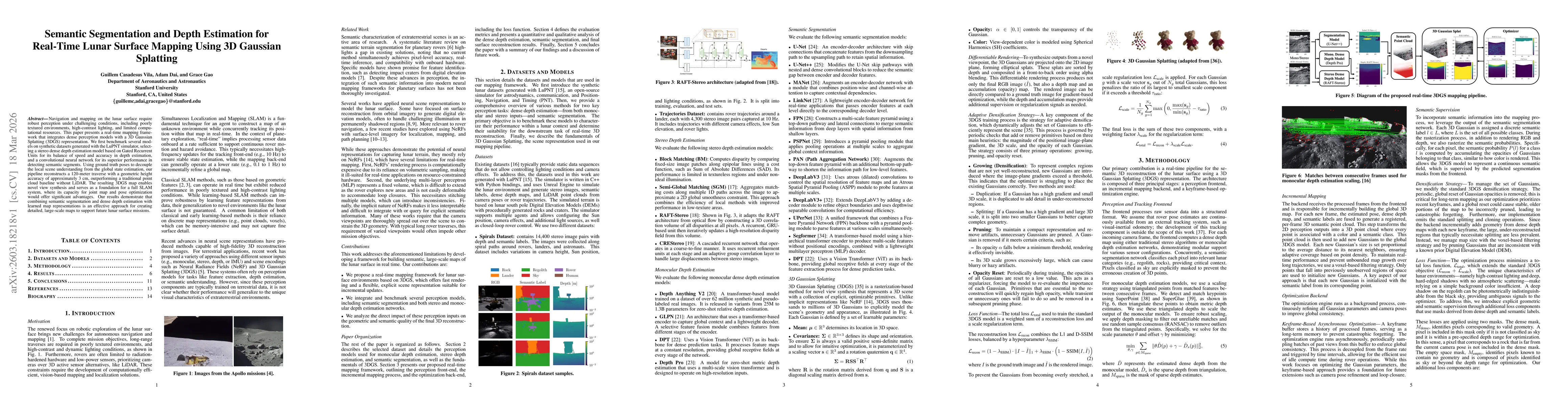
Navigation and mapping on the lunar surface require robust perception under challenging conditions, including poorly textured environments, high-contrast lighting, and limited computational resources....
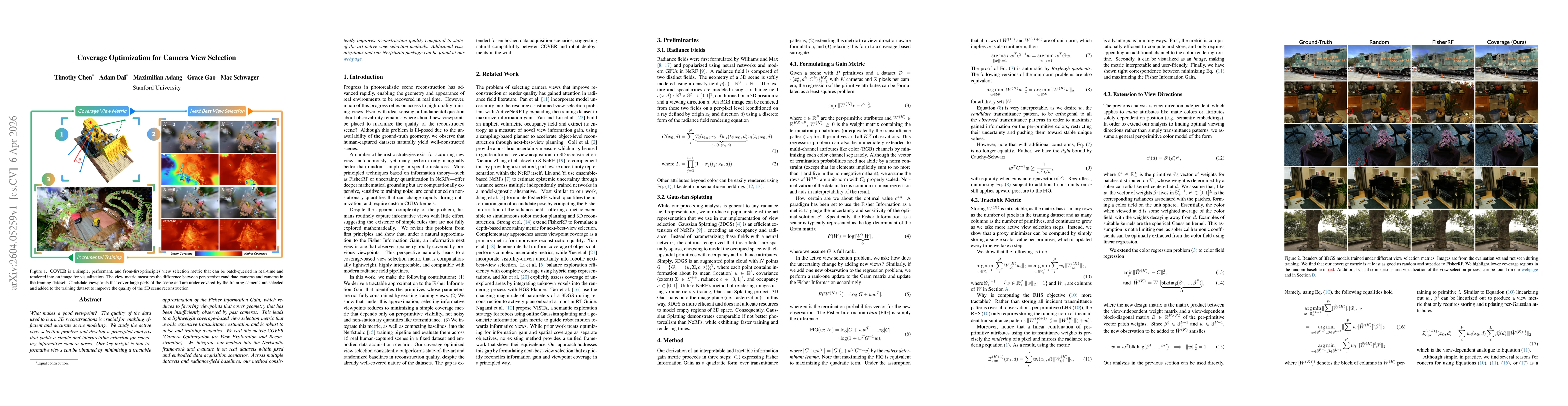
What makes a good viewpoint? The quality of the data used to learn 3D reconstructions is crucial for enabling efficient and accurate scene modeling. We study the active view selection problem and deve...