Academic Profile
Statistics
Similar Authors
Papers on arXiv
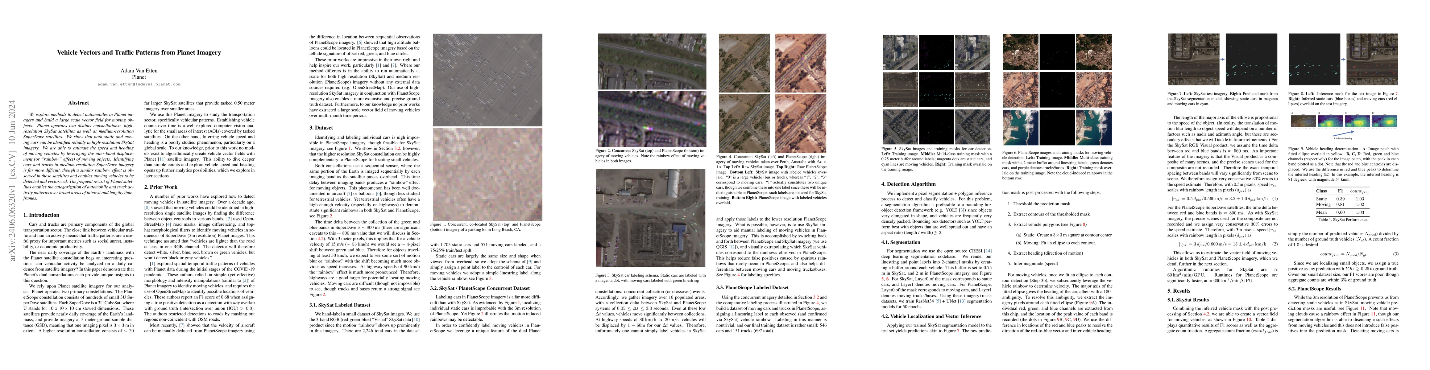
We explore methods to detect automobiles in Planet imagery and build a large scale vector field for moving objects. Planet operates two distinct constellations: high-resolution SkySat satellites as ...
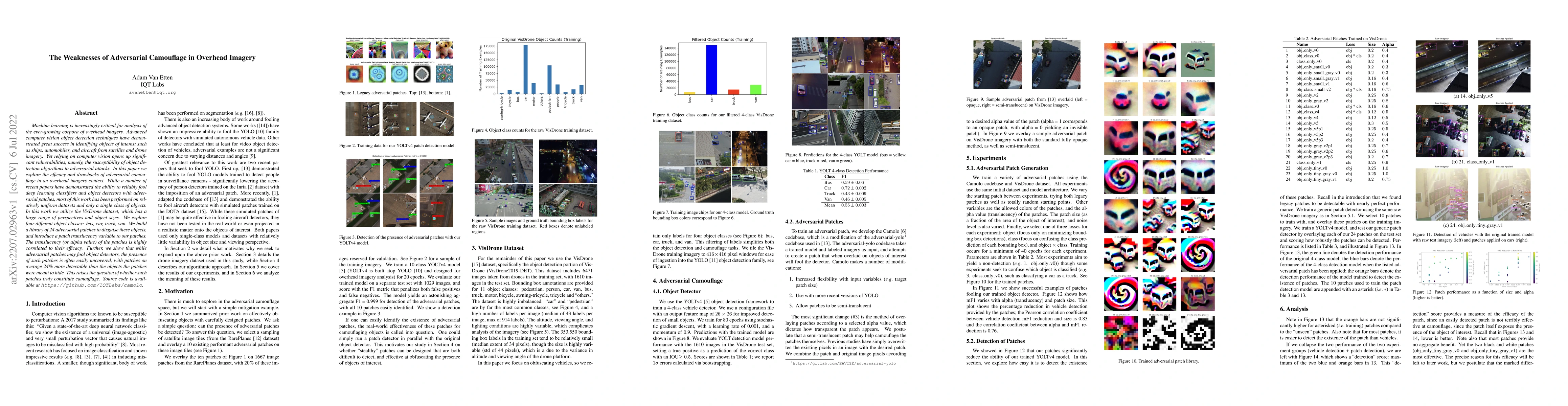
Machine learning is increasingly critical for analysis of the ever-growing corpora of overhead imagery. Advanced computer vision object detection techniques have demonstrated great success in identi...
Building footprints provide a useful proxy for a great many humanitarian applications. For example, building footprints are useful for high fidelity population estimates, and quantifying population ...
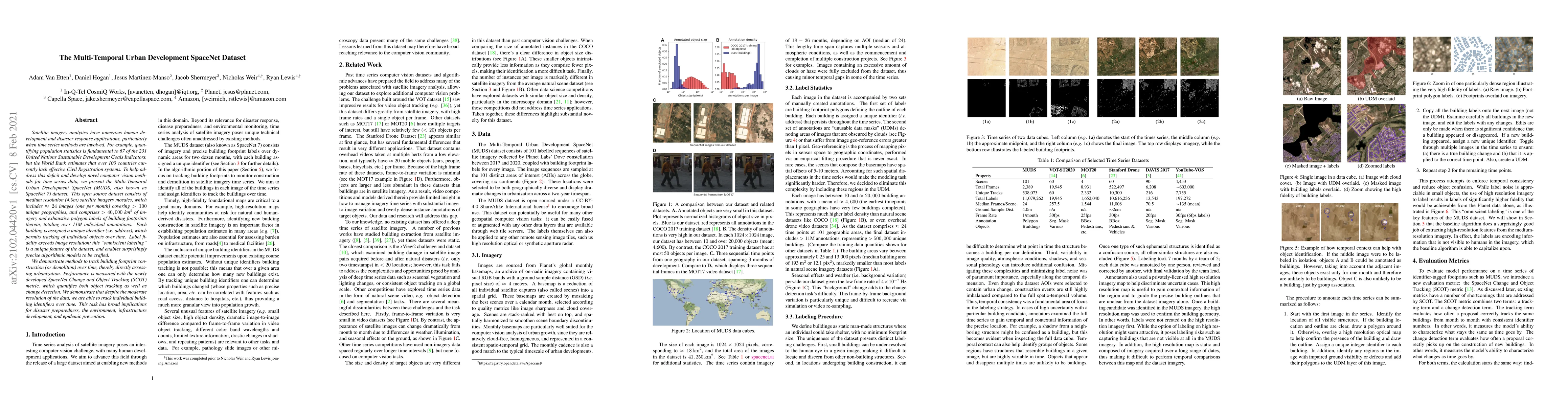
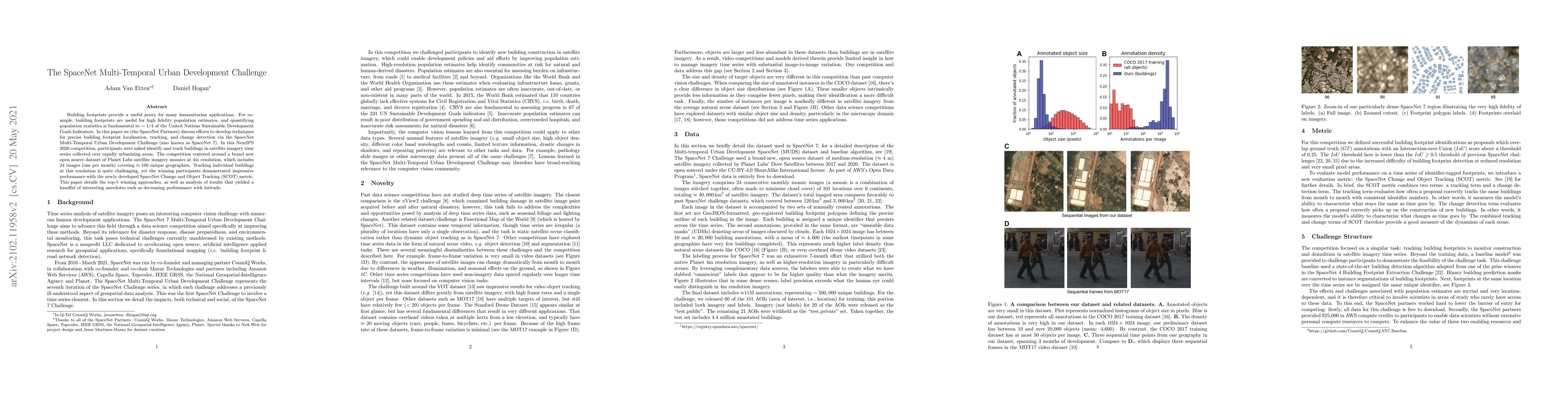
Satellite imagery analytics have numerous human development and disaster response applications, particularly when time series methods are involved. For example, quantifying population statistics is ...
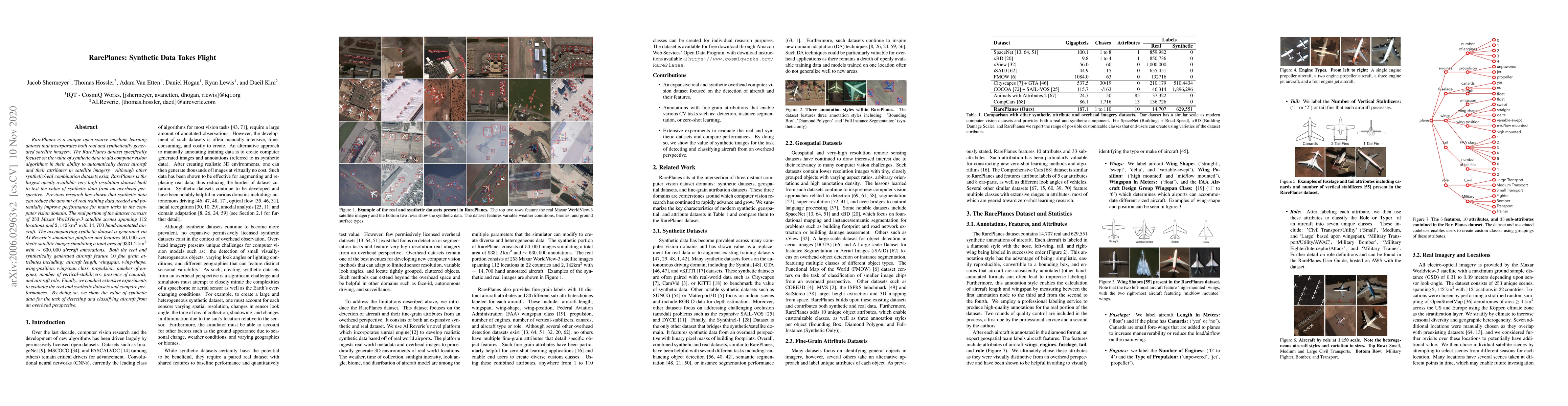
RarePlanes is a unique open-source machine learning dataset that incorporates both real and synthetically generated satellite imagery. The RarePlanes dataset specifically focuses on the value of syn...
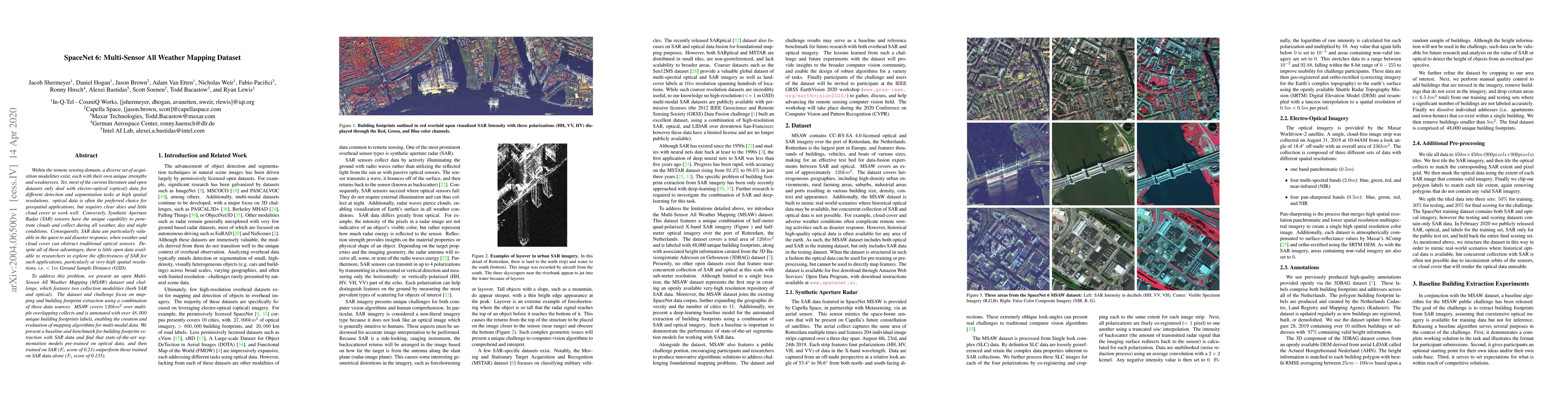
Within the remote sensing domain, a diverse set of acquisition modalities exist, each with their own unique strengths and weaknesses. Yet, most of the current literature and open datasets only deal ...
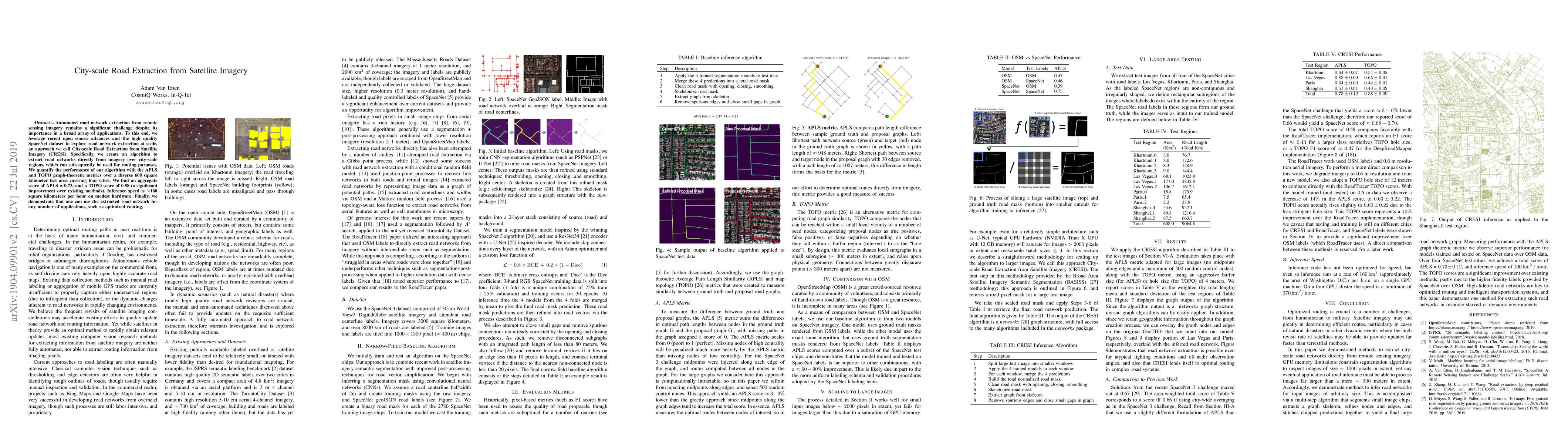
Automated road network extraction from remote sensing imagery remains a significant challenge despite its importance in a broad array of applications. To this end, we leverage recent open source adv...
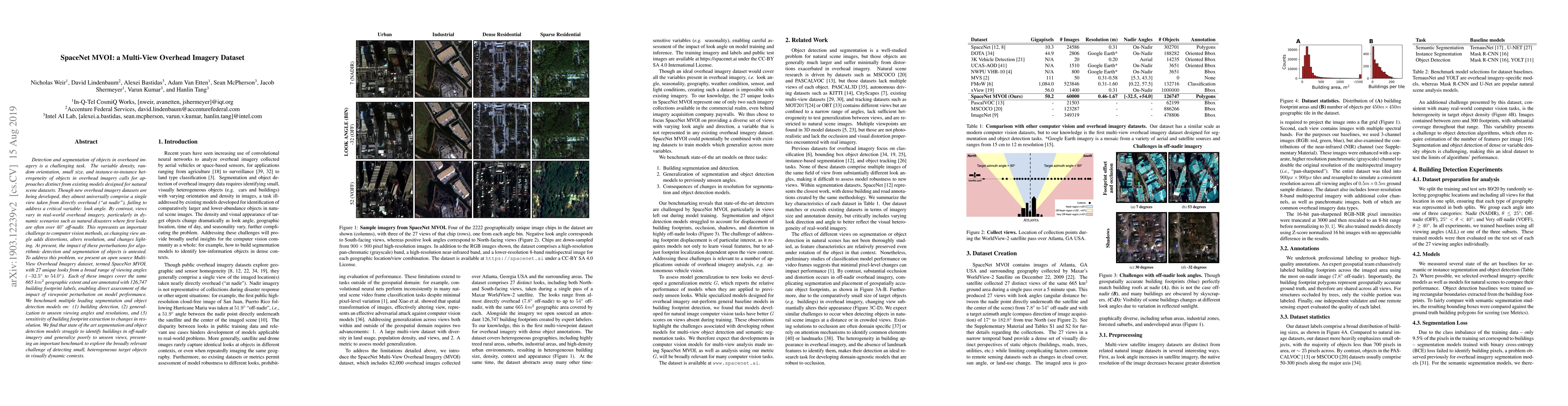
Detection and segmentation of objects in overheard imagery is a challenging task. The variable density, random orientation, small size, and instance-to-instance heterogeneity of objects in overhead ...
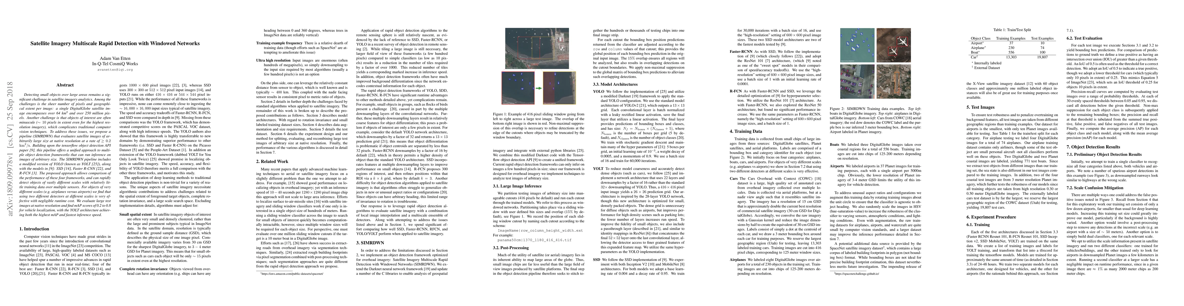
Detecting small objects over large areas remains a significant challenge in satellite imagery analytics. Among the challenges is the sheer number of pixels and geographical extent per image: a singl...
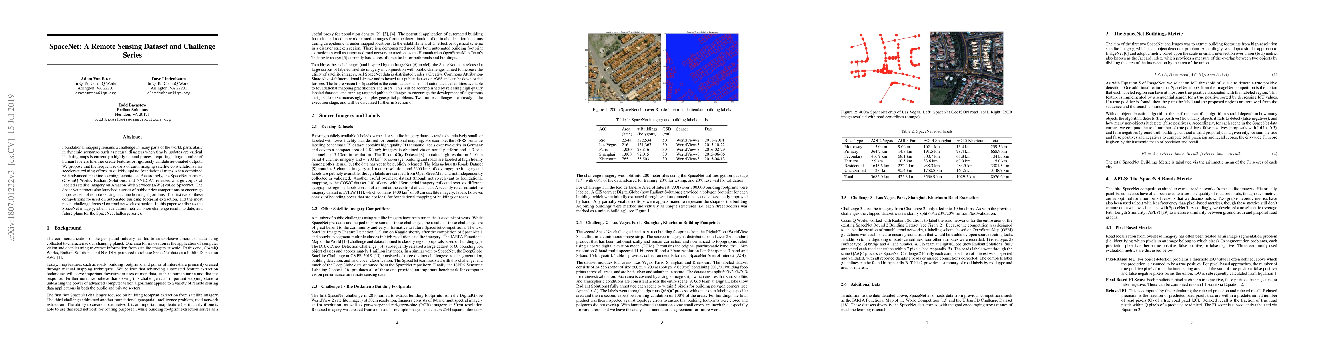
Foundational mapping remains a challenge in many parts of the world, particularly in dynamic scenarios such as natural disasters when timely updates are critical. Updating maps is currently a highly...