Academic Profile
Statistics
Similar Authors
Papers on arXiv
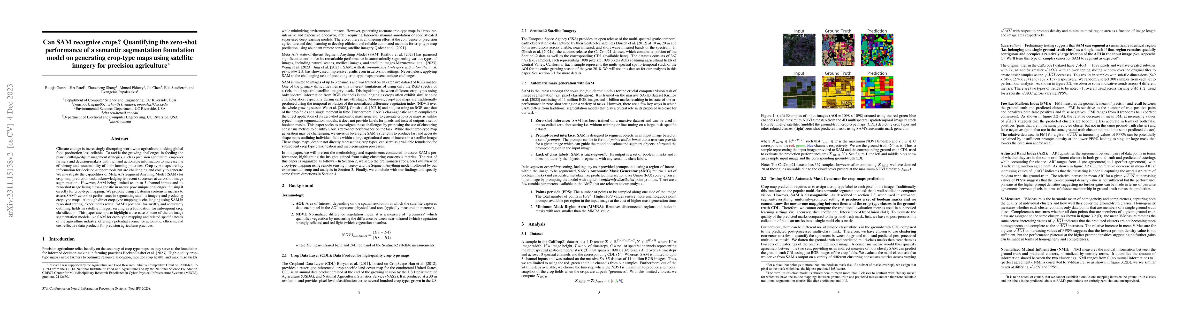
Climate change is increasingly disrupting worldwide agriculture, making global food production less reliable. To tackle the growing challenges in feeding the planet, cutting-edge management strategi...
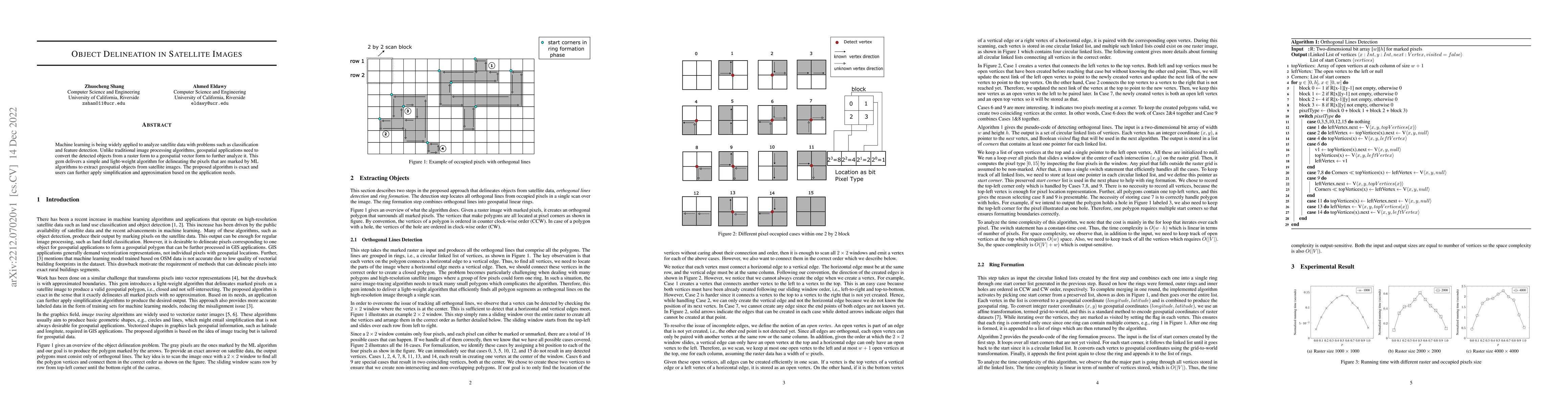
Machine learning is being widely applied to analyze satellite data with problems such as classification and feature detection. Unlike traditional image processing algorithms, geospatial applications...
![Thumbnail for Spatial Parquet: A Column File Format for Geospatial Data Lakes
[Extended Version]](https://nbg1.your-objectstorage.com/arxivlens/thumbnails/2209.02158.webp)
Modern data analytics applications prefer to use column-storage formats due to their improved storage efficiency through encoding and compression. Parquet is the most popular file format for column ...
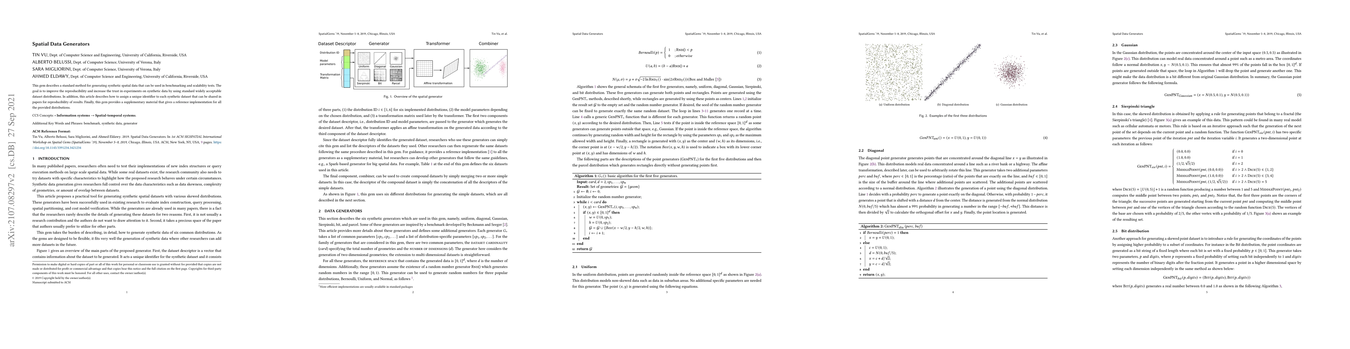
This gem describes a standard method for generating synthetic spatial data that can be used in benchmarking and scalability tests. The goal is to improve the reproducibility and increase the trust i...
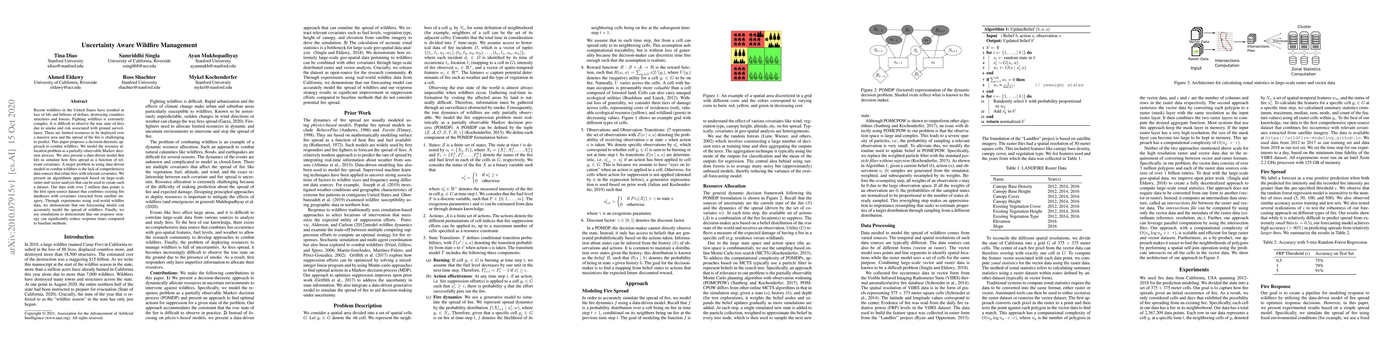
Recent wildfires in the United States have resulted in loss of life and billions of dollars, destroying countless structures and forests. Fighting wildfires is extremely complex. It is difficult to ...
![Thumbnail for Raptor Zonal Statistics: Fully Distributed Zonal Statistics of Big
Raster + Vector Data [Pre-Print]](https://nbg1.your-objectstorage.com/arxivlens/thumbnails/2010.06641.webp)
Recent advancements in remote sensing technology have resulted in petabytes of data in raster format. This data is often processed in combination with high resolution vector data that represents, fo...
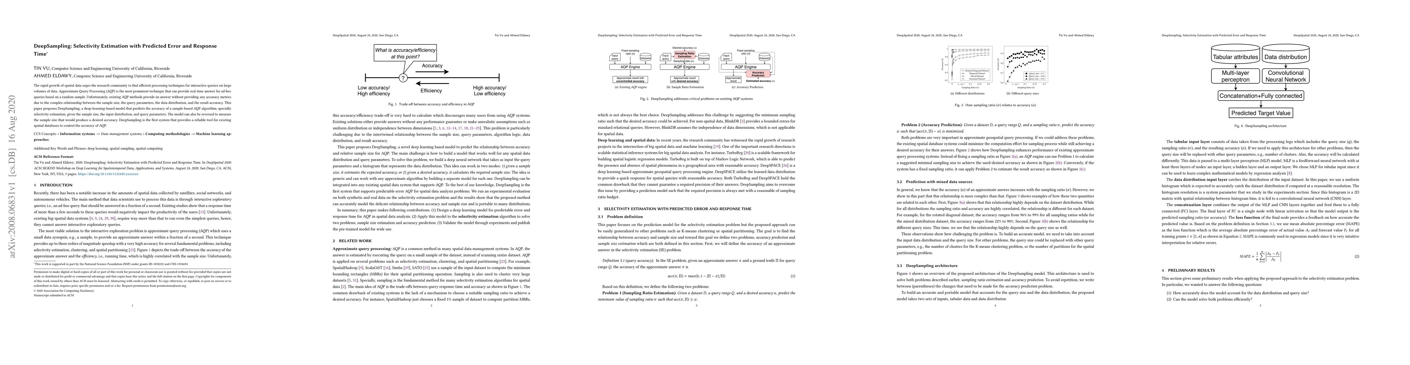
The rapid growth of spatial data urges the research community to find efficient processing techniques for interactive queries on large volumes of data. Approximate Query Processing (AQP) is the most...
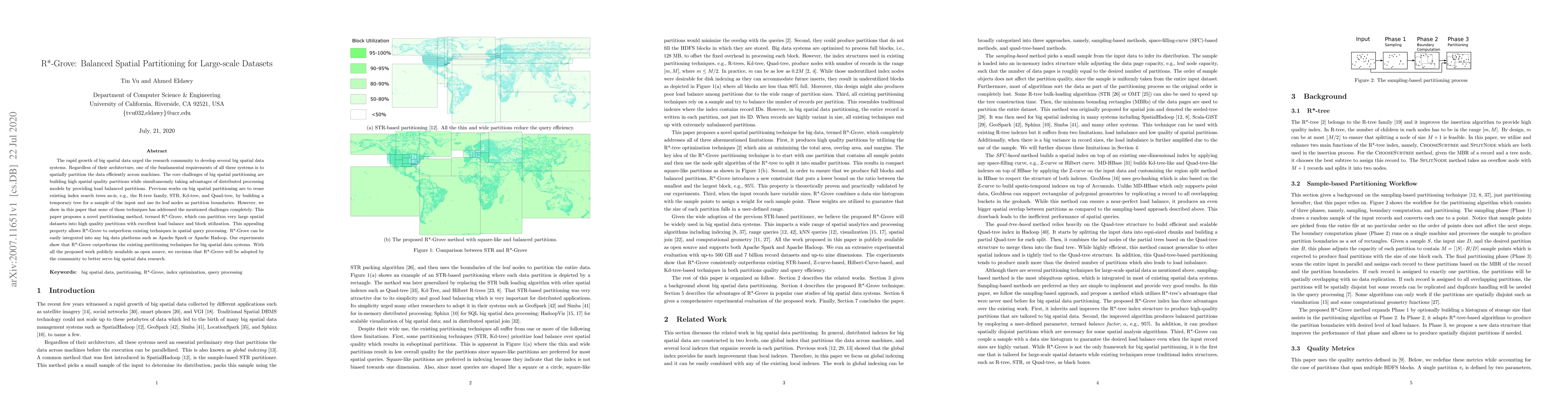
The rapid growth of big spatial data urged the research community to develop several big spatial data systems. Regardless of their architecture, one of the fundamental requirements of all these syst...
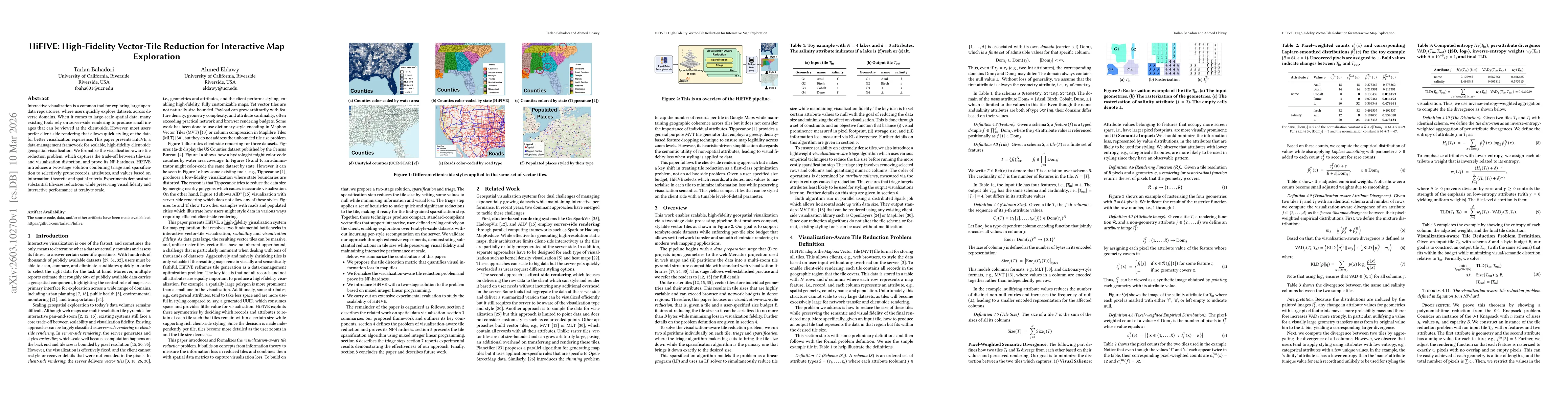
Interactive visualization is a common tool for exploring large open-data repositories, where users quickly explore datasets across diverse domains. When it comes to large-scale spatial data, many exis...
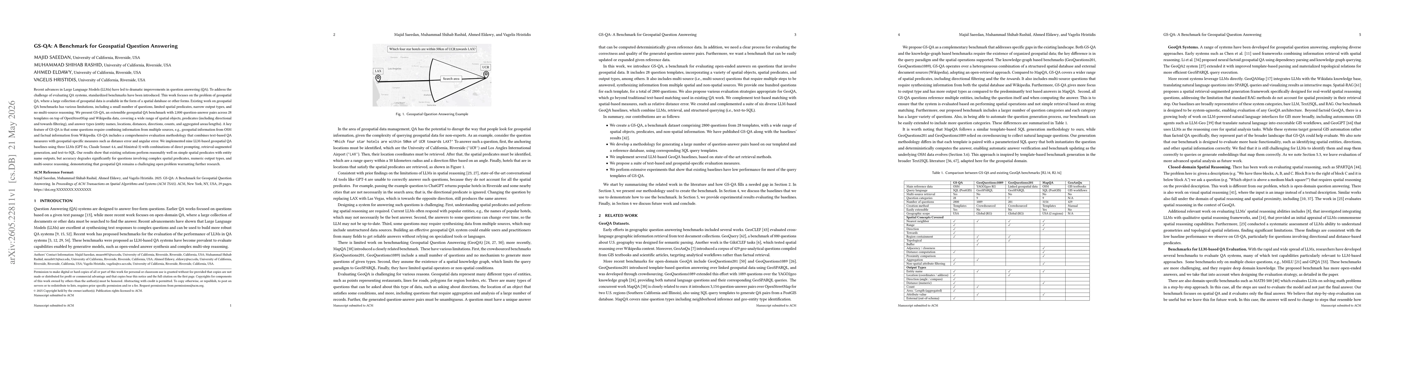
Recent advances in Large Language Models (LLMs) have led to dramatic improvements in question answering (QA). To address the challenge of evaluating QA systems, standardized benchmarks have been intro...
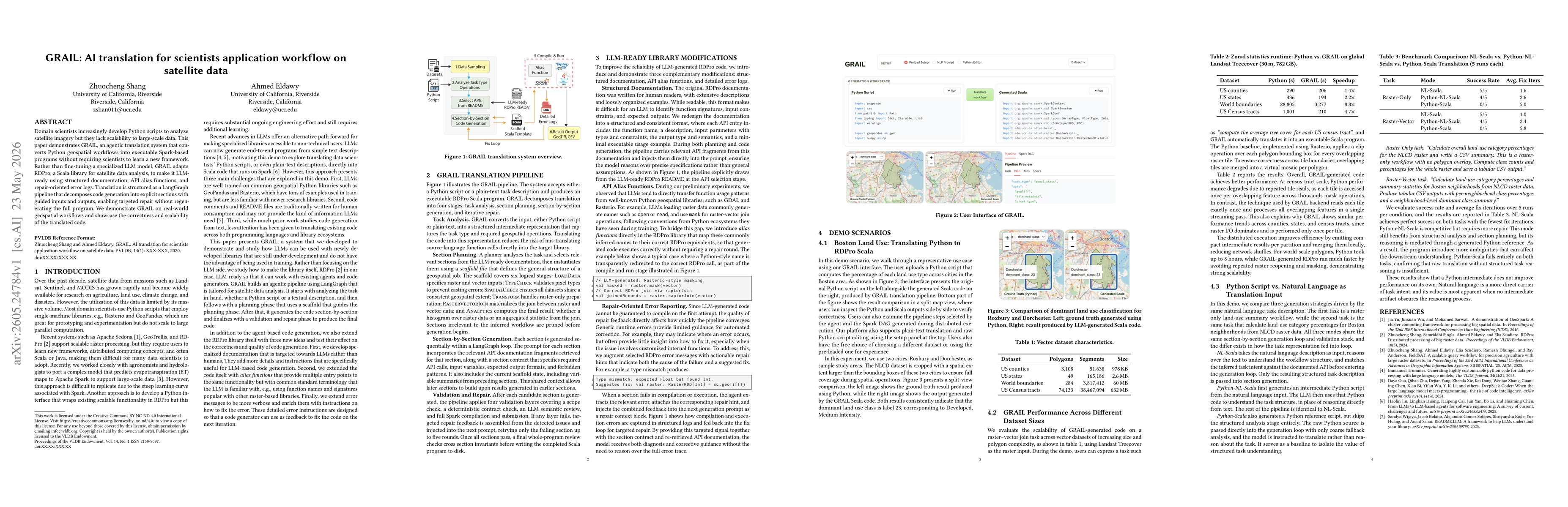
Domain scientists increasingly develop Python scripts to analyze satellite imagery but they lack scalability to large-scale data. This paper demonstrates GRAIL, an agentic translation system that conv...
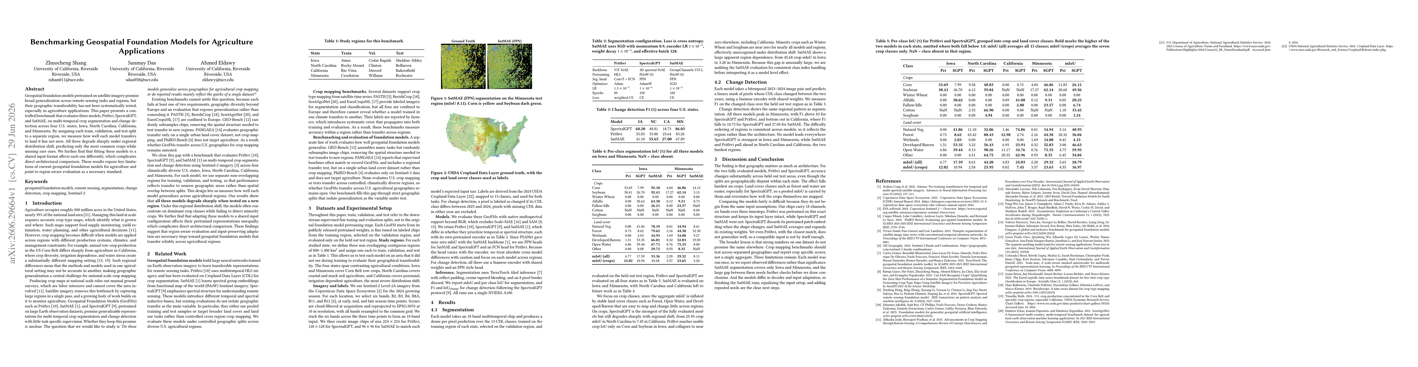
Geospatial foundation models pretrained on satellite imagery promise broad generalization across remote sensing tasks and regions, but their geographic transferability has not been systematically test...