Academic Profile
Statistics
Similar Authors
Papers on arXiv

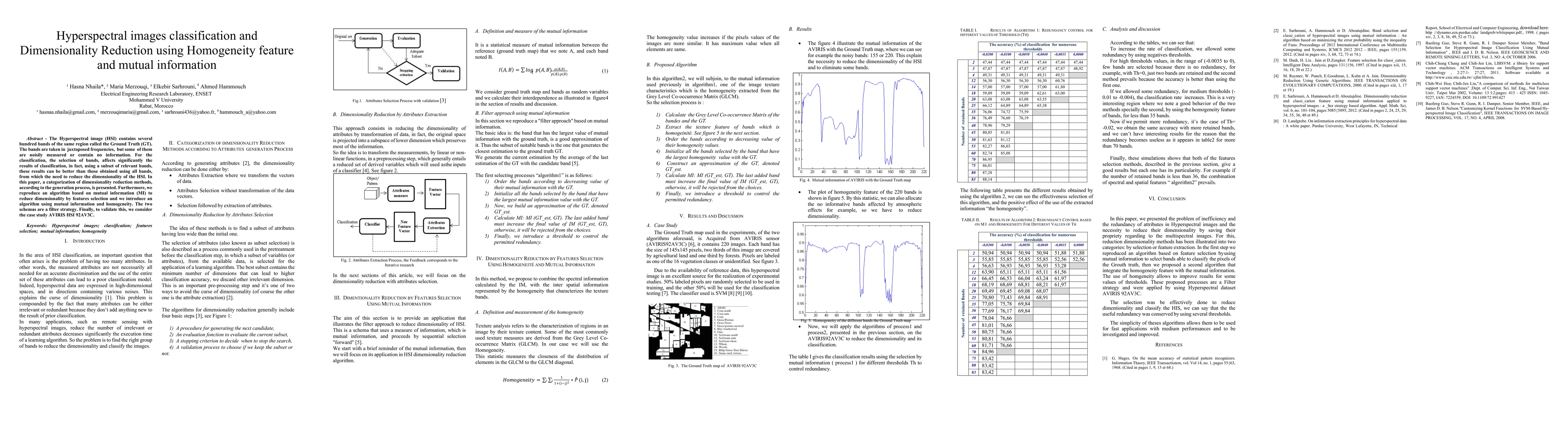
Hyperspectral images (HIS) classification is a high technical remote sensing tool. The goal is to reproduce a thematic map that will be compared with a reference ground truth map (GT), constructed b...
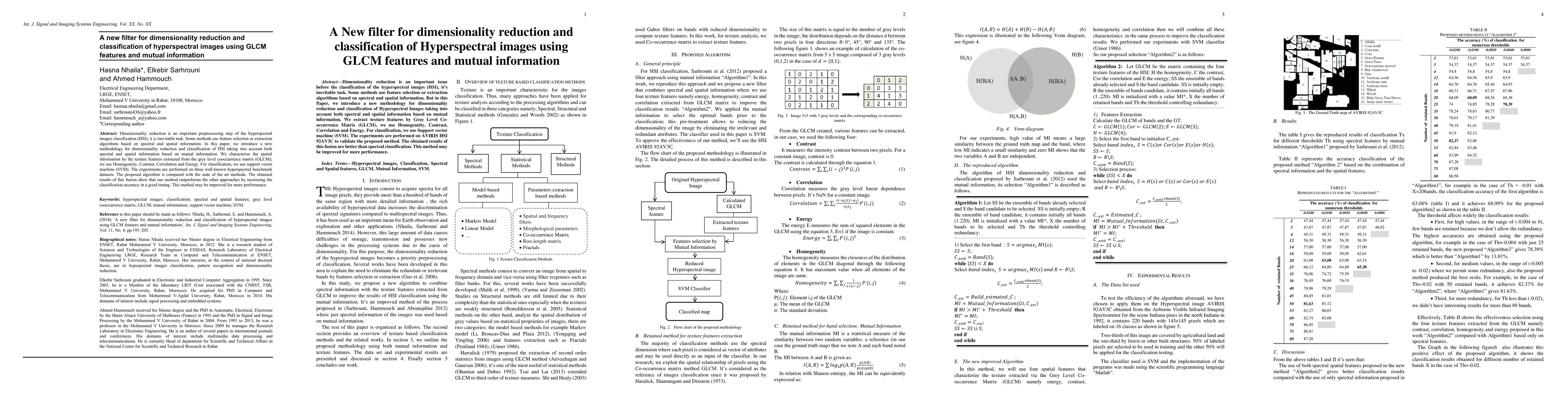
Dimensionality reduction is an important preprocessing step of the hyperspectral images classification (HSI), it is inevitable task. Some methods use feature selection or extraction algorithms based...
The Hyperspectral image (HSI) contains several hundred bands of the same region called the Ground Truth (GT). The bands are taken in juxtaposed frequencies, but some of them are noisily measured or ...
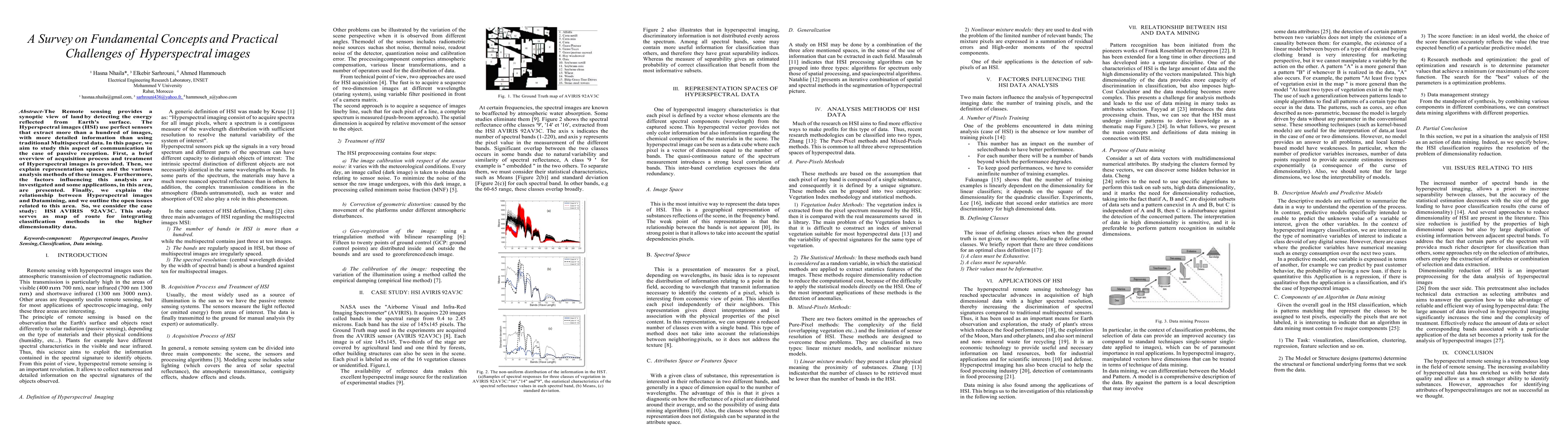
The Remote sensing provides a synoptic view of land by detecting the energy reflected from Earth's surface. The Hyperspectral images (HSI) use perfect sensors that extract more than a hundred of ima...
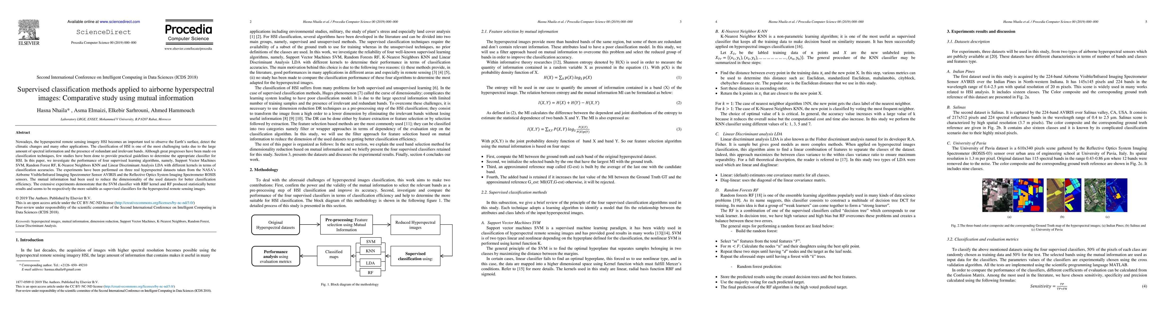
Over the past decades, the hyperspectral remote sensing technology development has attracted growing interest among scientists in various domains. The rich and detailed spectral information provided...
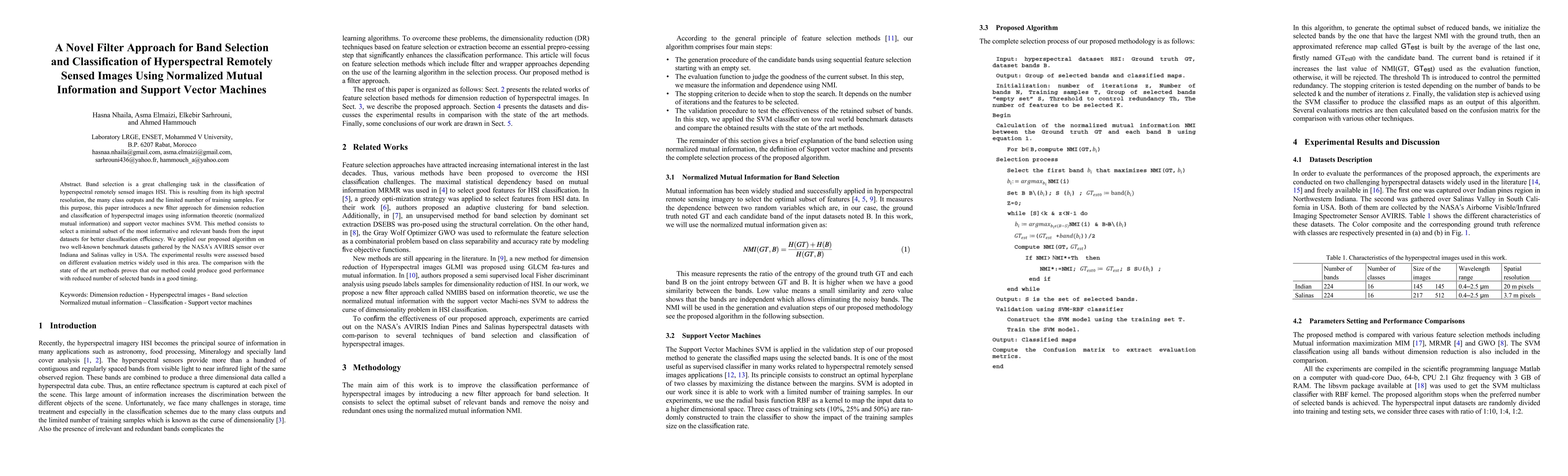
Band selection is a great challenging task in the classification of hyperspectral remotely sensed images HSI. This is resulting from its high spectral resolution, the many class outputs and the limi...
Nowadays, the hyperspectral remote sensing imagery HSI becomes an important tool to observe the Earth's surface, detect the climatic changes and many other applications. The classification of HSI is...
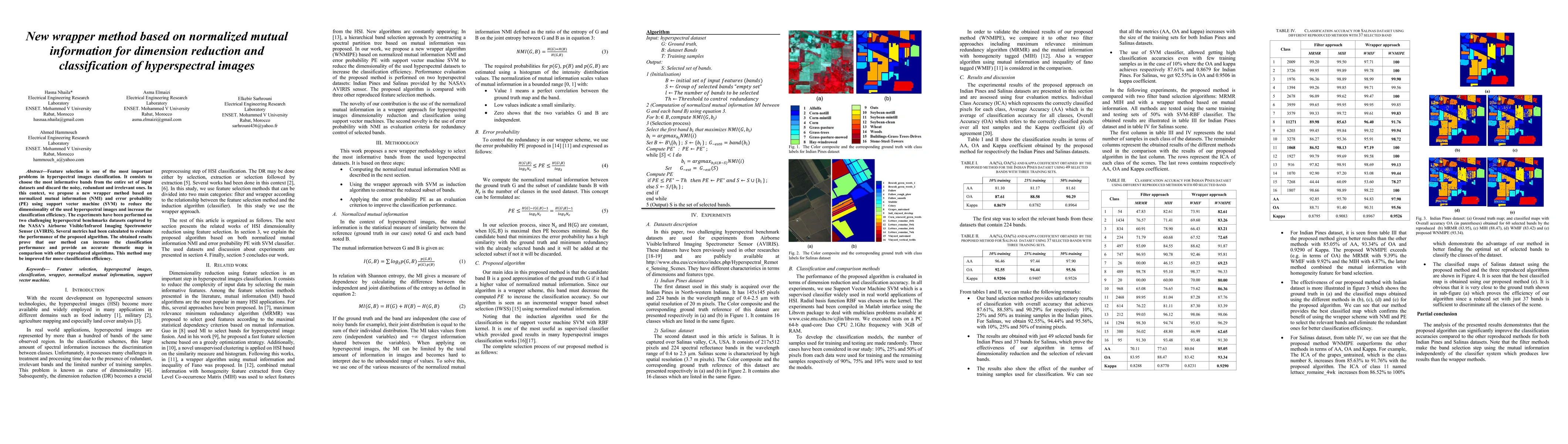
Recently, the hyperspectral sensors have improved our ability to monitor the earth surface with high spectral resolution. However, the high dimensionality of spectral data brings challenges for the ...
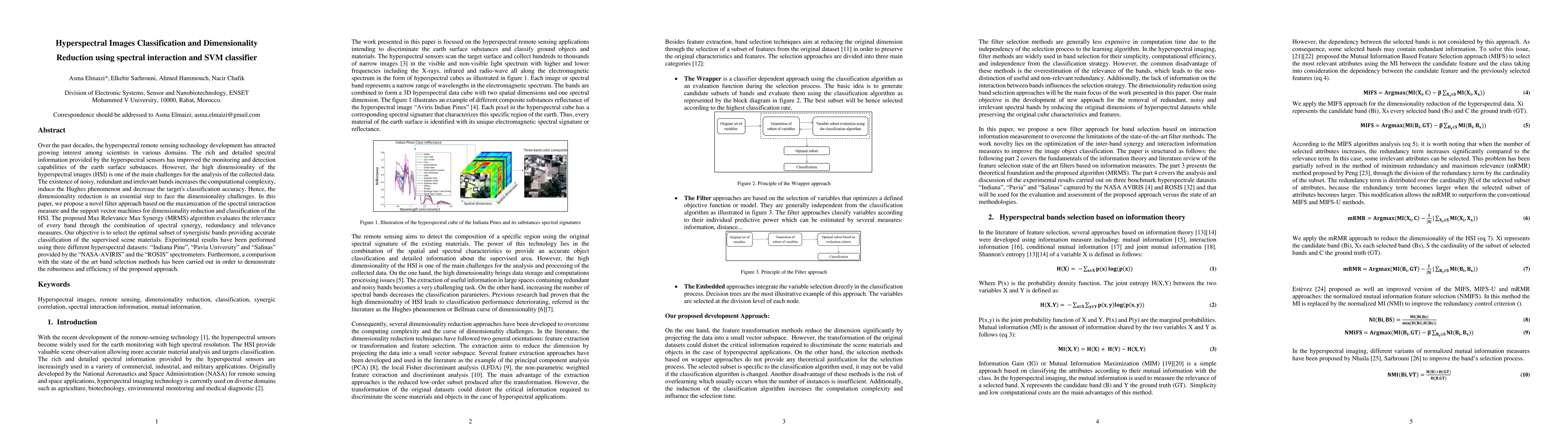
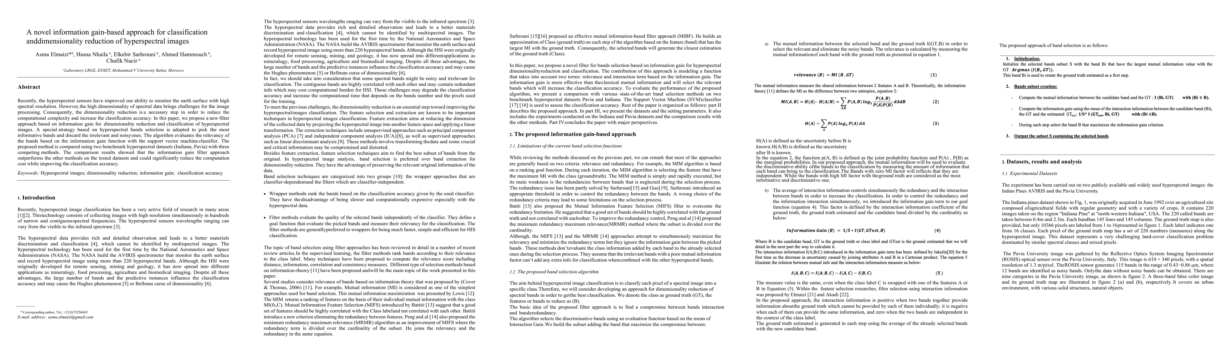
Feature selection is one of the most important problems in hyperspectral images classification. It consists to choose the most informative bands from the entire set of input datasets and discard the...
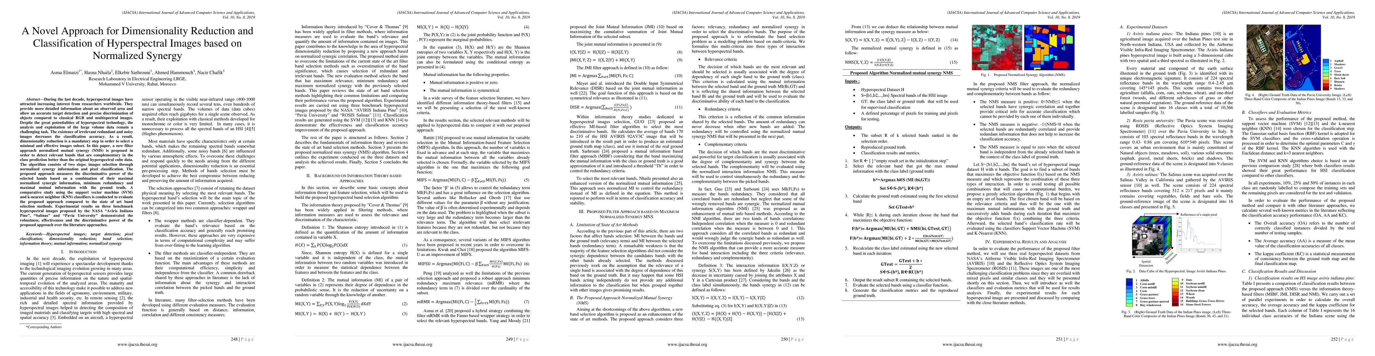
During the last decade, hyperspectral images have attracted increasing interest from researchers worldwide. They provide more detailed information about an observed area and allow an accurate target...
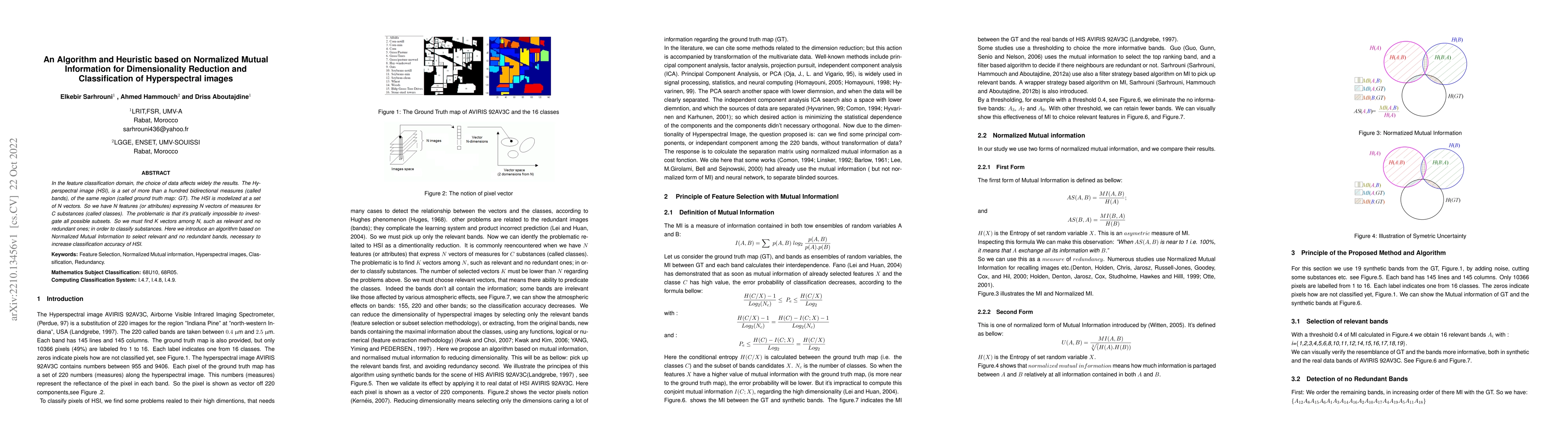
In the feature classification domain, the choice of data affects widely the results. The Hyperspectral image (HSI), is a set of more than a hundred bidirectional measures (called bands), of the same...
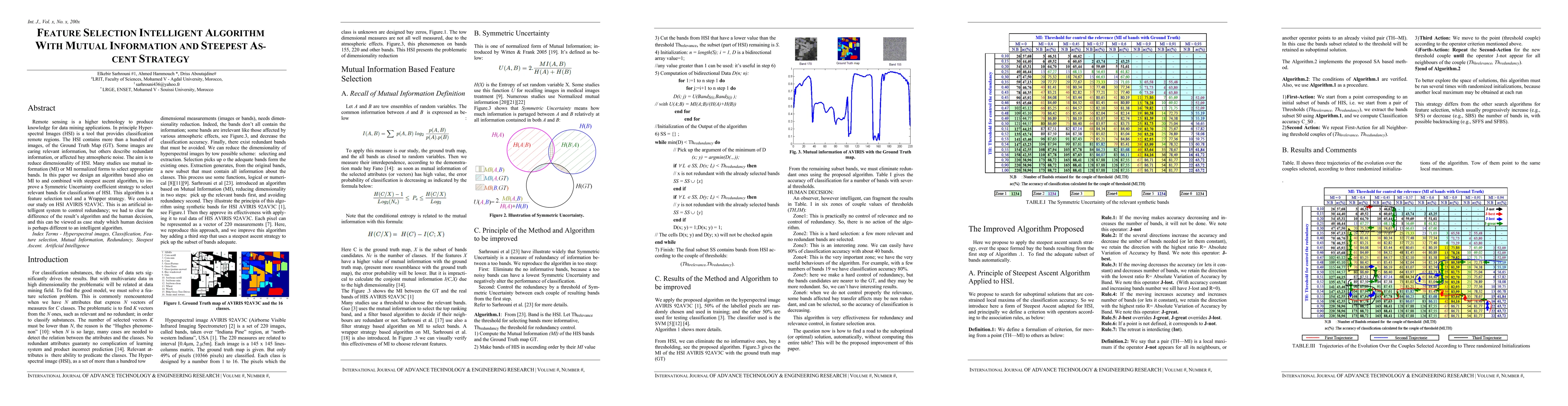
Remote sensing is a higher technology to produce knowledge for data mining applications. In principle hyperspectral images (HSIs) is a remote sensing tool that provides precise classification of reg...
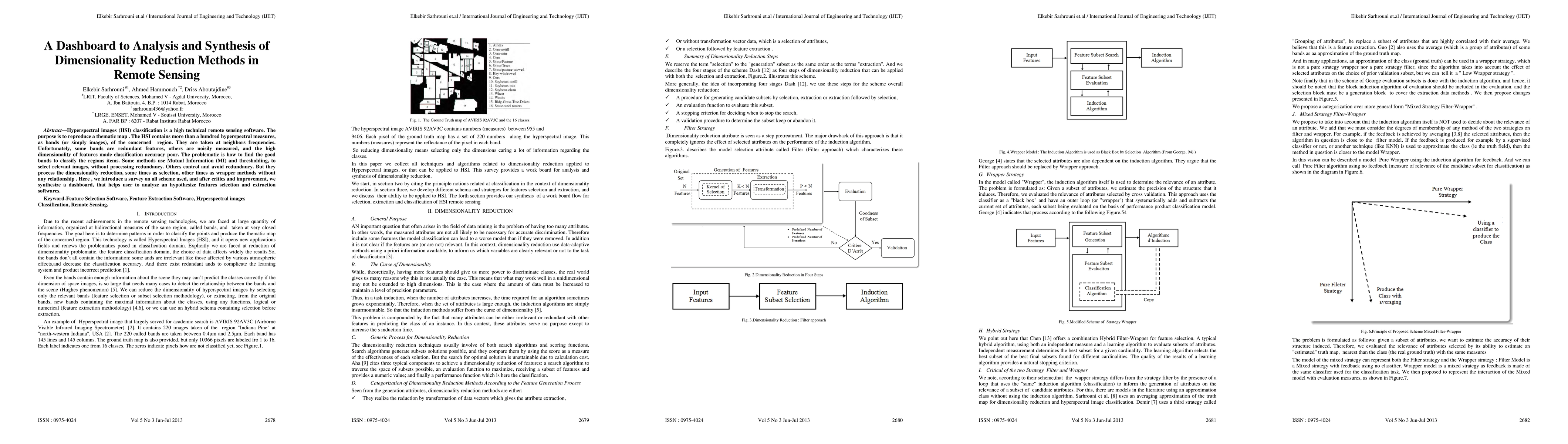
Hyperspectral images (HSI) classification is a high technical remote sensing software. The purpose is to reproduce a thematic map . The HSI contains more than a hundred hyperspectral measures, as ba...