Academic Profile
Statistics
Similar Authors
Papers on arXiv
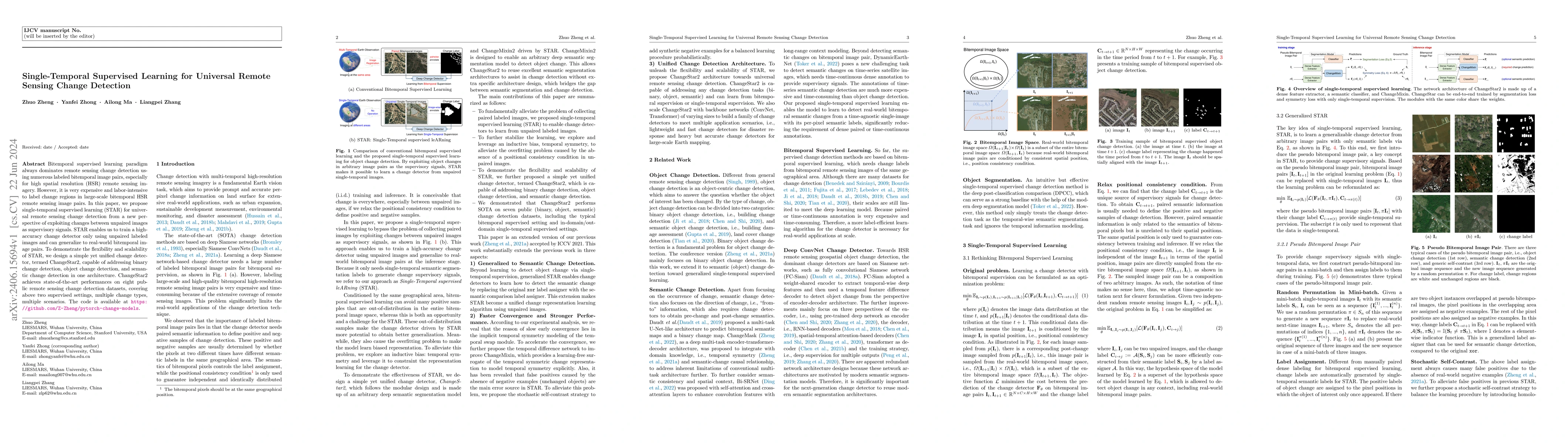
Bitemporal supervised learning paradigm always dominates remote sensing change detection using numerous labeled bitemporal image pairs, especially for high spatial resolution (HSR) remote sensing im...
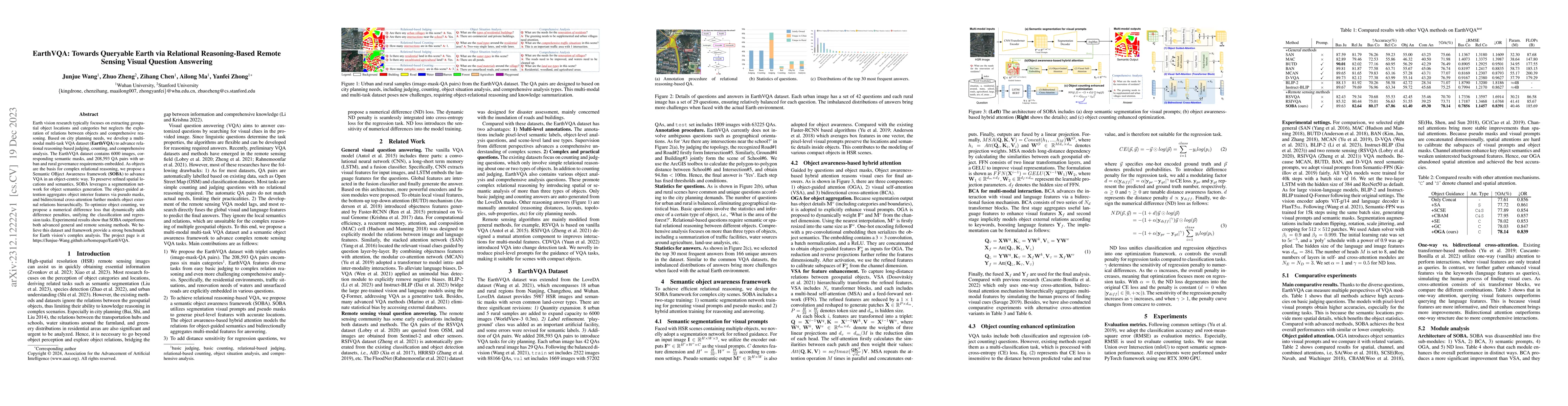
Earth vision research typically focuses on extracting geospatial object locations and categories but neglects the exploration of relations between objects and comprehensive reasoning. Based on city ...
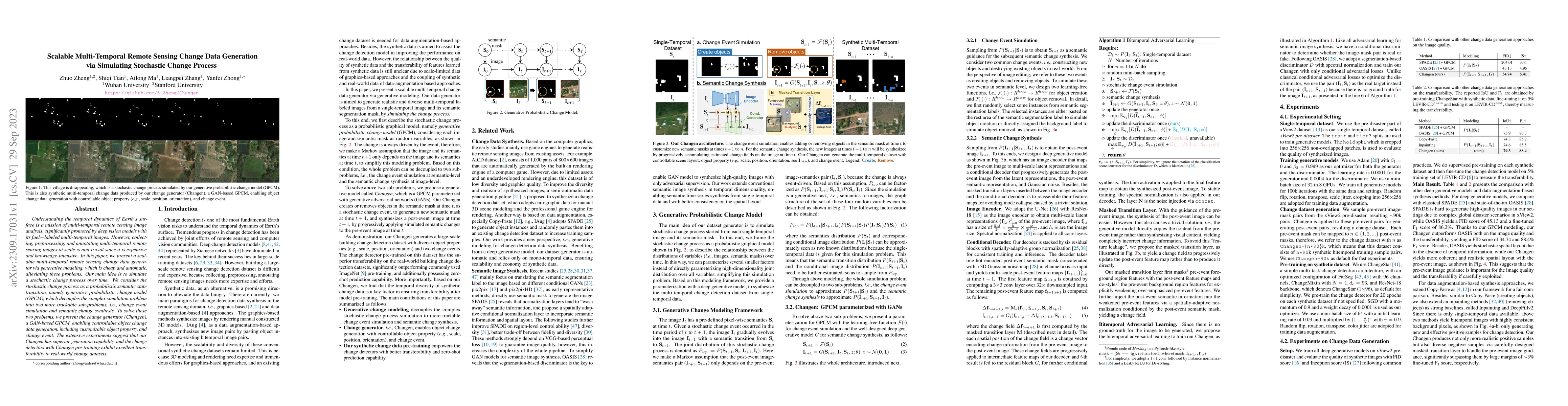
Understanding the temporal dynamics of Earth's surface is a mission of multi-temporal remote sensing image analysis, significantly promoted by deep vision models with its fuel -- labeled multi-tempo...
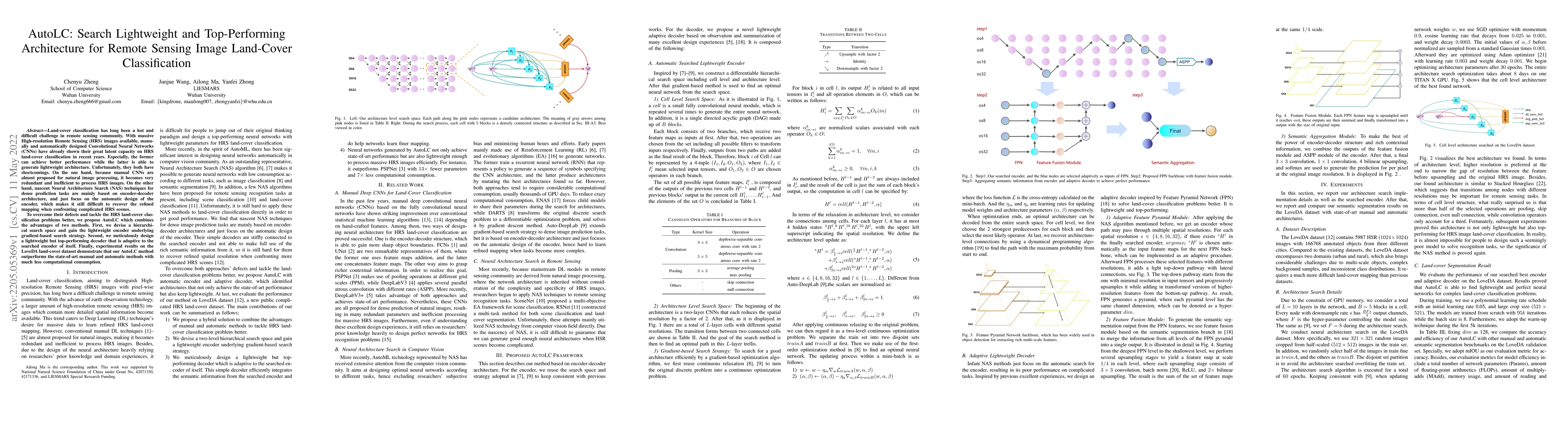
Land-cover classification has long been a hot and difficult challenge in remote sensing community. With massive High-resolution Remote Sensing (HRS) images available, manually and automatically desi...
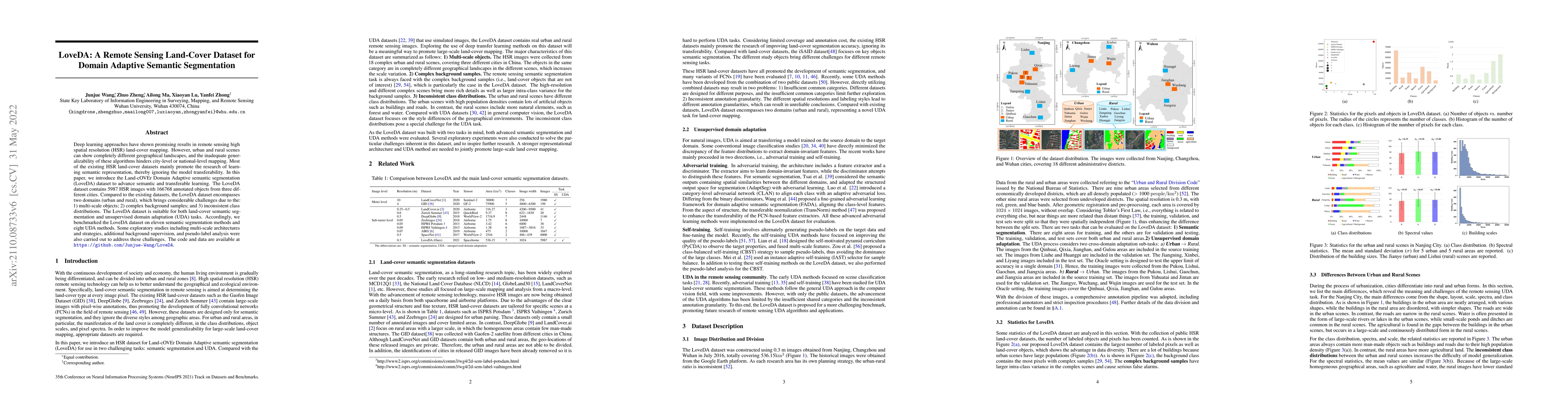
Deep learning approaches have shown promising results in remote sensing high spatial resolution (HSR) land-cover mapping. However, urban and rural scenes can show completely different geographical l...
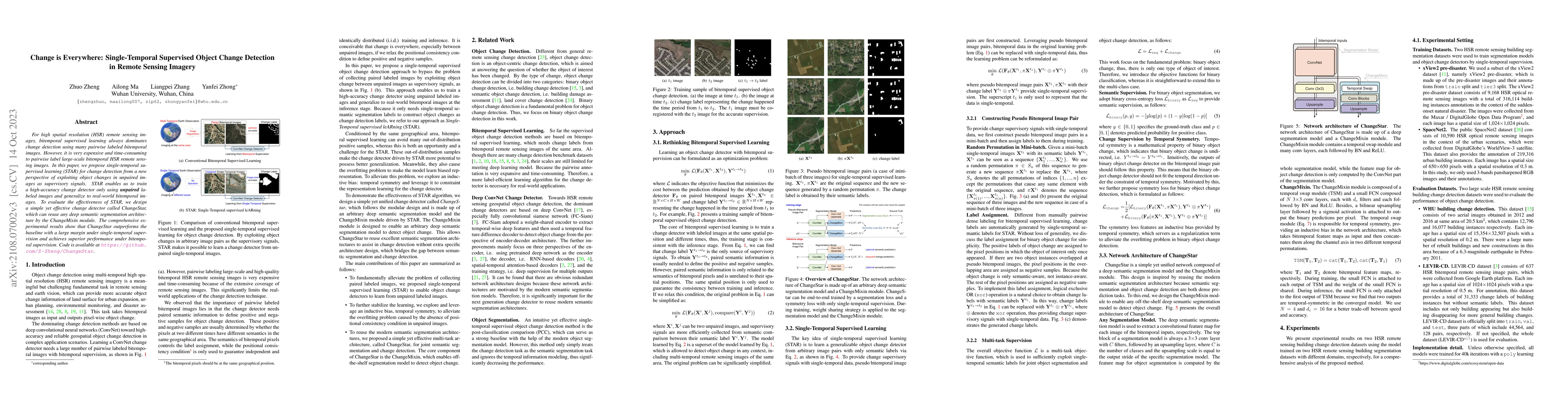
For high spatial resolution (HSR) remote sensing images, bitemporal supervised learning always dominates change detection using many pairwise labeled bitemporal images. However, it is very expensive...
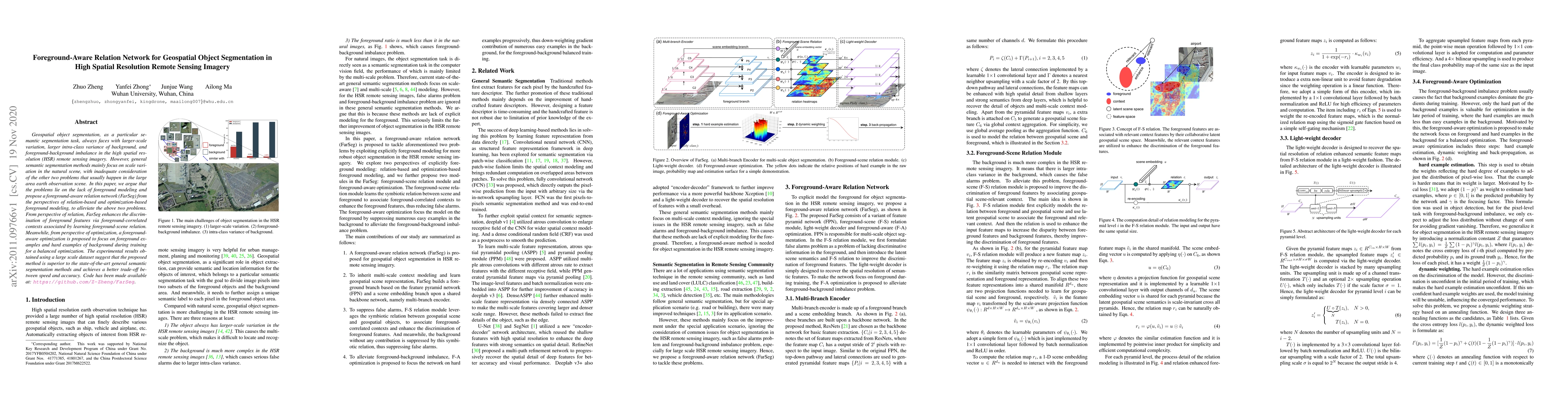
Geospatial object segmentation, as a particular semantic segmentation task, always faces with larger-scale variation, larger intra-class variance of background, and foreground-background imbalance i...
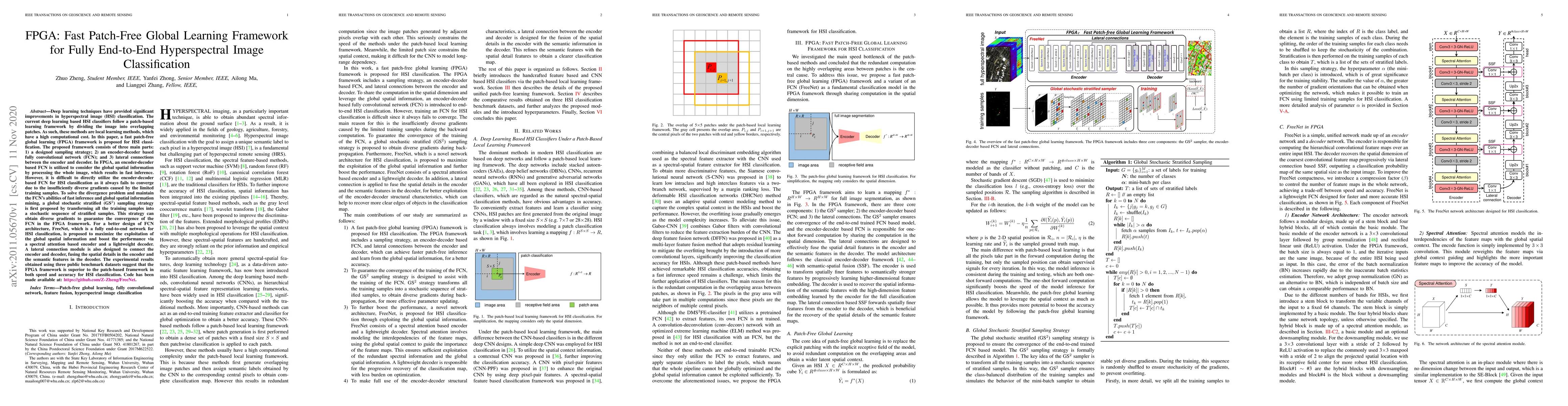
Deep learning techniques have provided significant improvements in hyperspectral image (HSI) classification. The current deep learning based HSI classifiers follow a patch-based learning framework b...
Earth vision has achieved milestones in geospatial object recognition but lacks exploration in object-relational reasoning, limiting comprehensive scene understanding. To address this, a progressive E...