Akram Zaytar
faculty of sciences and technologies tangier, Abdelmalek Essaadi University
Academic Profile
Statistics
Similar Authors
Papers on arXiv
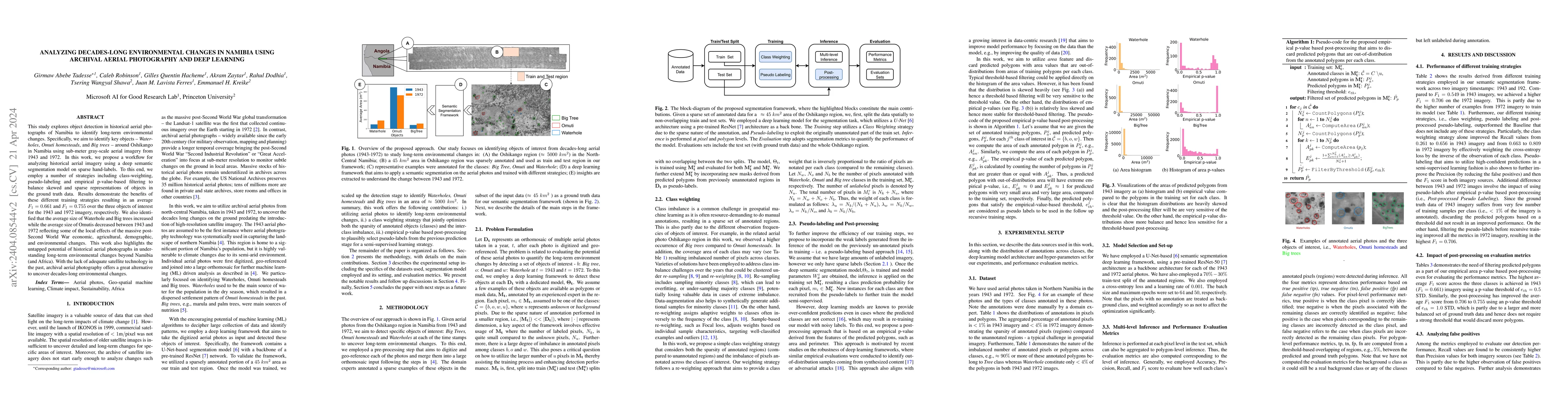
This study explores object detection in historical aerial photographs of Namibia to identify long-term environmental changes. Specifically, we aim to identify key objects -- Waterholes, Omuti homest...
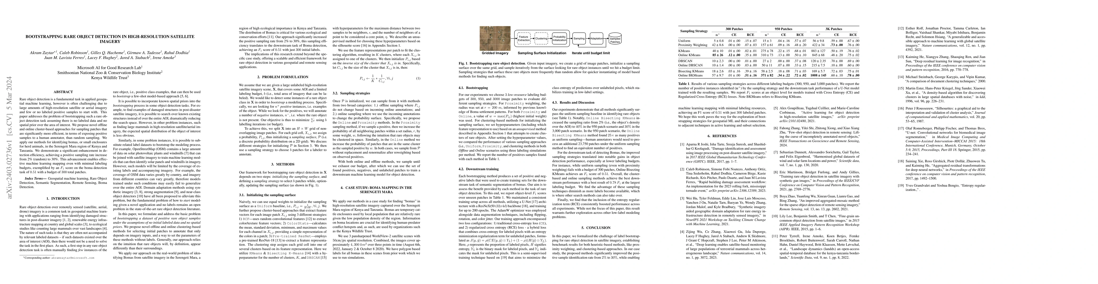
Rare object detection is a fundamental task in applied geospatial machine learning, however is often challenging due to large amounts of high-resolution satellite or aerial imagery and few or no lab...
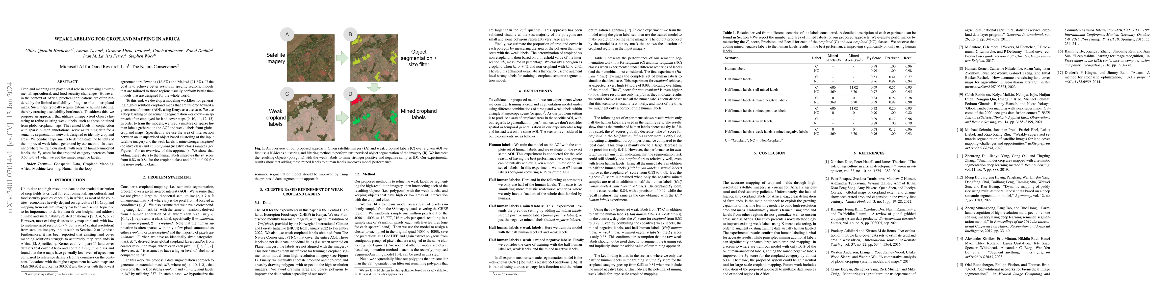
Cropland mapping can play a vital role in addressing environmental, agricultural, and food security challenges. However, in the context of Africa, practical applications are often hindered by the li...
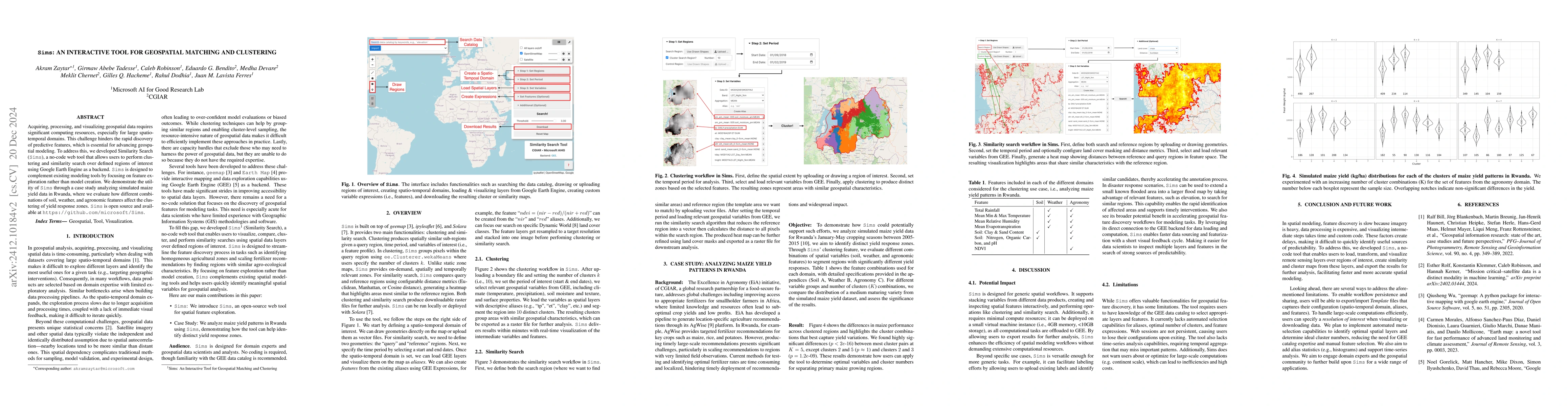
Acquiring, processing, and visualizing geospatial data requires significant computing resources, especially for large spatio-temporal domains. This challenge hinders the rapid discovery of predictive ...
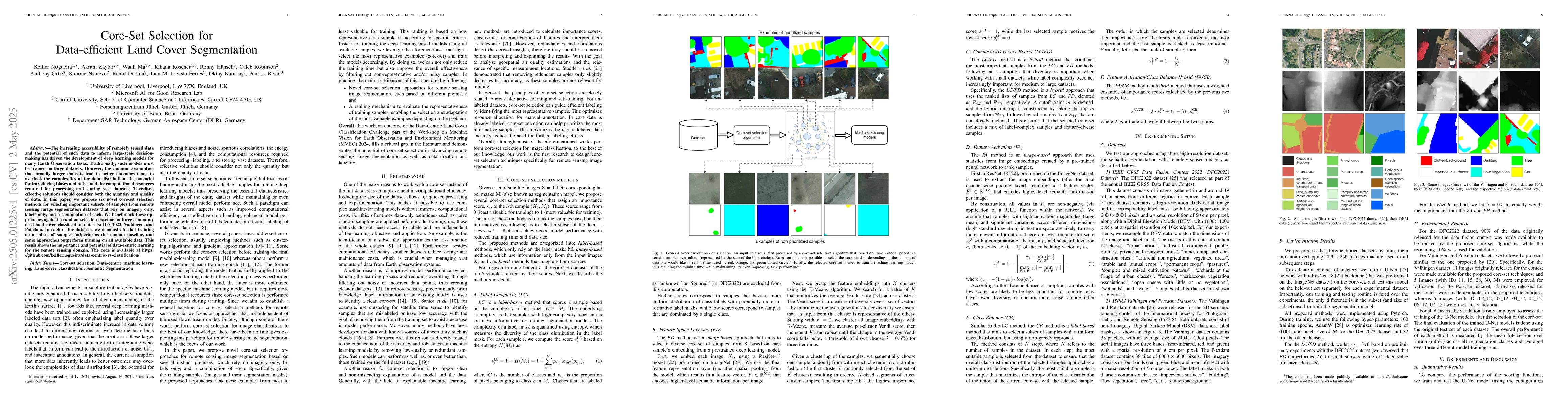
The increasing accessibility of remotely sensed data and the potential of such data to inform large-scale decision-making has driven the development of deep learning models for many Earth Observation ...
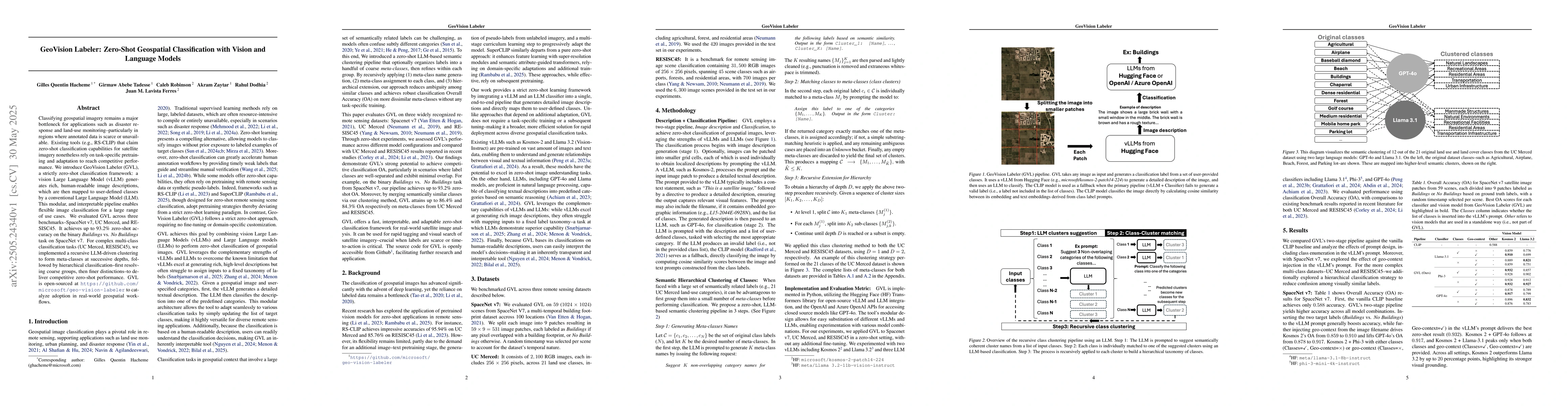
Classifying geospatial imagery remains a major bottleneck for applications such as disaster response and land-use monitoring-particularly in regions where annotated data is scarce or unavailable. Exis...
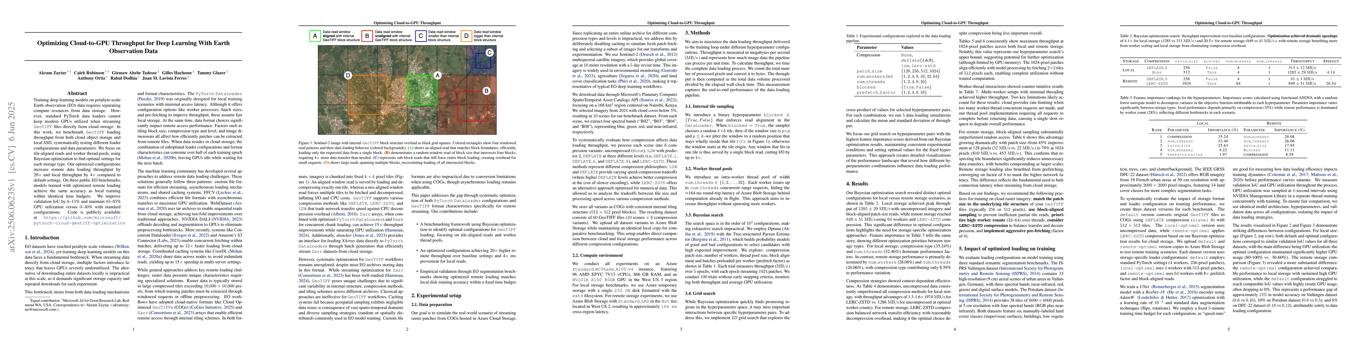
Training deep learning models on petabyte-scale Earth observation (EO) data requires separating compute resources from data storage. However, standard PyTorch data loaders cannot keep modern GPUs util...
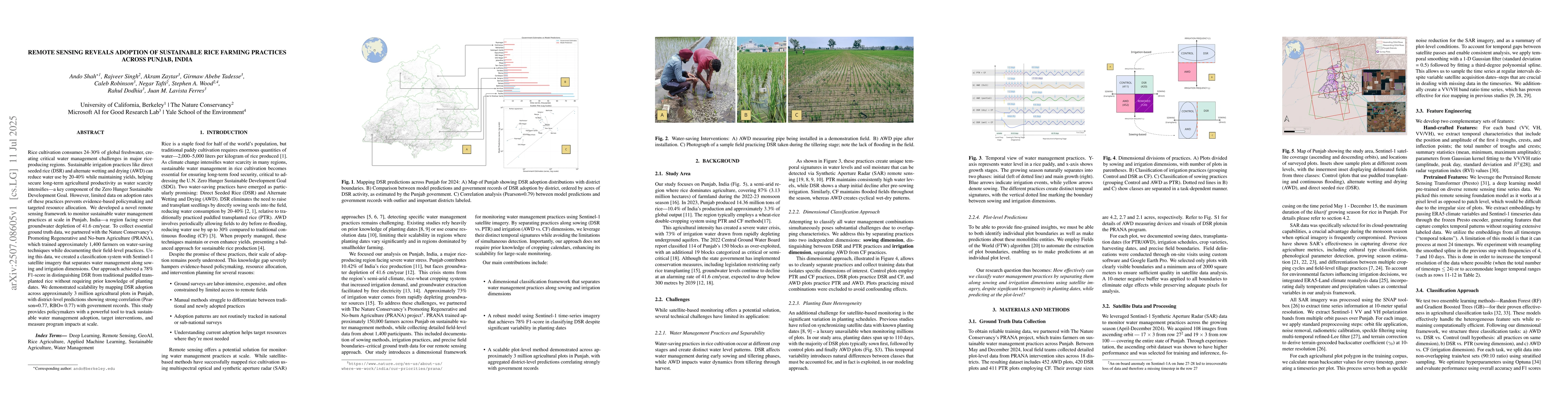
Rice cultivation consumes 24-30% of global freshwater, creating critical water management challenges in major rice-producing regions. Sustainable irrigation practices like direct seeded rice (DSR) and...
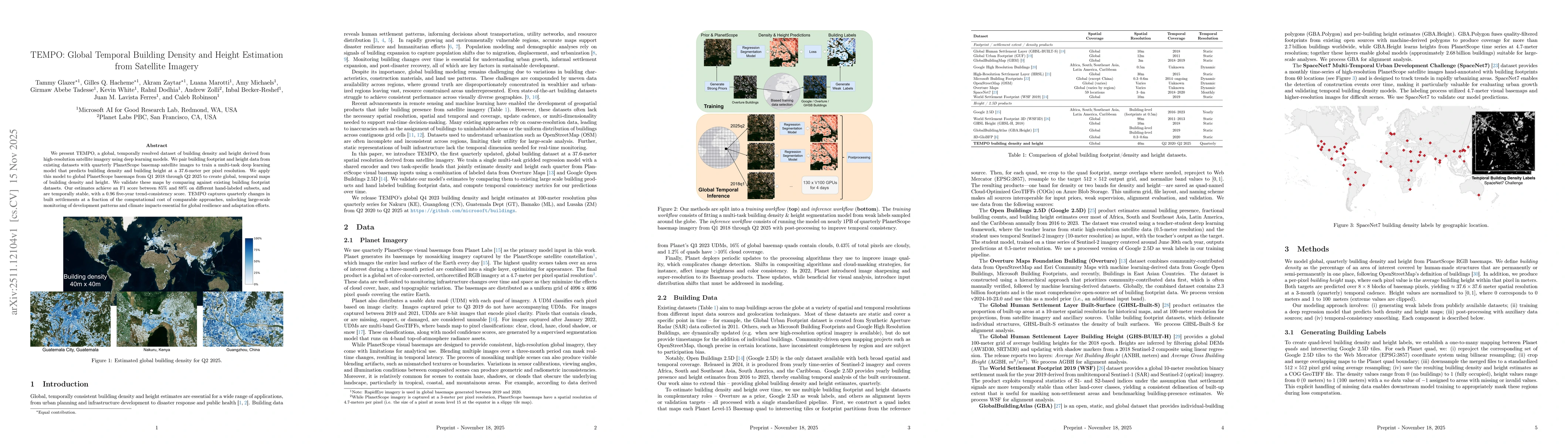
We present TEMPO, a global, temporally resolved dataset of building density and height derived from high-resolution satellite imagery using deep learning models. We pair building footprint and height ...
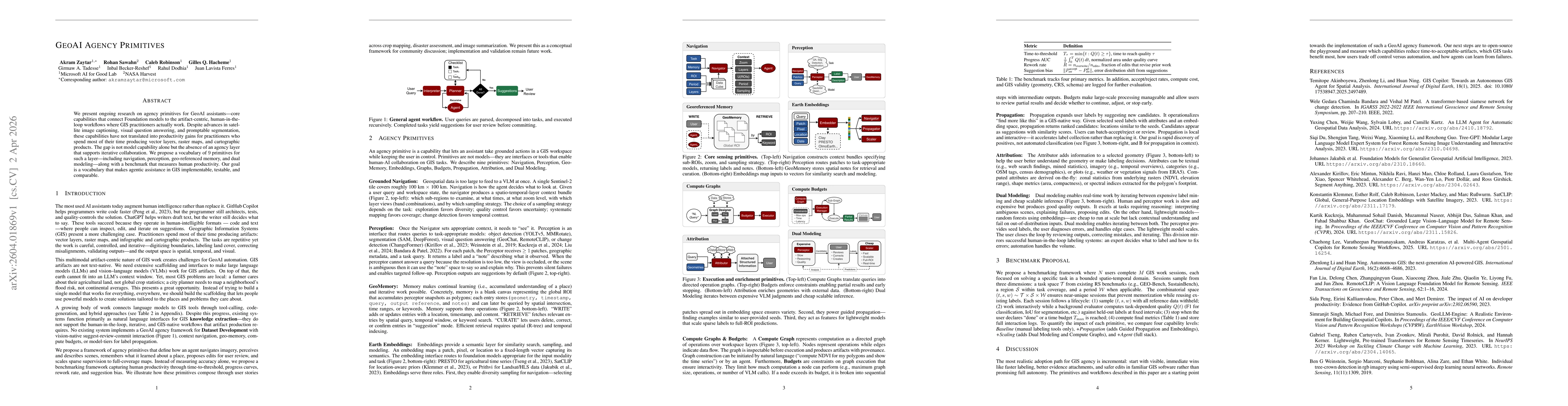
We present ongoing research on agency primitives for GeoAI assistants -- core capabilities that connect Foundation models to the artifact-centric, human-in-the-loop workflows where GIS practitioners a...