2
arXiv Papers
9
Total Publications
Profile
Academic Profile
Metrics
Statistics
2
arXiv Papers
9
Total Publications
Network
Similar Authors
Publications
Papers on arXiv
arXiv
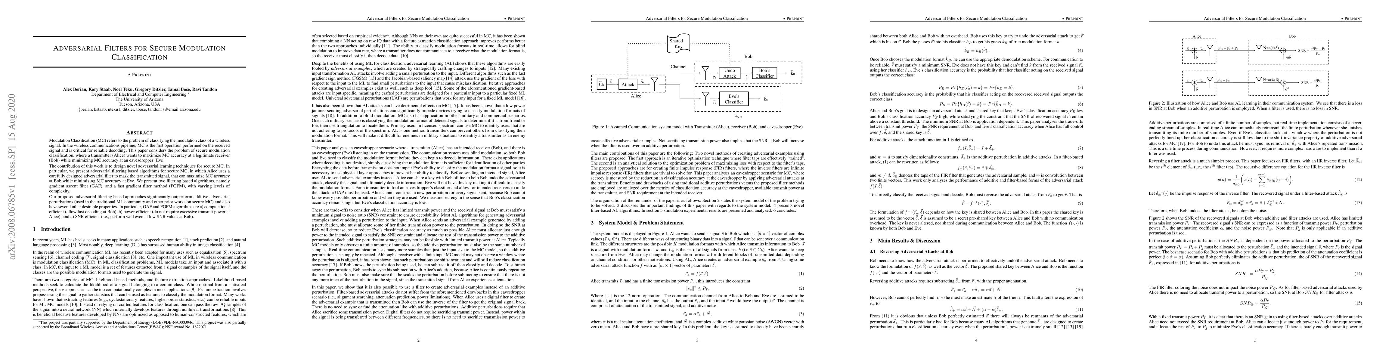
Adversarial Filters for Secure Modulation Classification
Modulation Classification (MC) refers to the problem of classifying the modulation class of a wireless signal. In the wireless communications pipeline, MC is the first operation performed on the rec...
arXiv
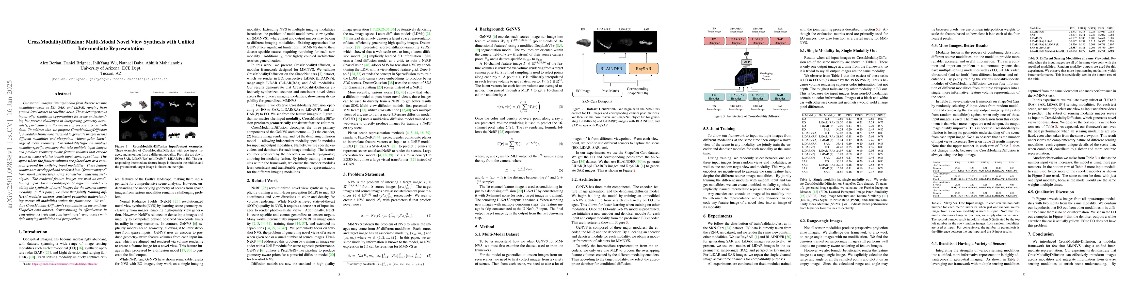
CrossModalityDiffusion: Multi-Modal Novel View Synthesis with Unified
Intermediate Representation
Geospatial imaging leverages data from diverse sensing modalities-such as EO, SAR, and LiDAR, ranging from ground-level drones to satellite views. These heterogeneous inputs offer significant opportun...