Academic Profile
Statistics
Similar Authors
Papers on arXiv
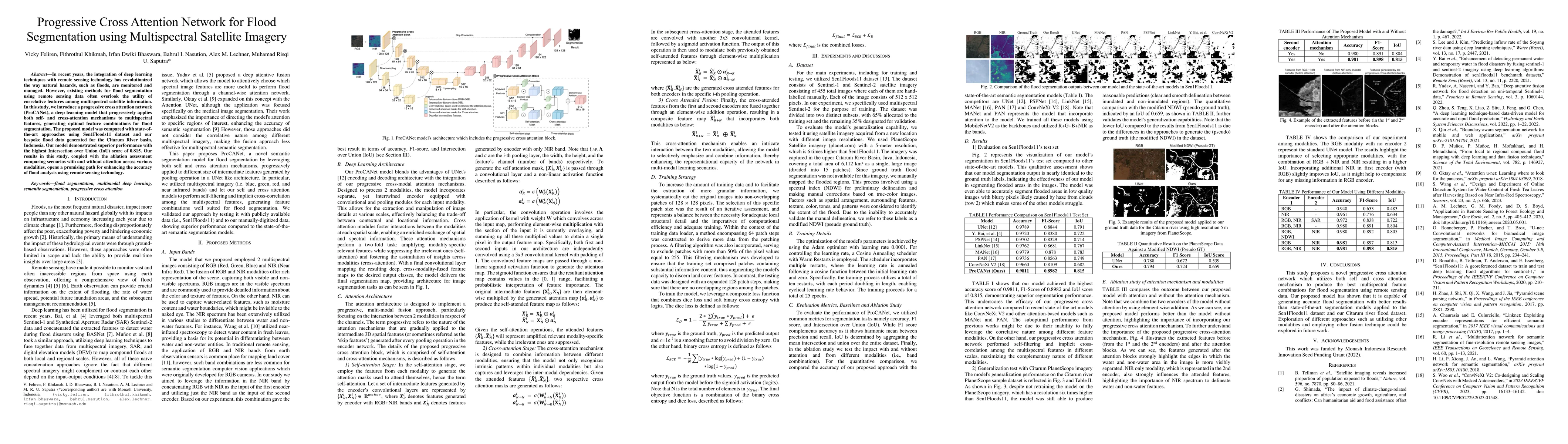
In recent years, the integration of deep learning techniques with remote sensing technology has revolutionized the way natural hazards, such as floods, are monitored and managed. However, existing met...
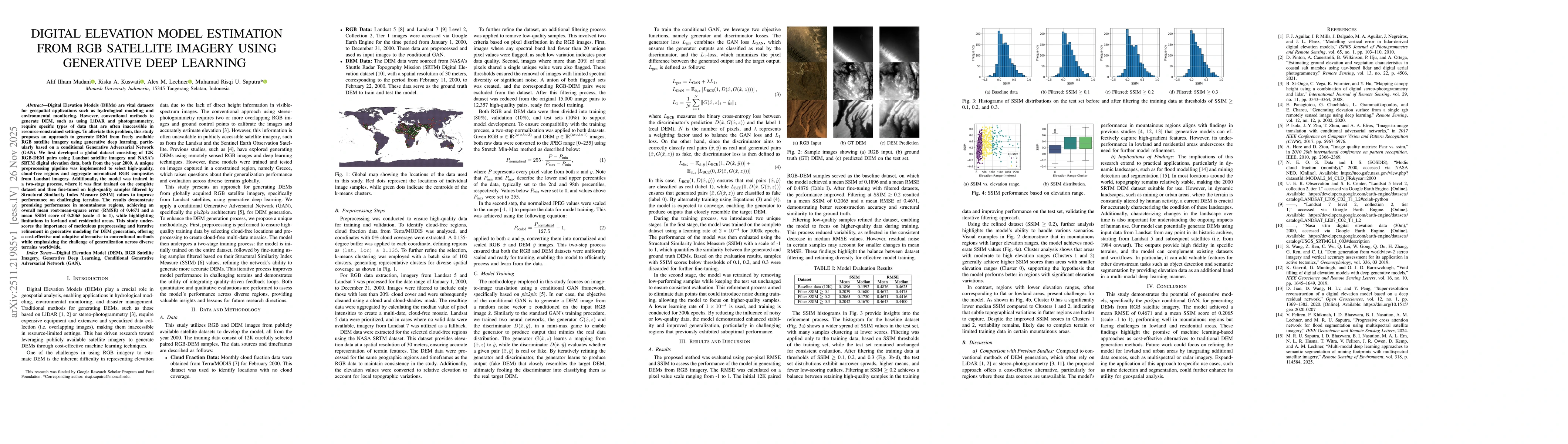
Digital Elevation Models (DEMs) are vital datasets for geospatial applications such as hydrological modeling and environmental monitoring. However, conventional methods to generate DEM, such as using ...
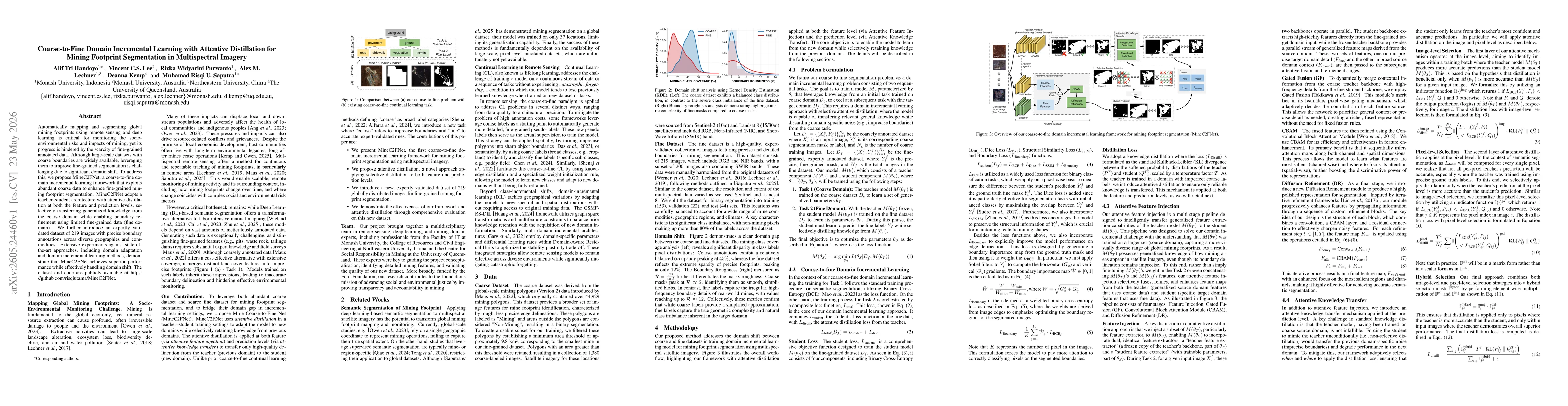
Automatically mapping and segmenting global mining footprints using remote sensing and deep learning is critical for monitoring the socio-environmental risks and impacts of mining, yet its progress is...