Academic Profile
Statistics
Similar Authors
Papers on arXiv
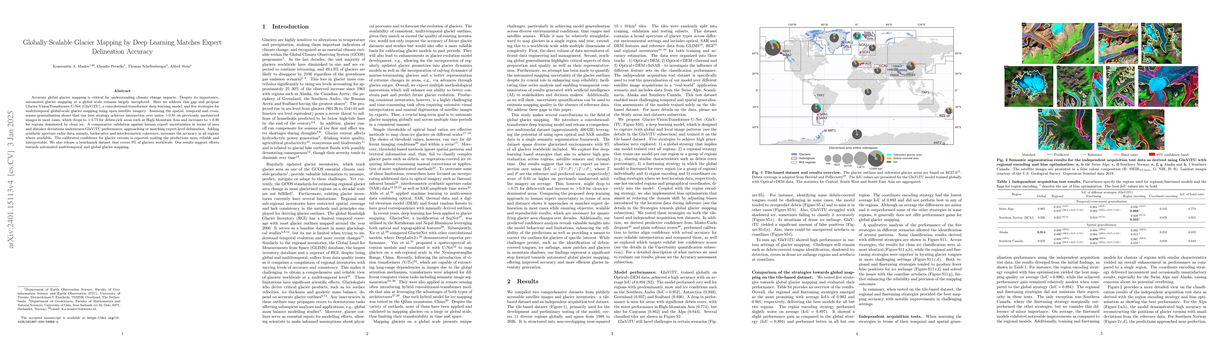
Accurate global glacier mapping is critical for understanding climate change impacts. Despite its importance, automated glacier mapping at a global scale remains largely unexplored. Here we address ...
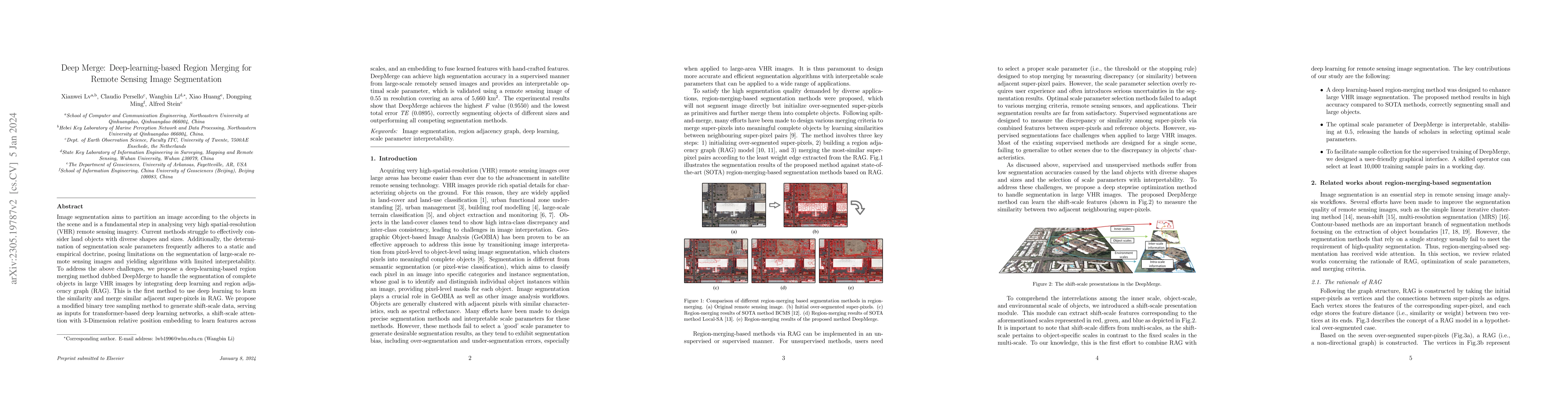
Image segmentation aims to partition an image according to the objects in the scene and is a fundamental step in analysing very high spatial-resolution (VHR) remote sensing imagery. Current methods ...
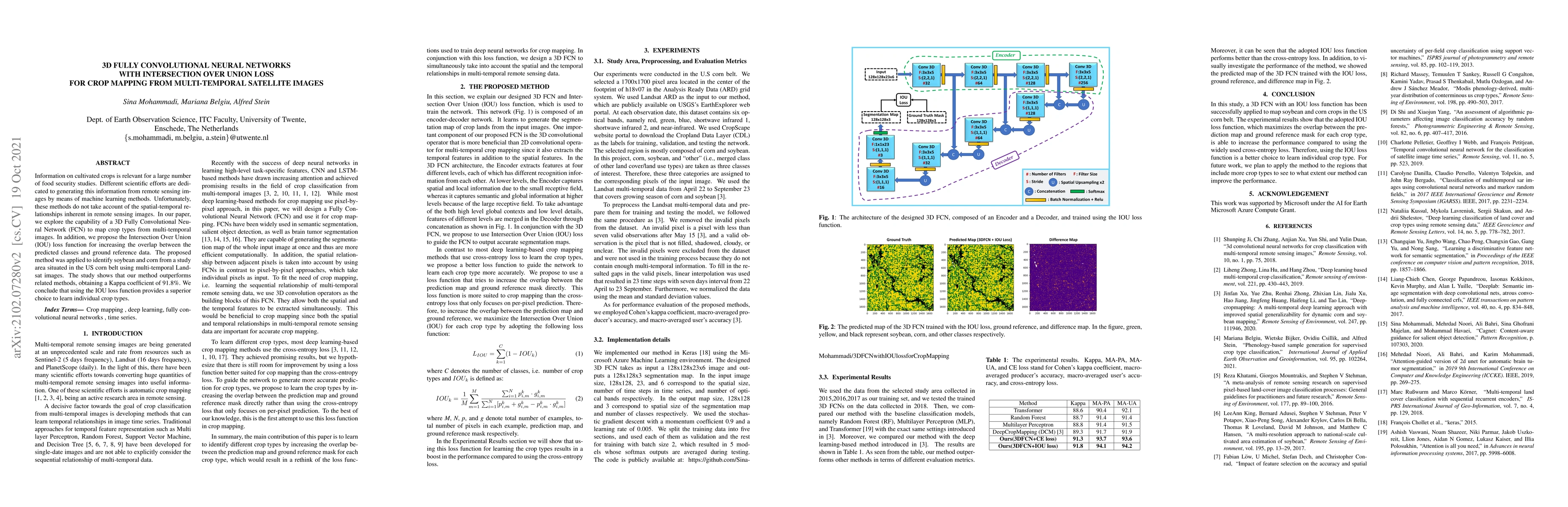
Information on cultivated crops is relevant for a large number of food security studies. Different scientific efforts are dedicated to generating this information from remote sensing images by means...