Academic Profile
Statistics
Similar Authors
Papers on arXiv
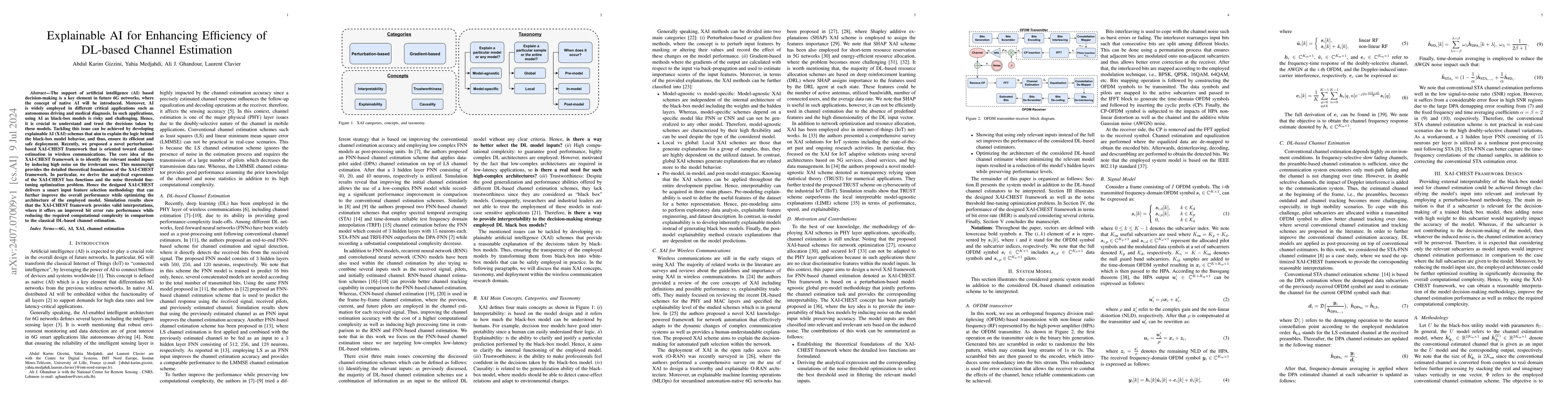
The support of artificial intelligence (AI) based decision-making is a key element in future 6G networks, where the concept of native AI will be introduced. Moreover, AI is widely employed in differen...
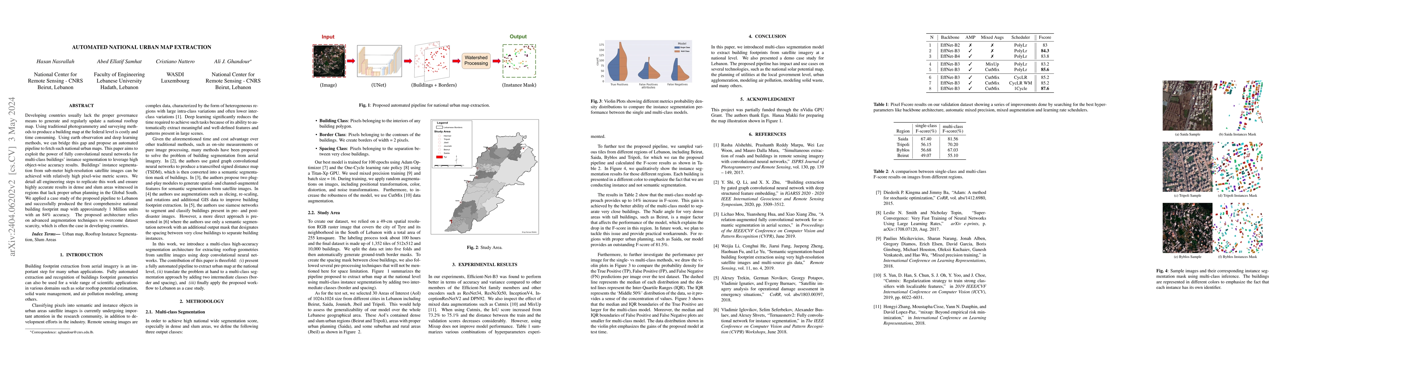
Developing countries usually lack the proper governance means to generate and regularly update a national rooftop map. Using traditional photogrammetry and surveying methods to produce a building ma...
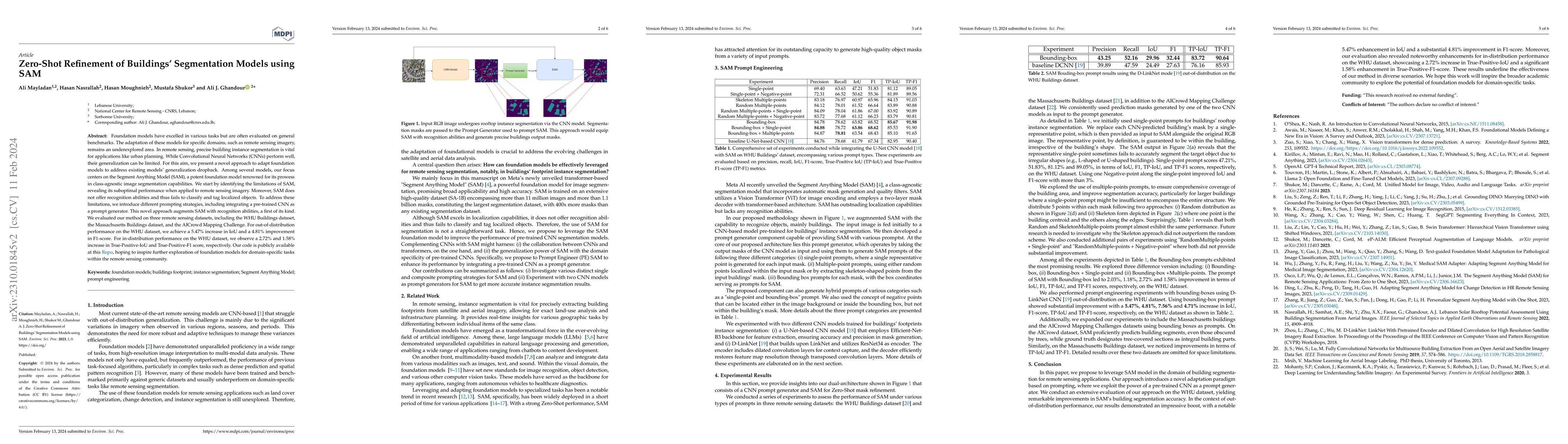
Foundation models have excelled in various tasks but are often evaluated on general benchmarks. The adaptation of these models for specific domains, such as remote sensing imagery, remains an undere...
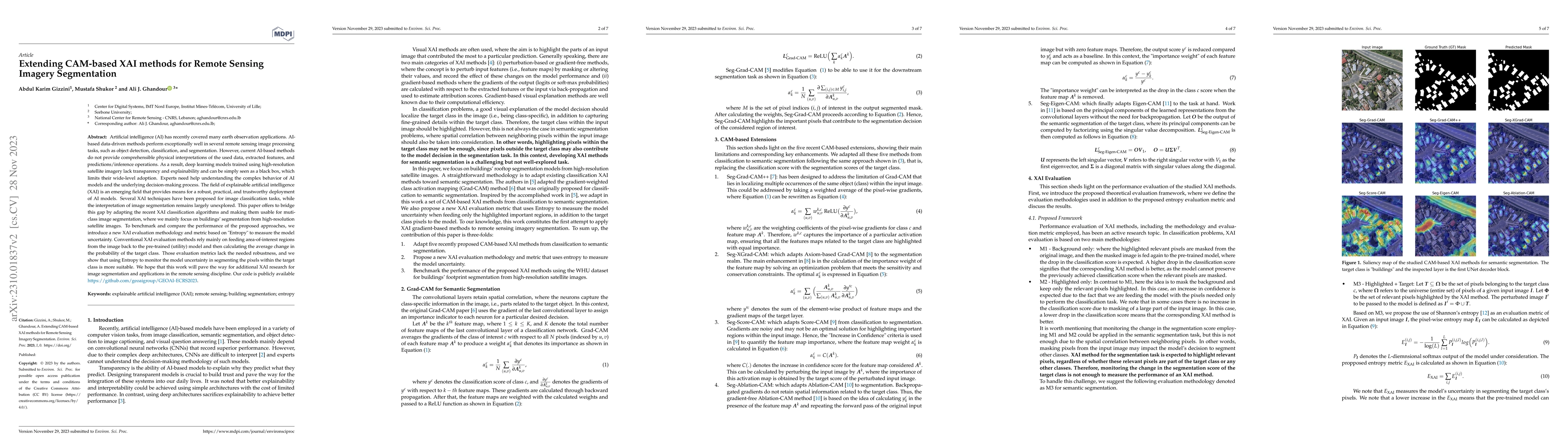
Current AI-based methods do not provide comprehensible physical interpretations of the utilized data, extracted features, and predictions/inference operations. As a result, deep learning models trai...
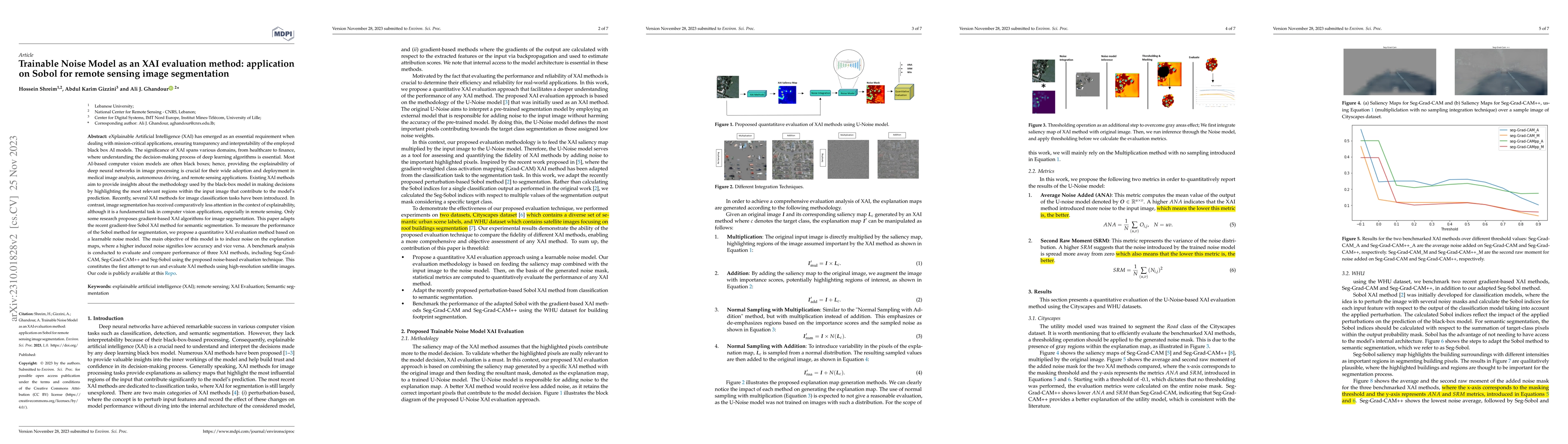
eXplainable Artificial Intelligence (XAI) has emerged as an essential requirement when dealing with mission-critical applications, ensuring transparency and interpretability of the employed black bo...
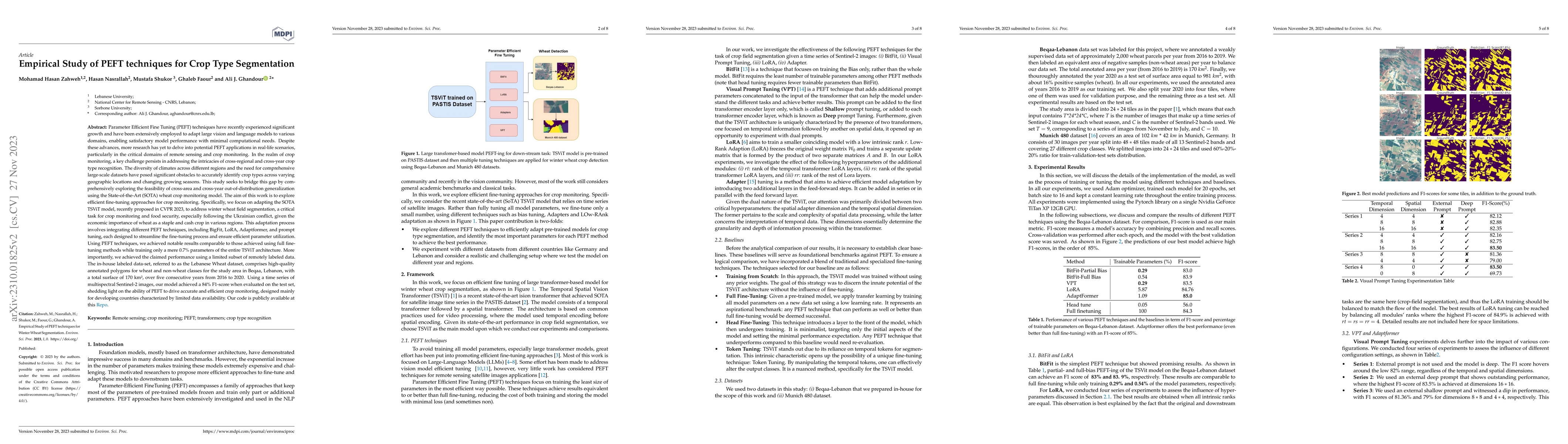
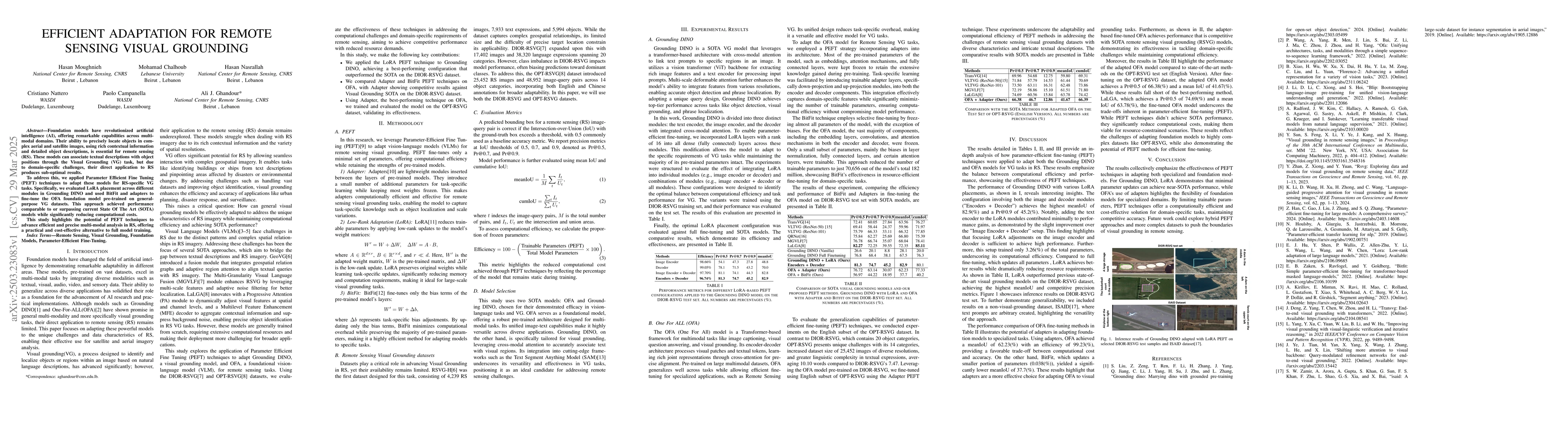
Parameter Efficient Fine Tuning (PEFT) techniques have recently experienced significant growth and have been extensively employed to adapt large vision and language models to various domains, enabli...
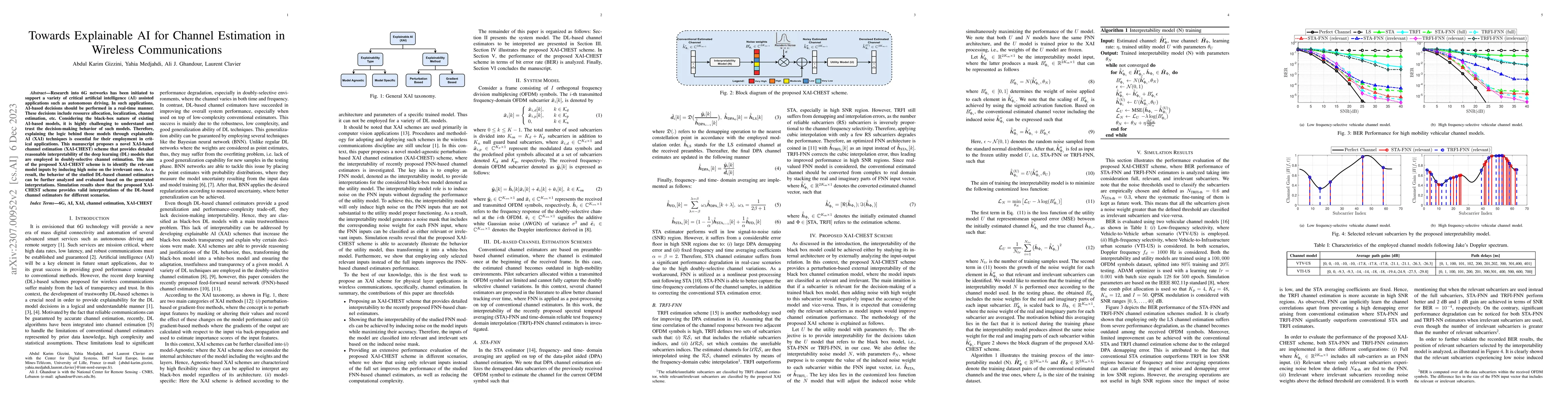
Research into 6G networks has been initiated to support a variety of critical artificial intelligence (AI) assisted applications such as autonomous driving. In such applications, AI-based decisions ...
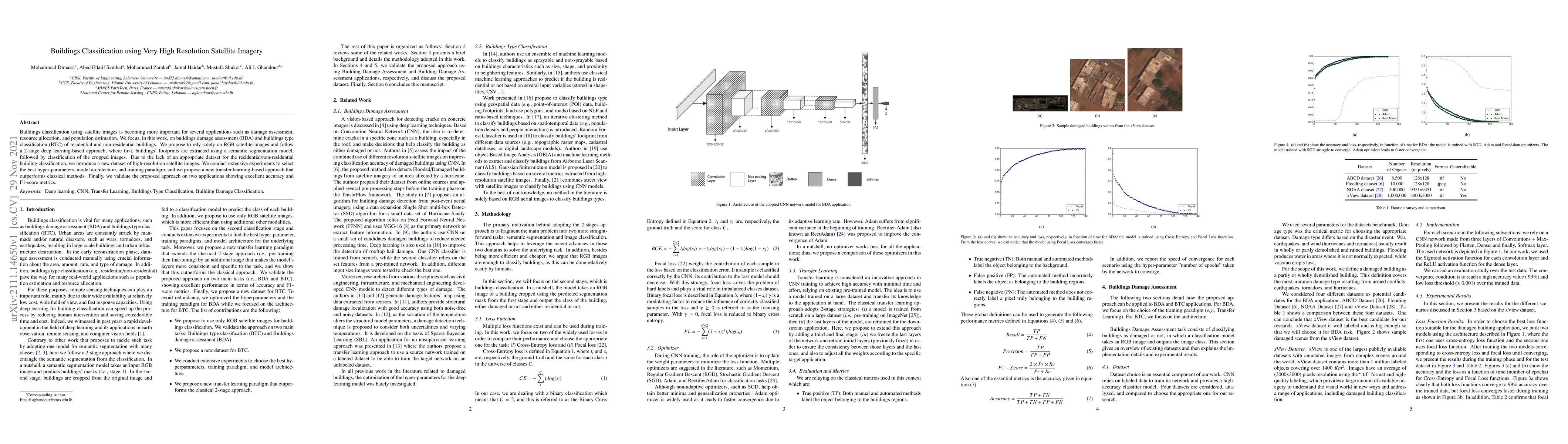
Buildings classification using satellite images is becoming more important for several applications such as damage assessment, resource allocation, and population estimation. We focus, in this work,...
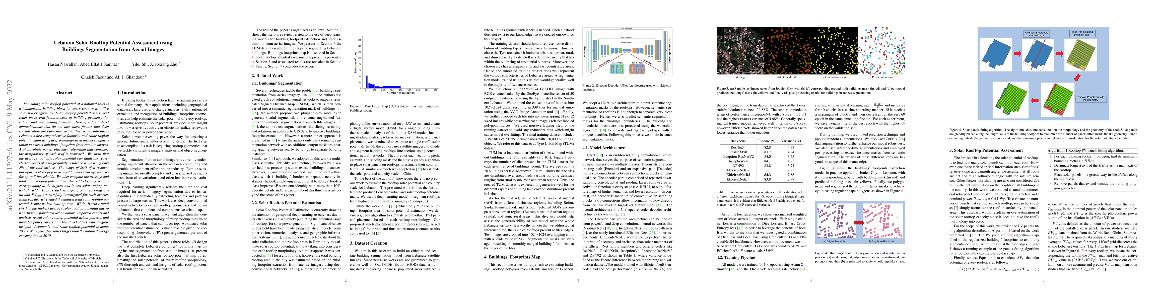
Estimating solar rooftop potential at a national level is a fundamental building block for every country to utilize solar power efficiently. Solar rooftop potential assessment relies on several feat...
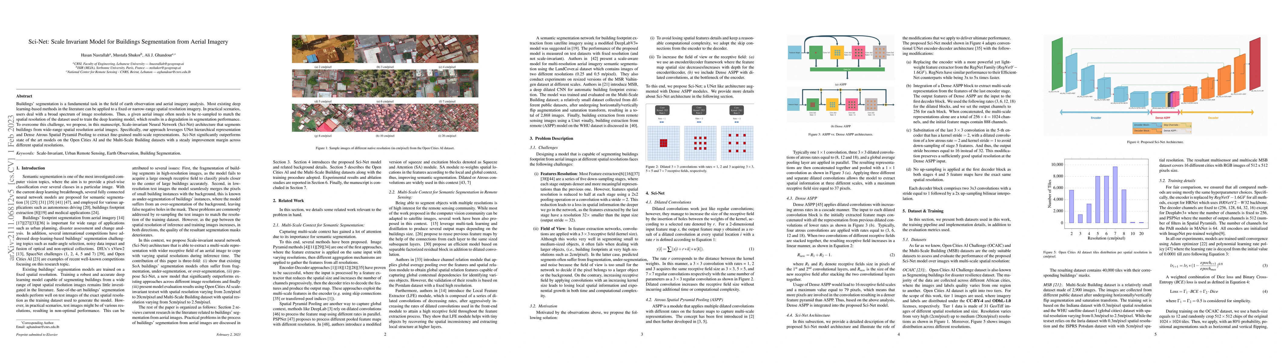
Buildings' segmentation is a fundamental task in the field of earth observation and aerial imagery analysis. Most existing deep learning-based methods in the literature can be applied to a fixed or ...
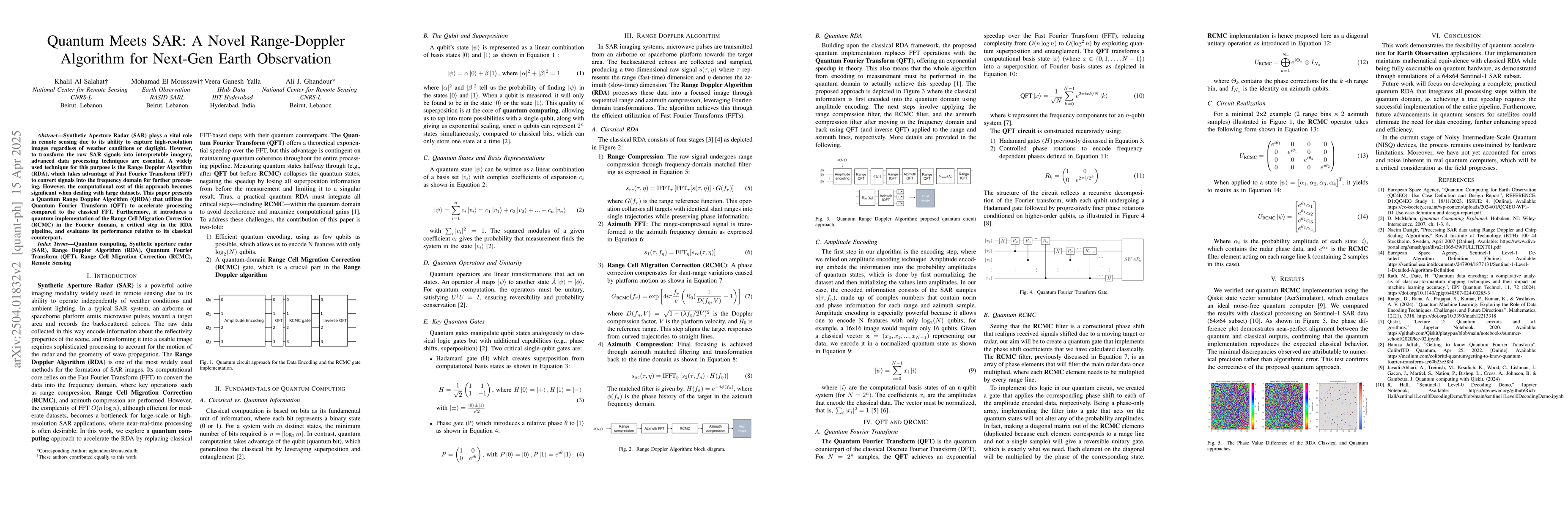
Synthetic Aperture Radar (SAR) plays a vital role in remote sensing due to its ability to capture high-resolution images regardless of weather conditions or daylight. However, to transform the raw SAR...
Foundation models have revolutionized artificial intelligence (AI), offering remarkable capabilities across multi-modal domains. Their ability to precisely locate objects in complex aerial and satelli...
Wheat accounts for approximately 20% of the world's caloric intake, making it a vital component of global food security. Given this importance, mapping wheat fields plays a crucial role in enabling va...