1
arXiv Papers
1
Total Publications
Profile
Academic Profile
Metrics
Statistics
1
arXiv Papers
1
Total Publications
Network
Similar Authors
Publications
Papers on arXiv
arXiv
Supervised Multi-Regional Segmentation Machine Learning Architecture for
Digital Twin Applications in Coastal Regions
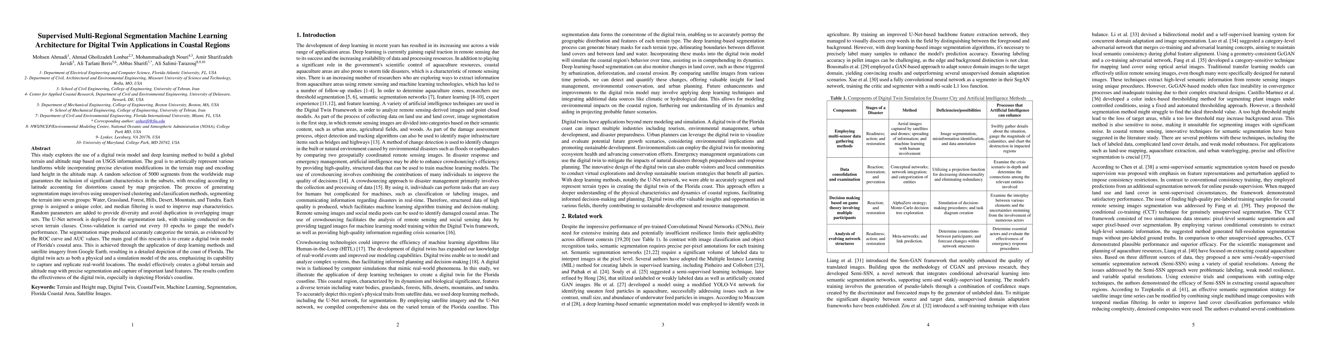
This study explores the use of a digital twin model and deep learning method to build a global terrain and altitude map based on USGS information. The goal is to artistically represent various landf...