Academic Profile
Statistics
Similar Authors
Papers on arXiv
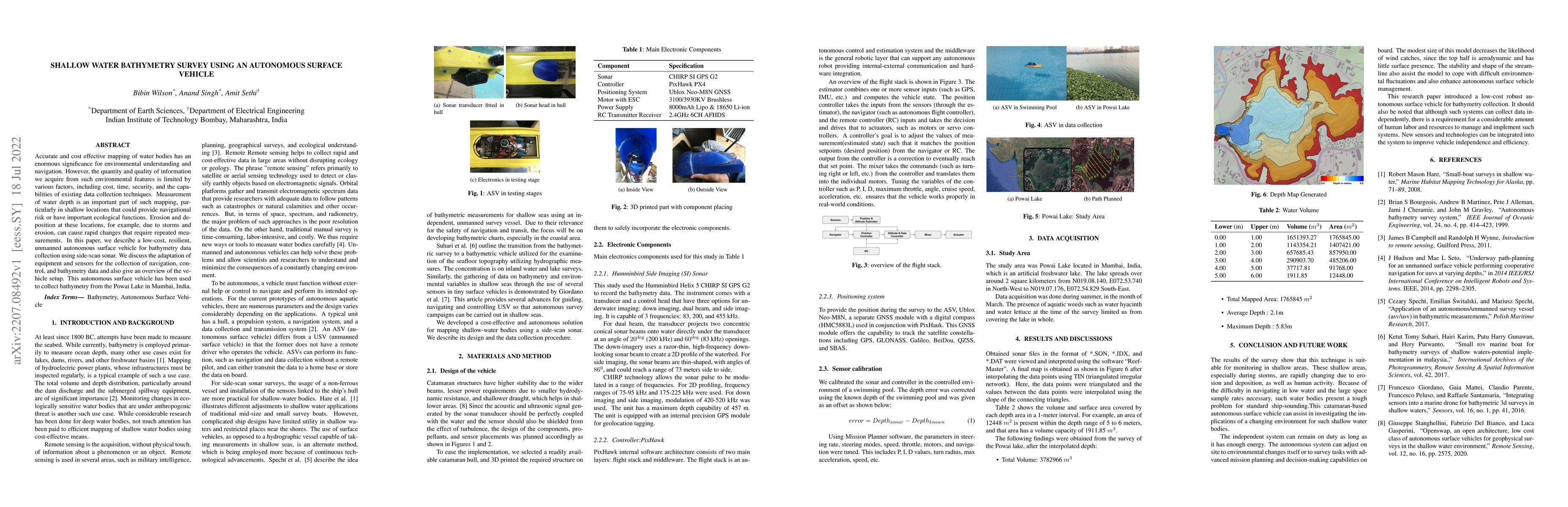
Accurate and cost effective mapping of water bodies has an enormous significance for environmental understanding and navigation. However, the quantity and quality of information we acquire from such...
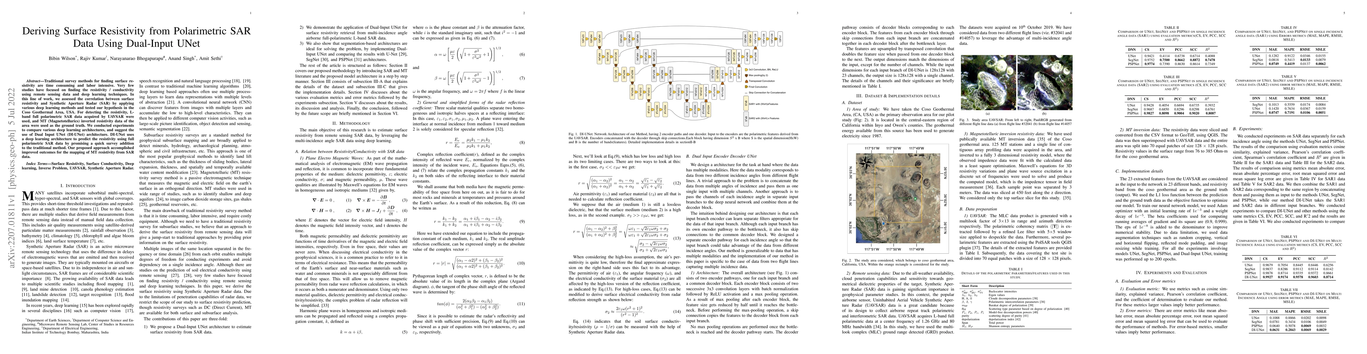
Traditional survey methods for finding surface resistivity are time-consuming and labor intensive. Very few studies have focused on finding the resistivity/conductivity using remote sensing data and...
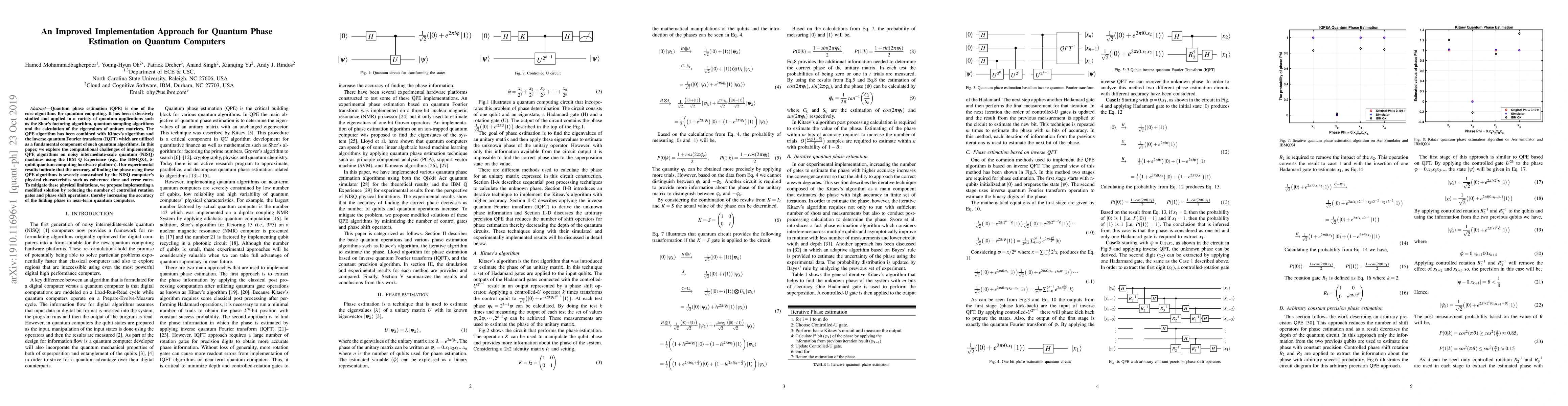
Quantum phase estimation (QPE) is one of the core algorithms for quantum computing. It has been extensively studied and applied in a variety of quantum applications such as the Shor's factoring algo...
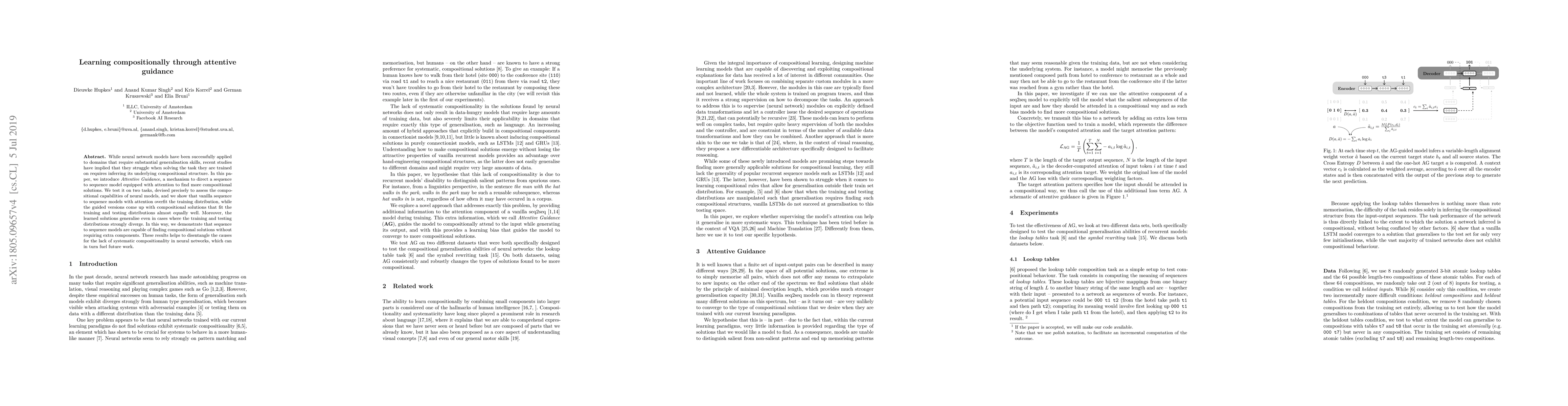
While neural network models have been successfully applied to domains that require substantial generalisation skills, recent studies have implied that they struggle when solving the task they are tr...

The safety and security of robotic systems are paramount when navigating around a hostile target. This paper addresses the problem of circumnavigating an unknown target by a unicycle robot while ensur...
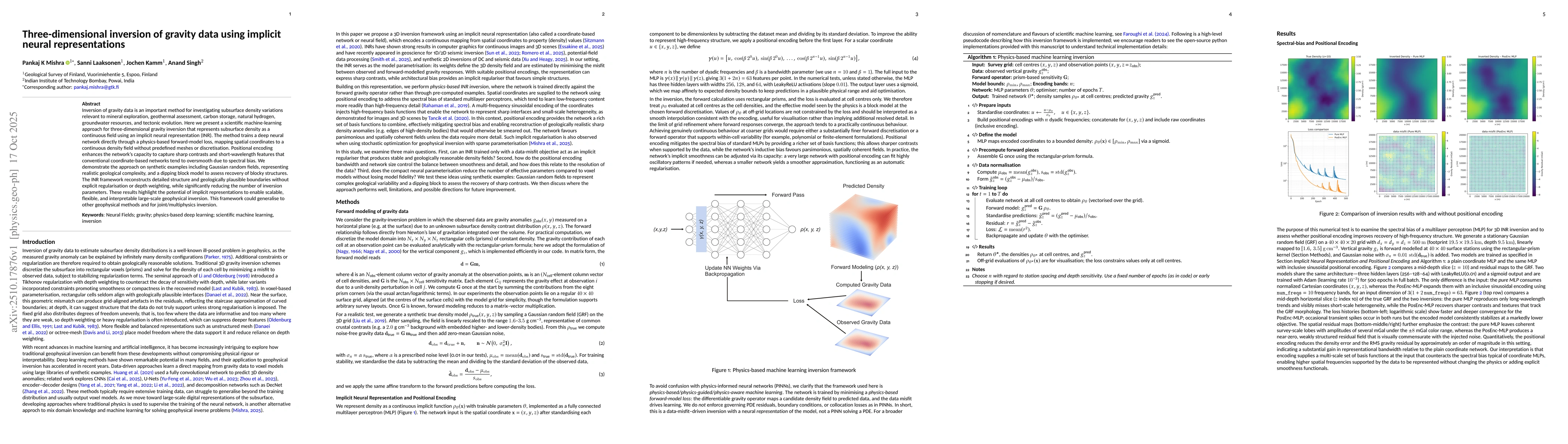
Inversion of gravity data is an important method for investigating subsurface density variations relevant to diverse applications including mineral exploration, geothermal assessment, carbon storage, ...
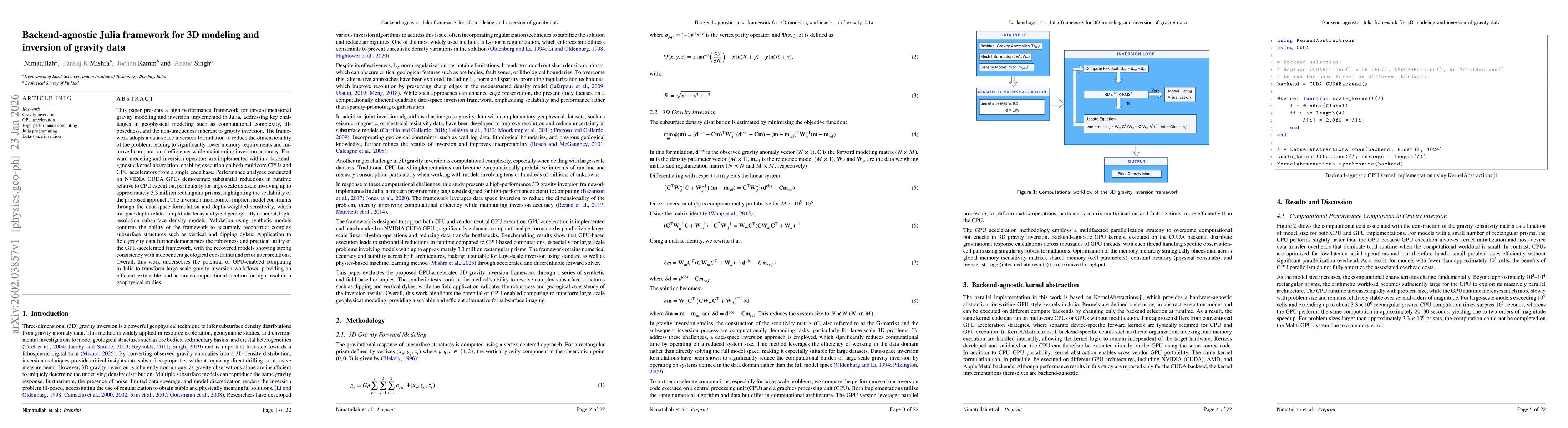
This paper presents a high-performance framework for three-dimensional gravity modeling and inversion implemented in Julia, addressing key challenges in geophysical modeling such as computational comp...
The rendering and display of text is a key use-case for augmented reality (AR). Here, we present the Read-AR, a dataset of reading in AR, for which we collected over 11,000 reading speeds and almost 6...