Academic Profile
Statistics
Similar Authors
Papers on arXiv
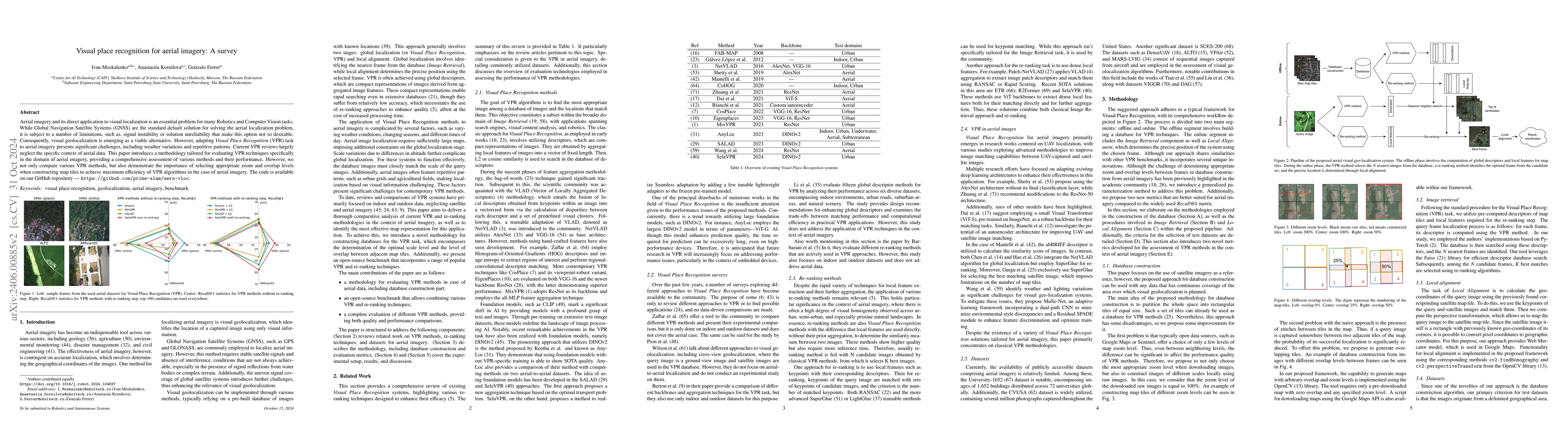
Aerial imagery and its direct application to visual localization is an essential problem for many Robotics and Computer Vision tasks. While Global Navigation Satellite Systems (GNSS) are the standar...
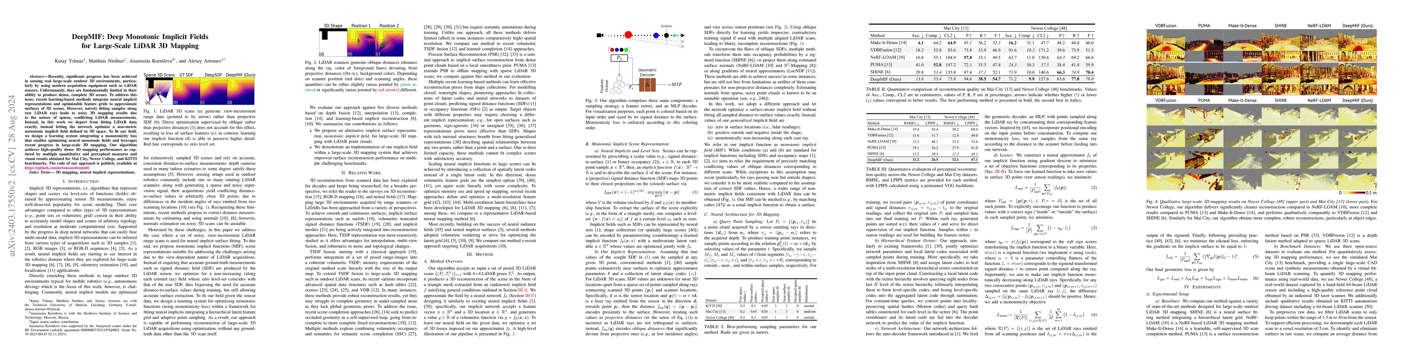
Recently, significant progress has been achieved in sensing real large-scale outdoor 3D environments, particularly by using modern acquisition equipment such as LiDAR sensors. Unfortunately, they ar...
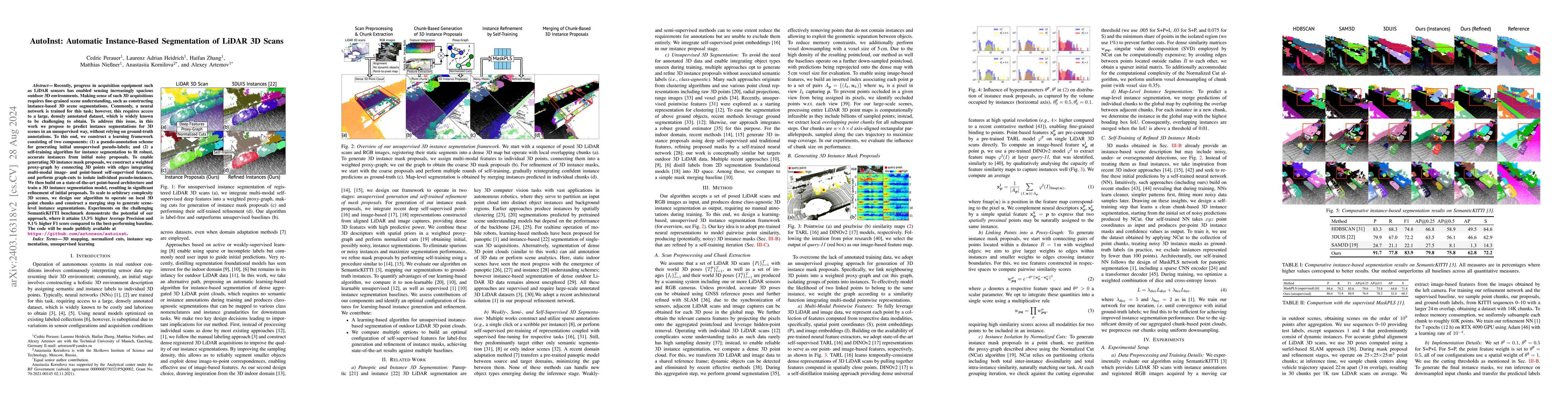
Recently, progress in acquisition equipment such as LiDAR sensors has enabled sensing increasingly spacious outdoor 3D environments. Making sense of such 3D acquisitions requires fine-grained scene ...
Uplift modeling is a collection of machine learning techniques for estimating causal effects of a treatment at the individual or subgroup levels. Over the last years, causality and uplift modeling h...
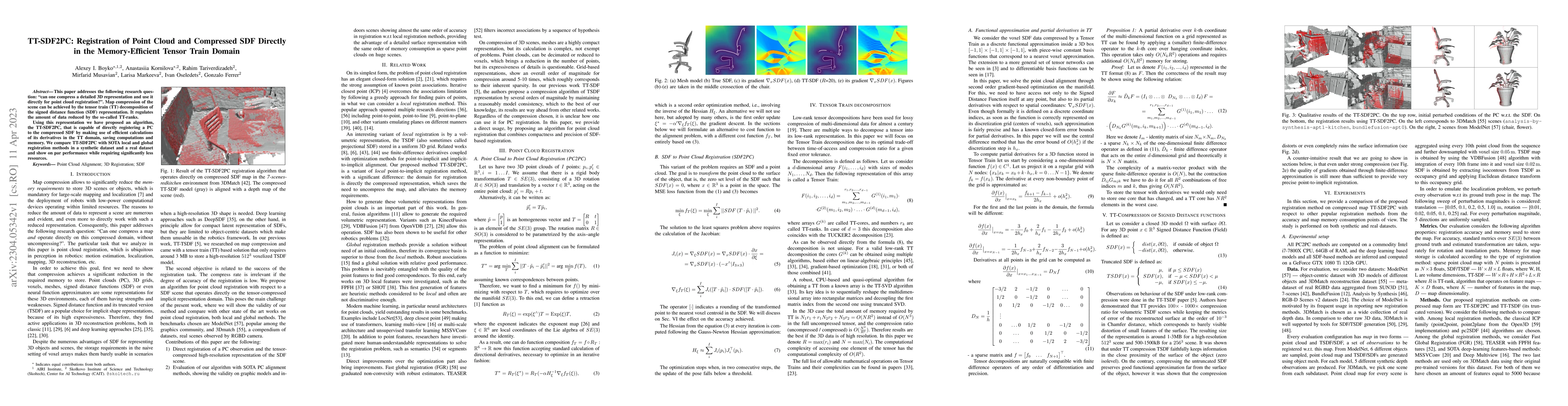
This paper addresses the following research question: ``can one compress a detailed 3D representation and use it directly for point cloud registration?''. Map compression of the scene can be achieve...
Modern depth sensors can generate a huge number of 3D points in few seconds to be latter processed by Localization and Mapping algorithms. Ideally, these algorithms should handle efficiently large s...
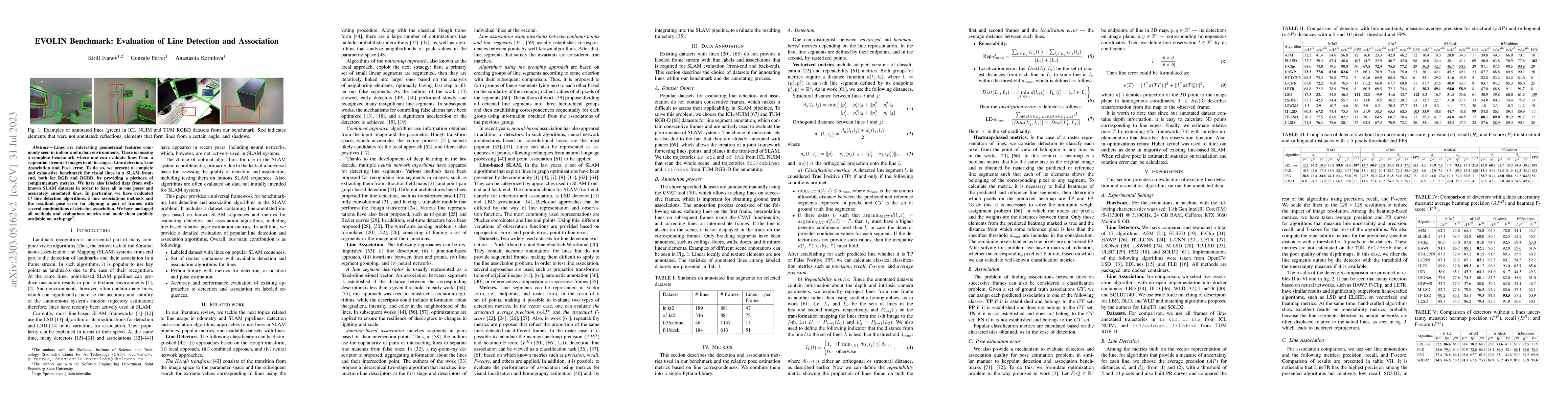
Lines are interesting geometrical features commonly seen in indoor and urban environments. There is missing a complete benchmark where one can evaluate lines from a sequential stream of images in al...
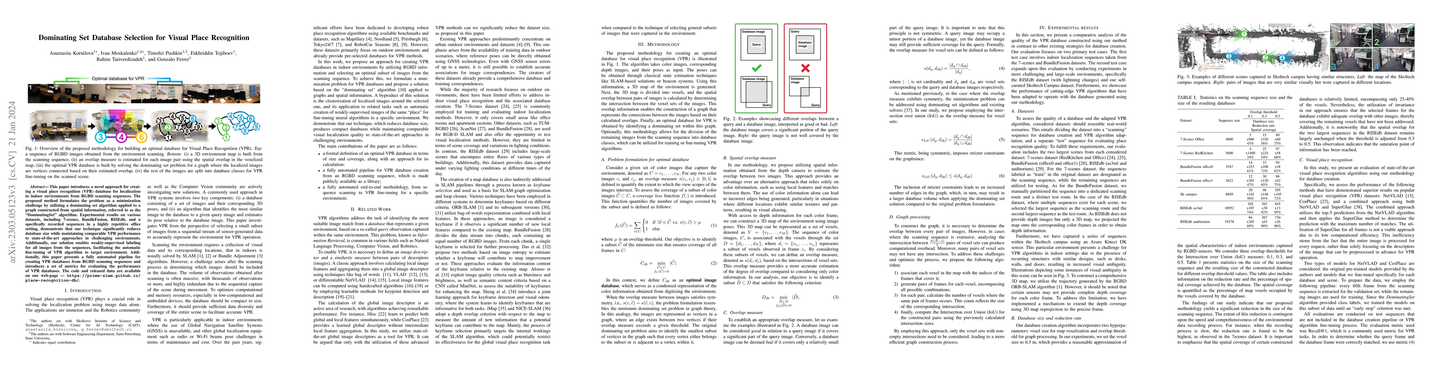
This paper presents an approach for creating a visual place recognition (VPR) database for localization in indoor environments from RGBD scanning sequences. The proposed approach is formulated as a ...
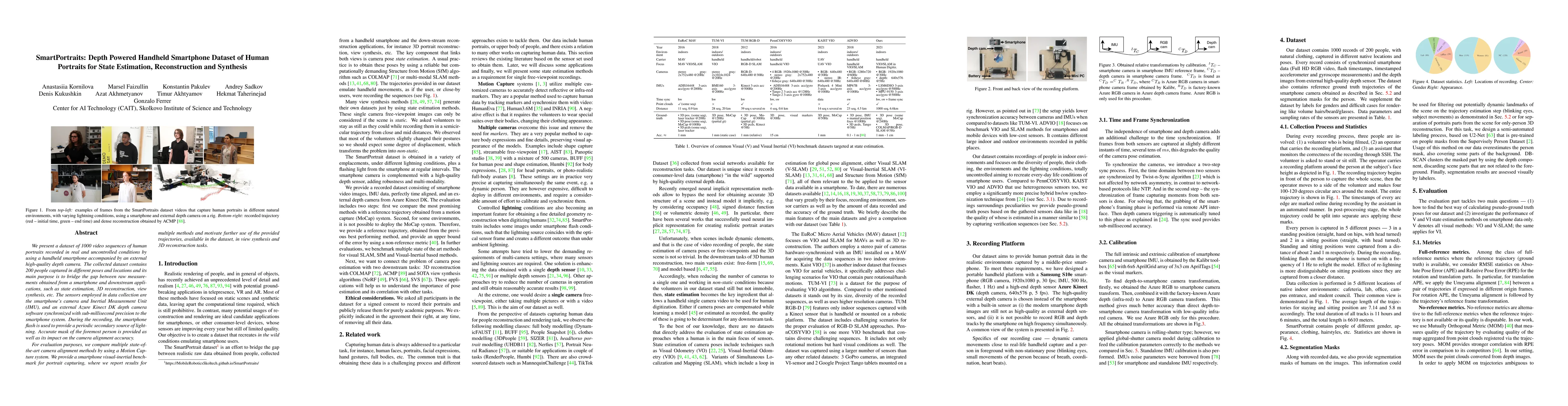
We present a dataset of 1000 video sequences of human portraits recorded in real and uncontrolled conditions by using a handheld smartphone accompanied by an external high-quality depth camera. The ...
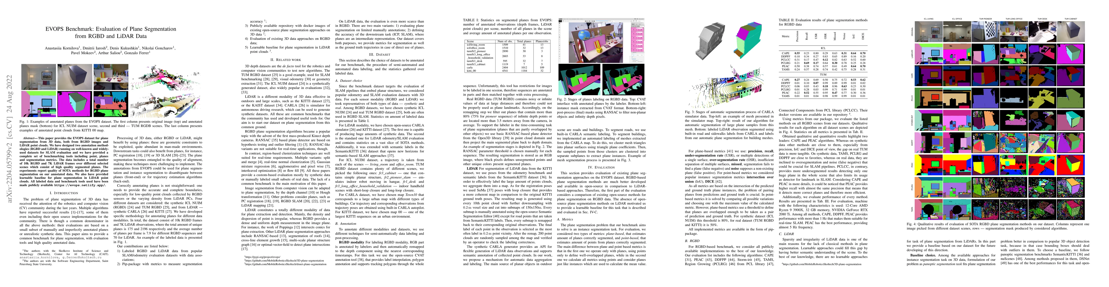
This paper provides the EVOPS dataset for plane segmentation from 3D data, both from RGBD images and LiDAR point clouds. We have designed two annotation methodologies (RGBD and LiDAR) running on wel...
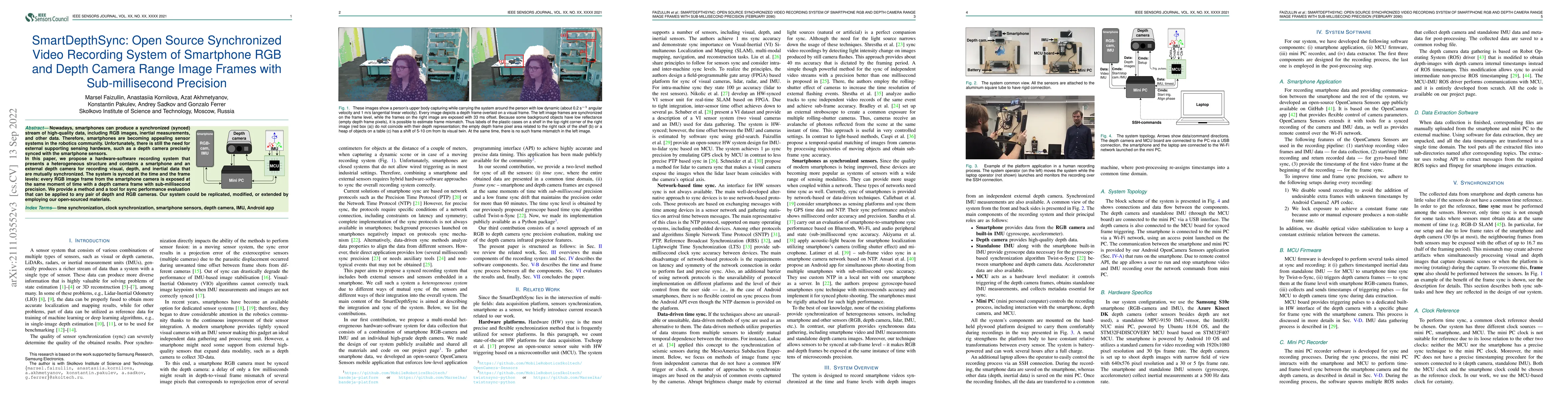
Nowadays, smartphones can produce a synchronized (synced) stream of high-quality data, including RGB images, inertial measurements, and other data. Therefore, smartphones are becoming appealing sens...
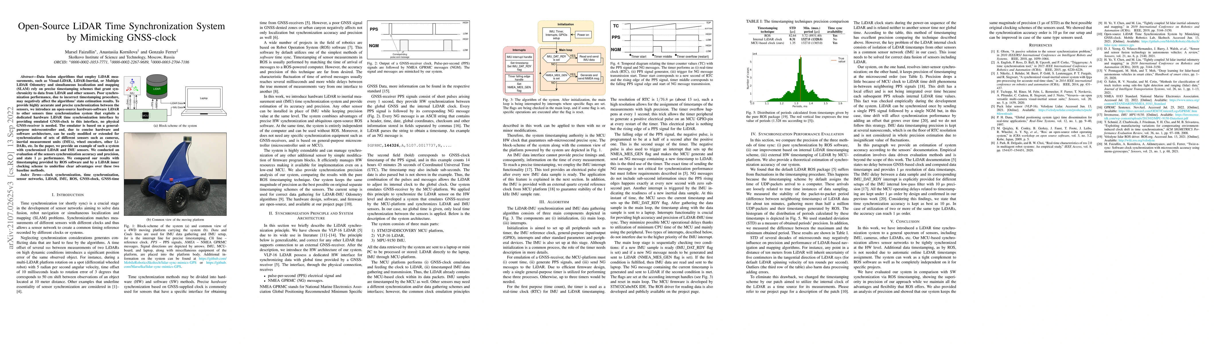
Data fusion algorithms that employ LiDAR measurements, such as Visual-LiDAR, LiDAR-Inertial, or Multiple LiDAR Odometry and simultaneous localization and mapping (SLAM) rely on precise timestamping ...
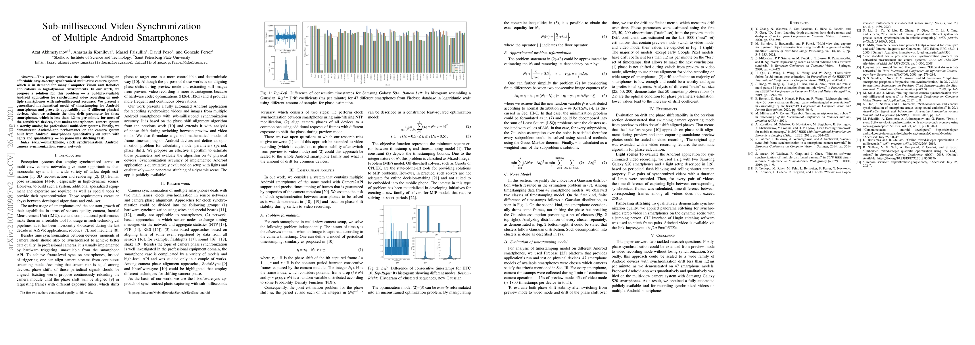
This paper addresses the problem of building an affordable easy-to-setup synchronized multi-view camera system, which is in demand for many Computer Vision and Robotics applications in high-dynamic ...
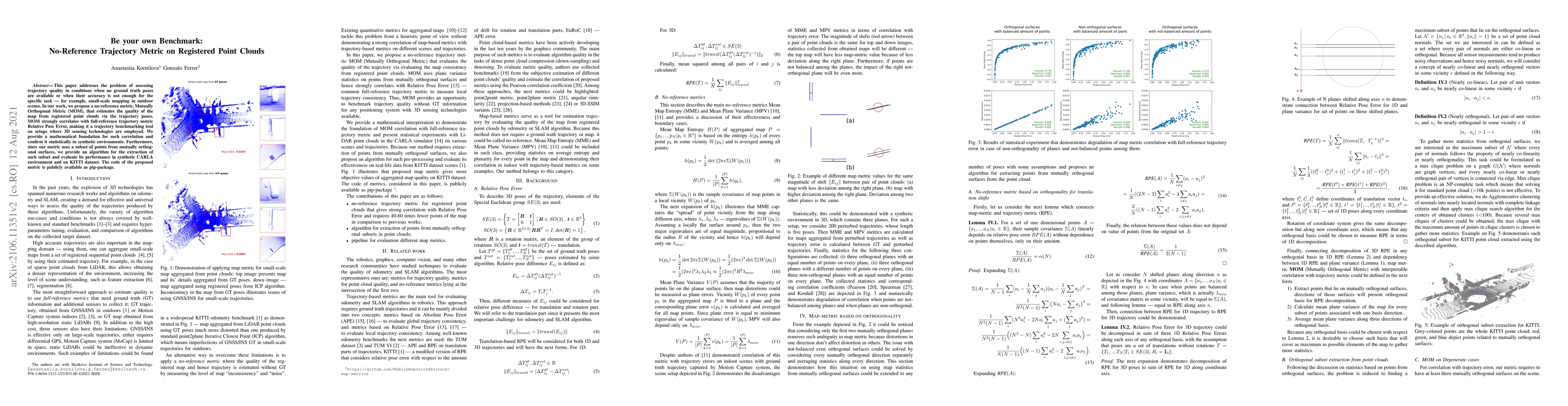
This paper addresses the problem of assessing trajectory quality in conditions when no ground truth poses are available or when their accuracy is not enough for the specific task - for example, smal...
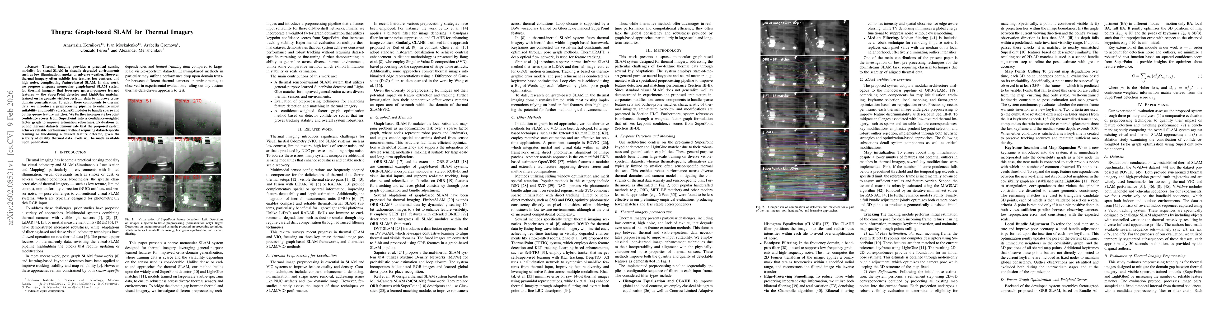
Thermal imaging provides a practical sensing modality for visual SLAM in visually degraded environments such as low illumination, smoke, or adverse weather. However, thermal imagery often exhibits low...