Academic Profile
Statistics
Similar Authors
Papers on arXiv
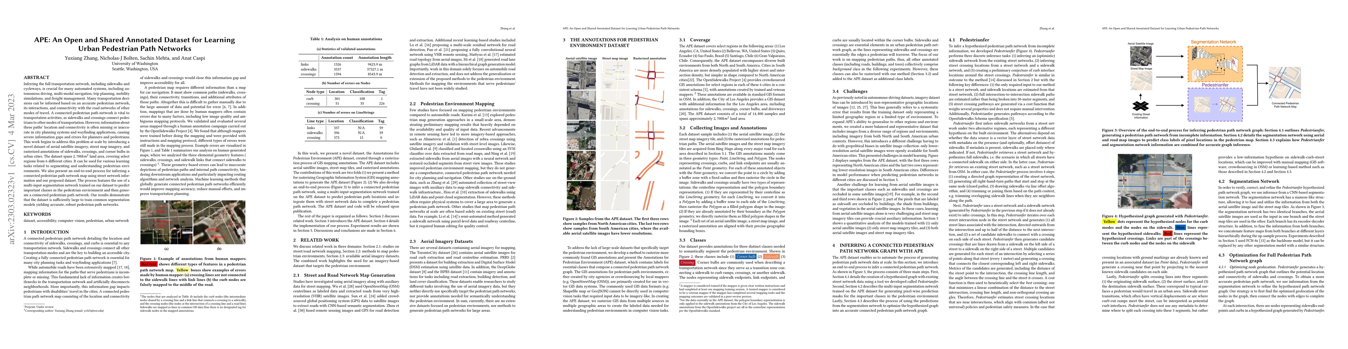
Inferring the full transportation network, including sidewalks and cycleways, is crucial for many automated systems, including autonomous driving, multi-modal navigation, trip planning, mobility sim...
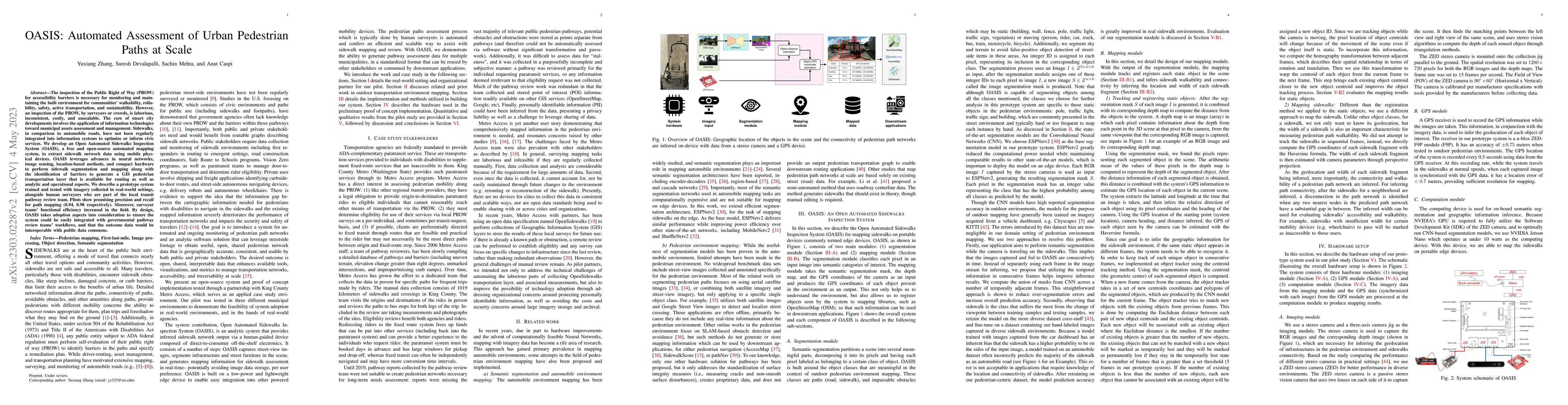
The inspection of the Public Right of Way (PROW) for accessibility barriers is necessary for monitoring and maintaining the built environment for communities' walkability, rollability, safety, activ...
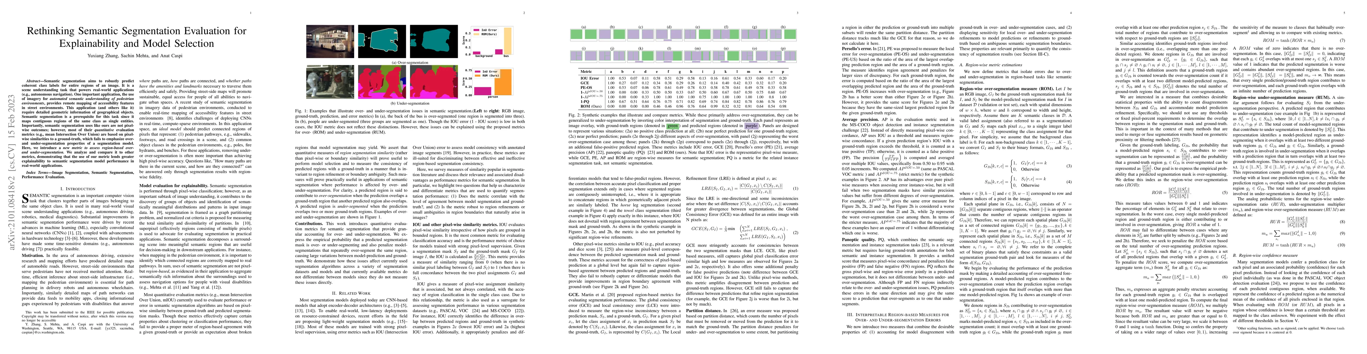
Semantic segmentation aims to robustly predict coherent class labels for entire regions of an image. It is a scene understanding task that powers real-world applications (e.g., autonomous navigation...
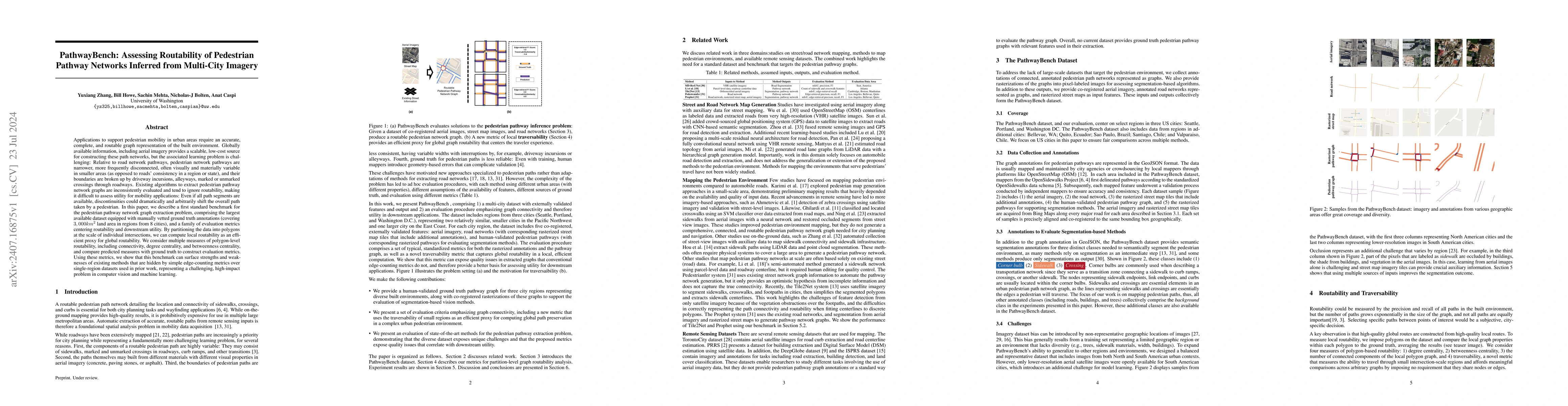
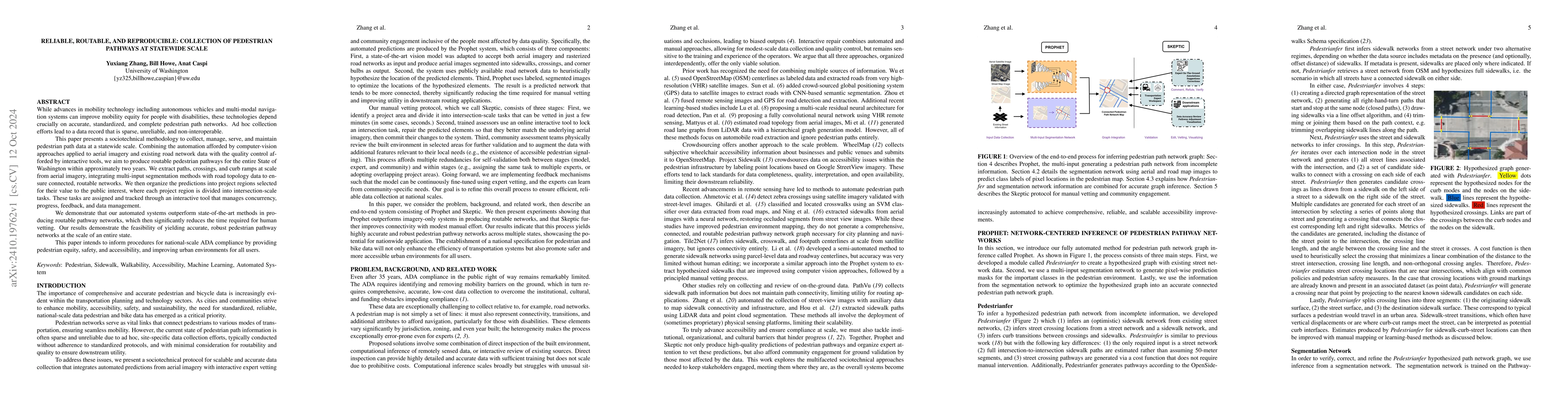
Applications to support pedestrian mobility in urban areas require a complete, and routable graph representation of the built environment. Globally available information, including aerial imagery prov...
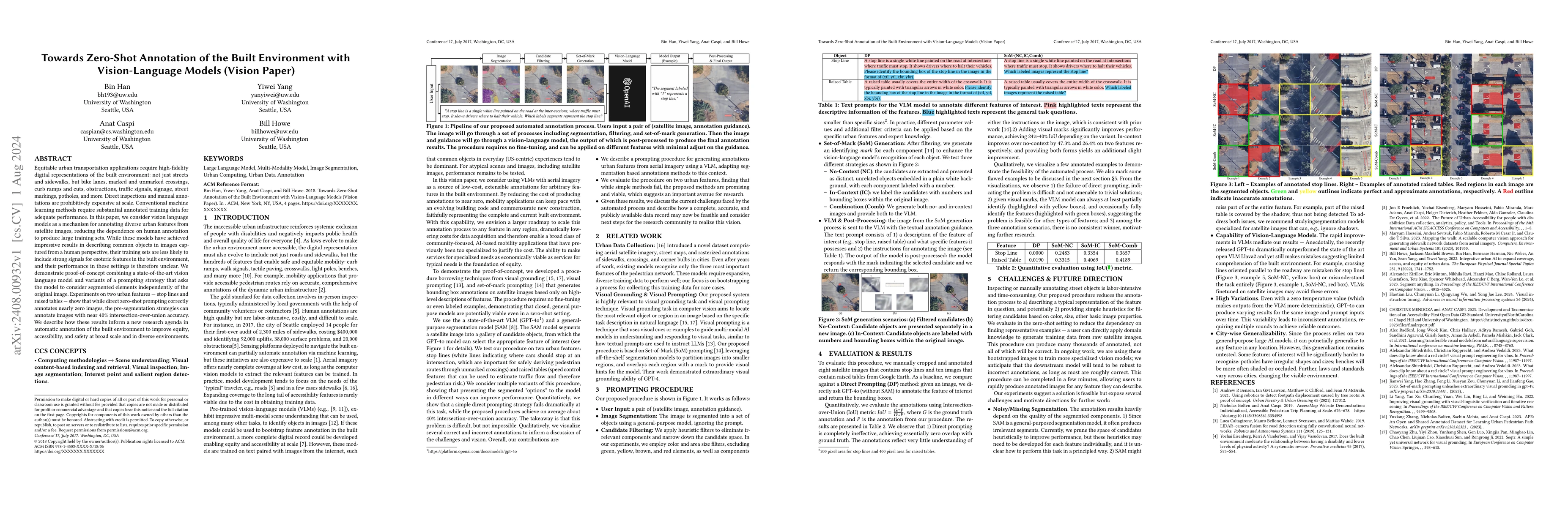
Equitable urban transportation applications require high-fidelity digital representations of the built environment: not just streets and sidewalks, but bike lanes, marked and unmarked crossings, curb ...
While advances in mobility technology including autonomous vehicles and multi-modal navigation systems can improve mobility equity for people with disabilities, these technologies depend crucially on ...
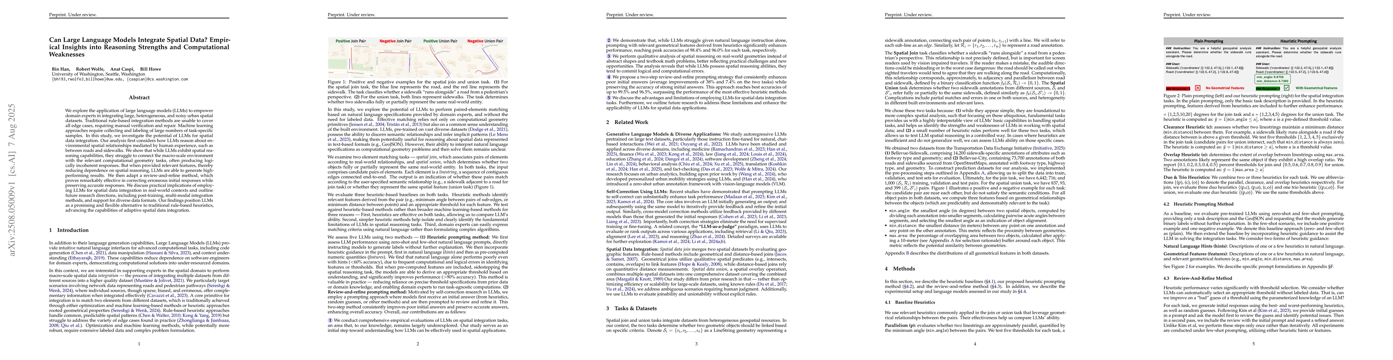
We explore the application of large language models (LLMs) to empower domain experts in integrating large, heterogeneous, and noisy urban spatial datasets. Traditional rule-based integration methods a...
Accurate, up-to-date sidewalk data is essential for building accessible and inclusive pedestrian infrastructure, yet current approaches to data collection are often costly, fragmented, and difficult t...