Academic Profile
Statistics
Similar Authors
Papers on arXiv
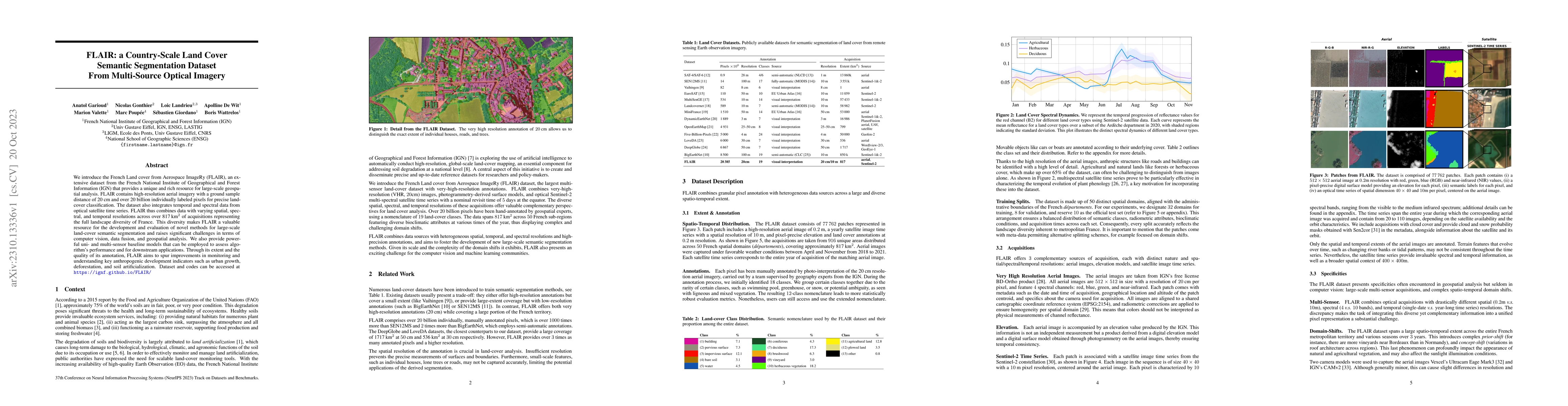
We introduce the French Land cover from Aerospace ImageRy (FLAIR), an extensive dataset from the French National Institute of Geographical and Forest Information (IGN) that provides a unique and ric...
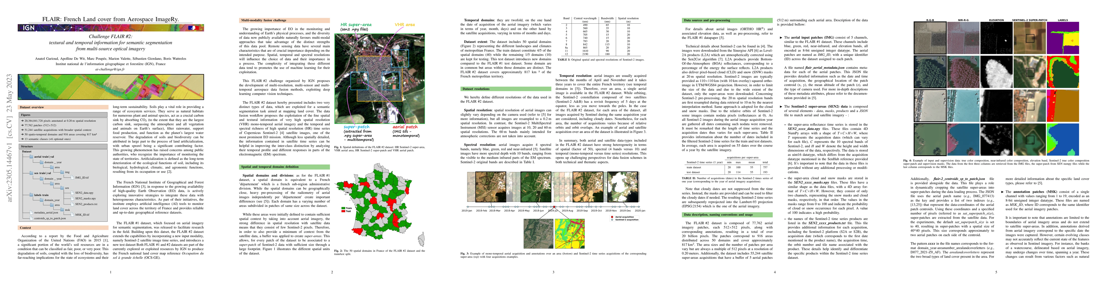
The FLAIR #2 dataset hereby presented includes two very distinct types of data, which are exploited for a semantic segmentation task aimed at mapping land cover. The data fusion workflow proposes th...
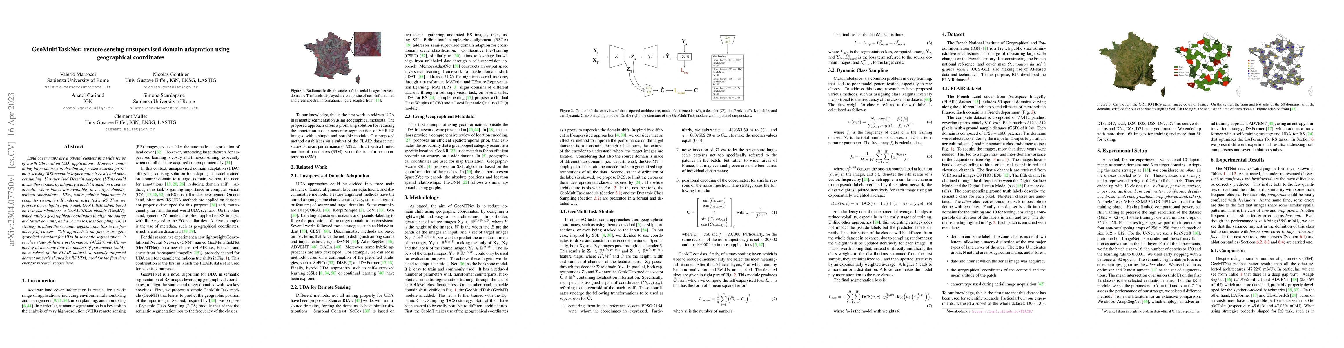
Land cover maps are a pivotal element in a wide range of Earth Observation (EO) applications. However, annotating large datasets to develop supervised systems for remote sensing (RS) semantic segmen...
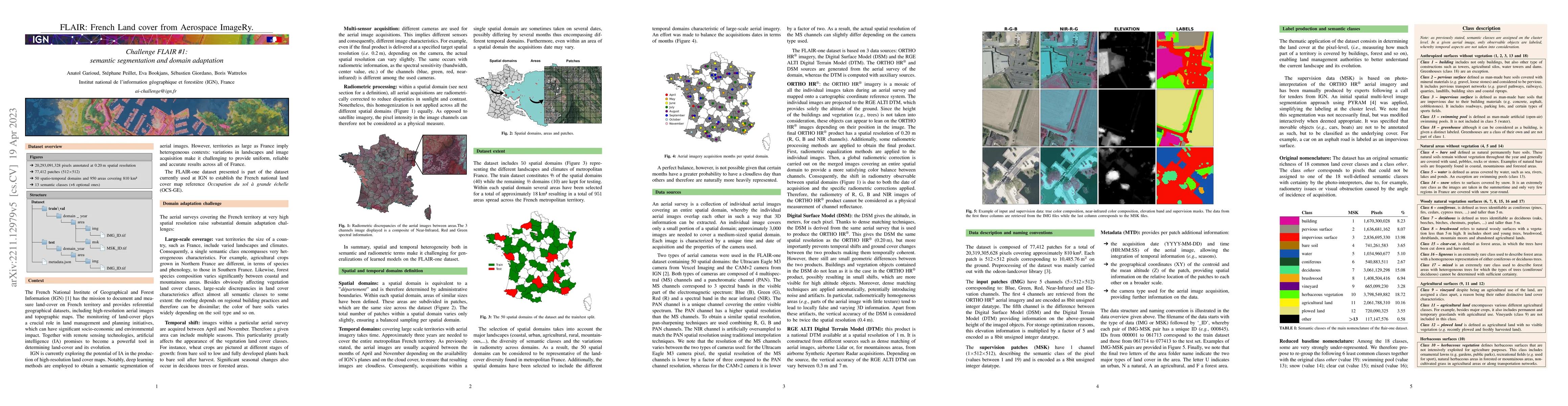
The French National Institute of Geographical and Forest Information (IGN) has the mission to document and measure land-cover on French territory and provides referential geographical datasets, incl...
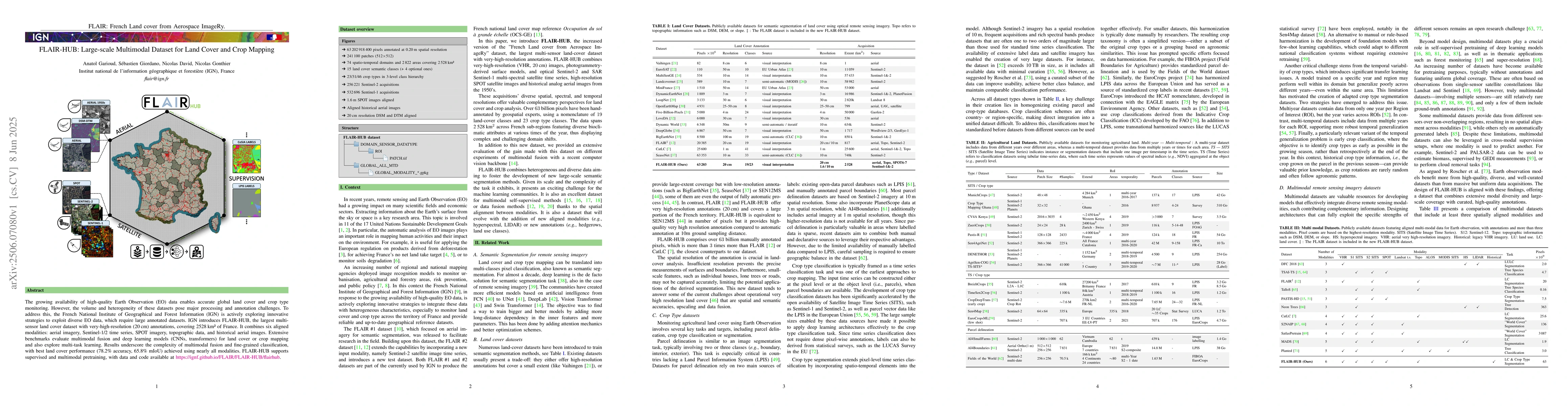
The growing availability of high-quality Earth Observation (EO) data enables accurate global land cover and crop type monitoring. However, the volume and heterogeneity of these datasets pose major pro...
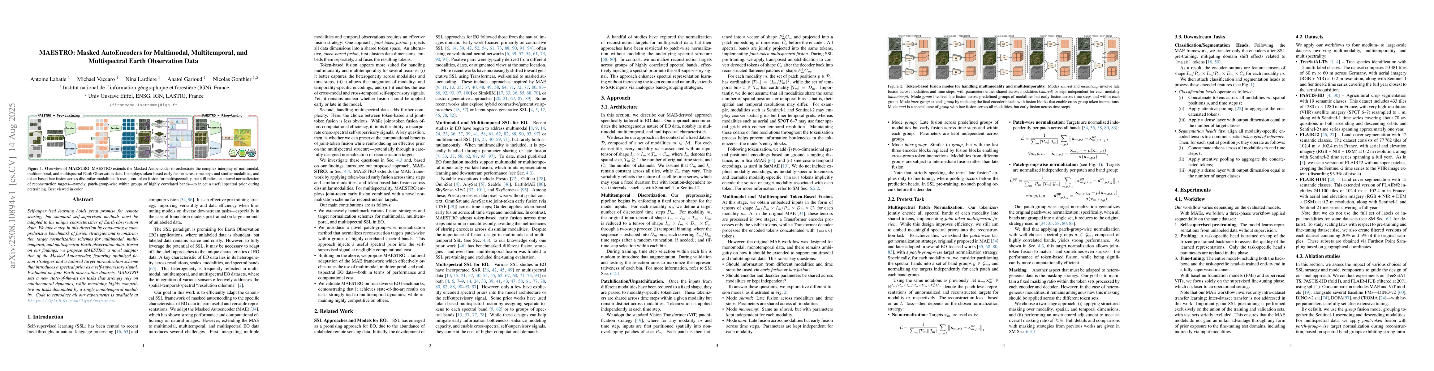
Self-supervised learning holds great promise for remote sensing, but standard self-supervised methods must be adapted to the unique characteristics of Earth observation data. We take a step in this di...