Academic Profile
Statistics
Similar Authors
Papers on arXiv
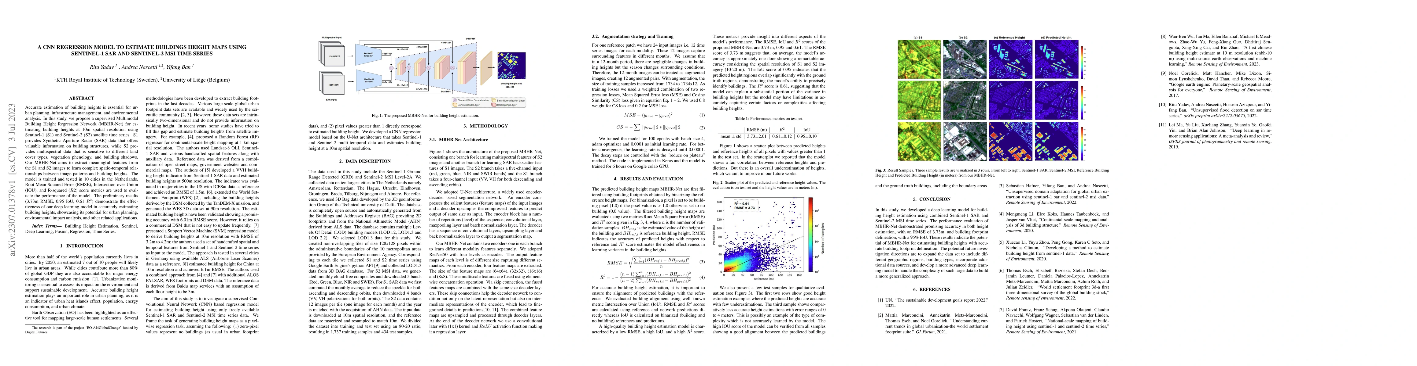
Accurate estimation of building heights is essential for urban planning, infrastructure management, and environmental analysis. In this study, we propose a supervised Multimodal Building Height Regr...
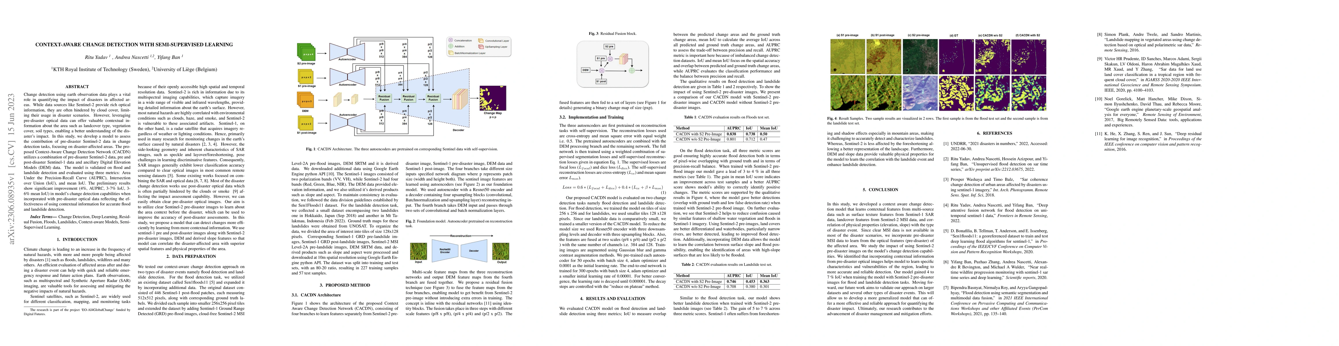
Change detection using earth observation data plays a vital role in quantifying the impact of disasters in affected areas. While data sources like Sentinel-2 provide rich optical information, they a...
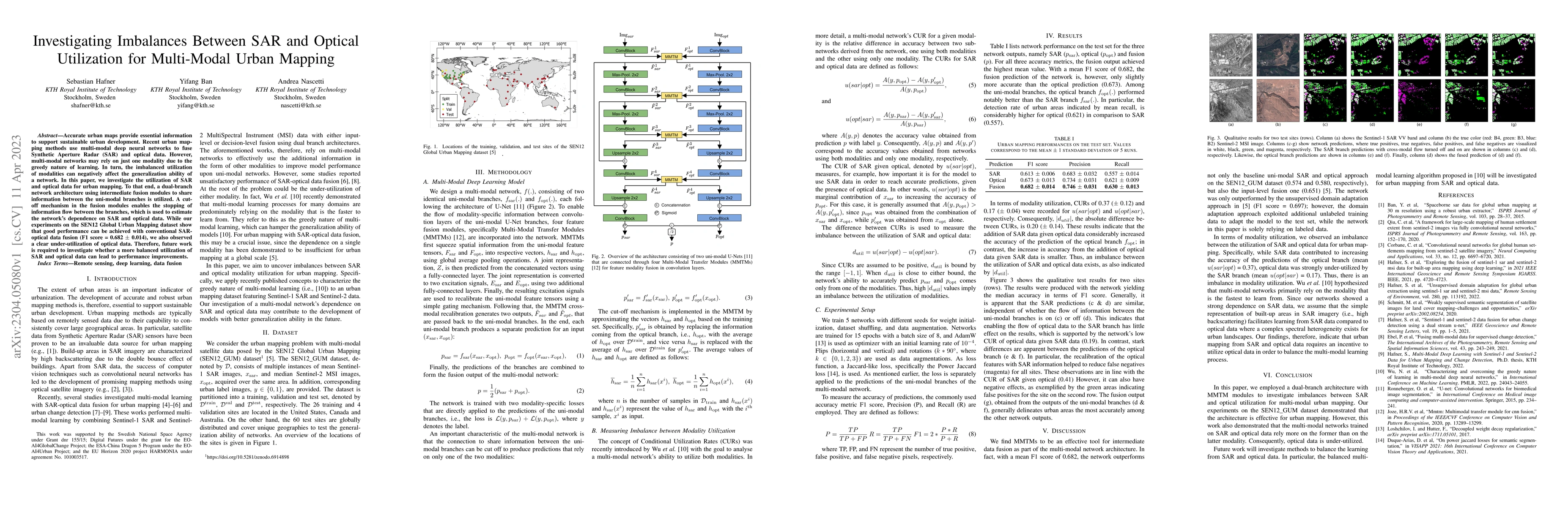
Accurate urban maps provide essential information to support sustainable urban development. Recent urban mapping methods use multi-modal deep neural networks to fuse Synthetic Aperture Radar (SAR) a...
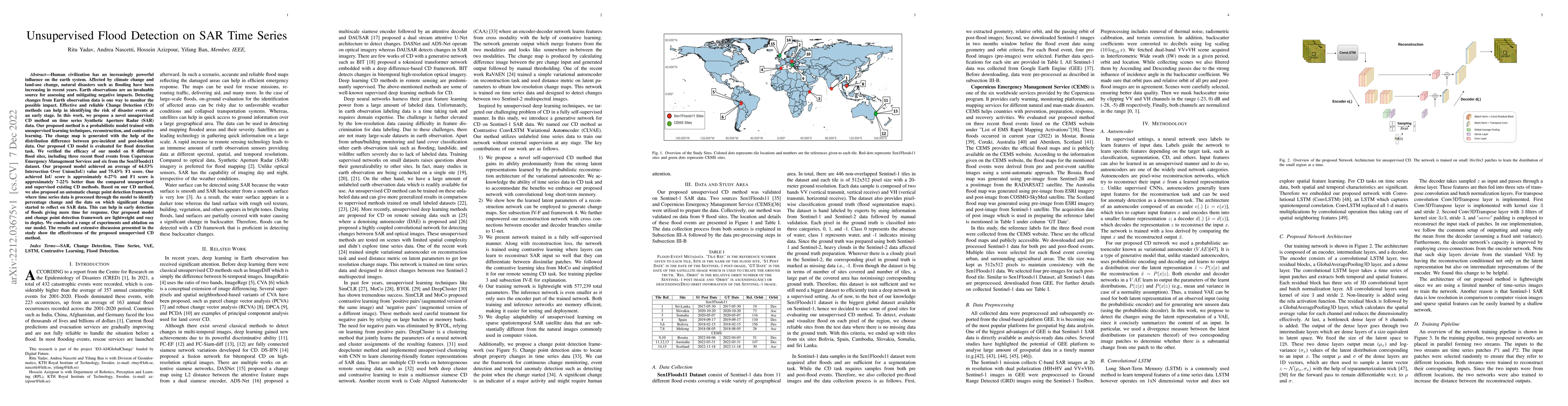
Human civilization has an increasingly powerful influence on the earth system. Affected by climate change and land-use change, natural disasters such as flooding have been increasing in recent years...
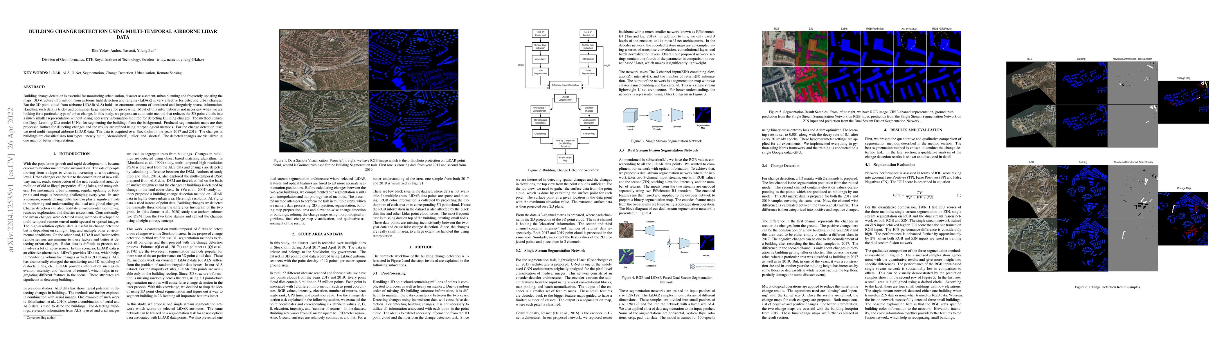
Building change detection is essential for monitoring urbanization, disaster assessment, urban planning and frequently updating the maps. 3D structure information from airborne light detection and r...
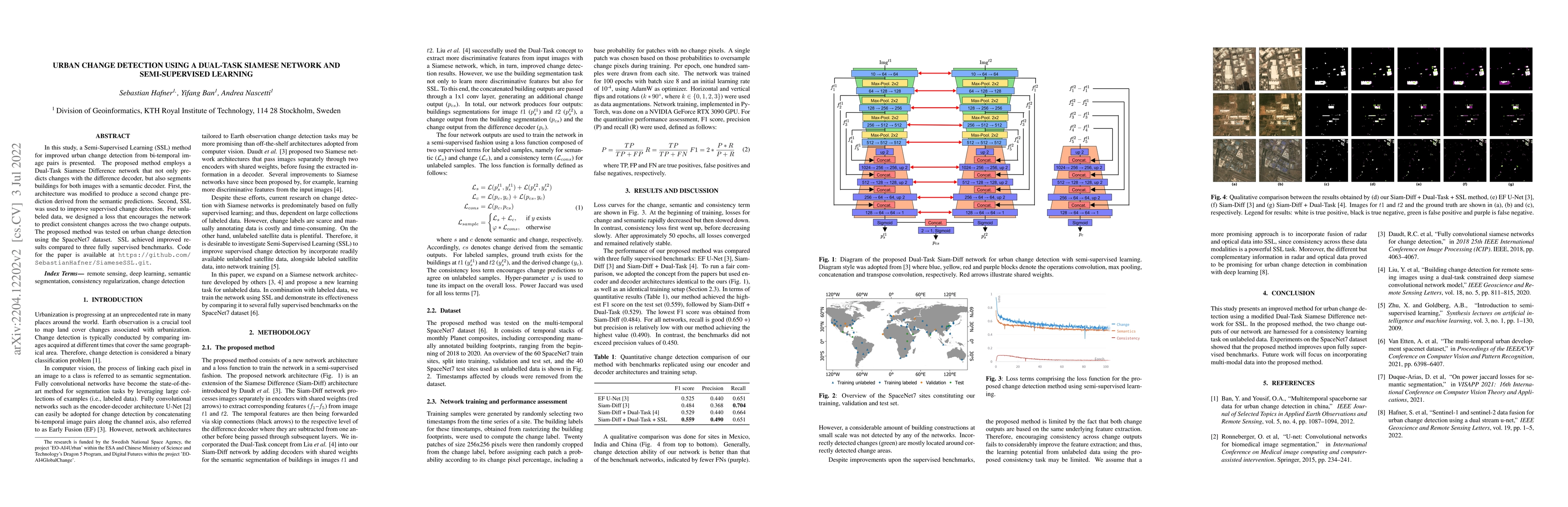
In this study, a Semi-Supervised Learning (SSL) method for improving urban change detection from bi-temporal image pairs was presented. The proposed method adapted a Dual-Task Siamese Difference net...
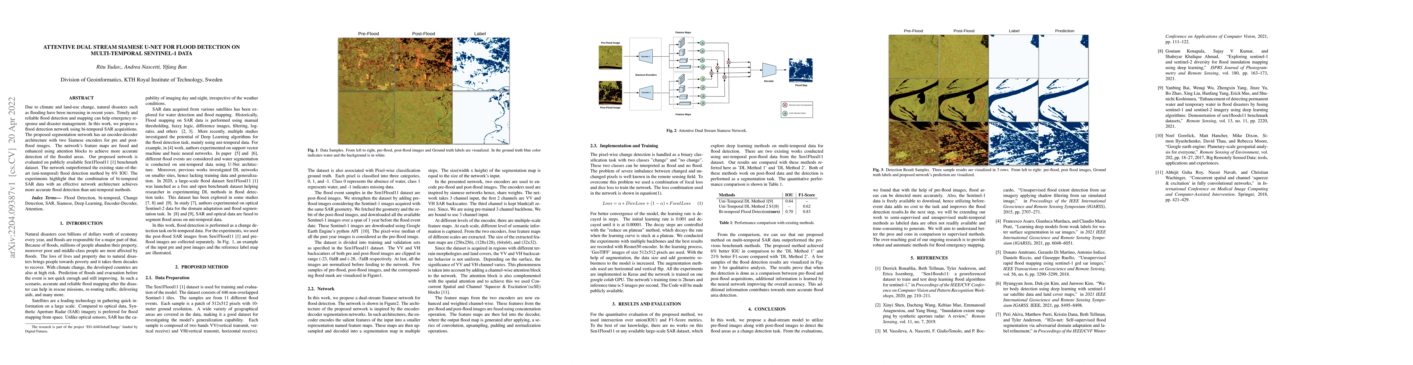
Due to climate and land-use change, natural disasters such as flooding have been increasing in recent years. Timely and reliable flood detection and mapping can help emergency response and disaster ...
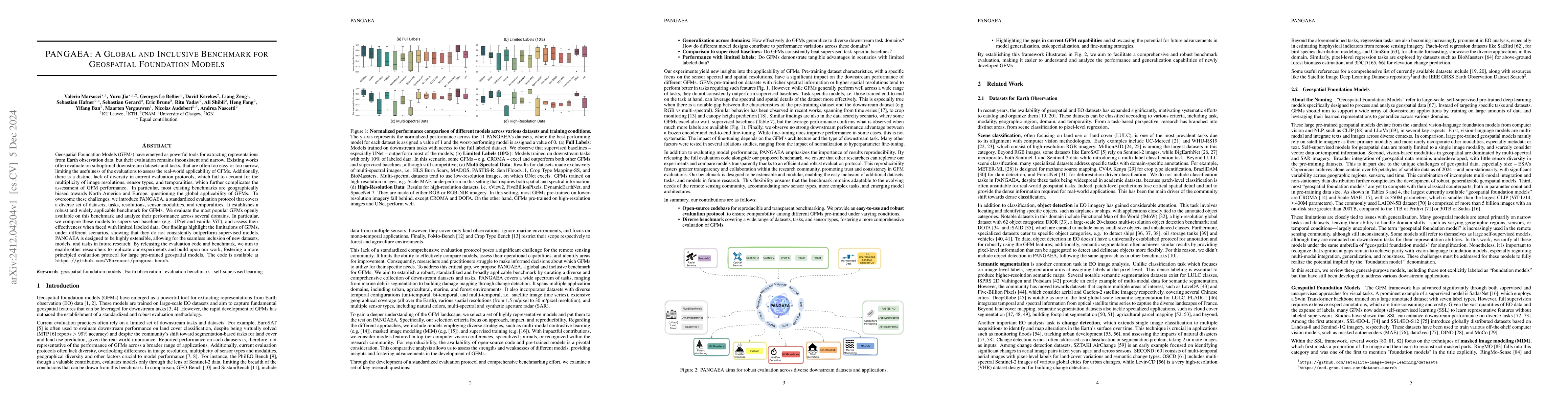
Geospatial Foundation Models (GFMs) have emerged as powerful tools for extracting representations from Earth observation data, but their evaluation remains inconsistent and narrow. Existing works ofte...
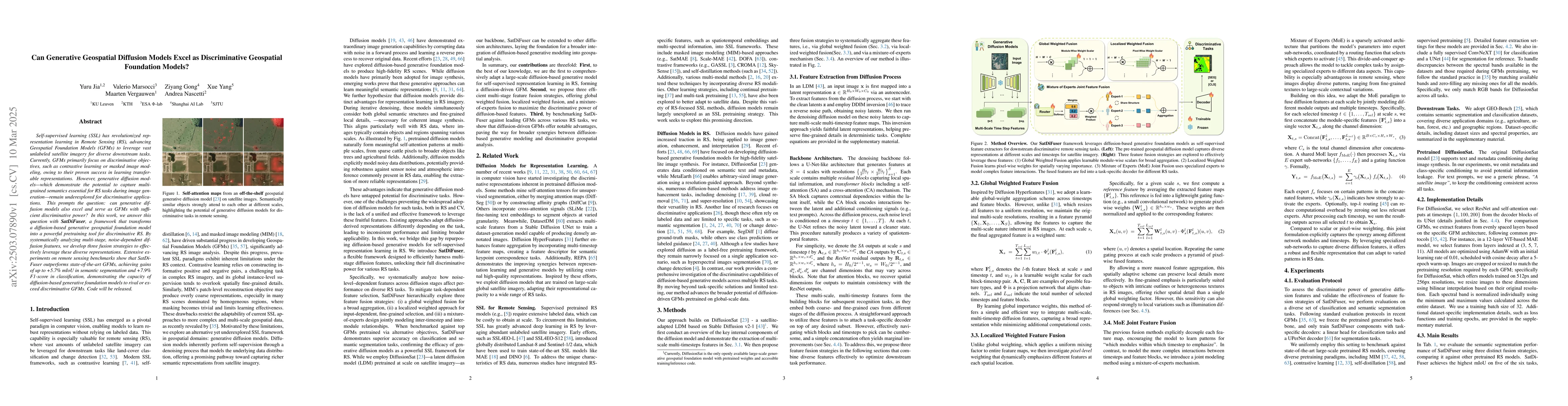
Self-supervised learning (SSL) has revolutionized representation learning in Remote Sensing (RS), advancing Geospatial Foundation Models (GFMs) to leverage vast unlabeled satellite imagery for diverse...

Tunnels are essential elements of transportation infrastructure, but are increasingly affected by ageing and deterioration mechanisms such as cracking. Regular inspections are required to ensure their...
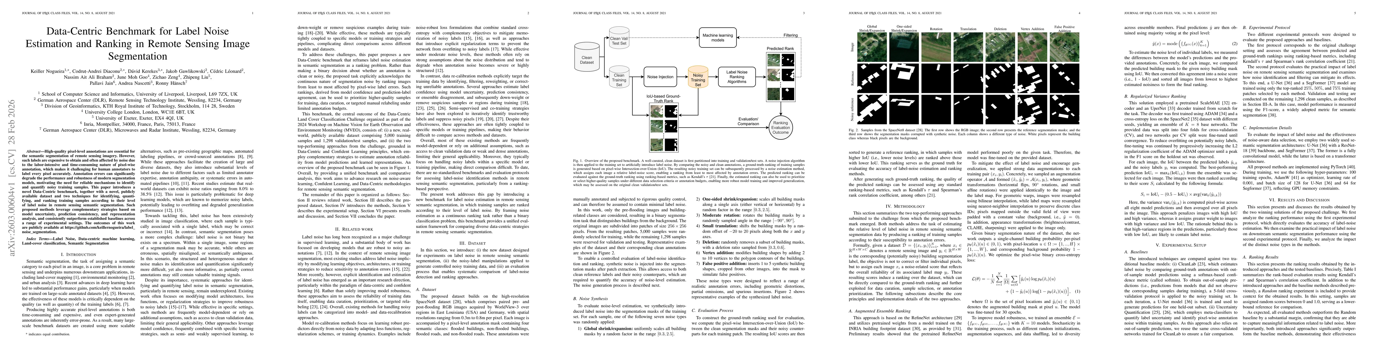
High-quality pixel-level annotations are essential for the semantic segmentation of remote sensing imagery. However, such labels are expensive to obtain and often affected by noise due to the labor-in...
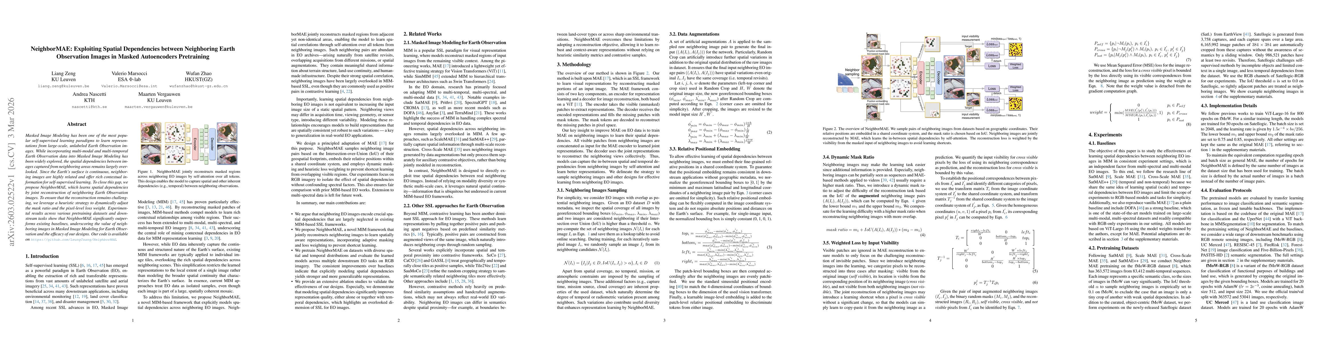
Masked Image Modeling has been one of the most popular self-supervised learning paradigms to learn representations from large-scale, unlabeled Earth Observation images. While incorporating multi-modal...
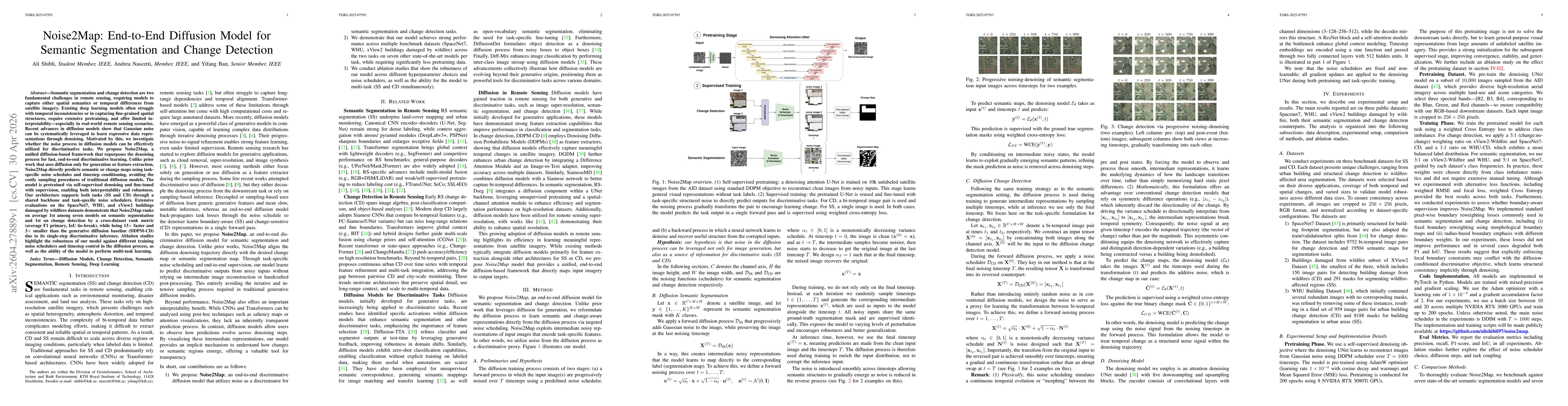
Semantic segmentation and change detection are two fundamental challenges in remote sensing, requiring models to capture either spatial semantics or temporal differences from satellite imagery. Existi...
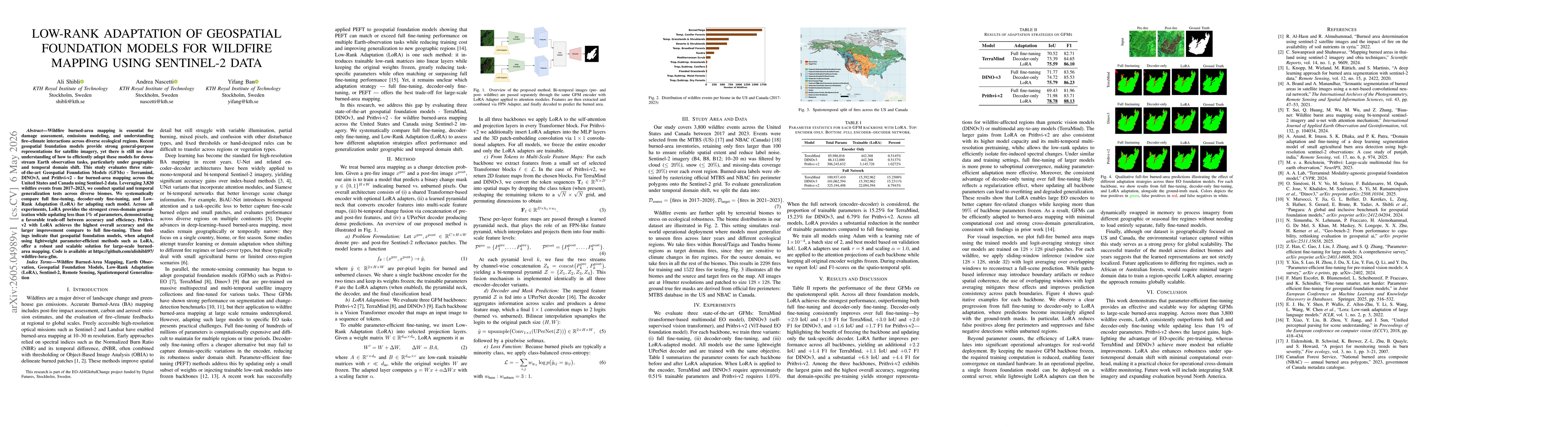
Wildfire burned-area mapping is essential for damage assessment, emissions modeling, and understanding fire-climate interactions across diverse ecological regions. Recent geospatial foundation models ...
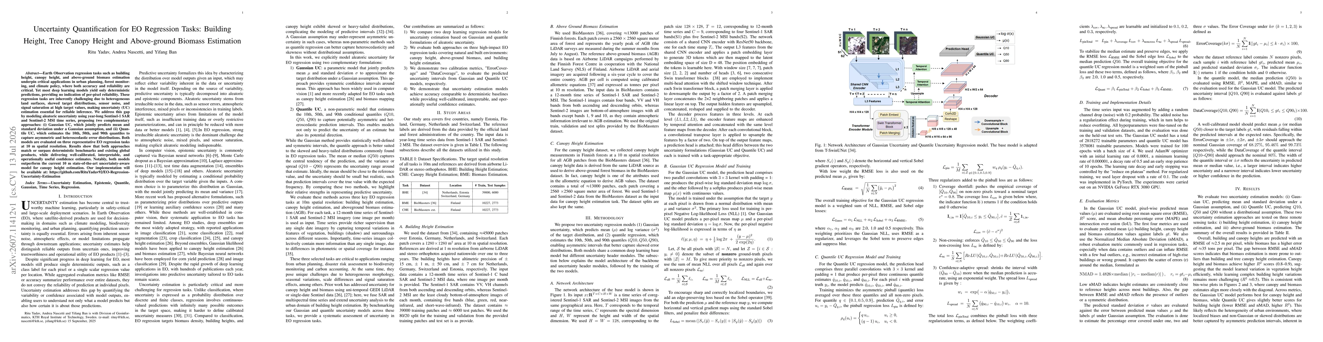
Earth Observation regression tasks such as building height, canopy height, and above-ground biomass estimation underpin critical applications in urban planning, forest monitoring, and climate policy, ...