Academic Profile
Statistics
Similar Authors
Papers on arXiv
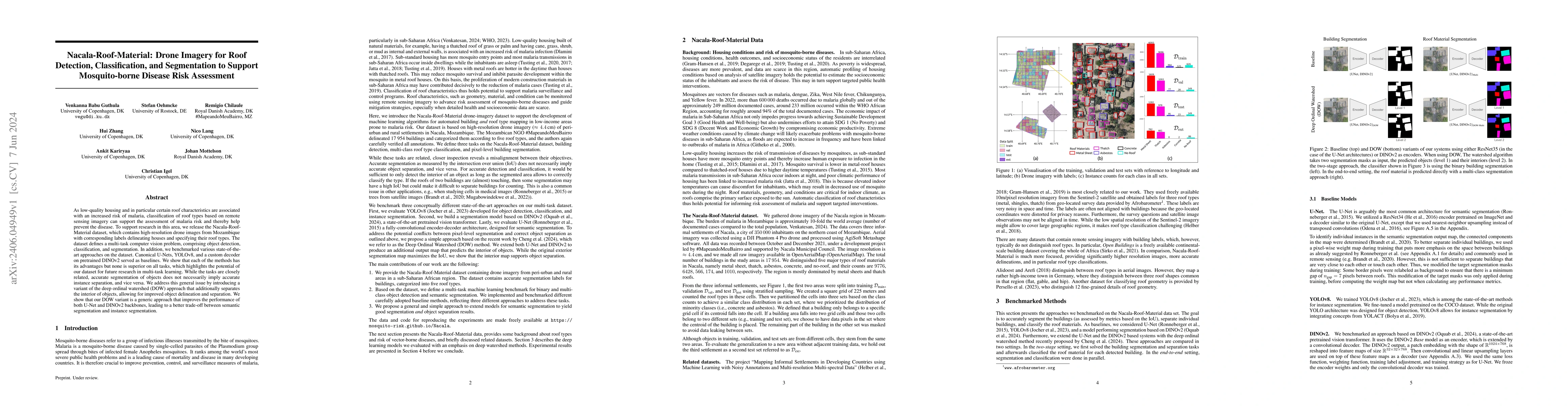
As low-quality housing and in particular certain roof characteristics are associated with an increased risk of malaria, classification of roof types based on remote sensing imagery can support the a...
The volume of unlabelled Earth observation (EO) data is huge, but many important applications lack labelled training data. However, EO data offers the unique opportunity to pair data from different ...
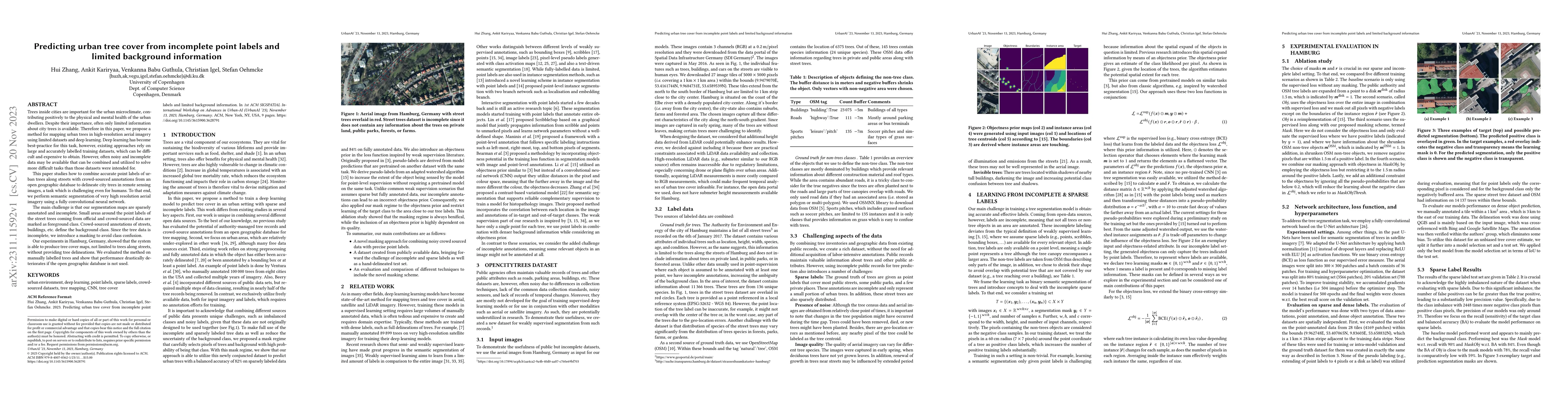
Trees inside cities are important for the urban microclimate, contributing positively to the physical and mental health of the urban dwellers. Despite their importance, often only limited informatio...
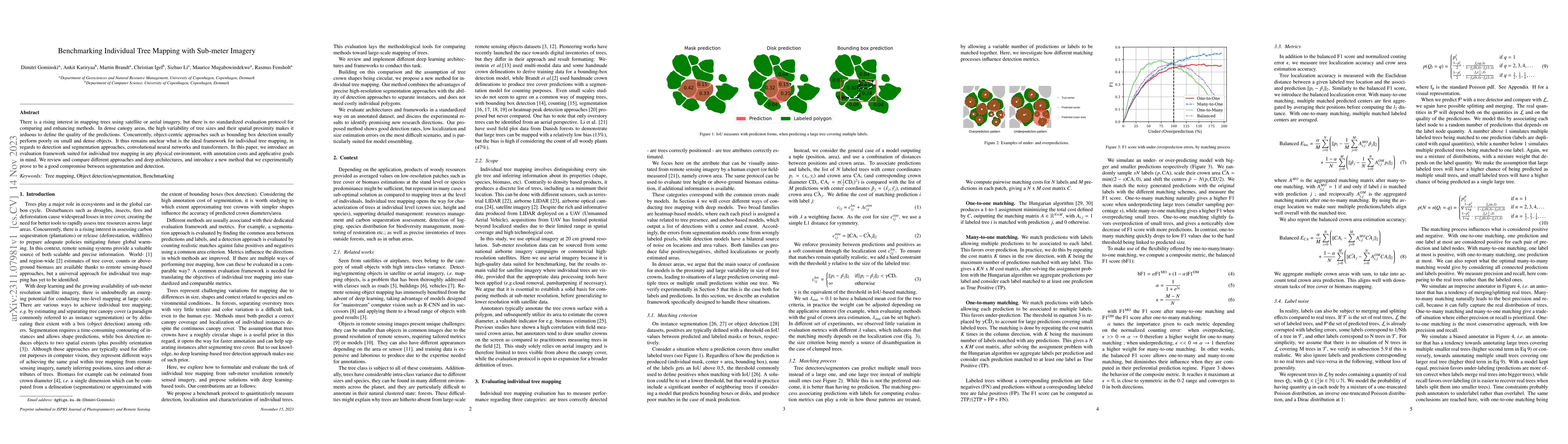
There is a rising interest in mapping trees using satellite or aerial imagery, but there is no standardized evaluation protocol for comparing and enhancing methods. In dense canopy areas, the high v...
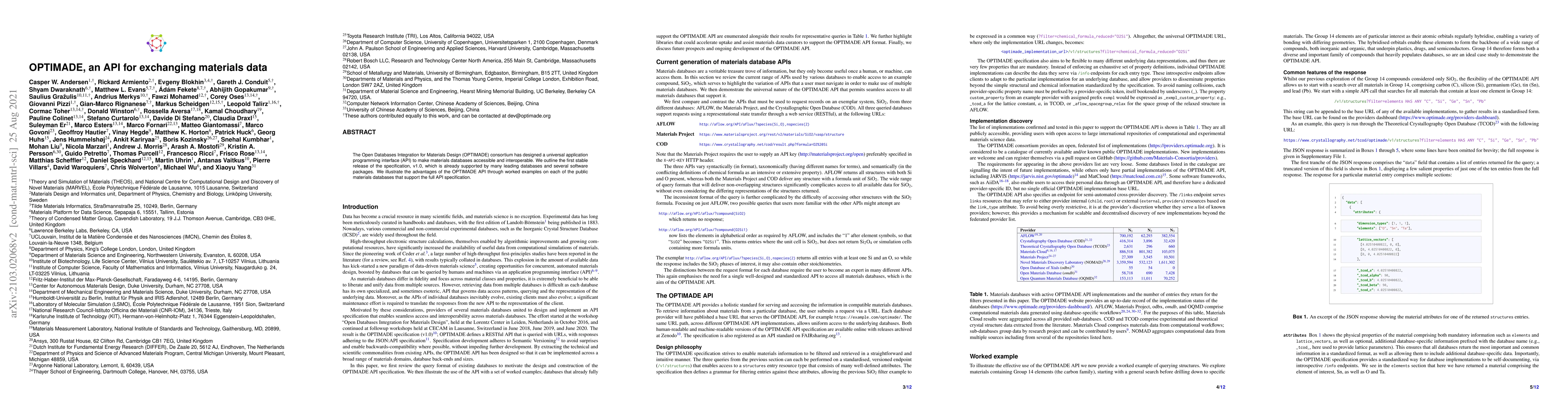
The Open Databases Integration for Materials Design (OPTIMADE) consortium has designed a universal application programming interface (API) to make materials databases accessible and interoperable. W...
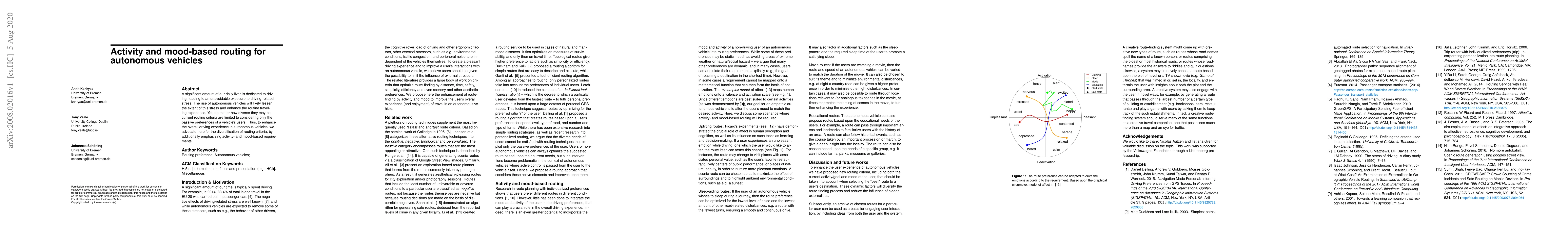
A significant amount of our daily lives is dedicated to driving, leading to an unavoidable exposure to driving-related stress. The rise of autonomous vehicles will likely lessen the extent of this s...
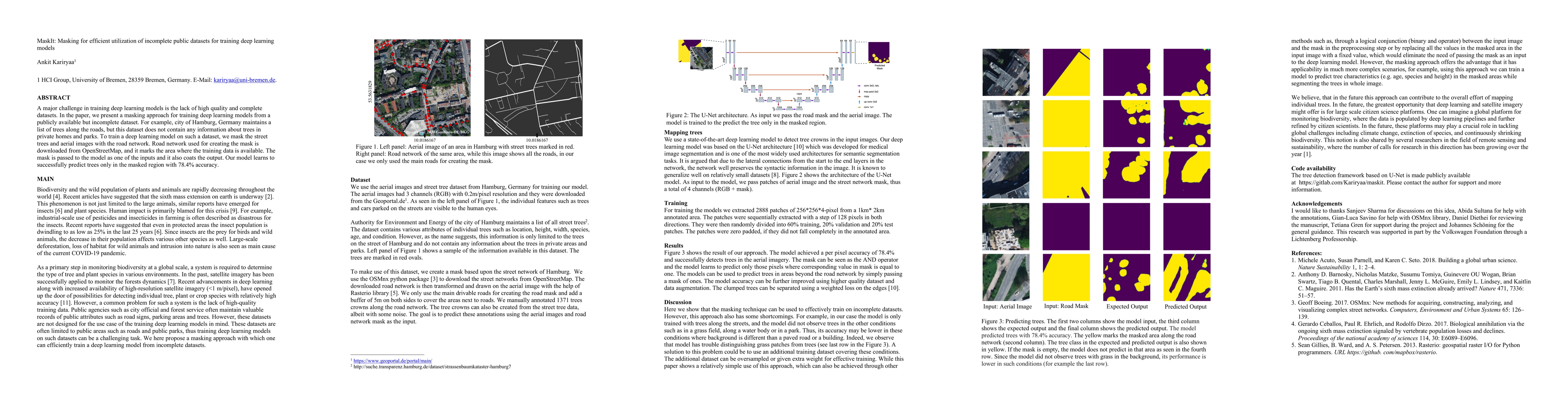
A major challenge in training deep learning models is the lack of high quality and complete datasets. In the paper, we present a masking approach for training deep learning models from a publicly av...
Supervised learning for image segmentation typically requires spatially aligned image and label sets. When images and labels originate from different sources, the pairing may be misaligned, which can ...