Academic Profile
Statistics
Similar Authors
Papers on arXiv
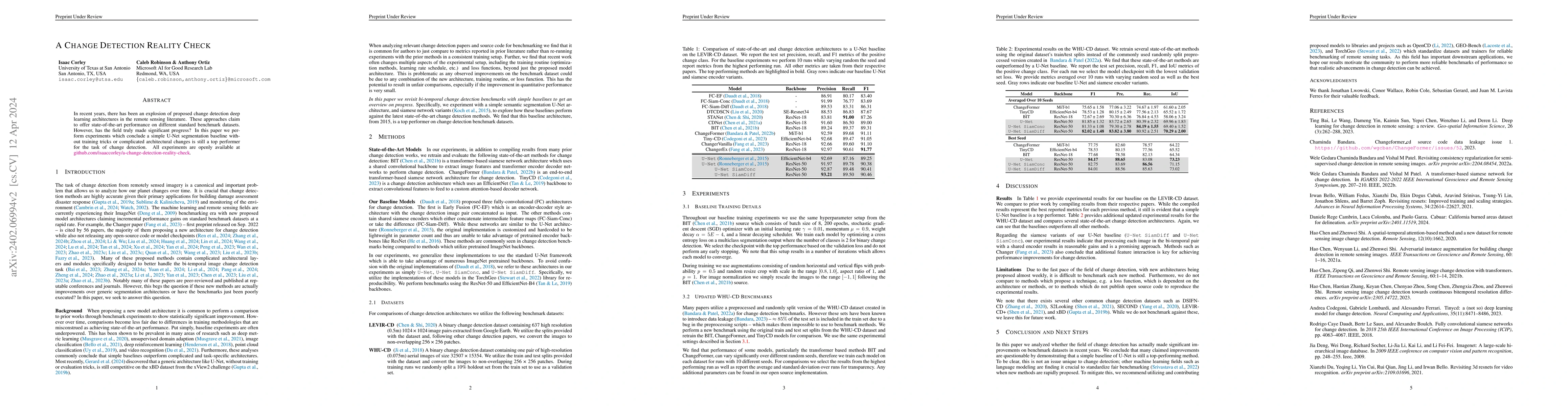
In recent years, there has been an explosion of proposed change detection deep learning architectures in the remote sensing literature. These approaches claim to offer state-of-the-art performance o...
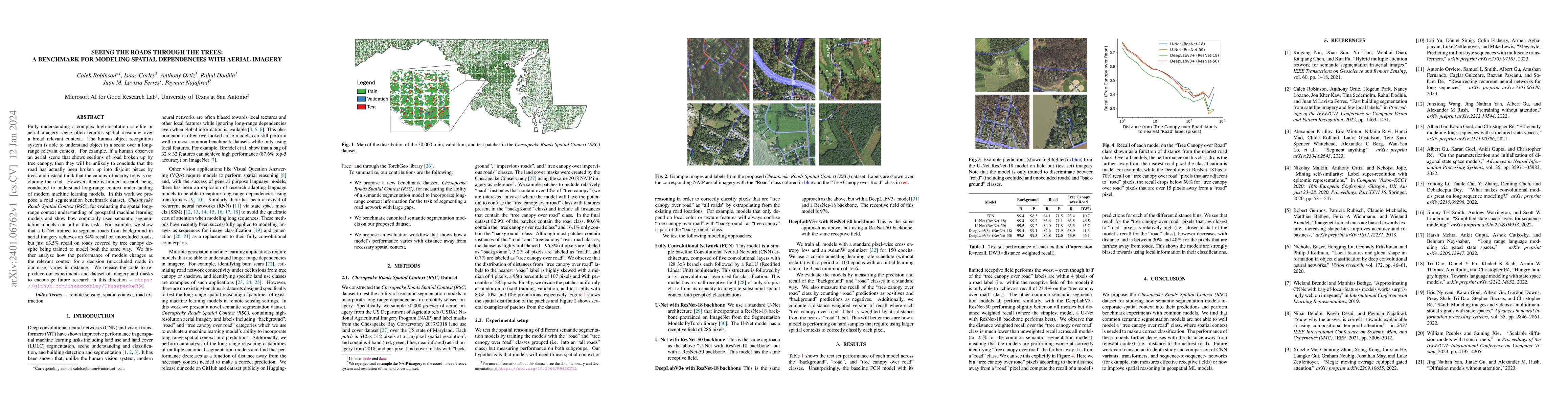
Fully understanding a complex high-resolution satellite or aerial imagery scene often requires spatial reasoning over a broad relevant context. The human object recognition system is able to underst...
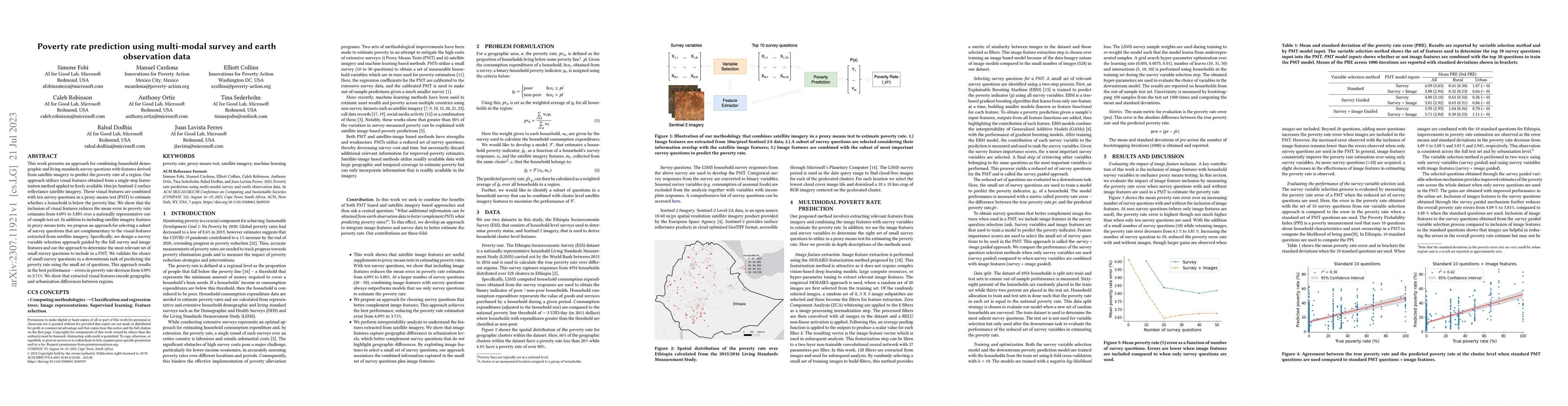
This work presents an approach for combining household demographic and living standards survey questions with features derived from satellite imagery to predict the poverty rate of a region. Our app...
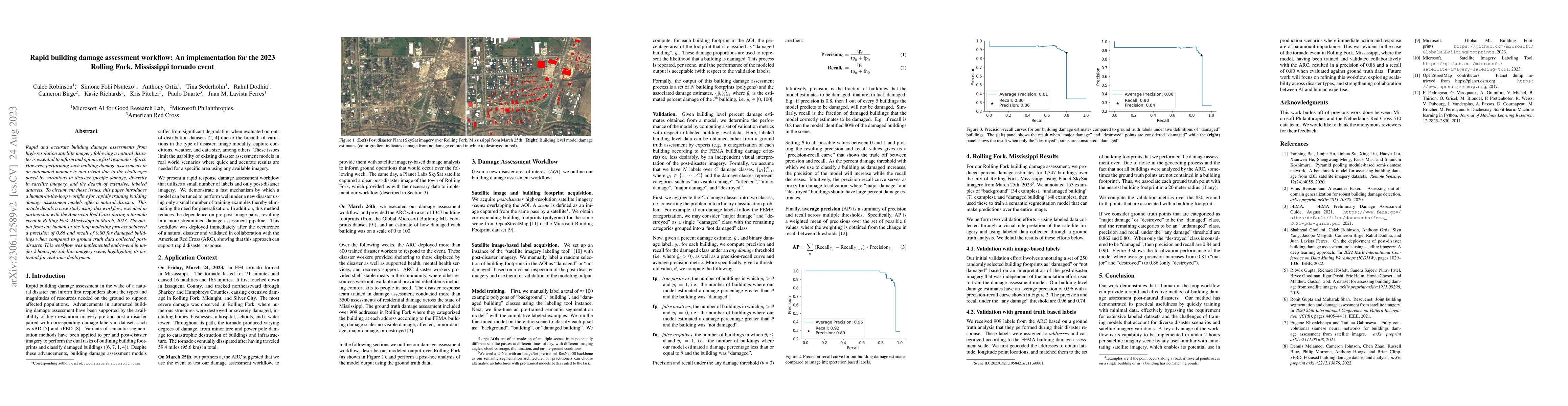
Rapid and accurate building damage assessments from high-resolution satellite imagery following a natural disaster is essential to inform and optimize first responder efforts. However, performing su...
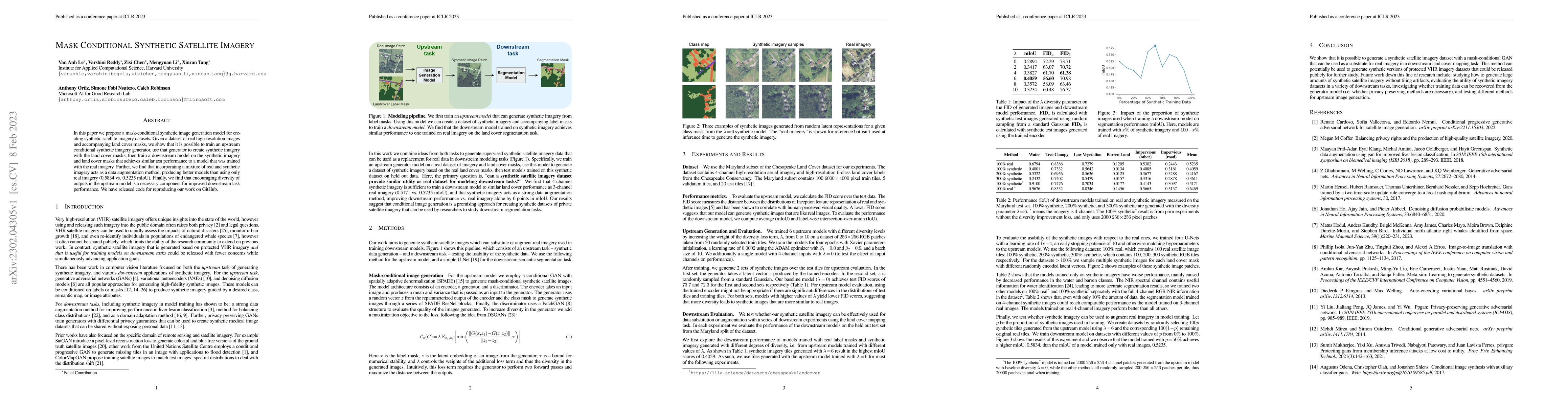
In this paper we propose a mask-conditional synthetic image generation model for creating synthetic satellite imagery datasets. Given a dataset of real high-resolution images and accompanying land c...
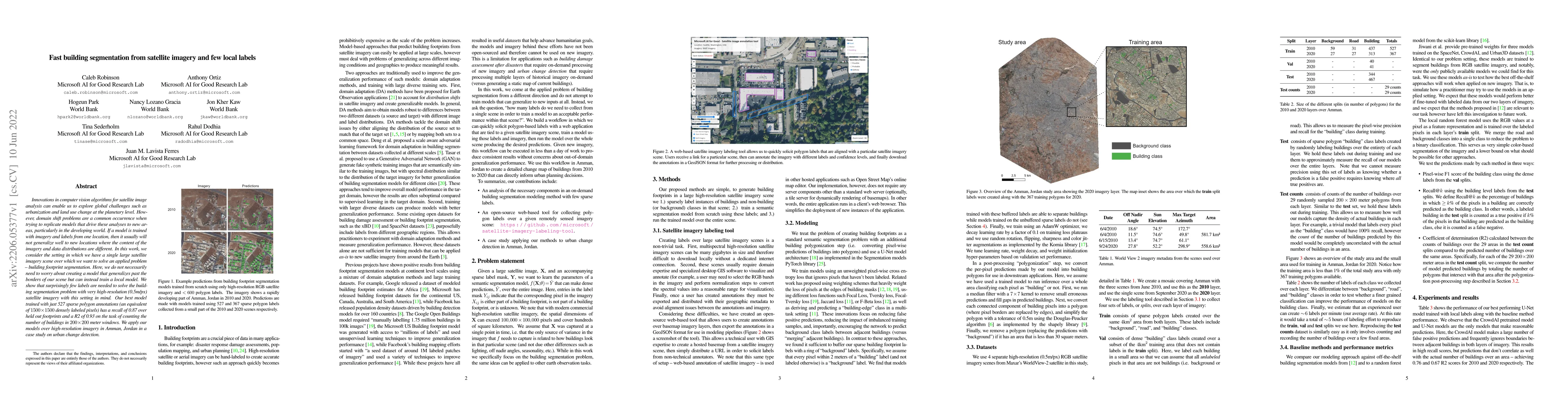
Innovations in computer vision algorithms for satellite image analysis can enable us to explore global challenges such as urbanization and land use change at the planetary level. However, domain shi...

Rapid development of renewable energy sources, particularly solar photovoltaics (PV), is critical to mitigate climate change. As a result, India has set ambitious goals to install 500 gigawatts of s...
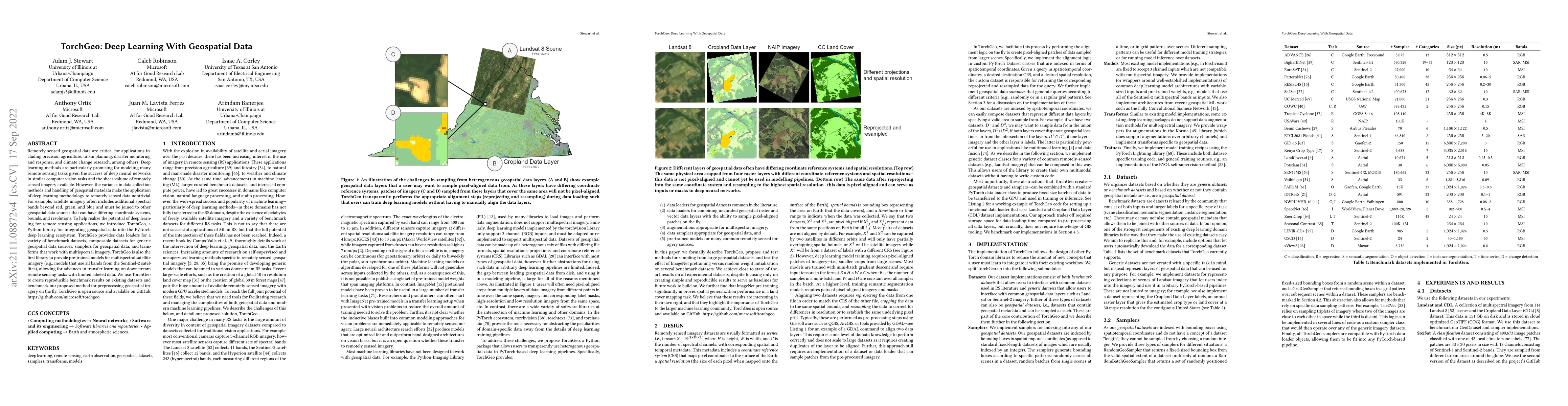
Remotely sensed geospatial data are critical for applications including precision agriculture, urban planning, disaster monitoring and response, and climate change research, among others. Deep learn...
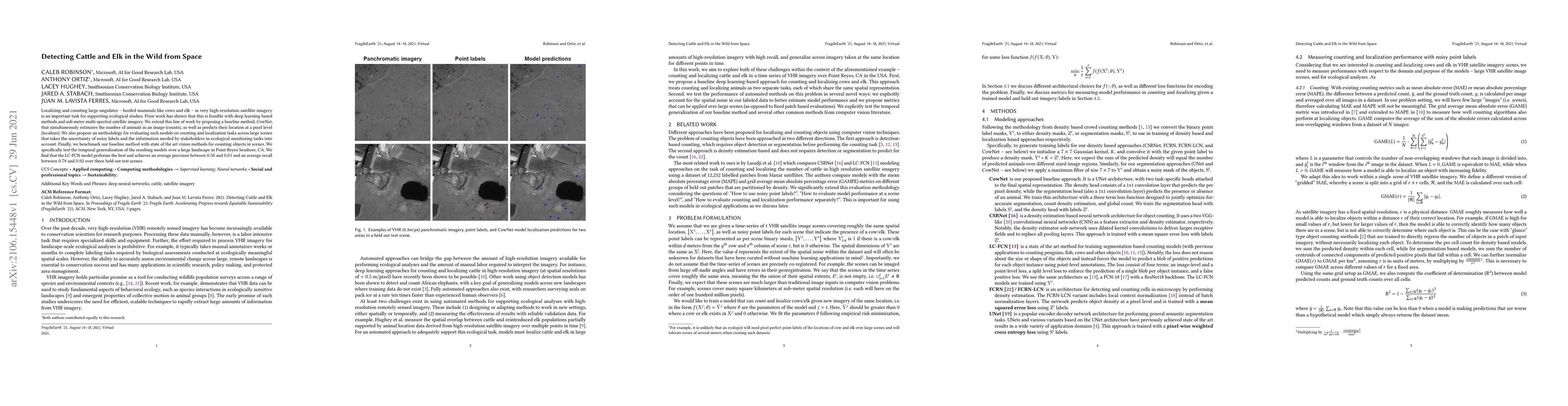
Localizing and counting large ungulates -- hoofed mammals like cows and elk -- in very high-resolution satellite imagery is an important task for supporting ecological studies. Prior work has shown ...
AI for good (AI4G) projects involve developing and applying artificial intelligence (AI) based solutions to further goals in areas such as sustainability, health, humanitarian aid, and social justic...
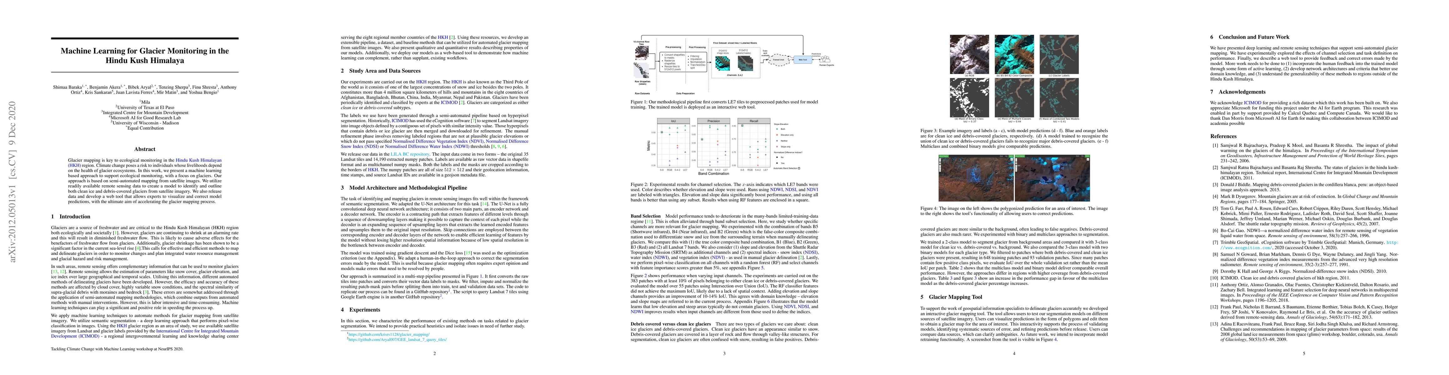
Glacier mapping is key to ecological monitoring in the hkh region. Climate change poses a risk to individuals whose livelihoods depend on the health of glacier ecosystems. In this work, we present a...
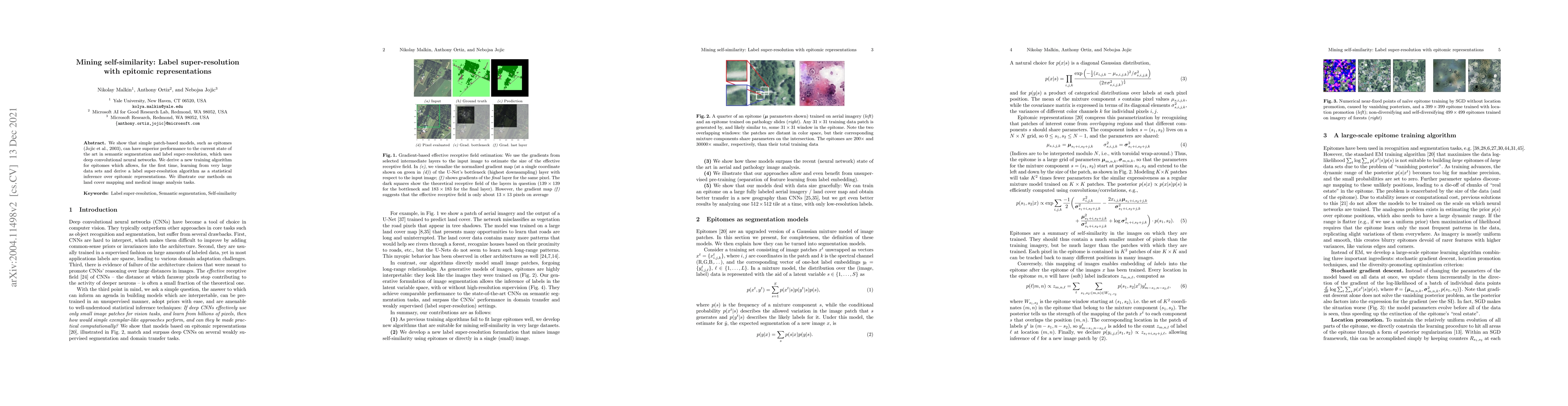
We show that simple patch-based models, such as epitomes, can have superior performance to the current state of the art in semantic segmentation and label super-resolution, which uses deep convoluti...
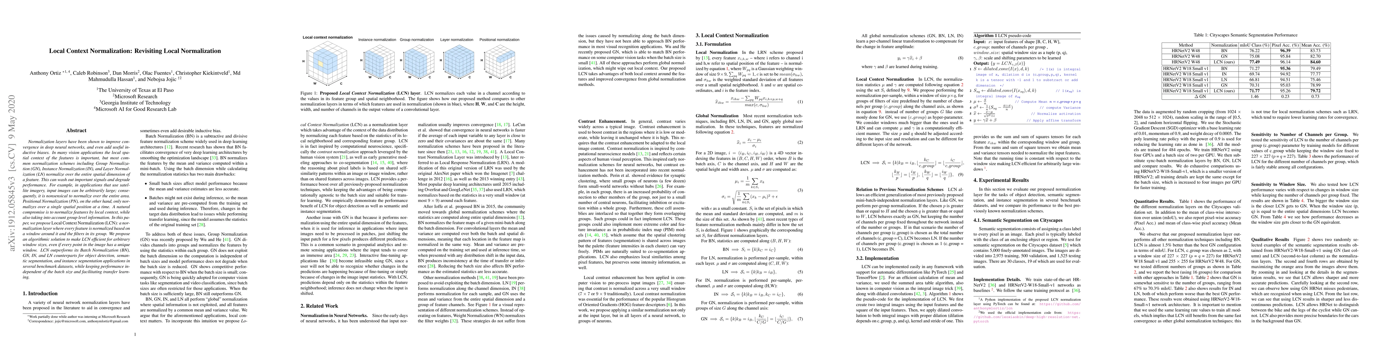
Normalization layers have been shown to improve convergence in deep neural networks, and even add useful inductive biases. In many vision applications the local spatial context of the features is im...
Batch normalization has been widely used to improve optimization in deep neural networks. While the uncertainty in batch statistics can act as a regularizer, using these dataset statistics specific ...
We propose incorporating human labelers in a model fine-tuning system that provides immediate user feedback. In our framework, human labelers can interactively query model predictions on unlabeled d...
As of 2023, a record 117 million people have been displaced worldwide, more than double the number from a decade ago [22]. Of these, 32 million are refugees under the UNHCR mandate, with 8.7 million r...
Remote sensing imagery is dense with objects and contextual visual information. There is a recent trend to combine paired satellite images and text captions for pretraining performant encoders for dow...
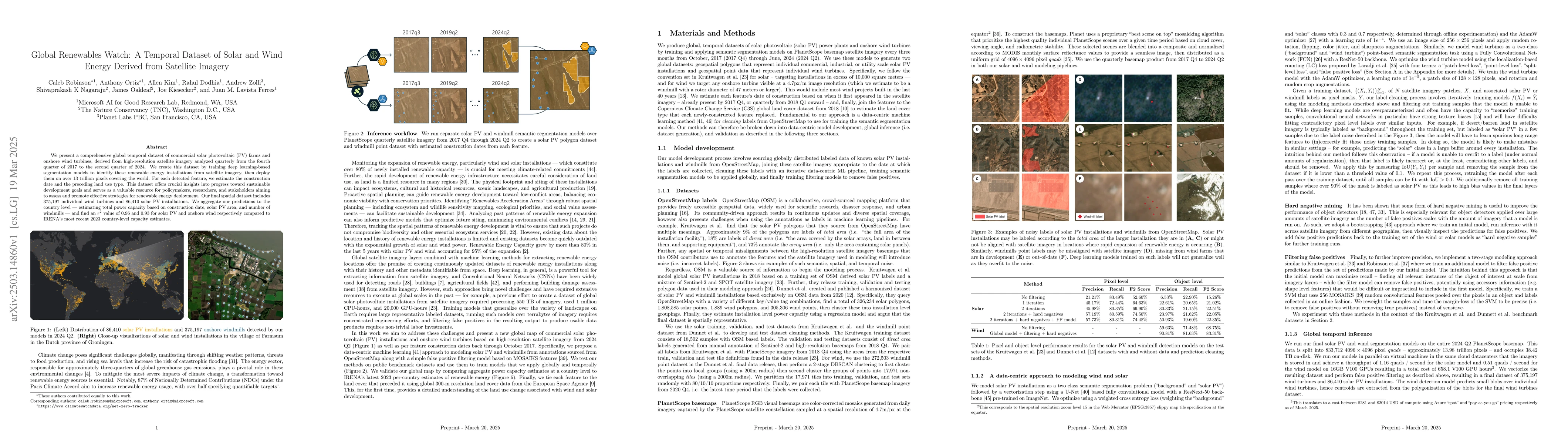
We present a comprehensive global temporal dataset of commercial solar photovoltaic (PV) farms and onshore wind turbines, derived from high-resolution satellite imagery analyzed quarterly from the fou...
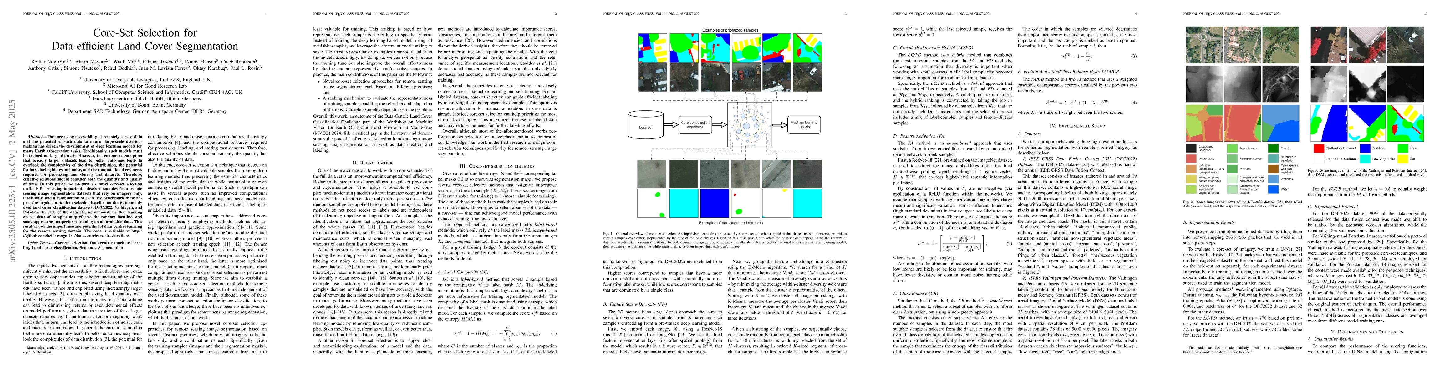
The increasing accessibility of remotely sensed data and the potential of such data to inform large-scale decision-making has driven the development of deep learning models for many Earth Observation ...
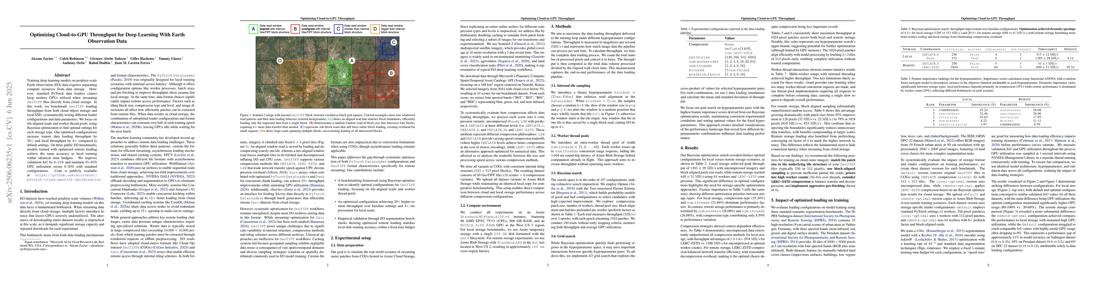
Training deep learning models on petabyte-scale Earth observation (EO) data requires separating compute resources from data storage. However, standard PyTorch data loaders cannot keep modern GPUs util...
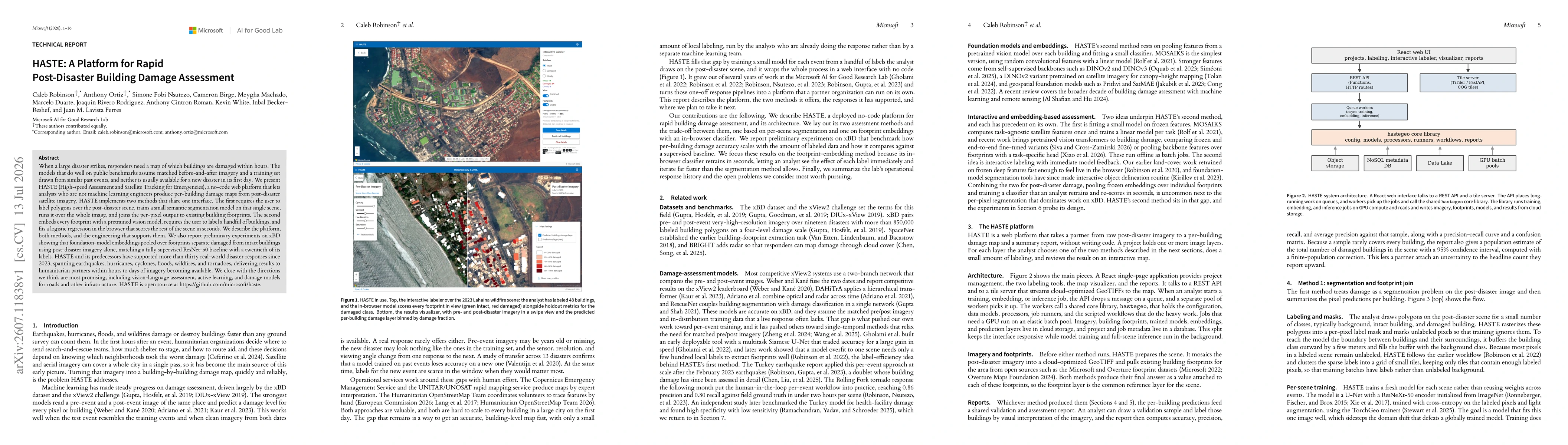
When a large disaster strikes, responders need a map of which buildings are damaged within hours. The models that do well on public benchmarks assume matched before-and-after imagery and a training se...