Academic Profile
Statistics
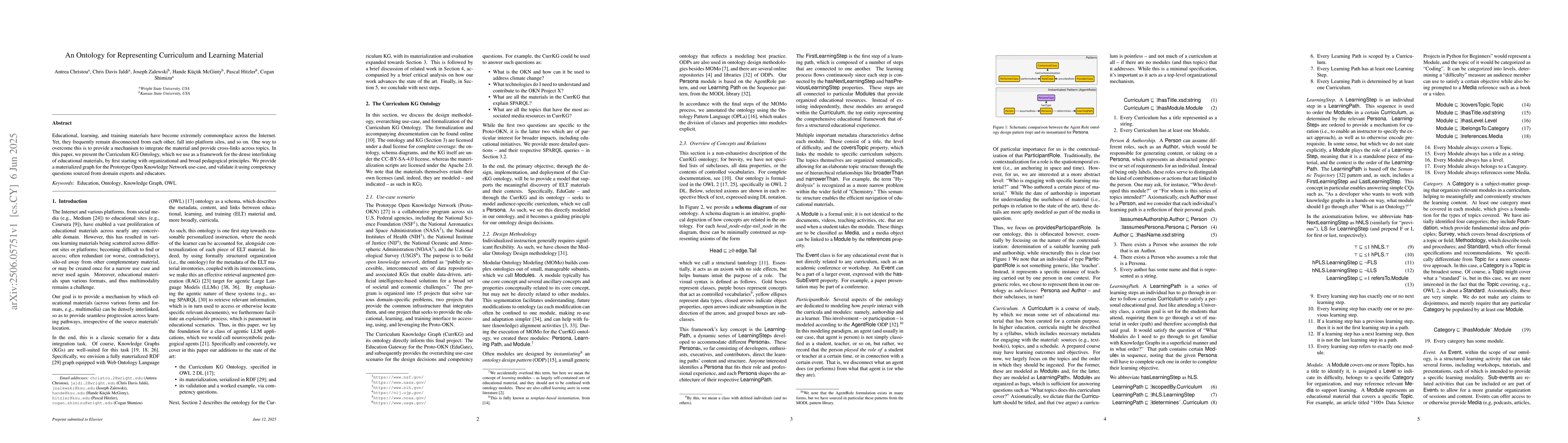
Similar Authors
Papers on arXiv
KnowWhereGraph is one of the largest fully publicly available geospatial knowledge graphs. It includes data from 30 layers on natural hazards (e.g., hurricanes, wildfires), climate variables (e.g., ai...
Geospatial Knowledge Graphs (GeoKGs) have become integral to the growing field of Geospatial Artificial Intelligence. Initiatives like the U.S. National Science Foundation's Open Knowledge Network pro...
Knowledge graphs (KGs) are increasingly utilized for data integration, representation, and visualization. While KG population is critical, it is often costly, especially when data must be extracted fr...
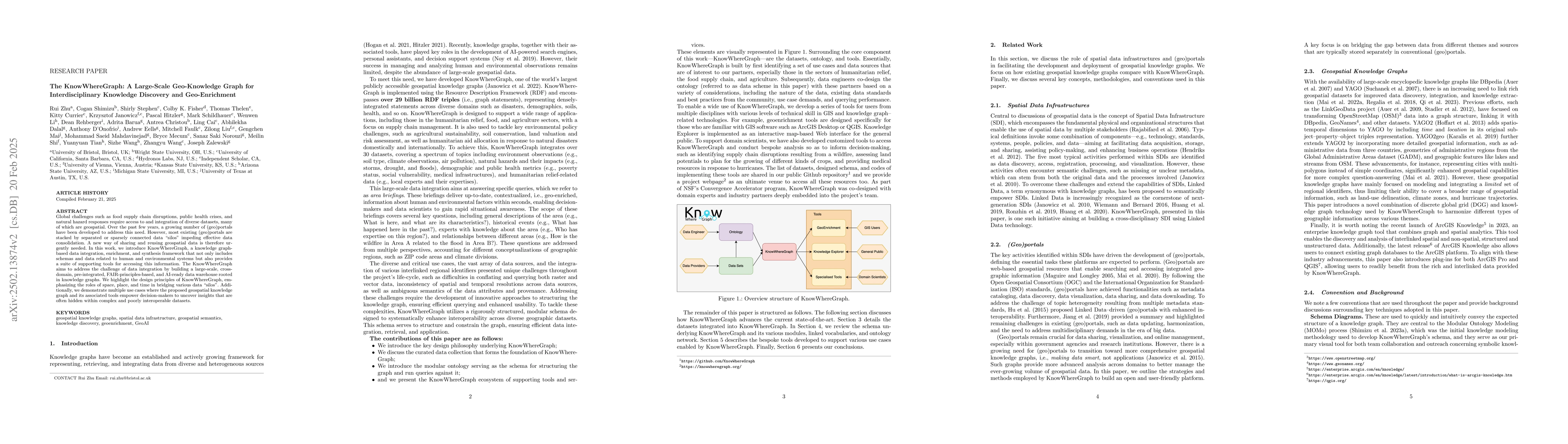
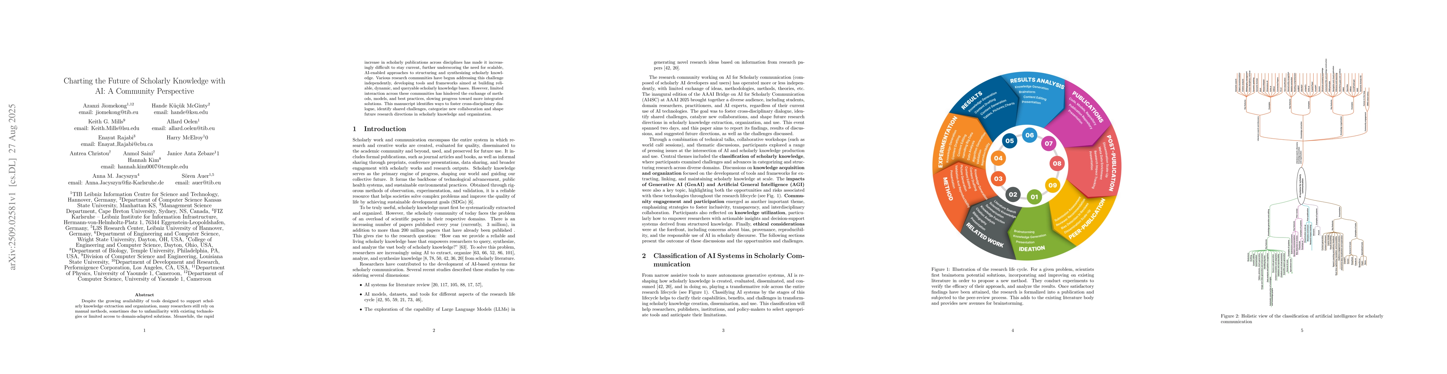
Global challenges such as food supply chain disruptions, public health crises, and natural hazard responses require access to and integration of diverse datasets, many of which are geospatial. Over th...
Educational, learning, and training materials have become extremely commonplace across the Internet. Yet, they frequently remain disconnected from each other, fall into platform silos, and so on. One ...
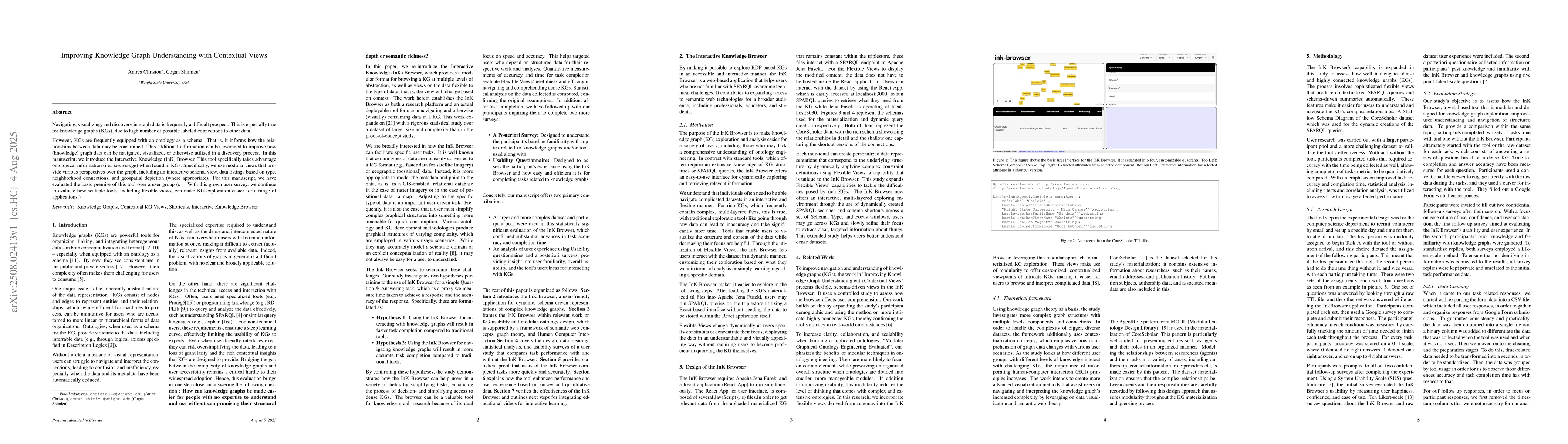
Navigating, visualizing, and discovery in graph data is frequently a difficult prospect. This is especially true for knowledge graphs (KGs), due to high number of possible labeled connections to other...
Despite the growing availability of tools designed to support scholarly knowledge extraction and organization, many researchers still rely on manual methods, sometimes due to unfamiliarity with existi...