Academic Profile
Statistics
Similar Authors
Papers on arXiv
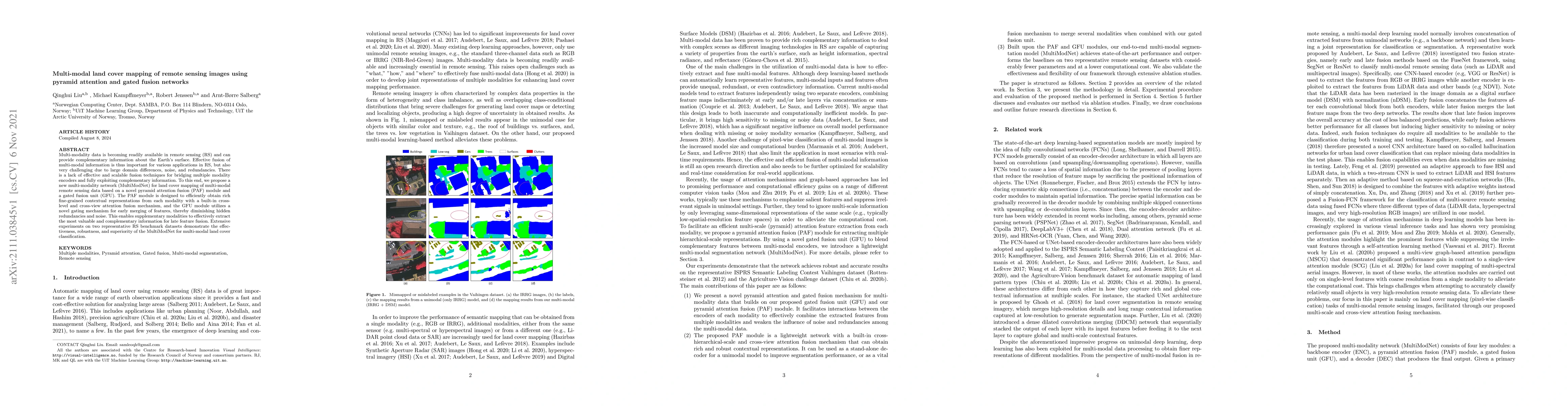
Multi-modality data is becoming readily available in remote sensing (RS) and can provide complementary information about the Earth's surface. Effective fusion of multi-modal information is thus impo...
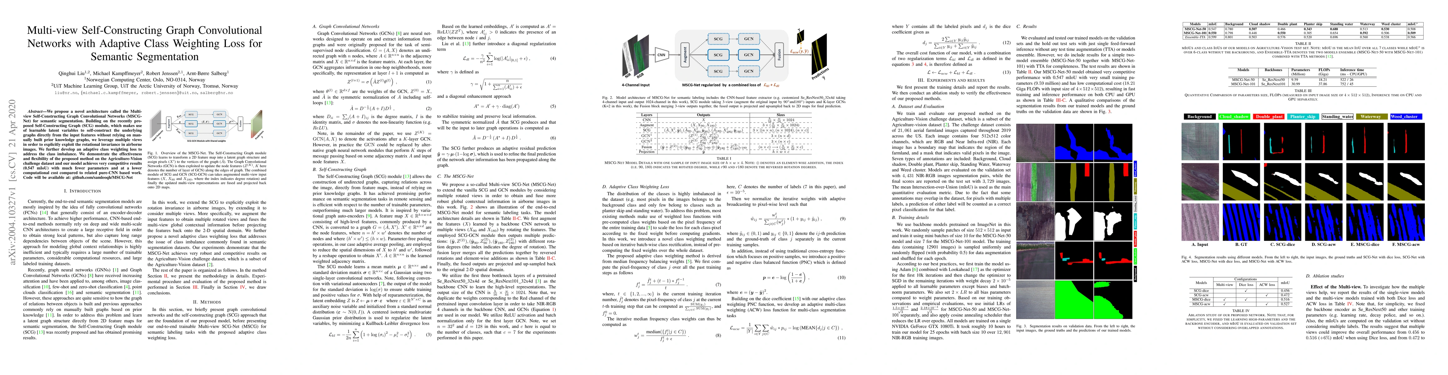
We propose a novel architecture called the Multi-view Self-Constructing Graph Convolutional Networks (MSCG-Net) for semantic segmentation. Building on the recently proposed Self-Constructing Graph (...
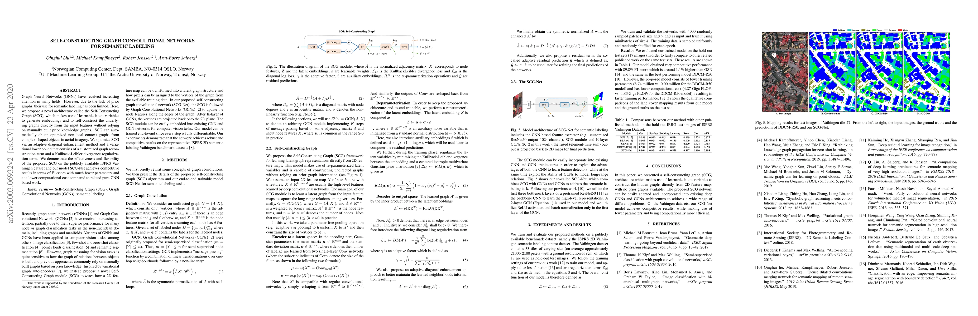
Graph Neural Networks (GNNs) have received increasing attention in many fields. However, due to the lack of prior graphs, their use for semantic labeling has been limited. Here, we propose a novel a...

Land cover classification of remote sensing images is a challenging task due to limited amounts of annotated data, highly imbalanced classes, frequent incorrect pixel-level annotations, and an inher...
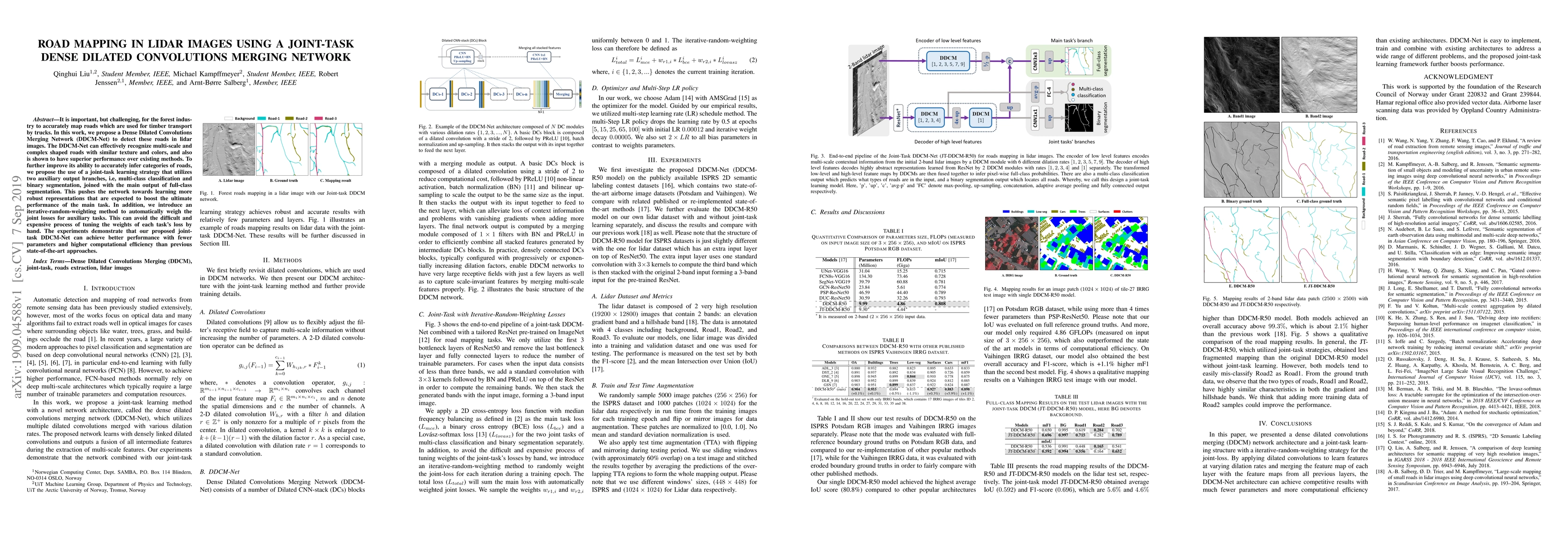
It is important, but challenging, for the forest industry to accurately map roads which are used for timber transport by trucks. In this work, we propose a Dense Dilated Convolutions Merging Network...
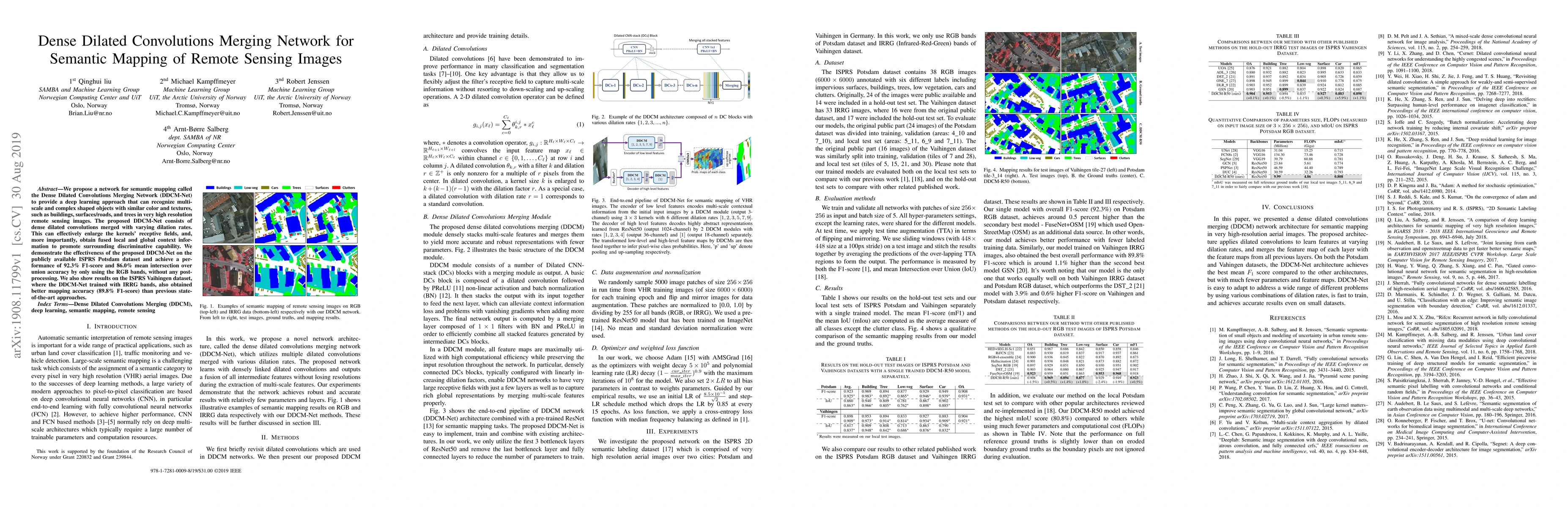
We propose a network for semantic mapping called the Dense Dilated Convolutions Merging Network (DDCM-Net) to provide a deep learning approach that can recognize multi-scale and complex shaped objec...
Accurate uncertainty information associated with essential climate variables (ECVs) is crucial for reliable climate modeling and understanding the spatiotemporal evolution of the Earth system. In rece...
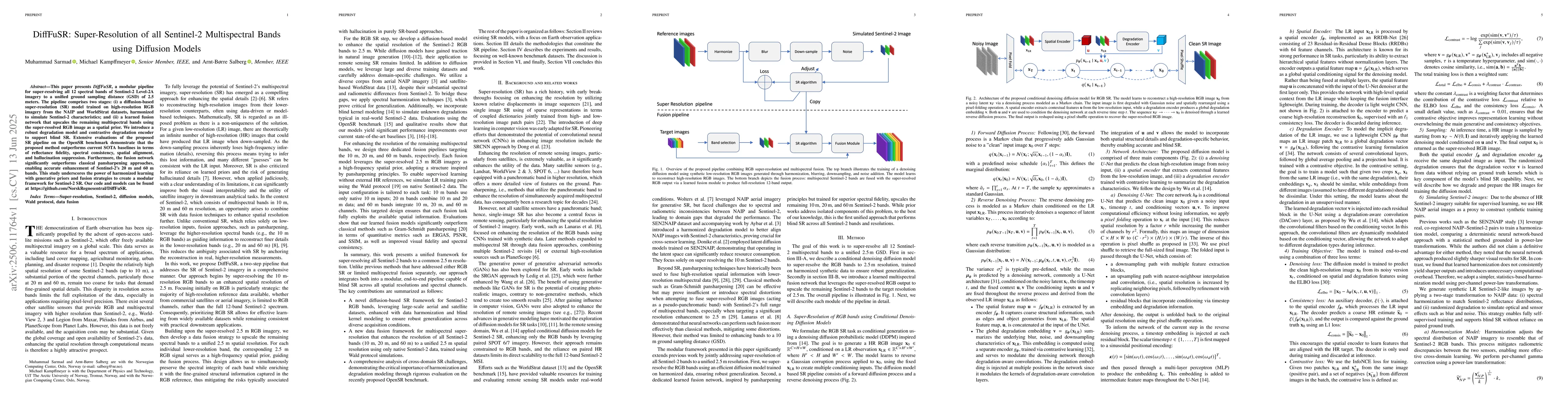
This paper presents DiffFuSR, a modular pipeline for super-resolving all 12 spectral bands of Sentinel-2 Level-2A imagery to a unified ground sampling distance (GSD) of 2.5 meters. The pipeline compri...
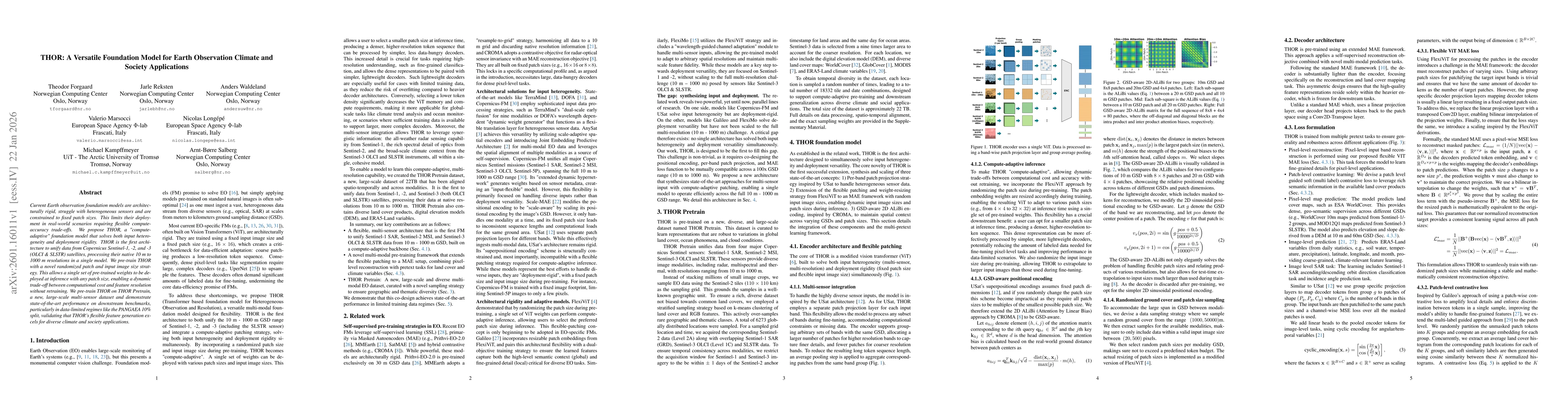
Current Earth observation foundation models are architecturally rigid, struggle with heterogeneous sensors and are constrained to fixed patch sizes. This limits their deployment in real-world scenario...
Most dimensionality reduction methods treat data as discrete point clouds, ignoring the continuous domain structure inherent to many real-world processes. To bridge this gap, we introduce Neural Opera...