Academic Profile
Statistics
Similar Authors
Papers on arXiv
Given a set \emph{S} of spatial feature types, its feature instances, a study area, and a neighbor relationship, the goal is to find pairs $<$a region ($r_{g}$), a subset \emph{C} of \emph{S}$>$ such ...
Given a collection of Boolean spatial feature types, their instances, a neighborhood relation (e.g., proximity), and a hierarchical taxonomy of the feature types, the goal is to find the subsets of ...
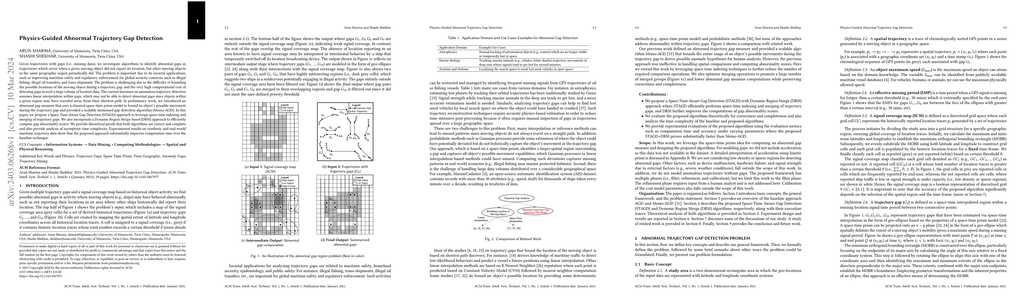
Given trajectories with gaps (i.e., missing data), we investigate algorithms to identify abnormal gaps in trajectories which occur when a given moving object did not report its location, but other m...
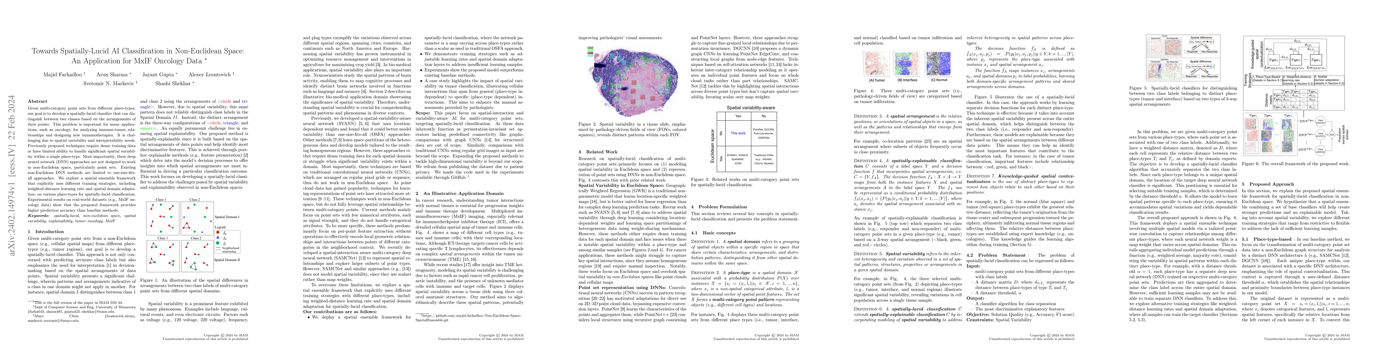
Given multi-category point sets from different place-types, our goal is to develop a spatially-lucid classifier that can distinguish between two classes based on the arrangements of their points. Th...
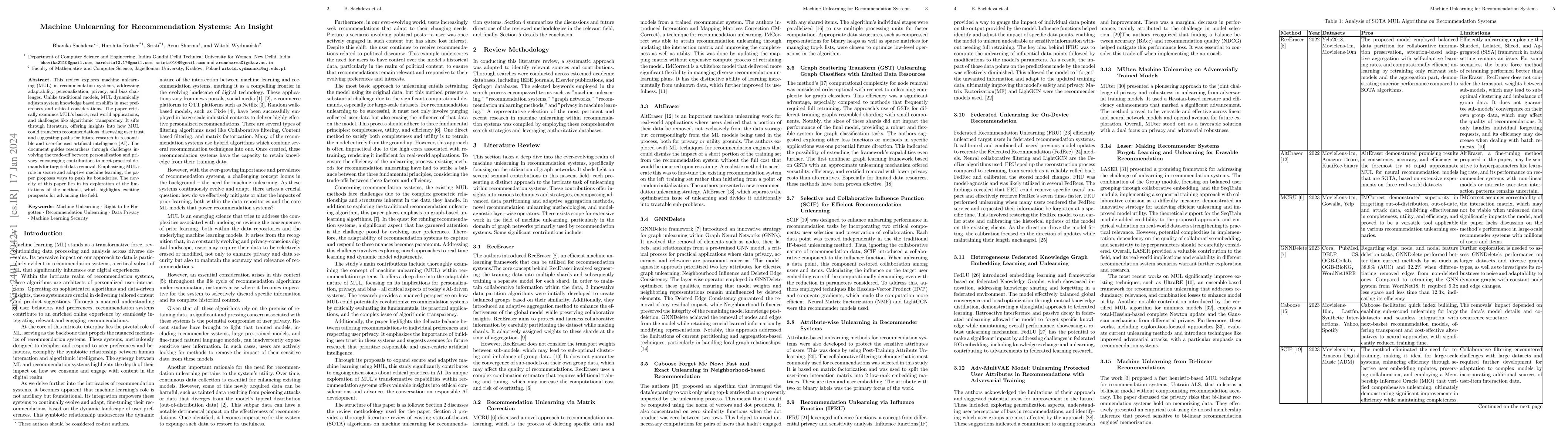
This review explores machine unlearning (MUL) in recommendation systems, addressing adaptability, personalization, privacy, and bias challenges. Unlike traditional models, MUL dynamically adjusts sy...
Given multi-model ensemble climate projections, the goal is to accurately and reliably predict future sea-level rise while lowering the uncertainty. This problem is important because sea-level rise ...
We consider the problem of reducing the time needed by healthcare professionals to understand patient medical history via the next generation of biomedical decision support. This problem is societal...
Given trajectories with gaps, we investigate methods to tighten spatial bounds on areas (e.g., nodes in a spatial network) where possible rendezvous activity could have occurred. The problem is impo...
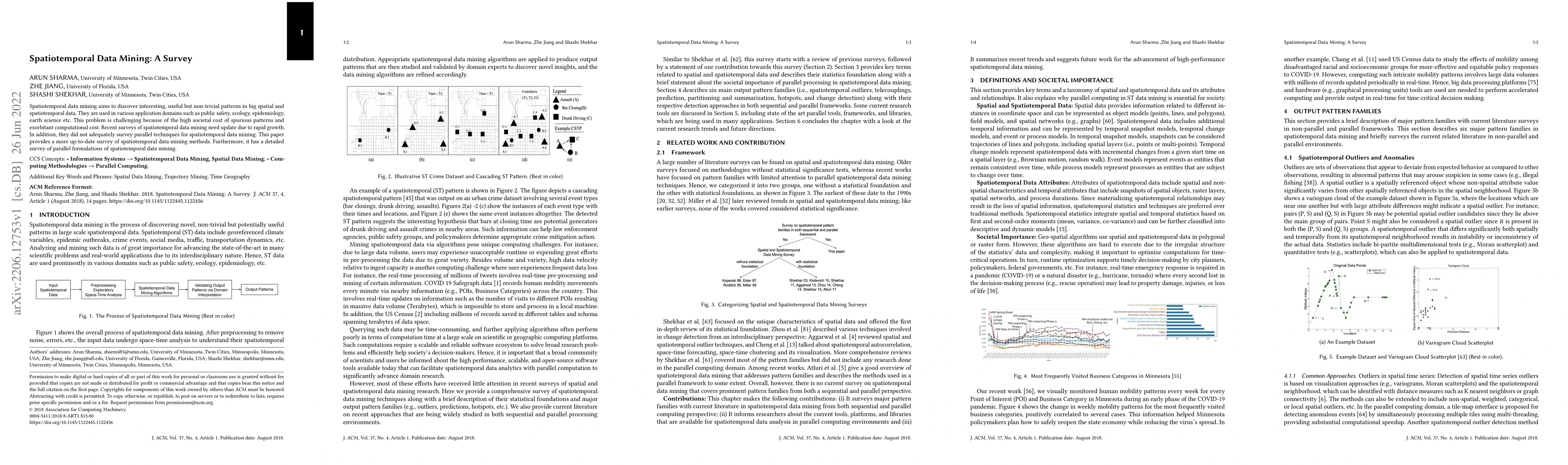
Spatiotemporal data mining aims to discover interesting, useful but non-trivial patterns in big spatial and spatiotemporal data. They are used in various application domains such as public safety, e...
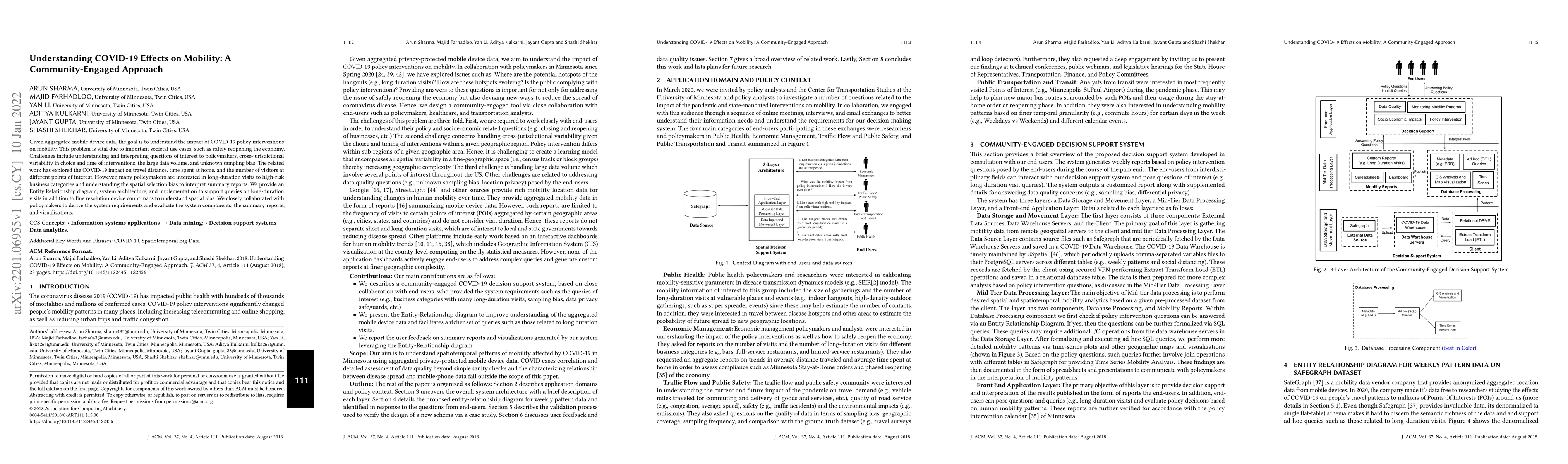
Given aggregated mobile device data, the goal is to understand the impact of COVID-19 policy interventions on mobility. This problem is vital due to important societal use cases, such as safely reop...
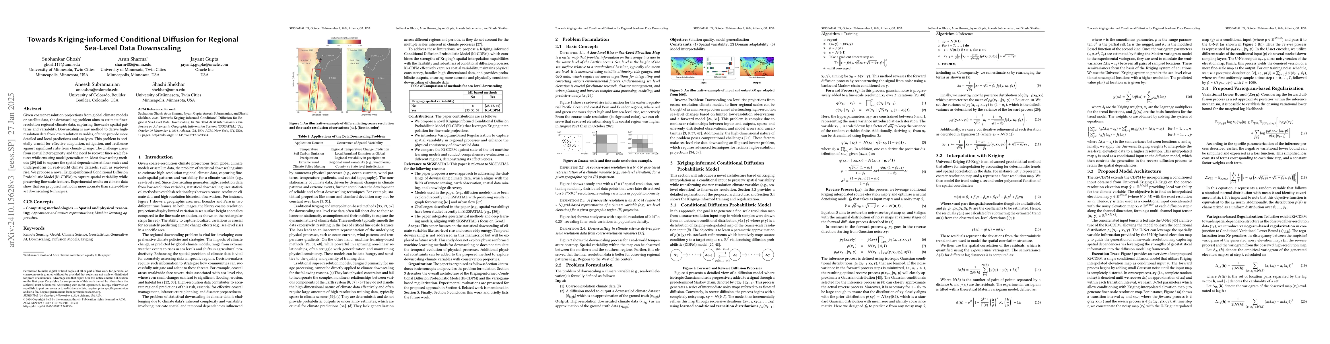
Given coarser-resolution projections from global climate models or satellite data, the downscaling problem aims to estimate finer-resolution regional climate data, capturing fine-scale spatial pattern...
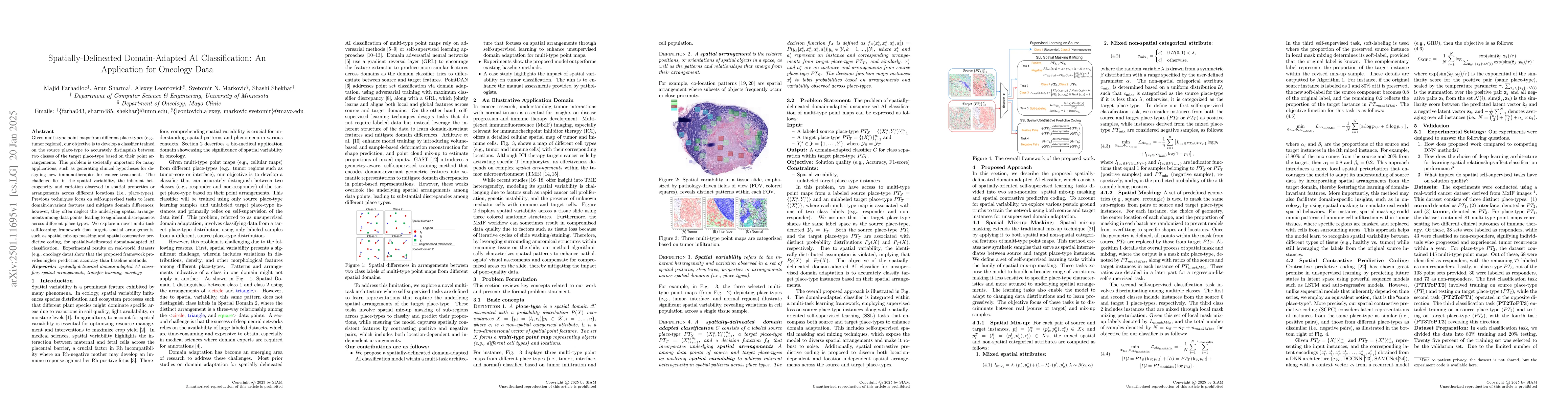
Given multi-type point maps from different place-types (e.g., tumor regions), our objective is to develop a classifier trained on the source place-type to accurately distinguish between two classes of...
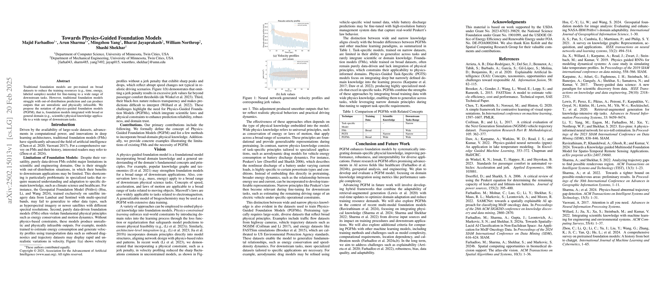
Traditional foundation models are pre-trained on broad datasets to reduce the training resources (e.g., time, energy, labeled samples) needed for fine-tuning a wide range of downstream tasks. However,...
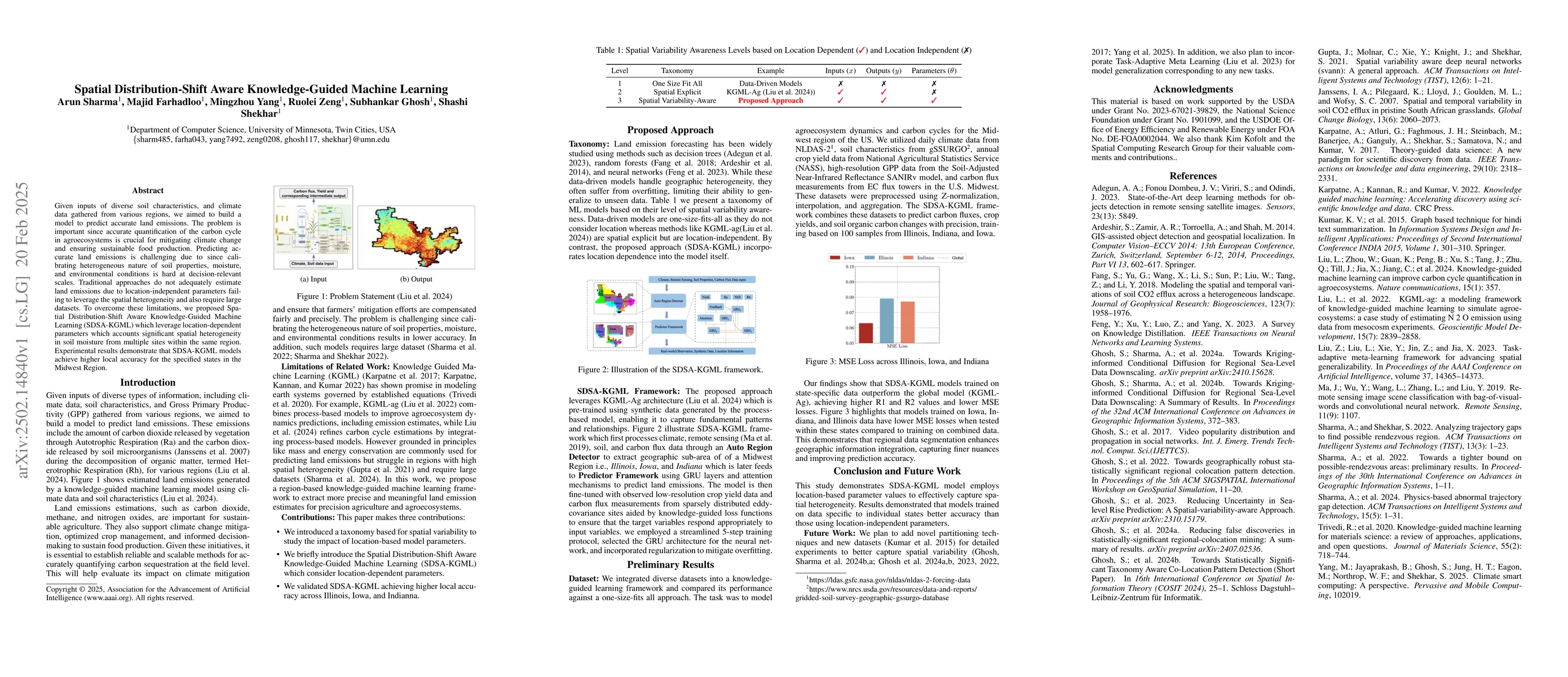
Given inputs of diverse soil characteristics and climate data gathered from various regions, we aimed to build a model to predict accurate land emissions. The problem is important since accurate quant...
Given trajectory data, a domain-specific study area, and a user-defined threshold, we aim to find anomalous trajectories indicative of possible GPS spoofing (e.g., fake trajectory). The problem is soc...
Big Language Models (LLMs) are changing the way businesses use software, the way people live their lives and the way industries work. Companies like Google, High-Flyer, Anthropic, OpenAI and Meta are ...
Accurate and cost-effective quantification of the agroecosystem carbon cycle at decision-relevant scales is essential for climate mitigation and sustainable agriculture. However, both transfer learnin...
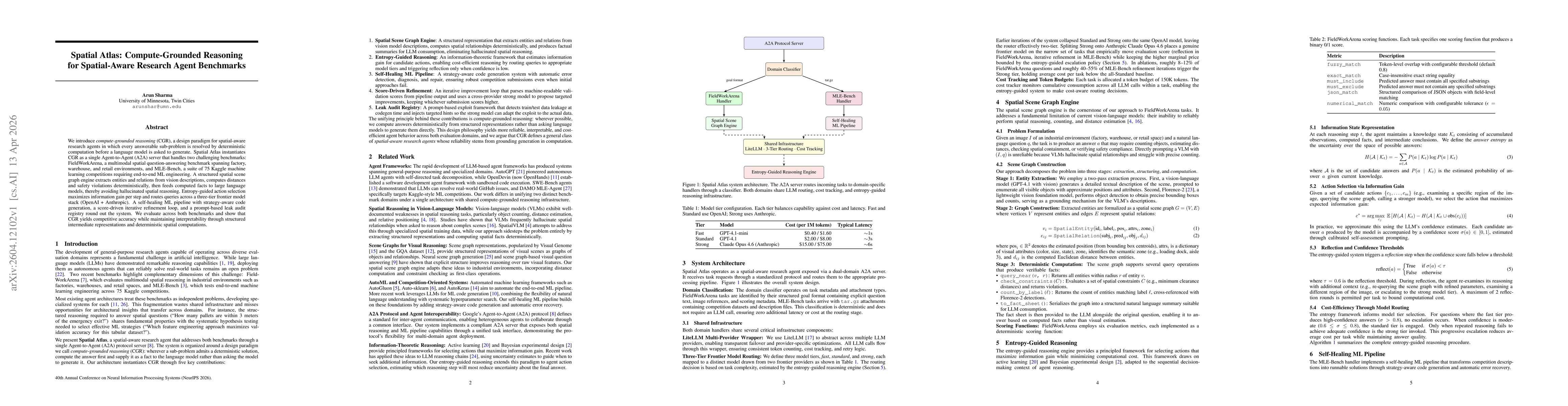
We introduce compute-grounded reasoning (CGR), a design paradigm for spatial-aware research agents in which every answerable sub-problem is resolved by deterministic computation before a language mode...

Open-vocabulary 3D scene segmentation usually assumes RGB-D video, calibrated multi-view imagery, or a reconstructed mesh. GeoSAM-3D studies a lighter setting: a user uploads a short monocular video, ...
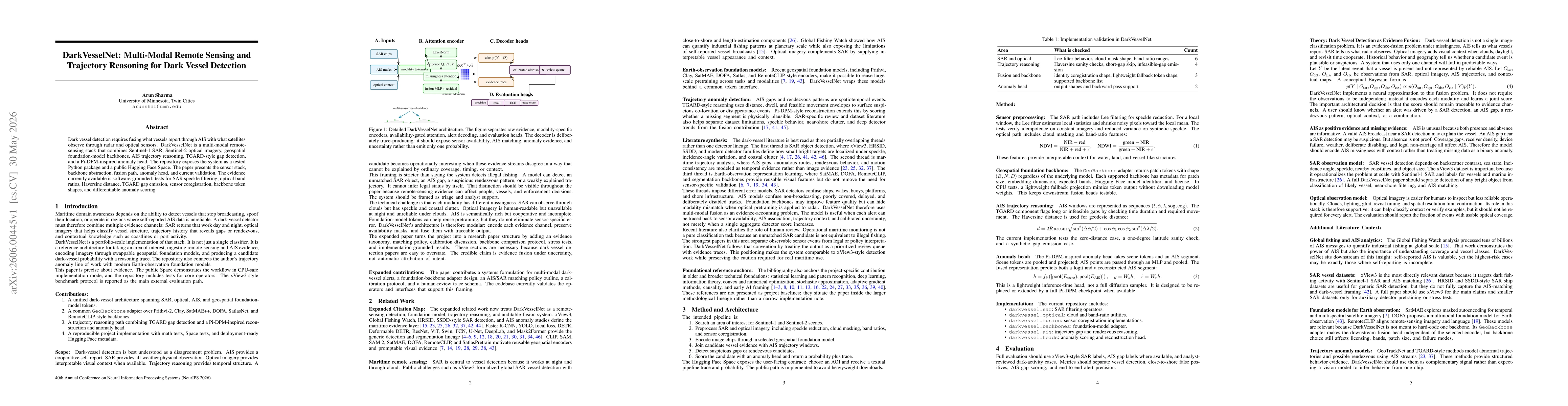
Dark vessel detection requires fusing what vessels report through AIS with what satellites observe through radar and optical sensors. DarkVesselNet is a multi-modal remote sensing stack that combines ...