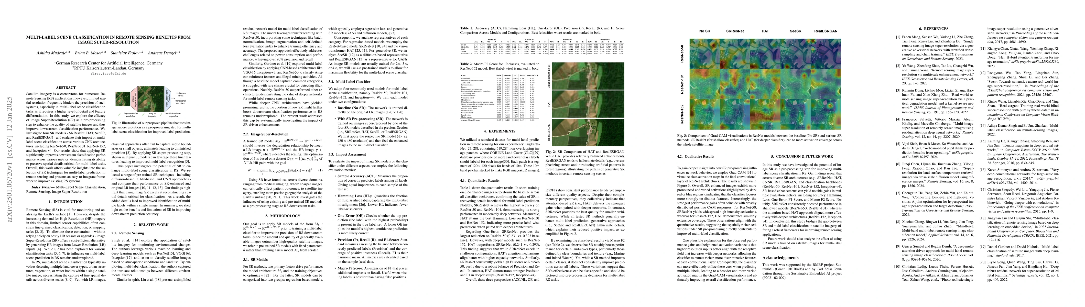
1
arXiv Papers
1
Total Publications
Profile
Academic Profile
Metrics
Statistics
1
arXiv Papers
1
Total Publications
Network
Similar Authors
Publications
Papers on arXiv
arXiv
Multi-Label Scene Classification in Remote Sensing Benefits from Image
Super-Resolution
Satellite imagery is a cornerstone for numerous Remote Sensing (RS) applications; however, limited spatial resolution frequently hinders the precision of such systems, especially in multi-label scene ...