Academic Profile
Statistics
Similar Authors
Papers on arXiv
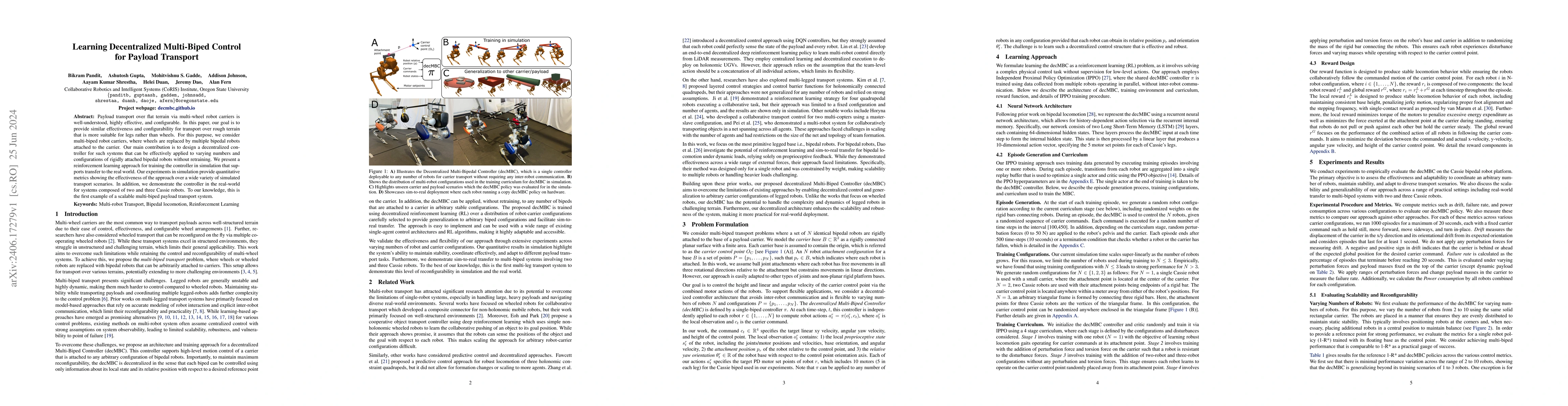
Payload transport over flat terrain via multi-wheel robot carriers is well-understood, highly effective, and configurable. In this paper, our goal is to provide similar effectiveness and configurabili...
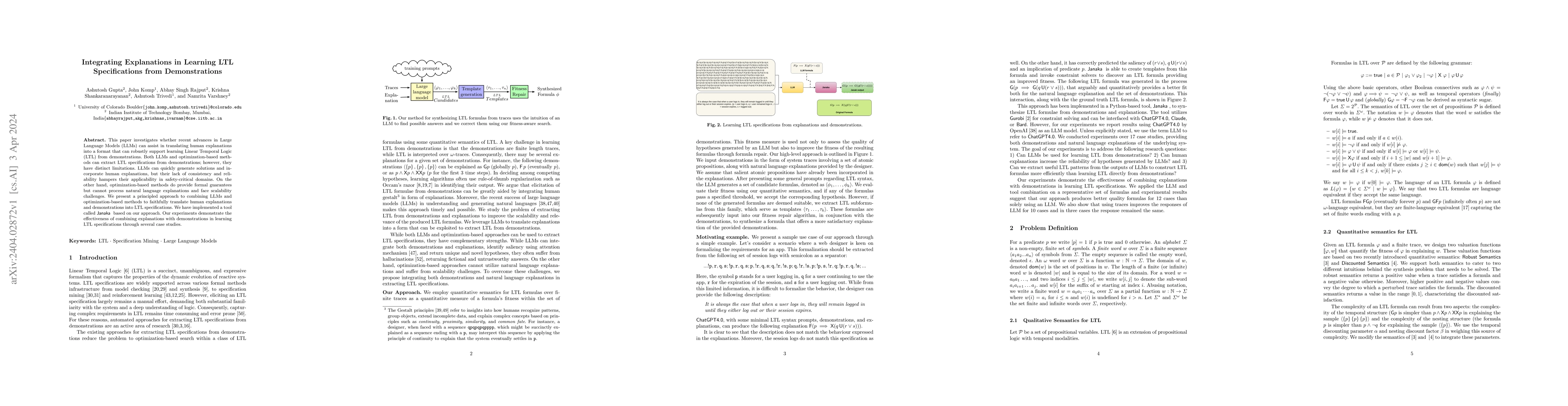
This paper investigates whether recent advances in Large Language Models (LLMs) can assist in translating human explanations into a format that can robustly support learning Linear Temporal Logic (L...
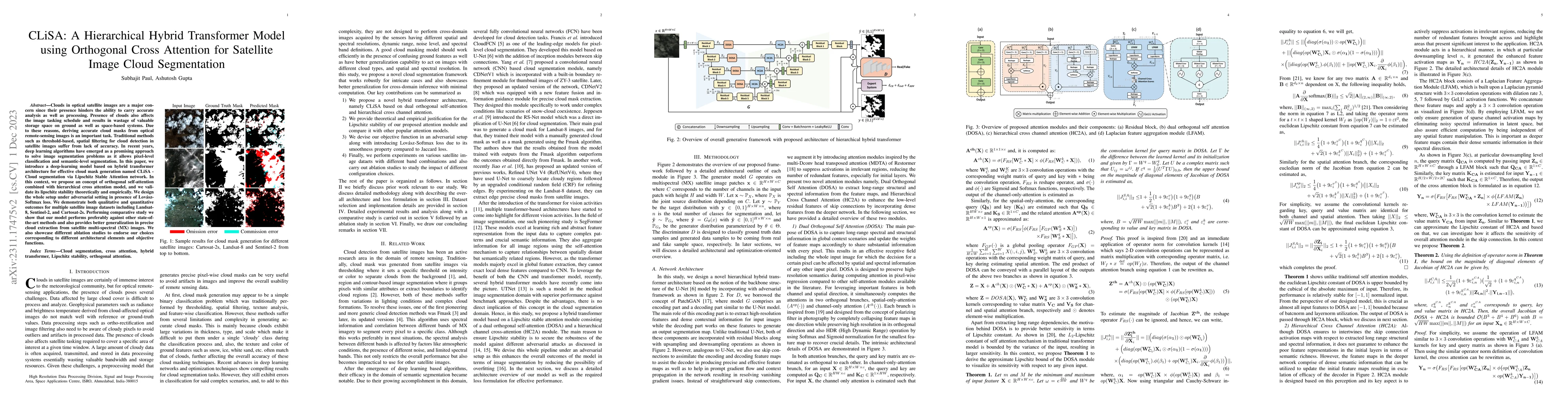
Clouds in optical satellite images are a major concern since their presence hinders the ability to carry accurate analysis as well as processing. Presence of clouds also affects the image tasking sc...
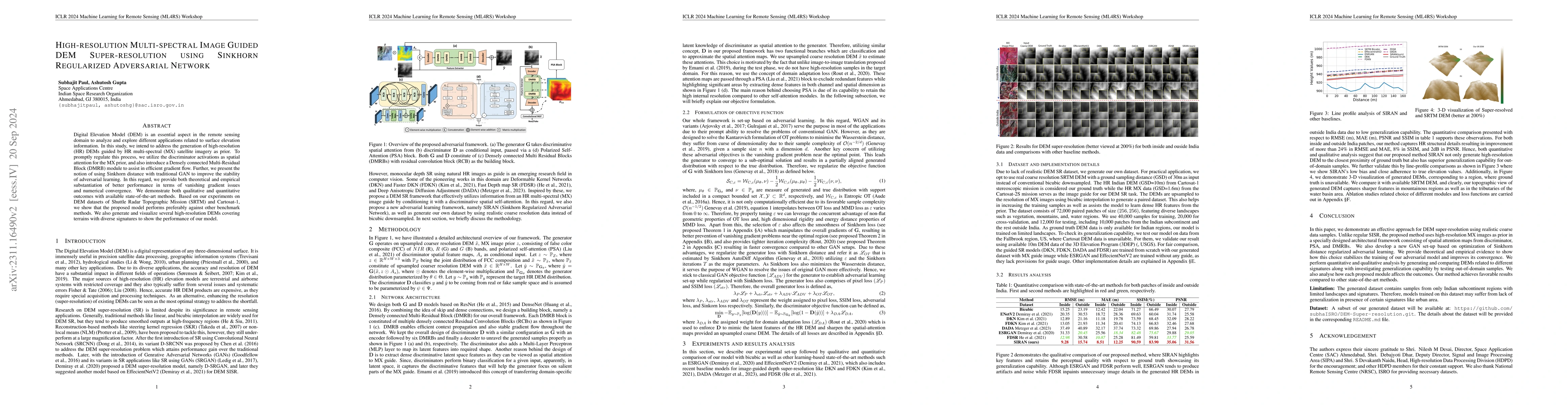
Digital Elevation Model (DEM) is an essential aspect in the remote sensing domain to analyze and explore different applications related to surface elevation information. In this study, we intend to ...
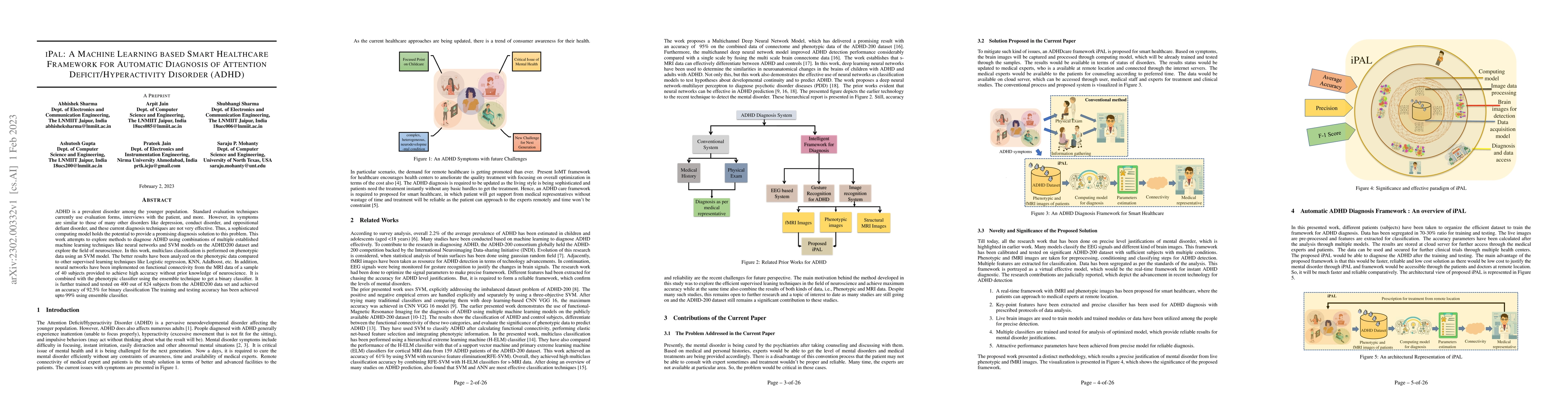
ADHD is a prevalent disorder among the younger population. Standard evaluation techniques currently use evaluation forms, interviews with the patient, and more. However, its symptoms are similar to ...
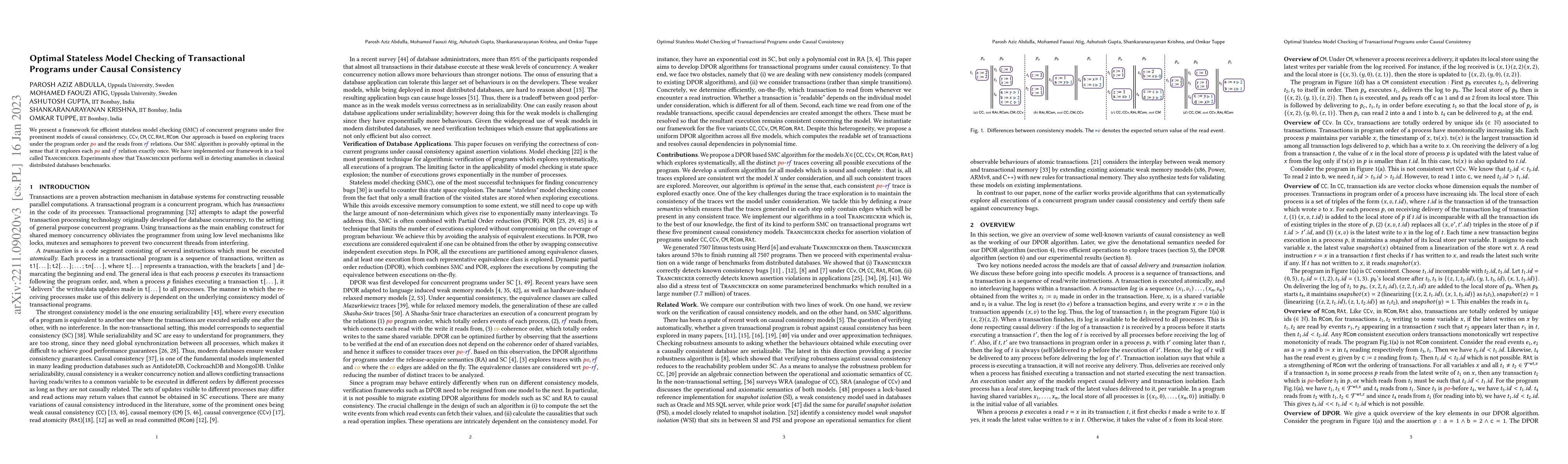
We present a framework for efficient stateless model checking (SMC) of concurrent programs under five prominent models of causal consistency, CCv,CM,CC, Read Committed and Read Atomic. Our approach ...
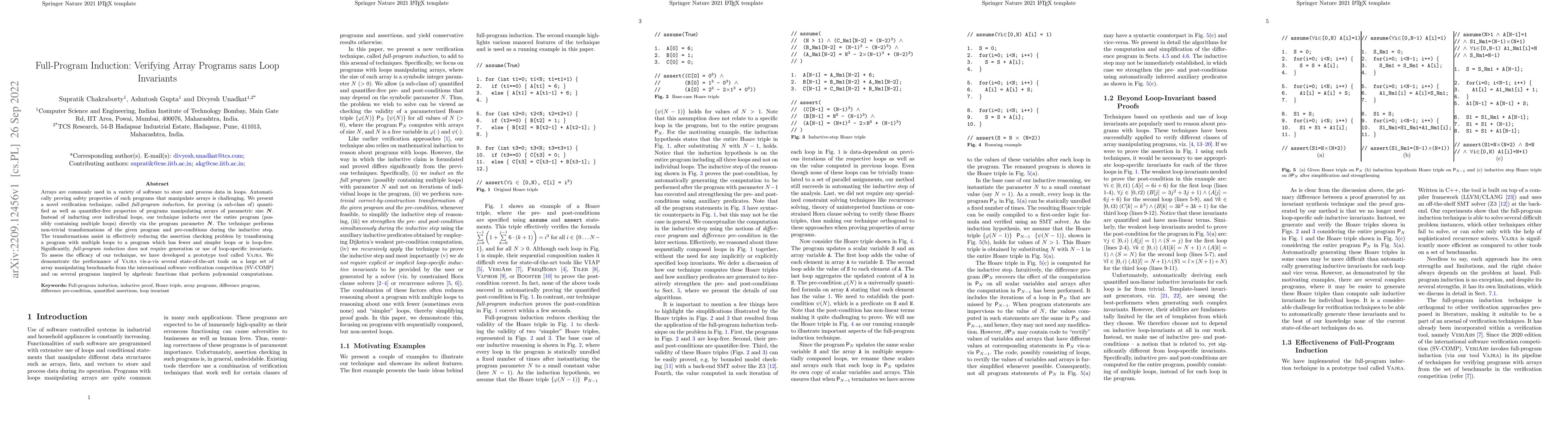
Arrays are commonly used in a variety of software to store and process data in loops. Automatically proving safety properties of such programs that manipulate arrays is challenging. We present a nov...
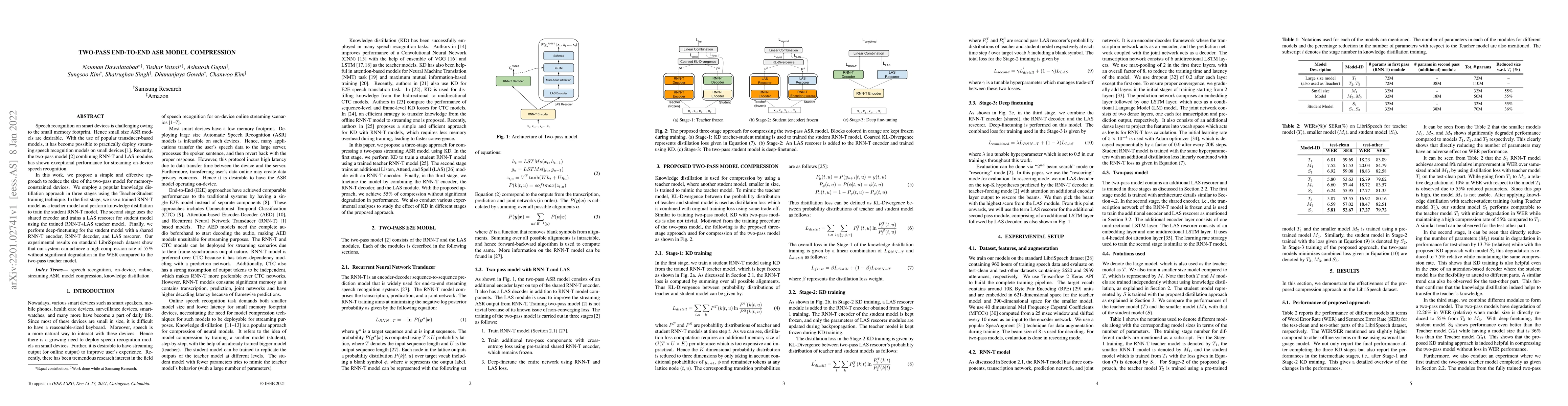
Speech recognition on smart devices is challenging owing to the small memory footprint. Hence small size ASR models are desirable. With the use of popular transducer-based models, it has become poss...
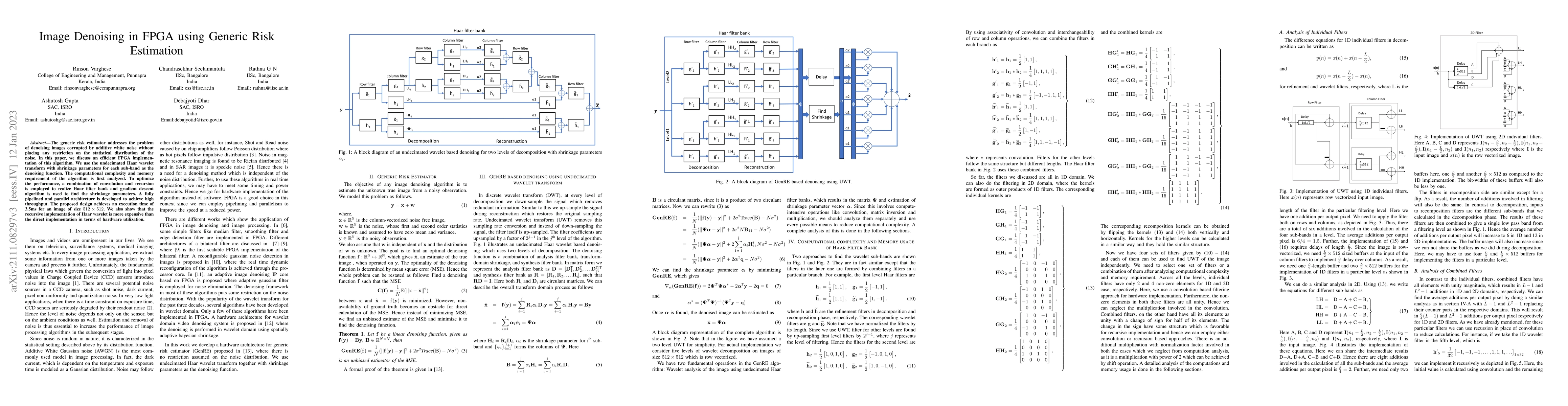
The generic risk estimator addresses the problem of denoising images corrupted by additive white noise without placing any restriction on the statistical distribution of the noise. In this paper, we...
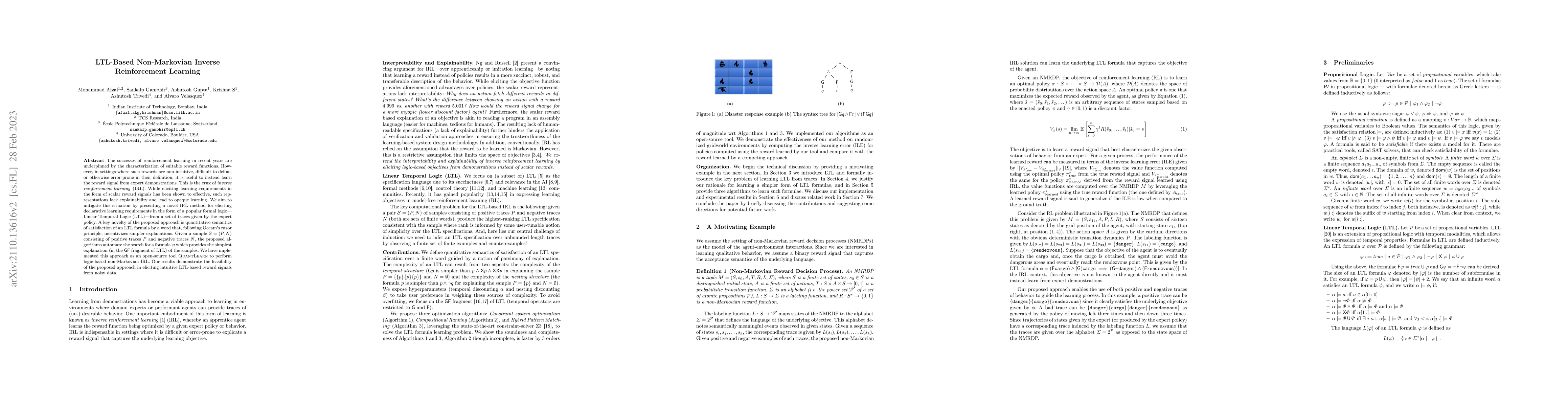
The successes of reinforcement learning in recent years are underpinned by the characterization of suitable reward functions. However, in settings where such rewards are non-intuitive, difficult to ...
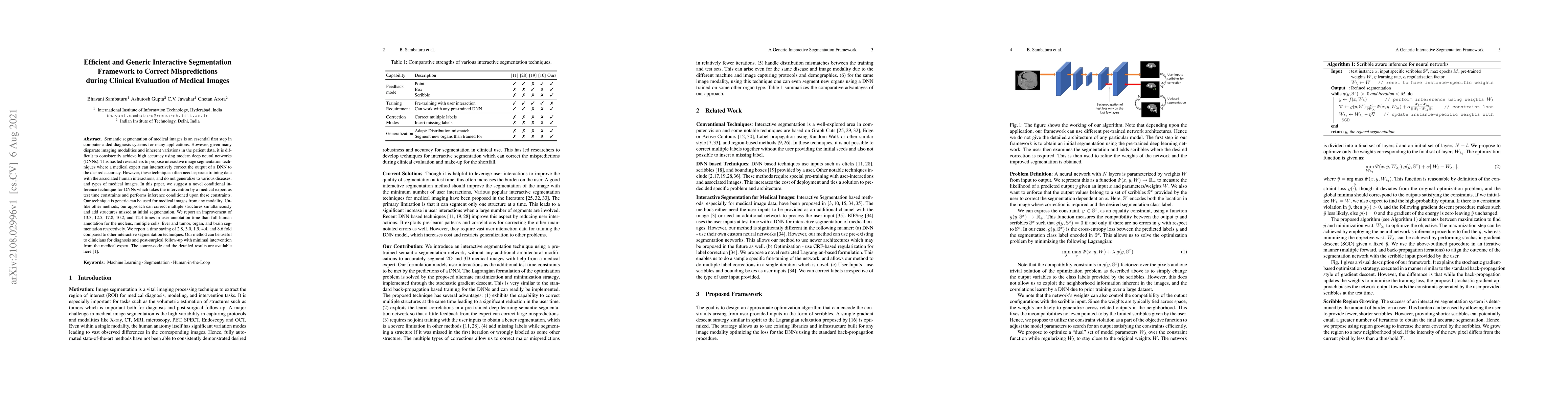
Semantic segmentation of medical images is an essential first step in computer-aided diagnosis systems for many applications. However, given many disparate imaging modalities and inherent variations...
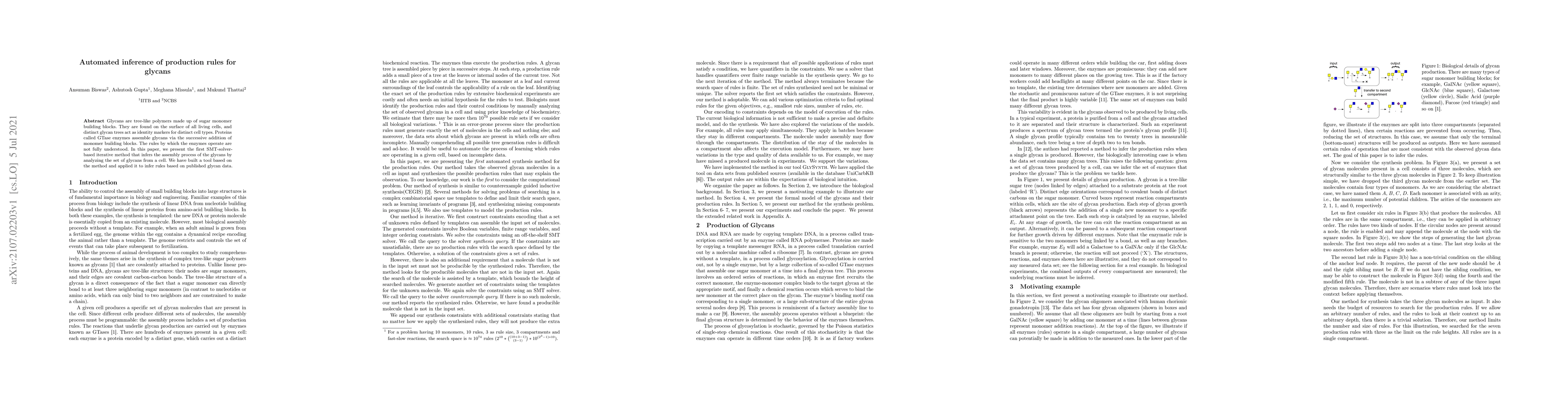
Glycans are tree-like polymers made up of sugar monomer building blocks. They are found on the surface of all living cells, and distinct glycan trees act as identity markers for distinct cell types....
We present a novel verification technique to prove interesting properties of a class of array programs with a symbolic parameter N denoting the size of arrays. The technique relies on constructing t...
We present a full-program induction technique for proving (a sub-class of) quantified as well as quantifier-free properties of programs manipulating arrays of parametric size N. Instead of inducting...
Recent progress in image deblurring techniques focuses mainly on operating in both frequency and spatial domains using the Fourier transform (FT) properties. However, their performance is limited due ...
Digital Elevation Model (DEM) is an essential aspect in the remote sensing (RS) domain to analyze various applications related to surface elevations. Here, we address the generation of high-resolution...
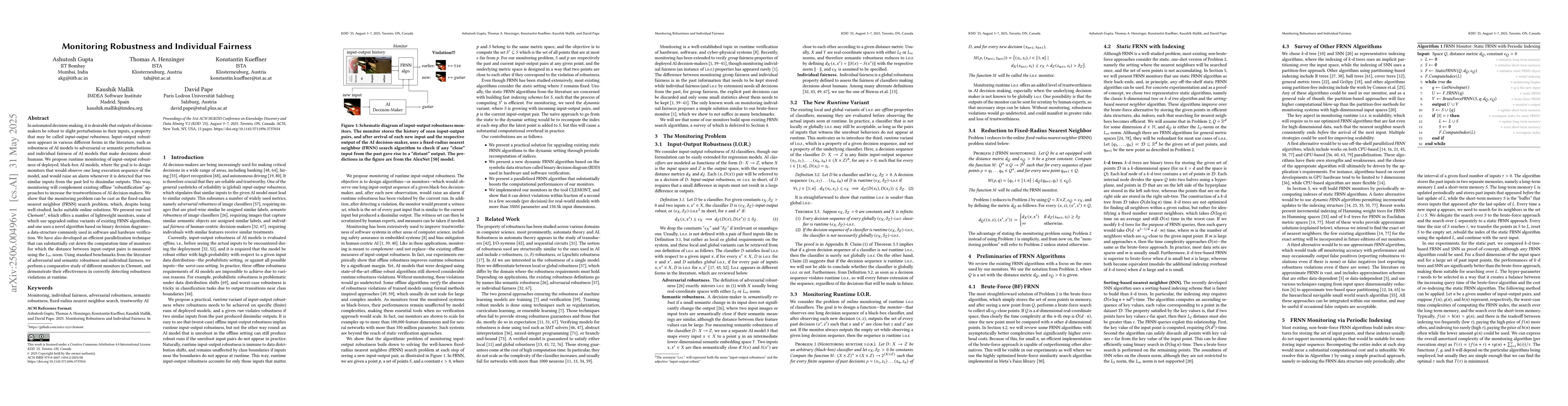
Input-output robustness appears in various different forms in the literature, such as robustness of AI models to adversarial or semantic perturbations and individual fairness of AI models that make de...
Many critical decision-making tasks are now delegated to machine-learned models, and it is imperative that their decisions are trustworthy and reliable, and their outputs are consistent across similar...
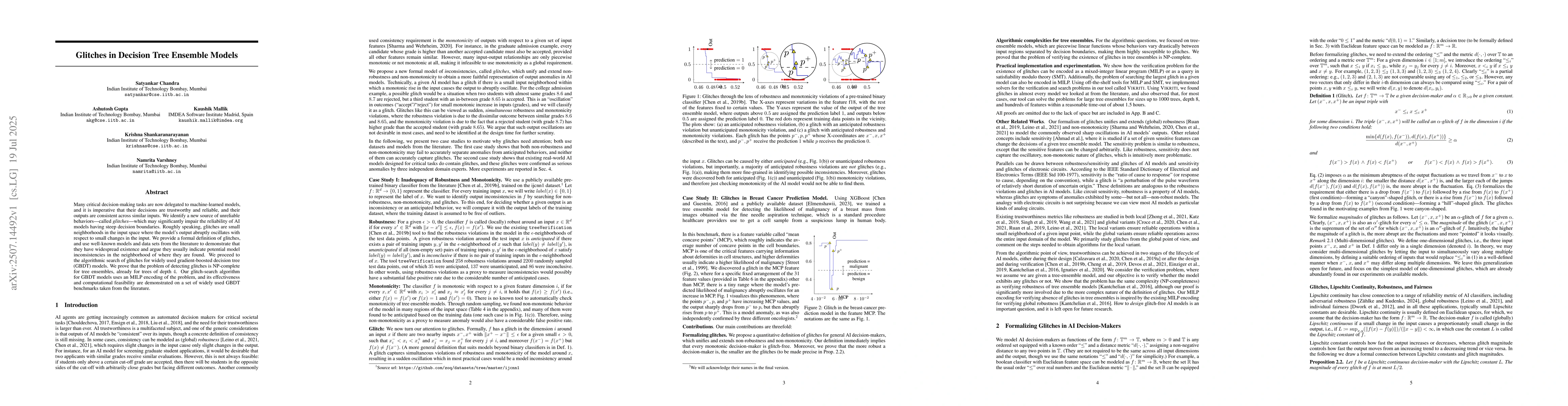
Robustness is a important problem in AI alignment and safety, with models such as neural networks being increasingly used in safety-critical systems. In the last decade, a large body of work has emerg...
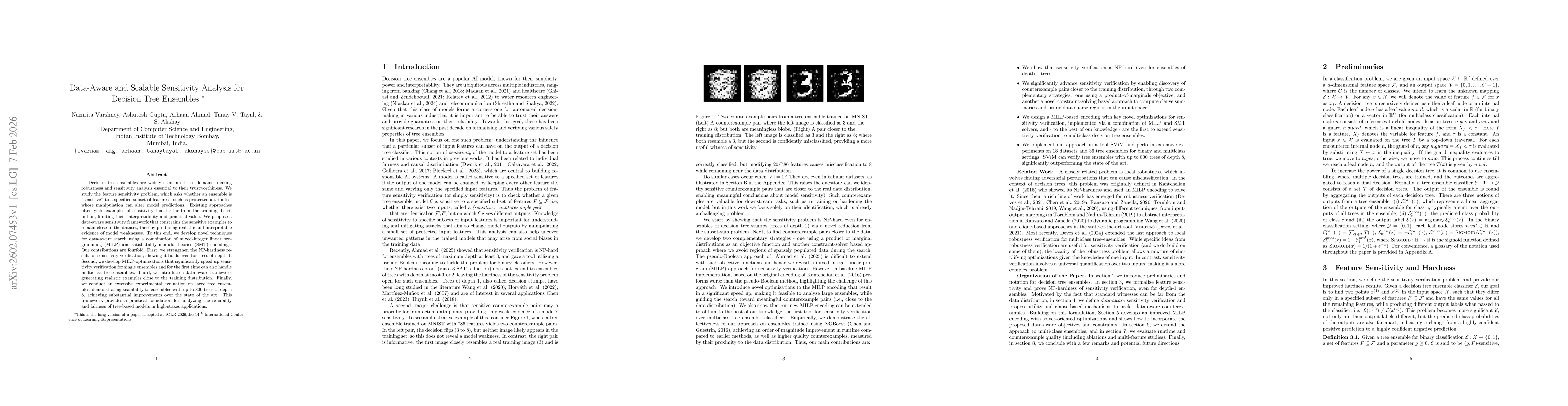
Decision tree ensembles are widely used in critical domains, making robustness and sensitivity analysis essential to their trustworthiness. We study the feature sensitivity problem, which asks whether...
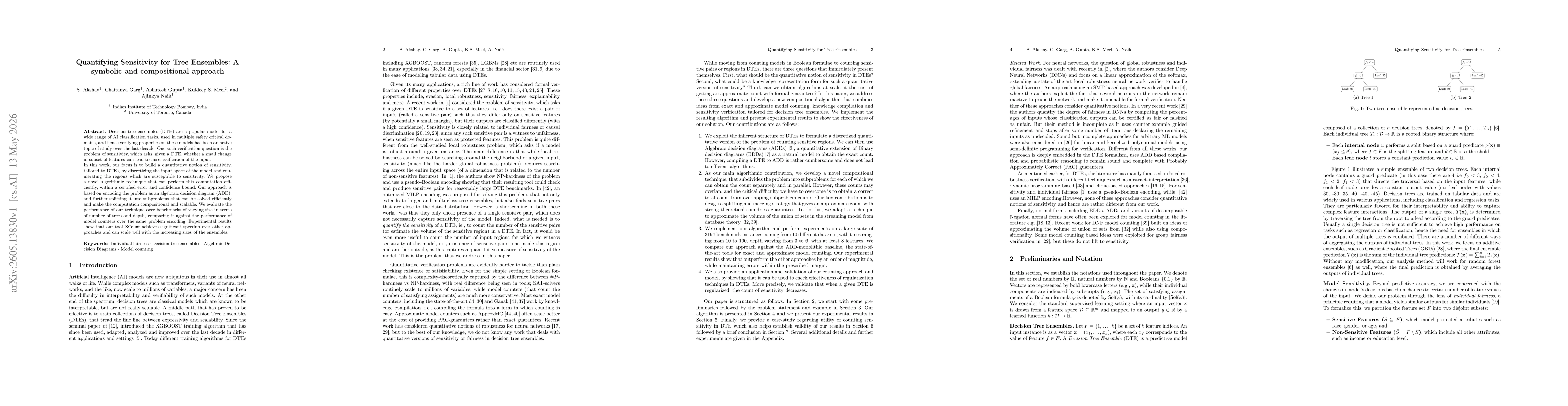
Decision tree ensembles (DTE) are a popular model for a wide range of AI classification tasks, used in multiple safety critical domains, and hence verifying properties on these models has been an acti...