Academic Profile
Statistics
Similar Authors
Papers on arXiv
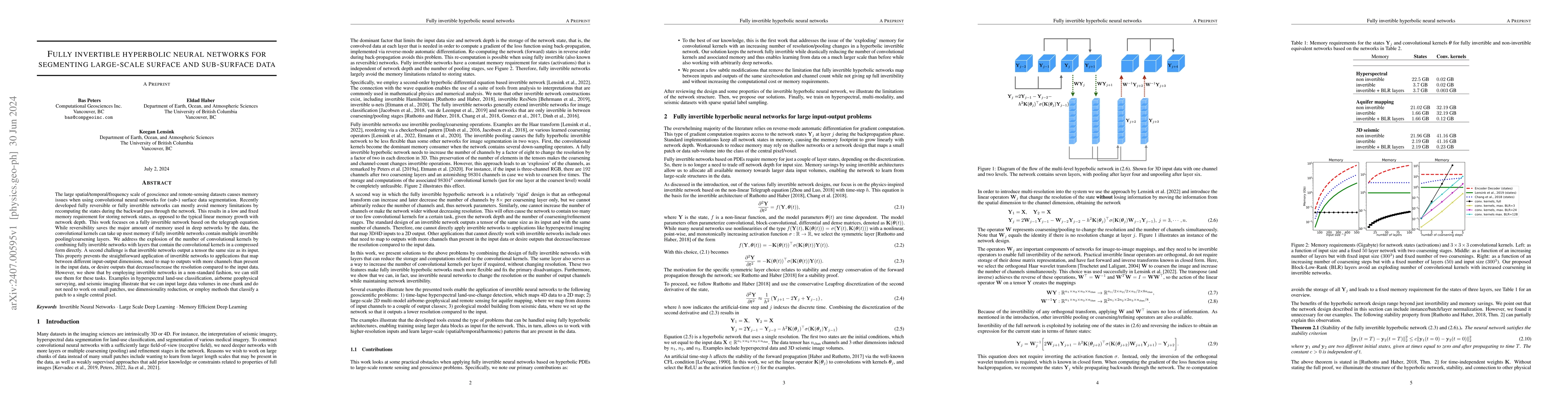
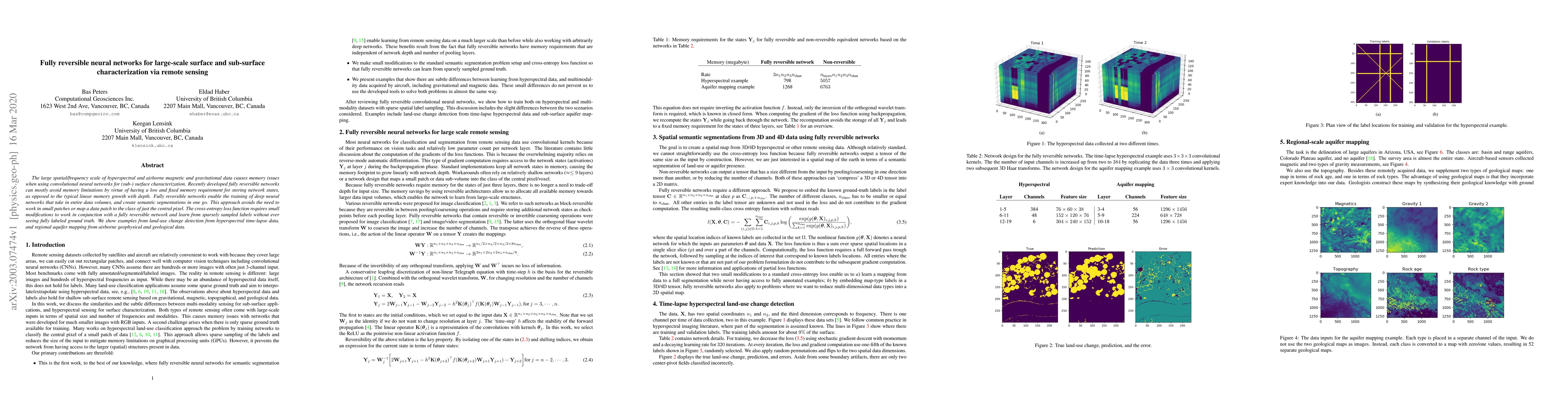
The large spatial/temporal/frequency scale of geoscience and remote-sensing datasets causes memory issues when using convolutional neural networks for (sub-) surface data segmentation. Recently develo...
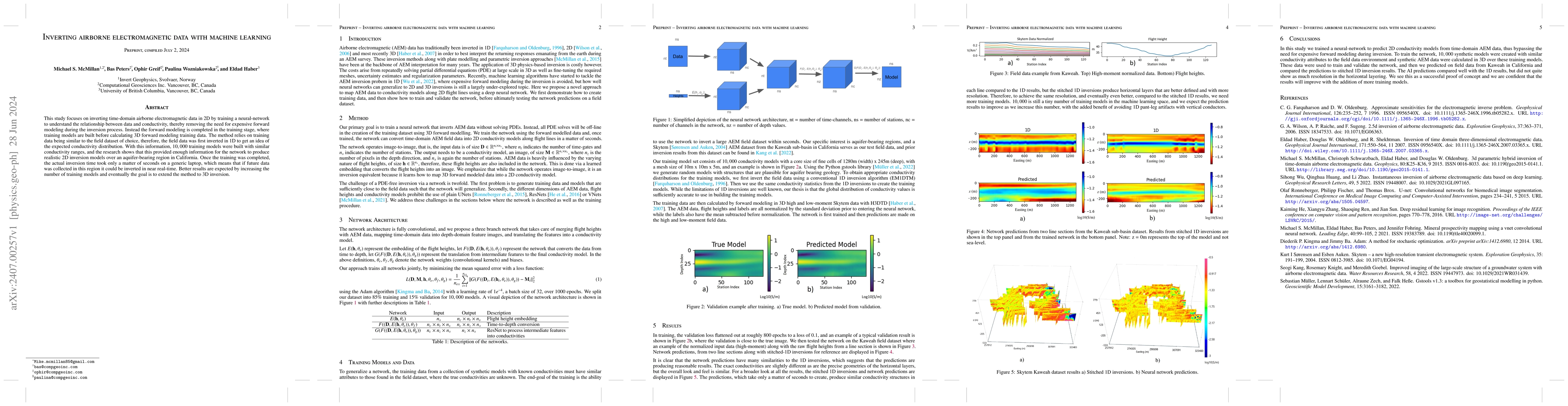
This study focuses on inverting time-domain airborne electromagnetic data in 2D by training a neural-network to understand the relationship between data and conductivity, thereby removing the need f...
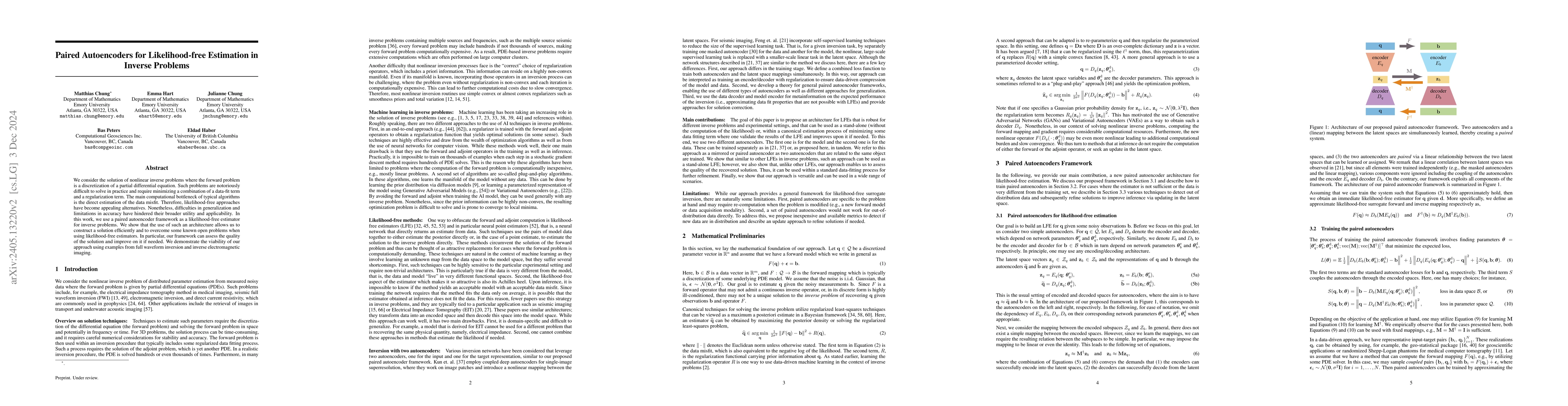
We consider the solution of nonlinear inverse problems where the forward problem is a discretization of a partial differential equation. Such problems are notoriously difficult to solve in practice ...
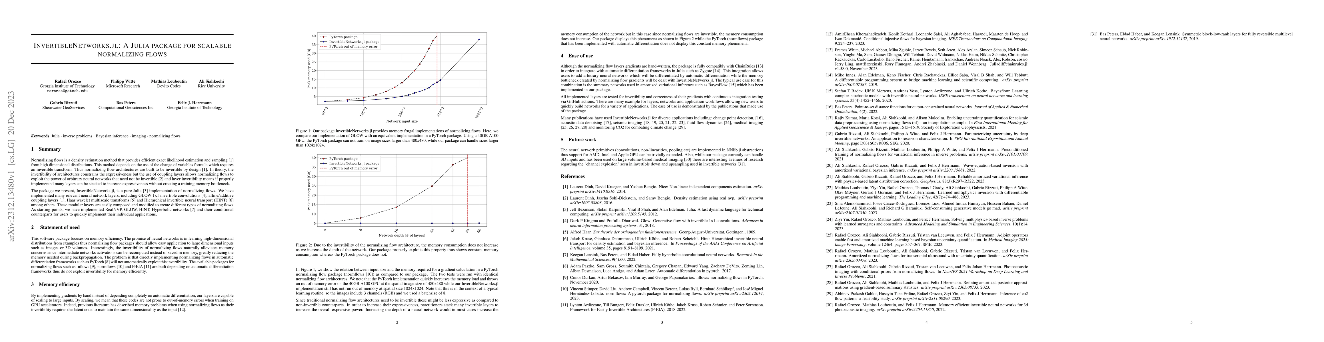
InvertibleNetworks.jl is a Julia package designed for the scalable implementation of normalizing flows, a method for density estimation and sampling in high-dimensional distributions. This package e...
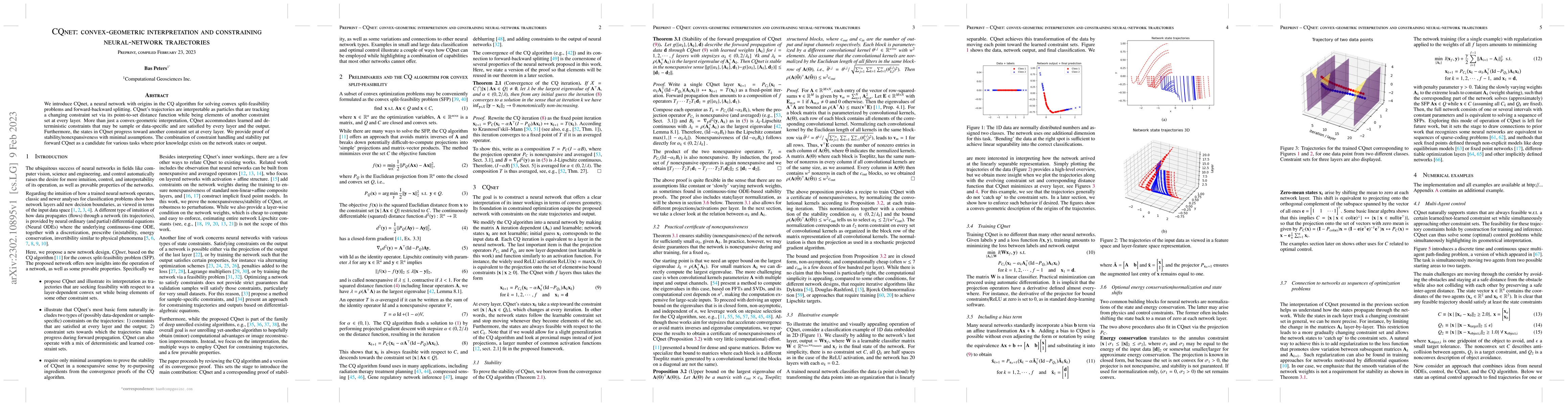
We introduce CQnet, a neural network with origins in the CQ algorithm for solving convex split-feasibility problems and forward-backward splitting. CQnet's trajectories are interpretable as particle...
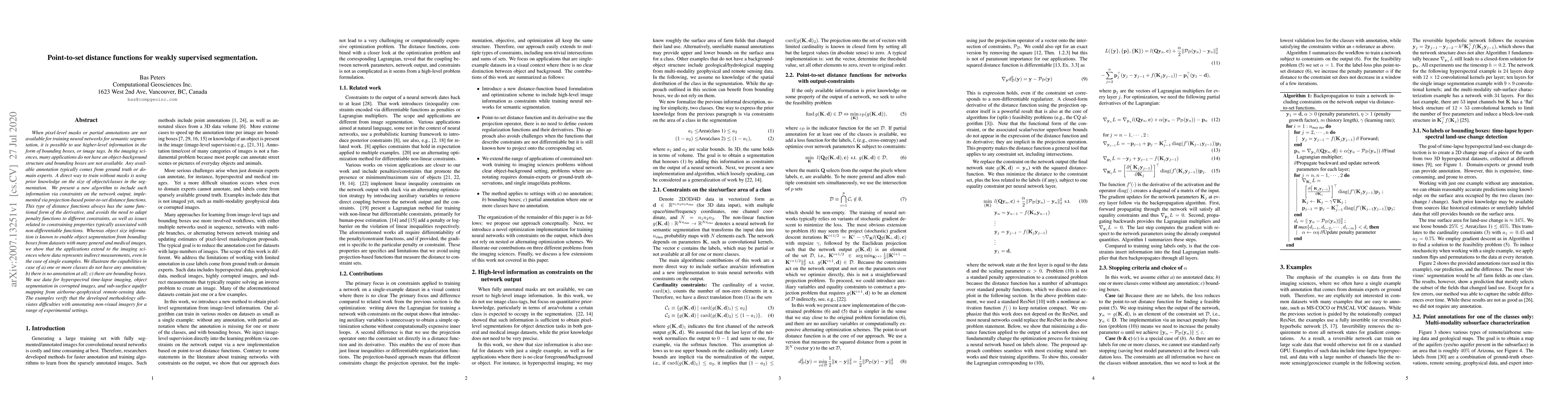
When pixel-level masks or partial annotations are not available for training neural networks for semantic segmentation, it is possible to use higher-level information in the form of bounding boxes, ...
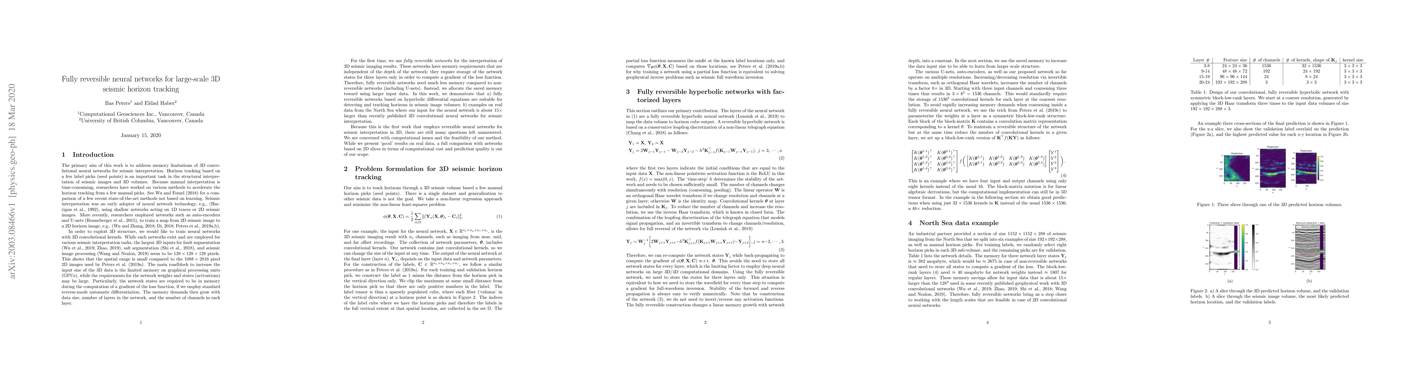
Tracking a horizon in seismic images or 3D volumes is an integral part of seismic interpretation. The last few decades saw progress in using neural networks for this task, starting from shallow netw...
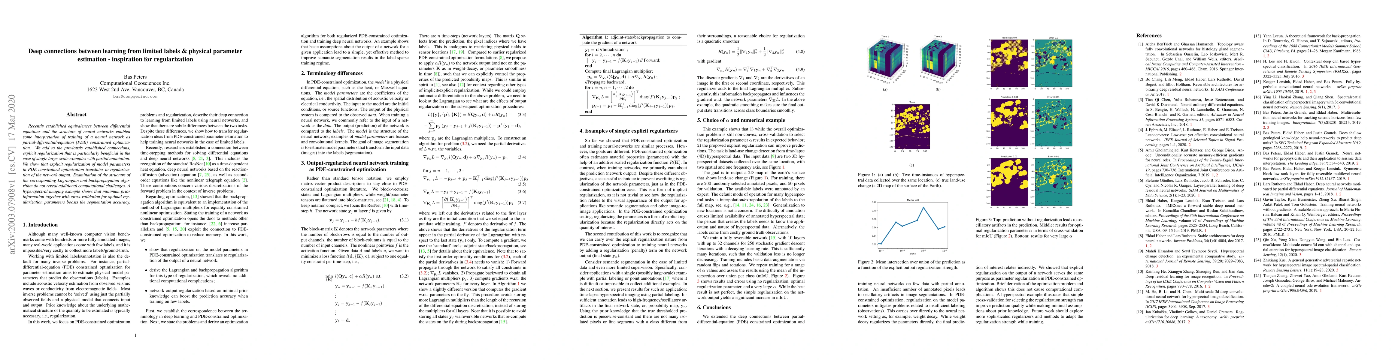
Recently established equivalences between differential equations and the structure of neural networks enabled some interpretation of training of a neural network as partial-differential-equation (PD...
The large spatial/frequency scale of hyperspectral and airborne magnetic and gravitational data causes memory issues when using convolutional neural networks for (sub-) surface characterization. Rec...
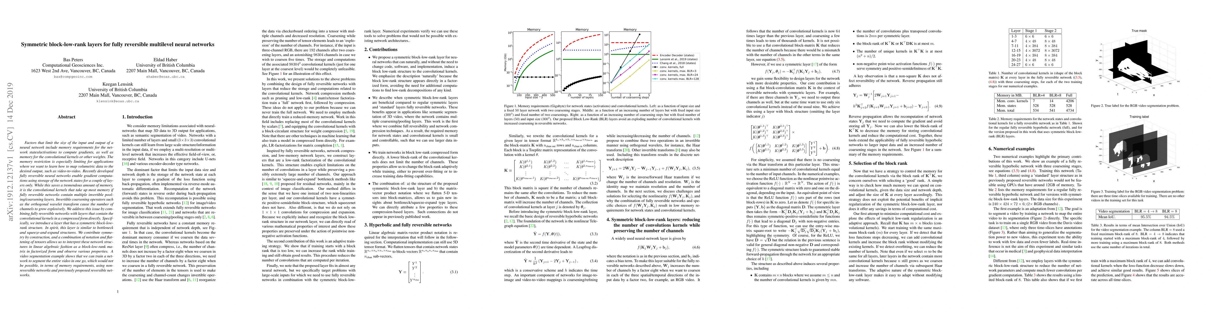
Factors that limit the size of the input and output of a neural network include memory requirements for the network states/activations to compute gradients, as well as memory for the convolutional k...
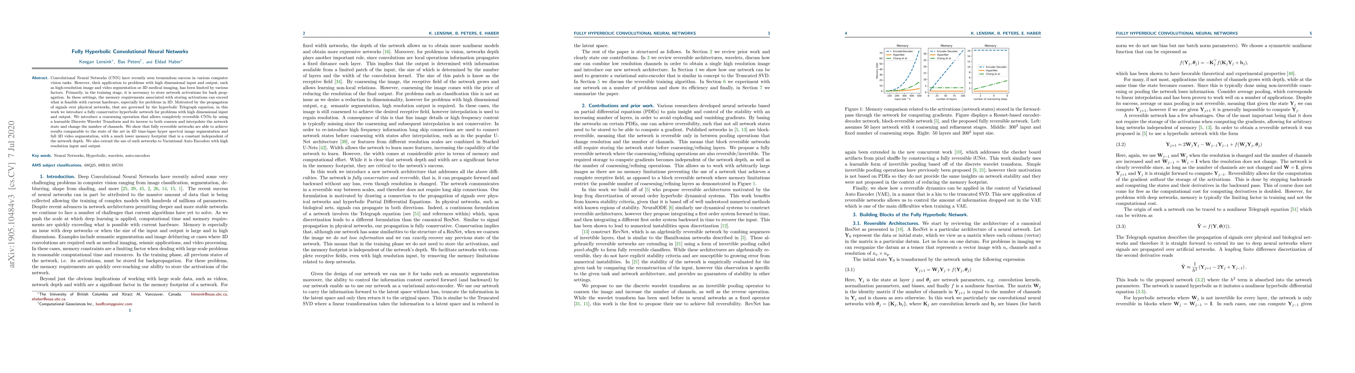
Convolutional Neural Networks (CNN) have recently seen tremendous success in various computer vision tasks. However, their application to problems with high dimensional input and output, such as hig...
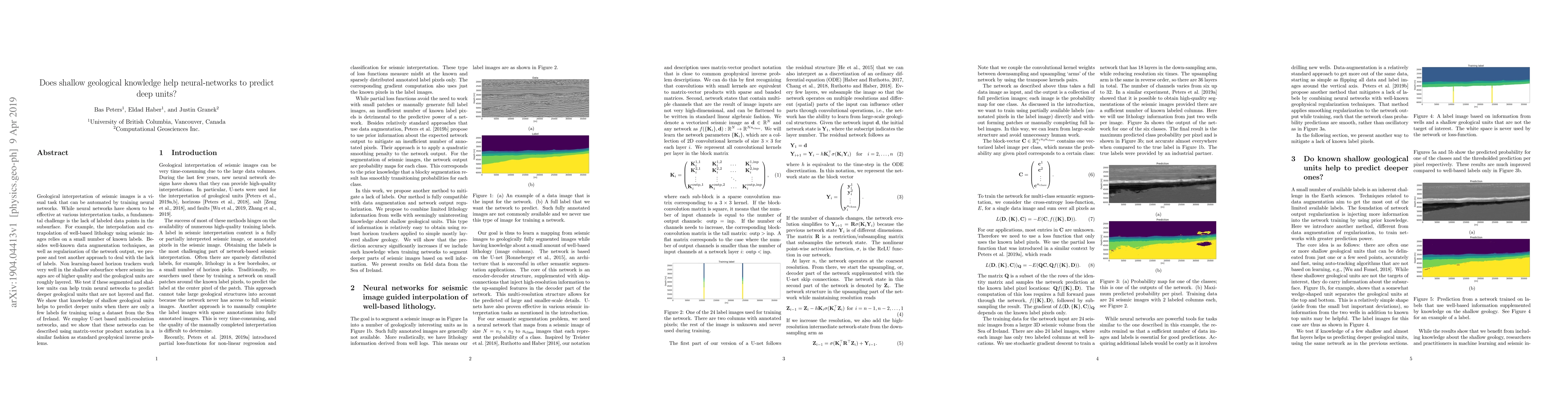
Geological interpretation of seismic images is a visual task that can be automated by training neural networks. While neural networks have shown to be effective at various interpretation tasks, a fu...
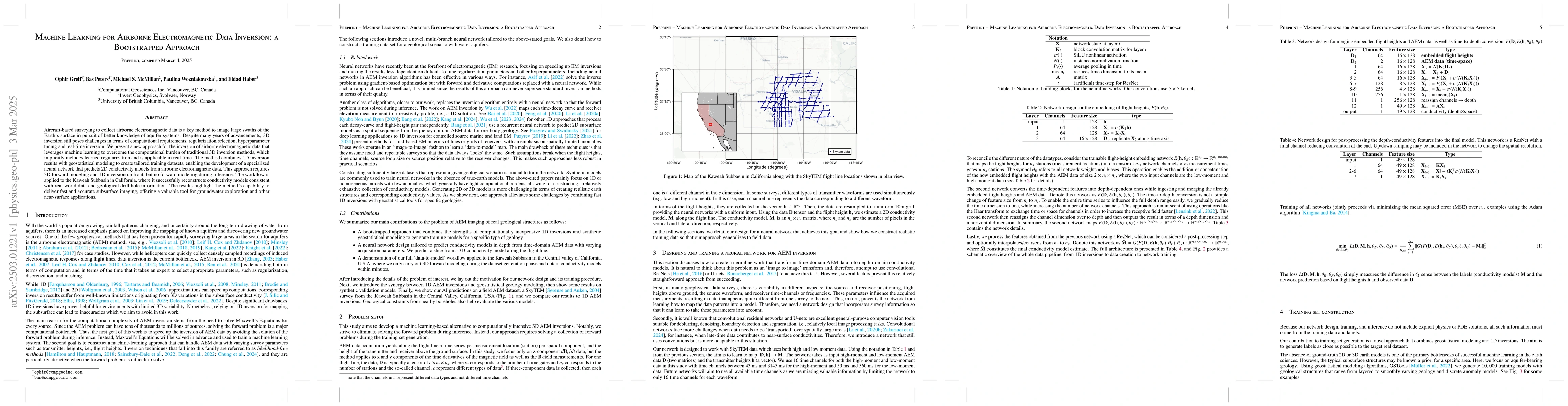
Aircraft-based surveying to collect airborne electromagnetic data is a key method to image large swaths of the Earth's surface in pursuit of better knowledge of aquifer systems. Despite many years of ...
In this book chapter, we discuss recent advances in data-driven approaches for inverse problems. In particular, we focus on the \emph{paired autoencoder} framework, which has proven to be a powerful t...
This work describes a novel data-driven latent space inference framework built on paired autoencoders to handle observational inconsistencies when solving inverse problems. Our approach uses two autoe...