Academic Profile
Statistics
Similar Authors
Papers on arXiv
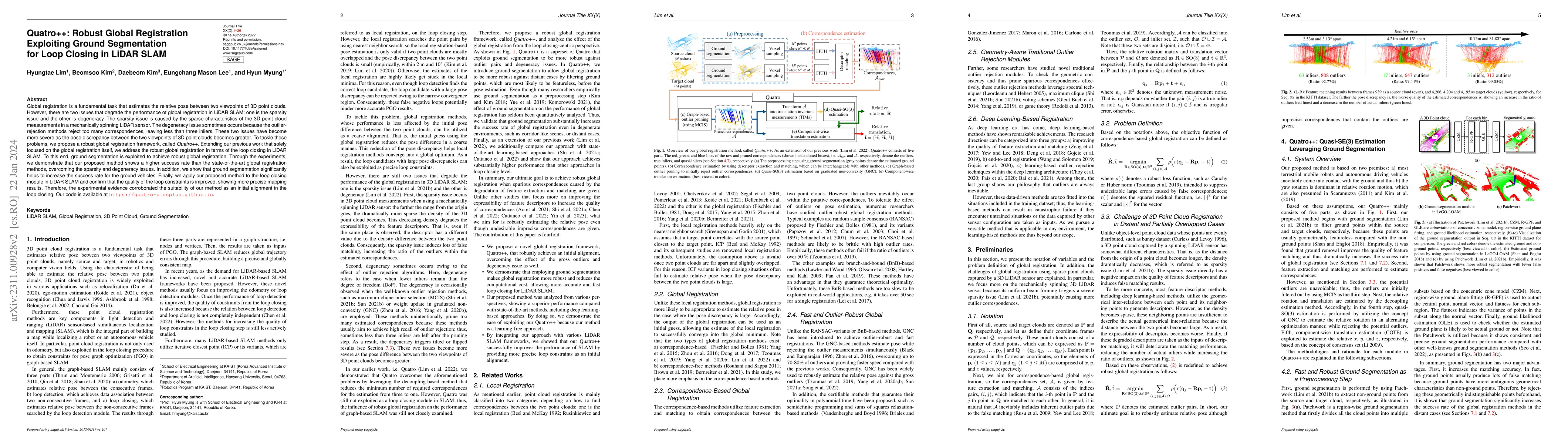
Global registration is a fundamental task that estimates the relative pose between two viewpoints of 3D point clouds. However, there are two issues that degrade the performance of global registratio...
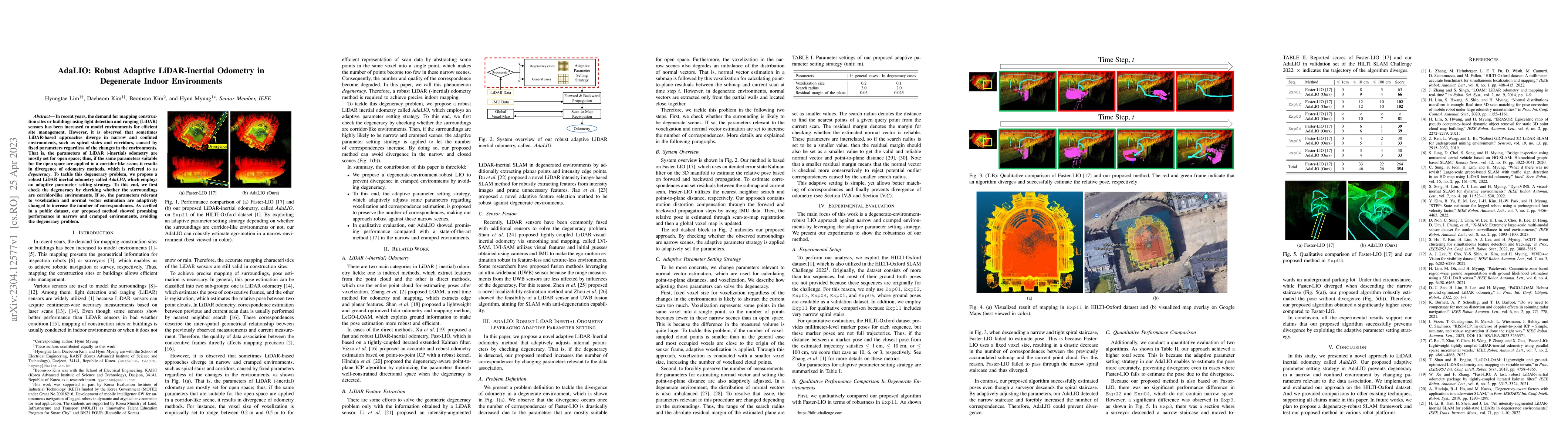
In recent years, the demand for mapping construction sites or buildings using light detection and ranging~(LiDAR) sensors has been increased to model environments for efficient site management. Howe...
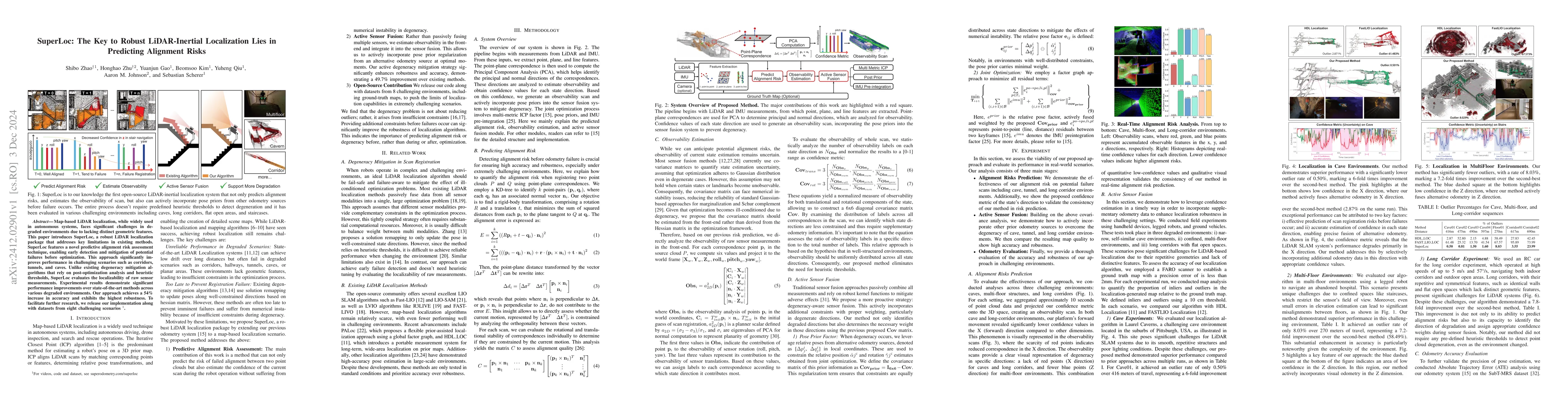
Map-based LiDAR localization, while widely used in autonomous systems, faces significant challenges in degraded environments due to lacking distinct geometric features. This paper introduces SuperLoc,...
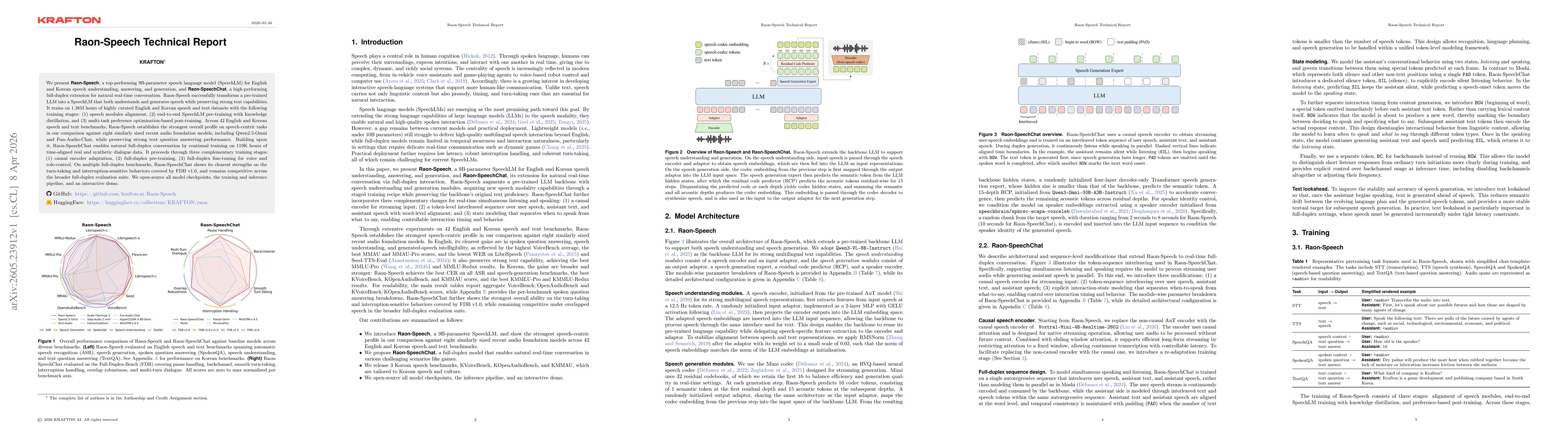
We present Raon-Speech, a top-performing 9B-parameter speech language model (SpeechLM) for English and Korean speech understanding, answering, and generation, and Raon-SpeechChat, a high-performing fu...