Beth Tellman

7 papers on arXiv

Academic Profile

Name: B. Tellman
Total Papers: 56

Statistics

arXiv Papers 7
Total Publications 56

Papers on arXiv

Thumbnail for Flood Event Extraction from News Media to Support Satellite-Based Flood
  Insurance

Flood Event Extraction from News Media to Support Satellite-Based Flood Insurance

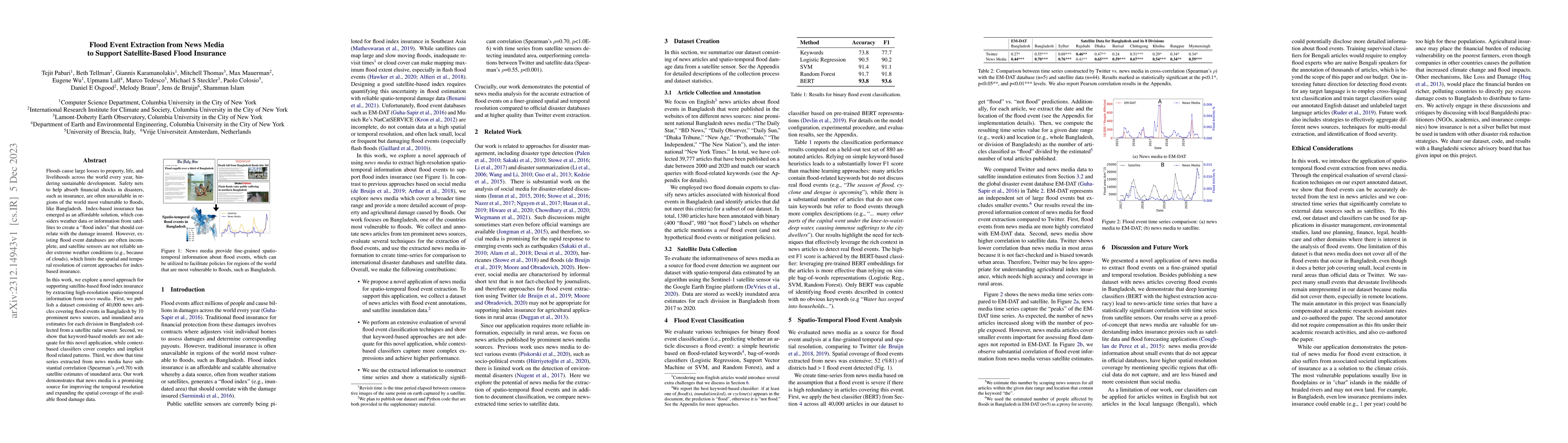
Floods cause large losses to property, life, and livelihoods across the world every year, hindering sustainable development. Safety nets to help absorb financial shocks in disasters, such as insuran...

Thumbnail for Inferring the past: a combined CNN-LSTM deep learning framework to fuse
  satellites for historical inundation mapping

Inferring the past: a combined CNN-LSTM deep learning framework to fuse satellites for historical inundation mapping

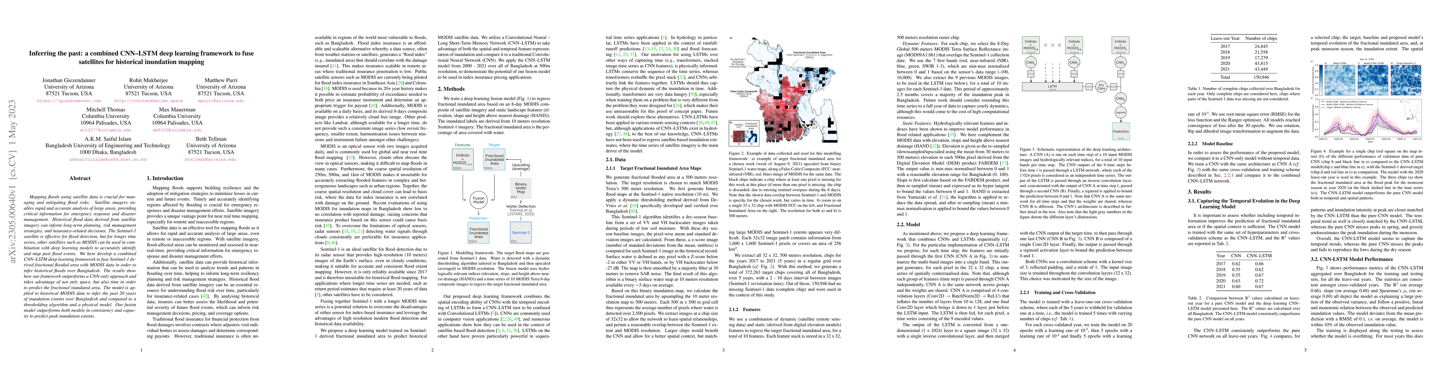
Mapping floods using satellite data is crucial for managing and mitigating flood risks. Satellite imagery enables rapid and accurate analysis of large areas, providing critical information for emerg...

Thumbnail for H2O-Net: Self-Supervised Flood Segmentation via Adversarial Domain
  Adaptation and Label Refinement

H2O-Net: Self-Supervised Flood Segmentation via Adversarial Domain Adaptation and Label Refinement

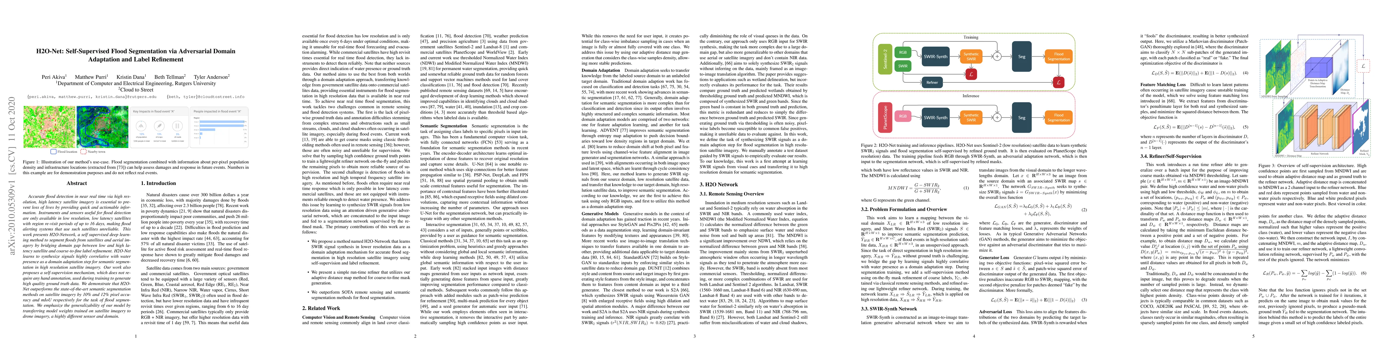
Accurate flood detection in near real time via high resolution, high latency satellite imagery is essential to prevent loss of lives by providing quick and actionable information. Instruments and se...

Thumbnail for GLACIA: Instance-Aware Positional Reasoning for Glacial Lake Segmentation via Multimodal Large Language Model

GLACIA: Instance-Aware Positional Reasoning for Glacial Lake Segmentation via Multimodal Large Language Model

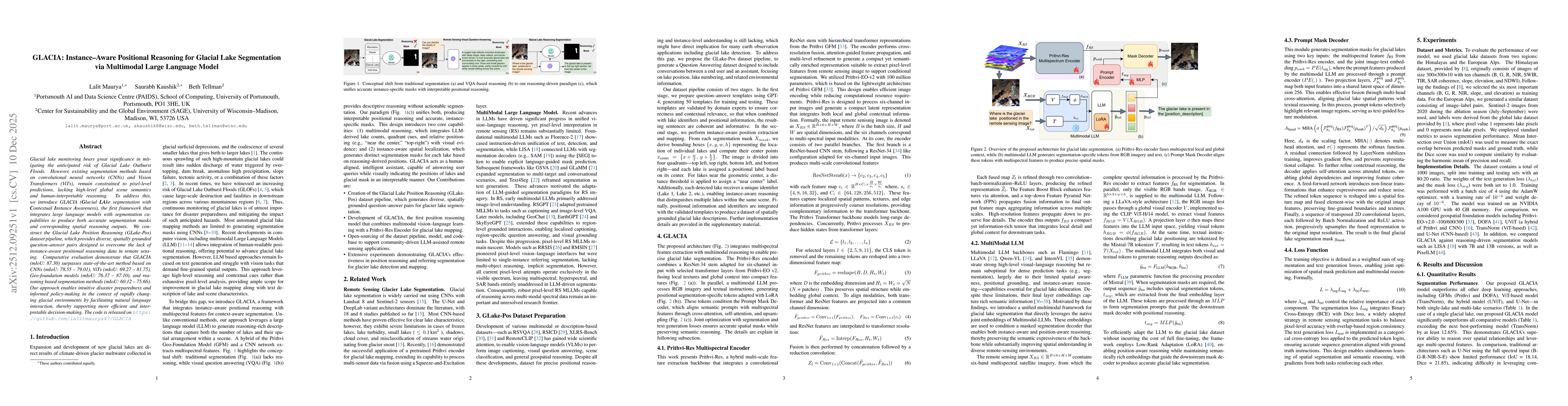
Glacial lake monitoring bears great significance in mitigating the anticipated risk of Glacial Lake Outburst Floods. However, existing segmentation methods based on convolutional neural networks (CNNs...

Thumbnail for Prithvi-Complimentary Adaptive Fusion Encoder (CAFE): unlocking full-potential for flood inundation mapping

Prithvi-Complimentary Adaptive Fusion Encoder (CAFE): unlocking full-potential for flood inundation mapping

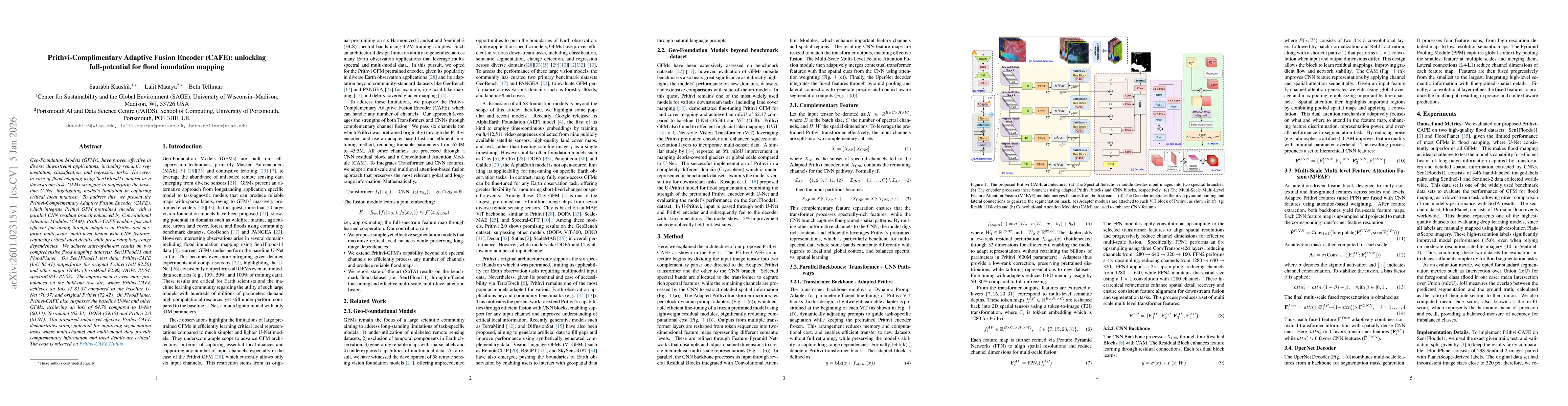
Geo-Foundation Models (GFMs), have proven effective in diverse downstream applications, including semantic segmentation, classification, and regression tasks. However, in case of flood mapping using S...

Thumbnail for Cryo-Bench: Benchmarking Foundation Models for Cryosphere Applications

Cryo-Bench: Benchmarking Foundation Models for Cryosphere Applications

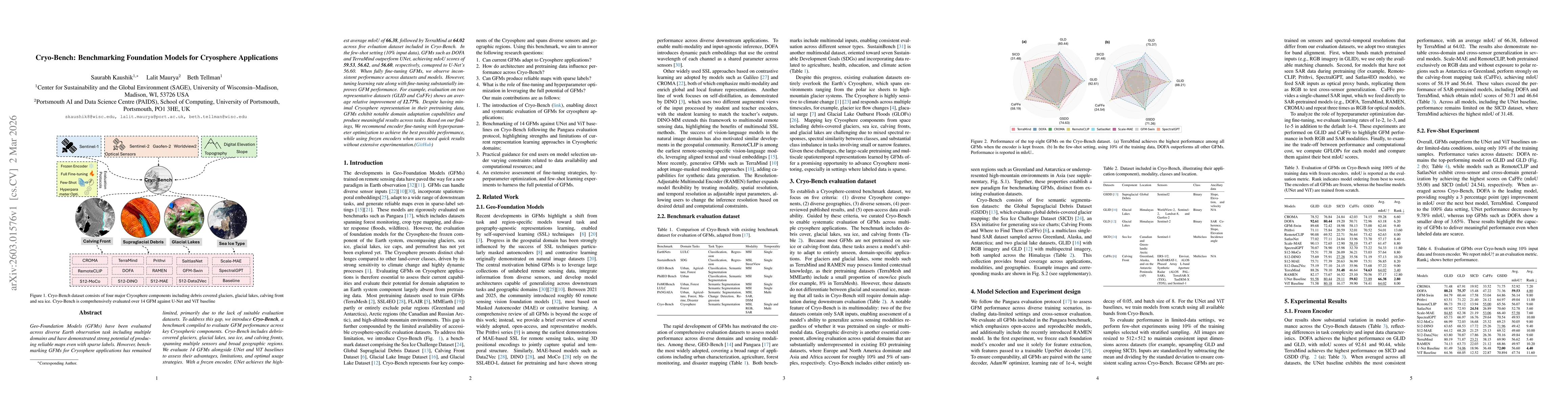
Geo-Foundation Models (GFMs) have been evaluated across diverse Earth observation task including multiple domains and have demonstrated strong potential of producing reliable maps even with sparse lab...

Thumbnail for Urban Flood Observations (UFO): A hand-labeled training and validation dataset of post-flood inundation

Urban Flood Observations (UFO): A hand-labeled training and validation dataset of post-flood inundation

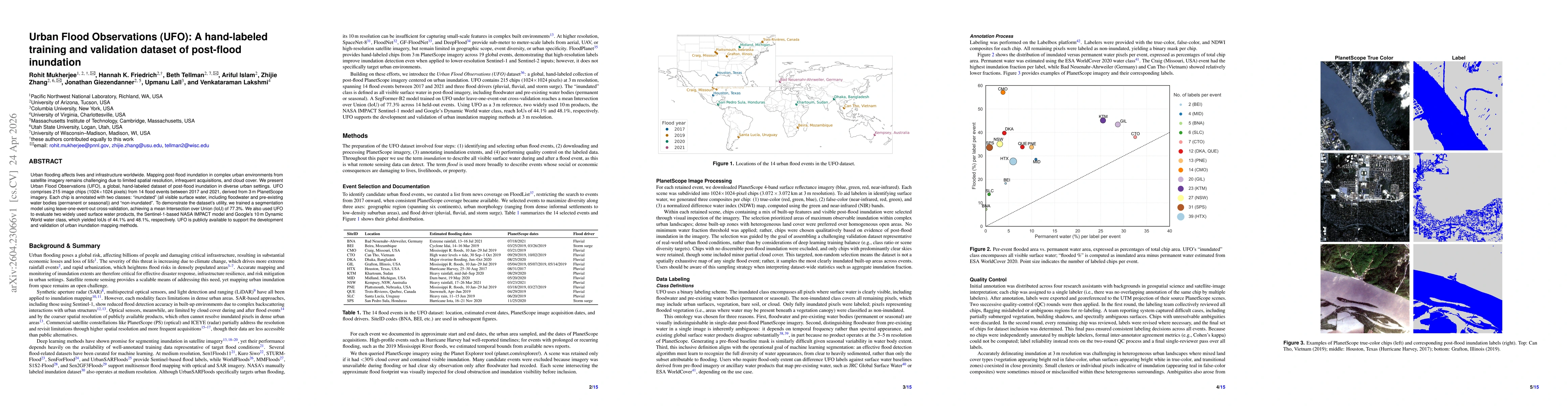
Urban flooding affects lives and infrastructure worldwide. Mapping inundation in complex urban environments from satellite imagery remains challenging due to limited spatial resolution, infrequent acq...

This website uses cookies to ensure you get the best experience. Learn more