Academic Profile
Statistics
Similar Authors
Papers on arXiv
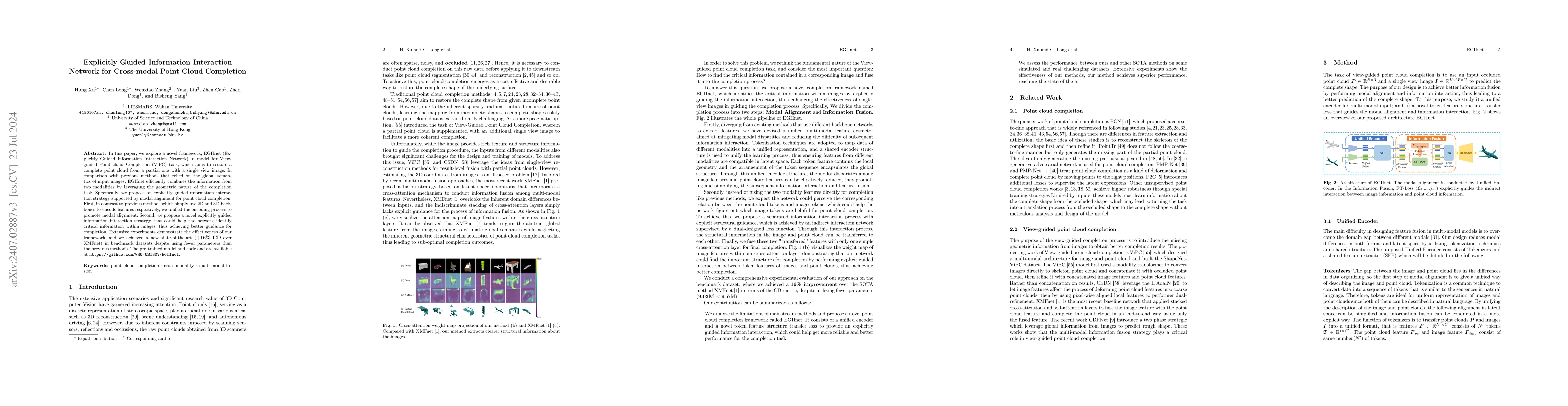
Corresponding author}In this paper, we explore a novel framework, EGIInet (Explicitly Guided Information Interaction Network), a model for View-guided Point cloud Completion (ViPC) task, which aims ...
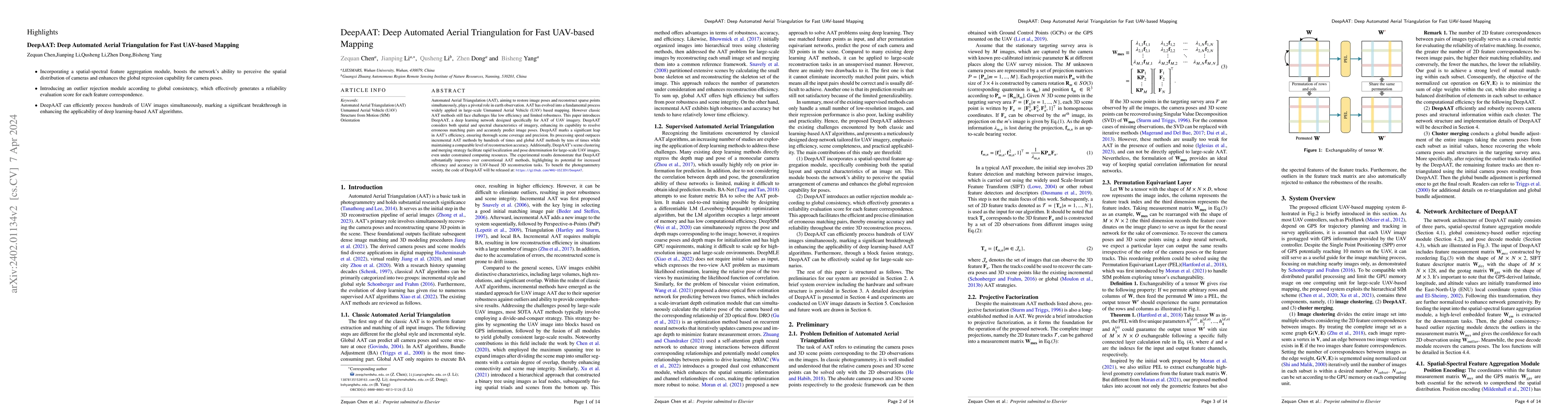
Automated Aerial Triangulation (AAT), aiming to restore image pose and reconstruct sparse points simultaneously, plays a pivotal role in earth observation. With its rich research heritage spanning s...
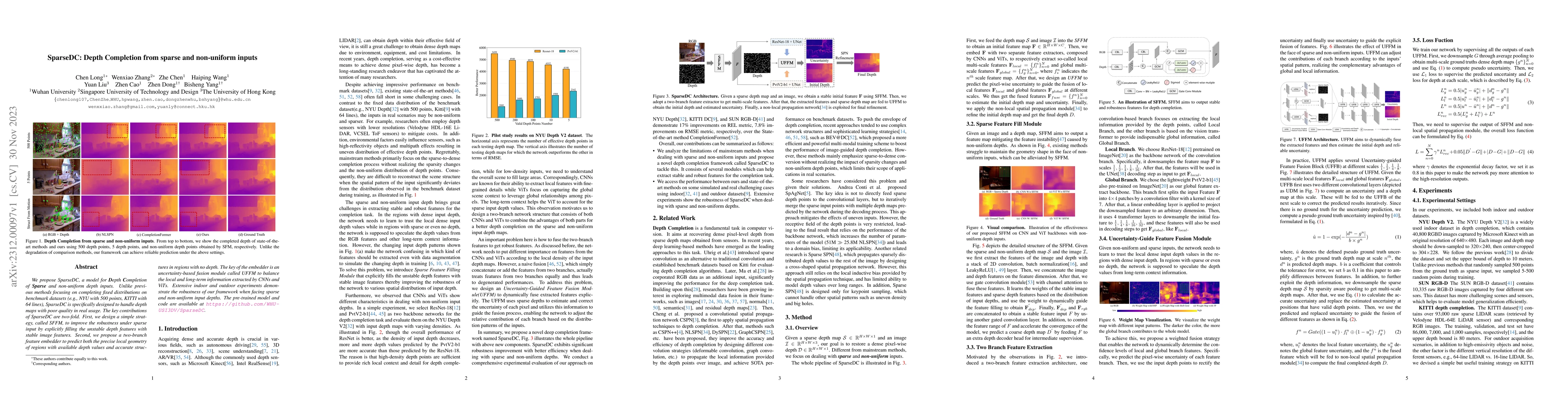
We propose SparseDC, a model for Depth Completion of Sparse and non-uniform depth inputs. Unlike previous methods focusing on completing fixed distributions on benchmark datasets (e.g., NYU with 500...
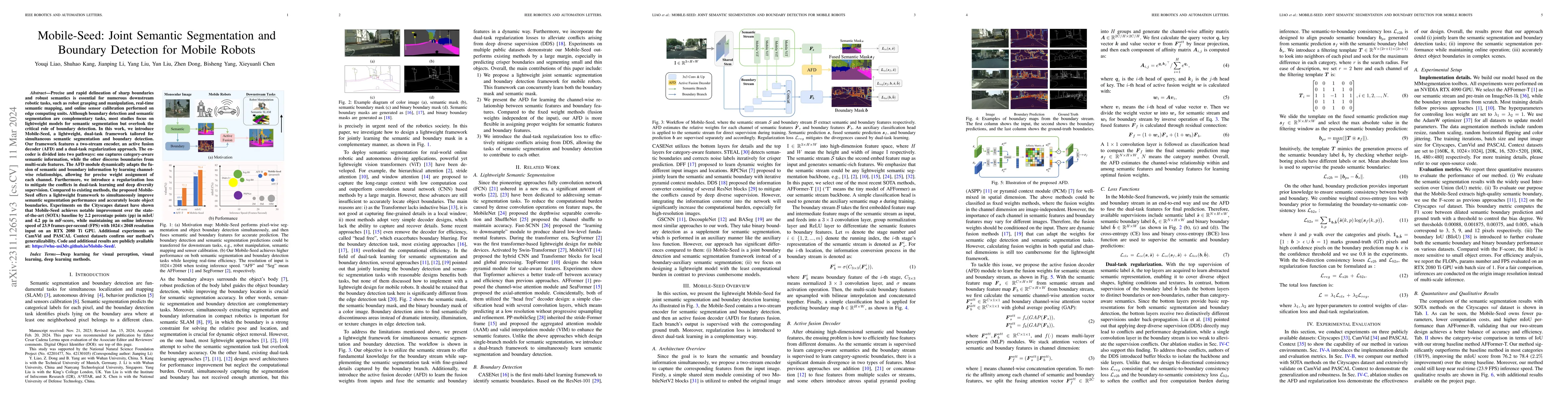
Precise and rapid delineation of sharp boundaries and robust semantics is essential for numerous downstream robotic tasks, such as robot grasping and manipulation, real-time semantic mapping, and on...
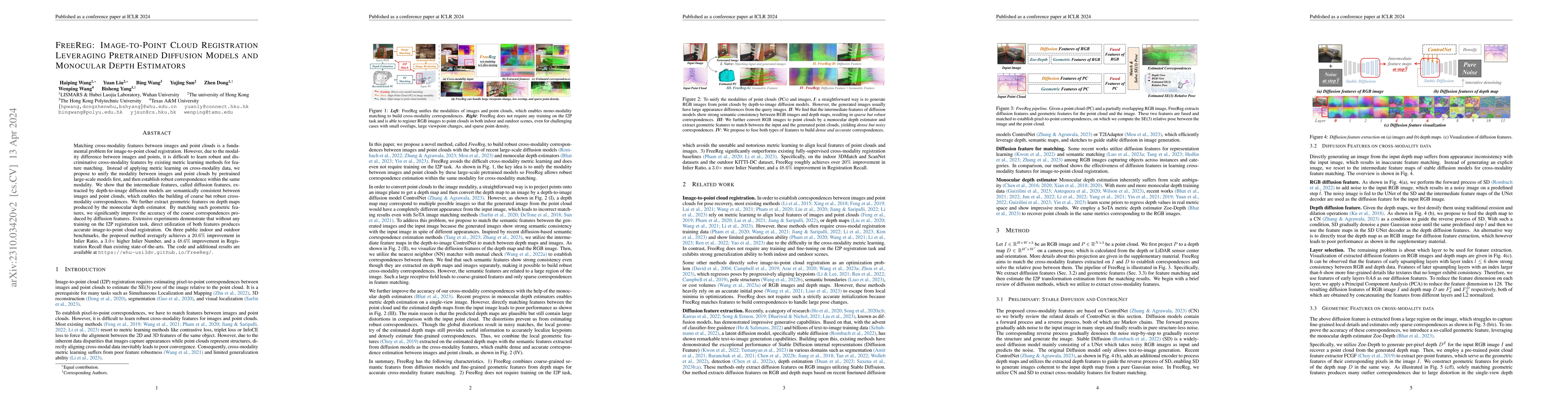
Matching cross-modality features between images and point clouds is a fundamental problem for image-to-point cloud registration. However, due to the modality difference between images and points, it...
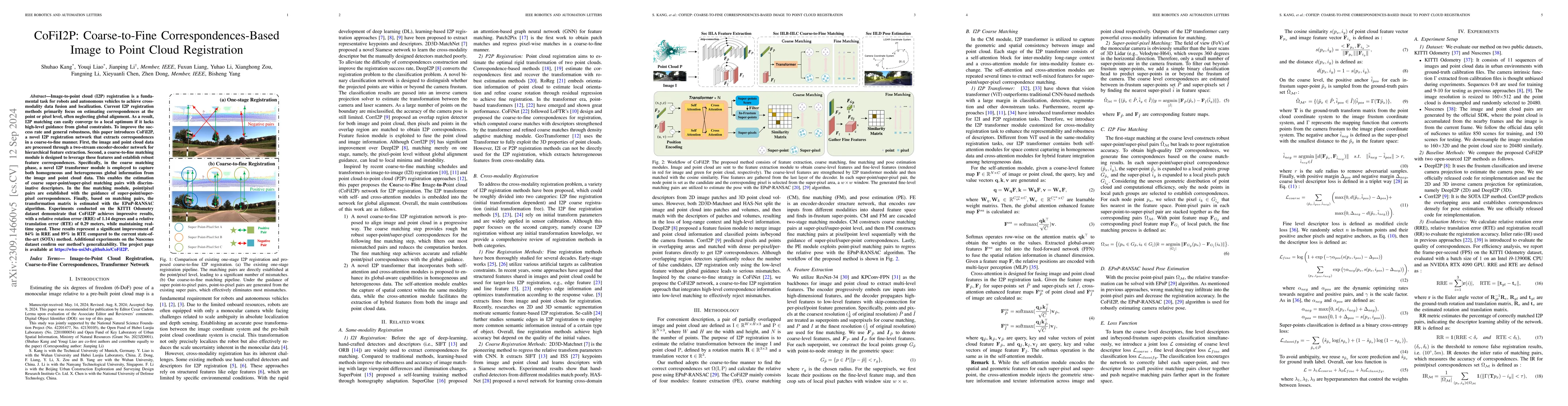
Image-to-point cloud (I2P) registration is a fundamental task for robots and autonomous vehicles to achieve cross-modality data fusion and localization. Existing I2P registration methods estimate co...
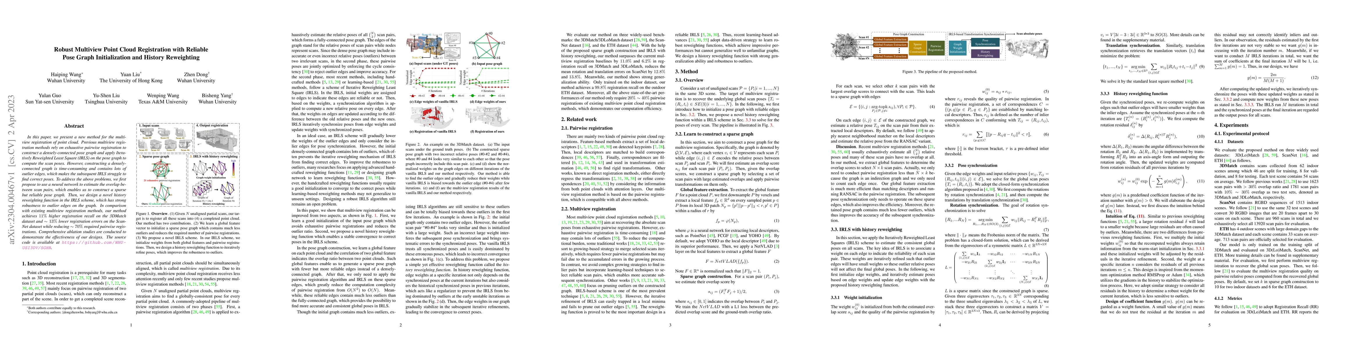
In this paper, we present a new method for the multiview registration of point cloud. Previous multiview registration methods rely on exhaustive pairwise registration to construct a densely-connecte...
At present, the anchor-based or anchor-free models that use LiDAR point clouds for 3D object detection use the center assigner strategy to infer the 3D bounding boxes. However, in a real world scene...
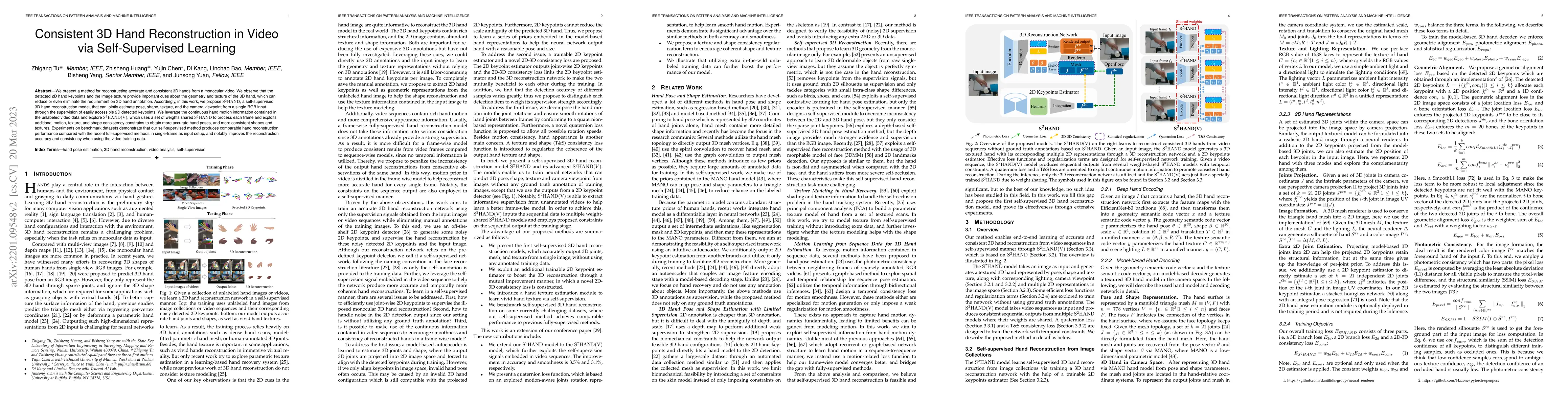
We present a method for reconstructing accurate and consistent 3D hands from a monocular video. We observe that detected 2D hand keypoints and the image texture provide important cues about the geom...
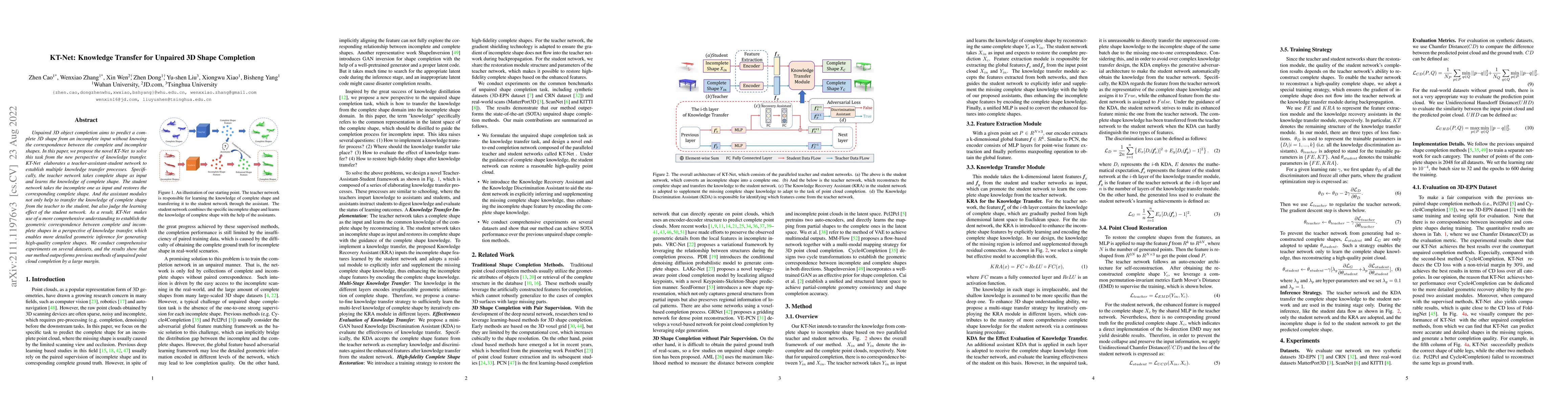
Unpaired 3D object completion aims to predict a complete 3D shape from an incomplete input without knowing the correspondence between the complete and incomplete shapes. In this paper, we propose th...
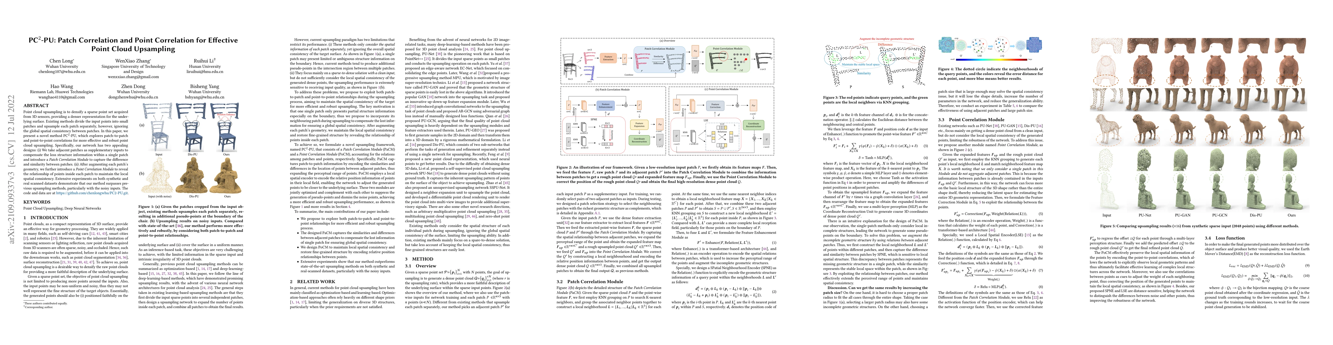
Point cloud upsampling is to densify a sparse point set acquired from 3D sensors, providing a denser representation for the underlying surface. Existing methods divide the input points into small pa...
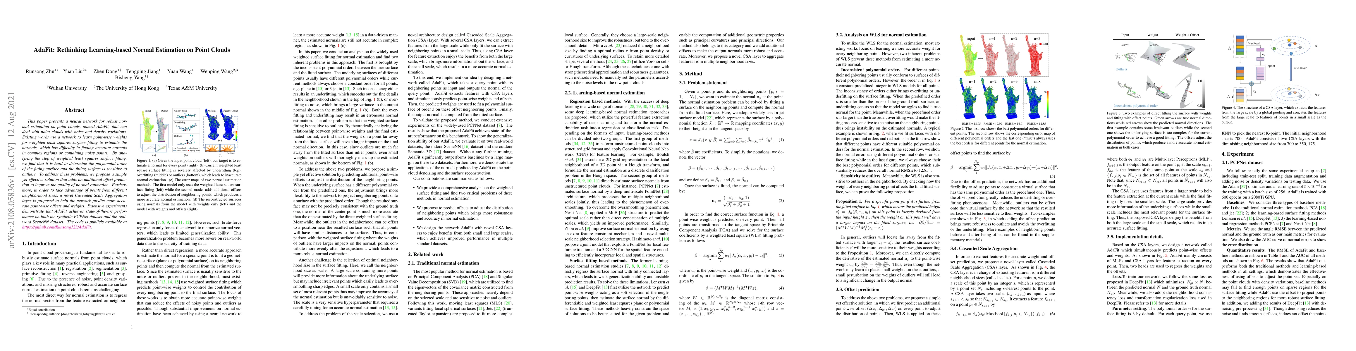
This paper presents a neural network for robust normal estimation on point clouds, named AdaFit, that can deal with point clouds with noise and density variations. Existing works use a network to le...
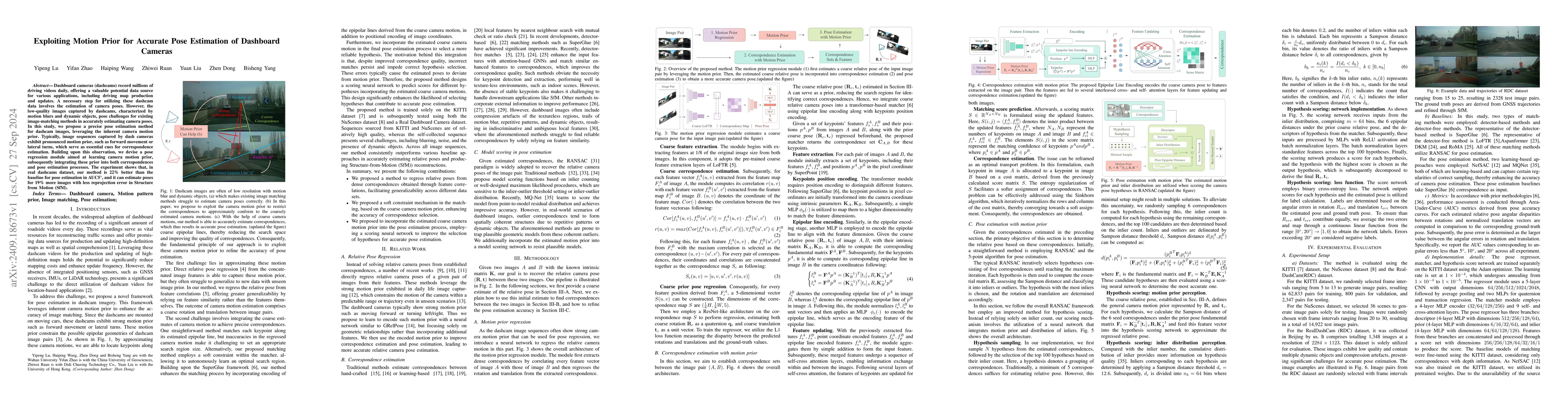
Dashboard cameras (dashcams) record millions of driving videos daily, offering a valuable potential data source for various applications, including driving map production and updates. A necessary step...
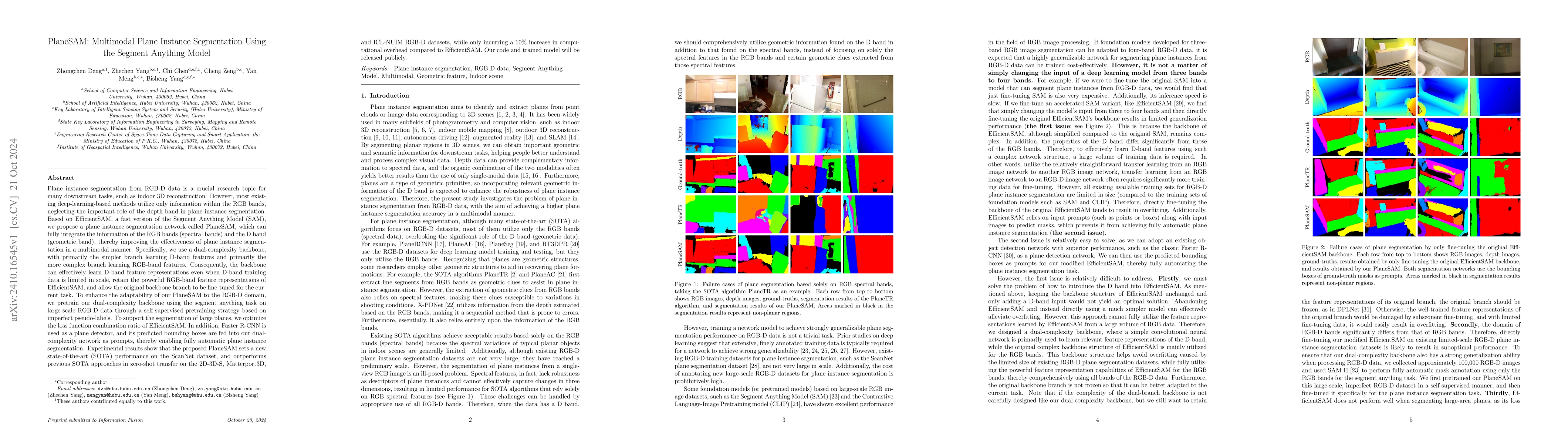
Plane instance segmentation from RGB-D data is a crucial research topic for many downstream tasks. However, most existing deep-learning-based methods utilize only information within the RGB bands, neg...
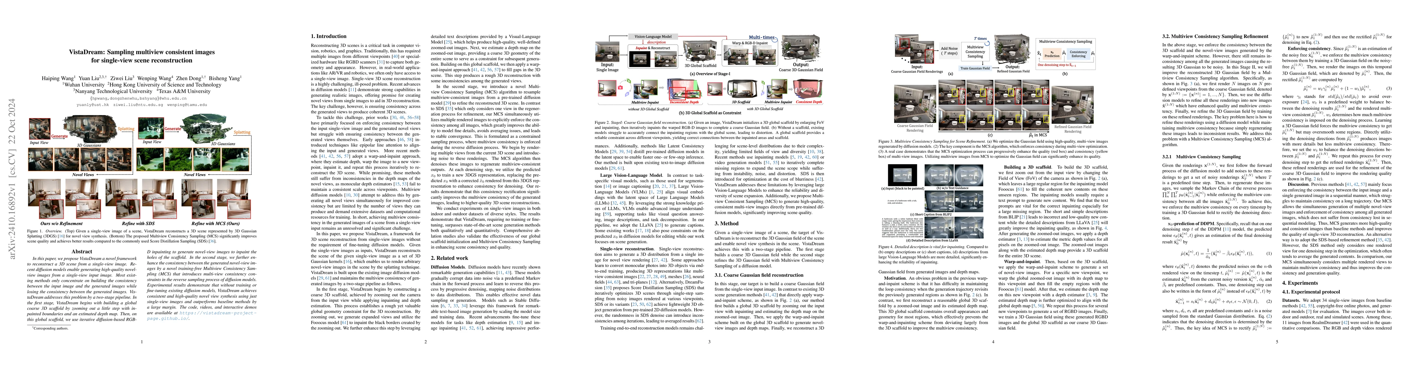
In this paper, we propose VistaDream a novel framework to reconstruct a 3D scene from a single-view image. Recent diffusion models enable generating high-quality novel-view images from a single-view i...
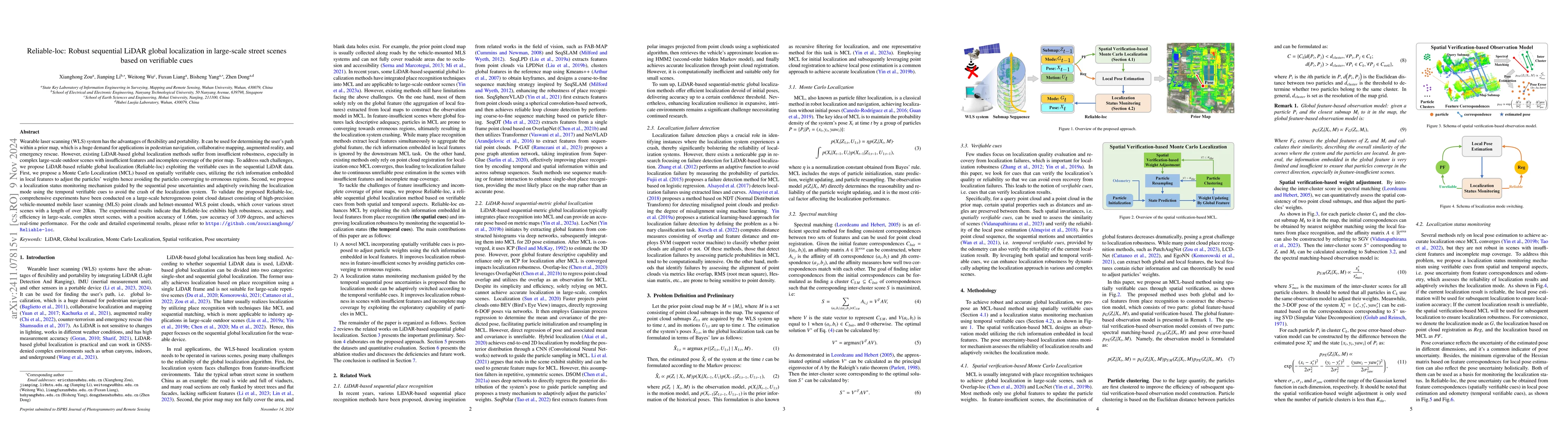
Wearable laser scanning (WLS) system has the advantages of flexibility and portability. It can be used for determining the user's path within a prior map, which is a huge demand for applications in pe...
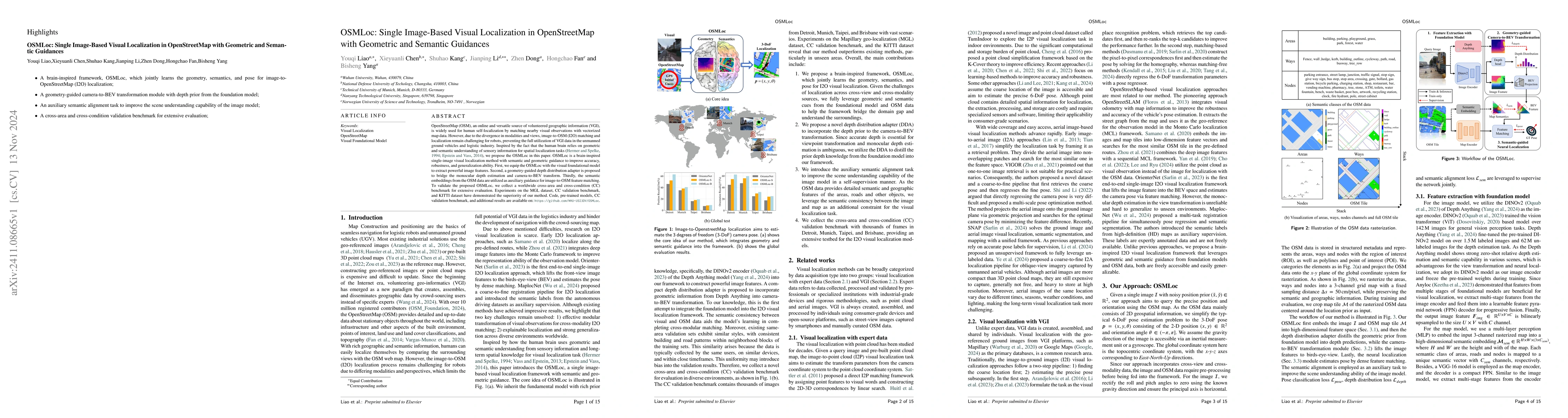
OpenStreetMap (OSM), an online and versatile source of volunteered geographic information (VGI), is widely used for human self-localization by matching nearby visual observations with vectorized map d...
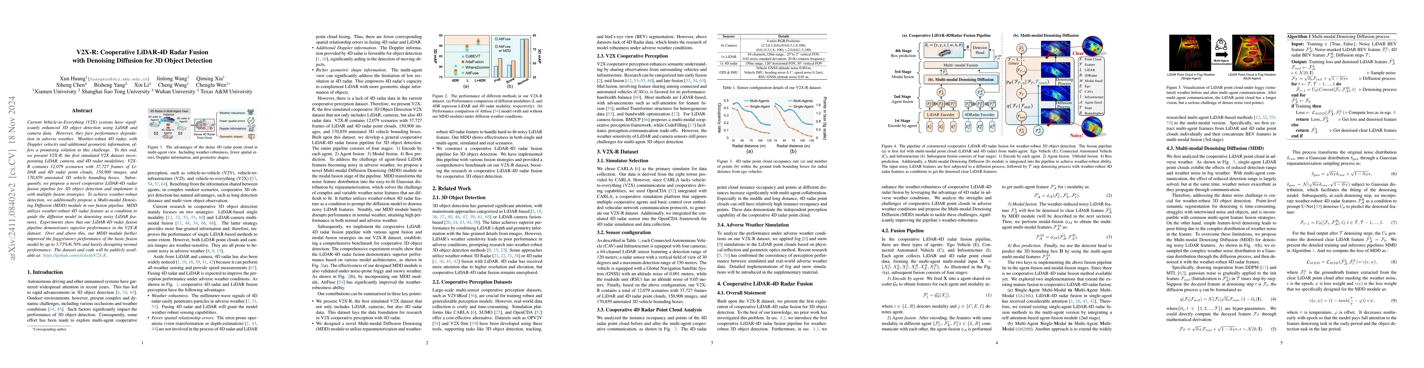
Current Vehicle-to-Everything (V2X) systems have significantly enhanced 3D object detection using LiDAR and camera data. However, these methods suffer from performance degradation in adverse weather c...
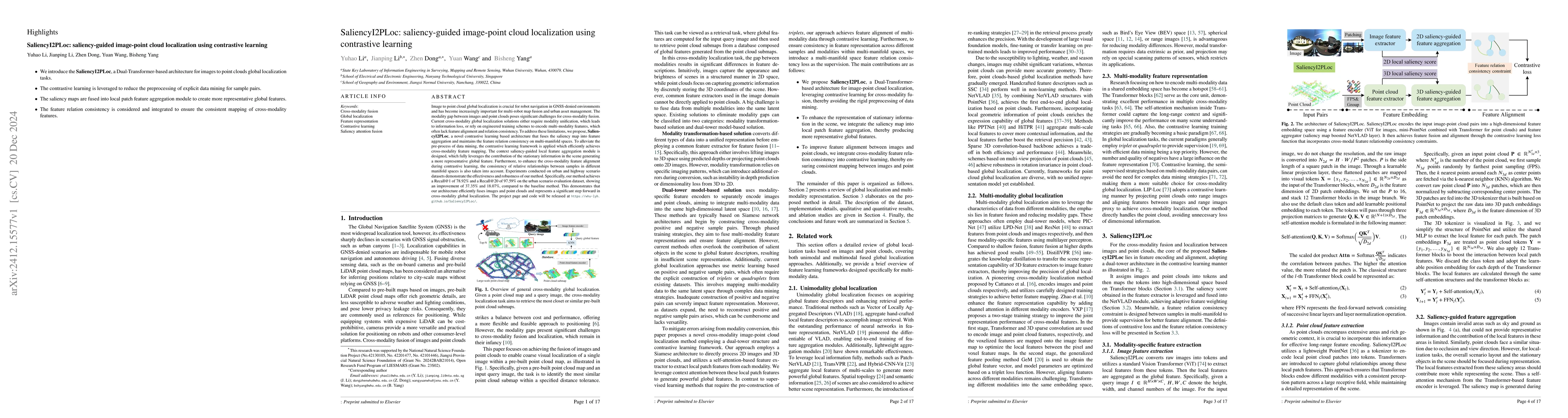
Image to point cloud global localization is crucial for robot navigation in GNSS-denied environments and has become increasingly important for multi-robot map fusion and urban asset management. The mo...
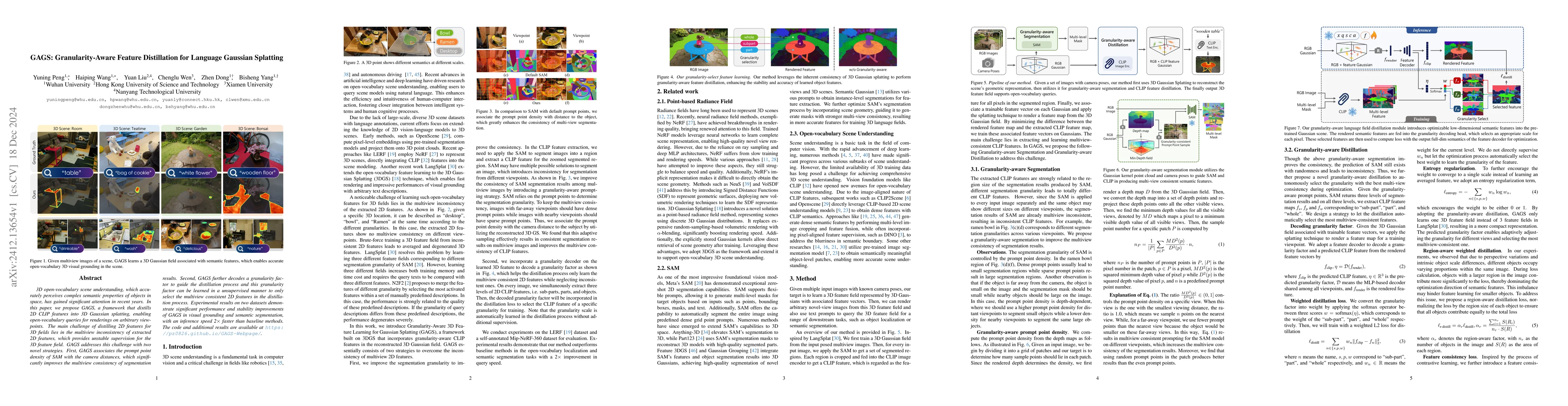
3D open-vocabulary scene understanding, which accurately perceives complex semantic properties of objects in space, has gained significant attention in recent years. In this paper, we propose GAGS, a ...
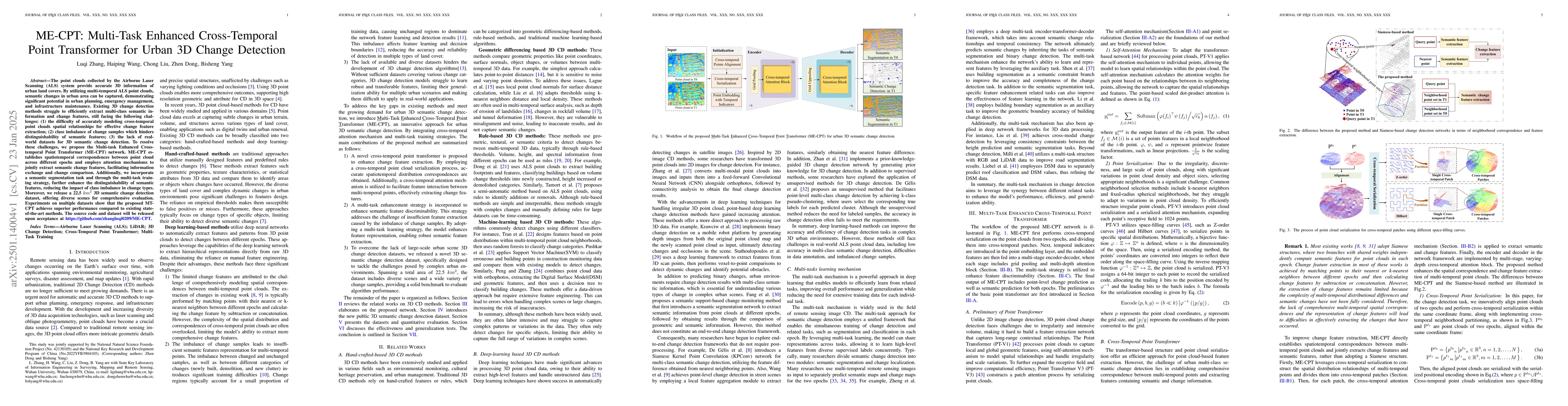
The point clouds collected by the Airborne Laser Scanning (ALS) system provide accurate 3D information of urban land covers. By utilizing multi-temporal ALS point clouds, semantic changes in urban are...
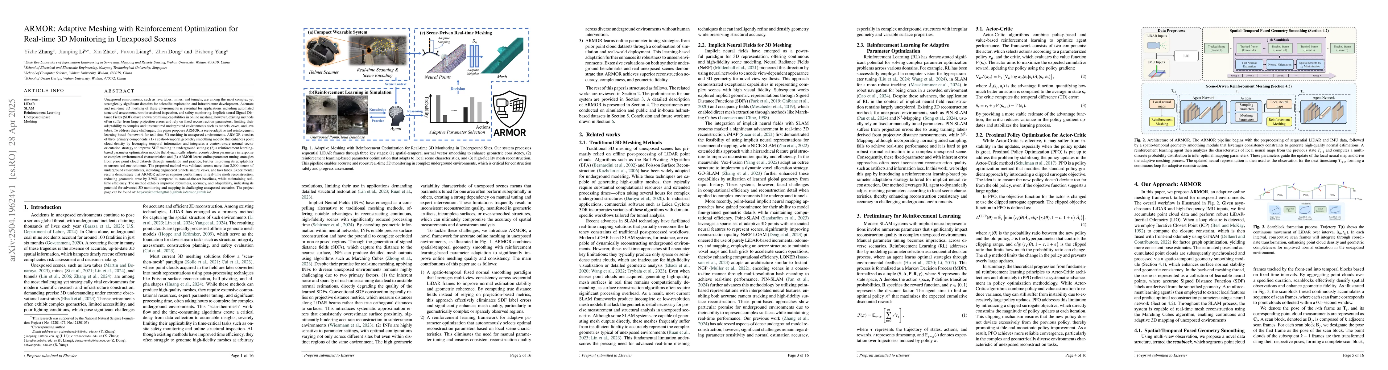
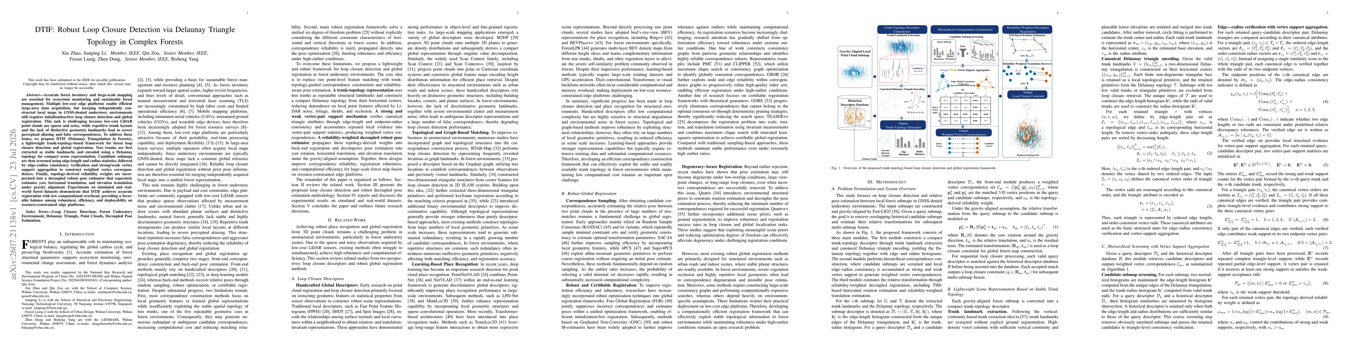
Unexposed environments, such as lava tubes, mines, and tunnels, are among the most complex yet strategically significant domains for scientific exploration and infrastructure development. Accurate and...
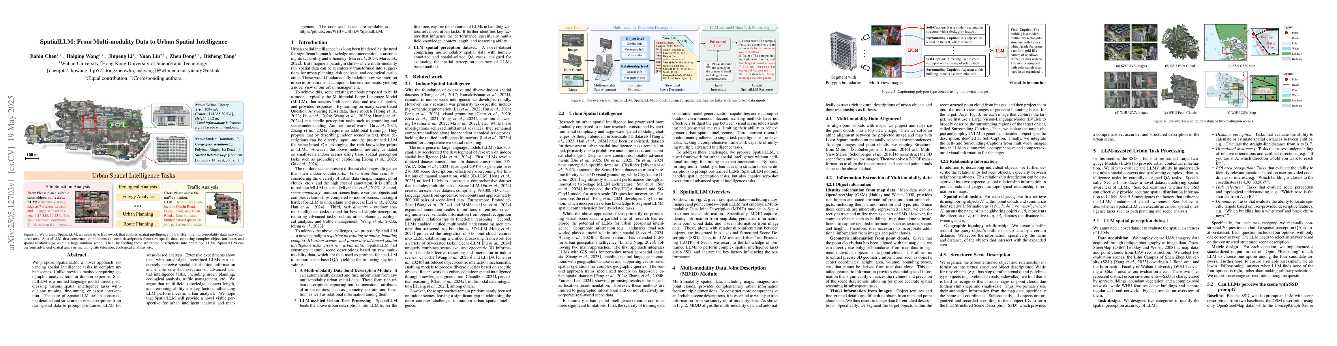
We propose SpatialLLM, a novel approach advancing spatial intelligence tasks in complex urban scenes. Unlike previous methods requiring geographic analysis tools or domain expertise, SpatialLLM is a u...
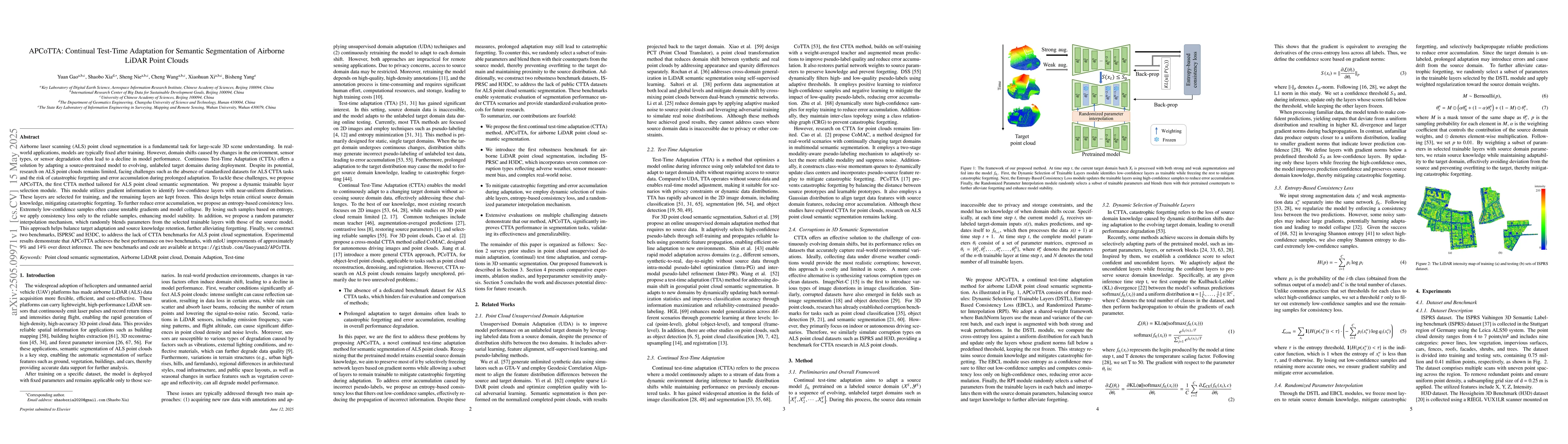
Airborne laser scanning (ALS) point cloud segmentation is a fundamental task for large-scale 3D scene understanding. In real-world applications, models are typically fixed after training. However, dom...
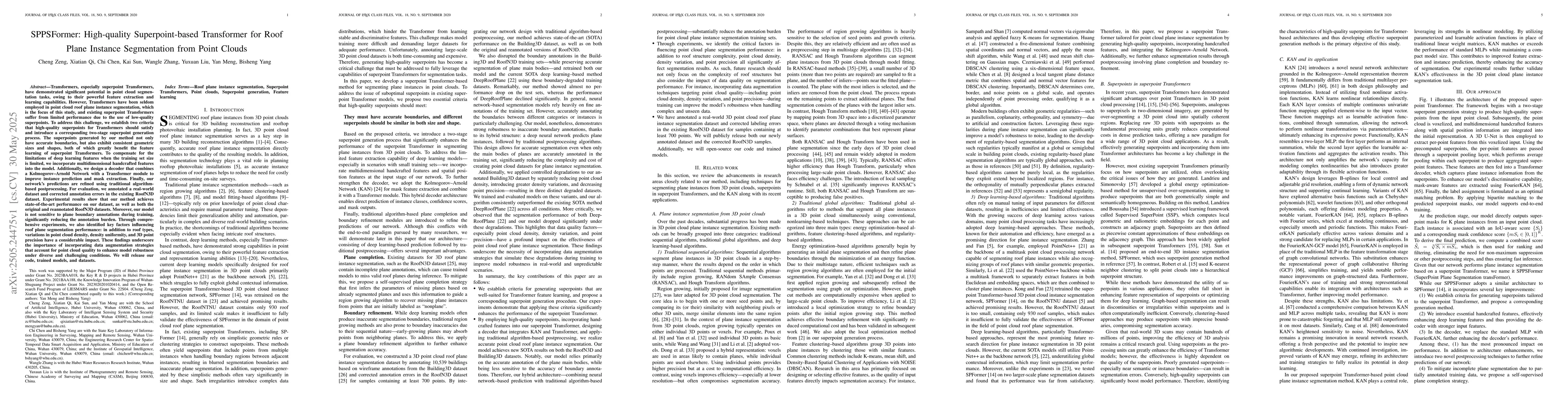
Transformers have been seldom employed in point cloud roof plane instance segmentation, which is the focus of this study, and existing superpoint Transformers suffer from limited performance due to th...
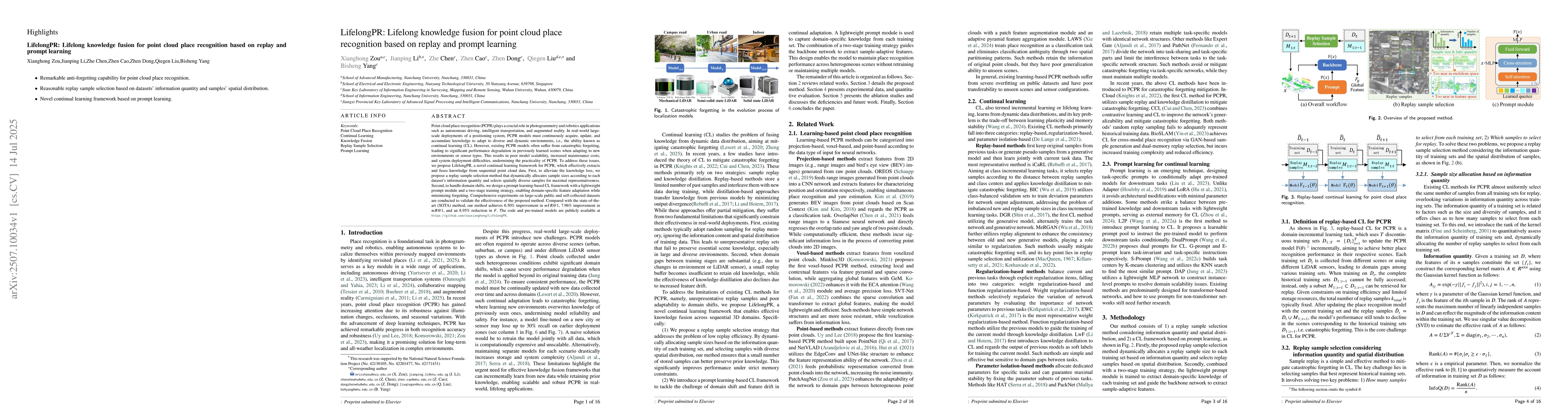
Point cloud place recognition (PCPR) plays a crucial role in photogrammetry and robotics applications such as autonomous driving, intelligent transportation, and augmented reality. In real-world large...
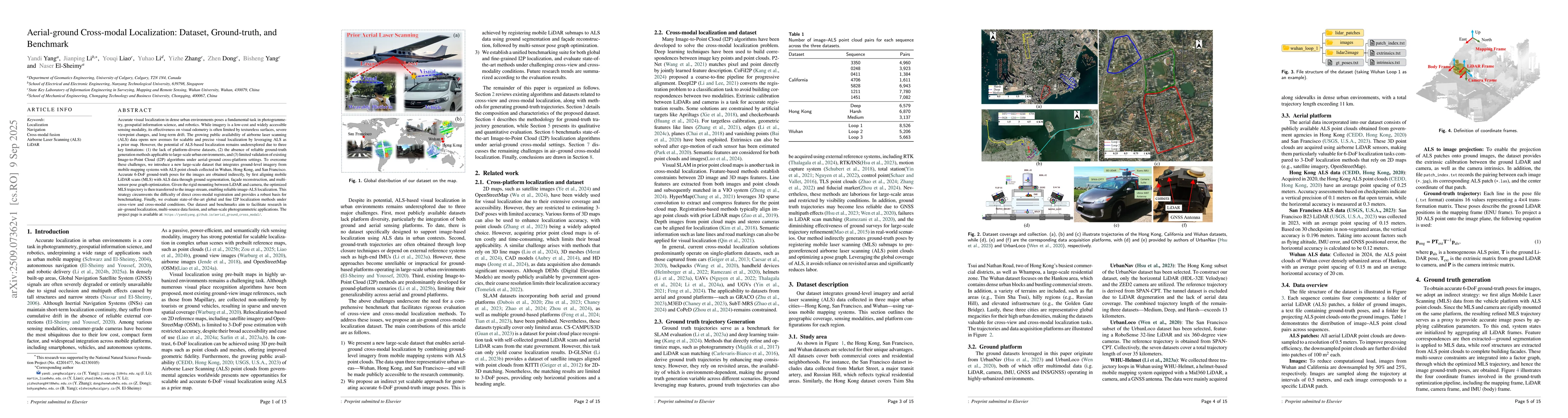
Accurate visual localization in dense urban environments poses a fundamental task in photogrammetry, geospatial information science, and robotics. While imagery is a low-cost and widely accessible sen...
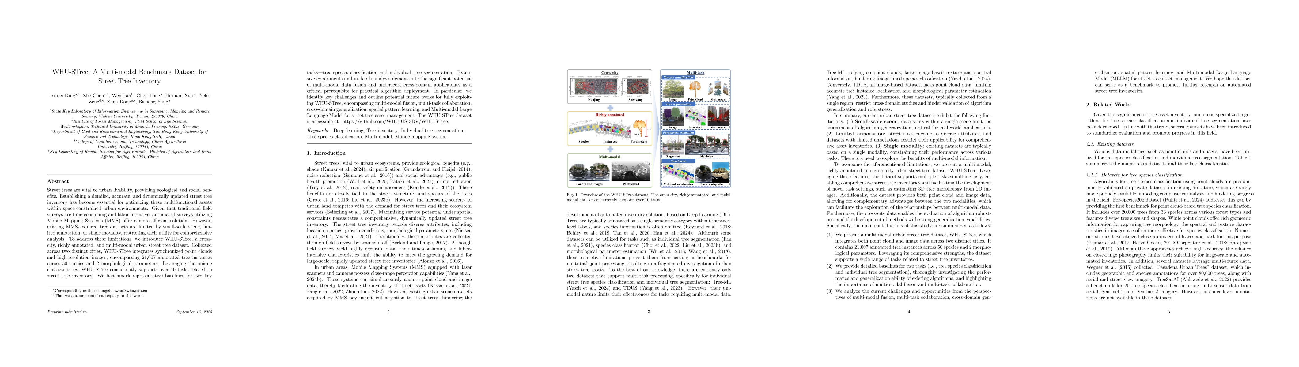
Street trees are vital to urban livability, providing ecological and social benefits. Establishing a detailed, accurate, and dynamically updated street tree inventory has become essential for optimizi...
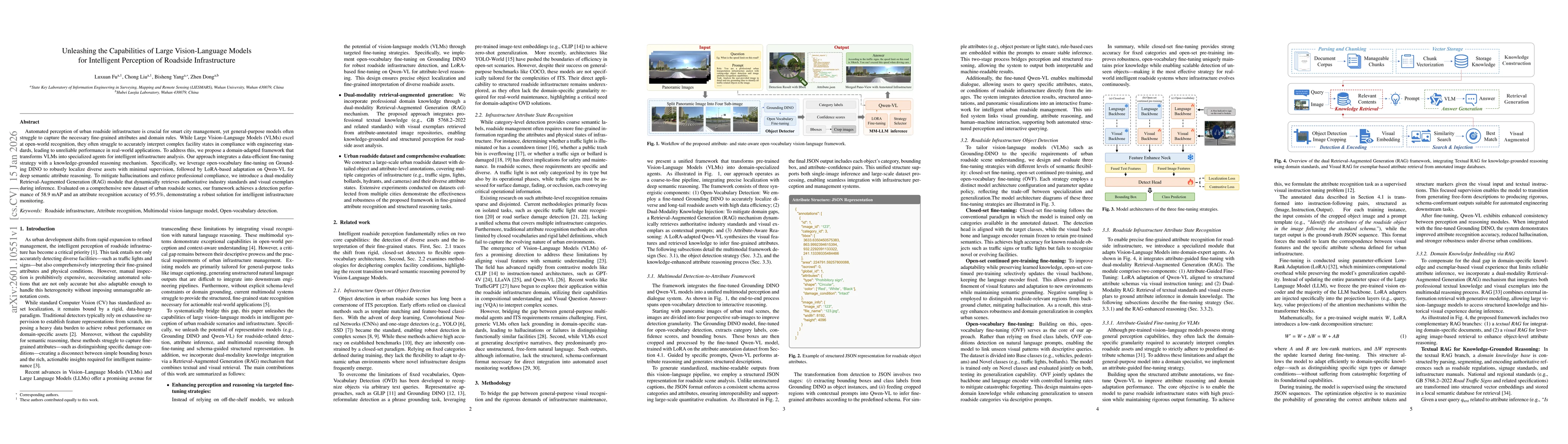
Automated perception of urban roadside infrastructure is crucial for smart city management, yet general-purpose models often struggle to capture the necessary fine-grained attributes and domain rules....
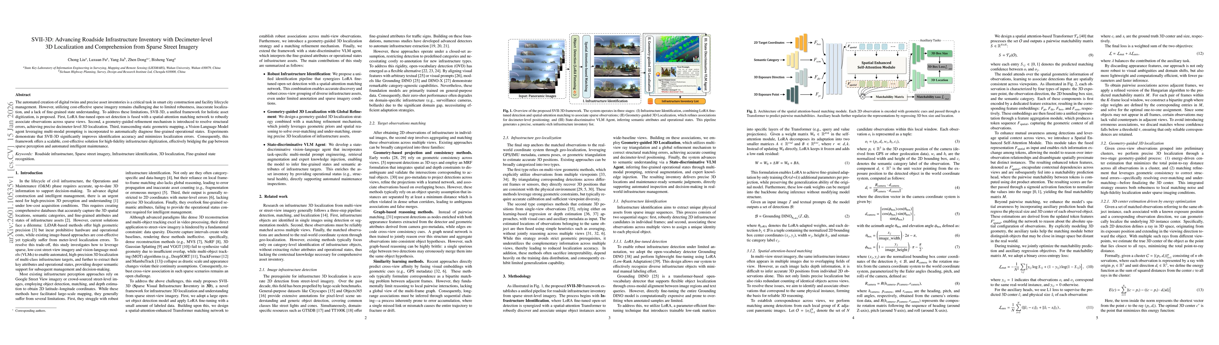
The automated creation of digital twins and precise asset inventories is a critical task in smart city construction and facility lifecycle management. However, utilizing cost-effective sparse imagery ...
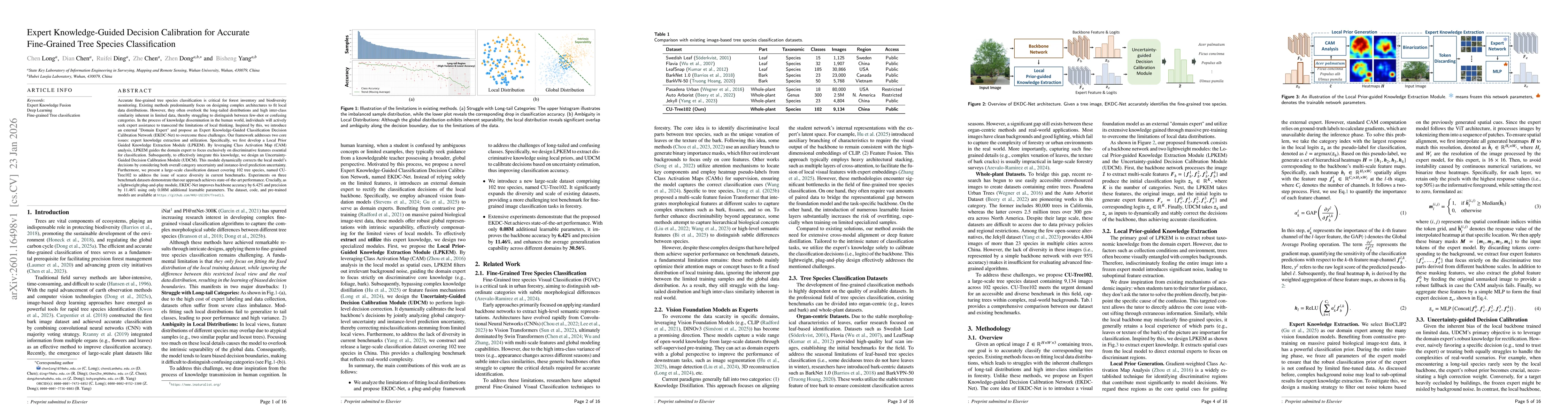
Accurate fine-grained tree species classification is critical for forest inventory and biodiversity monitoring. Existing methods predominantly focus on designing complex architectures to fit local dat...
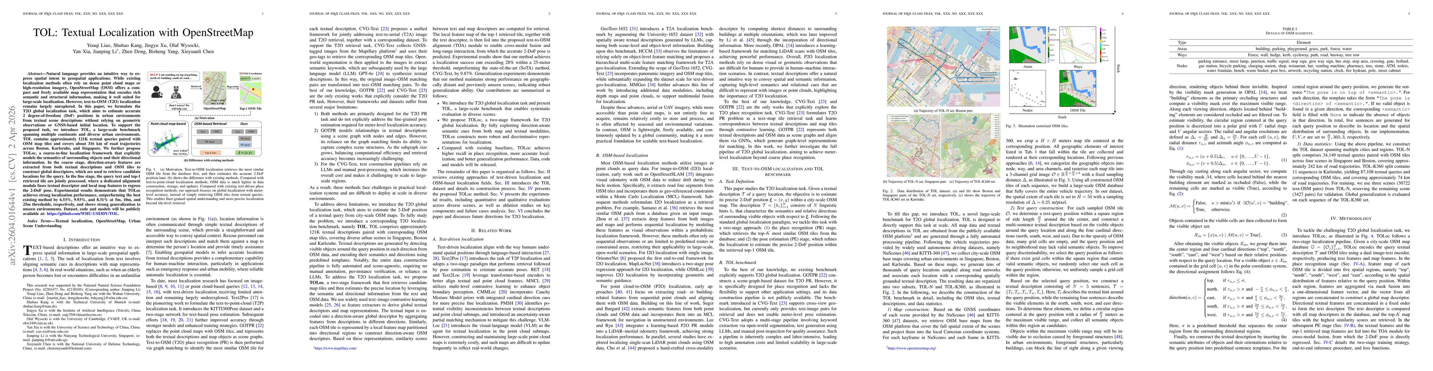
Natural language provides an intuitive way to express spatial intent in geospatial applications. While existing localization methods often rely on dense point cloud maps or high-resolution imagery, Op...
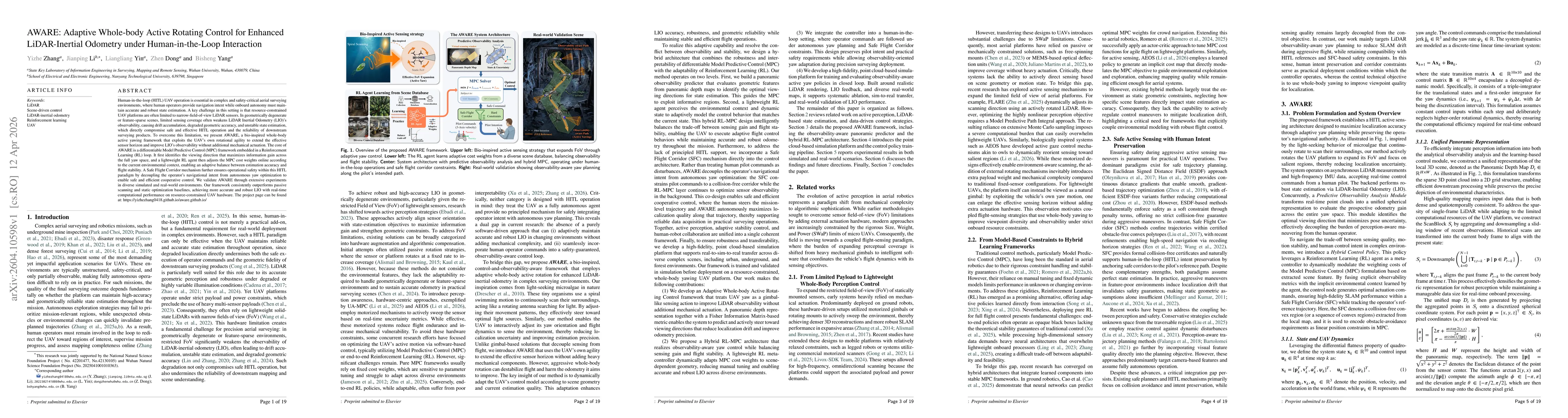
Human-in-the-loop (HITL) UAV operation is essential in complex and safety-critical aerial surveying environments, where human operators provide navigation intent while onboard autonomy must maintain a...
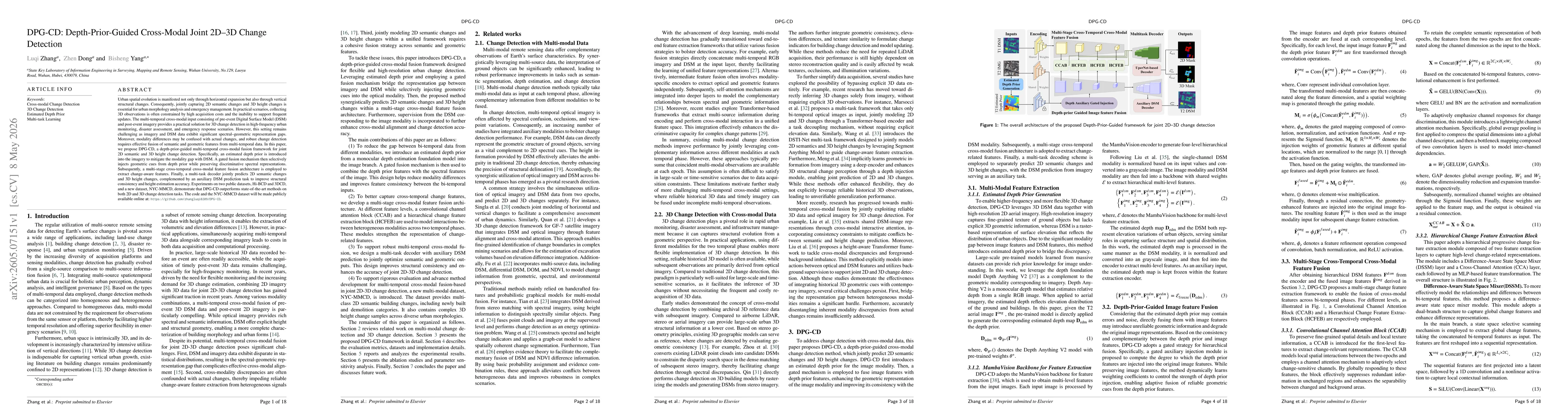
Urban spatial evolution is manifested not only through horizontal expansion but also through vertical structural changes. Consequently, jointly capturing 2D semantic changes and 3D height changes is e...
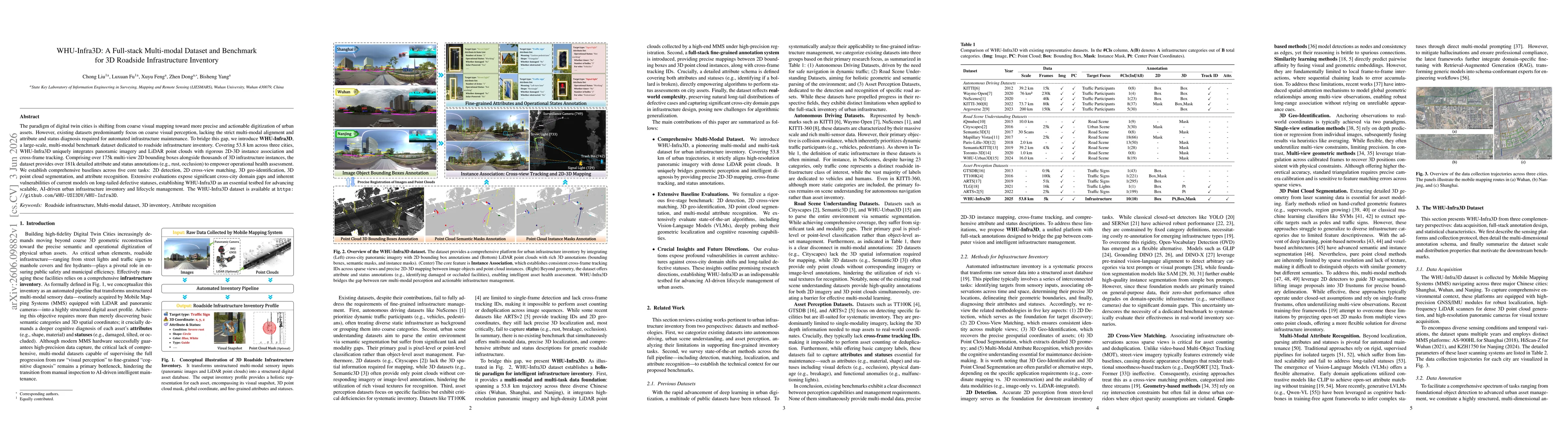
The paradigm of digital twin cities is shifting from coarse visual mapping toward more precise and actionable digitization of urban assets. However, existing datasets predominantly focus on coarse vis...
Accurate forest inventory and large-scale mapping are essential for ecosystem monitoring and sustainable forest management. Multiple low-cost edge platforms enable efficient large-area data acquisitio...