Academic Profile
Statistics
Similar Authors
Papers on arXiv
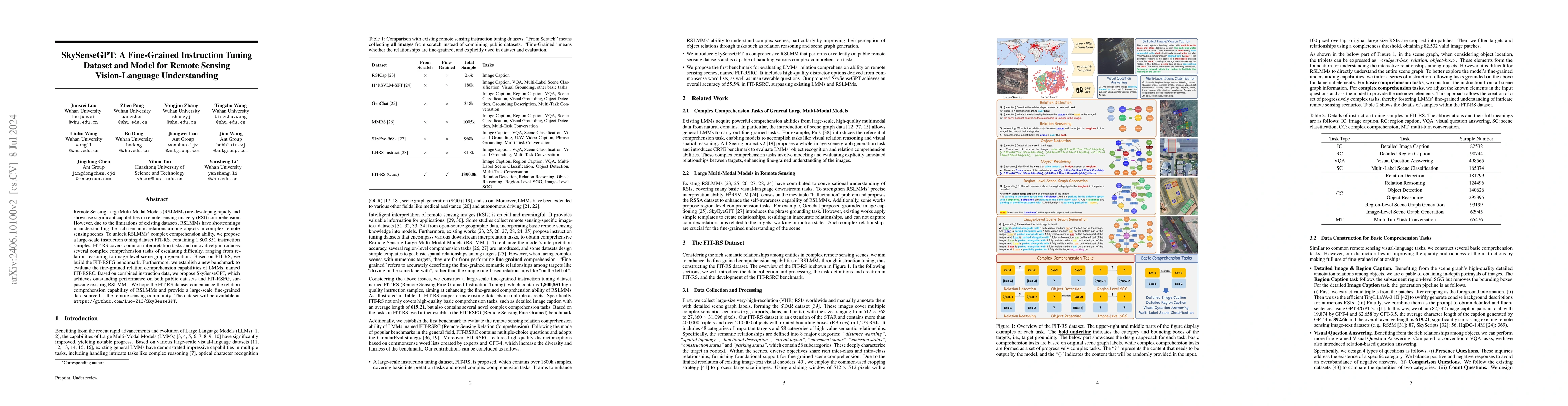
Remote Sensing Large Multi-Modal Models (RSLMMs) are developing rapidly and showcase significant capabilities in remote sensing imagery (RSI) comprehension. However, due to the limitations of existing...
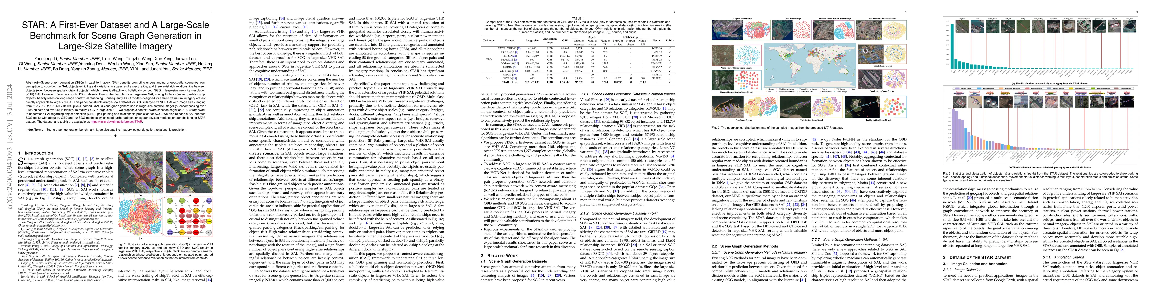
Scene graph generation (SGG) in satellite imagery (SAI) benefits promoting understanding of geospatial scenarios from perception to cognition. In SAI, objects exhibit great variations in scales and ...

The prevalence of mobile technology offers unique opportunities for addressing healthcare challenges, especially for individuals with visual impairments. This paper explores the development and impl...
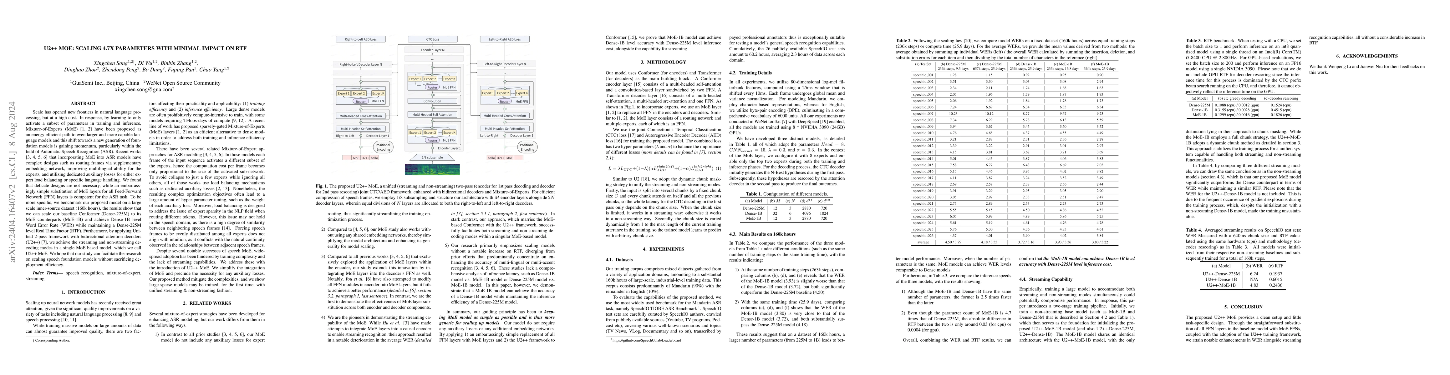
Scale has opened new frontiers in natural language processing, but at a high cost. In response, by learning to only activate a subset of parameters in training and inference, Mixture-of-Experts (MoE...
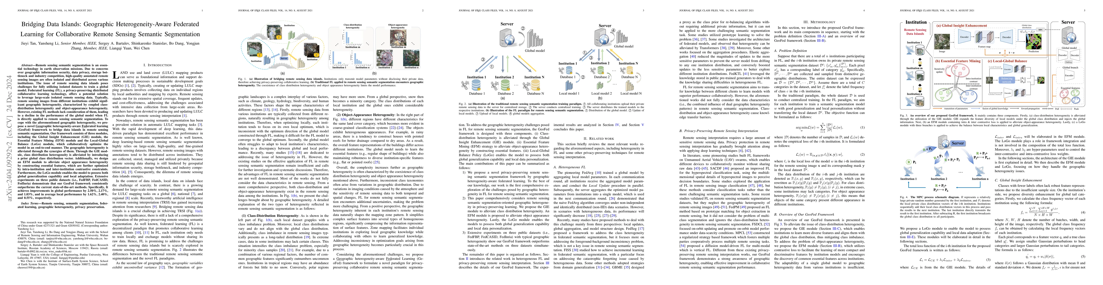
Remote sensing semantic segmentation (RSS) is an essential task in Earth Observation missions. Due to data privacy concerns, high-quality remote sensing images with annotations cannot be well shared...
Exploring the application of deep learning technologies in the field of medical diagnostics, Magnetic Resonance Imaging (MRI) provides a unique perspective for observing and diagnosing complex neuro...
Mobile Internet user credit assessment is an important way for communication operators to establish decisions and formulate measures, and it is also a guarantee for operators to obtain expected bene...
Transmission line detection technology is crucial for automatic monitoring and ensuring the safety of electrical facilities. The YOLOv5 series is currently one of the most advanced and widely used m...
Prior studies on Remote Sensing Foundation Model (RSFM) reveal immense potential towards a generic model for Earth Observation. Nevertheless, these works primarily focus on a single modality without...
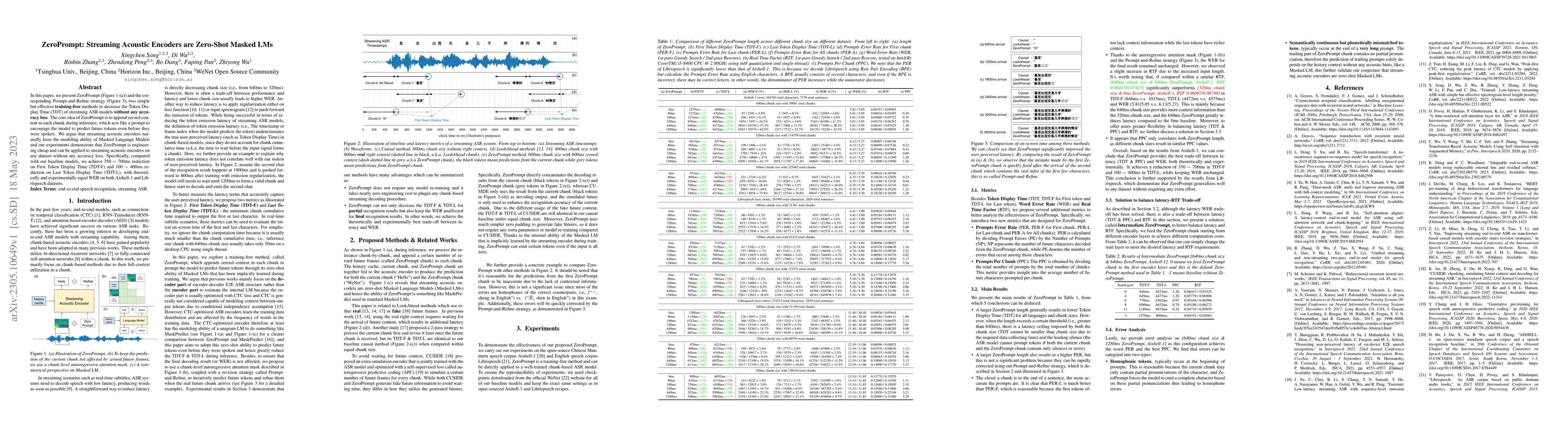
In this paper, we present ZeroPrompt (Figure 1-(a)) and the corresponding Prompt-and-Refine strategy (Figure 3), two simple but effective \textbf{training-free} methods to decrease the Token Display...
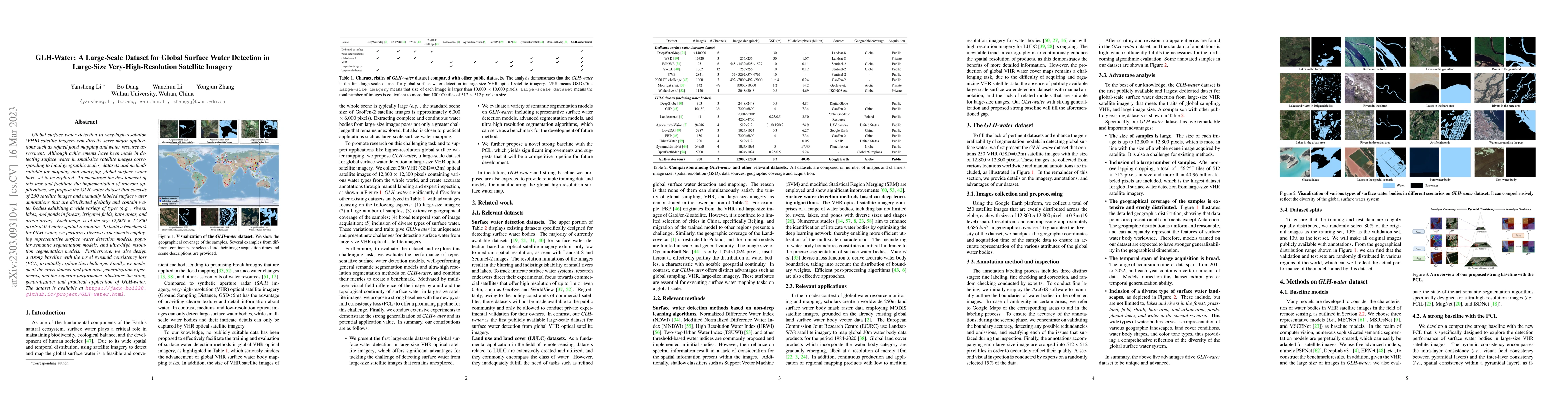
Global surface water detection in very-high-resolution (VHR) satellite imagery can directly serve major applications such as refined flood mapping and water resource assessment. Although achievement...
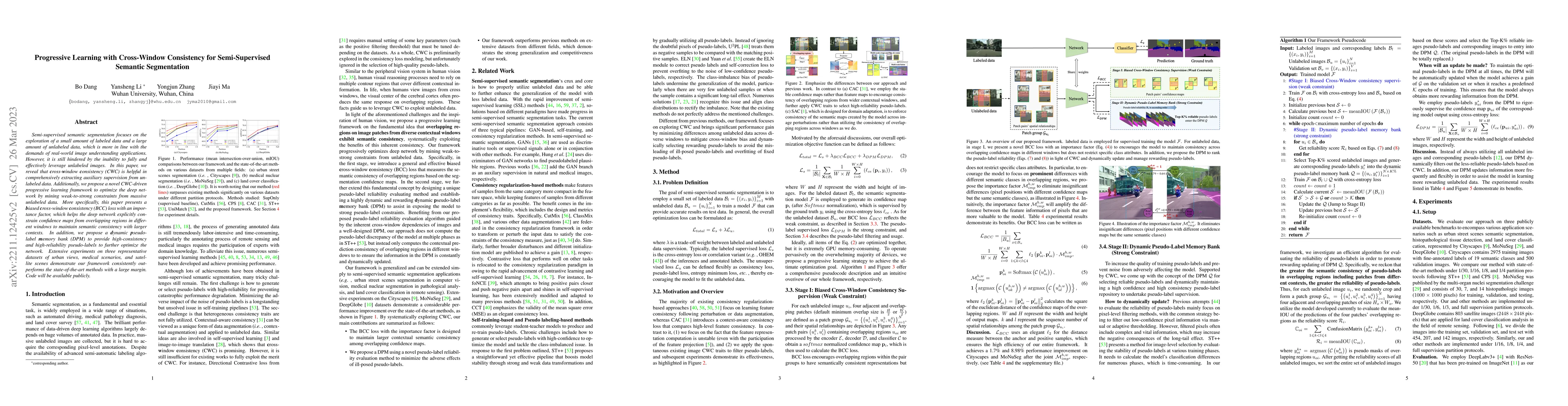
Semi-supervised semantic segmentation focuses on the exploration of a small amount of labeled data and a large amount of unlabeled data, which is more in line with the demands of real-world image un...
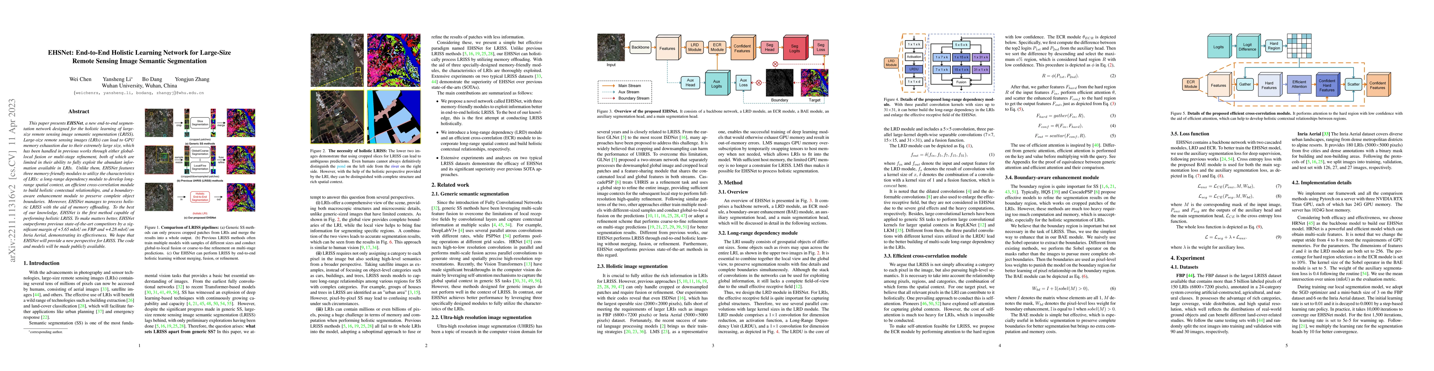
This paper presents EHSNet, a new end-to-end segmentation network designed for the holistic learning of large-size remote sensing image semantic segmentation (LRISS). Large-size remote sensing image...
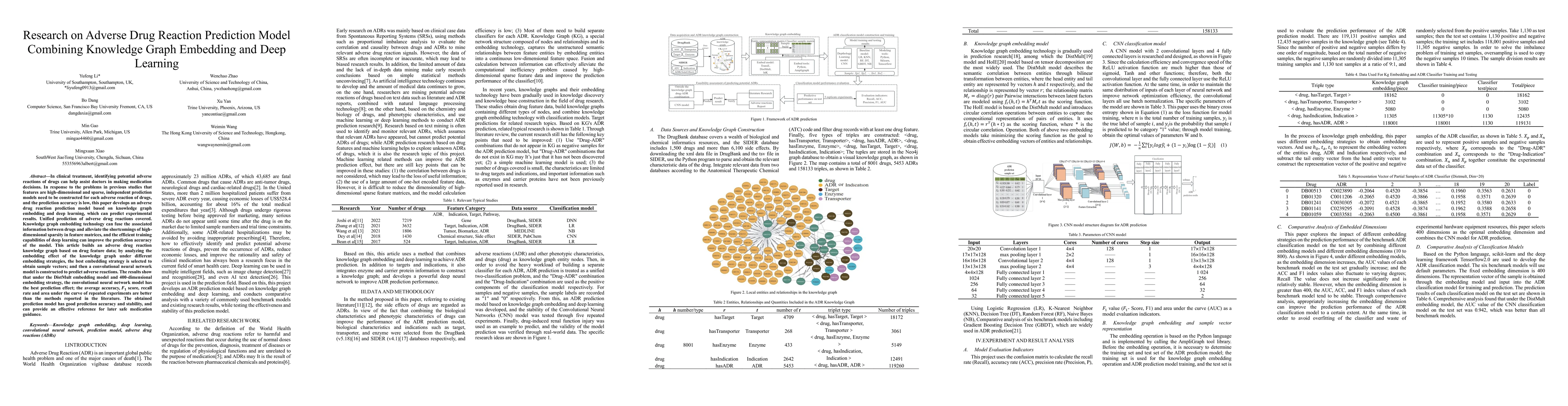
In clinical treatment, identifying potential adverse reactions of drugs can help assist doctors in making medication decisions. In response to the problems in previous studies that features are high-d...
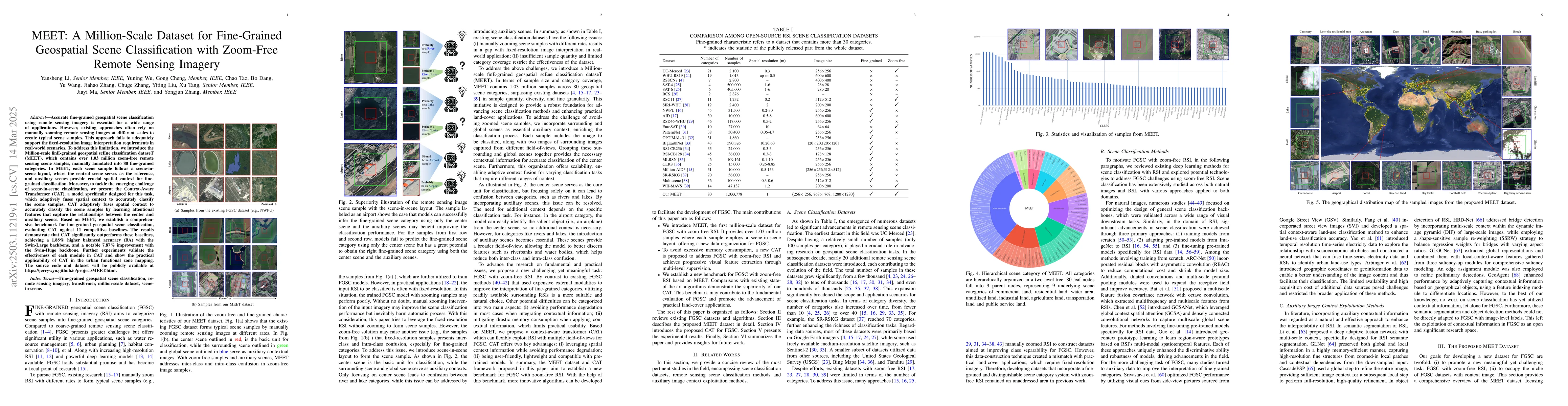
Accurate fine-grained geospatial scene classification using remote sensing imagery is essential for a wide range of applications. However, existing approaches often rely on manually zooming remote sen...
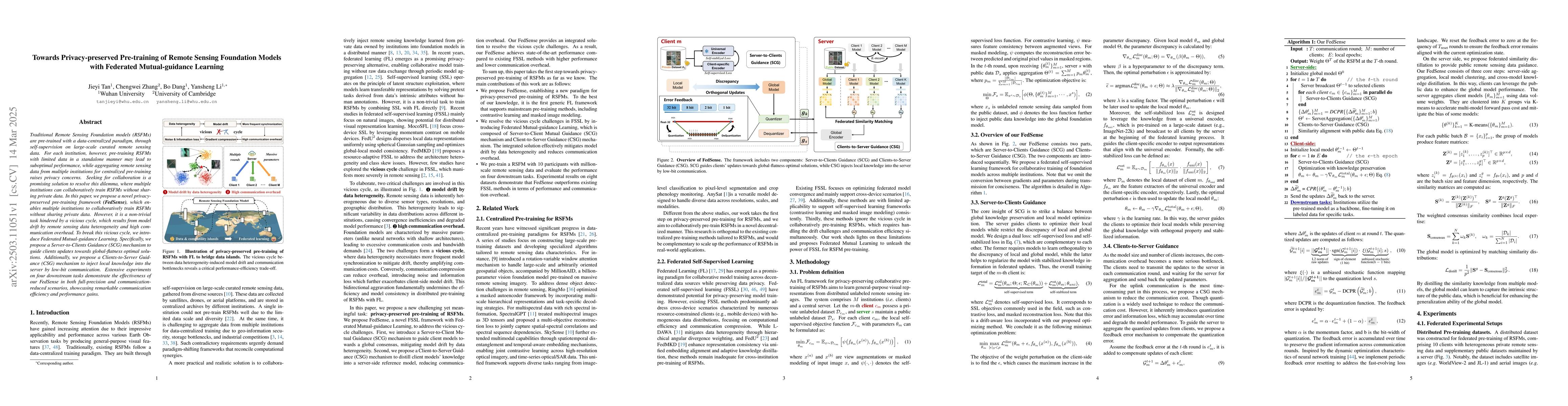
Traditional Remote Sensing Foundation models (RSFMs) are pre-trained with a data-centralized paradigm, through self-supervision on large-scale curated remote sensing data. For each institution, howeve...
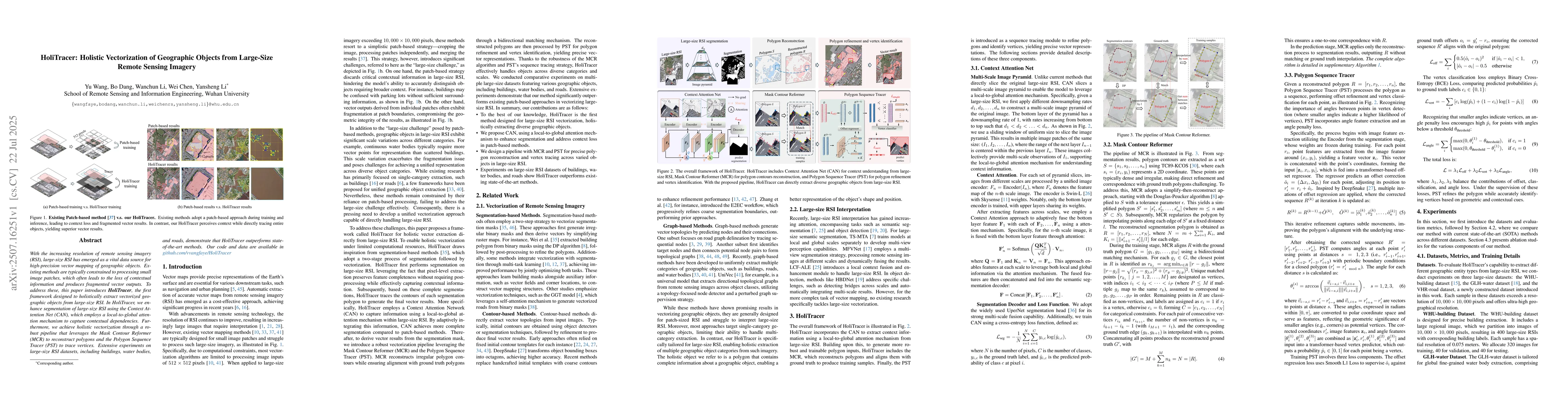
With the increasing resolution of remote sensing imagery (RSI), large-size RSI has emerged as a vital data source for high-precision vector mapping of geographic objects. Existing methods are typicall...
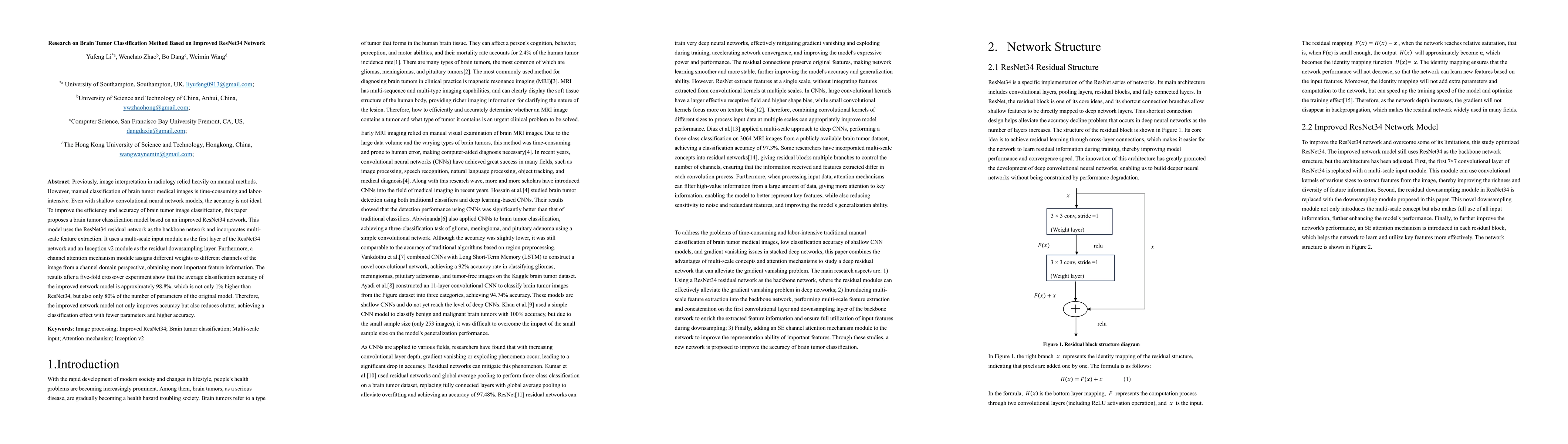
Previously, image interpretation in radiology relied heavily on manual methods. However, manual classification of brain tumor medical images is time-consuming and labor-intensive. Even with shallow co...