Bruno Adriano

5 papers on arXiv

Academic Profile

Name: B. Adriano
Total Papers: 2

Statistics

arXiv Papers 5
Total Publications 2

Papers on arXiv

Thumbnail for OpenEarthMap: A Benchmark Dataset for Global High-Resolution Land Cover
  Mapping

OpenEarthMap: A Benchmark Dataset for Global High-Resolution Land Cover Mapping

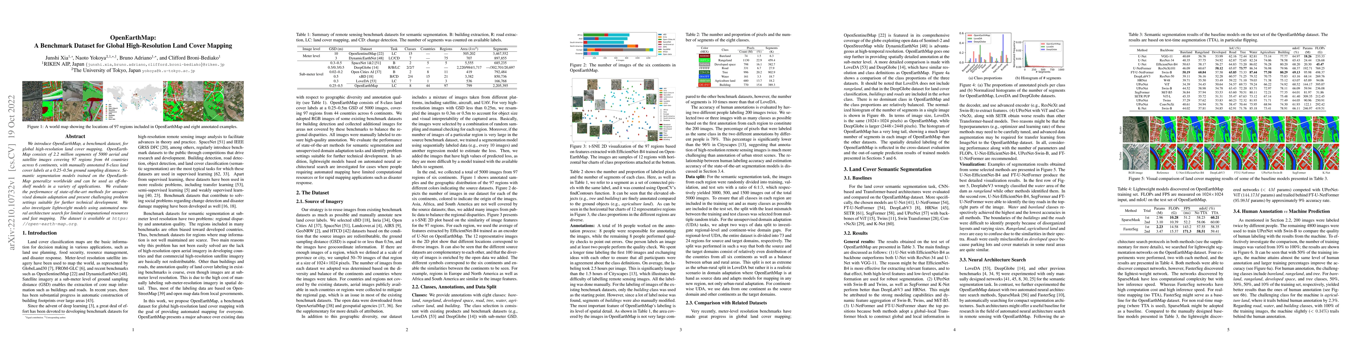
We introduce OpenEarthMap, a benchmark dataset, for global high-resolution land cover mapping. OpenEarthMap consists of 2.2 million segments of 5000 aerial and satellite images covering 97 regions f...

Thumbnail for Self-Supervised Learning for Building Damage Assessment from Large-scale
  xBD Satellite Imagery Benchmark Datasets

Self-Supervised Learning for Building Damage Assessment from Large-scale xBD Satellite Imagery Benchmark Datasets

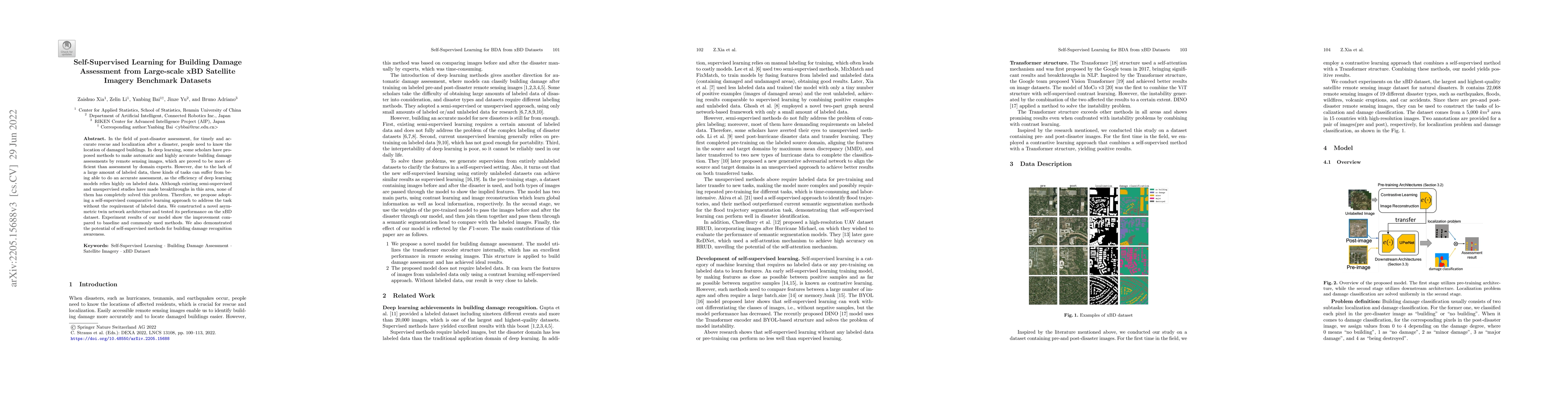
In the field of post-disaster assessment, for timely and accurate rescue and localization after a disaster, people need to know the location of damaged buildings. In deep learning, some scholars hav...

Thumbnail for Building Damage Mapping with Self-PositiveUnlabeled Learning

Building Damage Mapping with Self-PositiveUnlabeled Learning

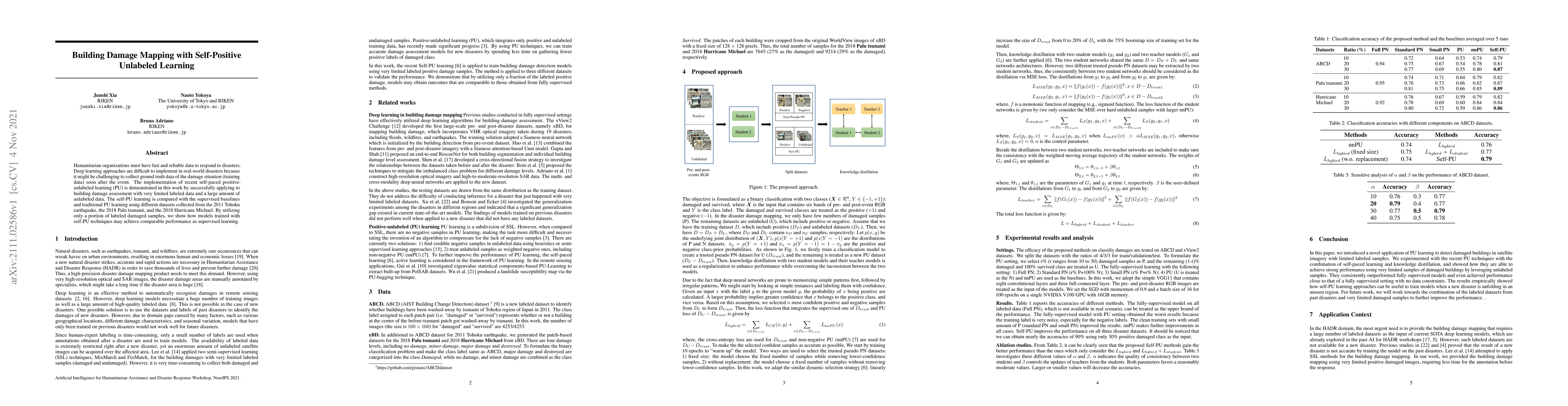
Humanitarian organizations must have fast and reliable data to respond to disasters. Deep learning approaches are difficult to implement in real-world disasters because it might be challenging to co...

Thumbnail for Learning from Multimodal and Multitemporal Earth Observation Data for
  Building Damage Mapping

Learning from Multimodal and Multitemporal Earth Observation Data for Building Damage Mapping

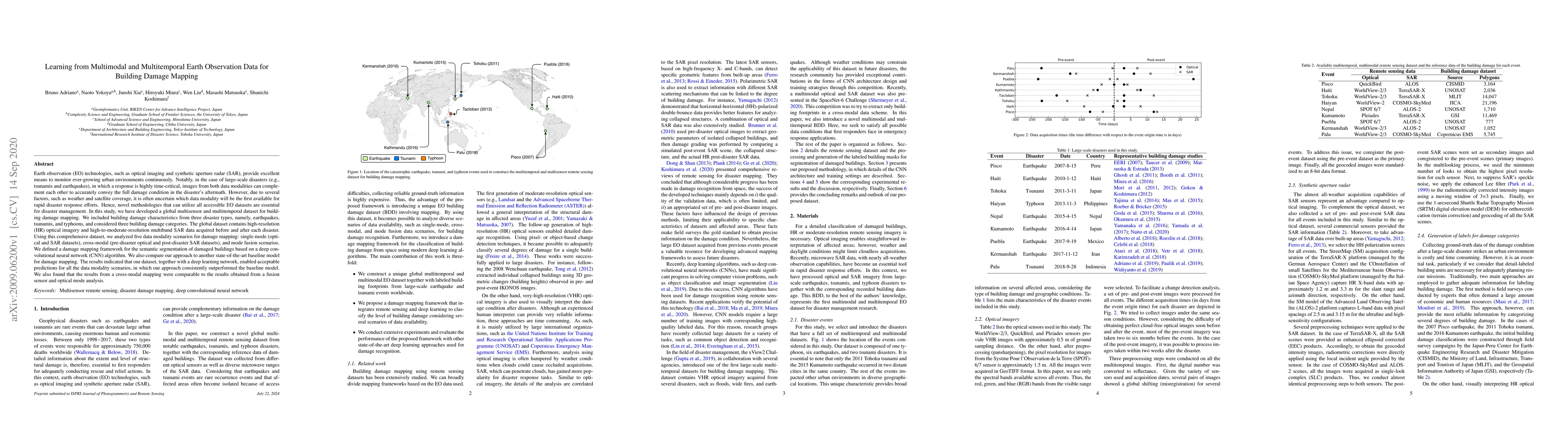
Earth observation technologies, such as optical imaging and synthetic aperture radar (SAR), provide excellent means to monitor ever-growing urban environments continuously. Notably, in the case of l...

Thumbnail for Breaking the Limits of Remote Sensing by Simulation and Deep Learning
  for Flood and Debris Flow Mapping

Breaking the Limits of Remote Sensing by Simulation and Deep Learning for Flood and Debris Flow Mapping

We propose a framework that estimates inundation depth (maximum water level) and debris-flow-induced topographic deformation from remote sensing imagery by integrating deep learning and numerical si...

This website uses cookies to ensure you get the best experience. Learn more