Academic Profile
Statistics
Similar Authors
Papers on arXiv
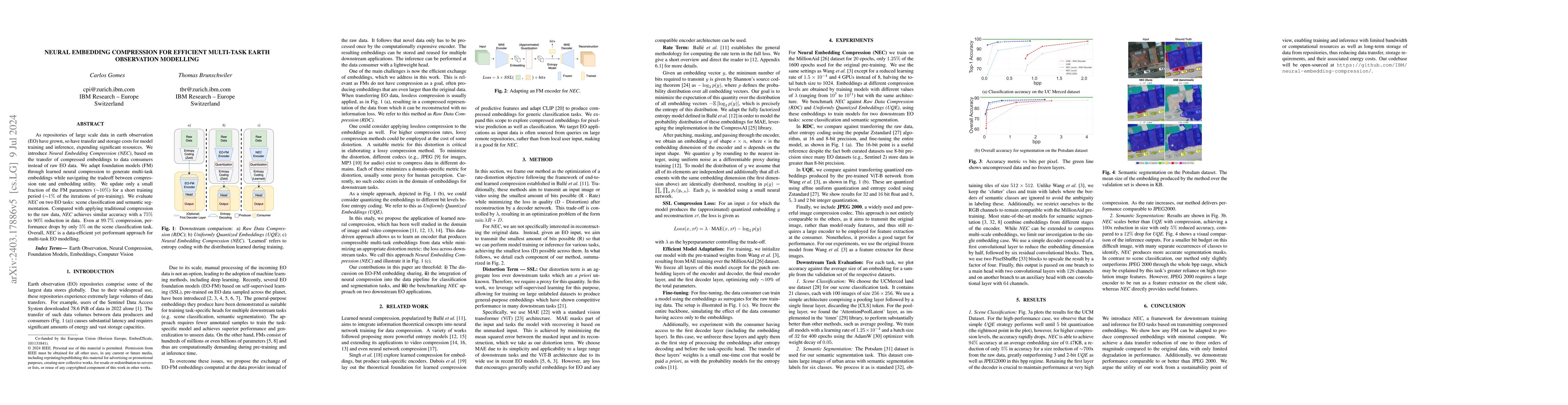
As repositories of large scale data in earth observation (EO) have grown, so have transfer and storage costs for model training and inference, expending significant resources. We introduce Neural Embe...
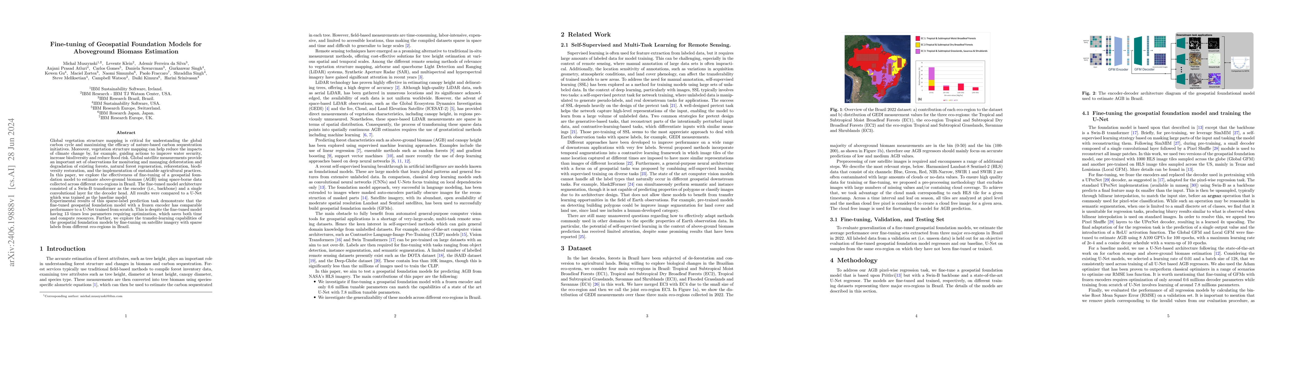
Global vegetation structure mapping is critical for understanding the global carbon cycle and maximizing the efficacy of nature-based carbon sequestration initiatives. Moreover, vegetation structure m...
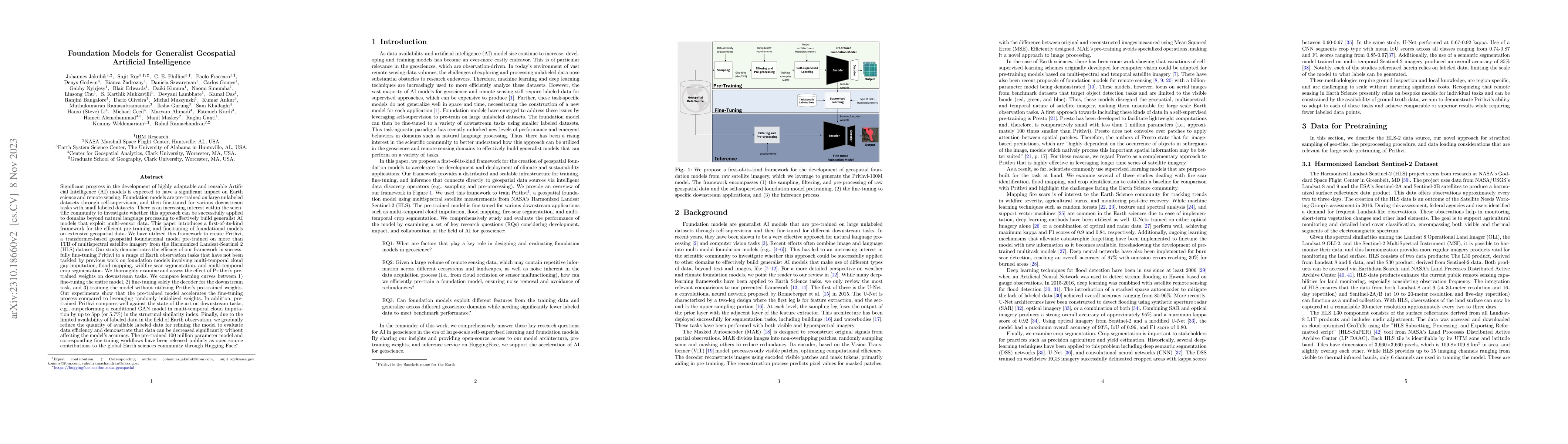
Significant progress in the development of highly adaptable and reusable Artificial Intelligence (AI) models is expected to have a significant impact on Earth science and remote sensing. Foundation ...
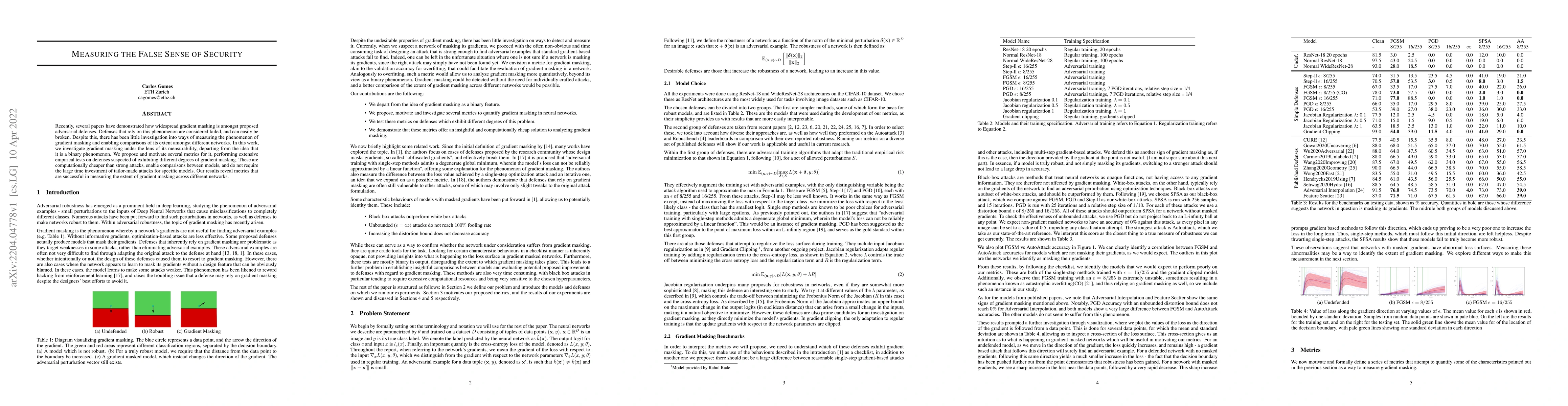
Recently, several papers have demonstrated how widespread gradient masking is amongst proposed adversarial defenses. Defenses that rely on this phenomenon are considered failed, and can easily be br...
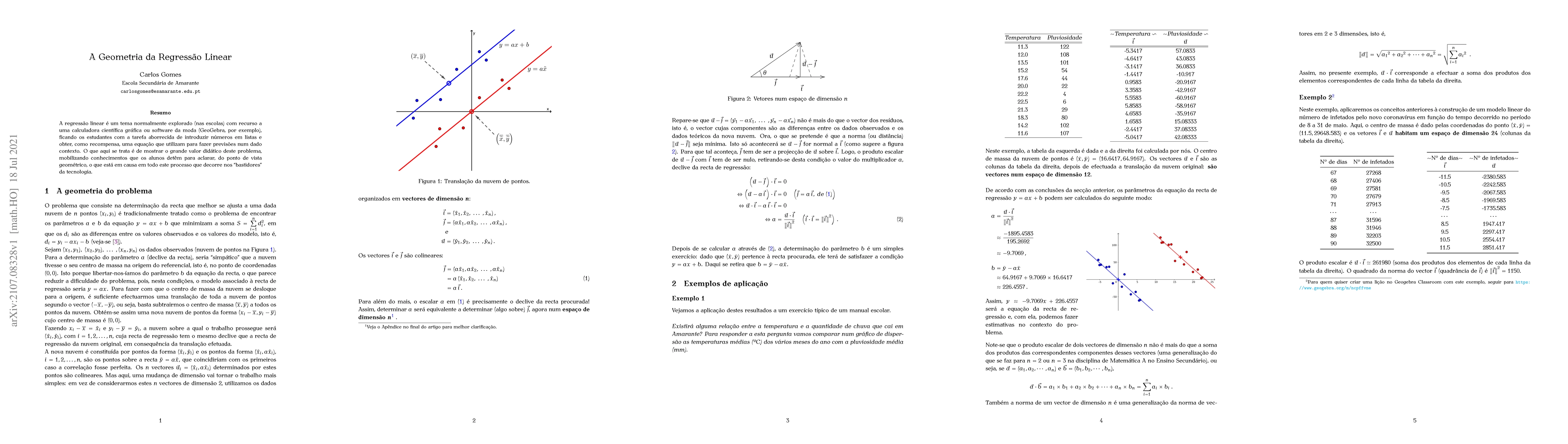
We present a geometrical interpretation of linear regression based on vectors in n dimensions (n the number of data points). This is to be used as a didactic tool for teachers when presenting that t...
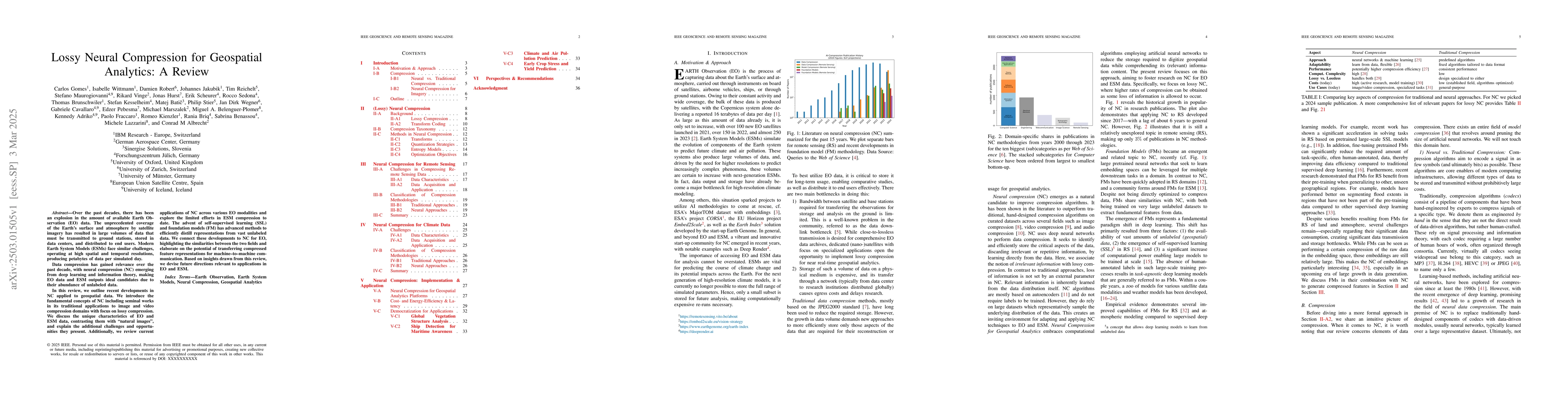
Over the past decades, there has been an explosion in the amount of available Earth Observation (EO) data. The unprecedented coverage of the Earth's surface and atmosphere by satellite imagery has res...
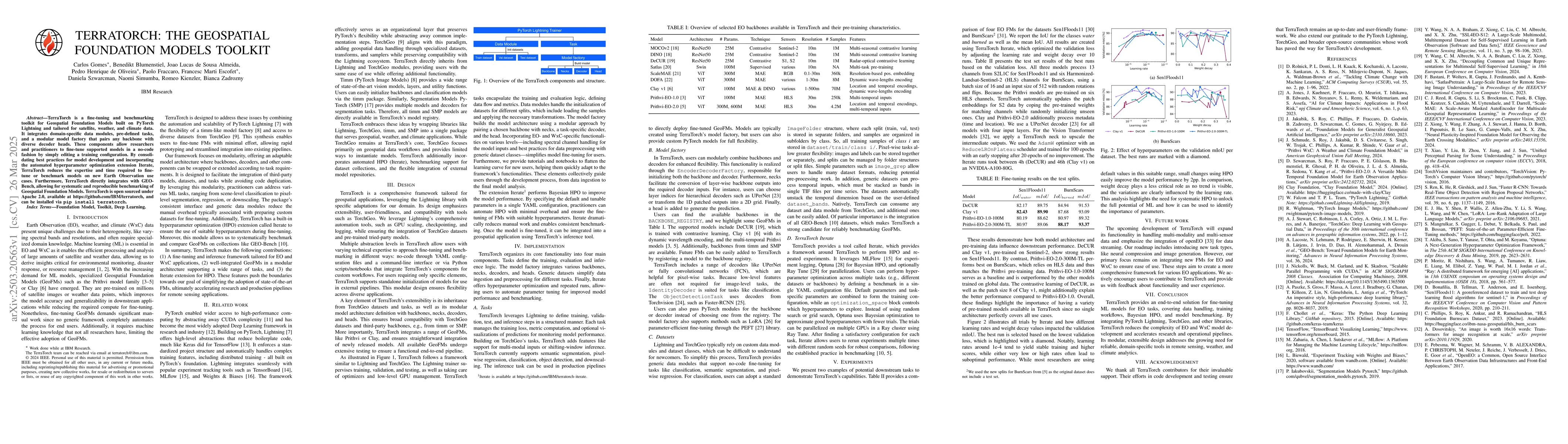
TerraTorch is a fine-tuning and benchmarking toolkit for Geospatial Foundation Models built on PyTorch Lightning and tailored for satellite, weather, and climate data. It integrates domain-specific da...