ArxivLens
C
Researcher

Casper Fibaek

5 papers on arXiv

5 arXiv Papers
4 Total Publications
Profile

Academic Profile

Name Casper Fibaek
Total Papers 4
Scholar Profile View on Semantic Scholar
Metrics

Statistics

5 arXiv Papers
4 Total Publications
Publications

Papers on arXiv

Thumbnail for Evaluating and Benchmarking Foundation Models for Earth Observation and
  Geospatial AI
arXiv
Evaluating and Benchmarking Foundation Models for Earth Observation and Geospatial AI

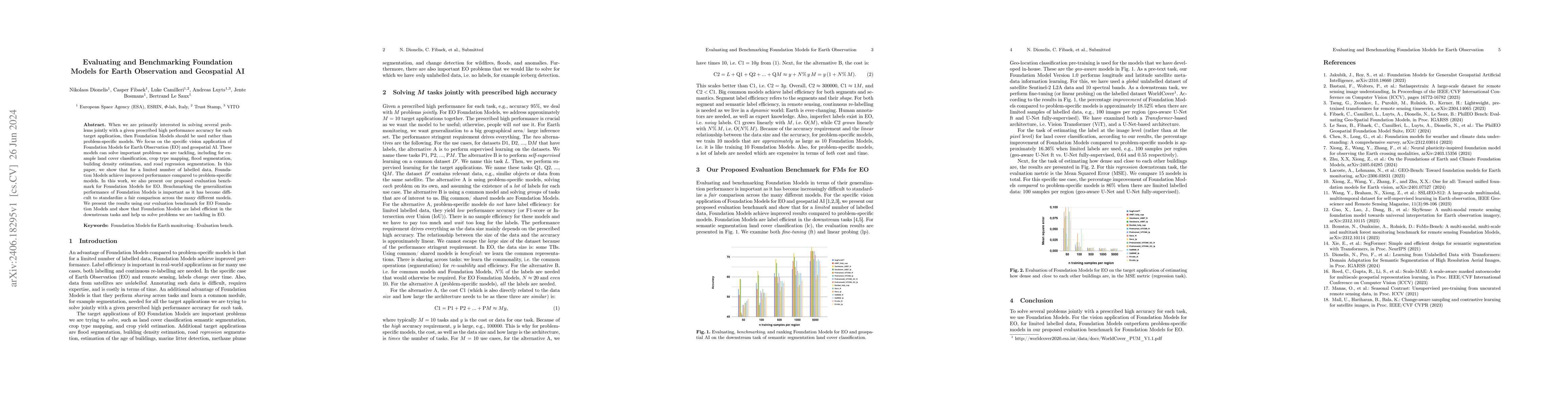
When we are primarily interested in solving several problems jointly with a given prescribed high performance accuracy for each target application, then Foundation Models should for most cases be used...

Thumbnail for PhilEO Bench: Evaluating Geo-Spatial Foundation Models
arXiv
PhilEO Bench: Evaluating Geo-Spatial Foundation Models

Massive amounts of unlabelled data are captured by Earth Observation (EO) satellites, with the Sentinel-2 constellation generating 1.6 TB of data daily. This makes Remote Sensing a data-rich domain ...

Thumbnail for Predicting Internet Connectivity in Schools: A Feasibility Study
  Leveraging Multi-modal Data and Location Encoders in Low-Resource Settings
arXiv
Predicting Internet Connectivity in Schools: A Feasibility Study Leveraging Multi-modal Data and Location Encoders in Low-Resource Settings

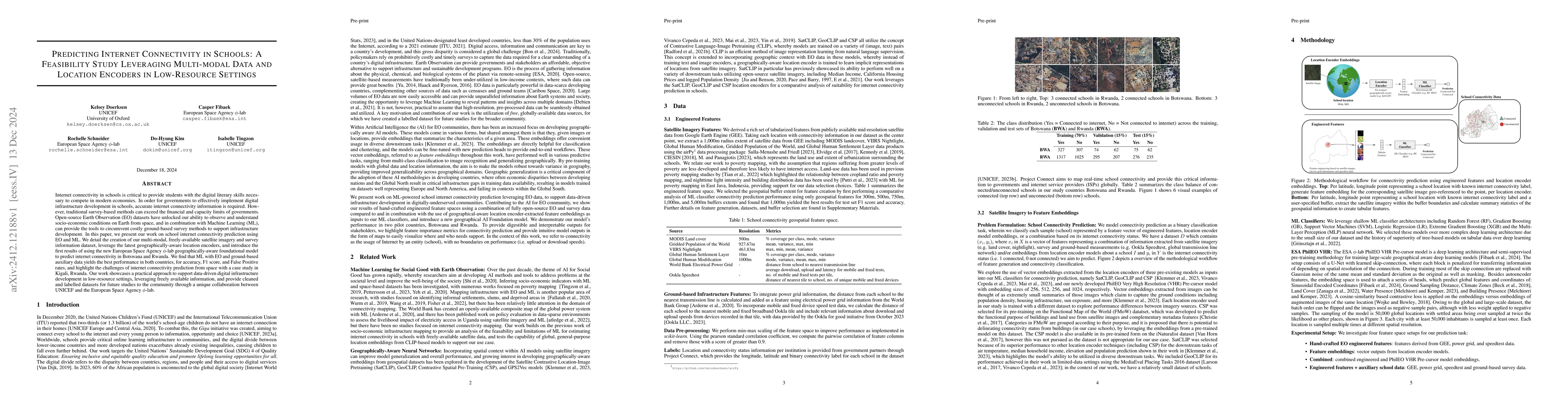
Internet connectivity in schools is critical to provide students with the digital literary skills necessary to compete in modern economies. In order for governments to effectively implement digital in...

Thumbnail for Scaling-Up the Pretraining of the Earth Observation Foundation Model
  PhilEO to the MajorTOM Dataset
arXiv
Scaling-Up the Pretraining of the Earth Observation Foundation Model PhilEO to the MajorTOM Dataset

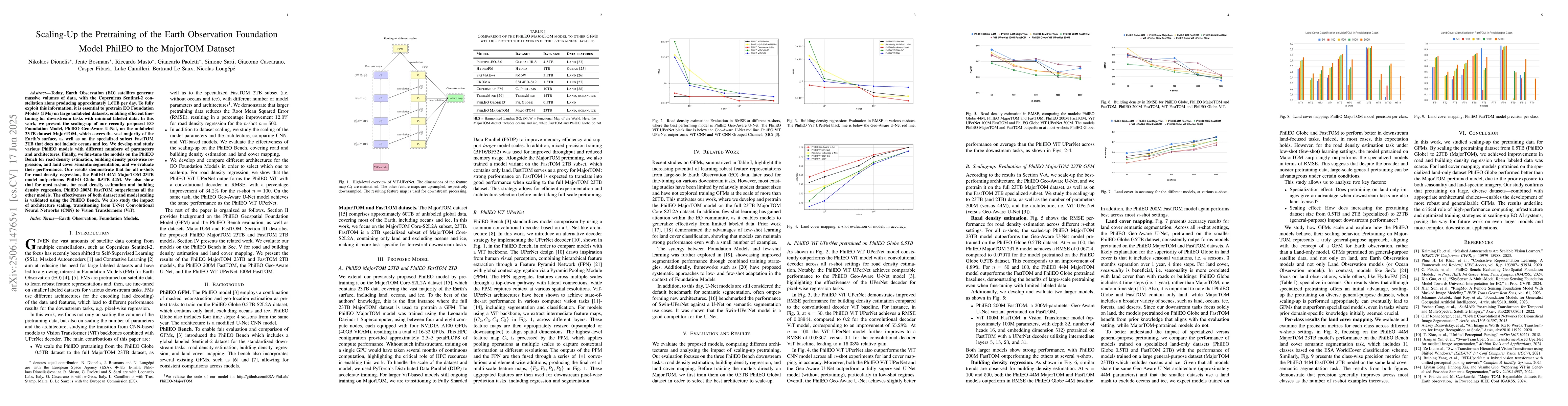
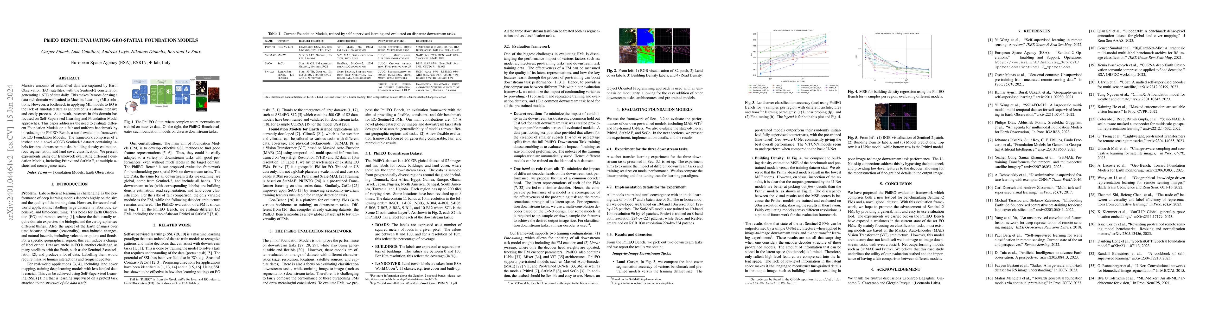
Today, Earth Observation (EO) satellites generate massive volumes of data, with the Copernicus Sentinel-2 constellation alone producing approximately 1.6TB per day. To fully exploit this information, ...

Thumbnail for A Multi-tiered Human-in-the-loop Approach for Interactive School Mapping
  Using Earth Observation and Machine Learning
arXiv
A Multi-tiered Human-in-the-loop Approach for Interactive School Mapping Using Earth Observation and Machine Learning

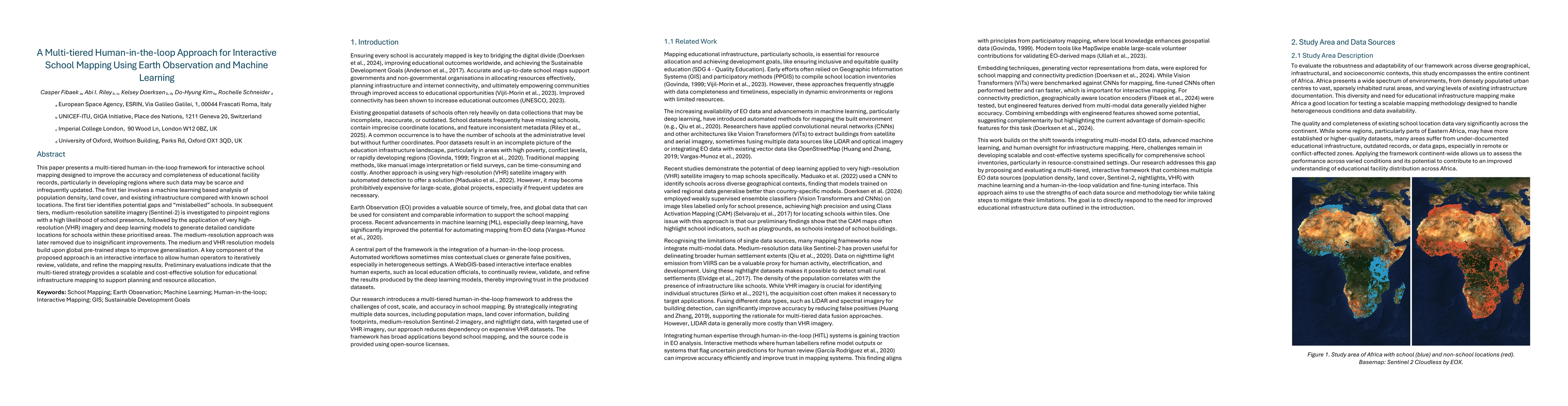
This paper presents a multi-tiered human-in-the-loop framework for interactive school mapping designed to improve the accuracy and completeness of educational facility records, particularly in develop...

This website uses cookies to ensure you get the best experience. Learn more