Academic Profile
Statistics
Similar Authors
Papers on arXiv
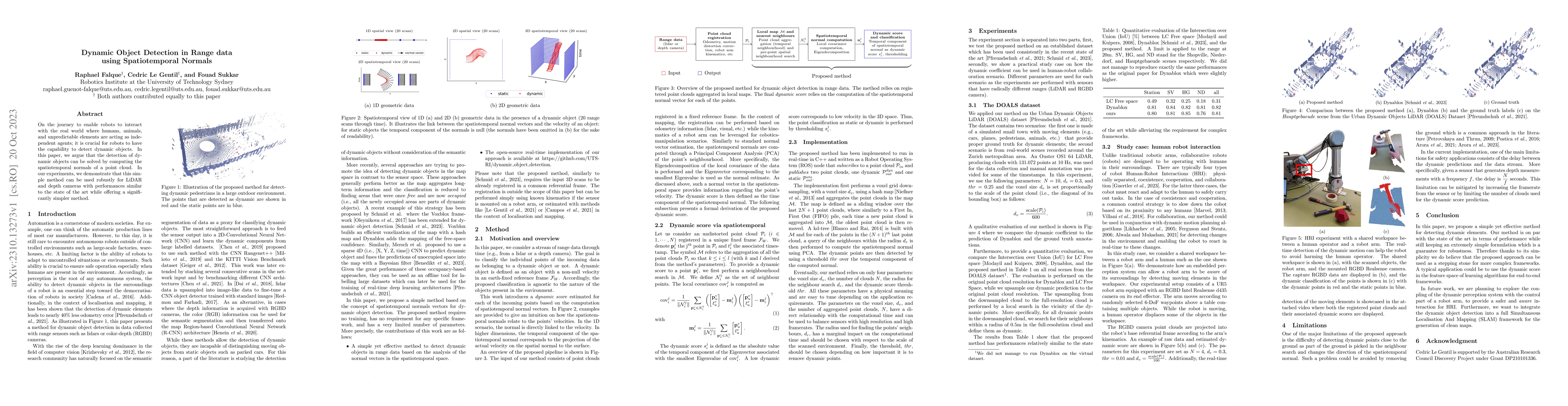
On the journey to enable robots to interact with the real world where humans, animals, and unpredictable elements are acting as independent agents; it is crucial for robots to have the capability to...
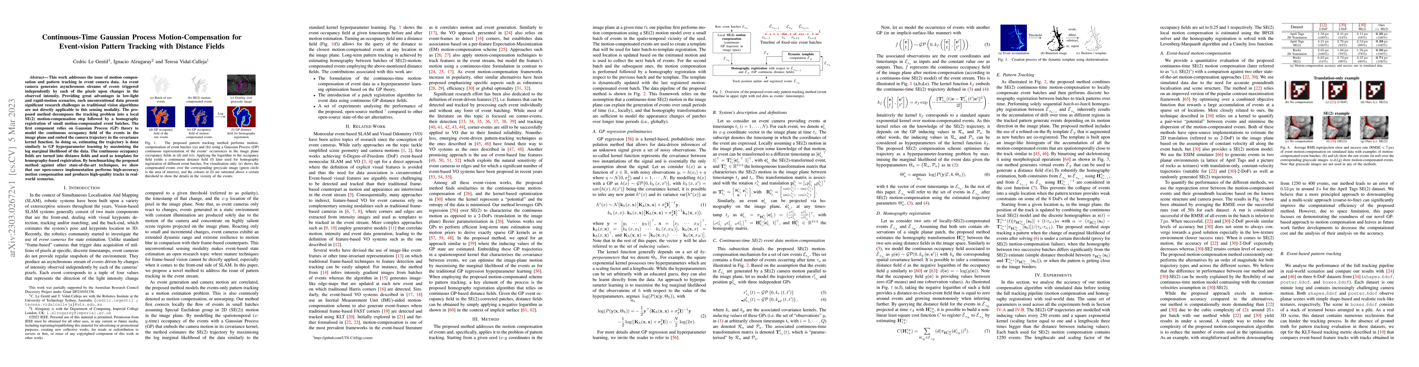
This work addresses the issue of motion compensation and pattern tracking in event camera data. An event camera generates asynchronous streams of events triggered independently by each of the pixels...
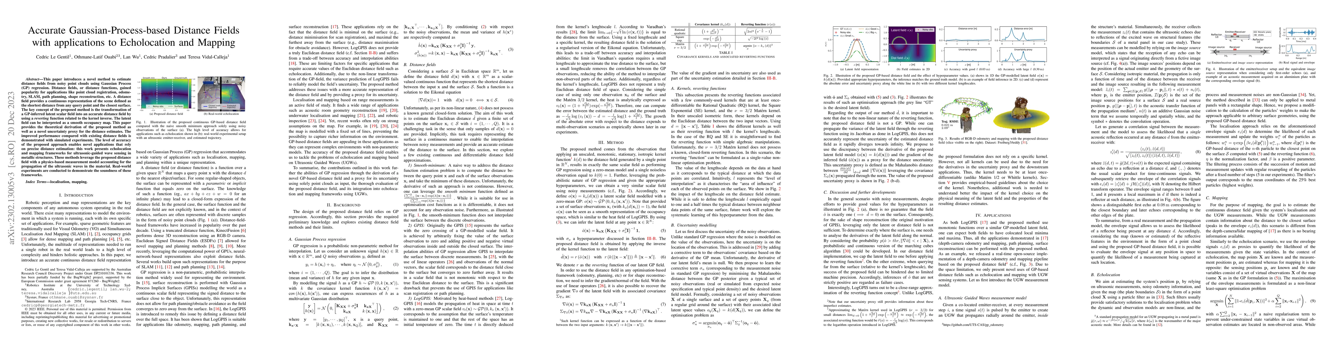
This paper introduces a novel method to estimate distance fields from noisy point clouds using Gaussian Process (GP) regression. Distance fields, or distance functions, gained popularity for applica...
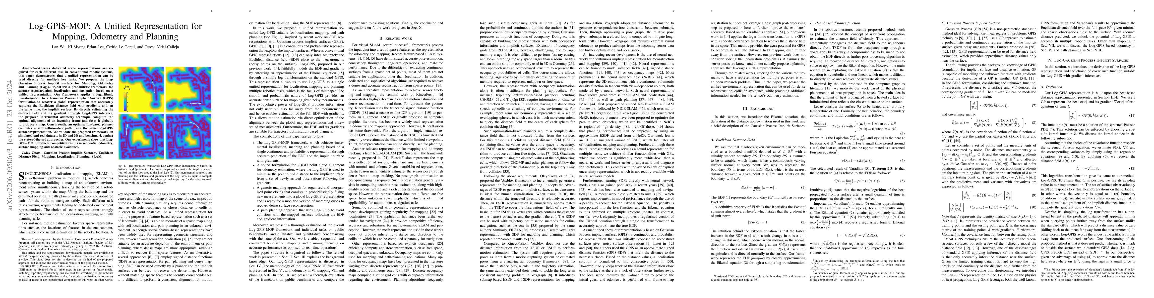
Whereas dedicated scene representations are required for each different task in conventional robotic systems, this paper demonstrates that a unified representation can be used directly for multiple ...
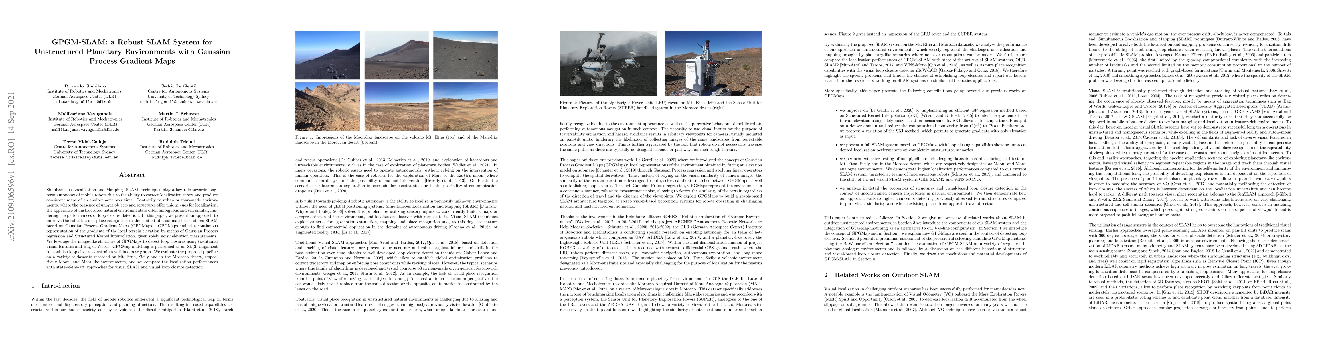
Simultaneous Localization and Mapping (SLAM) techniques play a key role towards long-term autonomy of mobile robots due to the ability to correct localization errors and produce consistent maps of a...
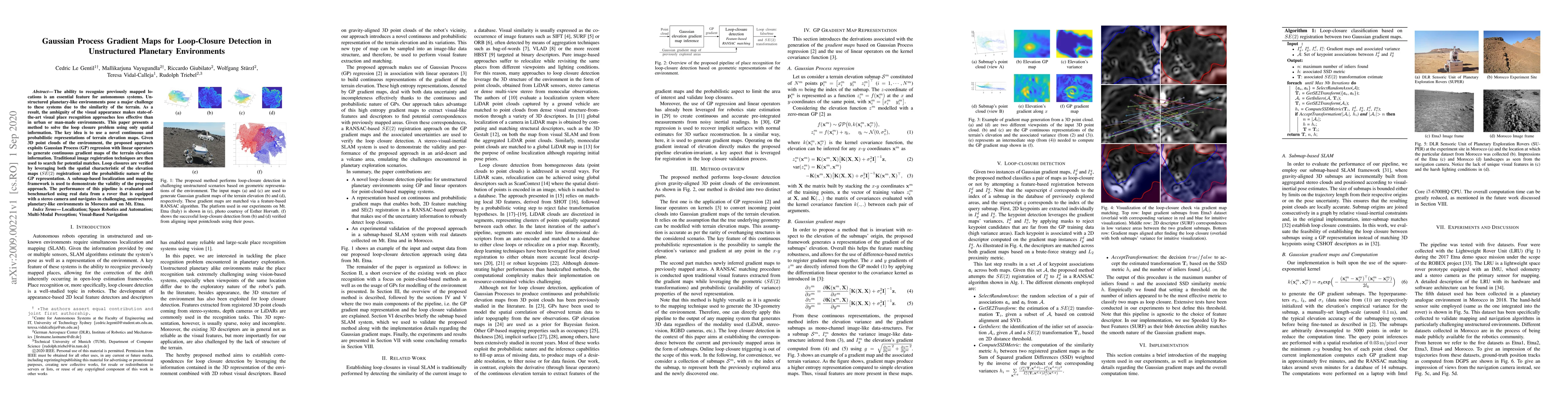
The ability to recognize previously mapped locations is an essential feature for autonomous systems. Unstructured planetary-like environments pose a major challenge to these systems due to the simil...
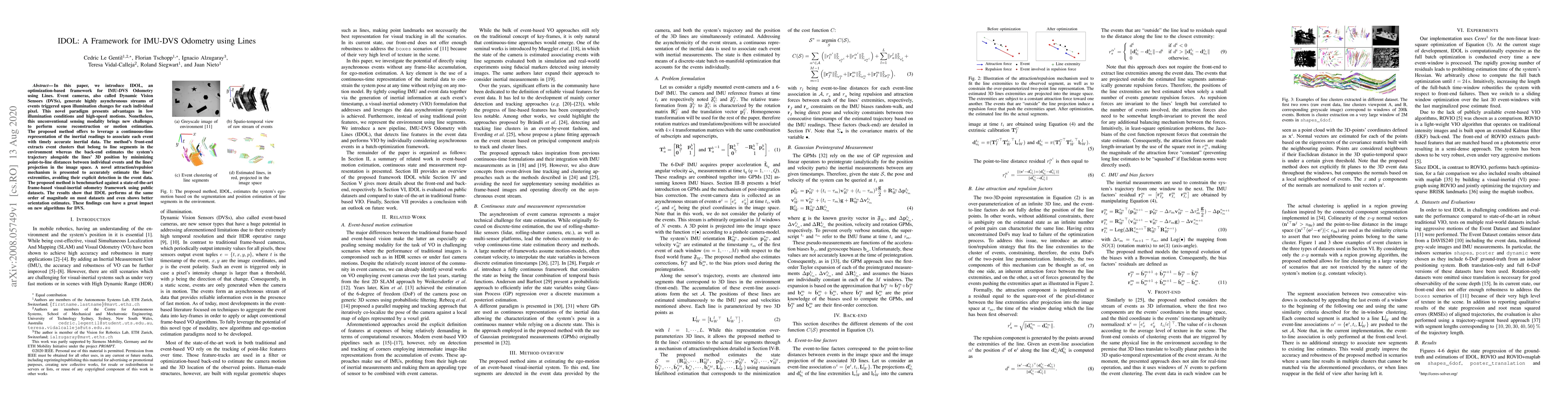
In this paper, we introduce IDOL, an optimization-based framework for IMU-DVS Odometry using Lines. Event cameras, also called Dynamic Vision Sensors (DVSs), generate highly asynchronous streams of ...
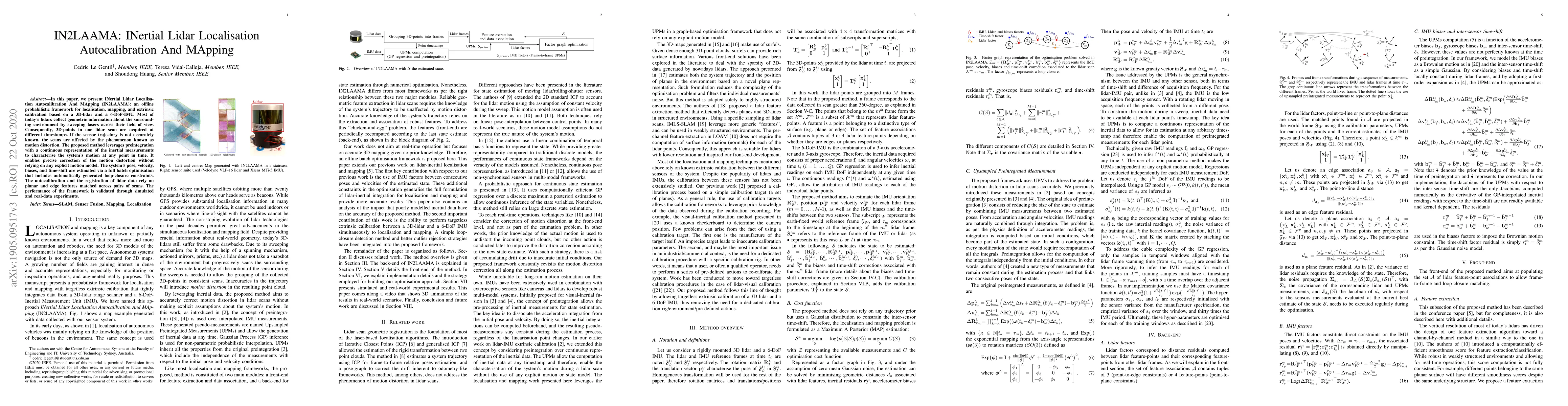
In this paper, we present INertial Lidar Localisation Autocalibration And MApping (IN2LAAMA): an offline probabilistic framework for localisation, mapping, and extrinsic calibration based on a 3D-li...
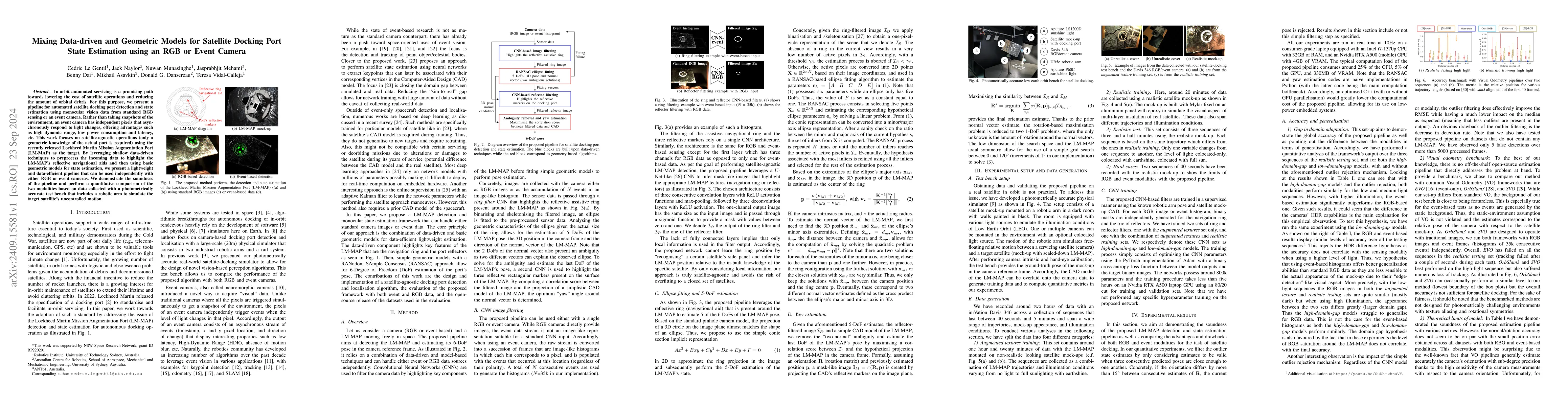
In-orbit automated servicing is a promising path towards lowering the cost of satellite operations and reducing the amount of orbital debris. For this purpose, we present a pipeline for automated sate...
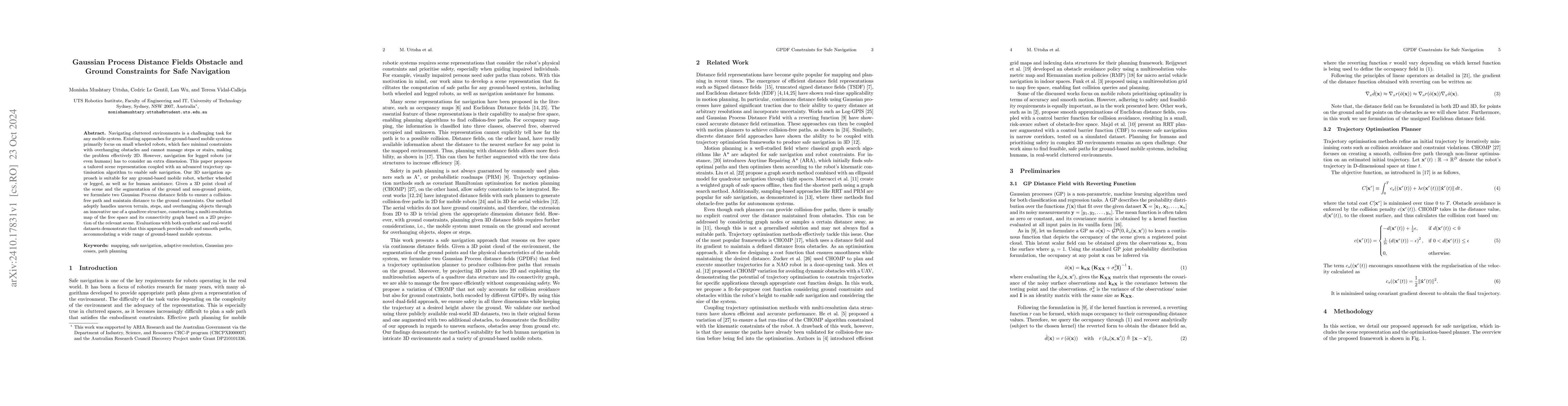
Navigating cluttered environments is a challenging task for any mobile system. Existing approaches for ground-based mobile systems primarily focus on small wheeled robots, which face minimal constrain...
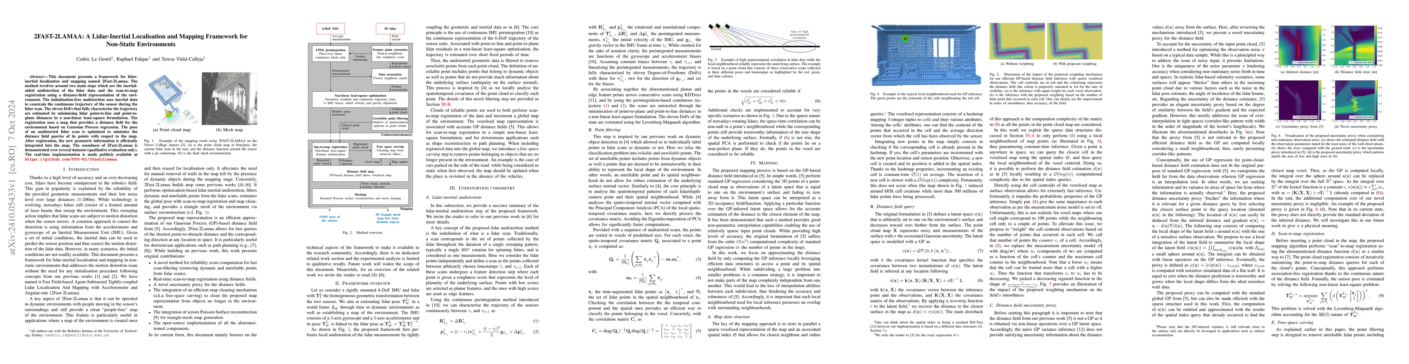
This document presents a framework for lidar-inertial localisation and mapping named 2Fast-2Lamaa. The method revolves around two main steps which are the inertial-aided undistortion of the lidar data...
Over the past decade, lidars have become a cornerstone of robotics state estimation and perception thanks to their ability to provide accurate geometric information about their surroundings in the for...
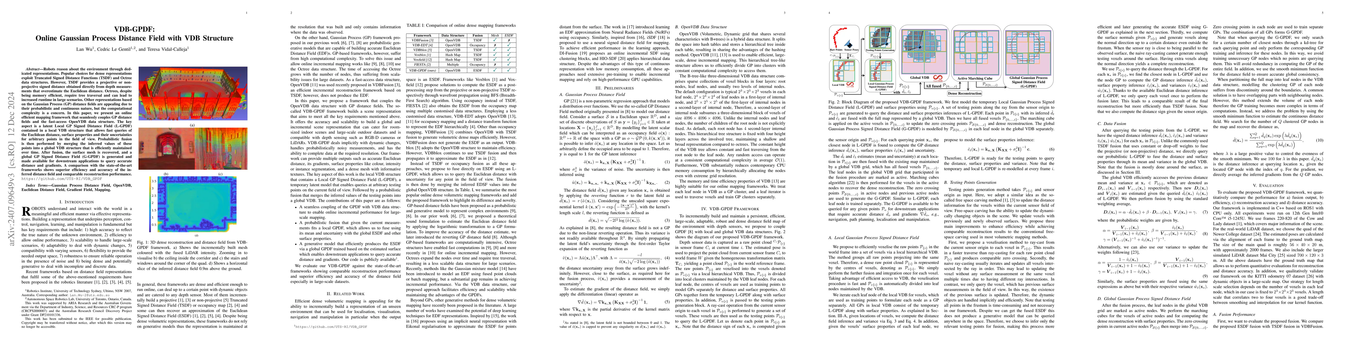
Robots reason about the environment through dedicated representations. Popular choices for dense representations exploit Truncated Signed Distance Functions (TSDF) and Octree data structures. However,...
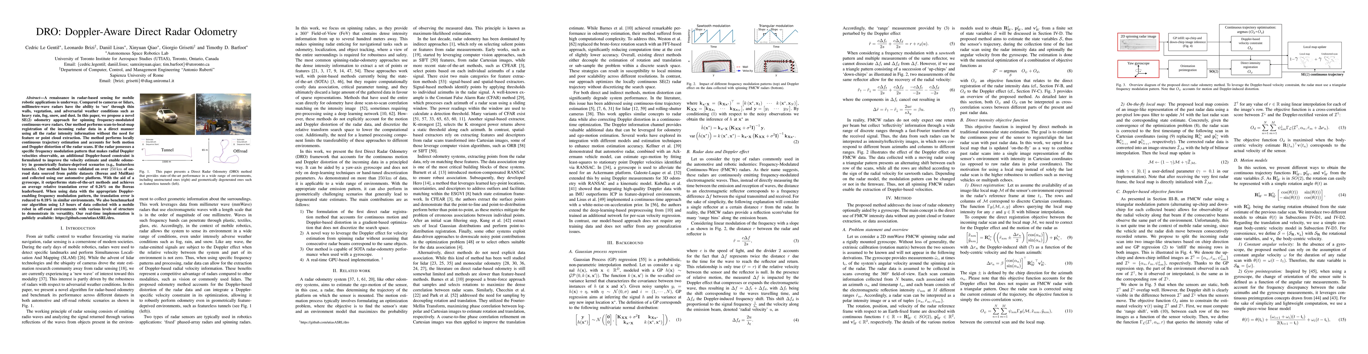
A renaissance in radar-based sensing for mobile robotic applications is underway. Compared to cameras or lidars, millimetre-wave radars have the ability to `see' through thin walls, vegetation, and ad...
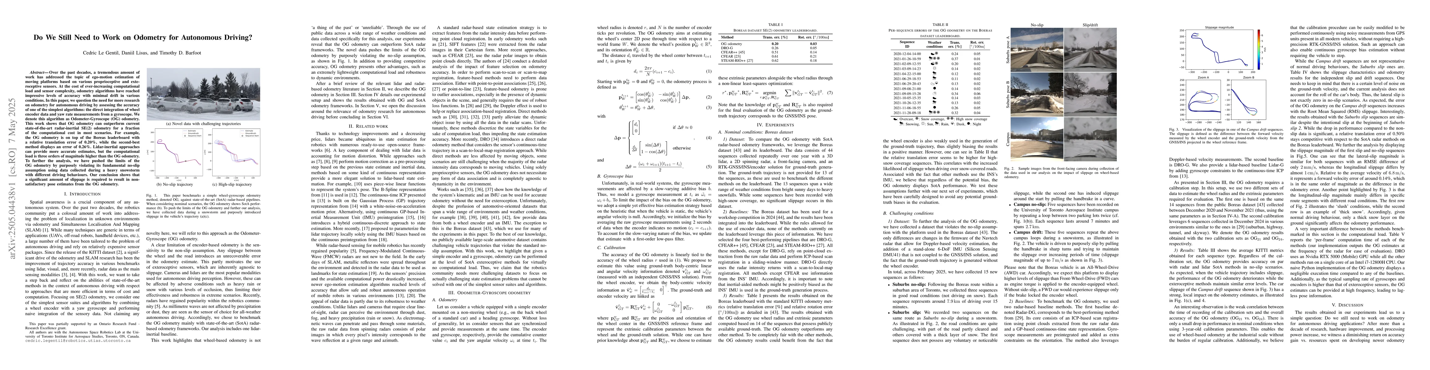
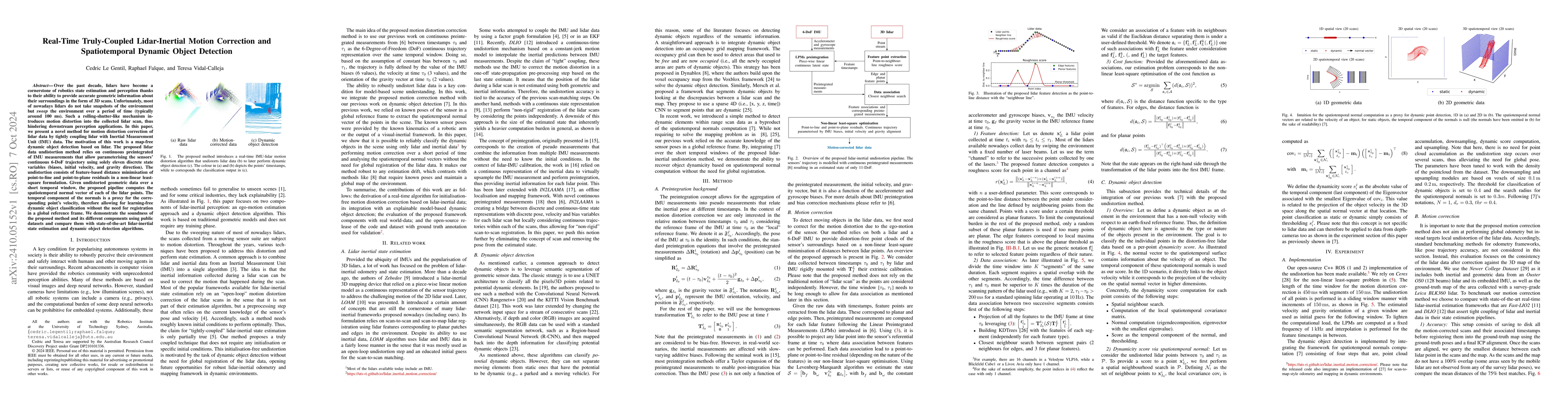
Over the past decades, a tremendous amount of work has addressed the topic of ego-motion estimation of moving platforms based on various proprioceptive and exteroceptive sensors. At the cost of ever-i...
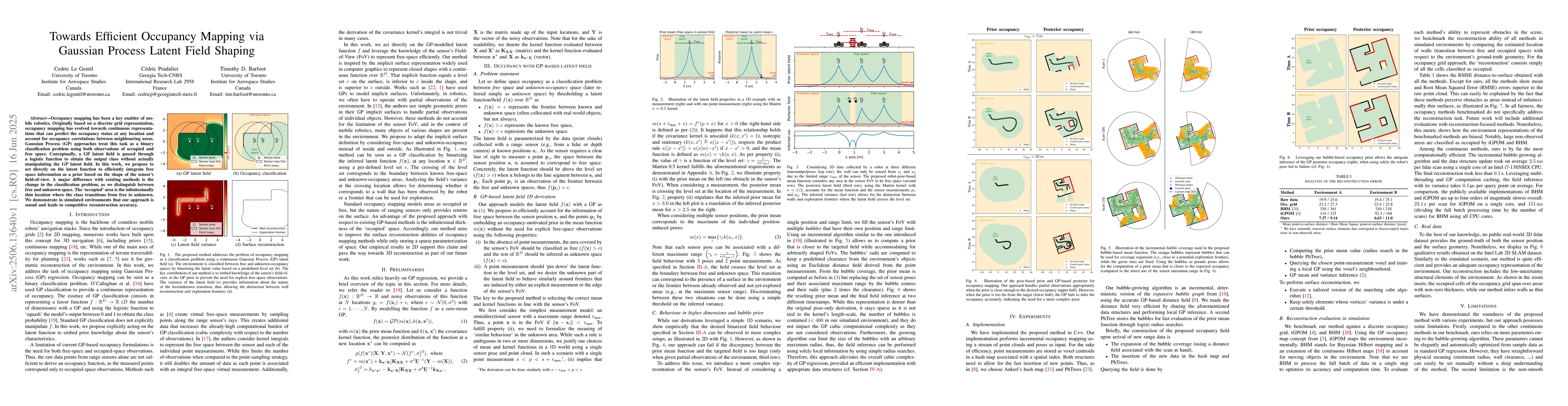
Occupancy mapping has been a key enabler of mobile robotics. Originally based on a discrete grid representation, occupancy mapping has evolved towards continuous representations that can predict the o...
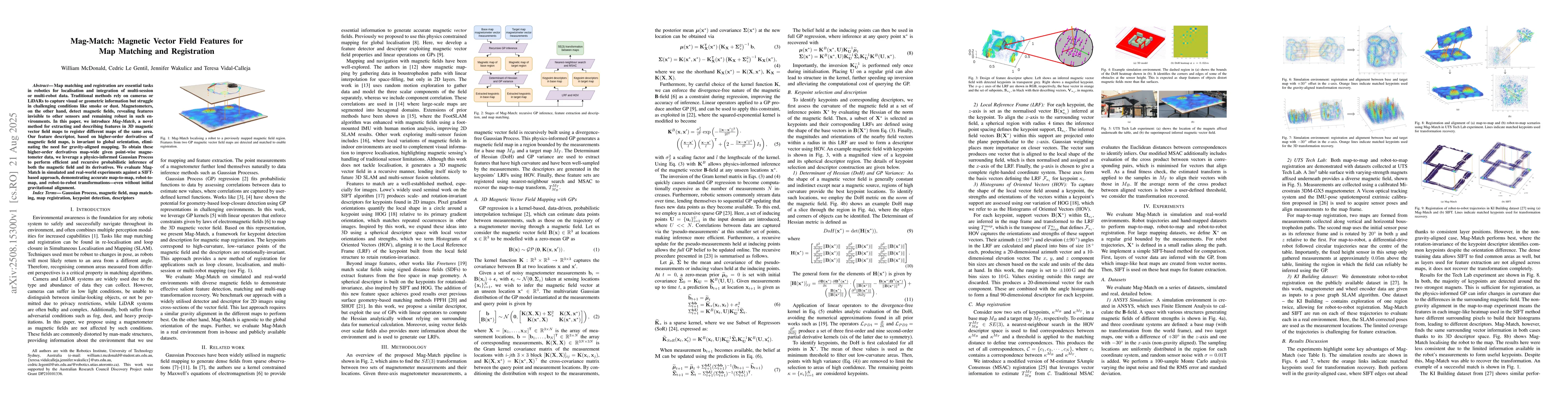
Map matching and registration are essential tasks in robotics for localisation and integration of multi-session or multi-robot data. Traditional methods rely on cameras or LiDARs to capture visual or ...
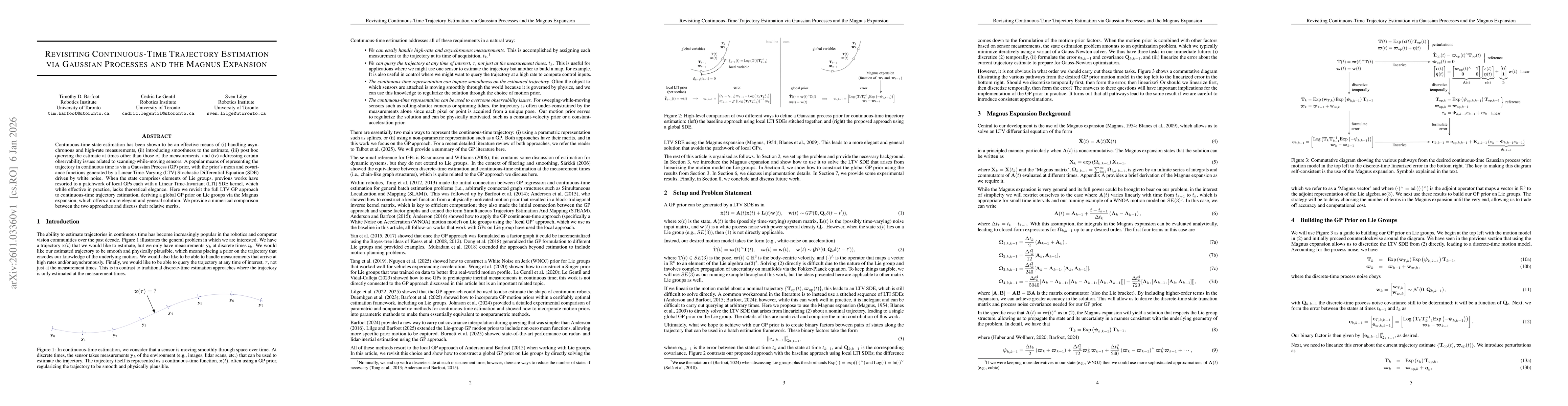
Continuous-time state estimation has been shown to be an effective means of (i) handling asynchronous and high-rate measurements, (ii) introducing smoothness to the estimate, (iii) post hoc querying t...
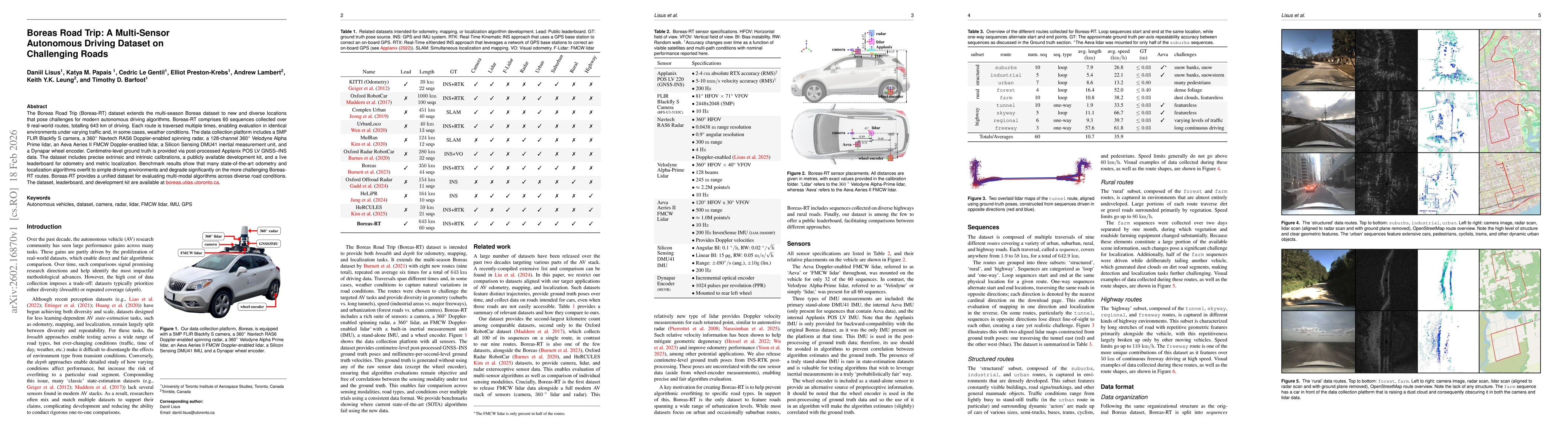
The Boreas Road Trip (Boreas-RT) dataset extends the multi-season Boreas dataset to new and diverse locations that pose challenges for modern autonomous driving algorithms. Boreas-RT comprises 60 sequ...
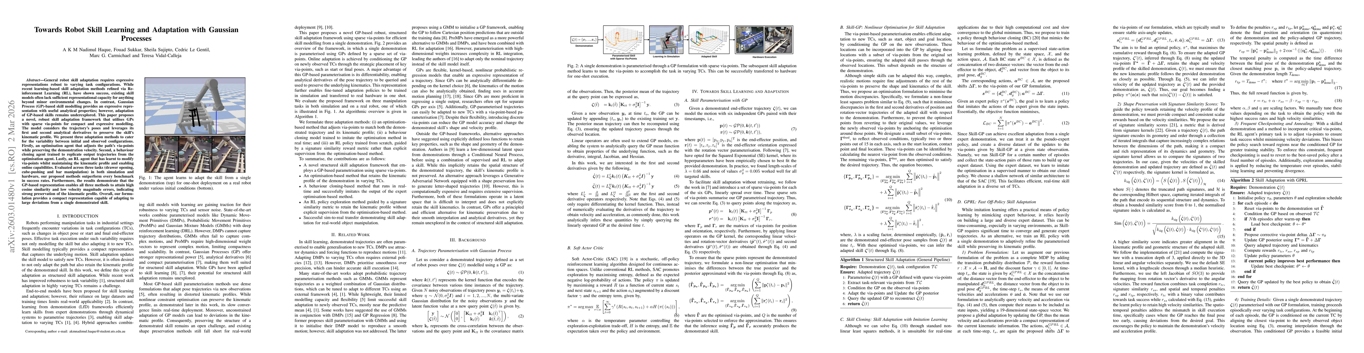
General robot skill adaptation requires expressive representations robust to varying task configurations. While recent learning-based skill adaptation methods refined via Reinforcement Learning (RL), ...
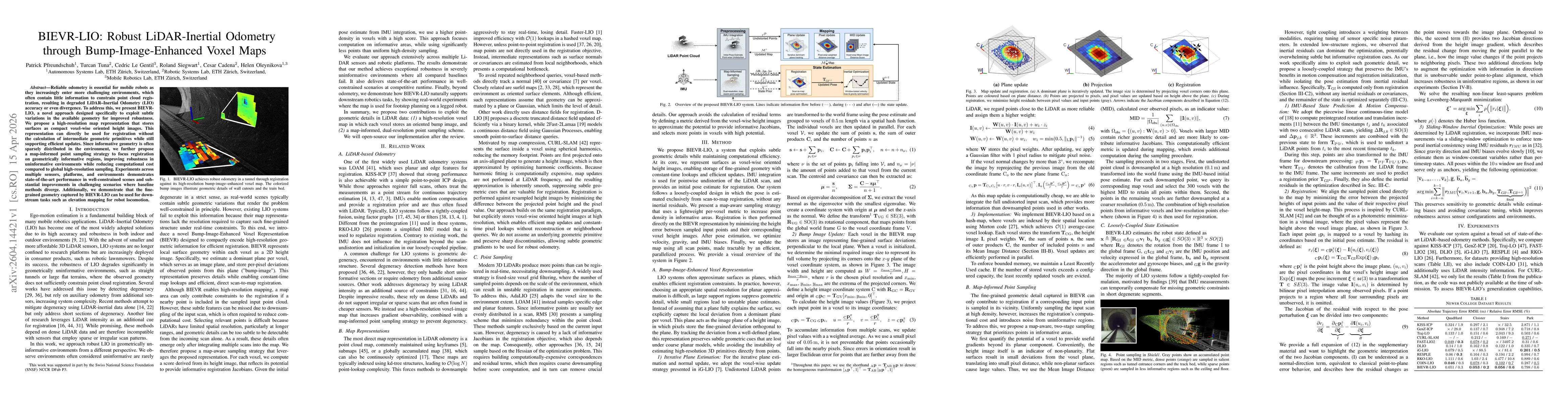
Reliable odometry is essential for mobile robots as they increasingly enter more challenging environments, which often contain little information to constrain point cloud registration, resulting in de...
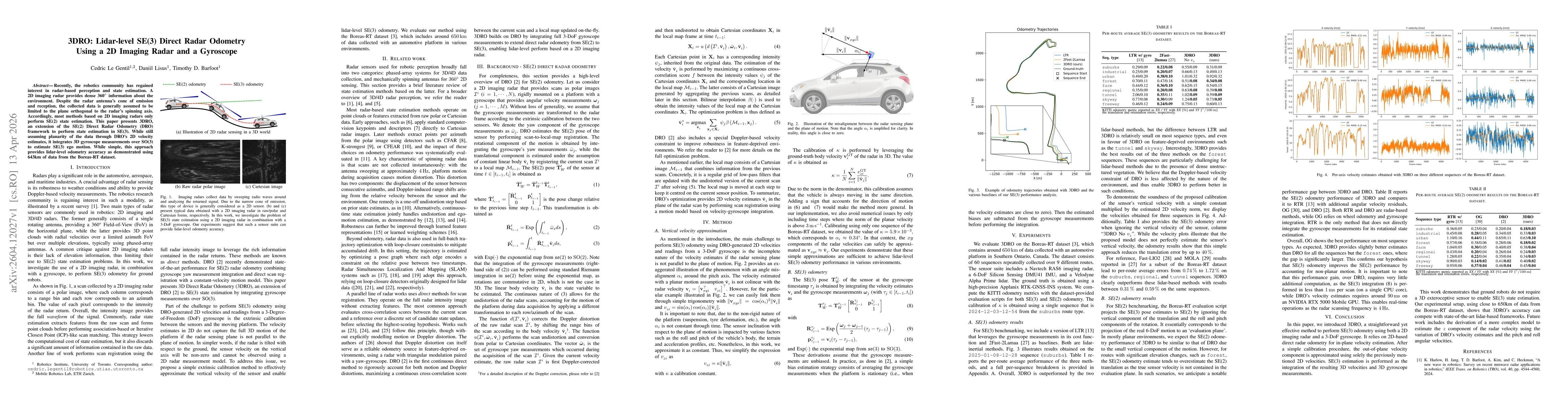
Recently, the robotics community has regained interest in radar-based perception and state estimation. A 2D imaging radar provides dense 360deg information about the environment. Despite the radar ant...
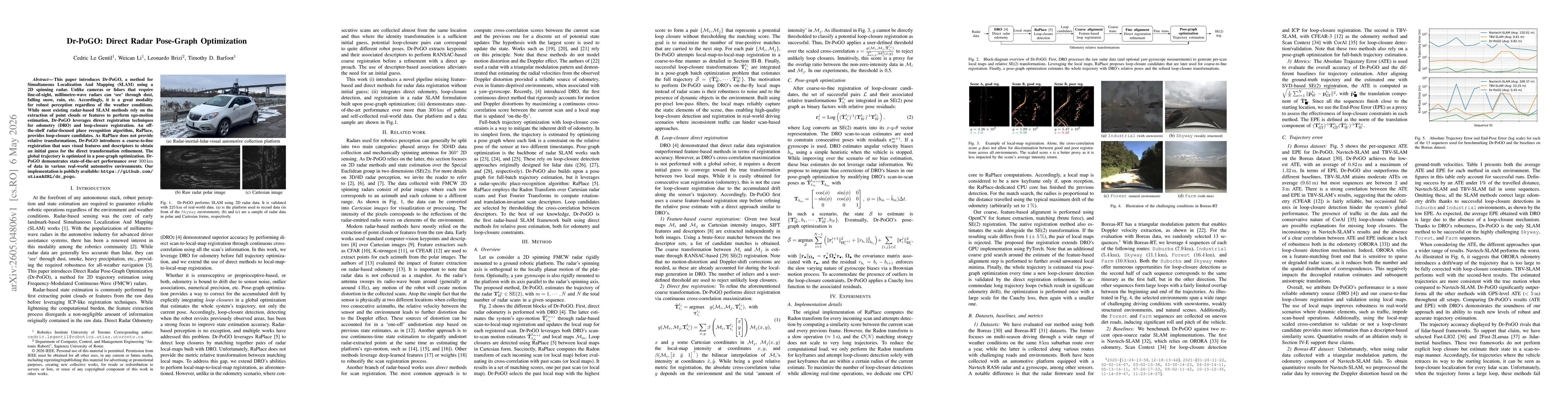
This paper introduces Dr-PoGO, a method for Simultaneous Localization And Mapping (SLAM) using a 2D spinning radar. Unlike cameras or lidars that require line-of-sight, millimetre-wave radars can `see...
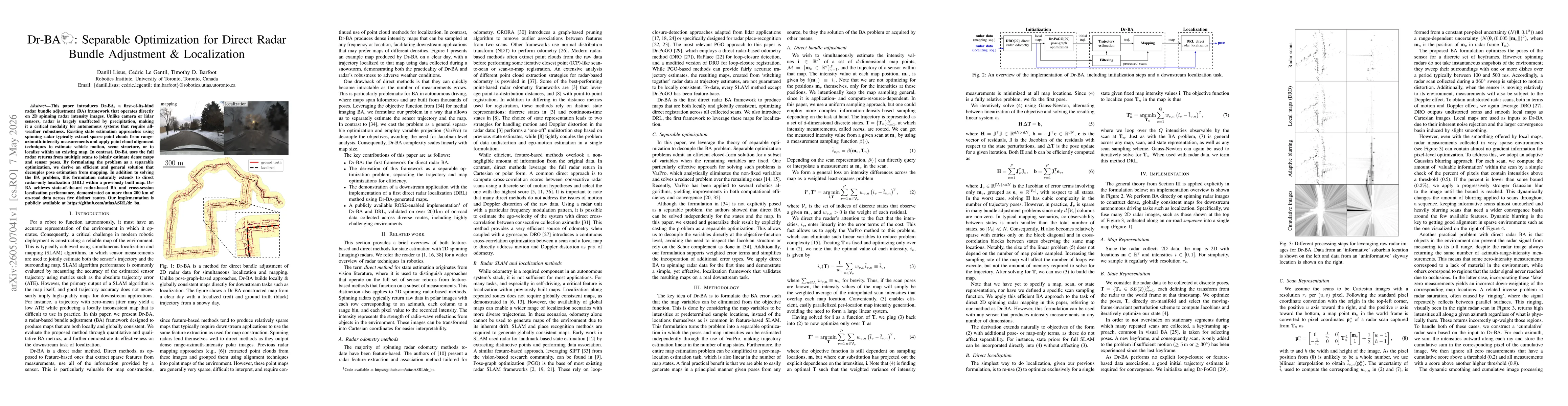
This paper introduces Dr-BA, a first-of-its-kind radar bundle adjustment (BA) framework that operates directly on 2D spinning radar intensity images. Unlike camera or lidar sensors, radar is largely u...