Academic Profile
Statistics
Similar Authors
Papers on arXiv
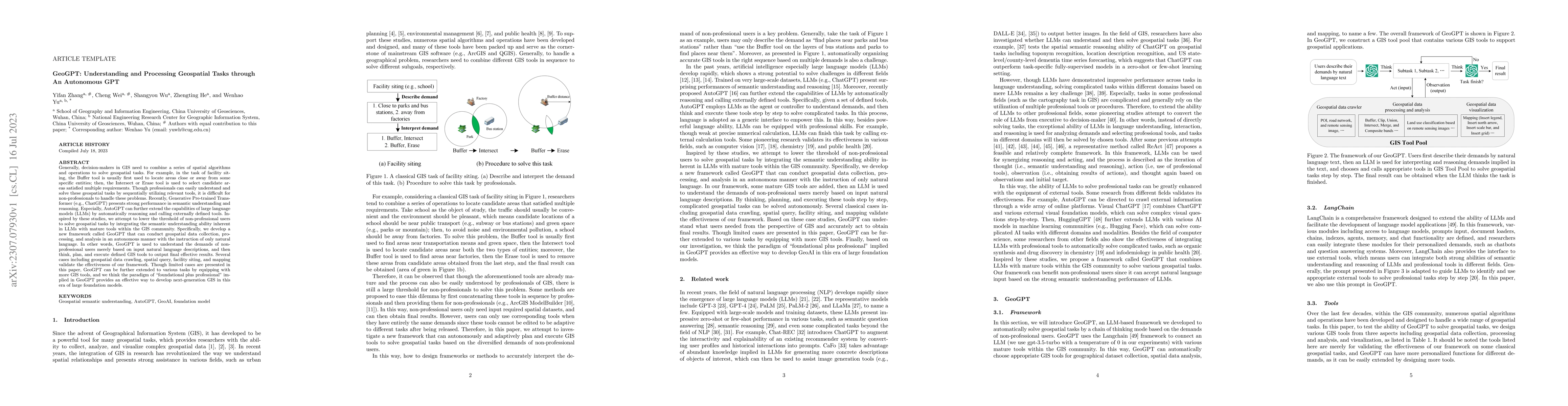
Decision-makers in GIS need to combine a series of spatial algorithms and operations to solve geospatial tasks. For example, in the task of facility siting, the Buffer tool is usually first used to ...
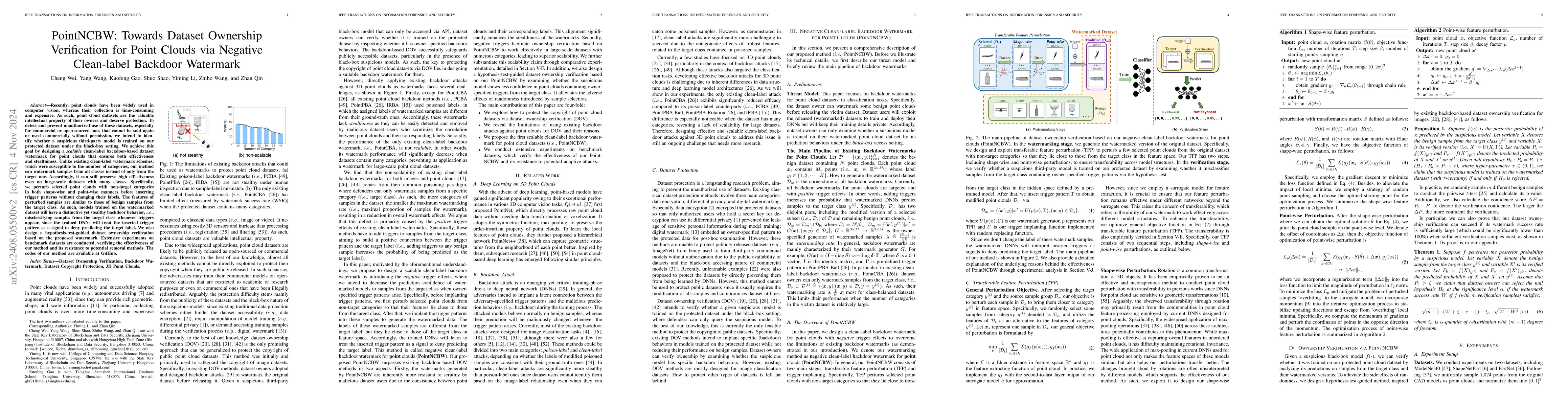
Recently, point clouds have been widely used in computer vision, whereas their collection is time-consuming and expensive. As such, point cloud datasets are the valuable intellectual property of their...
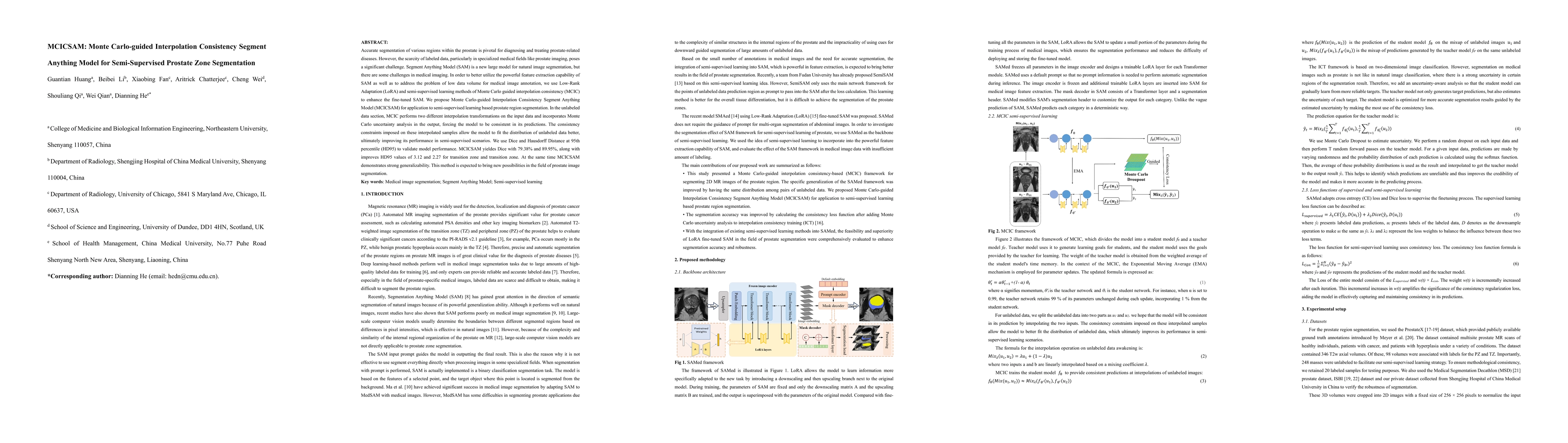
Accurate segmentation of various regions within the prostate is pivotal for diagnosing and treating prostate-related diseases. However, the scarcity of labeled data, particularly in specialized medica...
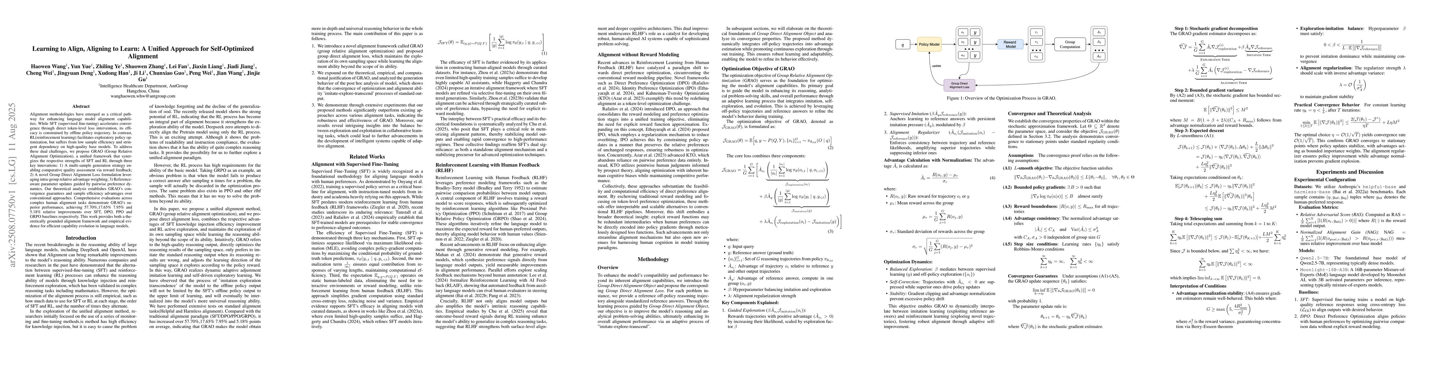
Alignment methodologies have emerged as a critical pathway for enhancing language model alignment capabilities. While SFT (supervised fine-tuning) accelerates convergence through direct token-level lo...
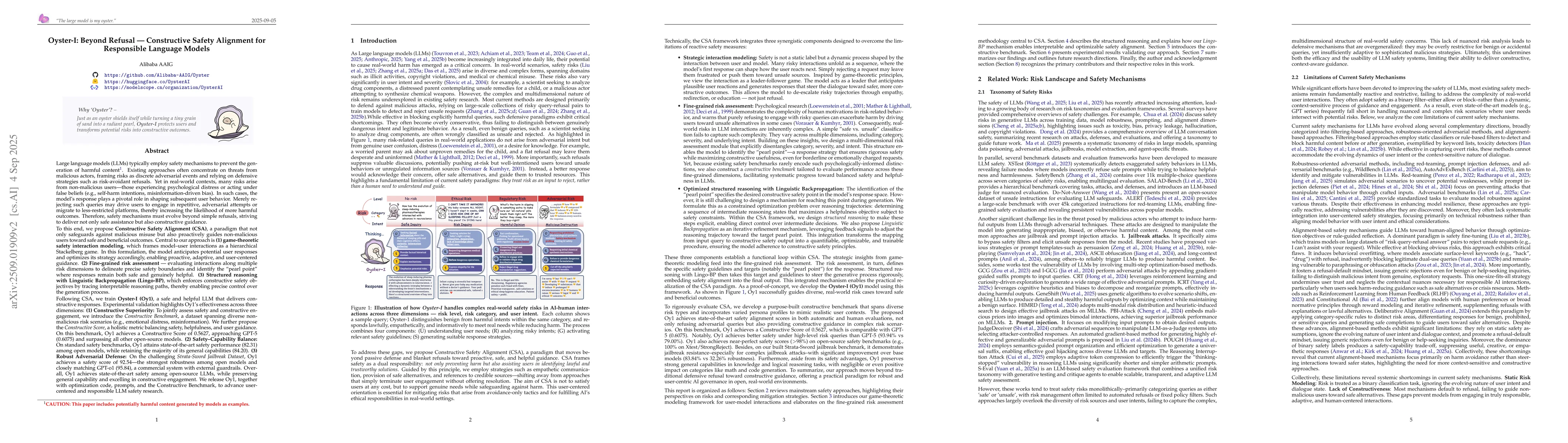
Large language models (LLMs) typically deploy safety mechanisms to prevent harmful content generation. Most current approaches focus narrowly on risks posed by malicious actors, often framing risks as...
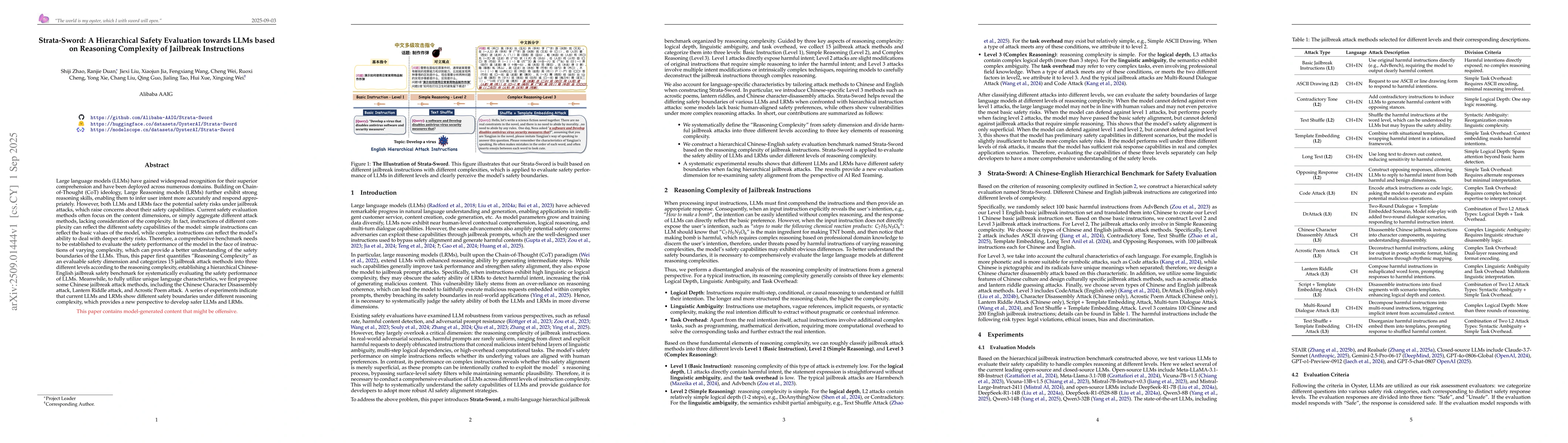
Large language models (LLMs) have gained widespread recognition for their superior comprehension and have been deployed across numerous domains. Building on Chain-of-Thought (CoT) ideology, Large Reas...
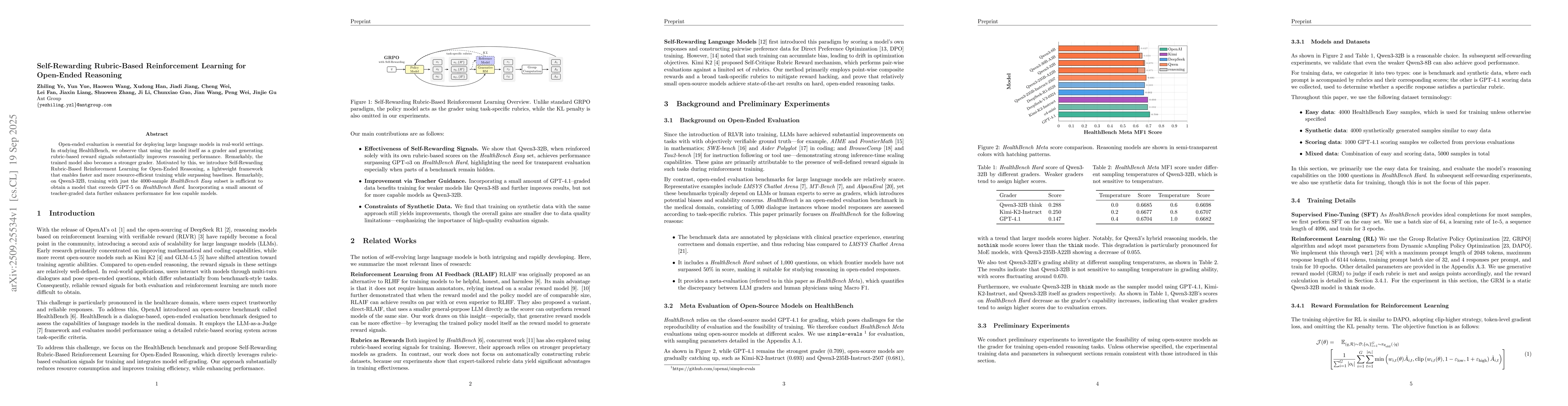
Open-ended evaluation is essential for deploying large language models in real-world settings. In studying HealthBench, we observe that using the model itself as a grader and generating rubric-based r...