Academic Profile
Statistics
Similar Authors
Papers on arXiv
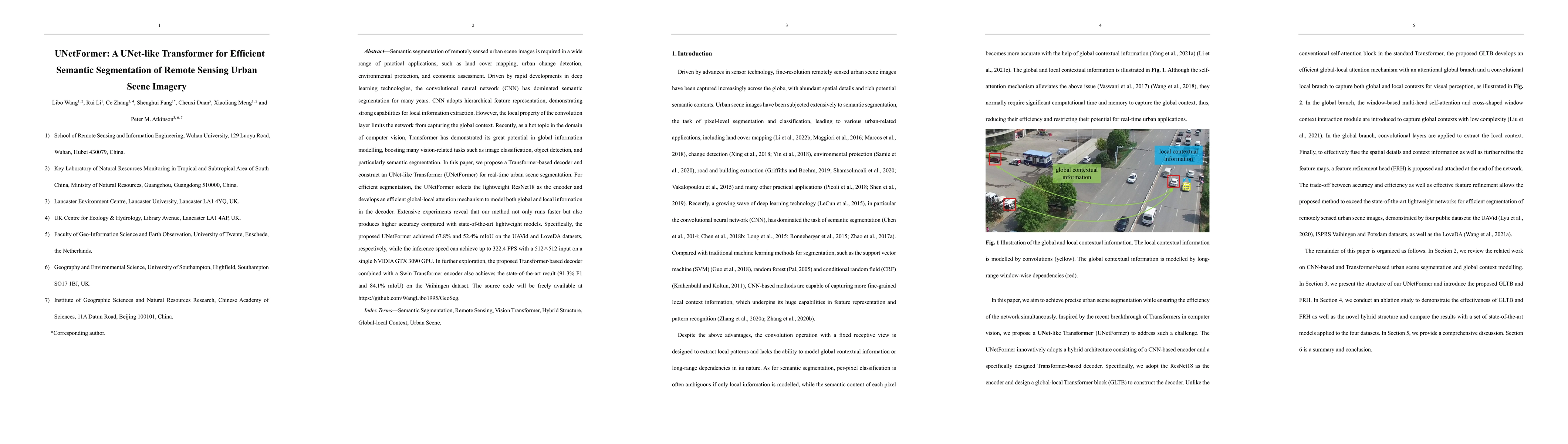
Semantic segmentation of remotely sensed urban scene images is required in a wide range of practical applications, such as land cover mapping, urban change detection, environmental protection, and e...
Semantic segmentation from very fine resolution (VFR) urban scene images plays a significant role in several application scenarios including autonomous driving, land cover classification, and urban ...
The fully convolutional network (FCN) with an encoder-decoder architecture has been the standard paradigm for semantic segmentation. The encoder-decoder architecture utilizes an encoder to capture m...
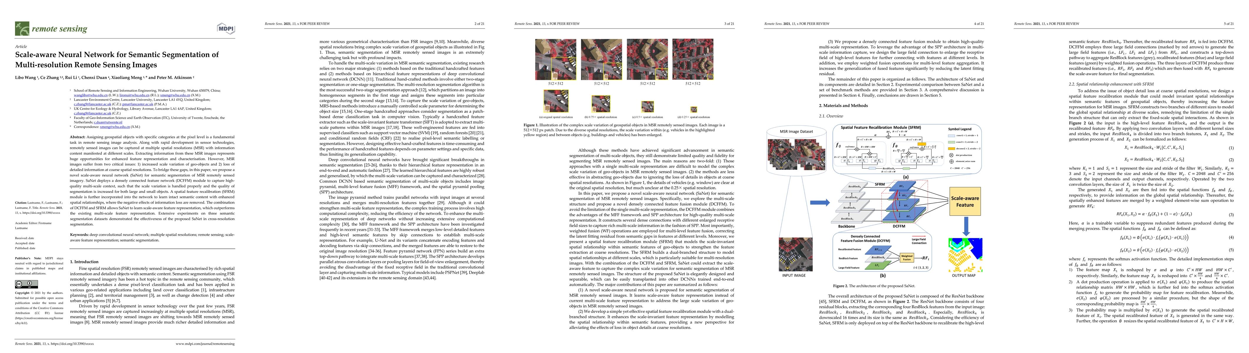
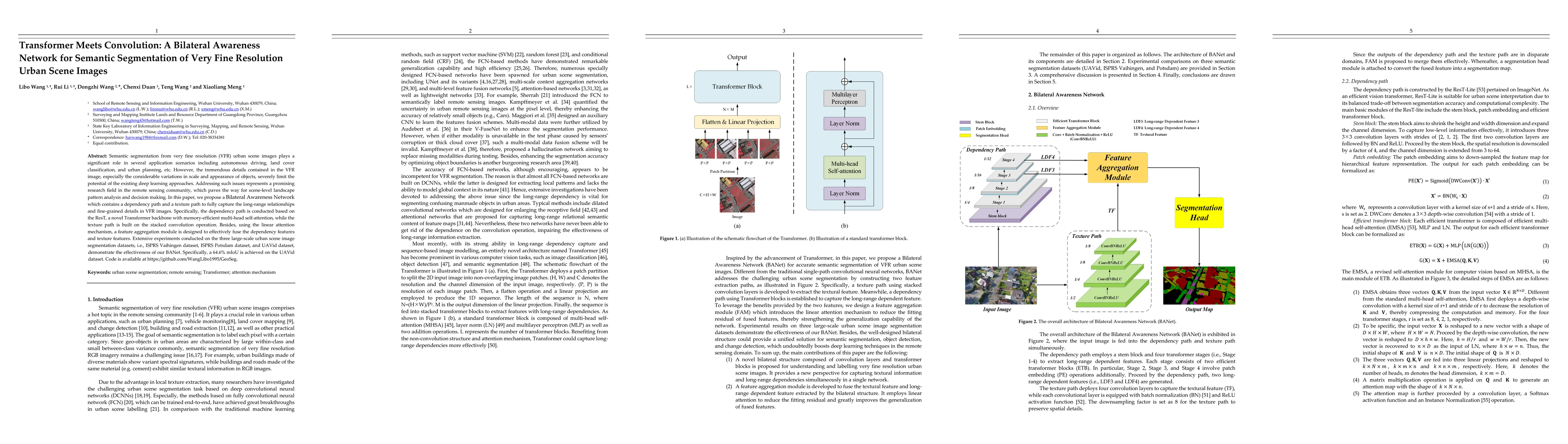
Assigning geospatial objects with specific categories at the pixel level is a fundamental task in remote sensing image analysis. Along with rapid development in sensor technologies, remotely sensed ...
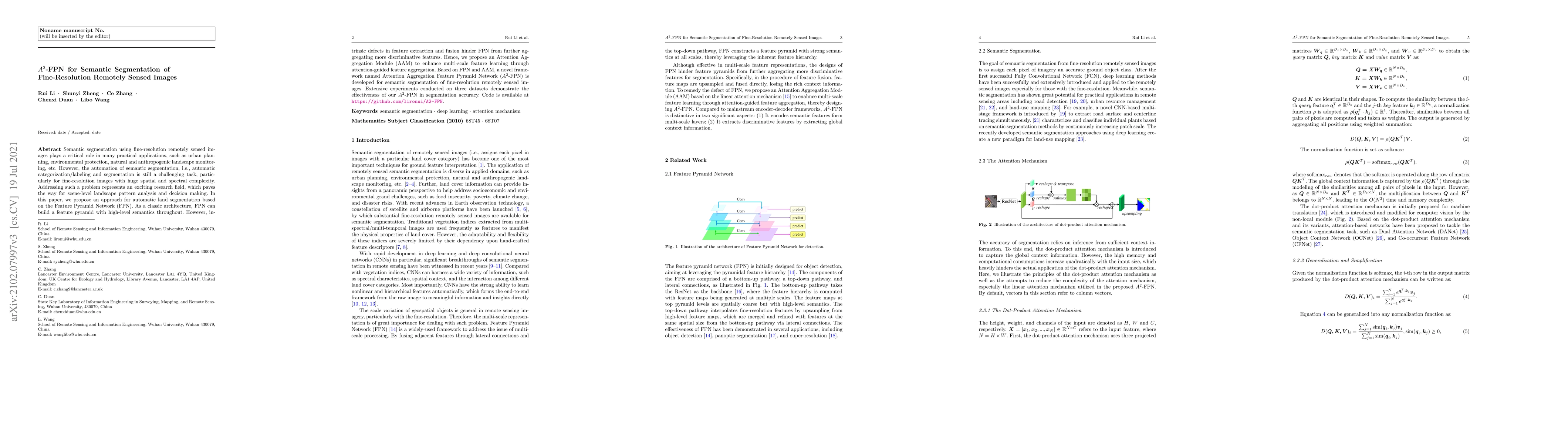
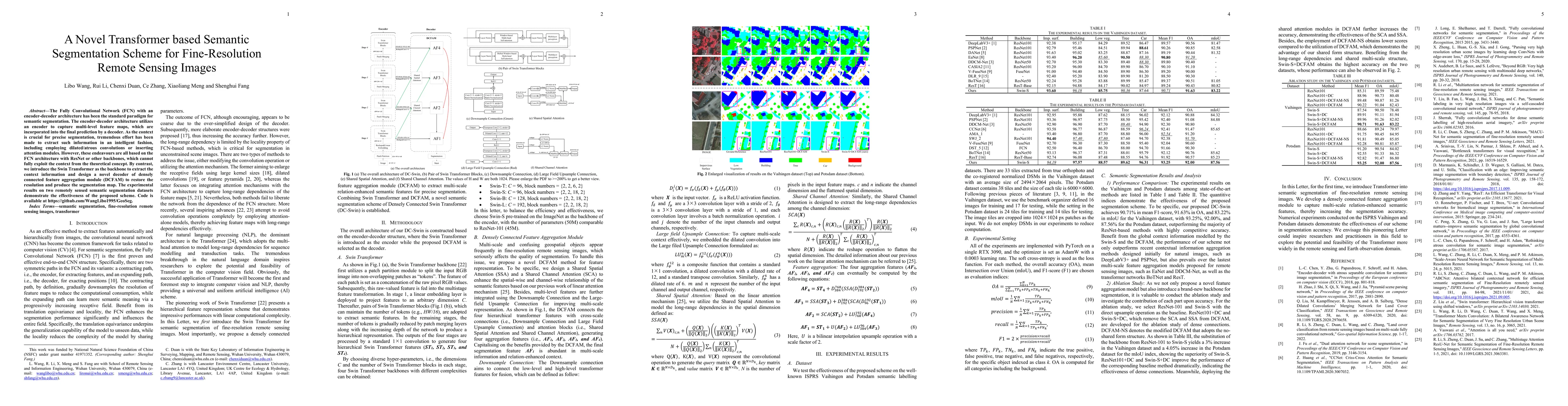
Semantic segmentation using fine-resolution remotely sensed images plays a critical role in many practical applications, such as urban planning, environmental protection, natural and anthropogenic l...
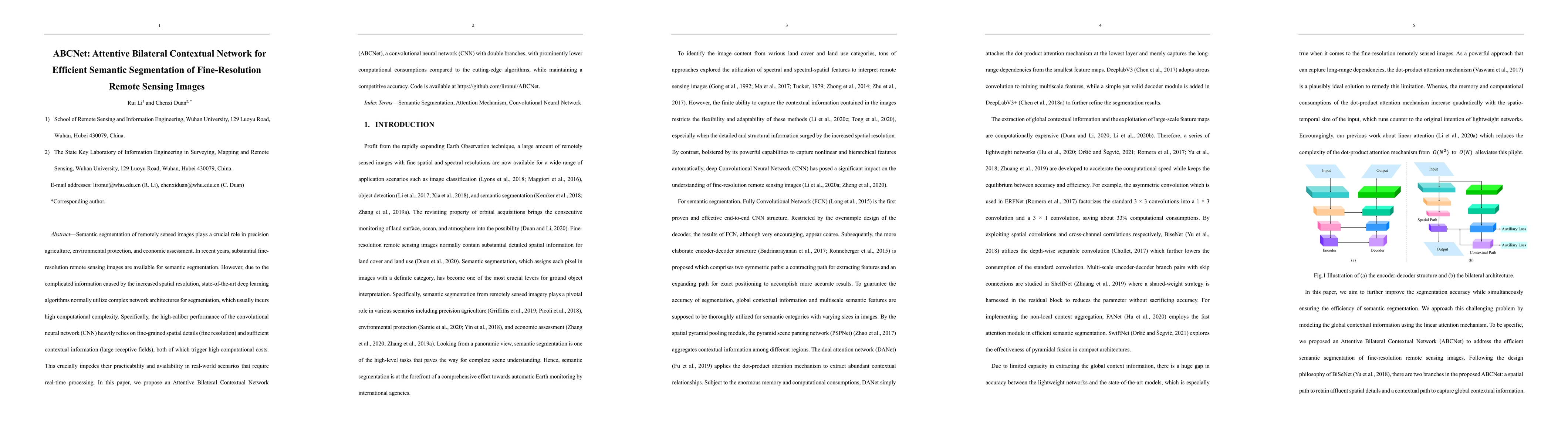
Semantic segmentation of remotely sensed images plays a crucial role in precision agriculture, environmental protection, and economic assessment. In recent years, substantial fine-resolution remote ...
In remote sensing images, the existence of the thin cloud is an inevitable and ubiquitous phenomenon that crucially reduces the quality of imageries and limits the scenarios of application. Therefor...

In this paper, a Multi-Scale Fully Convolutional Network (MSFCN) with multi-scale convolutional kernel is proposed to exploit discriminative representations from two-dimensional (2D) satellite image...
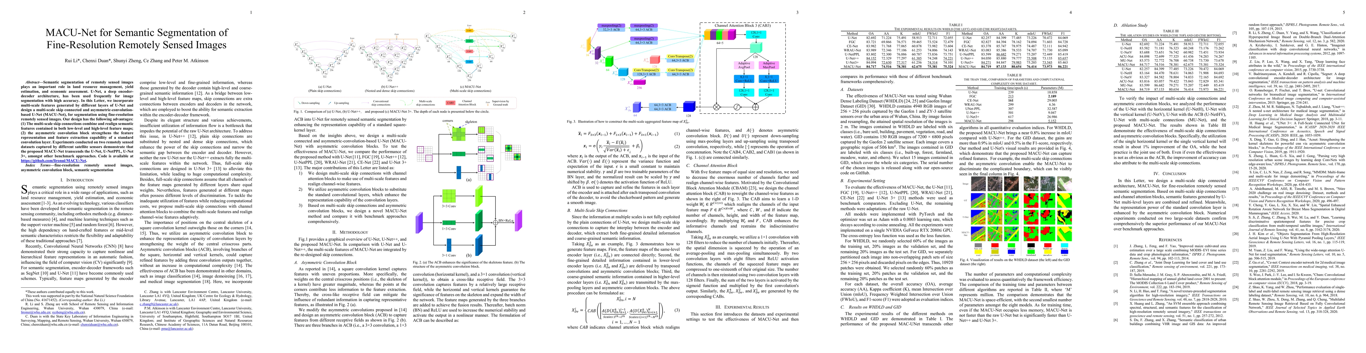
Semantic segmentation of remotely sensed images plays an important role in land resource management, yield estimation, and economic assessment. U-Net, a deep encoder-decoder architecture, has been u...

Addressing gaps caused by cloud cover and the long revisit cycle of satellites is vital for providing essential data to support remote sensing applications. This paper tackles the challenges of missin...