Academic Profile
Statistics
Similar Authors
Papers on arXiv
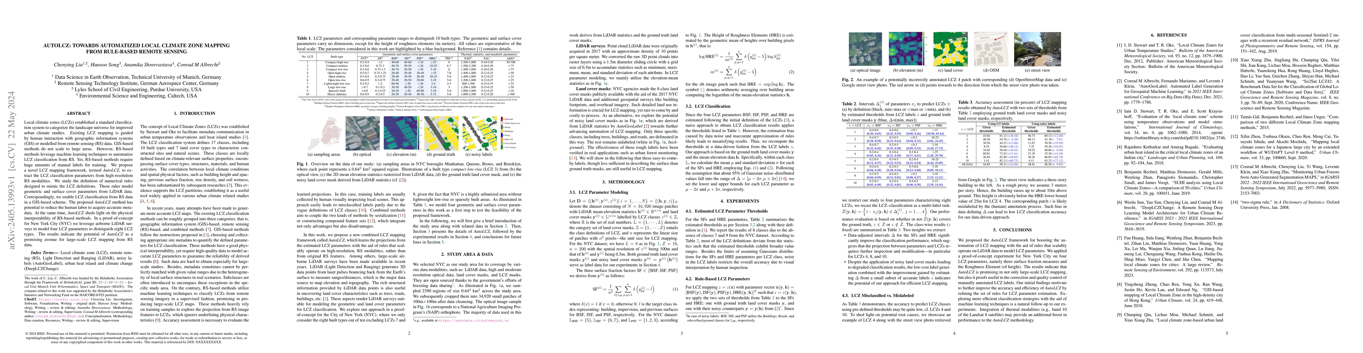
Local climate zones (LCZs) established a standard classification system to categorize the landscape universe for improved urban climate studies. Existing LCZ mapping is guided by human interaction w...
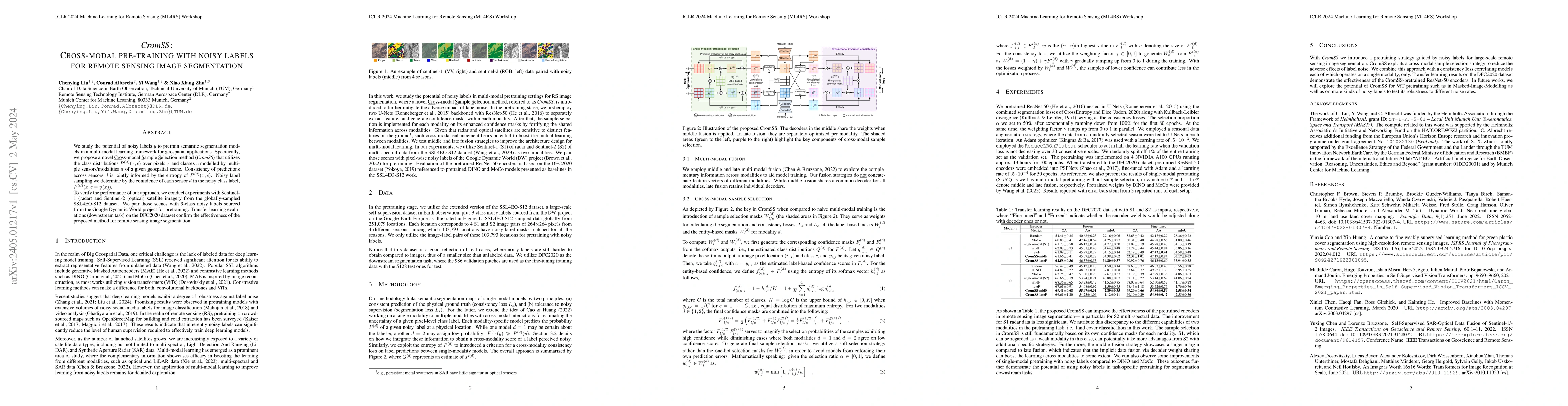
We study the potential of noisy labels y to pretrain semantic segmentation models in a multi-modal learning framework for geospatial applications. Specifically, we propose a novel Cross-modal Sample...
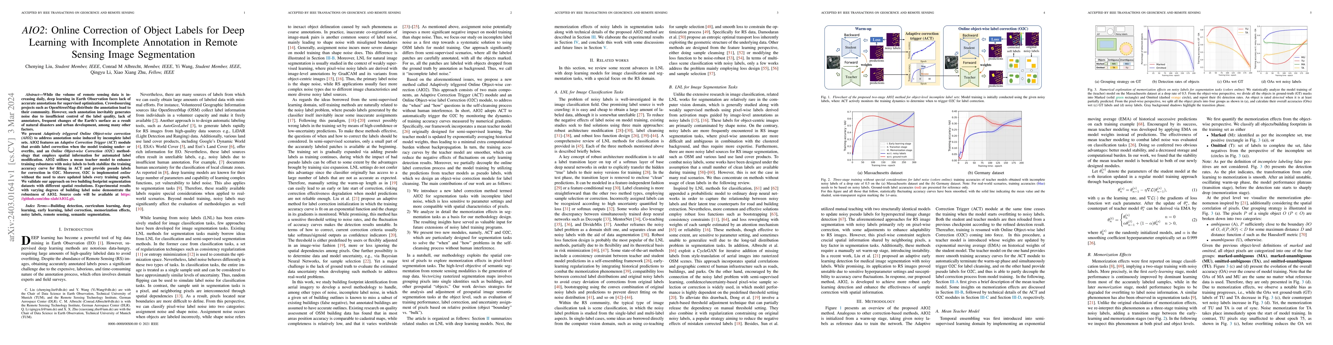
While the volume of remote sensing data is increasing daily, deep learning in Earth Observation faces lack of accurate annotations for supervised optimization. Crowdsourcing projects such as OpenStr...
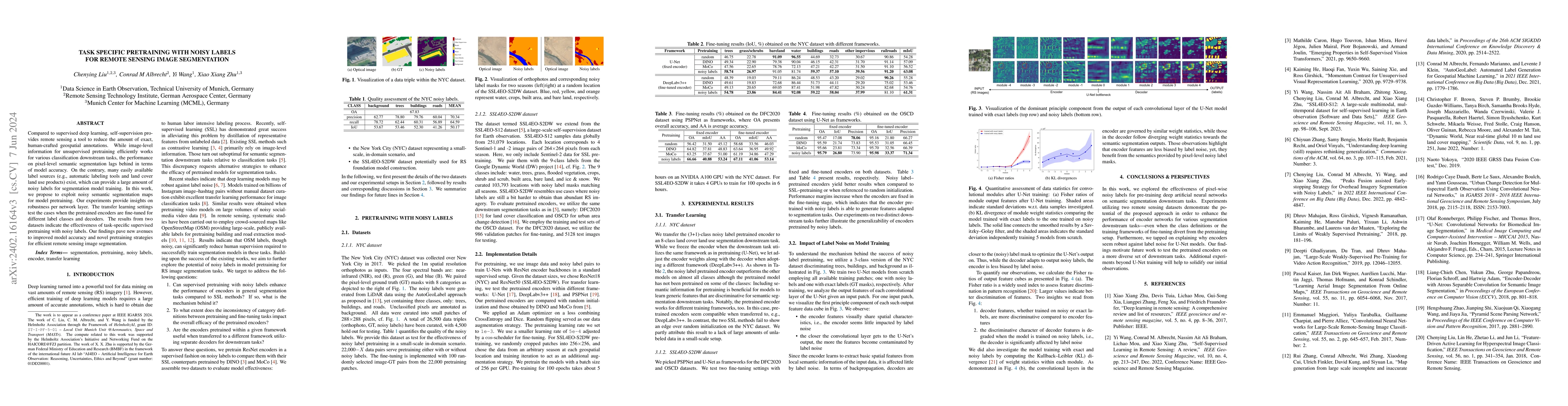
Compared to supervised deep learning, self-supervision provides remote sensing a tool to reduce the amount of exact, human-crafted geospatial annotations. While image-level information for unsupervi...
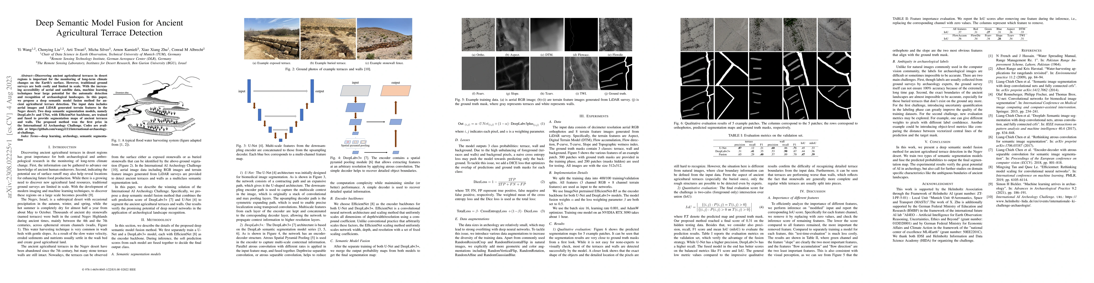
Discovering ancient agricultural terraces in desert regions is important for the monitoring of long-term climate changes on the Earth's surface. However, traditional ground surveys are both costly a...
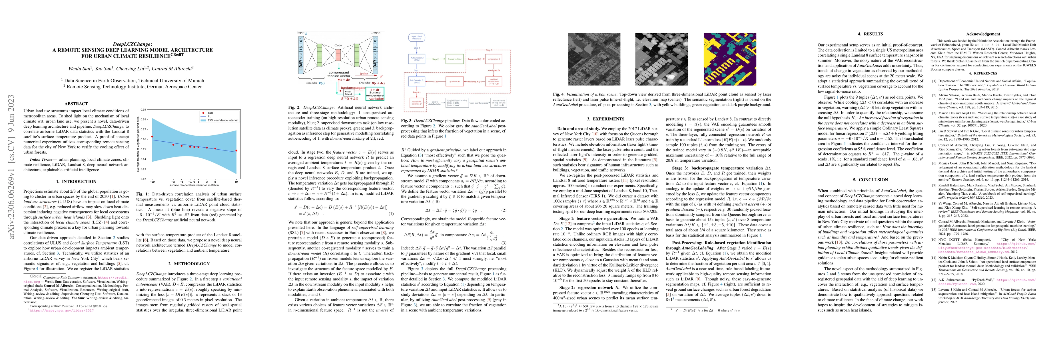
Urban land use structures impact local climate conditions of metropolitan areas. To shed light on the mechanism of local climate wrt. urban land use, we present a novel, data-driven deep learning ar...
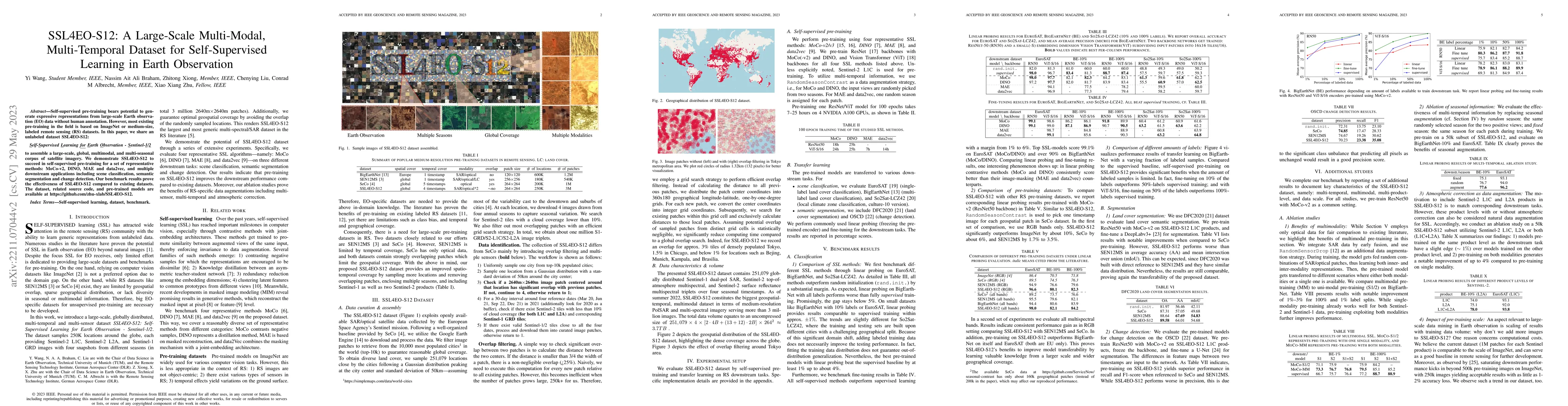
Self-supervised pre-training bears potential to generate expressive representations without human annotation. Most pre-training in Earth observation (EO) are based on ImageNet or medium-size, labele...
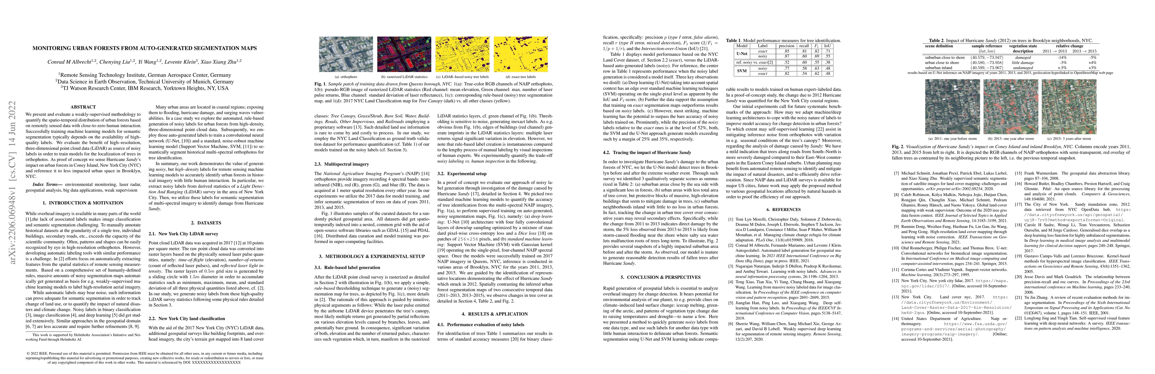
We present and evaluate a weakly-supervised methodology to quantify the spatio-temporal distribution of urban forests based on remotely sensed data with close-to-zero human interaction. Successfully...
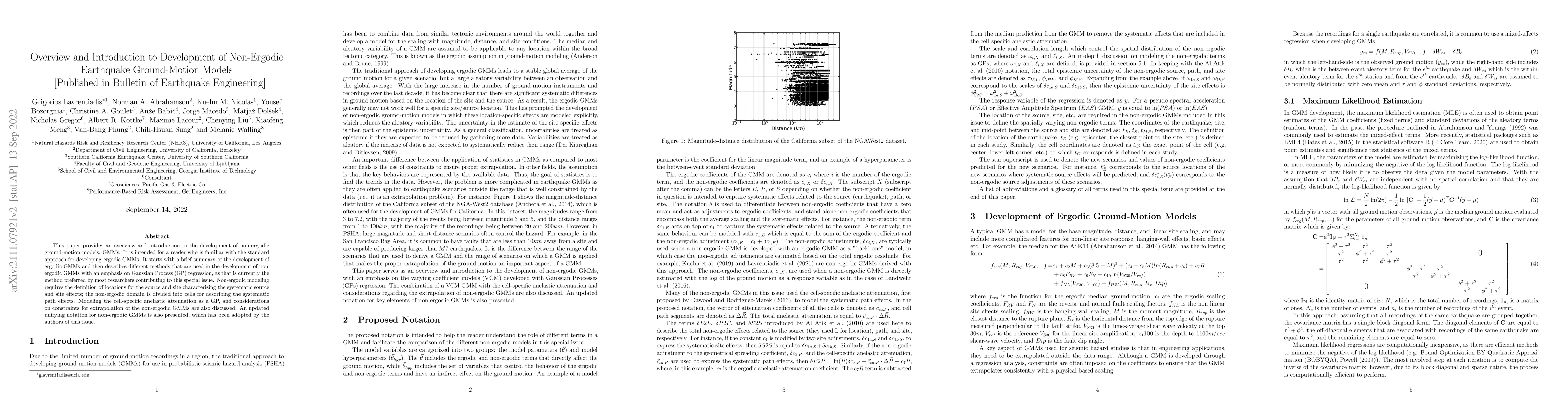
This paper provides an overview and introduction to the development of non-ergodic ground-motion models, GMMs. It is intended for a reader who is familiar with the standard approach for developing e...
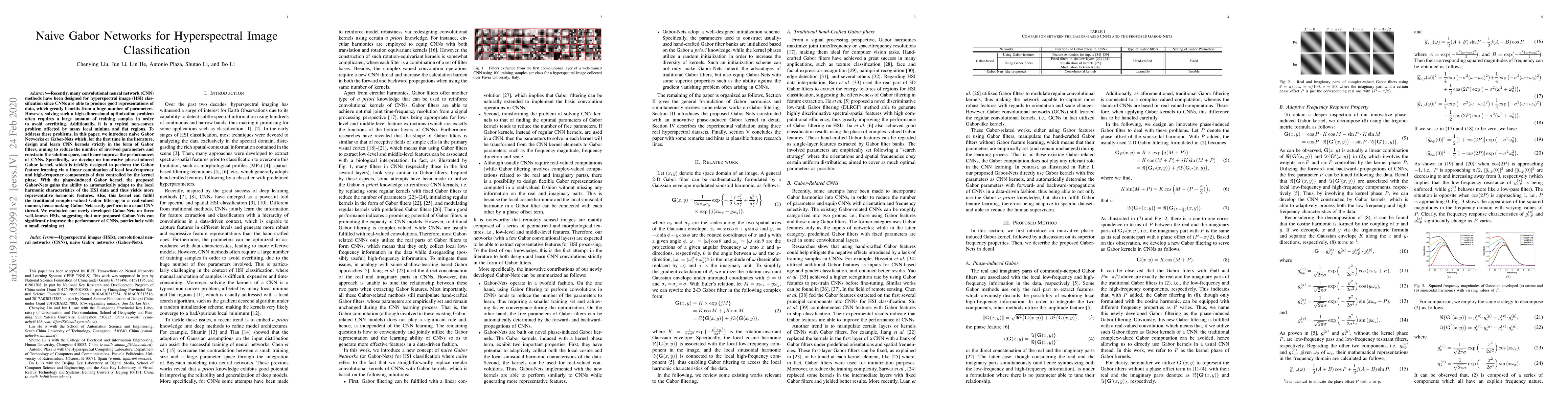
Recently, many convolutional neural network (CNN) methods have been designed for hyperspectral image (HSI) classification since CNNs are able to produce good representations of data, which greatly b...
The wrist plays a pivotal role in facilitating motion dexterity and hand functions. Wrist orthoses, from passive braces to active exoskeletons, provide an effective solution for the assistance and reh...
Advances in Earth observation (EO) foundation models have unlocked the potential of big satellite data to learn generic representations from space, benefiting a wide range of downstream applications c...
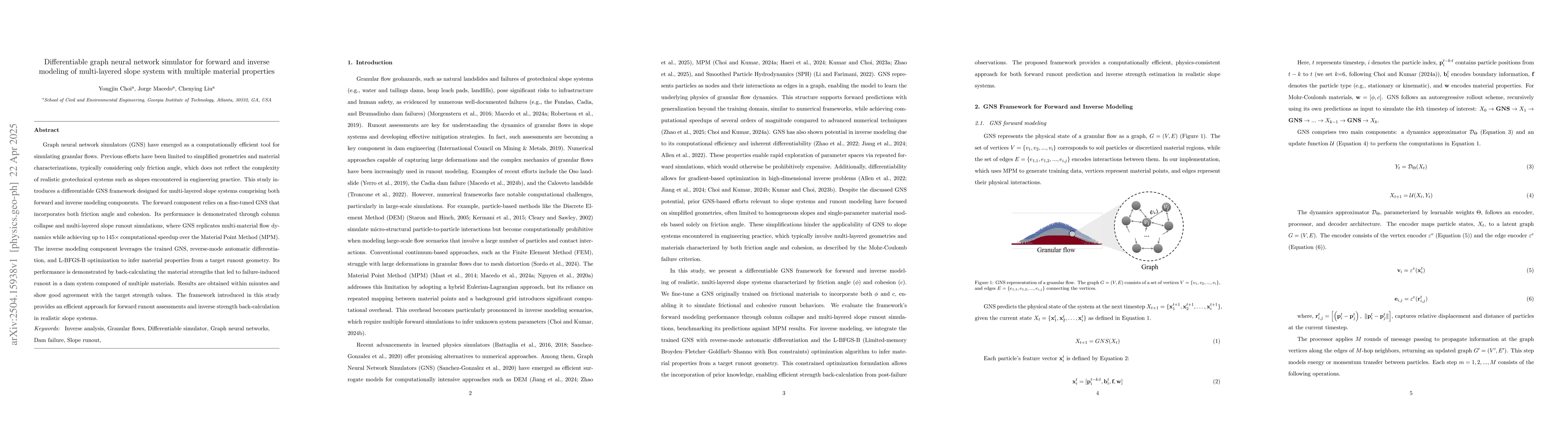
Graph neural network simulators (GNS) have emerged as a computationally efficient tool for simulating granular flows. Previous efforts have been limited to simplified geometries and material character...
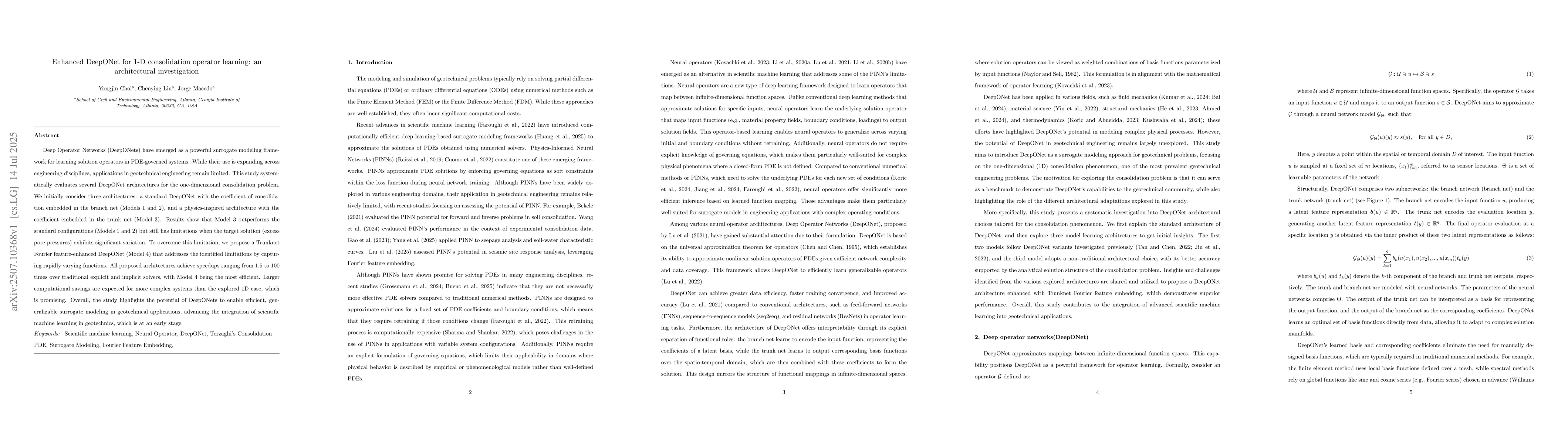
Deep Operator Networks (DeepONets) have emerged as a powerful surrogate modeling framework for learning solution operators in PDE-governed systems. While their use is expanding across engineering disc...
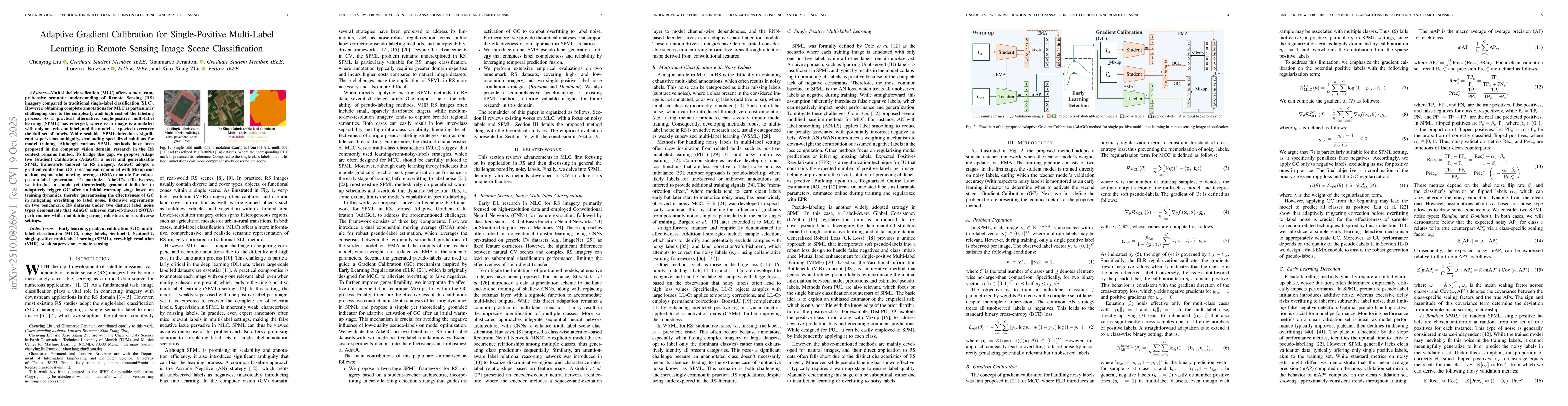
Multi-label classification (MLC) offers a more comprehensive semantic understanding of Remote Sensing (RS) imagery compared to traditional single-label classification (SLC). However, obtaining complet...
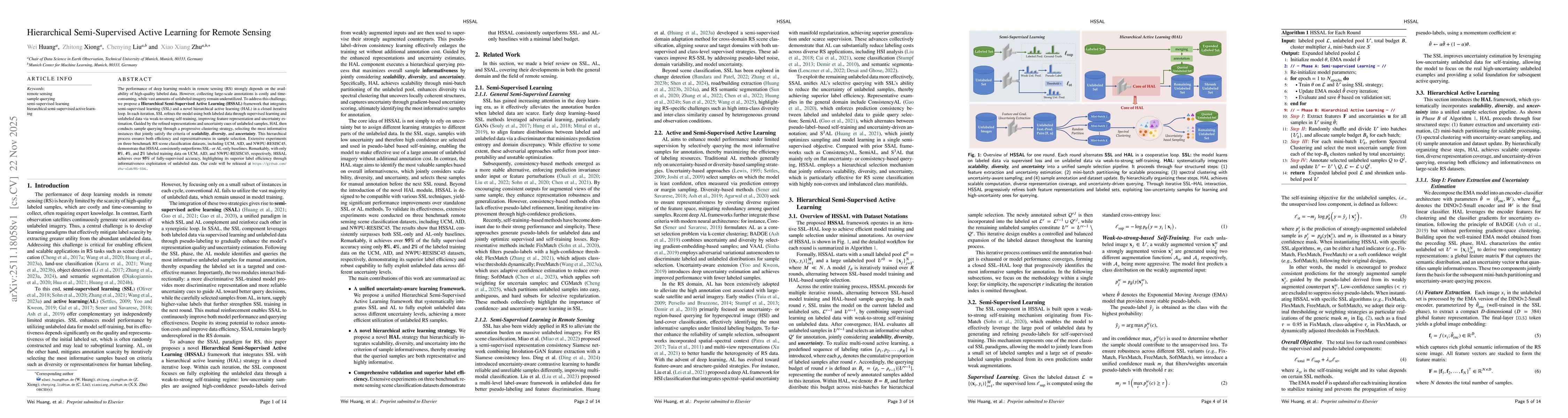
The performance of deep learning models in remote sensing (RS) strongly depends on the availability of high-quality labeled data. However, collecting large-scale annotations is costly and time-consumi...
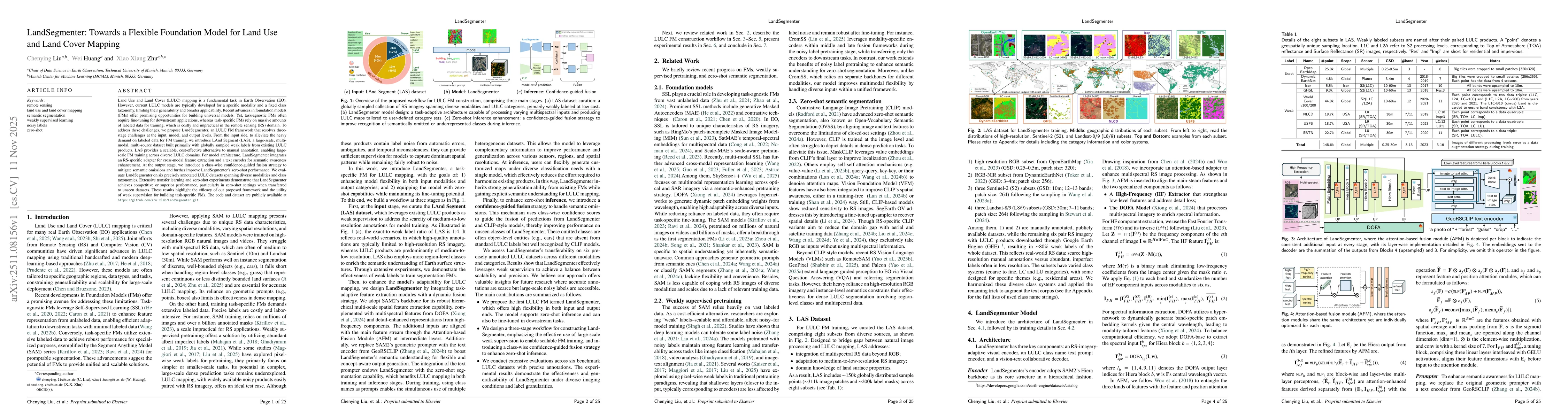
Land Use and Land Cover (LULC) mapping is a fundamental task in Earth Observation (EO). However, current LULC models are typically developed for a specific modality and a fixed class taxonomy, limitin...
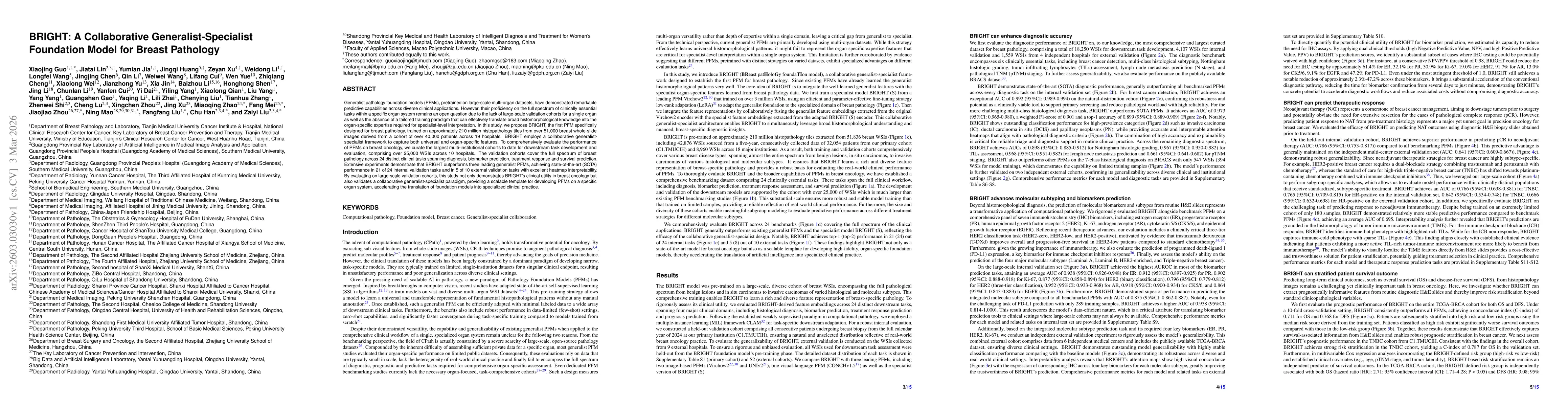
Generalist pathology foundation models (PFMs), pretrained on large-scale multi-organ datasets, have demonstrated remarkable predictive capabilities across diverse clinical applications. However, their...
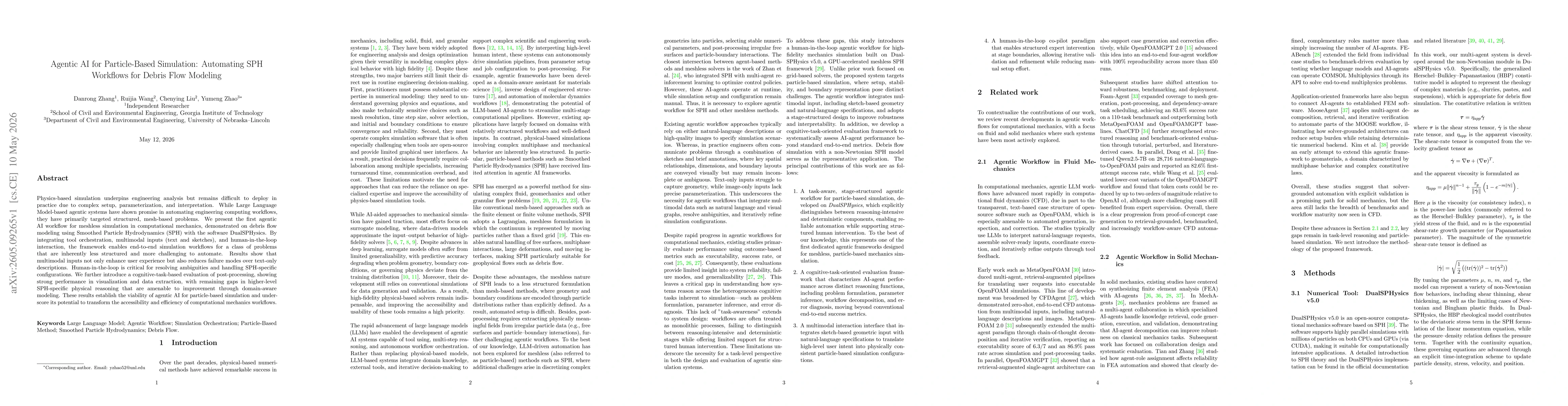
Physics-based simulation underpins engineering analysis but remains difficult to deploy in practice due to complex setup, parameterization, and interpretation. While Large Language Model-based agentic...