Academic Profile
Statistics
Similar Authors
Papers on arXiv
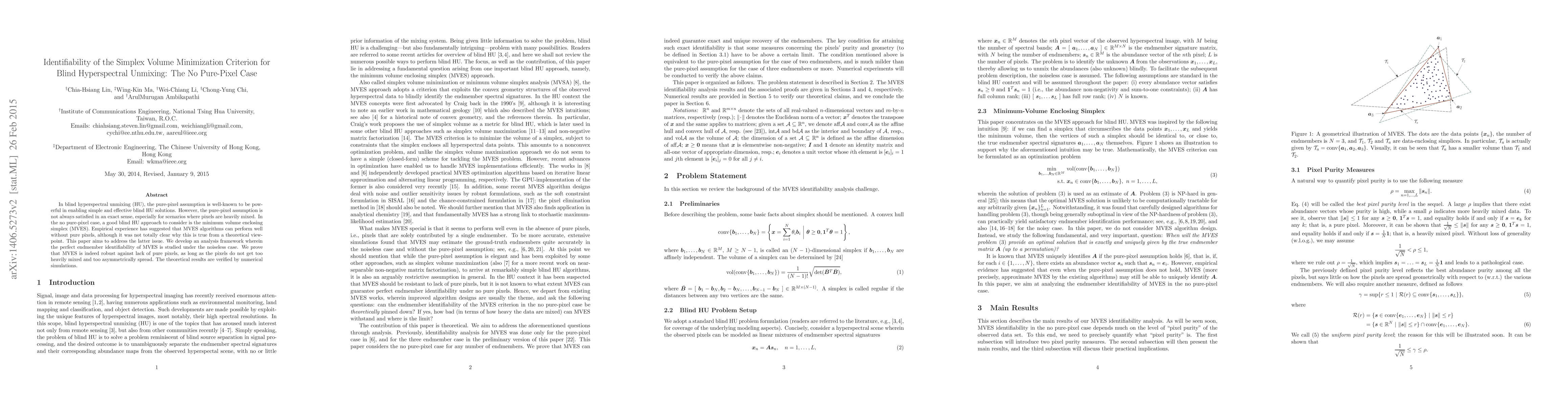
In blind hyperspectral unmixing (HU), the pure-pixel assumption is well-known to be powerful in enabling simple and effective blind HU solutions. However, the pure-pixel assumption is not always sat...
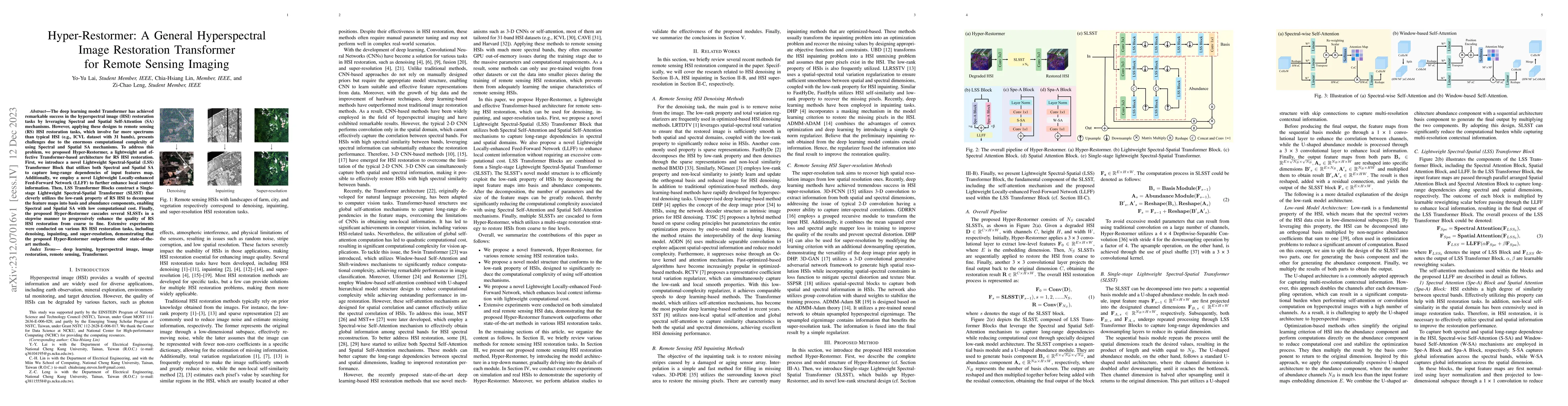
The deep learning model Transformer has achieved remarkable success in the hyperspectral image (HSI) restoration tasks by leveraging Spectral and Spatial Self-Attention (SA) mechanisms. However, app...
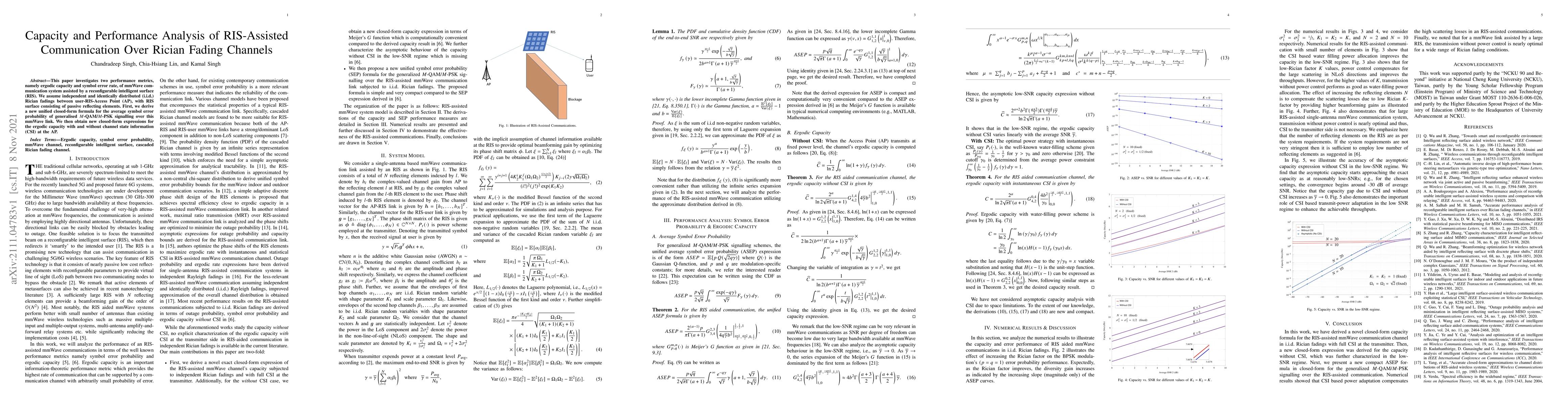
This paper investigates two performance metrics, namely ergodic capacity and symbol error rate, of mmWave communication system assisted by a reconfigurable intelligent surface (RIS). We assume indep...
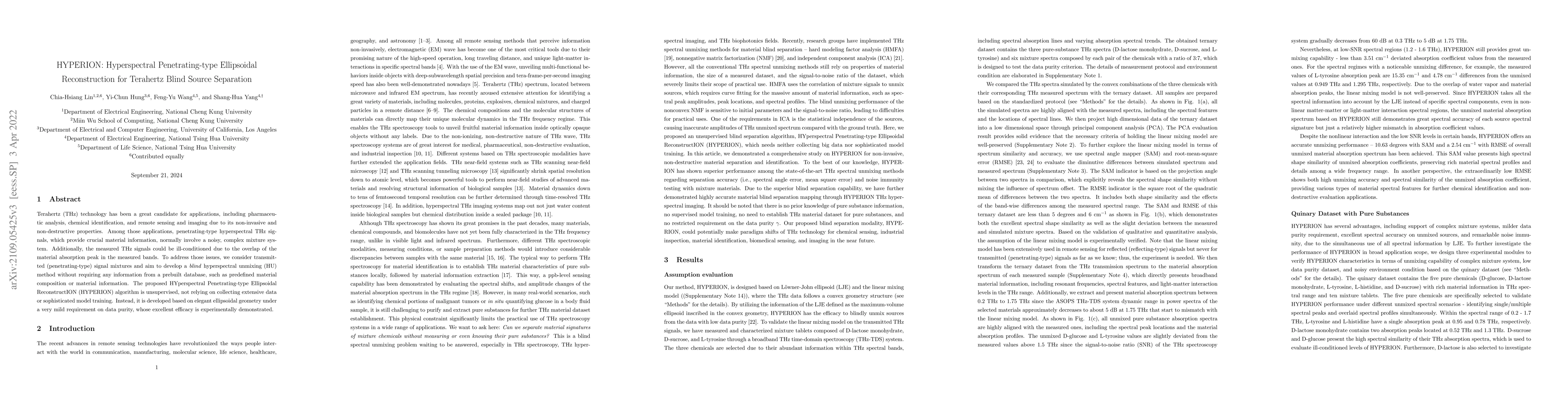
Terahertz (THz) technology has been a great candidate for applications, including pharmaceutic analysis, chemical identification, and remote sensing and imaging due to its non-invasive and non-destr...
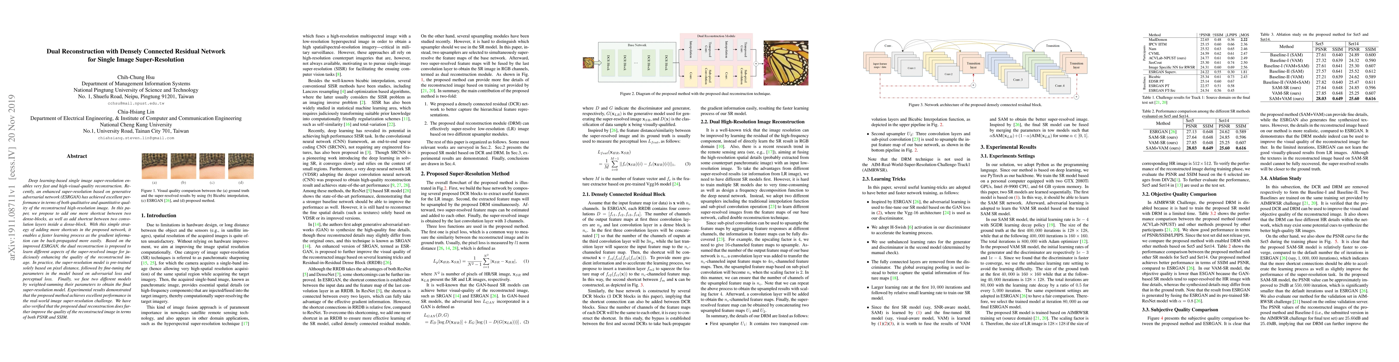
Deep learning-based single image super-resolution enables very fast and high-visual-quality reconstruction. Recently, an enhanced super-resolution based on generative adversarial network (ESRGAN) ha...
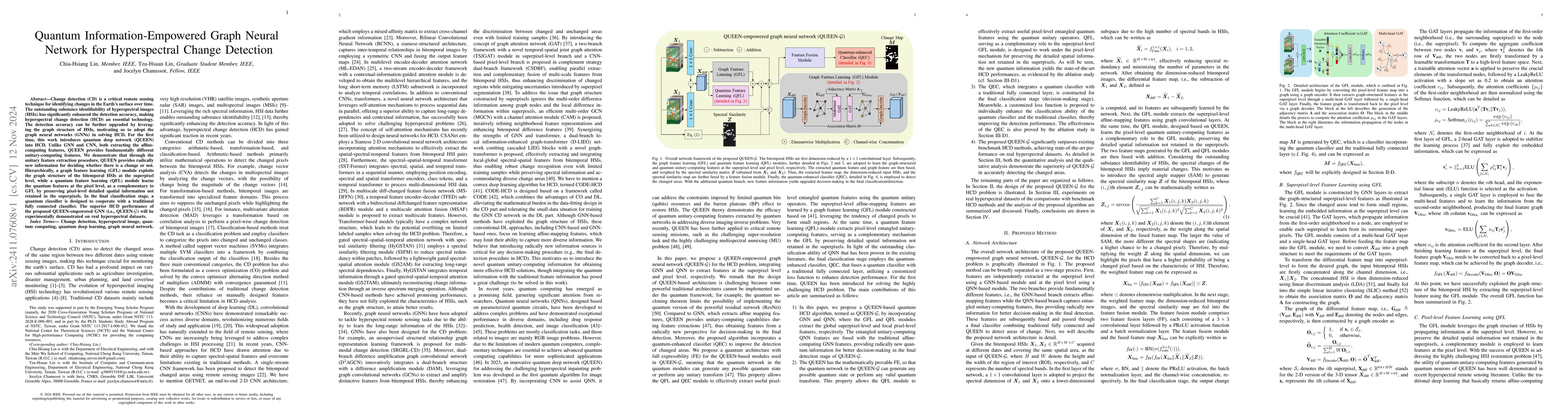
Change detection (CD) is a critical remote sensing technique for identifying changes in the Earth's surface over time. The outstanding substance identifiability of hyperspectral images (HSIs) has sign...
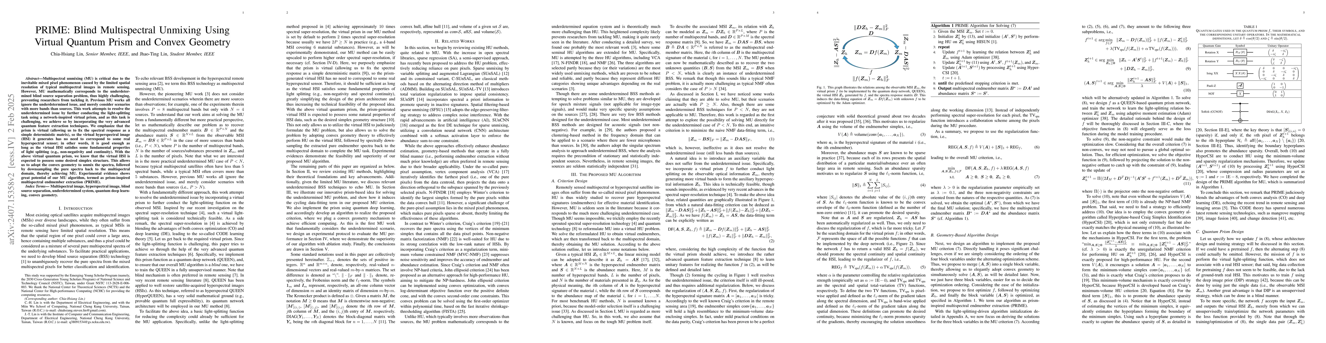
Multispectral unmixing (MU) is critical due to the inevitable mixed pixel phenomenon caused by the limited spatial resolution of typical multispectral images in remote sensing. However, MU mathematica...
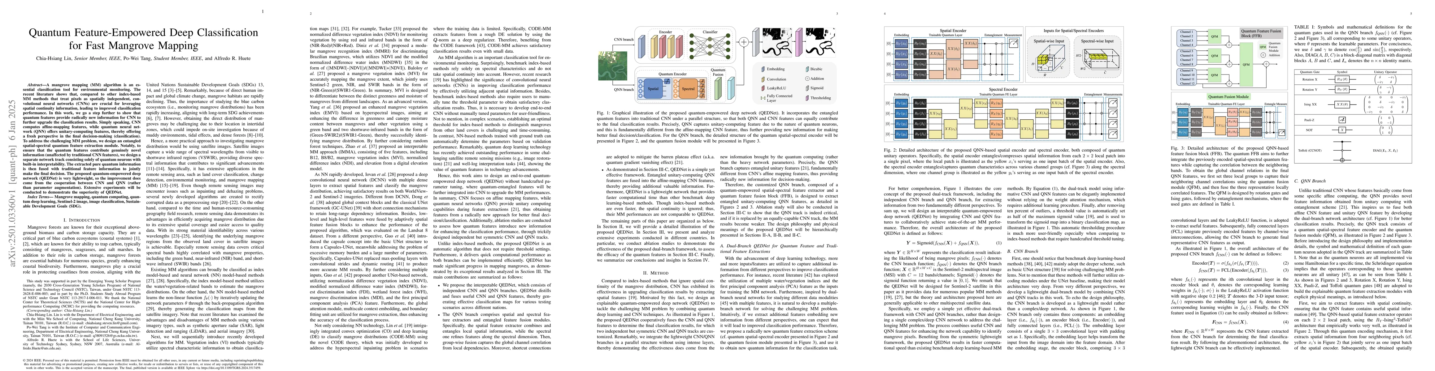
A mangrove mapping (MM) algorithm is an essential classification tool for environmental monitoring. The recent literature shows that compared with other index-based MM methods that treat pixels as spa...
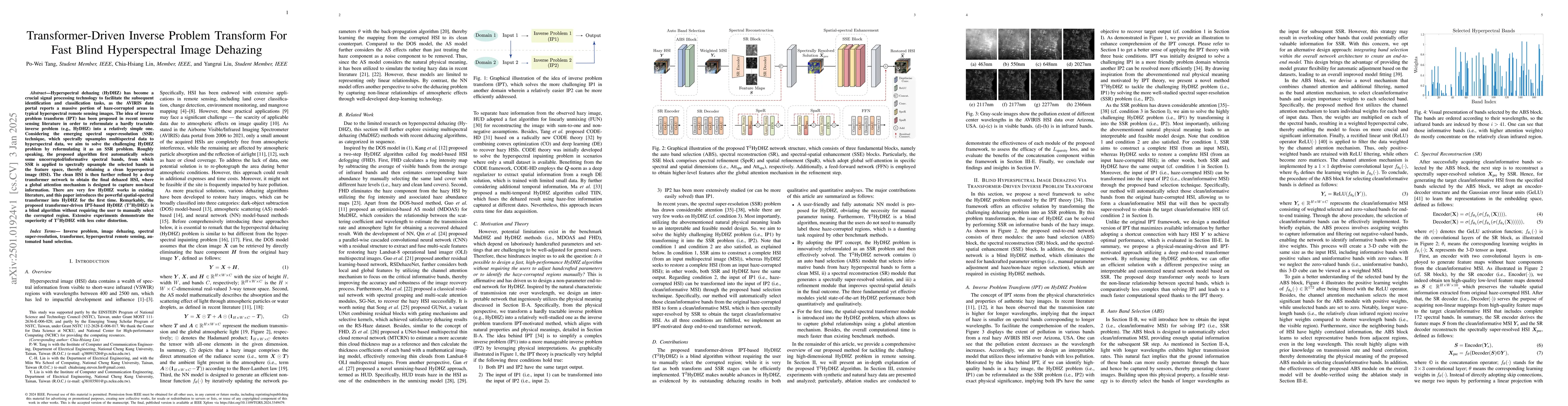
Hyperspectral dehazing (HyDHZ) has become a crucial signal processing technology to facilitate the subsequent identification and classification tasks, as the airborne visible/infrared imaging spectrom...
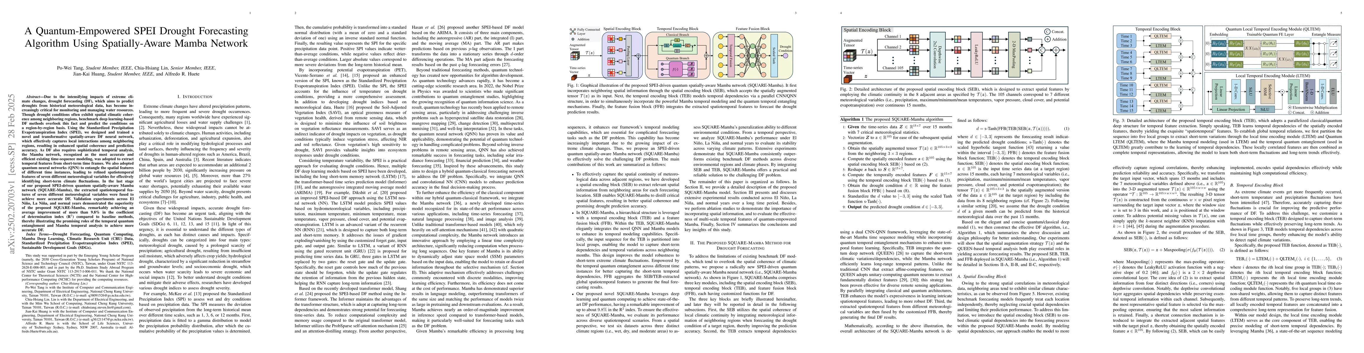
Due to the intensifying impacts of extreme climate changes, drought forecasting (DF), which aims to predict droughts from historical meteorological data, has become increasingly critical for monitorin...
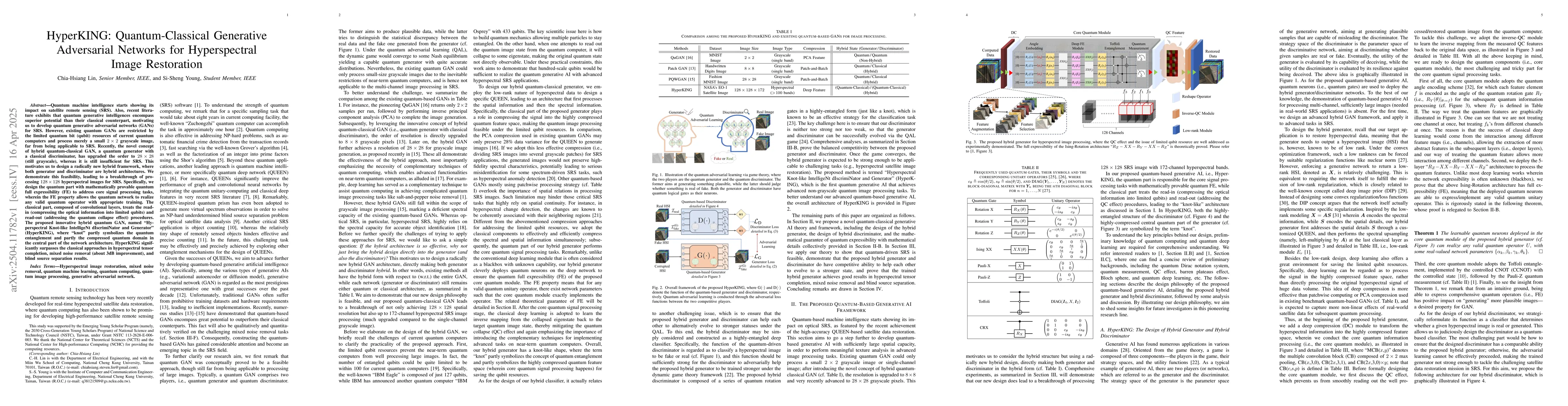
Quantum machine intelligence starts showing its impact on satellite remote sensing (SRS). Also, recent literature exhibits that quantum generative intelligences encompass superior potential than their...
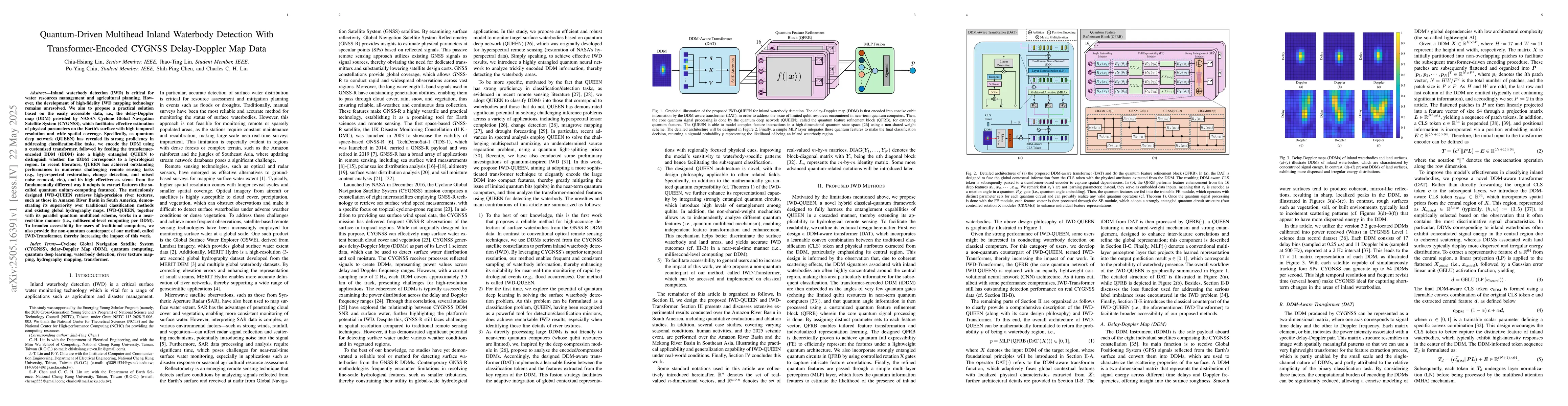
Inland waterbody detection (IWD) is critical for water resources management and agricultural planning. However, the development of high-fidelity IWD mapping technology remains unresolved. We aim to pr...
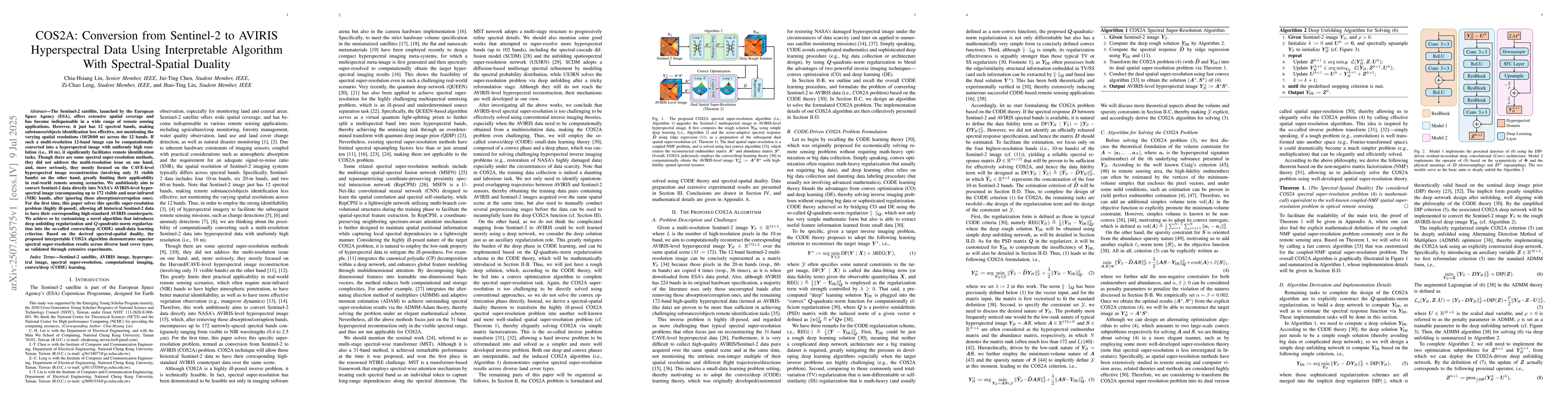
The Sentinel-2 satellite, launched by the European Space Agency (ESA), offers extensive spatial coverage and has become indispensable in a wide range of remote sensing applications. However, it just h...
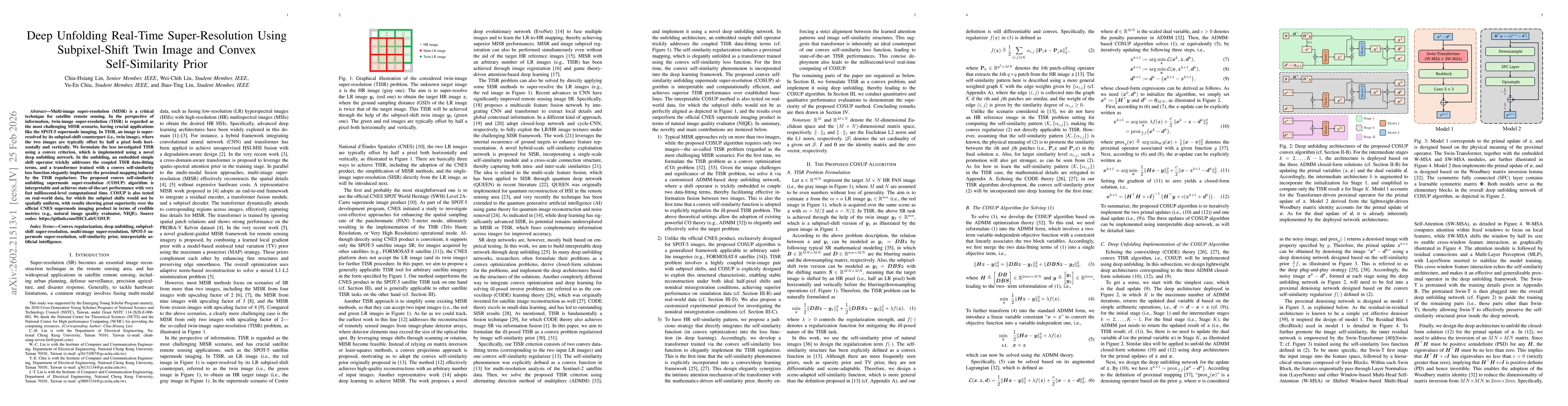
Multi-image super-resolution (MISR) is a critical technique for satellite remote sensing. In the perspective of information, twin-image super-resolution (TISR) is regarded as the most challenging MISR...
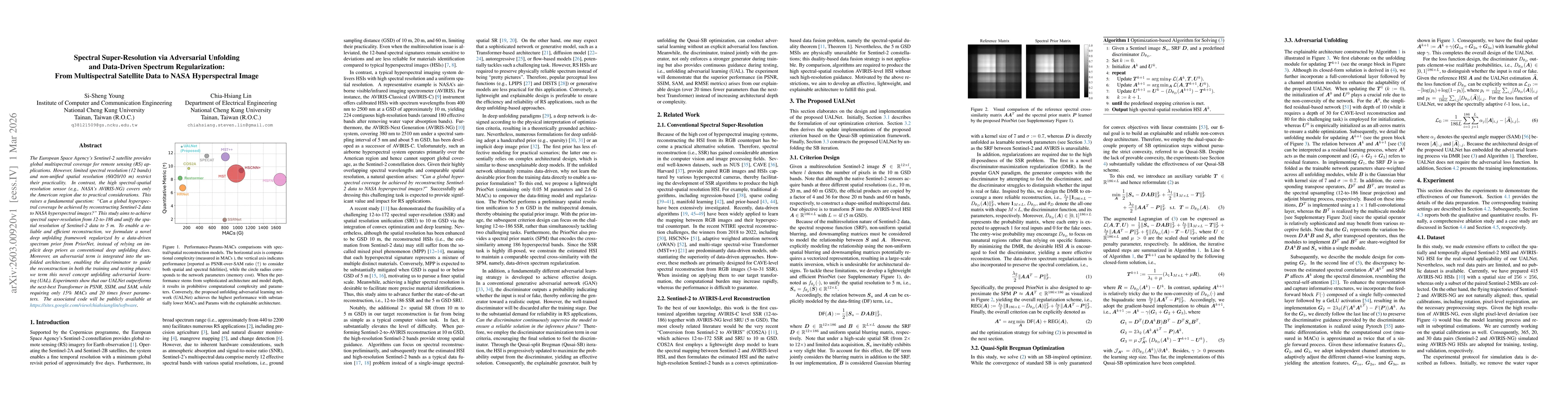
The European Space Agency's Sentinel-2 satellite provides global multispectral coverage for remote sensing (RS) applications. However, limited spectral resolution (12 bands) and non-unified spatial re...
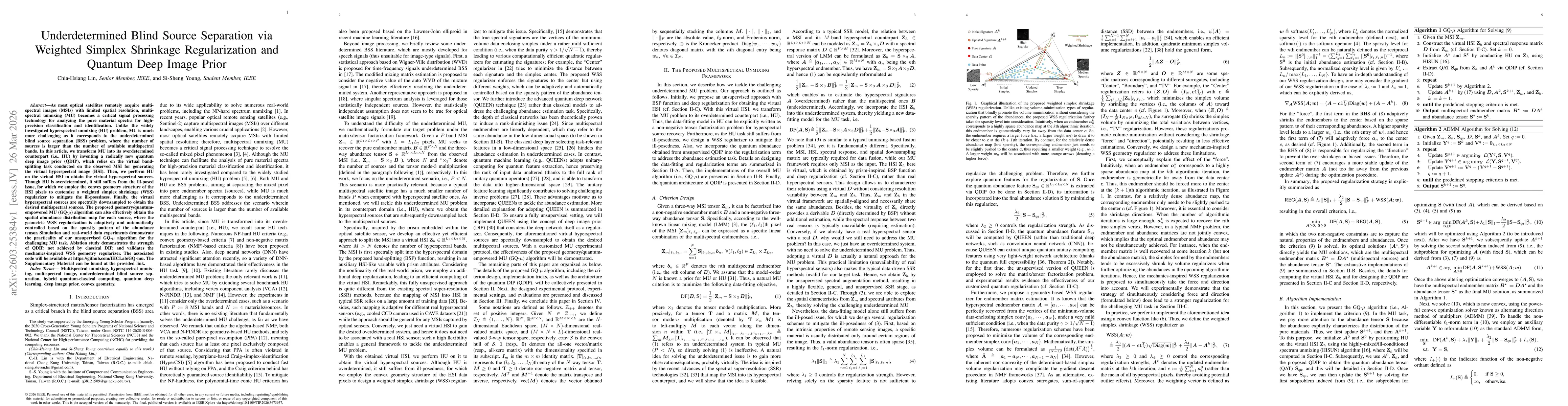
As most optical satellites remotely acquire multispectral images (MSIs) with limited spatial resolution, multispectral unmixing (MU) becomes a critical signal processing technology for analyzing the p...
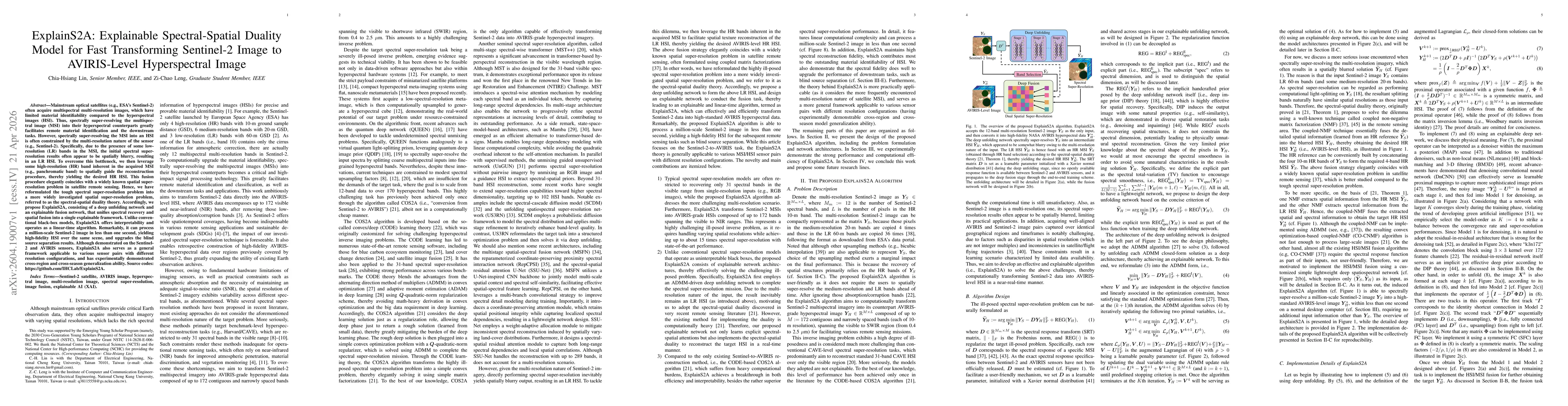
Mainstream optical satellites often acquire multispectral multi-resolution images, which have limited material identifiability compared to the HSIs. Thus, spectrally super-resolving the MSI into their...
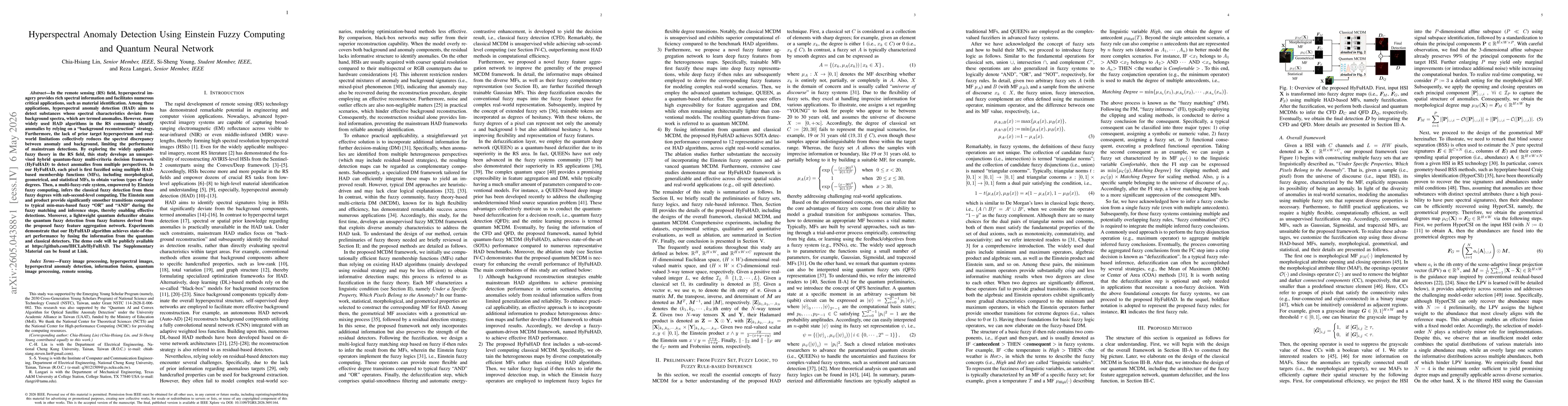
In the remote sensing (RS) field, hyperspectral imagery provides rich spectral information and facilitates numerous critical applications, such as material identification. Among these applications, hy...
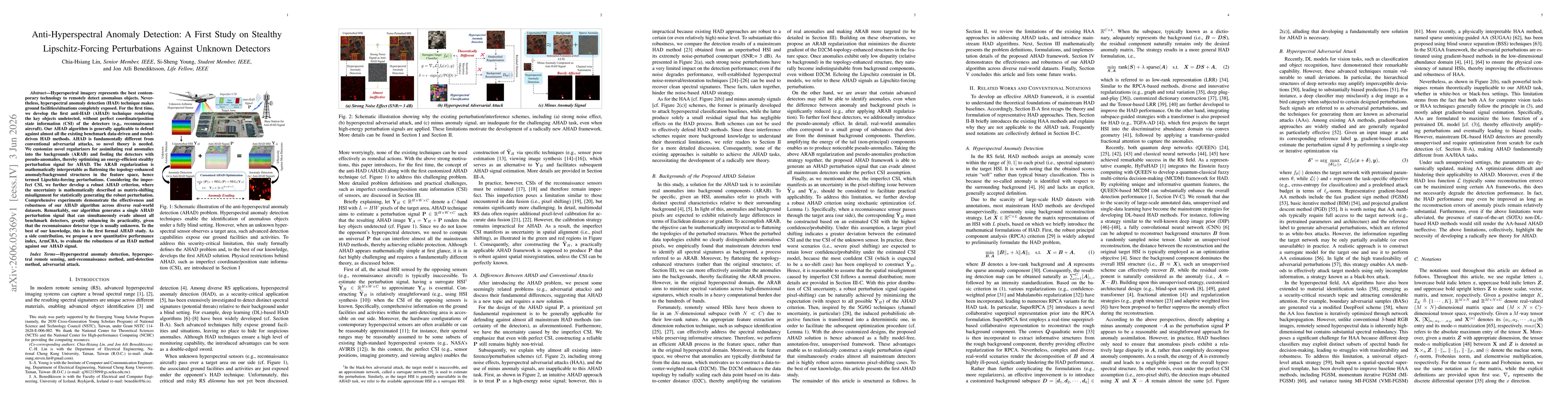
Hyperspectral imagery represents the best contemporary technology to remotely detect anomalous objects. Nevertheless, hyperspectral anomaly detection (HAD) technique makes ground facilities/situations...