Academic Profile
Statistics
Similar Authors
Papers on arXiv
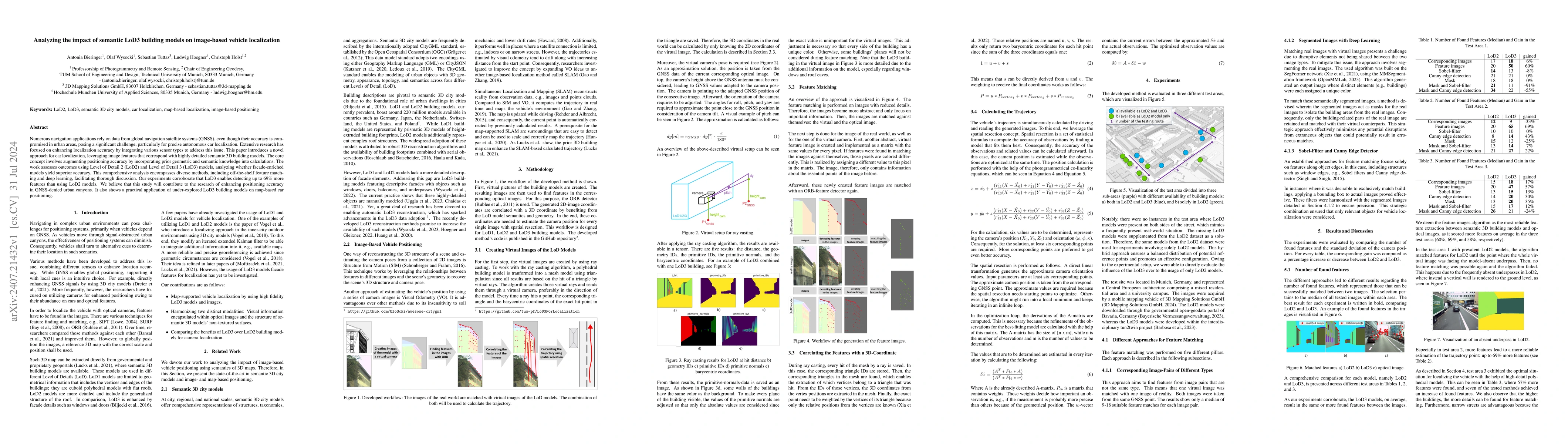
Numerous navigation applications rely on data from global navigation satellite systems (GNSS), even though their accuracy is compromised in urban areas, posing a significant challenge, particularly fo...
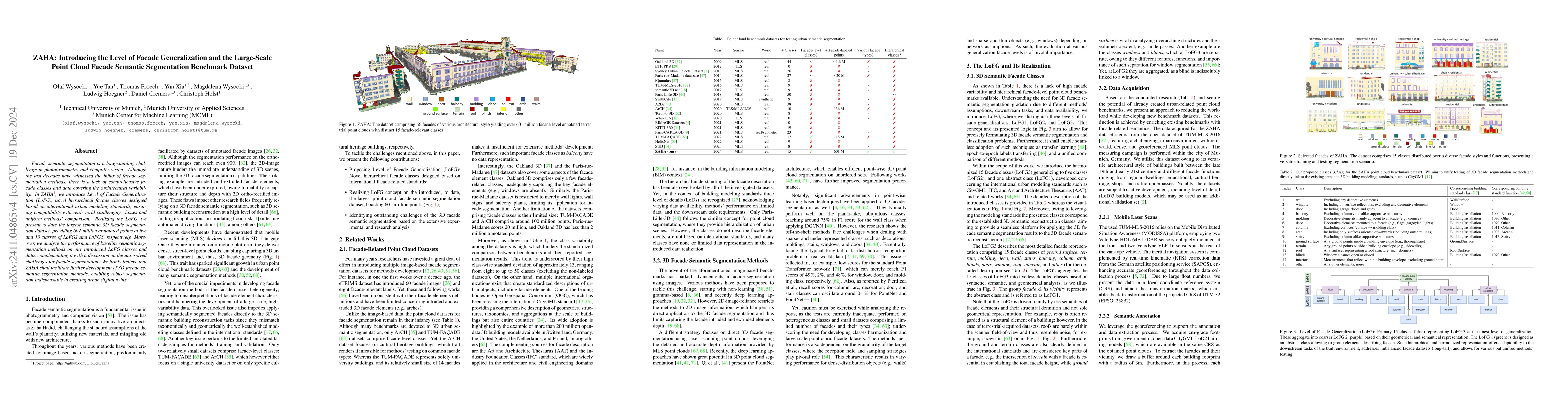
Facade semantic segmentation is a long-standing challenge in photogrammetry and computer vision. Although the last decades have witnessed the influx of facade segmentation methods, there is a lack of ...
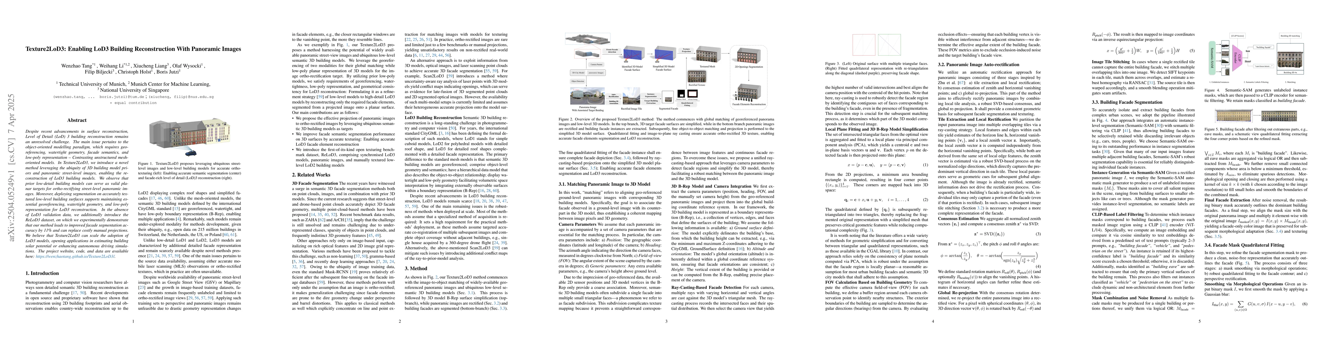
Despite recent advancements in surface reconstruction, Level of Detail (LoD) 3 building reconstruction remains an unresolved challenge. The main issue pertains to the object-oriented modelling paradig...
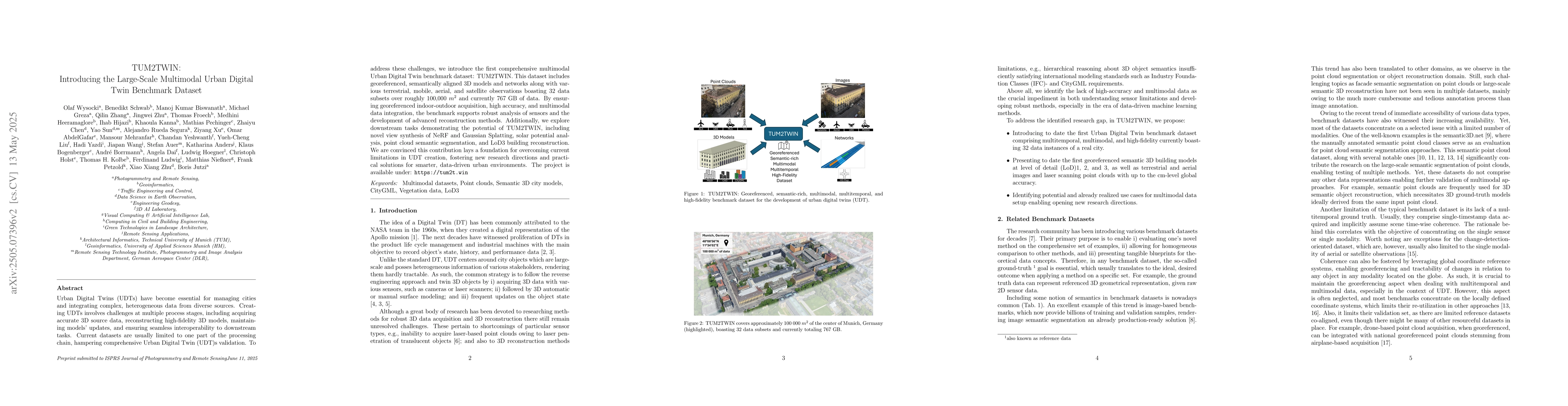
Urban Digital Twins (UDTs) have become essential for managing cities and integrating complex, heterogeneous data from diverse sources. Creating UDTs involves challenges at multiple process stages, inc...
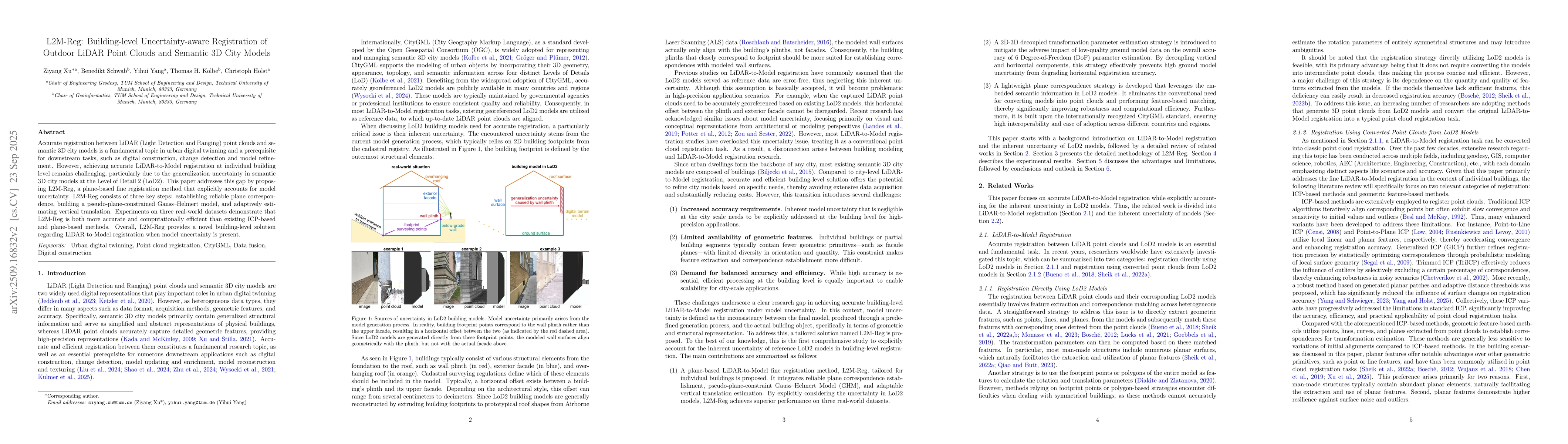
Accurate registration between LiDAR (Light Detection and Ranging) point clouds and semantic 3D city models is a fundamental topic in urban digital twinning and a prerequisite for downstream tasks, suc...
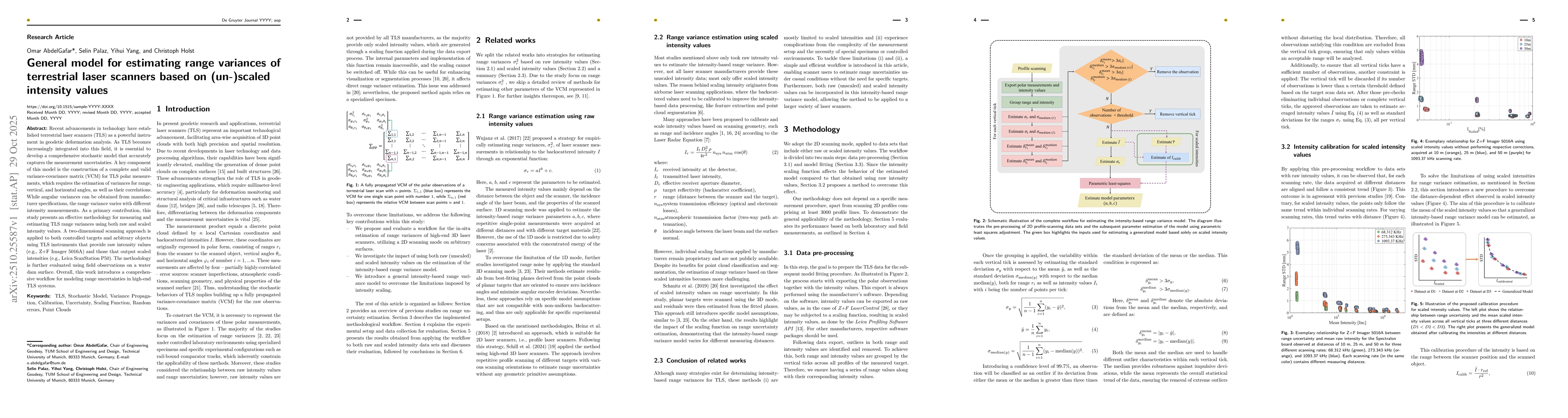
Recent advancements in technology have established terrestrial laser scanners (TLS) as a powerful instrument in geodetic deformation analysis. As TLS becomes increasingly integrated into this field, i...
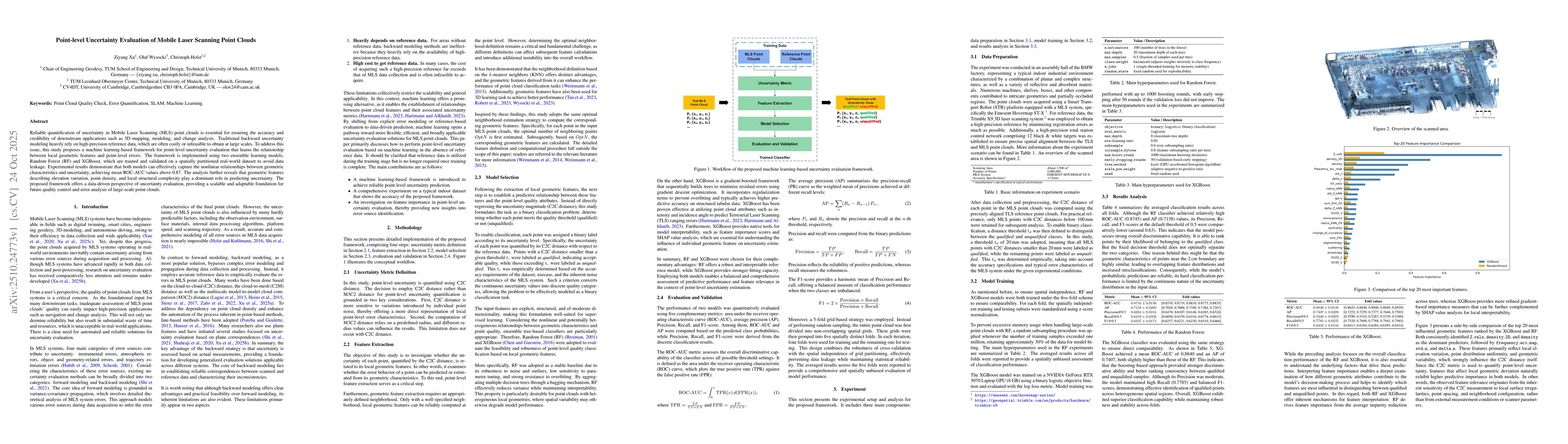
Reliable quantification of uncertainty in Mobile Laser Scanning (MLS) point clouds is essential for ensuring the accuracy and credibility of downstream applications such as 3D mapping, modeling, and c...
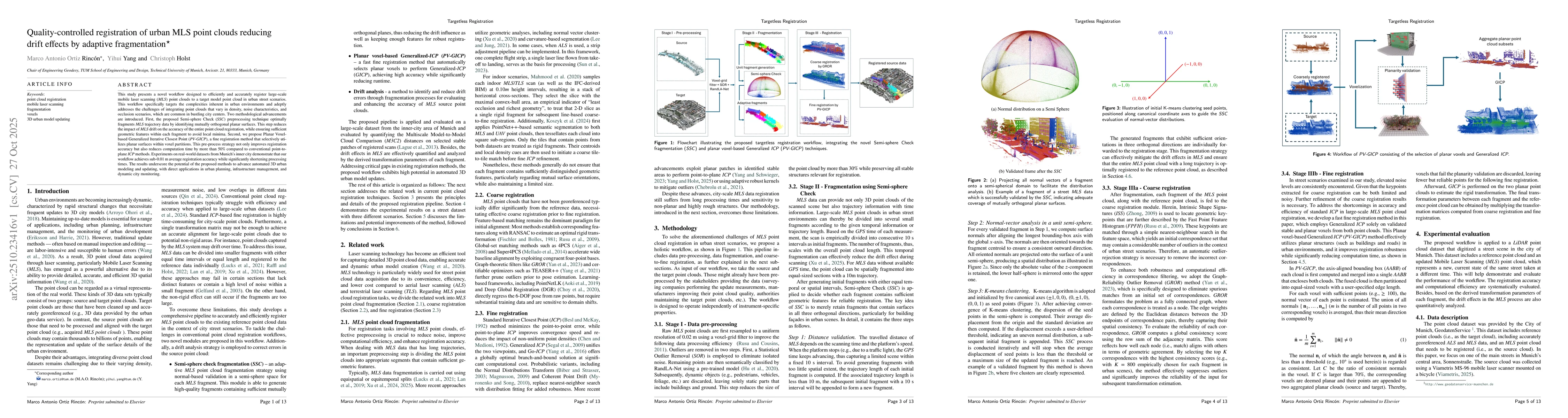
This study presents a novel workflow designed to efficiently and accurately register large-scale mobile laser scanning (MLS) point clouds to a target model point cloud in urban street scenarios. This ...
Globally consistent semantic digital twins require centimeter-accurate and geographically transferable 3D facade segmentation. However, progress in facade parsing is limited by the lack of large-scale...