Academic Profile
Statistics
Similar Authors
Papers on arXiv
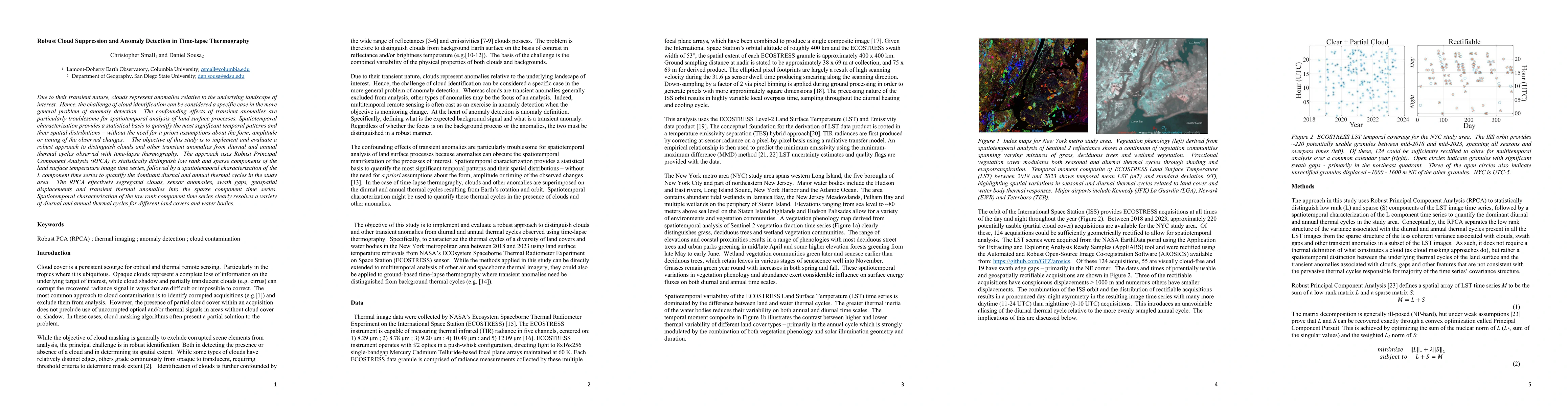
Due to their transient nature, clouds represent anomalies relative to the underlying landscape of interest. Hence, the challenge of cloud identification can be considered a specific case in the more...
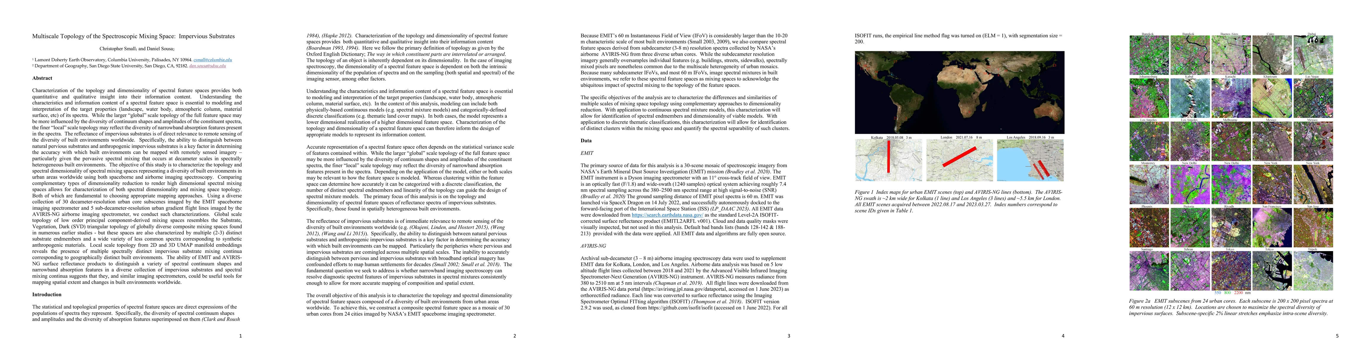
Characterization of topology and dimensionality of spectral feature spaces provides insight into information content. The objective of this study is to characterize topology and spectral dimensional...
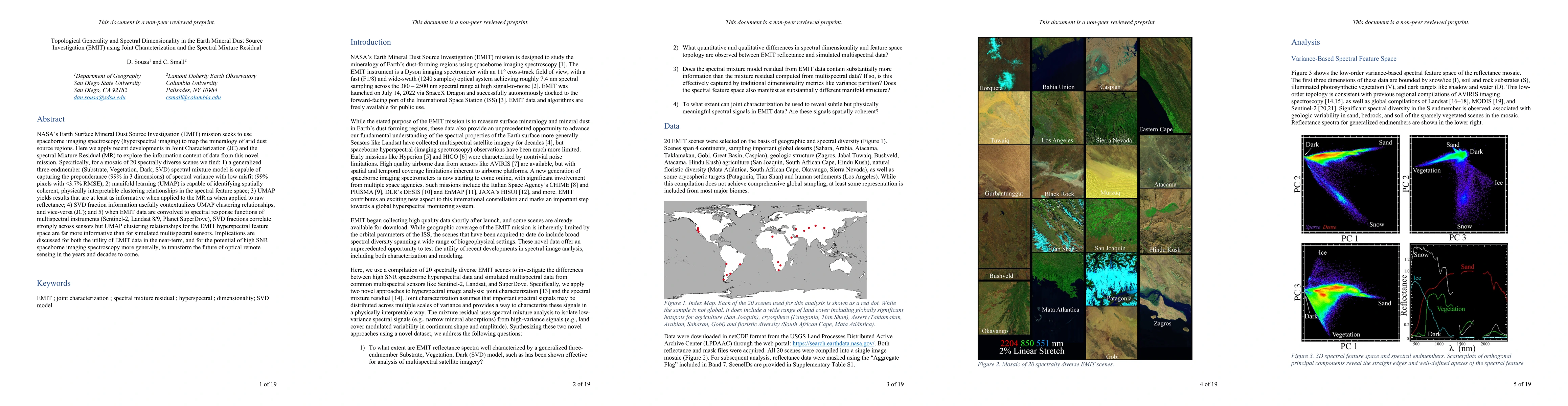
NASA's Earth Surface Mineral Dust Source Investigation (EMIT) mission seeks to use spaceborne imaging spectroscopy (hyperspectral imaging) to map the mineralogy of arid dust source regions. Here we ...
Systems for large scale deliberation have resolved polarized issues and shifted agenda setting into the public's hands. These systems integrate bridging-based ranking algorithms - including group in...
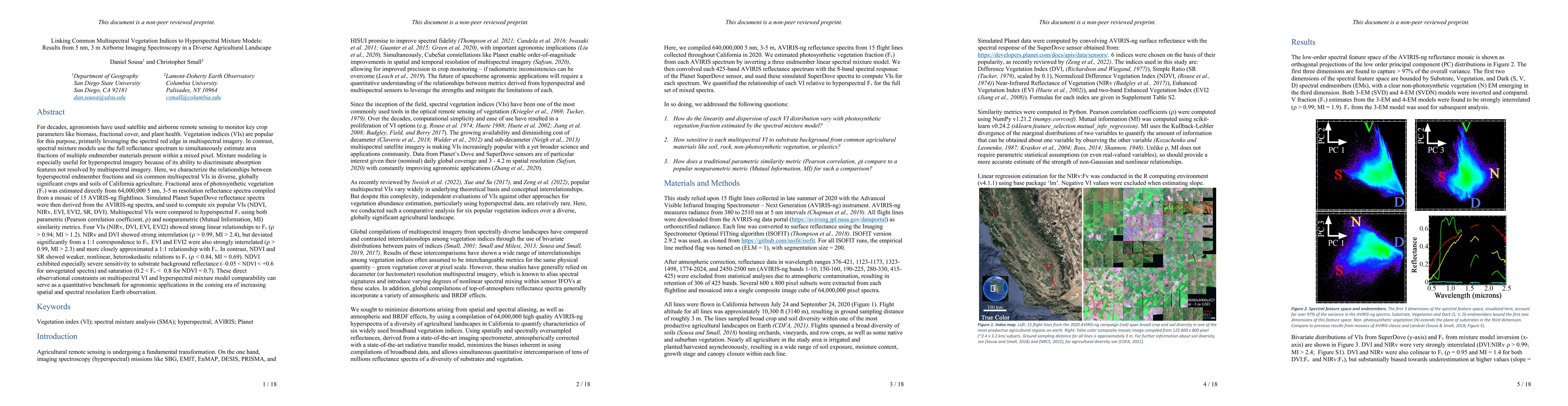
For decades, agronomists have used remote sensing to monitor key crop parameters like biomass, fractional cover, and plant health. Vegetation indices (VIs) are popular for this purpose, primarily le...
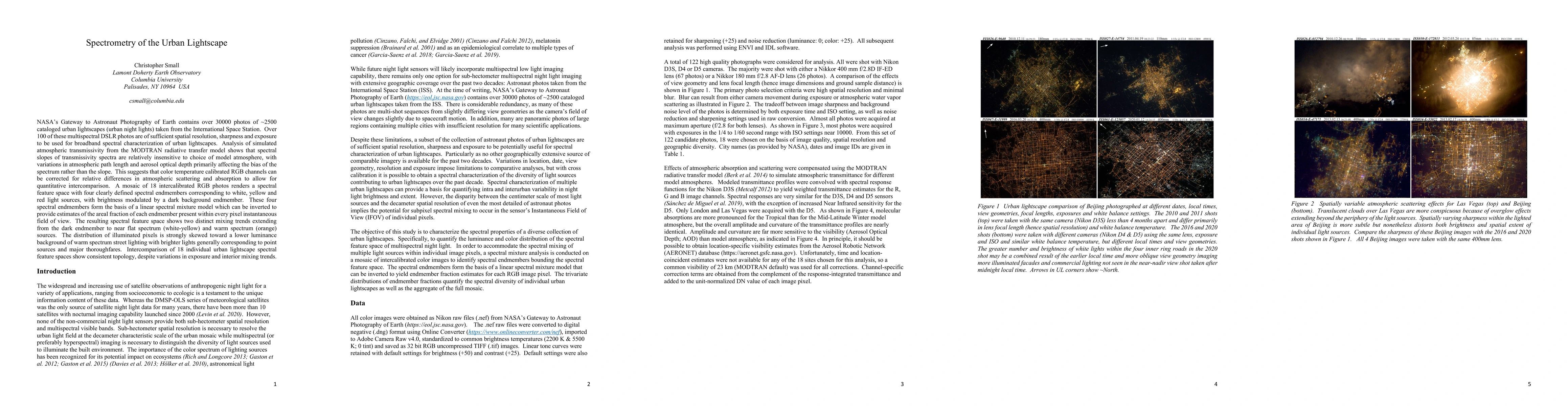
NASA's Gateway to Astronaut Photography of Earth Contains over 30000 photos of 2500 cataloged urban lightscapes (urban night lights) taken from the International Space Station. Over 100 of these mul...
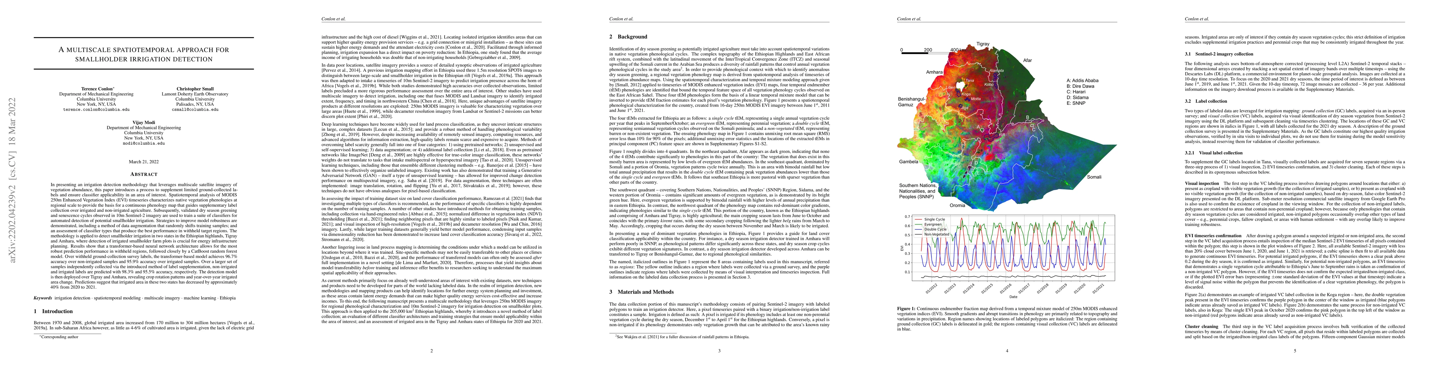
In presenting an irrigation detection methodology that leverages multiscale satellite imagery of vegetation abundance, this paper introduces a process to supplement limited ground-collected labels a...
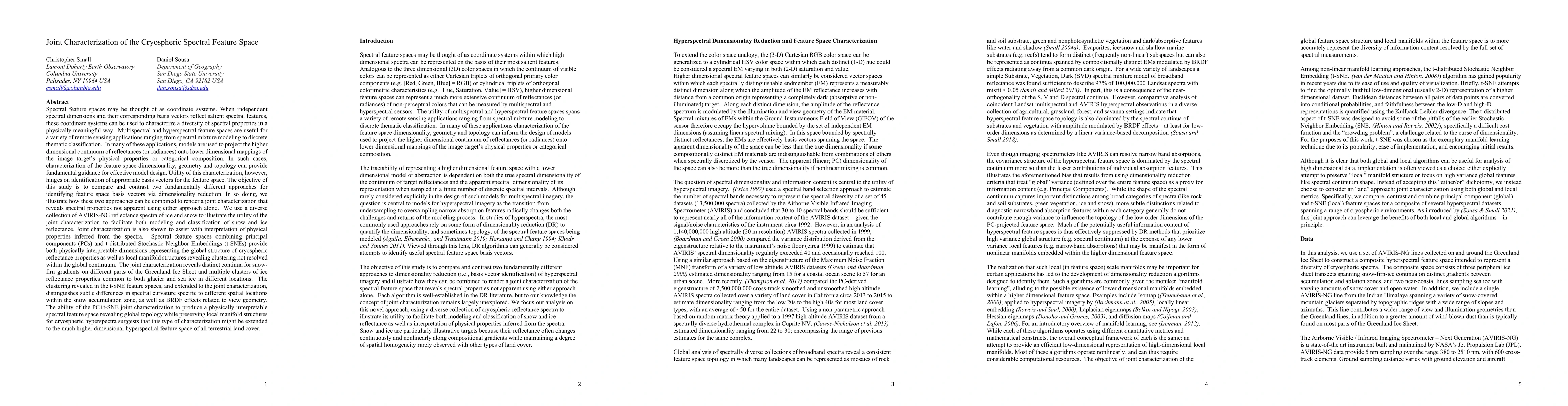
Hyperspectral feature spaces are useful for many remote sensing applications ranging from spectral mixture modeling to discrete thematic classification. In such cases, characterization of the featur...
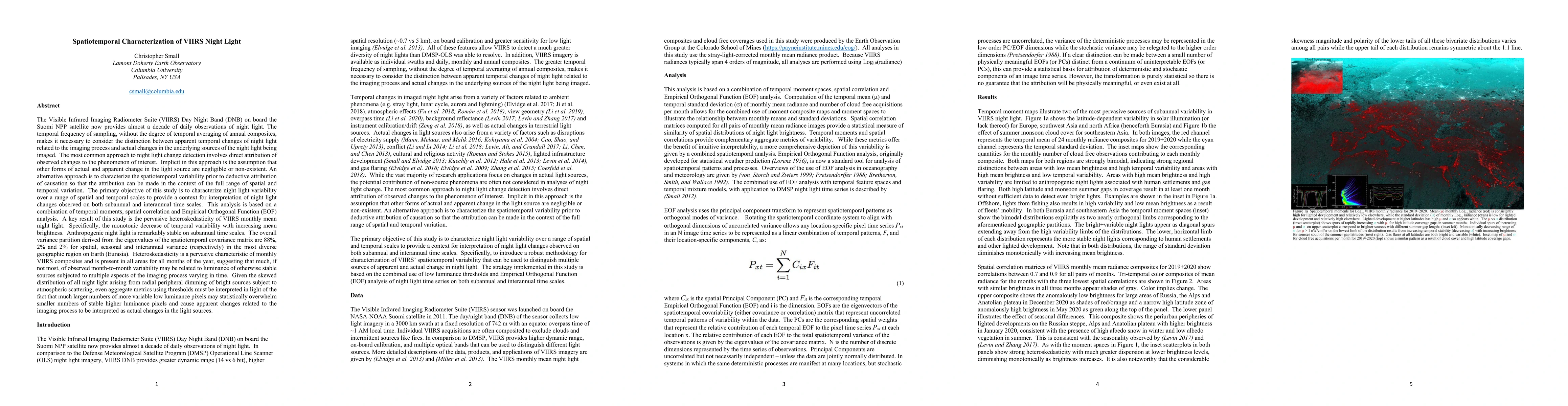
The VIIRS Day Night Band sensor on the Suomi NPP satellite provides almost a decade of observations of night light. The daily frequency of sampling, without the temporal averaging of annual composit...
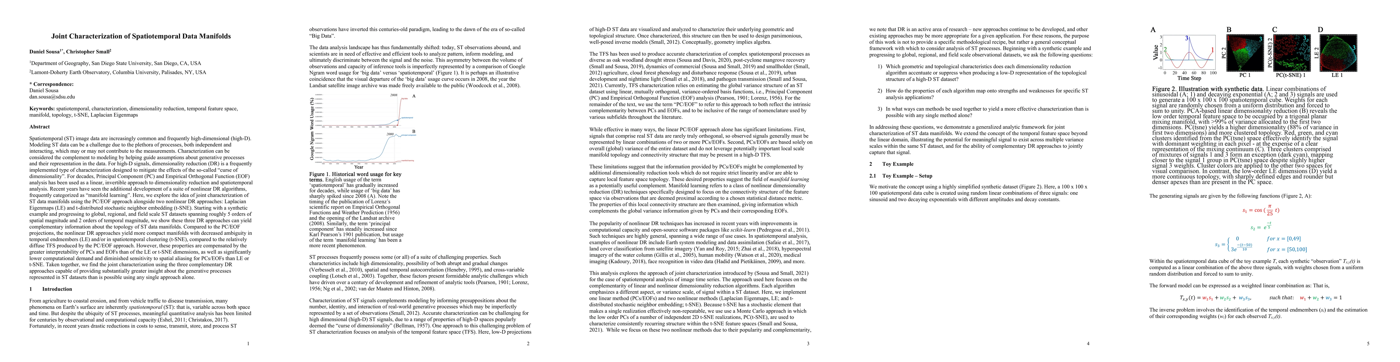
Spatiotemporal (ST) image data are increasingly common and often high-dimensional (high-D). Modeling ST data can be a challenge due to the plethora of independent and interacting processes which may...
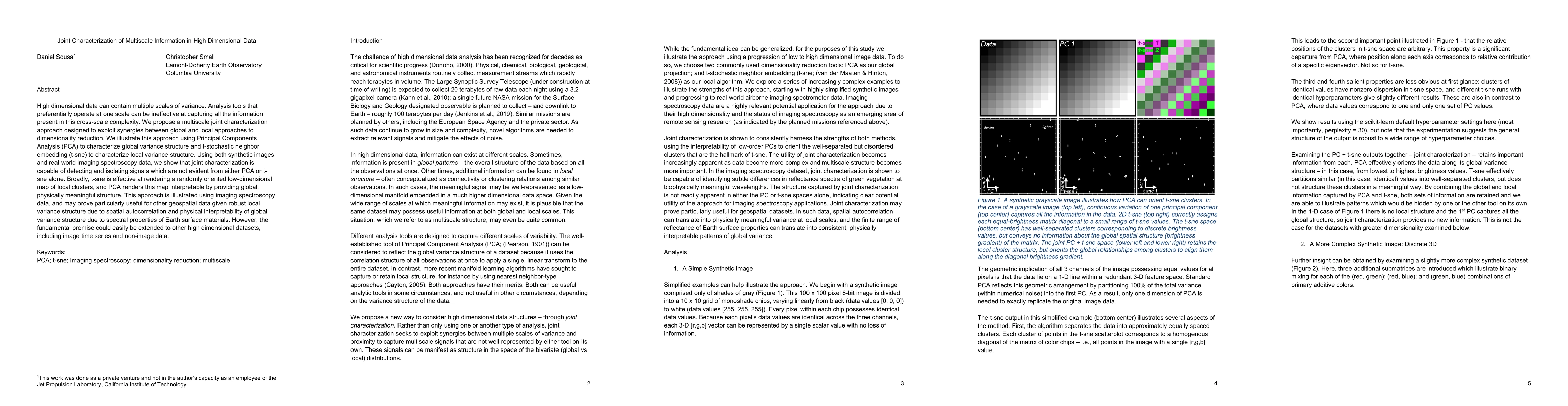
High dimensional data can contain multiple scales of variance. Analysis tools that preferentially operate at one scale can be ineffective at capturing all the information present in this cross-scale...
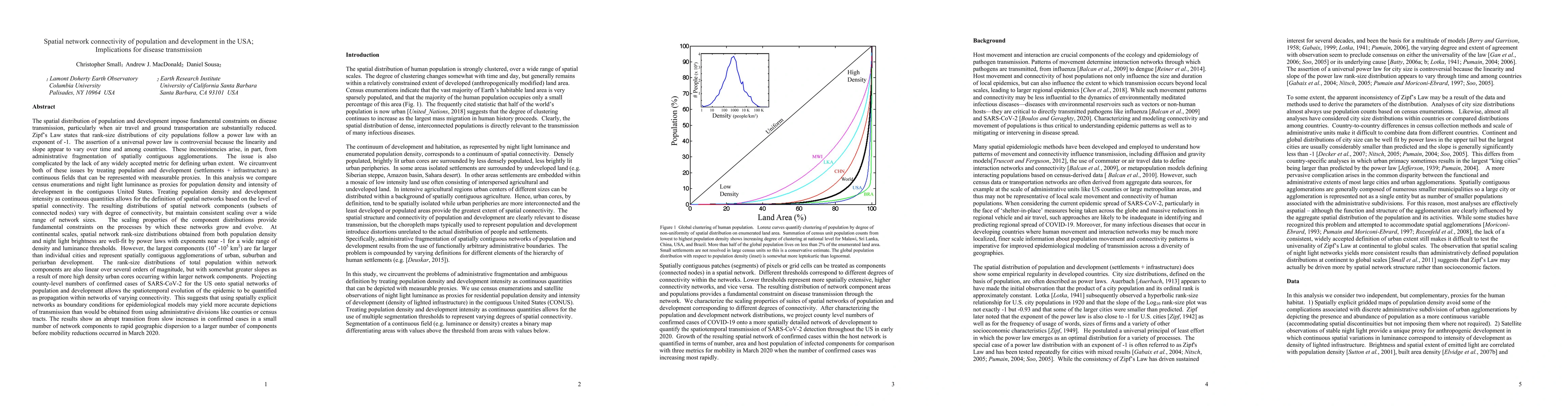
Zipfs Law states that rank-size distributions of city populations follow a power law with an exponent of -1. The assertion of a universal power law is controversial because the linearity and slope a...
Two substantial technological advances have reshaped the public square in recent decades: first with the advent of the internet and second with the recent introduction of large language models (LLMs)....