Academic Profile
Statistics
Similar Authors
Papers on arXiv
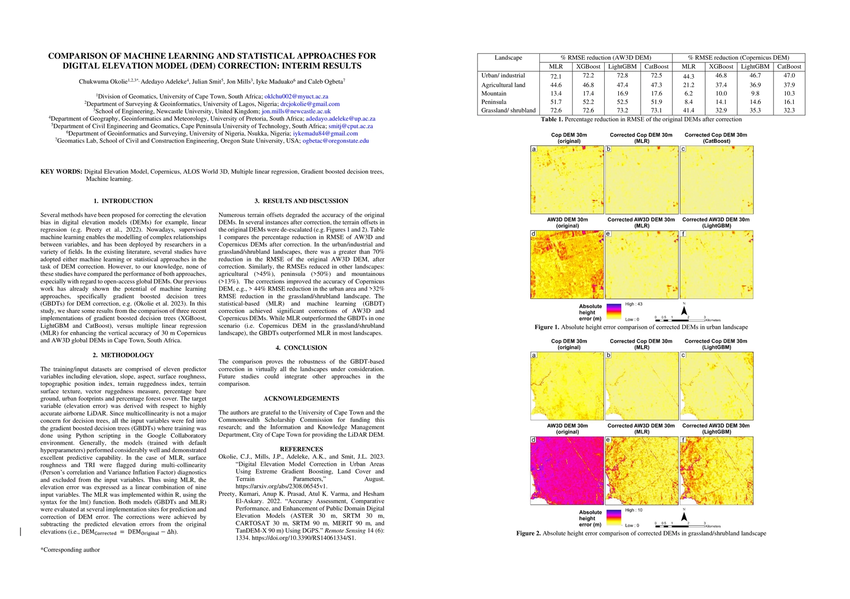
Several methods have been proposed for correcting the elevation bias in digital elevation models (DEMs) for example, linear regression. Nowadays, supervised machine learning enables the modelling of...
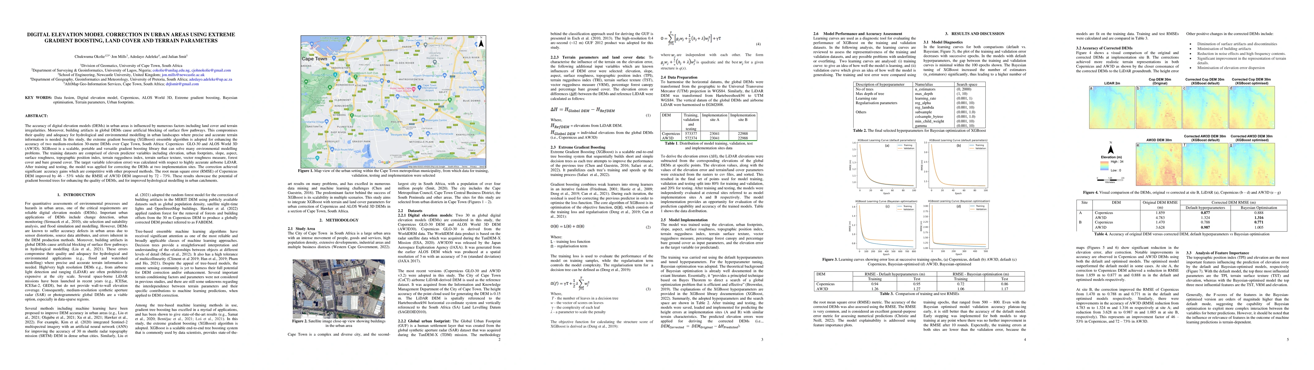
The accuracy of digital elevation models (DEMs) in urban areas is influenced by numerous factors including land cover and terrain irregularities. Moreover, building artifacts in global DEMs cause ar...
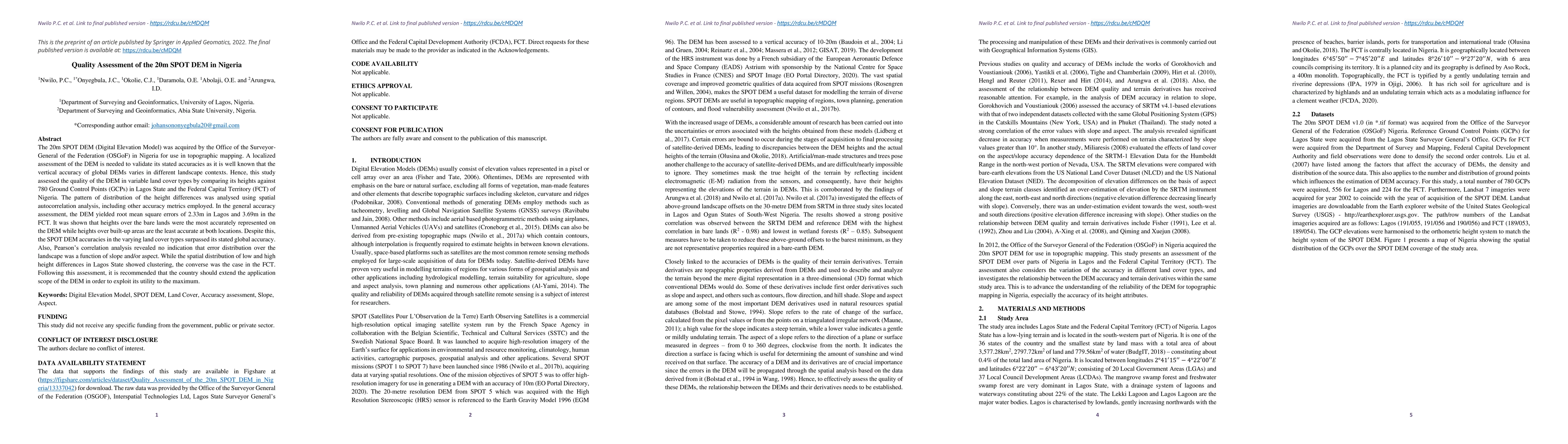
The 20m SPOT DEM (Digital Elevation Model) was acquired by the Office of the Surveyor-General of the Federation (OSGoF) in Nigeria for use in topographic mapping. A localized assessment of the DEM i...
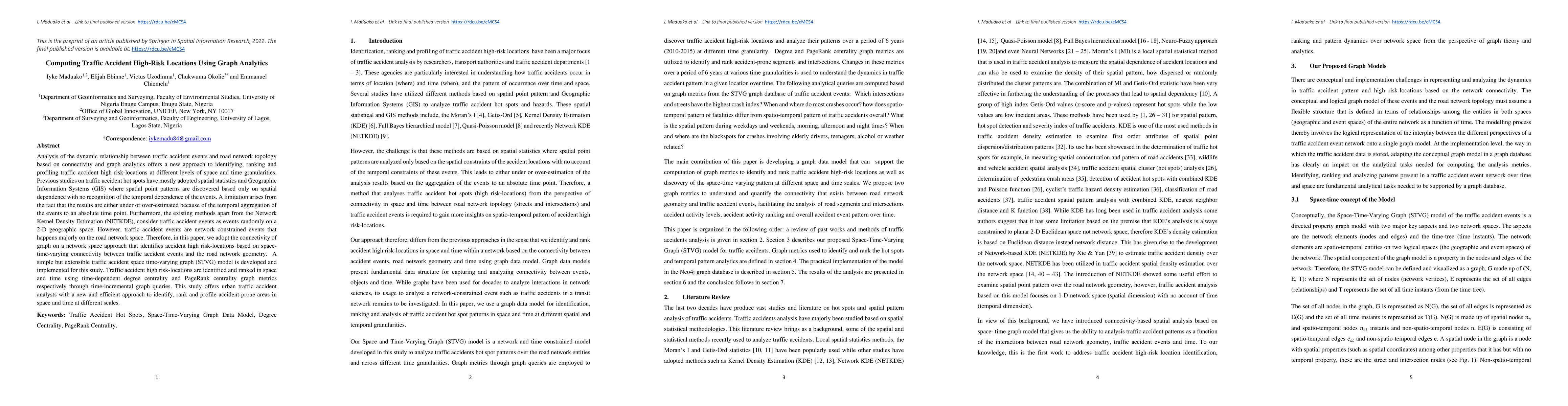
Analysis of the dynamic relationship between traffic accident events and road network topology based on connectivity and graph analytics offers a new approach to identifying, ranking and profiling t...
The remote sensing community has identified data fusion as one of the key challenging topics of the 21st century. The subject of image fusion in two-dimensional (2D) space has been covered in severa...