Academic Profile
Statistics
Similar Authors
Papers on arXiv
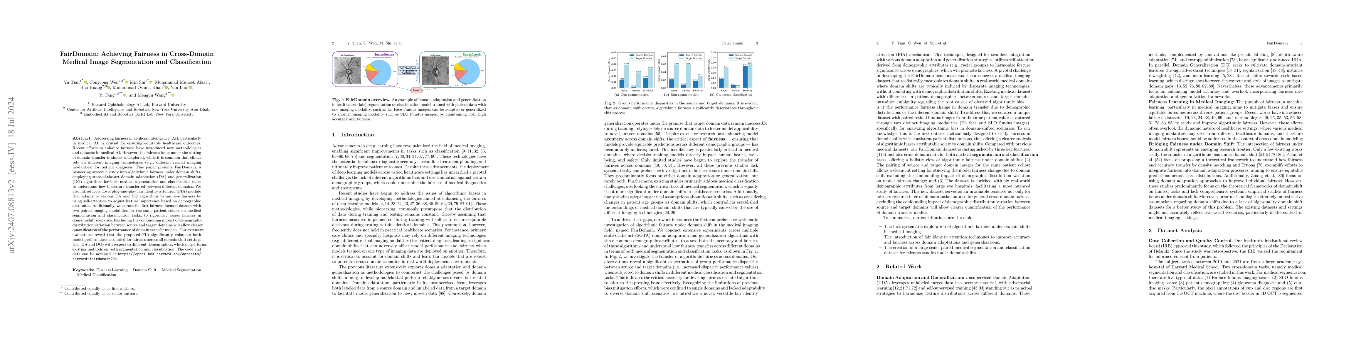
Addressing fairness in artificial intelligence (AI), particularly in medical AI, is crucial for ensuring equitable healthcare outcomes. Recent efforts to enhance fairness have introduced new methodolo...
We introduce the first work on benchmarking and evaluating deep clustering algorithms on large-scale non-categorical 3D CAD models. We first propose a workflow to allow expert mechanical engineers t...
In the field of robotics and automation, navigation systems based on Large Language Models (LLMs) have recently shown impressive performance. However, the security aspects of these systems have rece...
City modeling and generation have attracted an increased interest in various applications, including gaming, urban planning, and autonomous driving. Unlike previous works focused on the generation o...
The emergence of large-scale large language models, with GPT-4 as a prominent example, has significantly propelled the rapid advancement of artificial general intelligence and sparked the revolution...
The remarkable achievements of ChatGPT and GPT-4 have sparked a wave of interest and research in the field of large language models for Artificial General Intelligence (AGI). These models provide in...
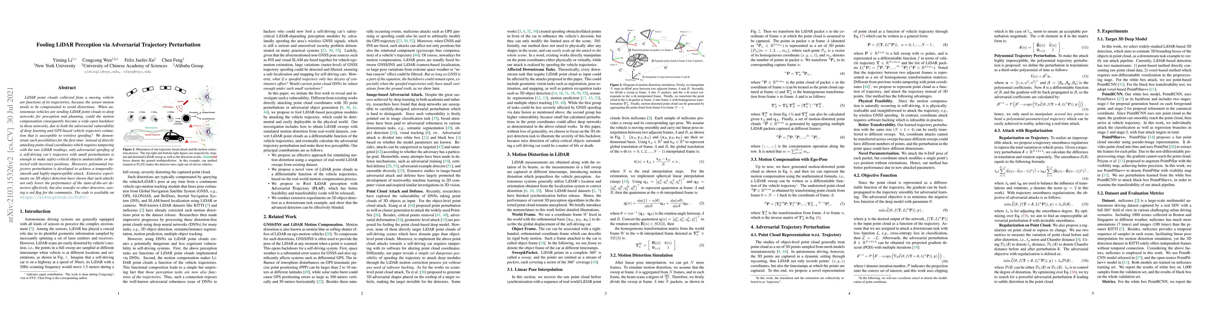
LiDAR point clouds collected from a moving vehicle are functions of its trajectories, because the sensor motion needs to be compensated to avoid distortions. When autonomous vehicles are sending LiD...
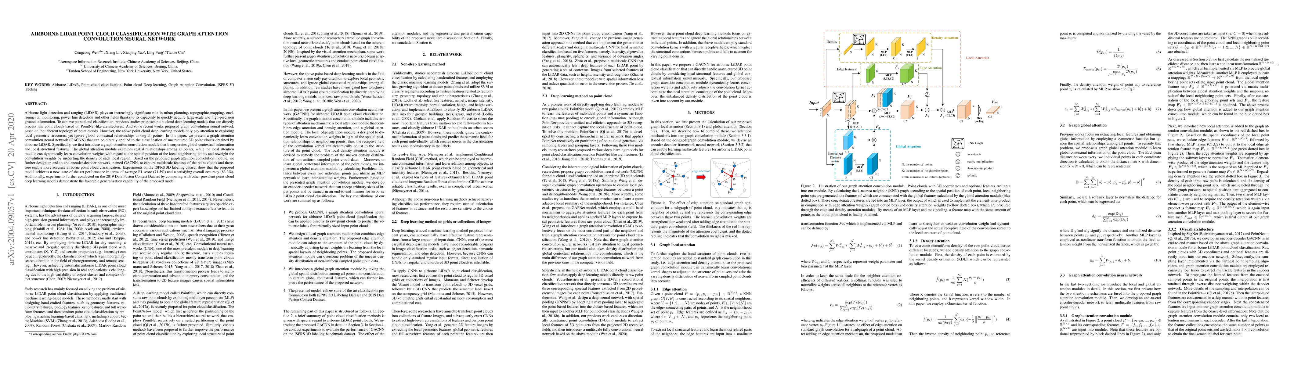
Airborne light detection and ranging (LiDAR) plays an increasingly significant role in urban planning, topographic mapping, environmental monitoring, power line detection and other fields thanks to ...
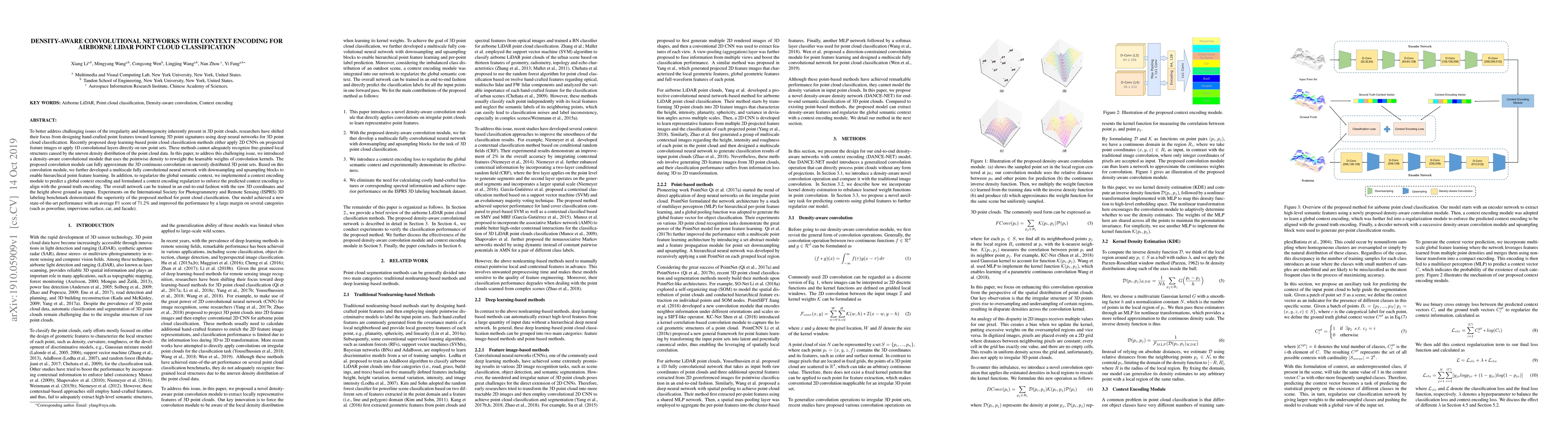
To better address challenging issues of the irregularity and inhomogeneity inherently present in 3D point clouds, researchers have been shifting their focus from the design of hand-craft point featu...
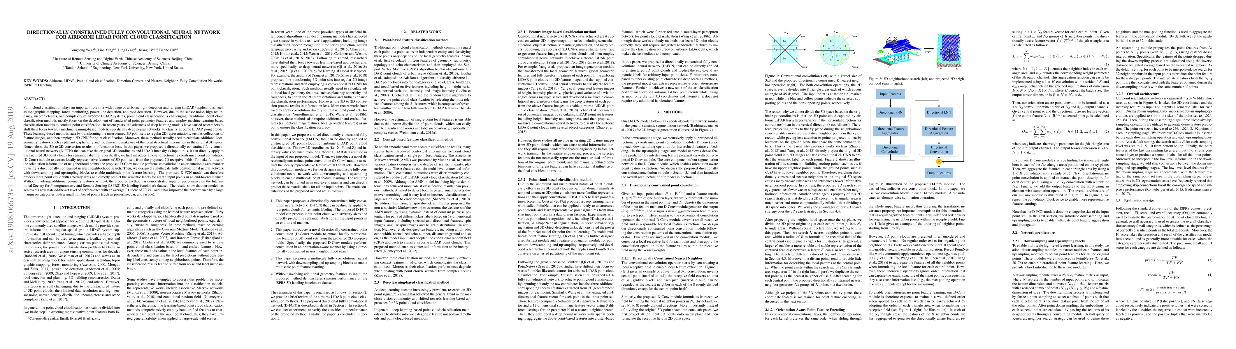
Point cloud classification plays an important role in a wide range of airborne light detection and ranging (LiDAR) applications, such as topographic mapping, forest monitoring, power line detection,...
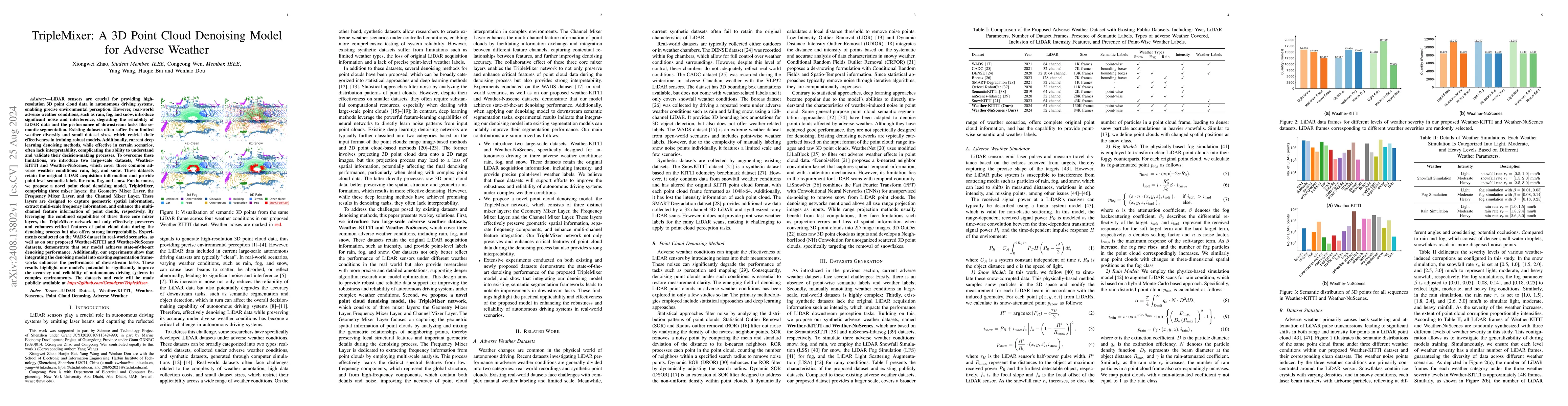
LiDAR sensors are crucial for providing high-resolution 3D point cloud data in autonomous driving systems, enabling precise environmental perception. However, real-world adverse weather conditions, su...
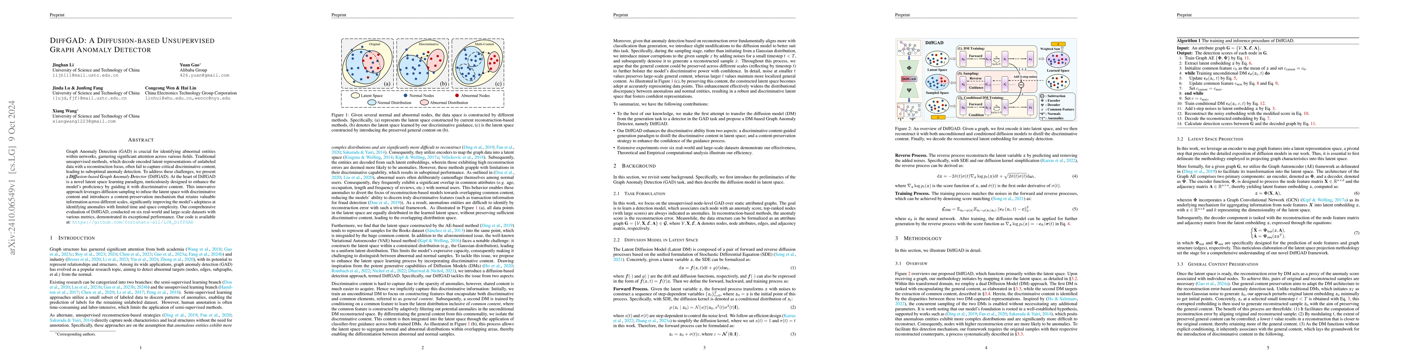
Graph Anomaly Detection (GAD) is crucial for identifying abnormal entities within networks, garnering significant attention across various fields. Traditional unsupervised methods, which decode encode...
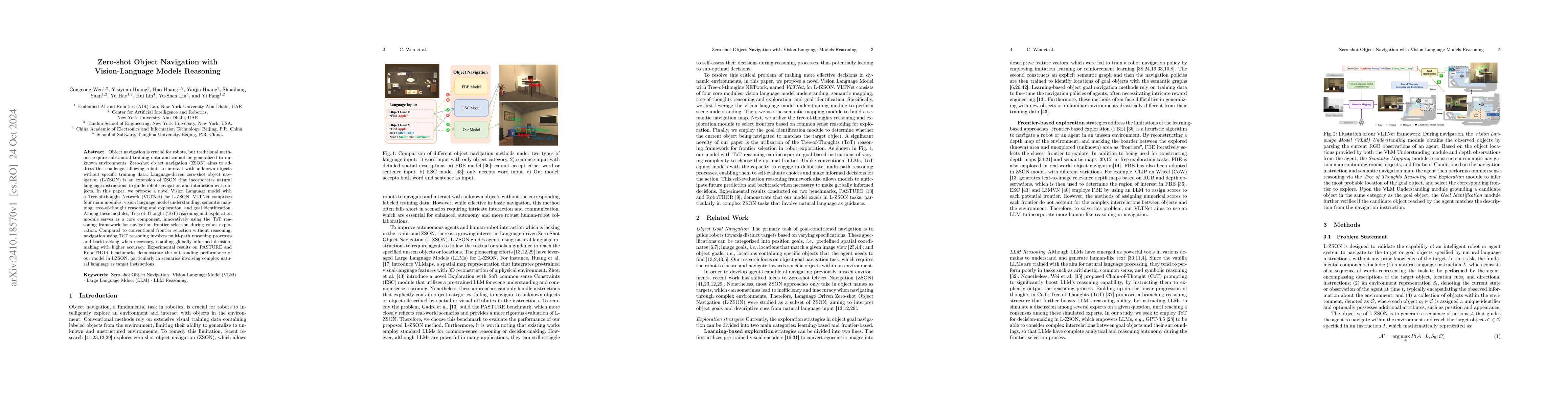
Object navigation is crucial for robots, but traditional methods require substantial training data and cannot be generalized to unknown environments. Zero-shot object navigation (ZSON) aims to address...
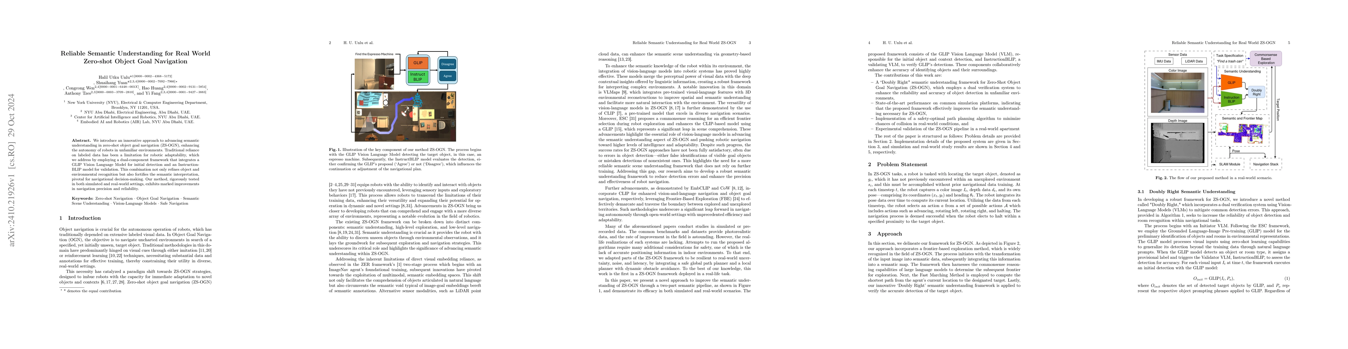
We introduce an innovative approach to advancing semantic understanding in zero-shot object goal navigation (ZS-OGN), enhancing the autonomy of robots in unfamiliar environments. Traditional reliance ...
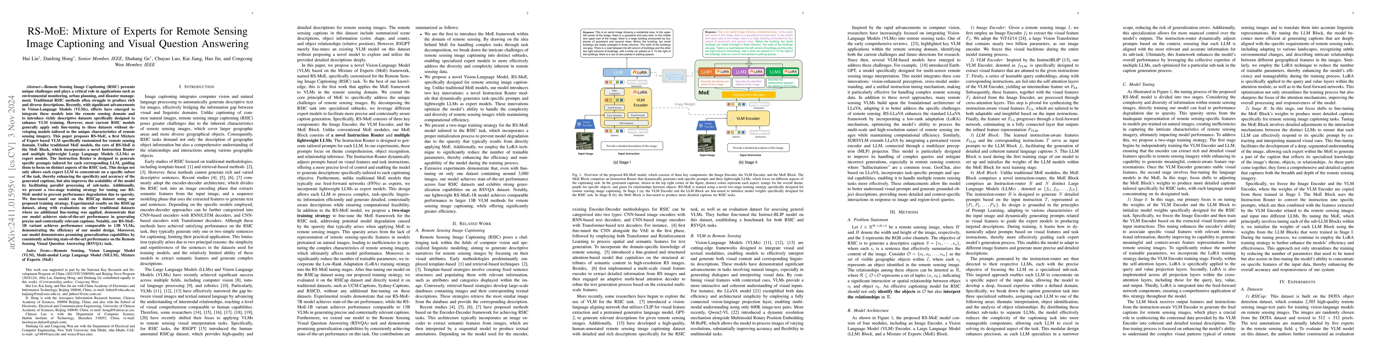
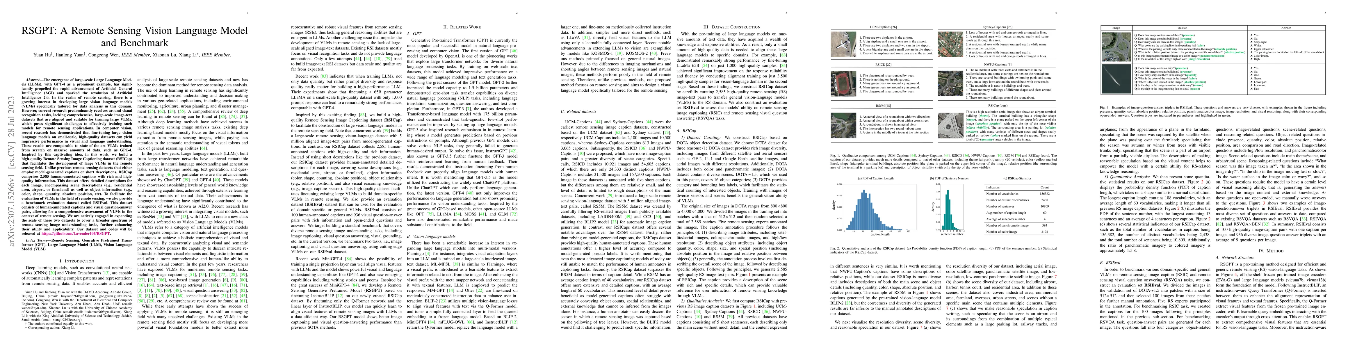
Remote Sensing Image Captioning (RSIC) presents unique challenges and plays a critical role in applications. Traditional RSIC methods often struggle to produce rich and diverse descriptions. Recently,...
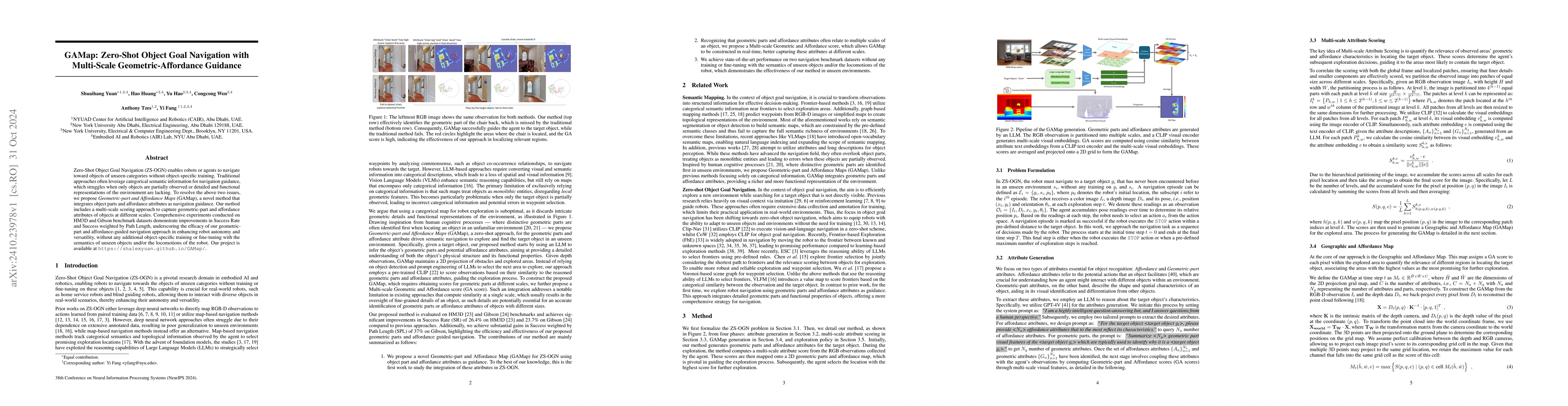
Zero-Shot Object Goal Navigation (ZS-OGN) enables robots or agents to navigate toward objects of unseen categories without object-specific training. Traditional approaches often leverage categorical s...
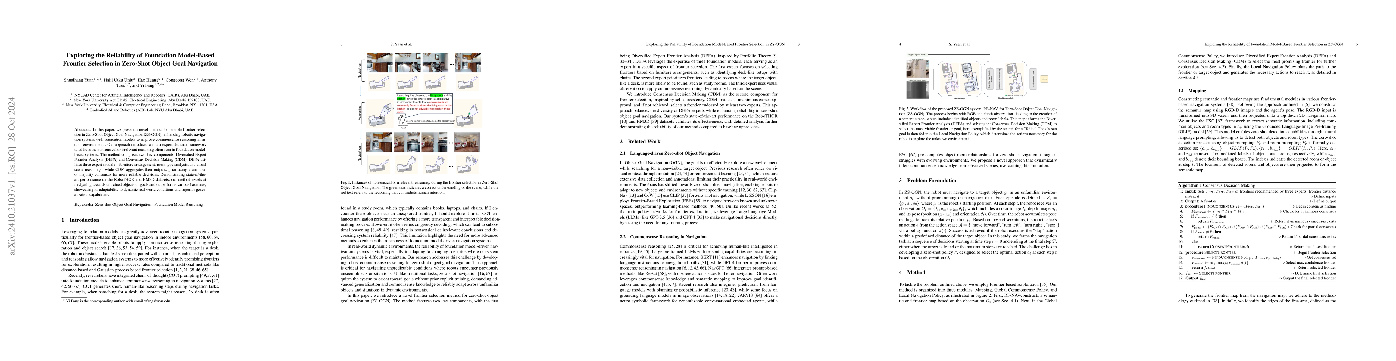
In this paper, we present a novel method for reliable frontier selection in Zero-Shot Object Goal Navigation (ZS-OGN), enhancing robotic navigation systems with foundation models to improve commonsens...
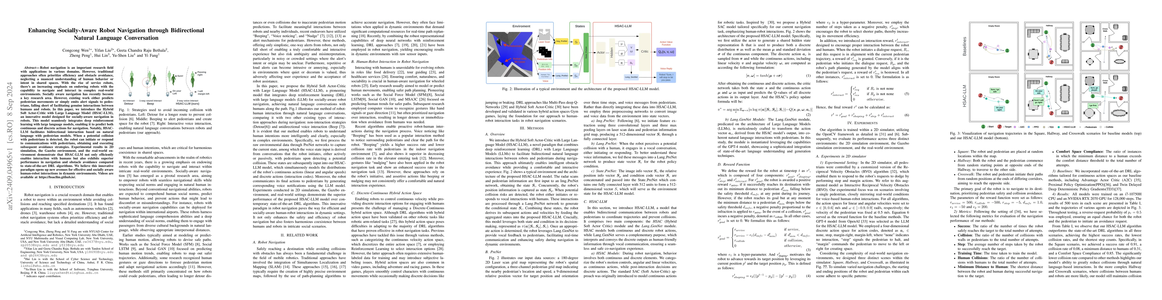
Robot navigation is an important research field with applications in various domains. However, traditional approaches often prioritize efficiency and obstacle avoidance, neglecting a nuanced understan...
Recent progress in generative AI, especially diffusion models, has demonstrated significant utility in text-to-image synthesis. Particularly in healthcare, these models offer immense potential in gene...
We present a comprehensive theoretical framework analyzing the relationship between data distributions and fairness guarantees in equitable deep learning. Our work establishes novel theoretical bounds...
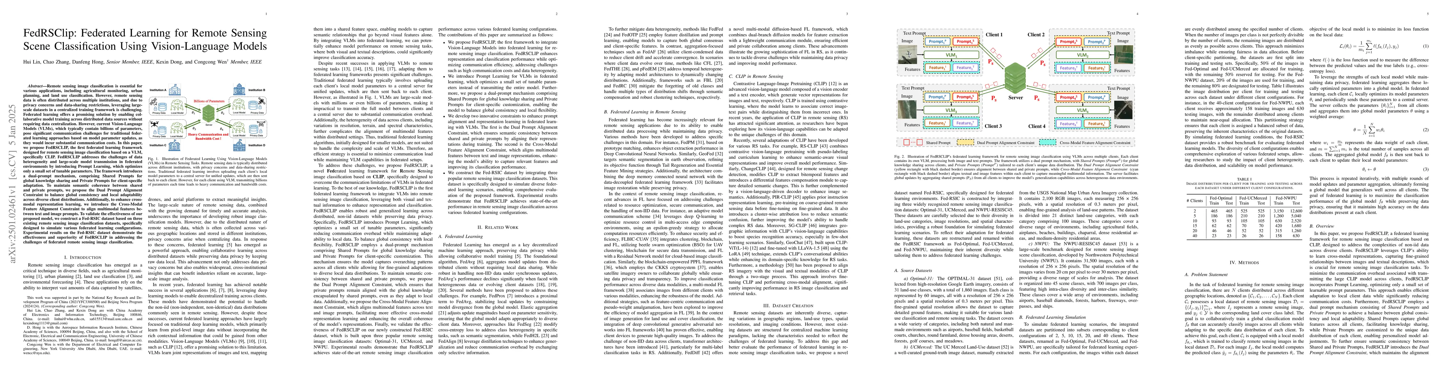
Remote sensing data is often distributed across multiple institutions, and due to privacy concerns and data-sharing restrictions, leveraging large-scale datasets in a centralized training framework is...
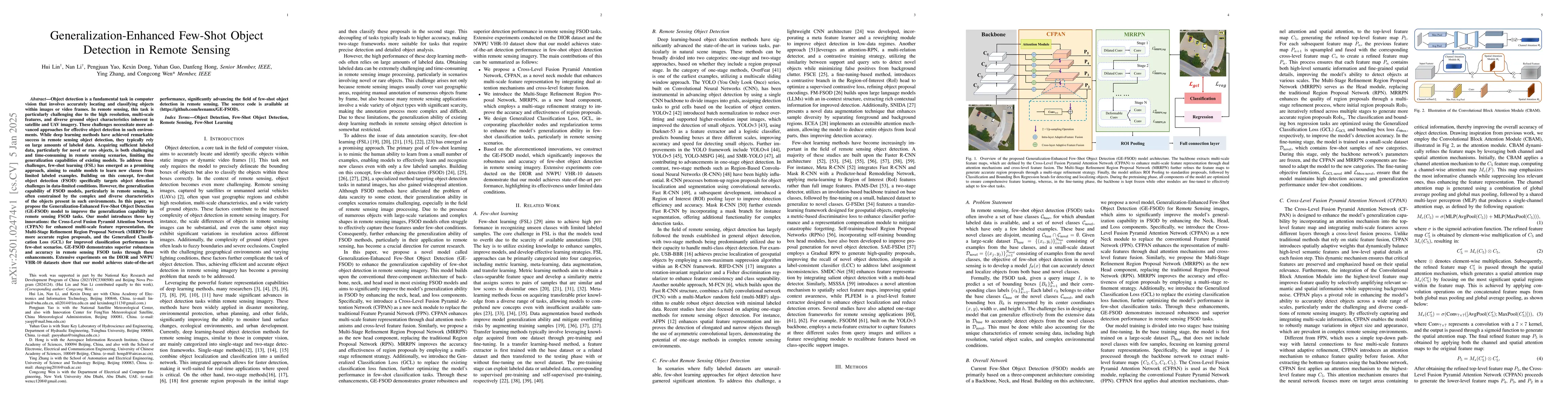
Remote sensing object detection is particularly challenging due to the high resolution, multi-scale features, and diverse ground object characteristics inherent in satellite and UAV imagery. These cha...
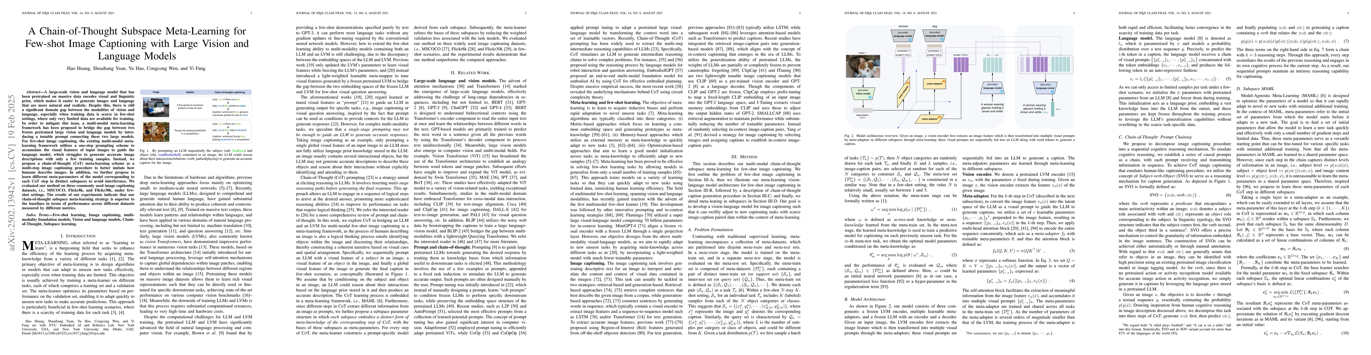
A large-scale vision and language model that has been pretrained on massive data encodes visual and linguistic prior, which makes it easier to generate images and language that are more natural and re...
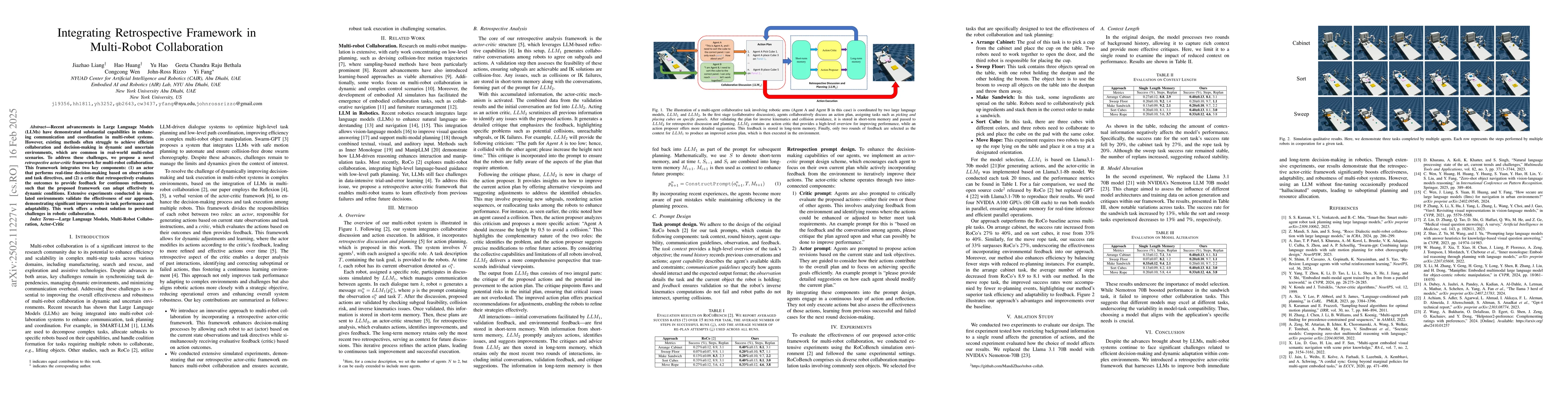
Recent advancements in Large Language Models (LLMs) have demonstrated substantial capabilities in enhancing communication and coordination in multi-robot systems. However, existing methods often strug...
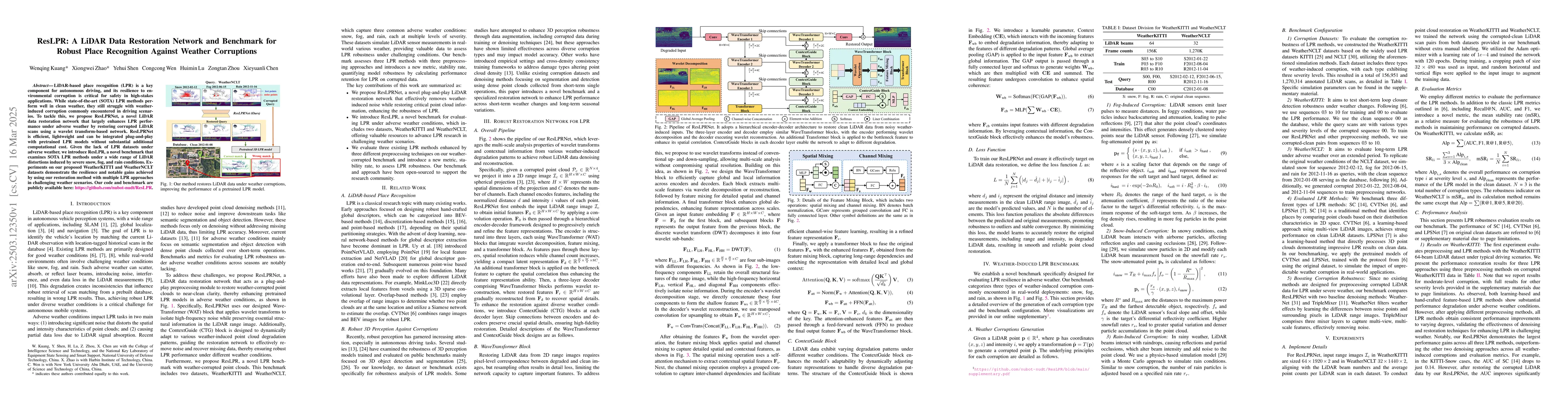
LiDAR-based place recognition (LPR) is a key component for autonomous driving, and its resilience to environmental corruption is critical for safety in high-stakes applications. While state-of-the-art...
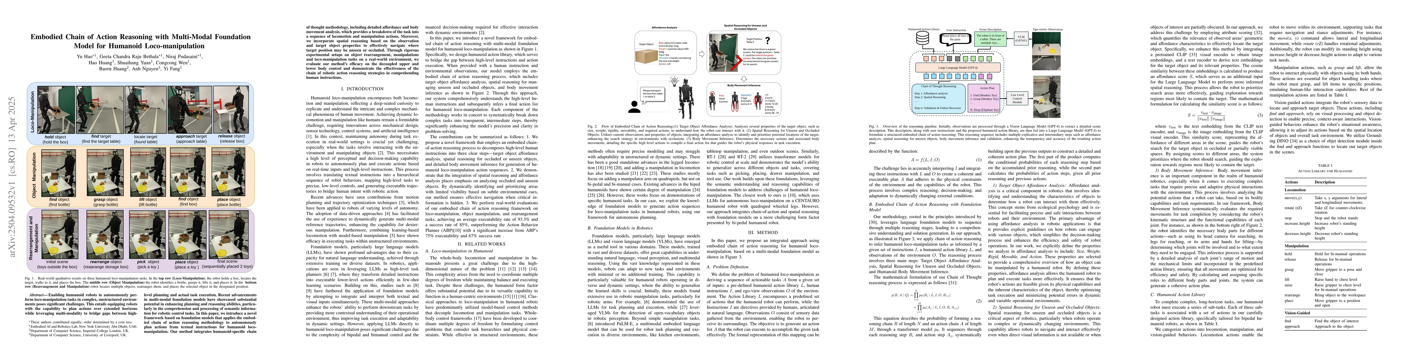
Enabling humanoid robots to autonomously perform loco-manipulation tasks in complex, unstructured environments poses significant challenges. This entails equipping robots with the capability to plan a...
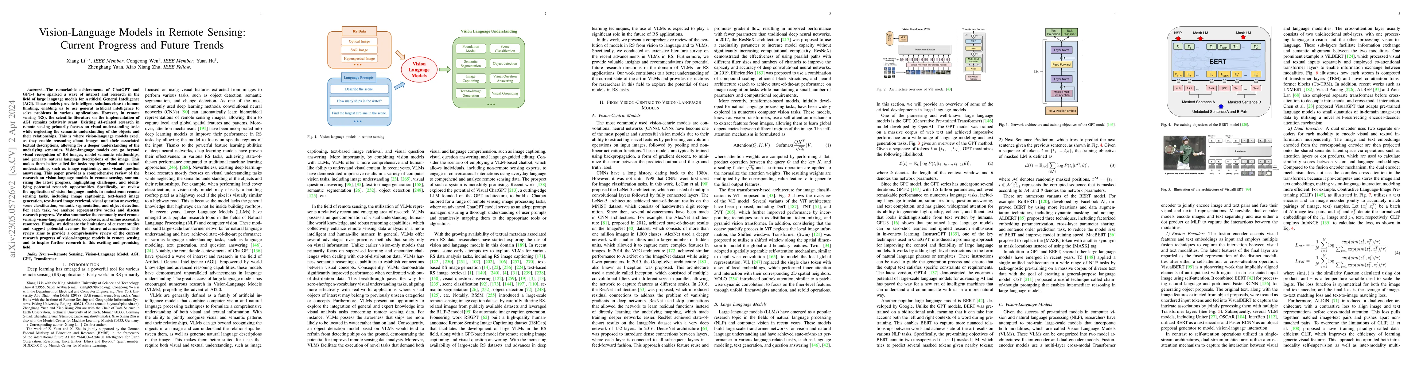
Recent progress in VLMs has demonstrated impressive capabilities across a variety of tasks in the natural image domain. Motivated by these advancements, the remote sensing community has begun to adopt...
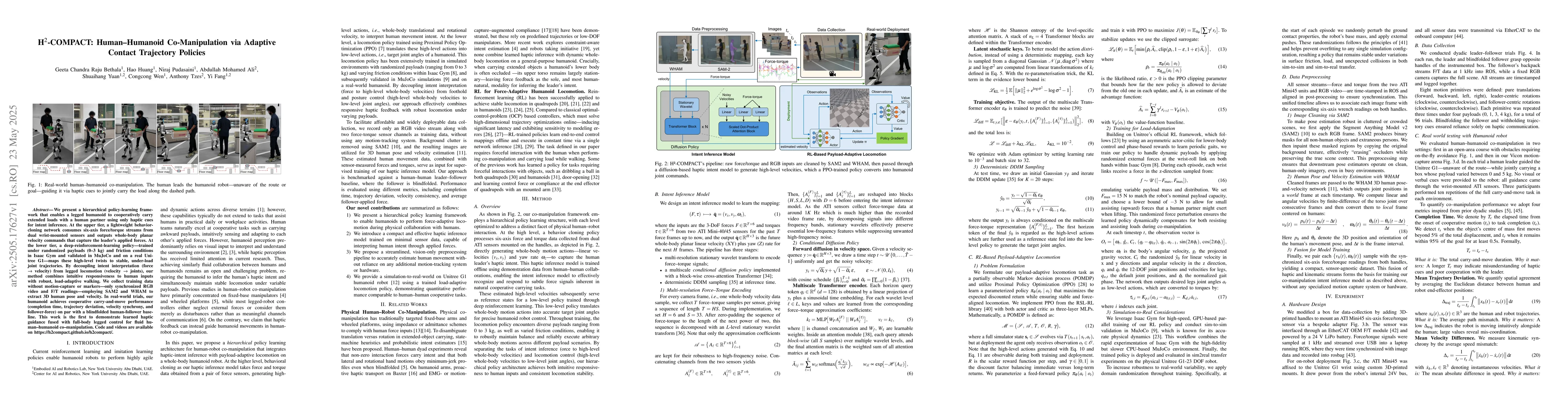
We present a hierarchical policy-learning framework that enables a legged humanoid to cooperatively carry extended loads with a human partner using only haptic cues for intent inference. At the upper ...
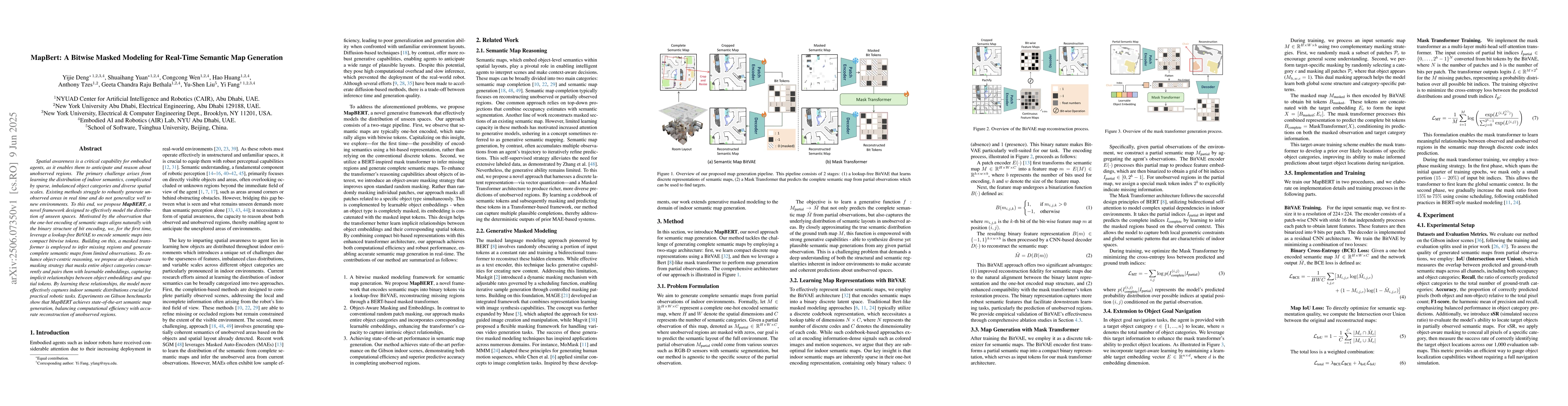
Spatial awareness is a critical capability for embodied agents, as it enables them to anticipate and reason about unobserved regions. The primary challenge arises from learning the distribution of ind...
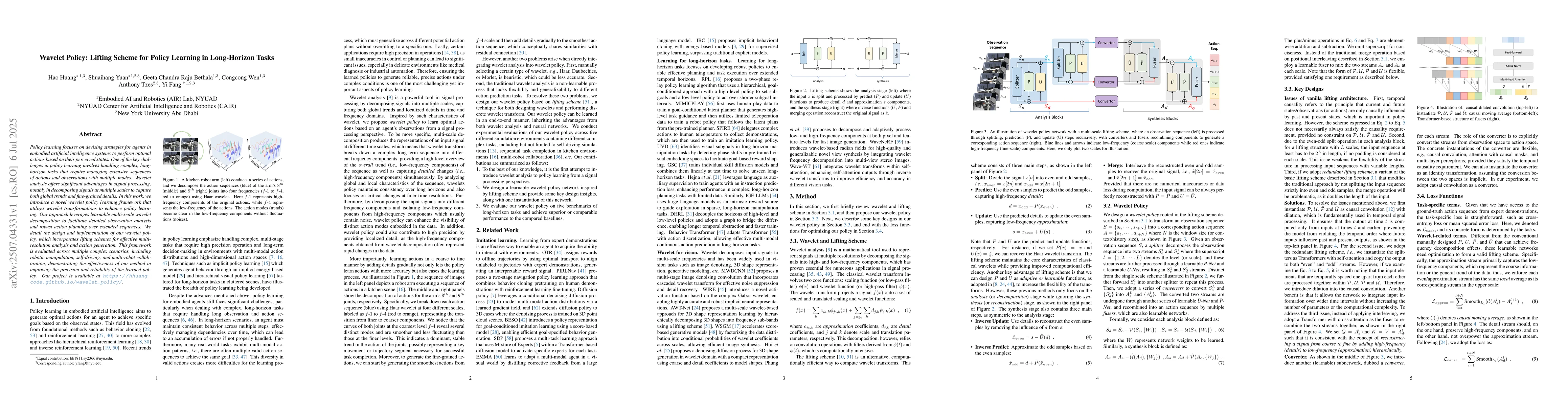
Policy learning focuses on devising strategies for agents in embodied artificial intelligence systems to perform optimal actions based on their perceived states. One of the key challenges in policy le...
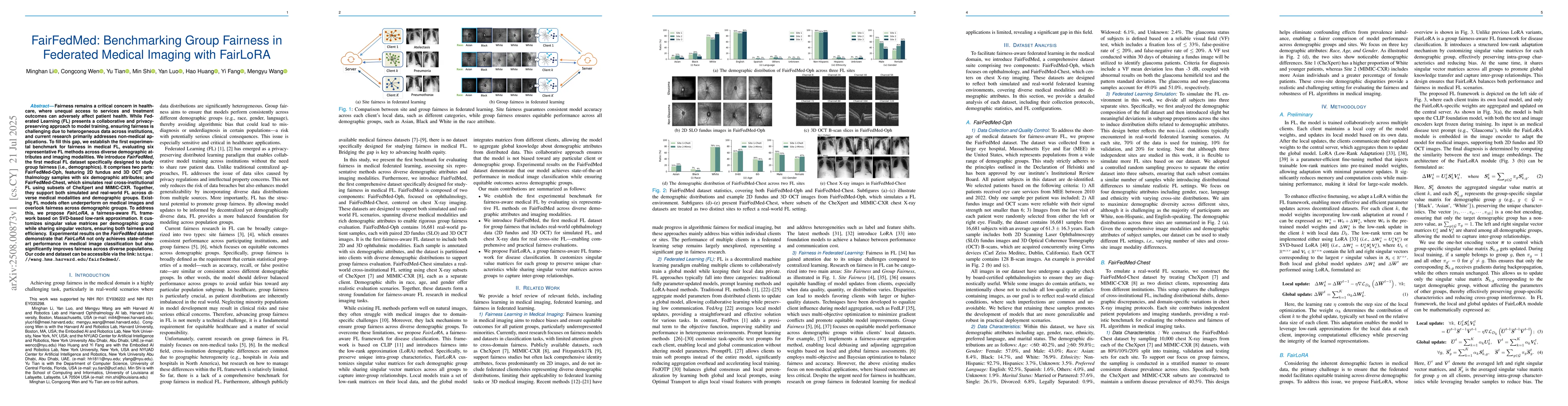
Fairness remains a critical concern in healthcare, where unequal access to services and treatment outcomes can adversely affect patient health. While Federated Learning (FL) presents a collaborative a...
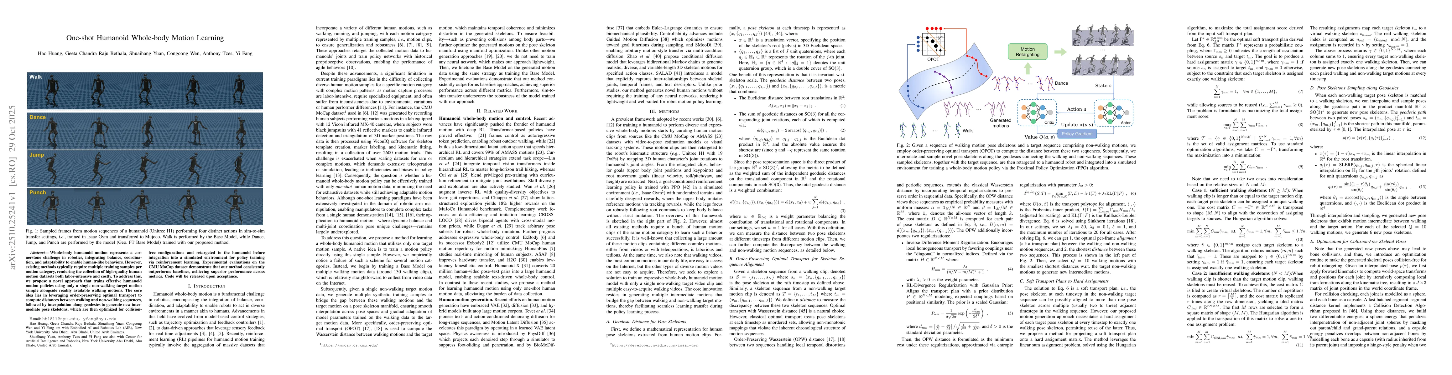
Whole-body humanoid motion represents a cornerstone challenge in robotics, integrating balance, coordination, and adaptability to enable human-like behaviors. However, existing methods typically requi...
The rapid advances in audio analysis underscore its vast potential for humancomputer interaction, environmental monitoring, and public safety; yet, existing audioonly datasets often lack spatial conte...