Academic Profile
Statistics
Similar Authors
Papers on arXiv
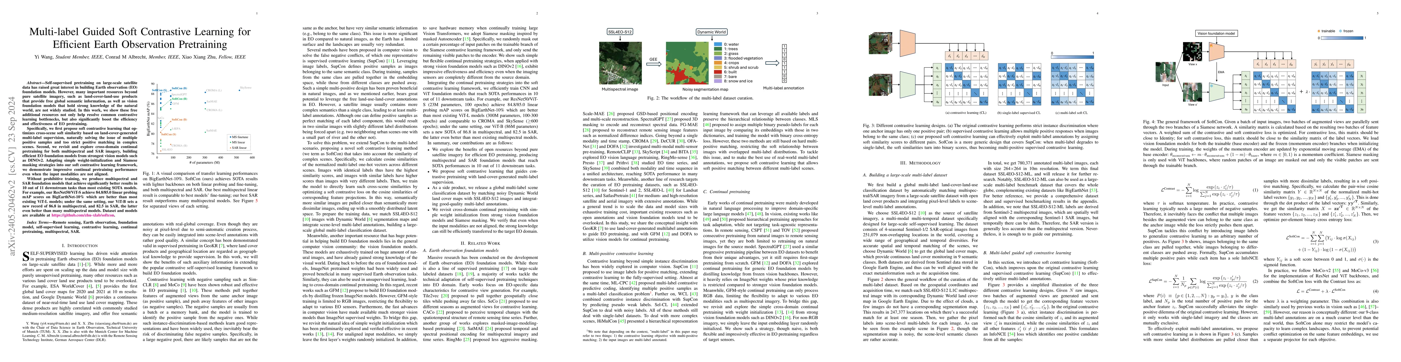
Self-supervised pretraining on large-scale satellite data has raised great interest in building Earth observation (EO) foundation models. However, many important resources beyond pure satellite imag...
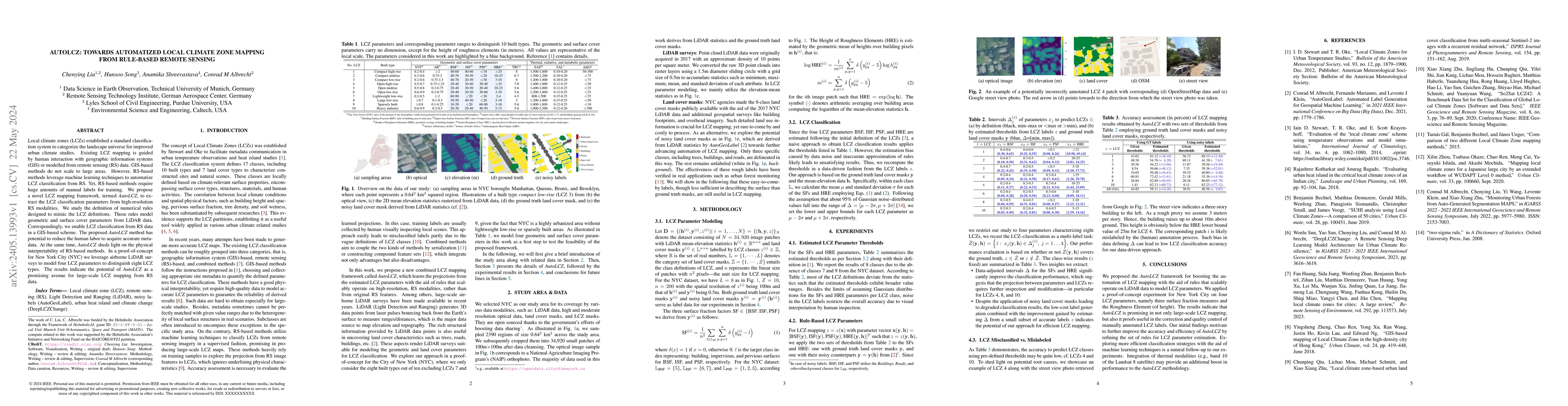
Local climate zones (LCZs) established a standard classification system to categorize the landscape universe for improved urban climate studies. Existing LCZ mapping is guided by human interaction w...
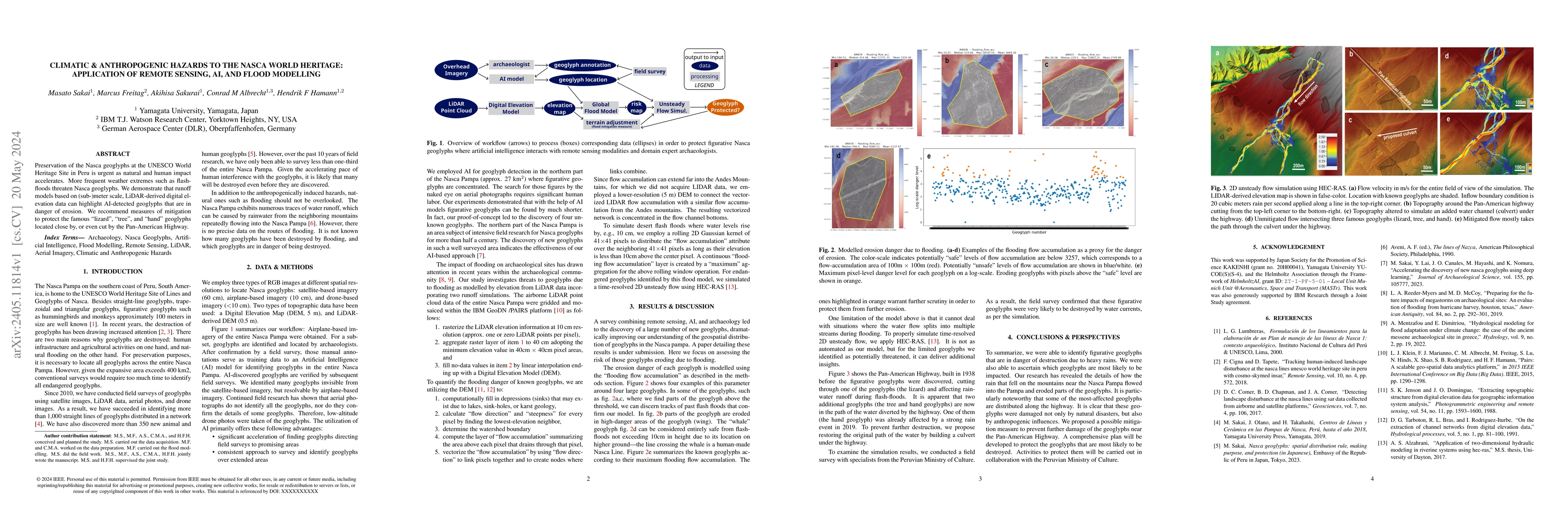
Preservation of the Nasca geoglyphs at the UNESCO World Heritage Site in Peru is urgent as natural and human impact accelerates. More frequent weather extremes such as flashfloods threaten Nasca art...
While the volume of remote sensing data is increasing daily, deep learning in Earth Observation faces lack of accurate annotations for supervised optimization. Crowdsourcing projects such as OpenStr...
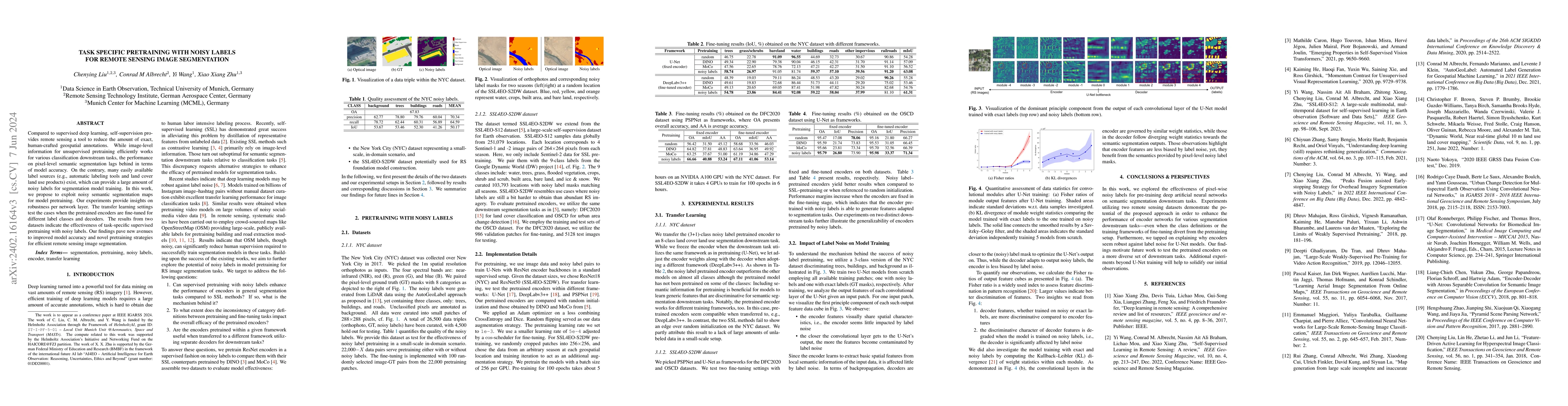
Compared to supervised deep learning, self-supervision provides remote sensing a tool to reduce the amount of exact, human-crafted geospatial annotations. While image-level information for unsupervi...
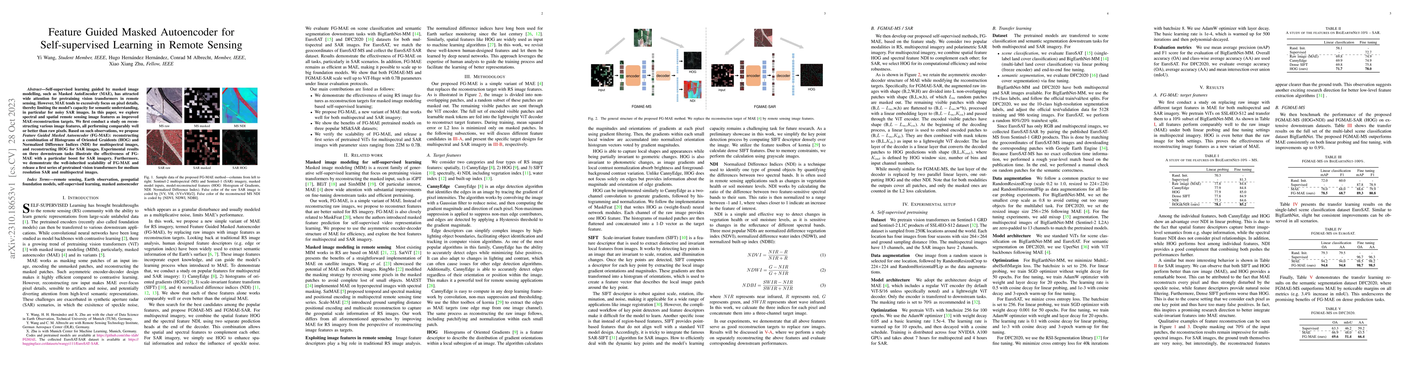
Self-supervised learning guided by masked image modelling, such as Masked AutoEncoder (MAE), has attracted wide attention for pretraining vision transformers in remote sensing. However, MAE tends to...
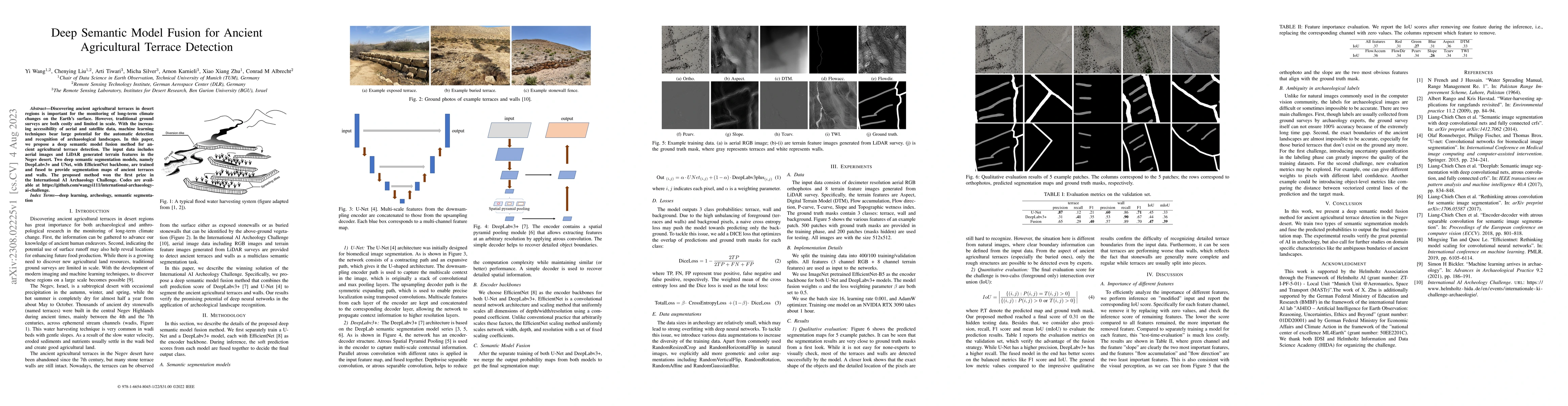
Discovering ancient agricultural terraces in desert regions is important for the monitoring of long-term climate changes on the Earth's surface. However, traditional ground surveys are both costly a...
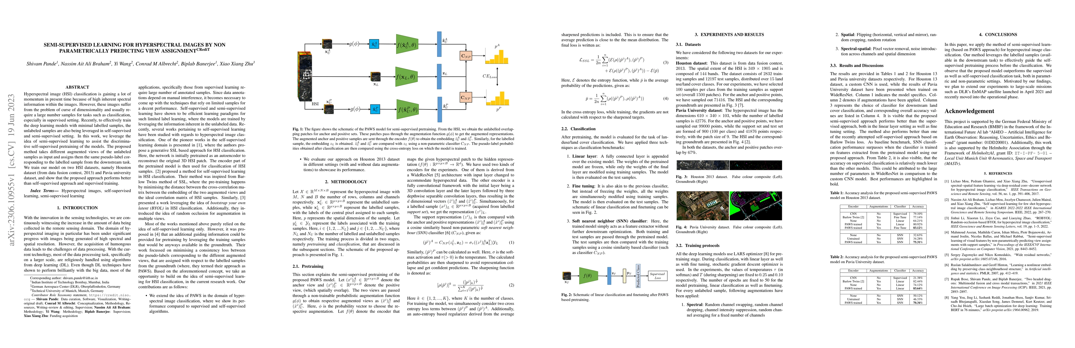
Hyperspectral image (HSI) classification is gaining a lot of momentum in present time because of high inherent spectral information within the images. However, these images suffer from the problem o...
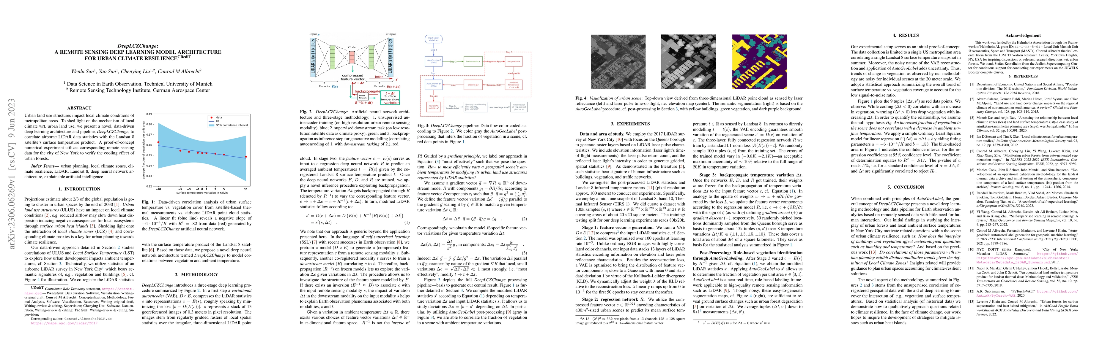
Urban land use structures impact local climate conditions of metropolitan areas. To shed light on the mechanism of local climate wrt. urban land use, we present a novel, data-driven deep learning ar...
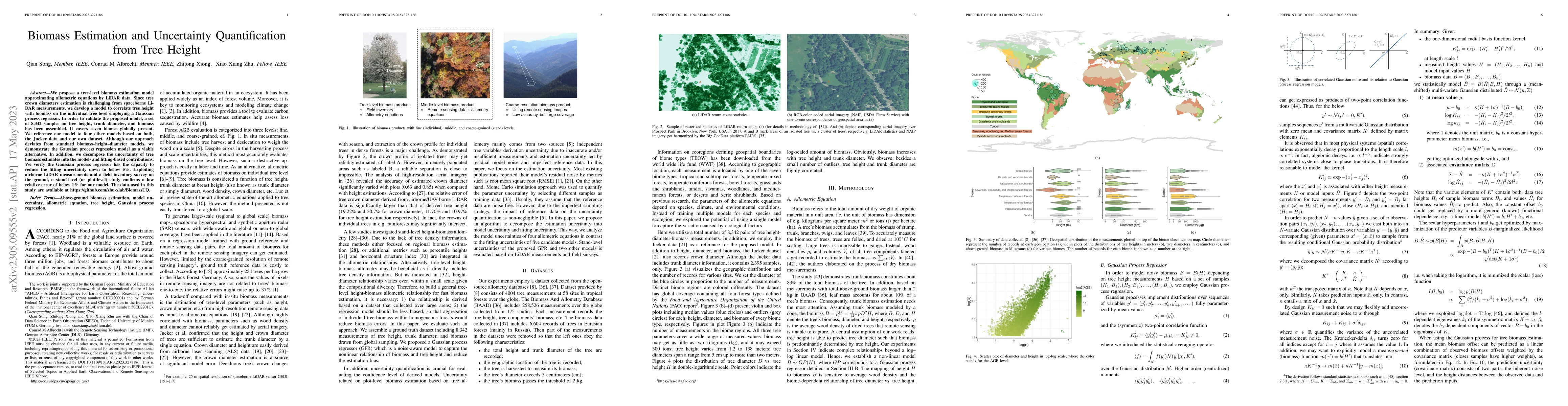
We propose a tree-level biomass estimation model approximating allometric equations by LiDAR data. Since tree crown diameters estimation is challenging from spaceborne LiDAR measurements, we develop...
Self-supervised pre-training bears potential to generate expressive representations without human annotation. Most pre-training in Earth observation (EO) are based on ImageNet or medium-size, labele...
In deep learning research, self-supervised learning (SSL) has received great attention triggering interest within both the computer vision and remote sensing communities. While there has been a big ...
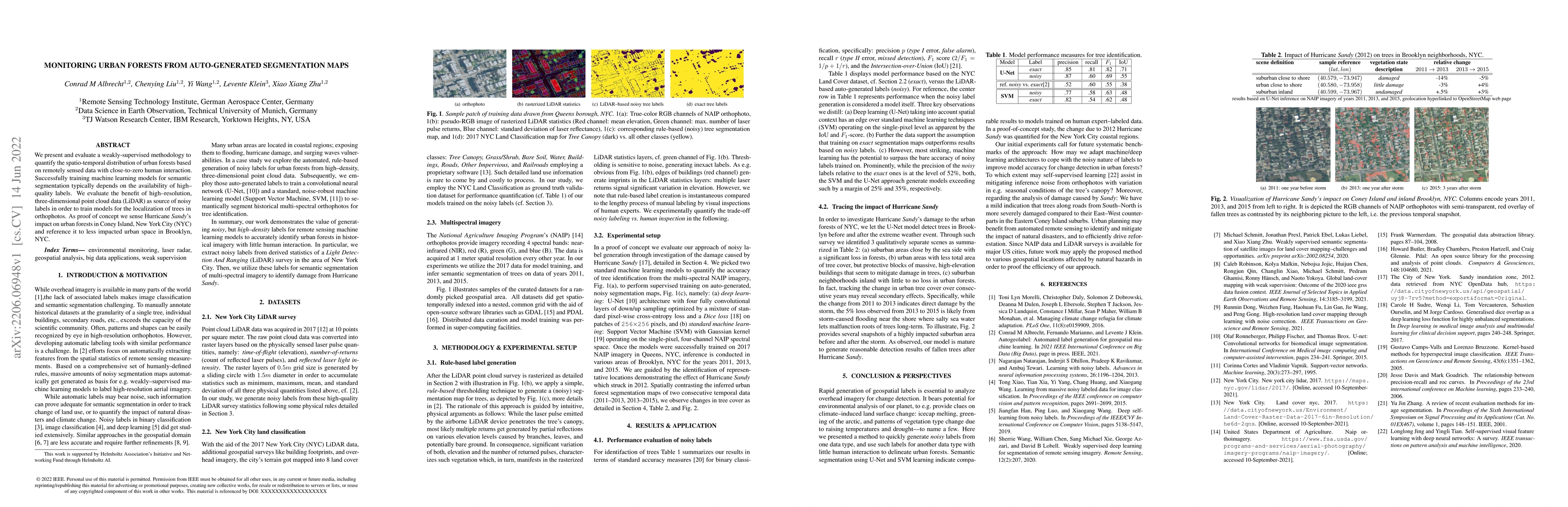
We present and evaluate a weakly-supervised methodology to quantify the spatio-temporal distribution of urban forests based on remotely sensed data with close-to-zero human interaction. Successfully...
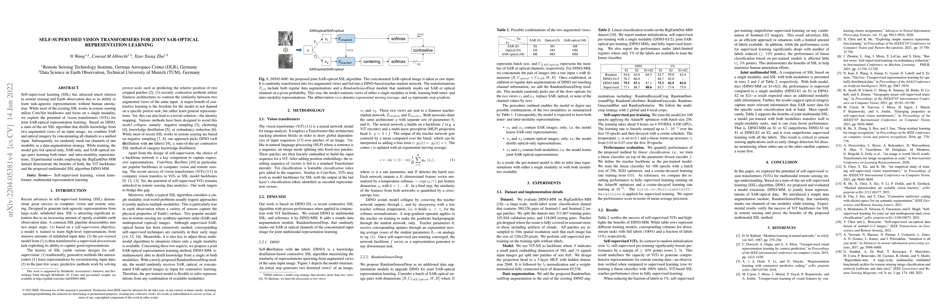
Self-supervised learning (SSL) has attracted much interest in remote sensing and earth observation due to its ability to learn task-agnostic representations without human annotation. While most of t...
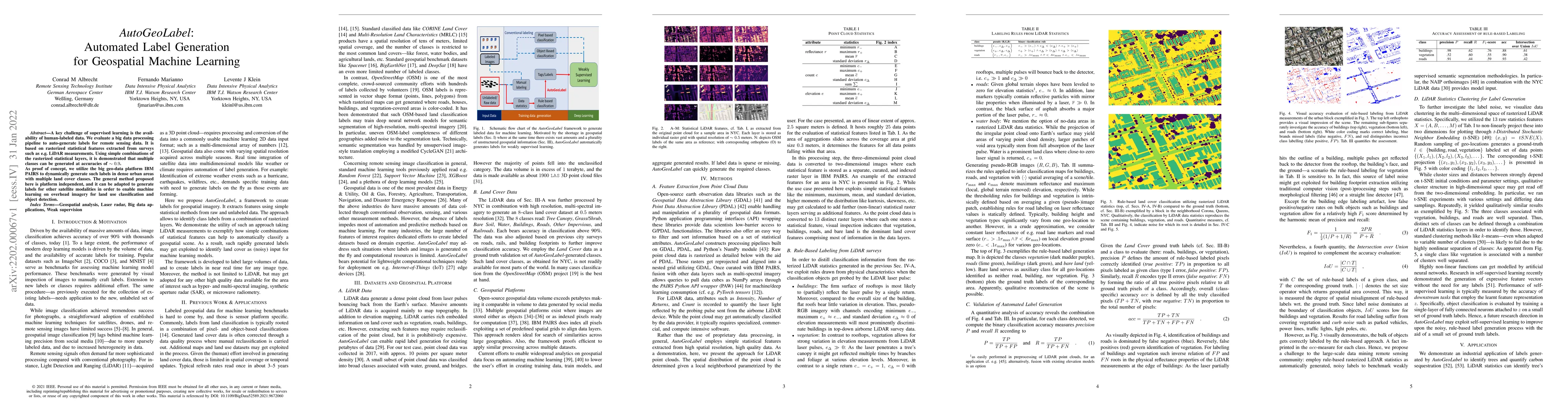
A key challenge of supervised learning is the availability of human-labeled data. We evaluate a big data processing pipeline to auto-generate labels for remote sensing data. It is based on rasterize...
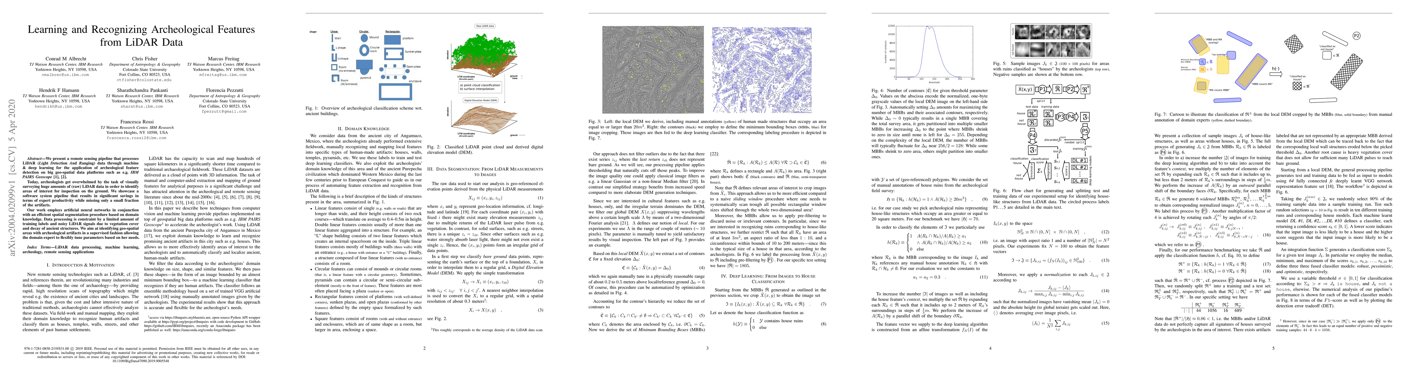
We present a remote sensing pipeline that processes LiDAR (Light Detection And Ranging) data through machine & deep learning for the application of archeological feature detection on big geo-spatial...
We present an efficient clustering algorithm applicable to one-dimensional data such as e.g. a series of timestamps. Given an expected frequency $\Delta T^{-1}$, we introduce an $\mathcal{O}(N)$-eff...
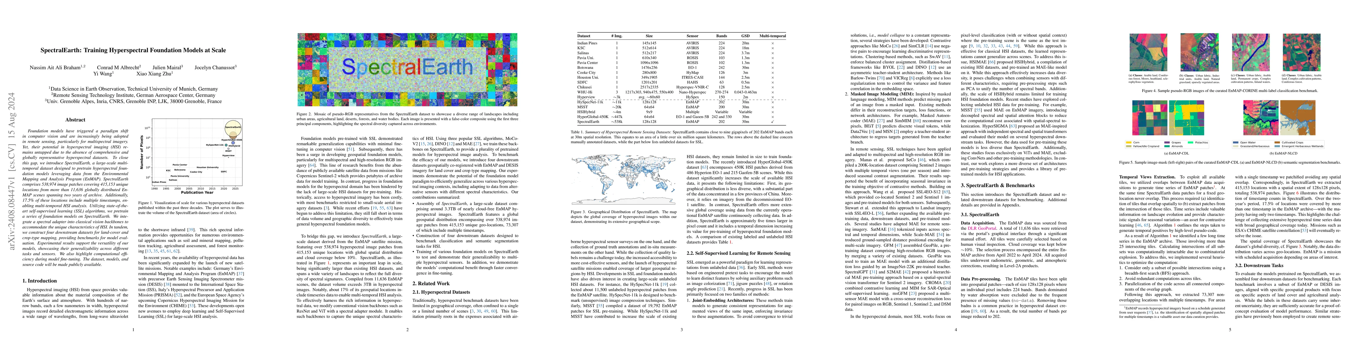
Foundation models have triggered a paradigm shift in computer vision and are increasingly being adopted in remote sensing, particularly for multispectral imagery. Yet, their potential in hyperspectral...
Hyperspectral imaging provides detailed spectral information, offering significant potential for monitoring greenhouse gases like CH4 and NO2. However, its application is constrained by limited spatia...
Over the past decades, there has been an explosion in the amount of available Earth Observation (EO) data. The unprecedented coverage of the Earth's surface and atmosphere by satellite imagery has res...
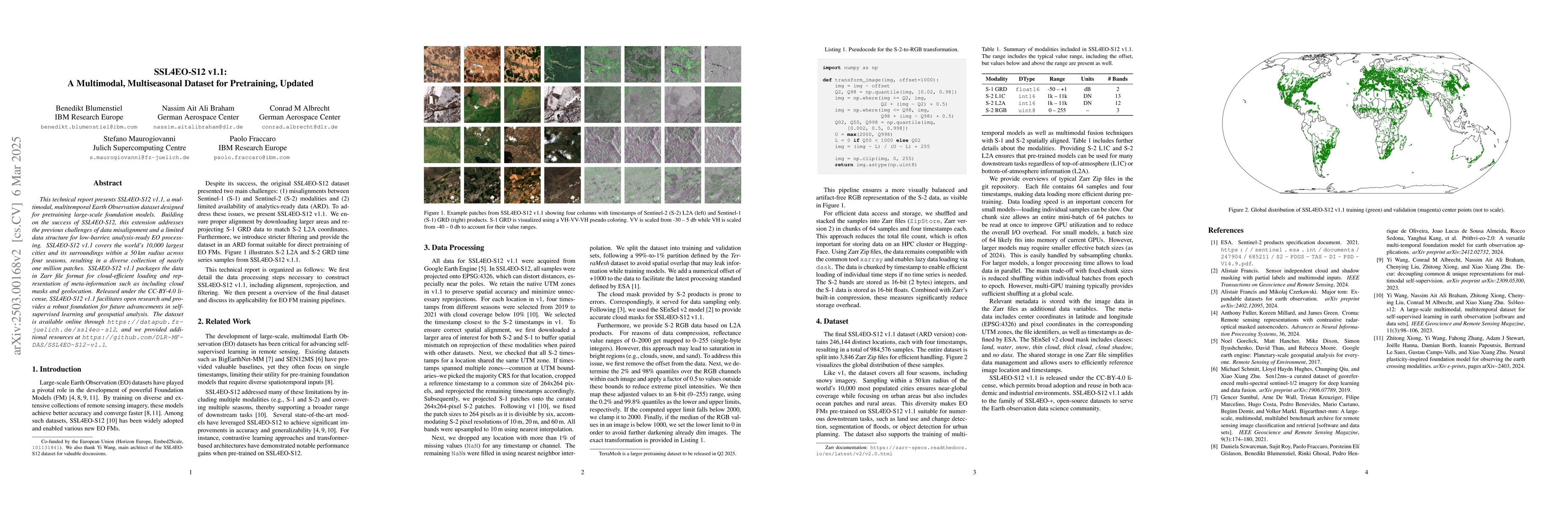
This technical report presents SSL4EO-S12 v1.1, a multimodal, multitemporal Earth Observation dataset designed for pretraining large-scale foundation models. Building on the success of SSL4EO-S12 v1.0...
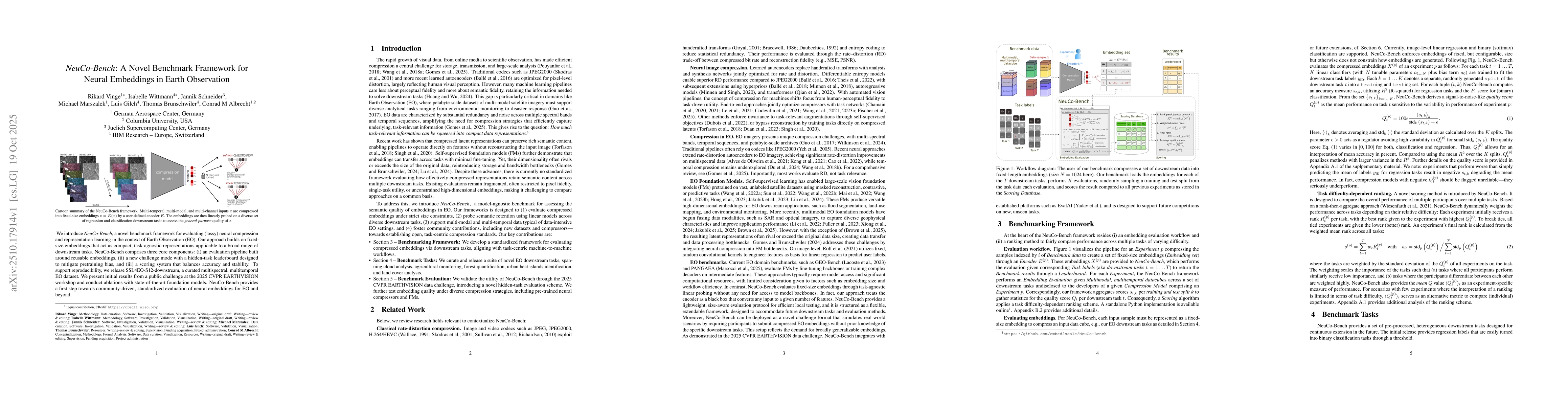
We introduce NeuCo-Bench, a novel benchmark framework for evaluating (lossy) neural compression and representation learning in the context of Earth Observation (EO). Our approach builds on fixed-size ...
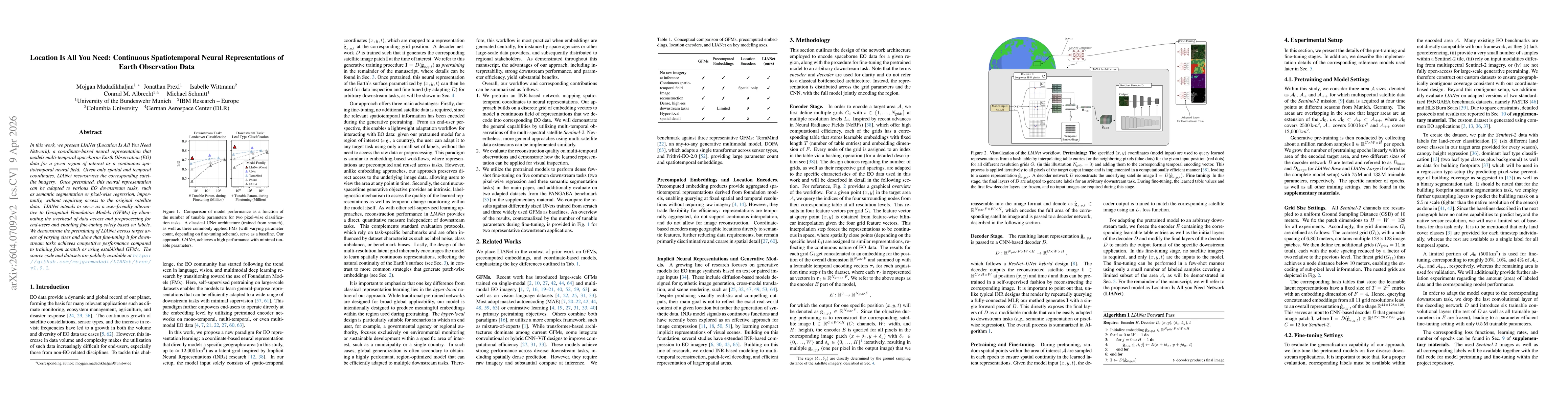
In this work, we present LIANet (Location Is All You Need Network), a coordinate-based neural representation that models multi-temporal spaceborne Earth observation (EO) data for a given region of int...