2
arXiv Papers
5
Total Publications
Profile
Academic Profile
Metrics
Statistics
2
arXiv Papers
5
Total Publications
Network
Similar Authors
Publications
Papers on arXiv
arXiv
Transformer-Guided Convolutional Neural Network for Cross-View
Geolocalization
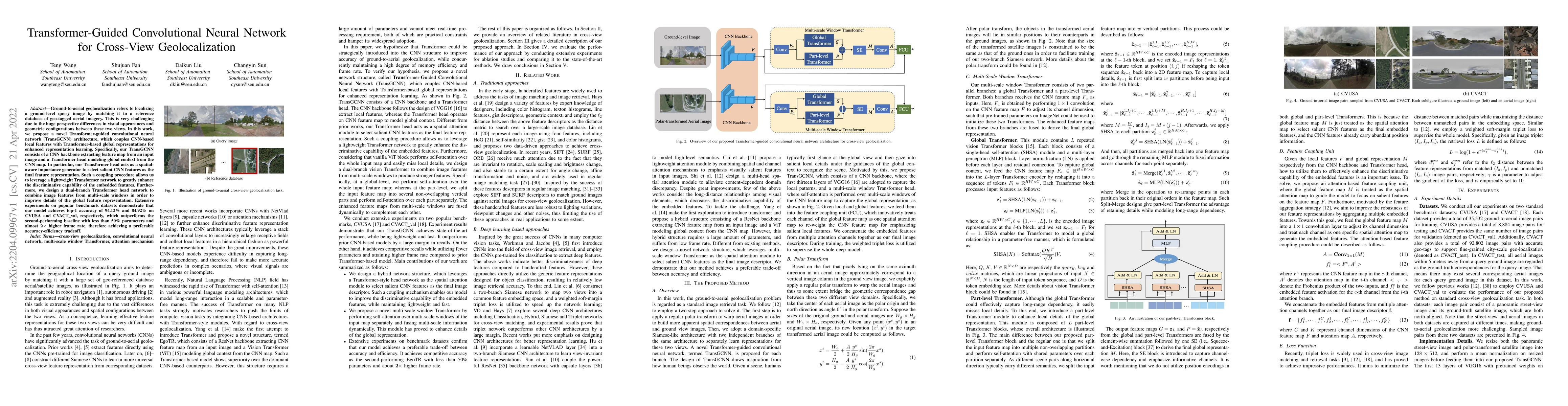
Ground-to-aerial geolocalization refers to localizing a ground-level query image by matching it to a reference database of geo-tagged aerial imagery. This is very challenging due to the huge perspec...
arXiv
EDCFlow: Exploring Temporally Dense Difference Maps for Event-based
Optical Flow Estimation
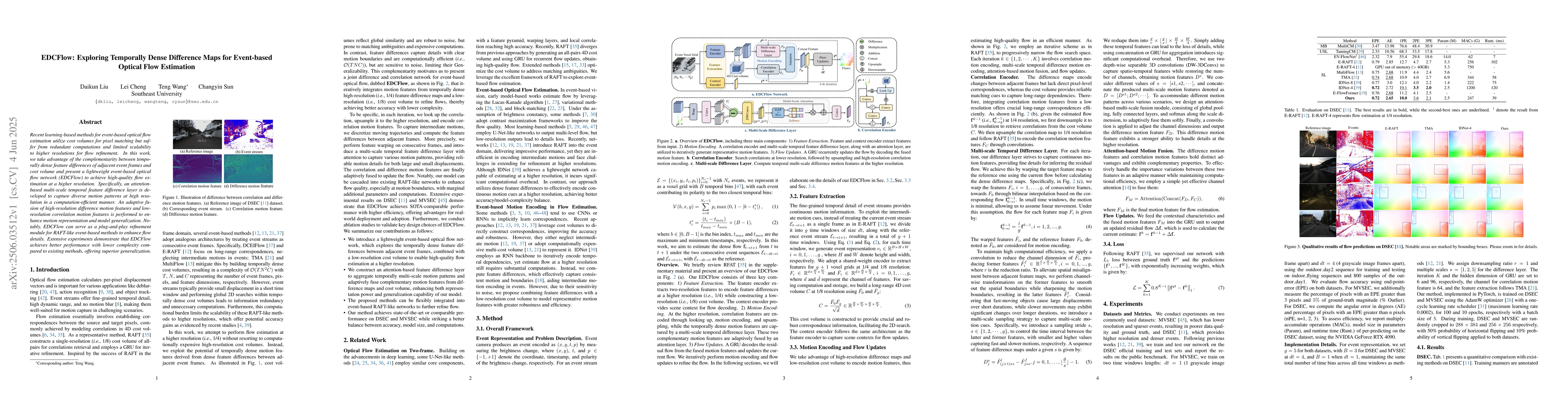
Recent learning-based methods for event-based optical flow estimation utilize cost volumes for pixel matching but suffer from redundant computations and limited scalability to higher resolutions for f...