1
arXiv Papers
26
Total Publications
Profile
Academic Profile
Metrics
Statistics
1
arXiv Papers
26
Total Publications
Network
Similar Authors
Publications
Papers on arXiv
arXiv
SegForestNet: Spatial-Partitioning-Based Aerial Image Segmentation
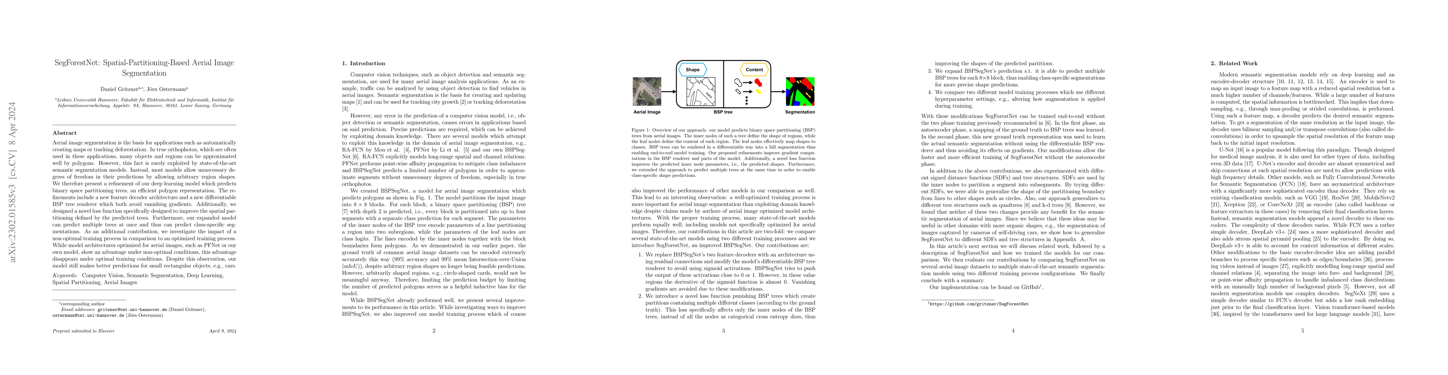
Aerial image segmentation is the basis for applications such as automatically creating maps or tracking deforestation. In true orthophotos, which are often used in these applications, many objects a...