Academic Profile
Statistics
Similar Authors
Papers on arXiv
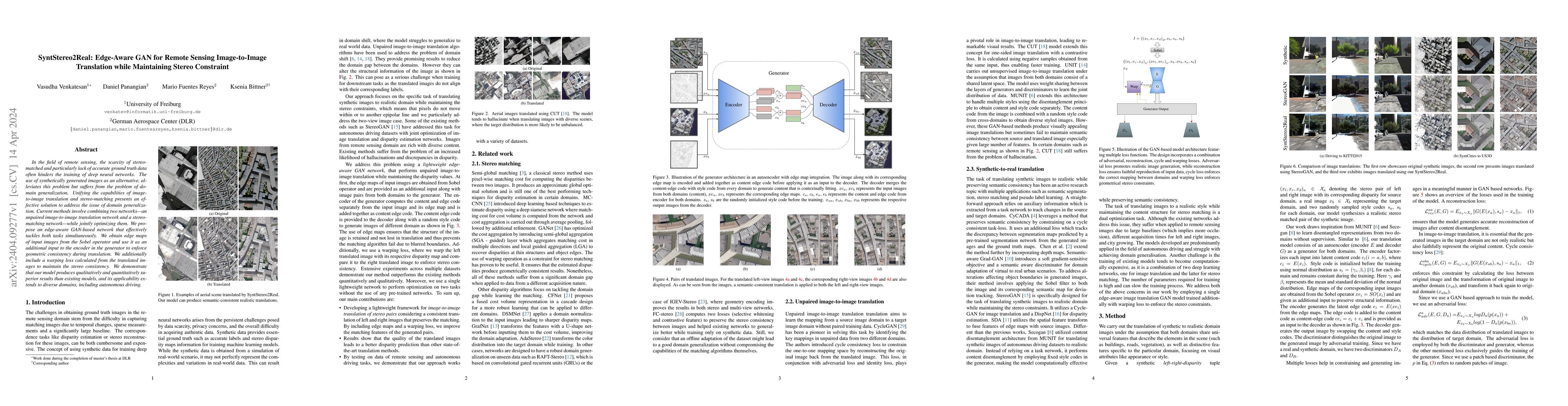
In the field of remote sensing, the scarcity of stereo-matched and particularly lack of accurate ground truth data often hinders the training of deep neural networks. The use of synthetically genera...
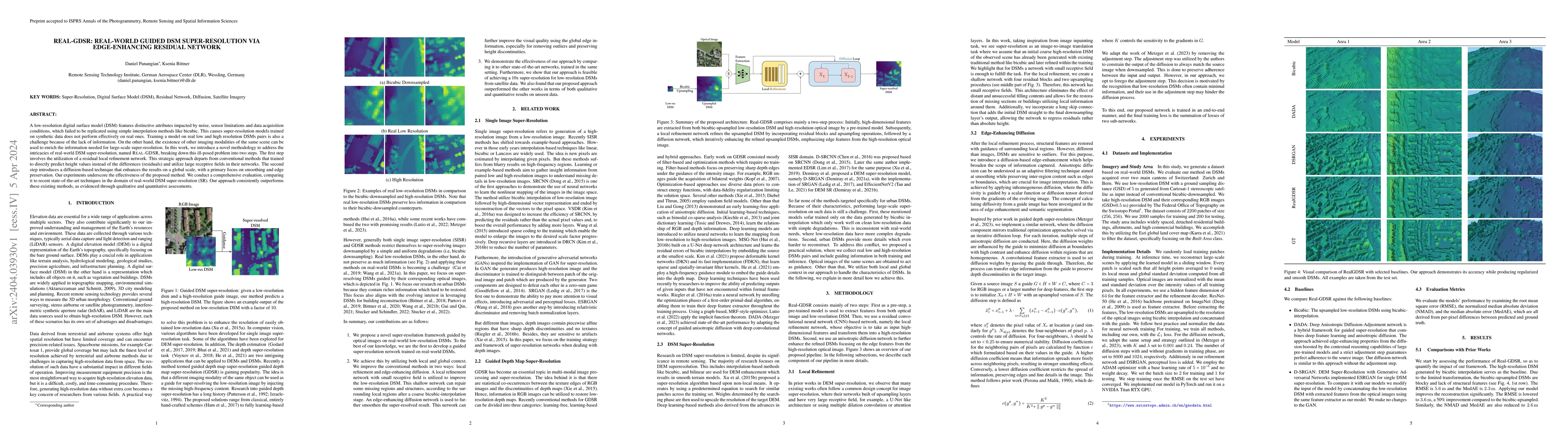
A low-resolution digital surface model (DSM) features distinctive attributes impacted by noise, sensor limitations and data acquisition conditions, which failed to be replicated using simple interpo...
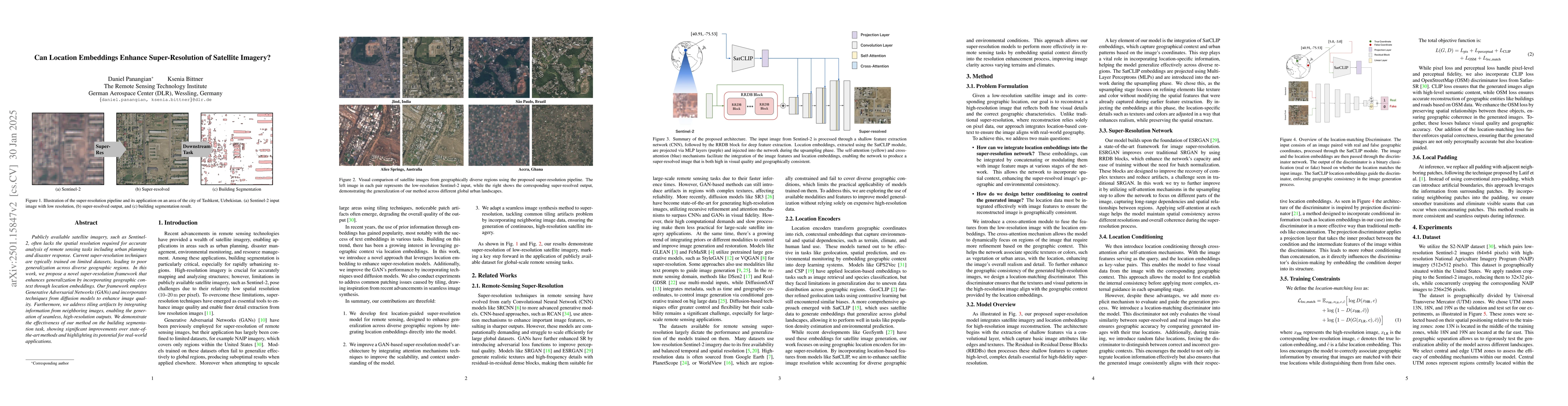
Publicly available satellite imagery, such as Sentinel- 2, often lacks the spatial resolution required for accurate analysis of remote sensing tasks including urban planning and disaster response. Cur...
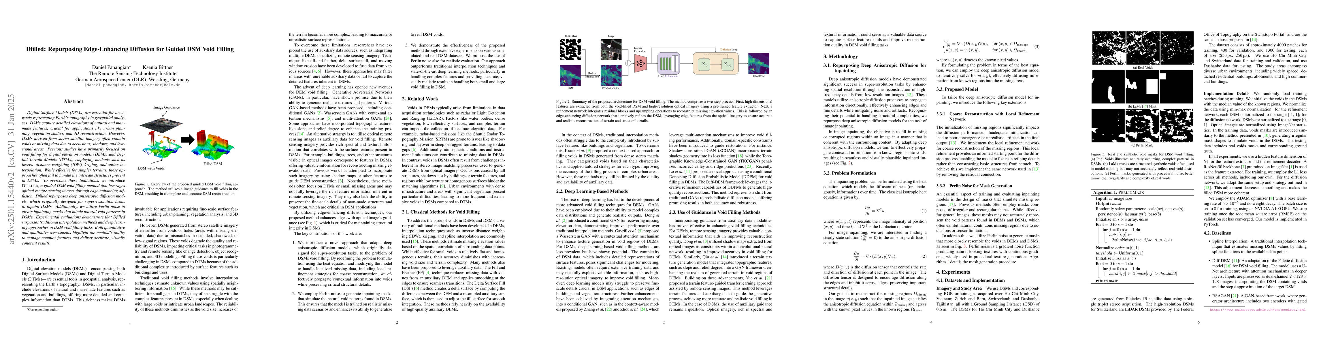
Digital Surface Models (DSMs) are essential for accurately representing Earth's topography in geospatial analyses. DSMs capture detailed elevations of natural and manmade features, crucial for applica...
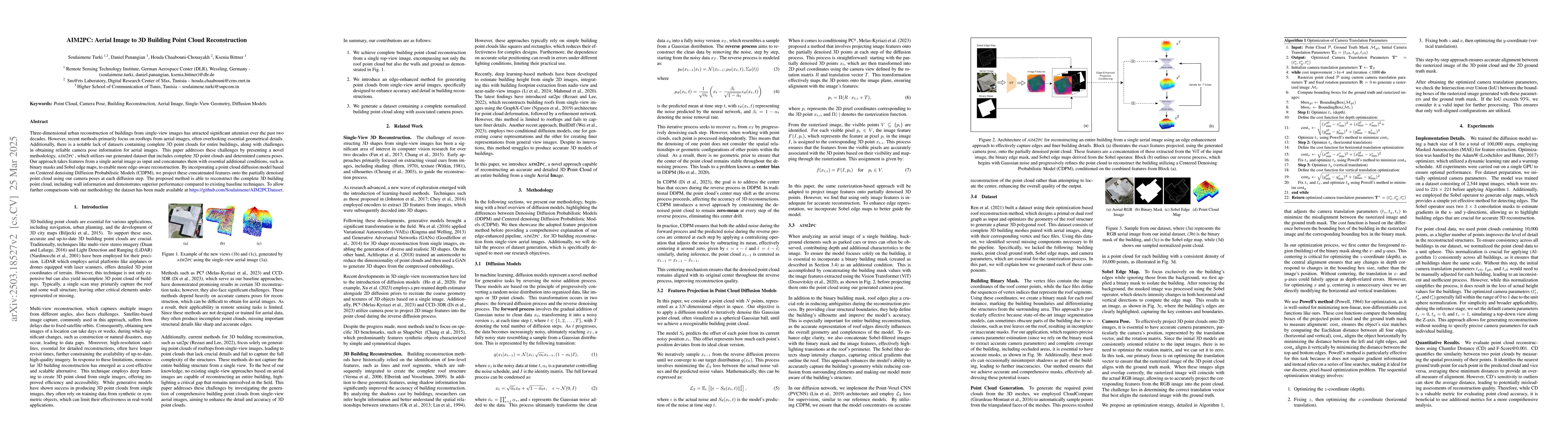
Three-dimensional urban reconstruction of buildings from single-view images has attracted significant attention over the past two decades. However, recent methods primarily focus on rooftops from aeri...
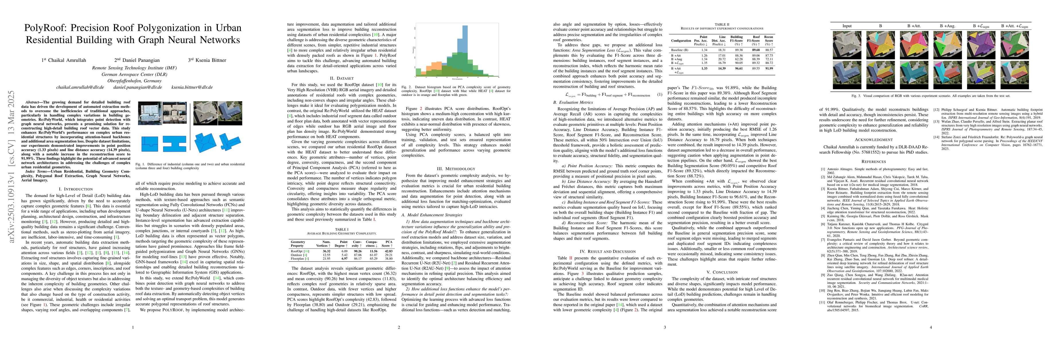
The growing demand for detailed building roof data has driven the development of automated extraction methods to overcome the inefficiencies of traditional approaches, particularly in handling complex...