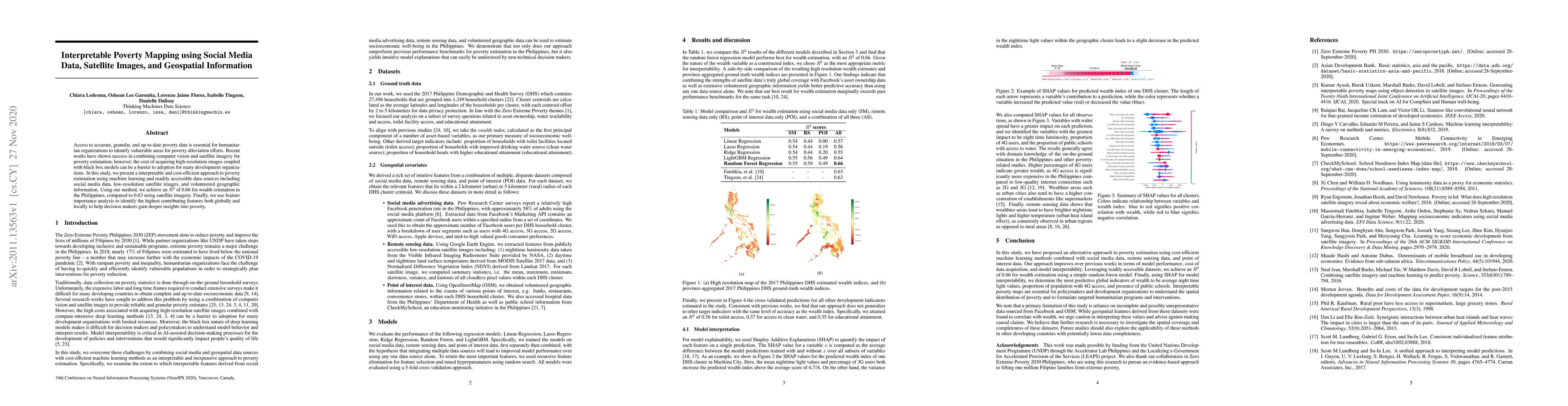
1
arXiv Papers
Profile
Academic Profile
Metrics
Statistics
1
arXiv Papers
Network
Similar Authors
Publications
Papers on arXiv
arXiv
Interpretable Poverty Mapping using Social Media Data, Satellite Images,
and Geospatial Information
Access to accurate, granular, and up-to-date poverty data is essential for humanitarian organizations to identify vulnerable areas for poverty alleviation efforts. Recent works have shown success in...