Academic Profile
Statistics
Similar Authors
Papers on arXiv
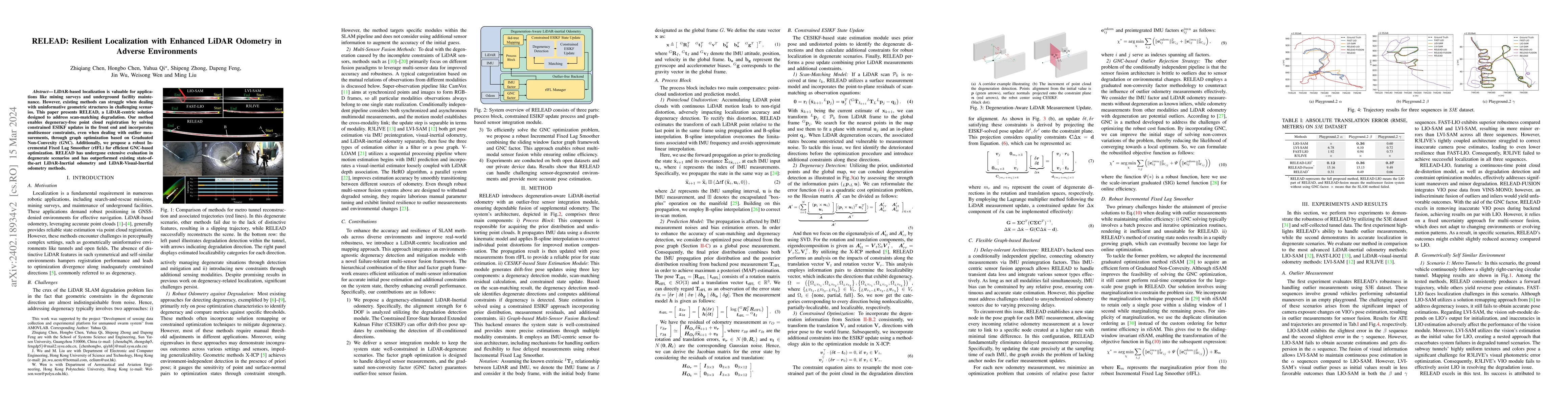
LiDAR-based localization is valuable for applications like mining surveys and underground facility maintenance. However, existing methods can struggle when dealing with uninformative geometric struc...
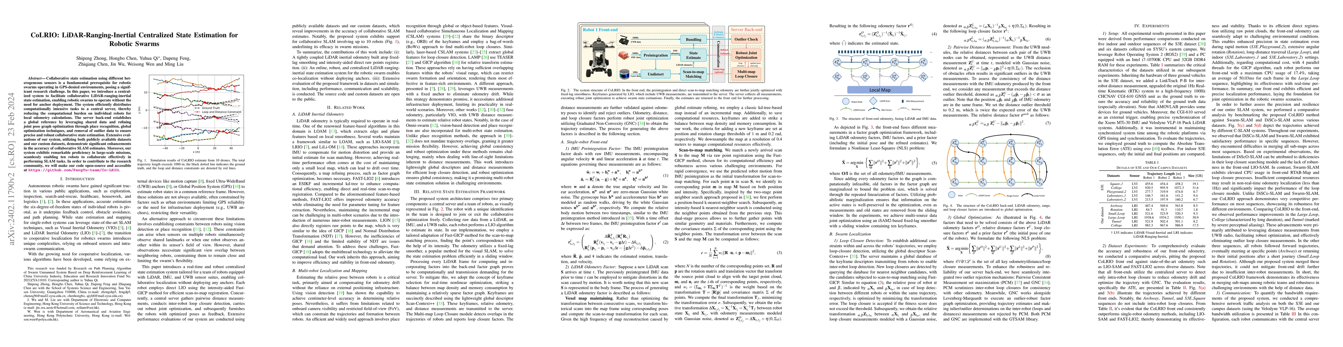
Collaborative state estimation using different heterogeneous sensors is a fundamental prerequisite for robotic swarms operating in GPS-denied environments, posing a significant research challenge. I...
Process-Based Modeling (PBM) and Machine Learning (ML) are often perceived as distinct paradigms in the geosciences. Here we present differentiable geoscientific modeling as a powerful pathway towar...
Predictions of hydrologic variables across the entire water cycle have significant value for water resource management as well as downstream applications such as ecosystem and water quality modeling...
When fitting statistical models to variables in geoscientific disciplines such as hydrology, it is a customary practice to regionalize - to divide a large spatial domain into multiple regions and st...
While long short-term memory (LSTM) models have demonstrated stellar performance with streamflow predictions, there are major risks in applying these models in contiguous regions with no gauges, or ...
The behaviors and skills of models in many geosciences (e.g., hydrology and ecosystem sciences) strongly depend on spatially-varying parameters that need calibration. A well-calibrated model can rea...
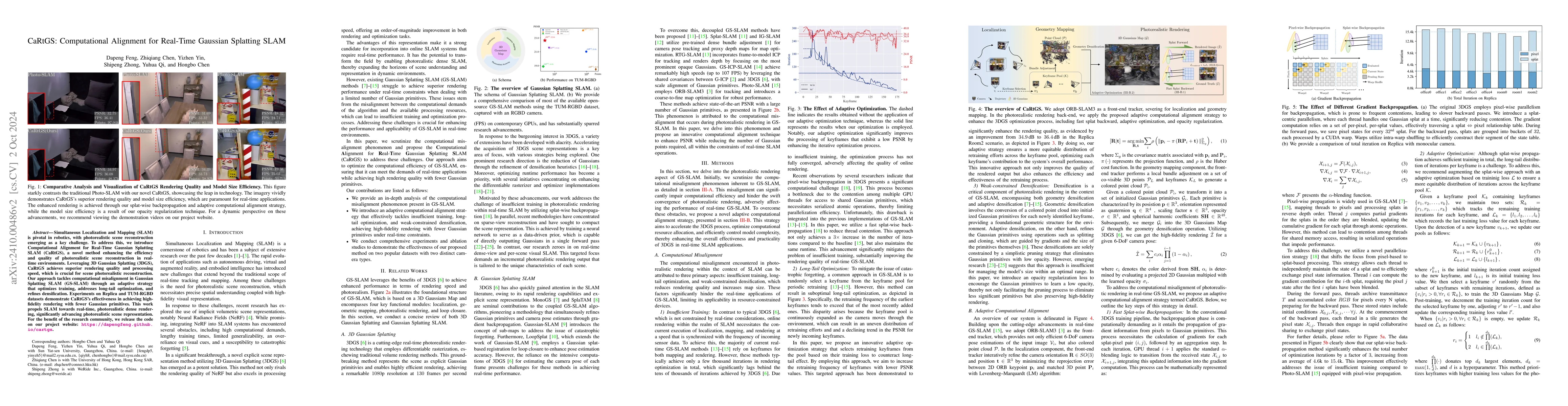
Simultaneous Localization and Mapping (SLAM) is pivotal in robotics, with photorealistic scene reconstruction emerging as a key challenge. To address this, we introduce Computational Alignment for Rea...
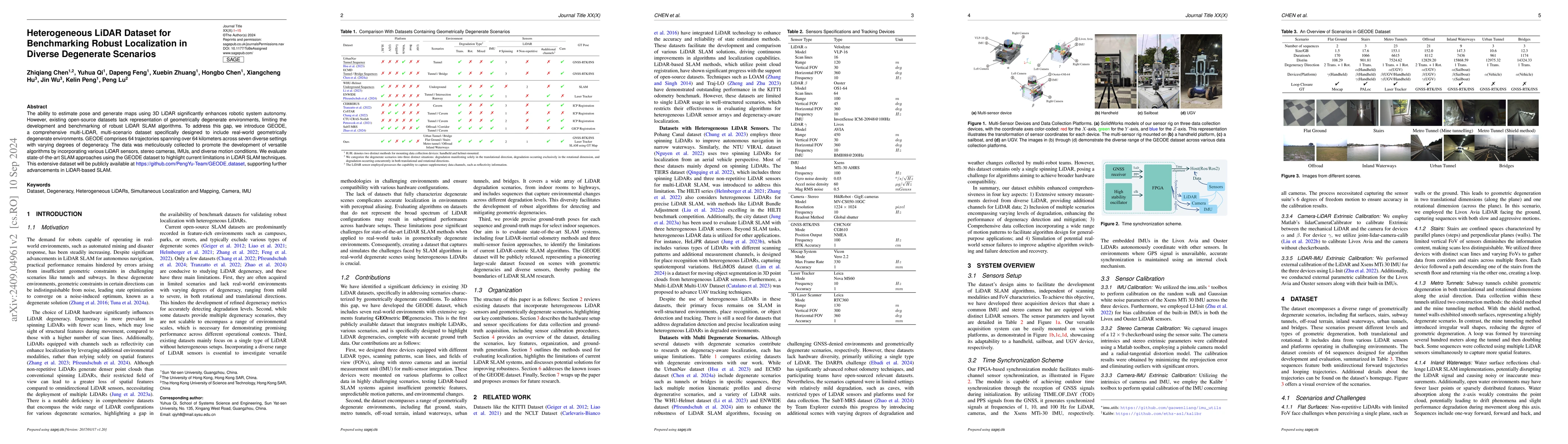
The ability to estimate pose and generate maps using 3D LiDAR significantly enhances robotic system autonomy. However, existing open-source datasets lack representation of geometrically degenerate env...
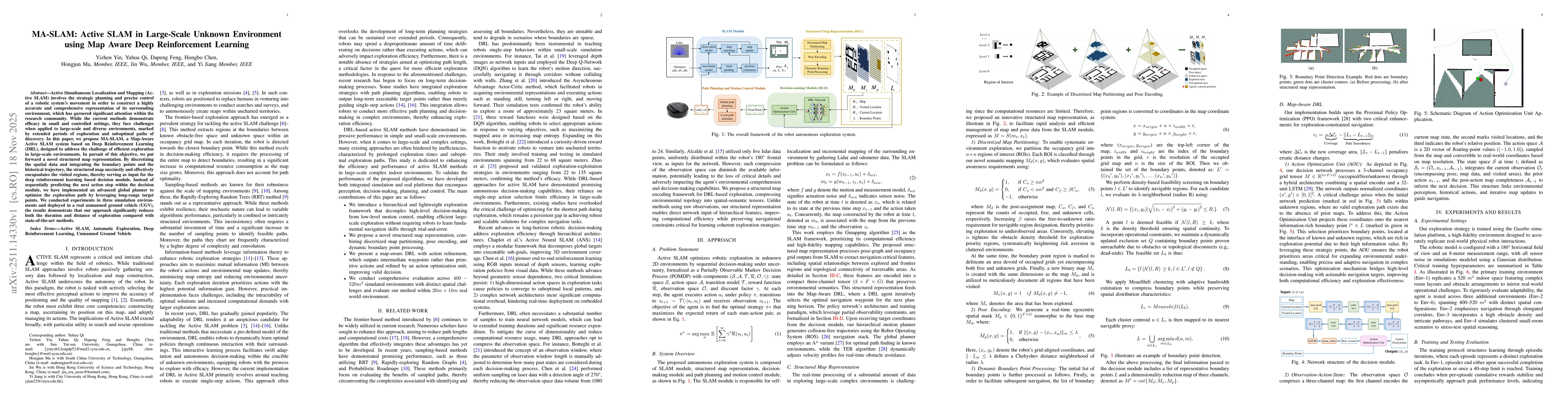
Active Simultaneous Localization and Mapping (Active SLAM) involves the strategic planning and precise control of a robotic system's movement in order to construct a highly accurate and comprehensive ...
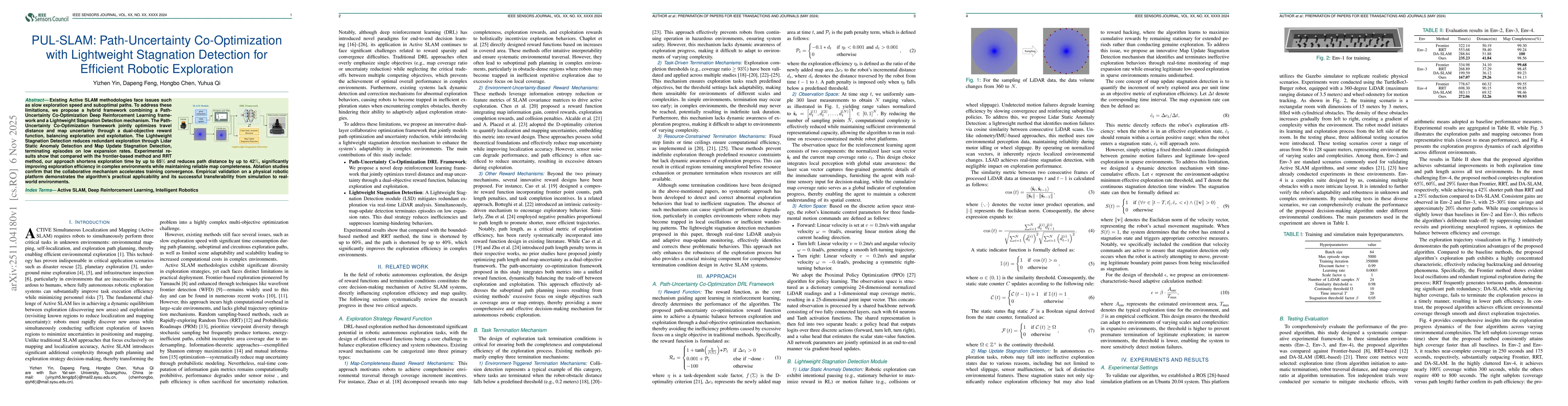
Existing Active SLAM methodologies face issues such as slow exploration speed and suboptimal paths. To address these limitations, we propose a hybrid framework combining a Path-Uncertainty Co-Optimiza...
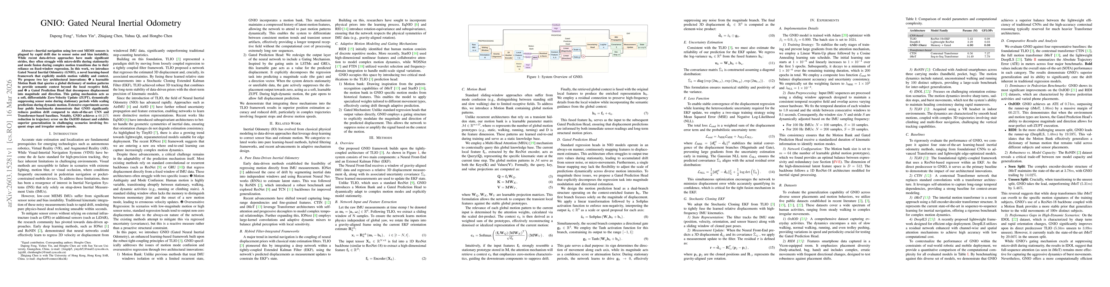
Inertial navigation using low-cost MEMS sensors is plagued by rapid drift due to sensor noise and bias instability. While recent data-driven approaches have made significant strides, they often strugg...