Academic Profile
Statistics
Similar Authors
Papers on arXiv
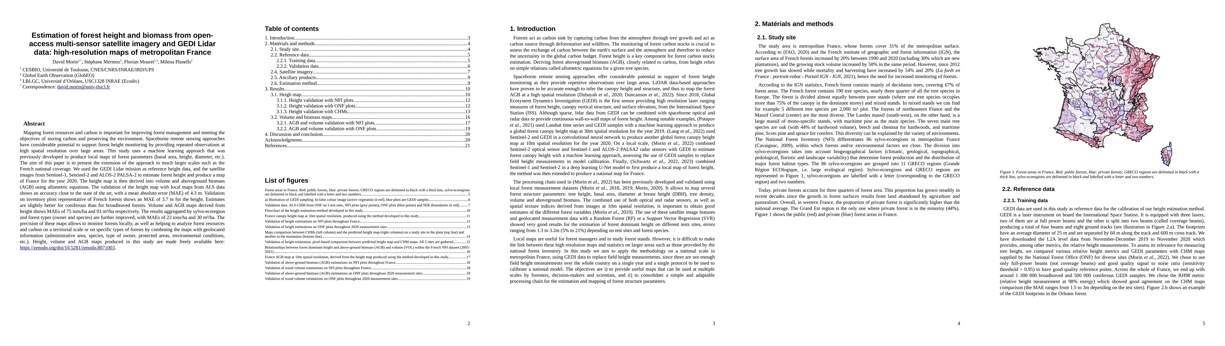
Mapping forest resources and carbon is important for improving forest management and meeting the objectives of storing carbon and preserving the environment. Spaceborne remote sensing approaches hav...
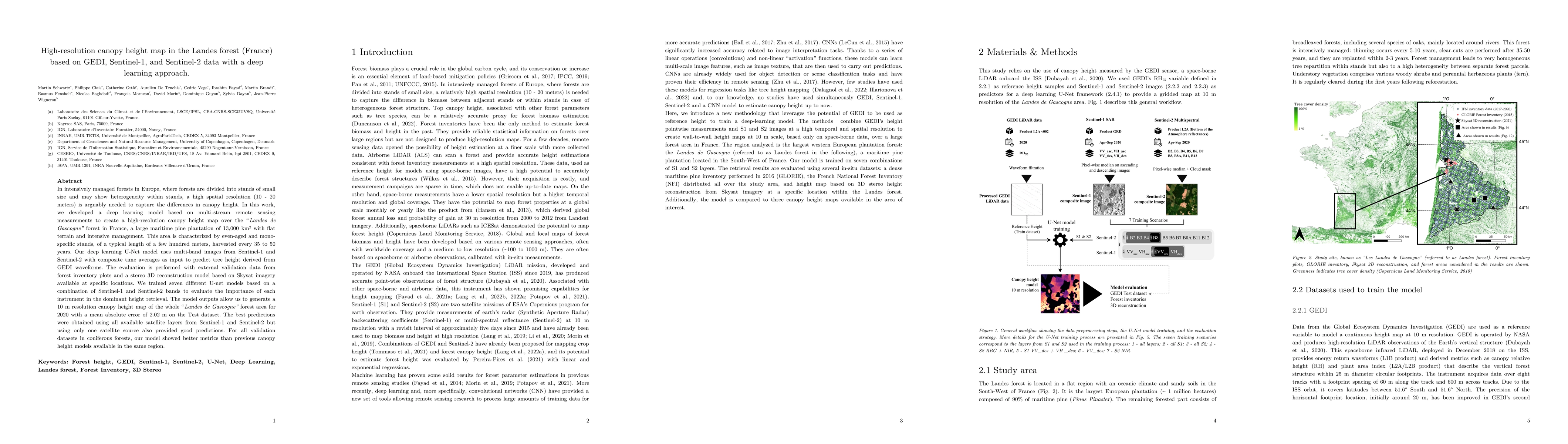
In intensively managed forests in Europe, where forests are divided into stands of small size and may show heterogeneity within stands, a high spatial resolution (10 - 20 meters) is arguably needed ...
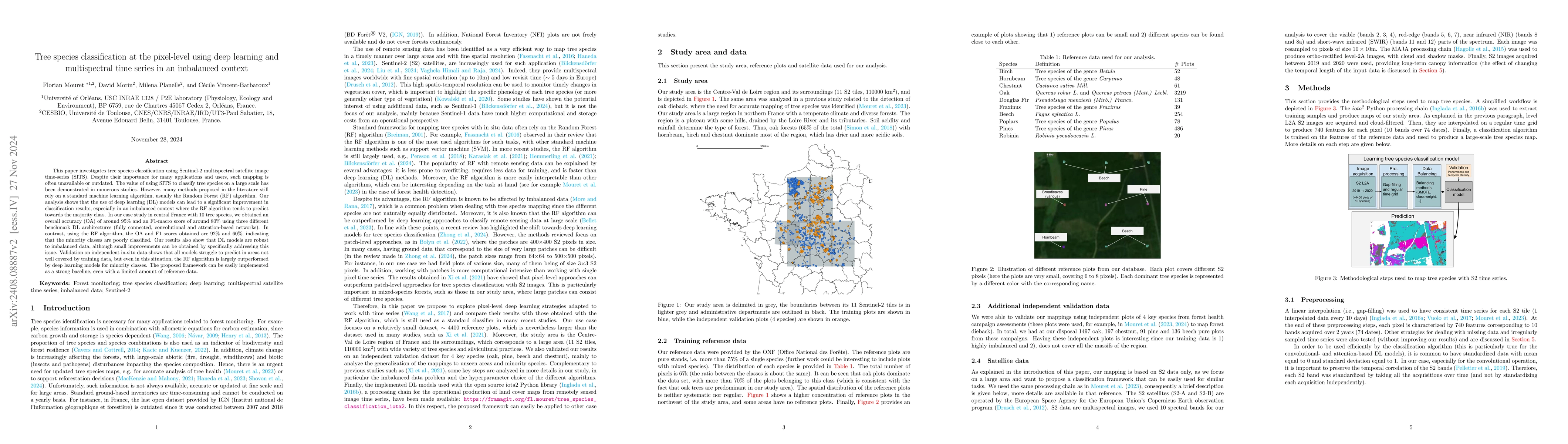
This paper investigates tree species classification using Sentinel-2 multispectral satellite image time-series. Despite their critical importance for many applications, such maps are often unavailable...