Academic Profile
Statistics
Similar Authors
Papers on arXiv
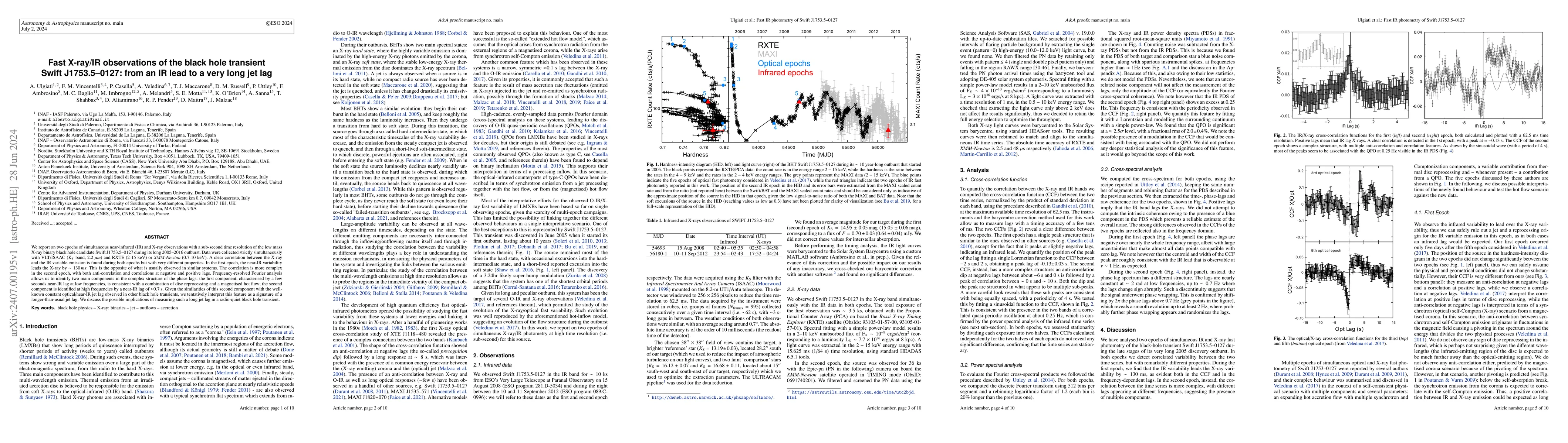
We report on two epochs of simultaneous near-infrared (IR) and X-ray observations with a sub-second time resolution of the low mass X-ray binary black hole candidate Swift J1753.5--0127 during its l...
Aerial imagery is increasingly used in Earth science and natural resource management as a complement to labor-intensive ground-based surveys. Aerial systems can collect overlapping images that provi...
Modern armed conflicts have a tendency to cluster together and spread geographically. However, the geography of most conflicts remains under-studied. To fill this gap, this article presents a new in...
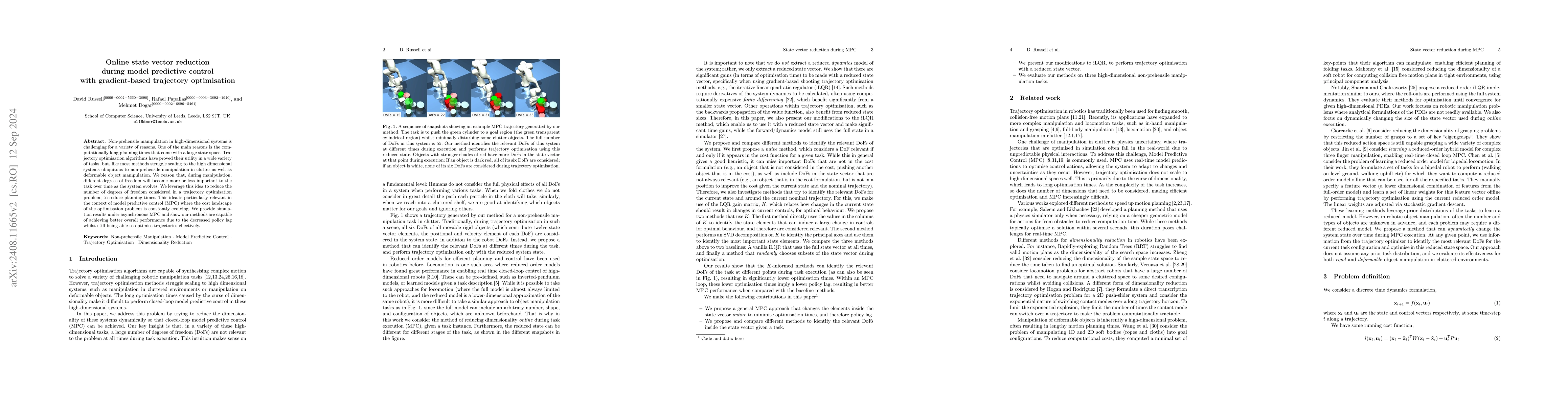
Non-prehensile manipulation in high-dimensional systems is challenging for a variety of reasons. One of the main reasons is the computationally long planning times that come with a large state space. ...
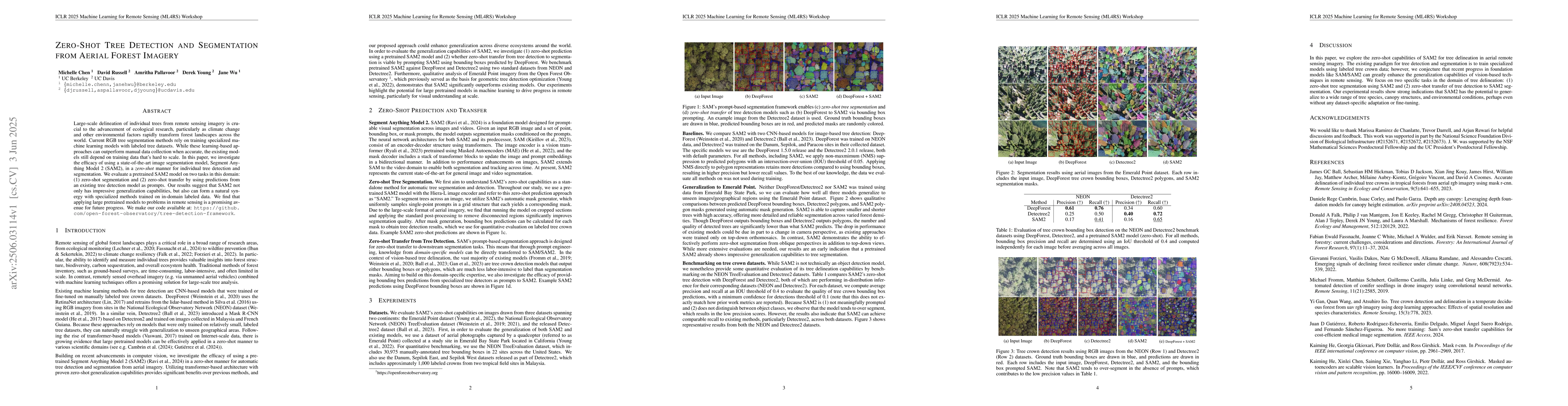
Large-scale delineation of individual trees from remote sensing imagery is crucial to the advancement of ecological research, particularly as climate change and other environmental factors rapidly tra...
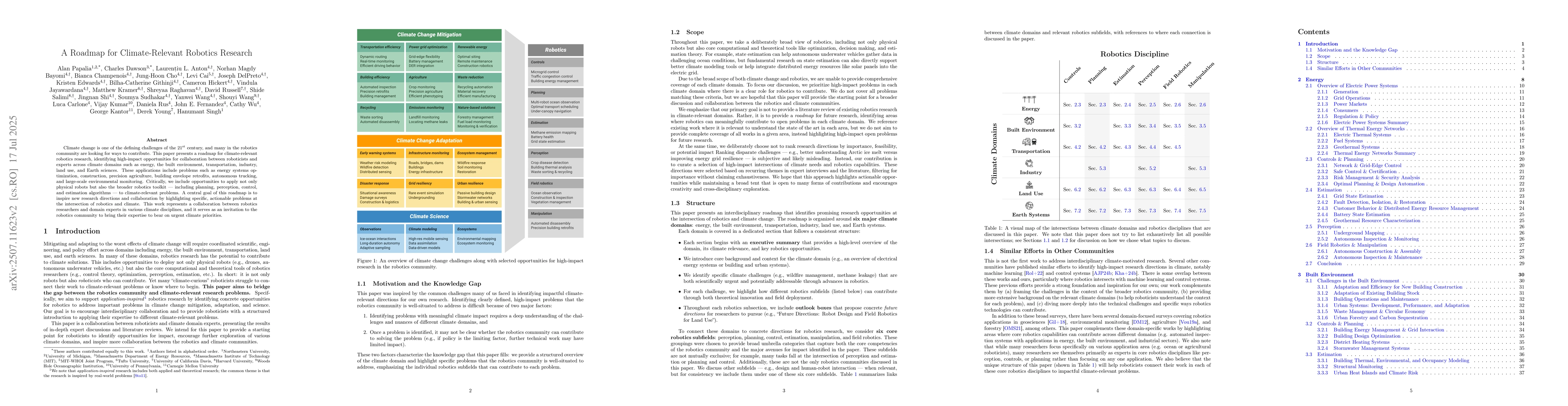
Climate change is one of the defining challenges of the 21st century, and many in the robotics community are looking for ways to contribute. This paper presents a roadmap for climate-relevant robotics...
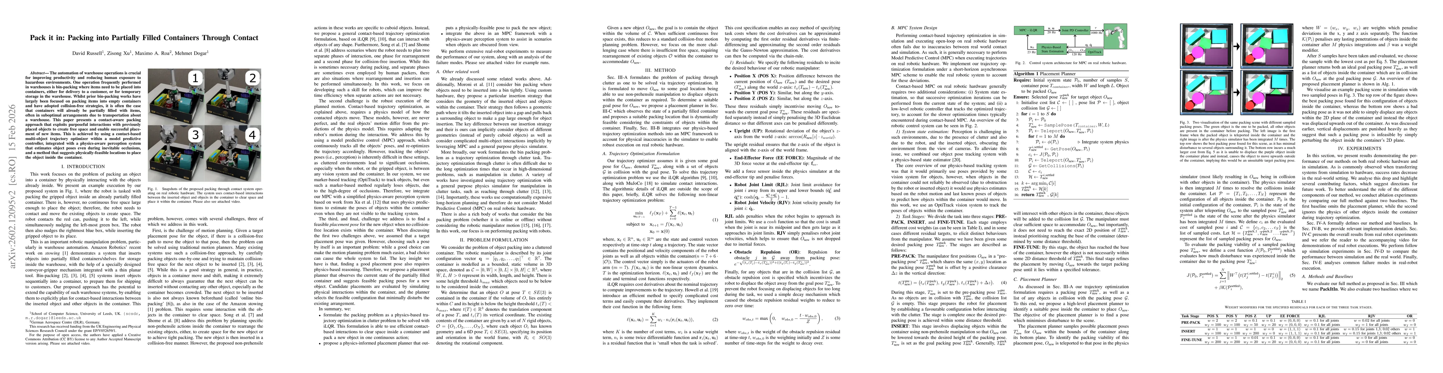
The automation of warehouse operations is crucial for improving productivity and reducing human exposure to hazardous environments. One operation frequently performed in warehouses is bin-packing wher...
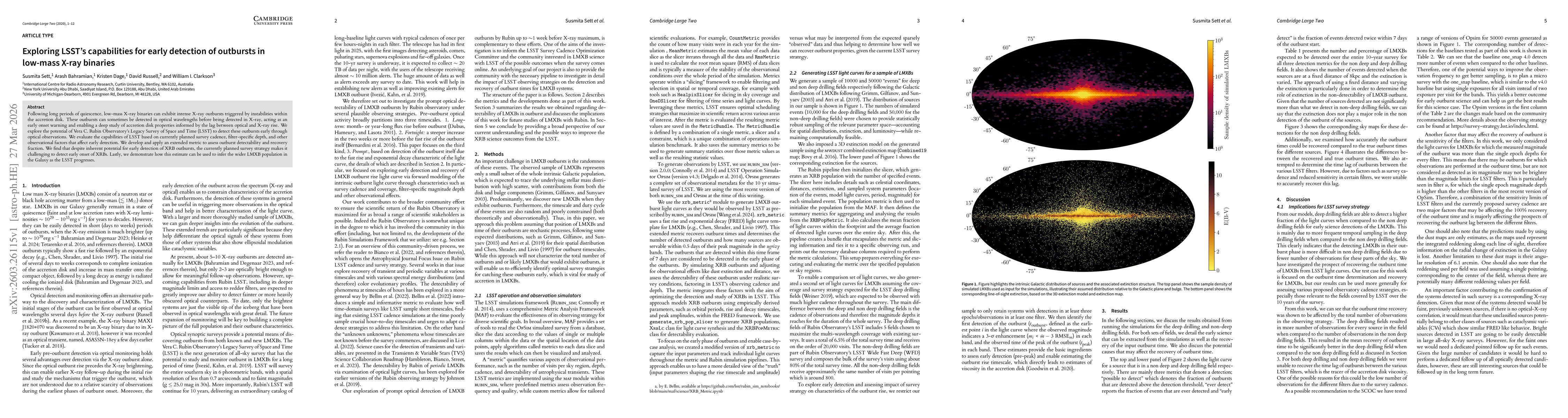
Following long periods of quiescence, low-mass X-ray binaries can exhibit intense X-ray outbursts triggered by instabilities within the accretion disk. These outbursts can sometimes be detected in opt...